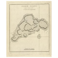
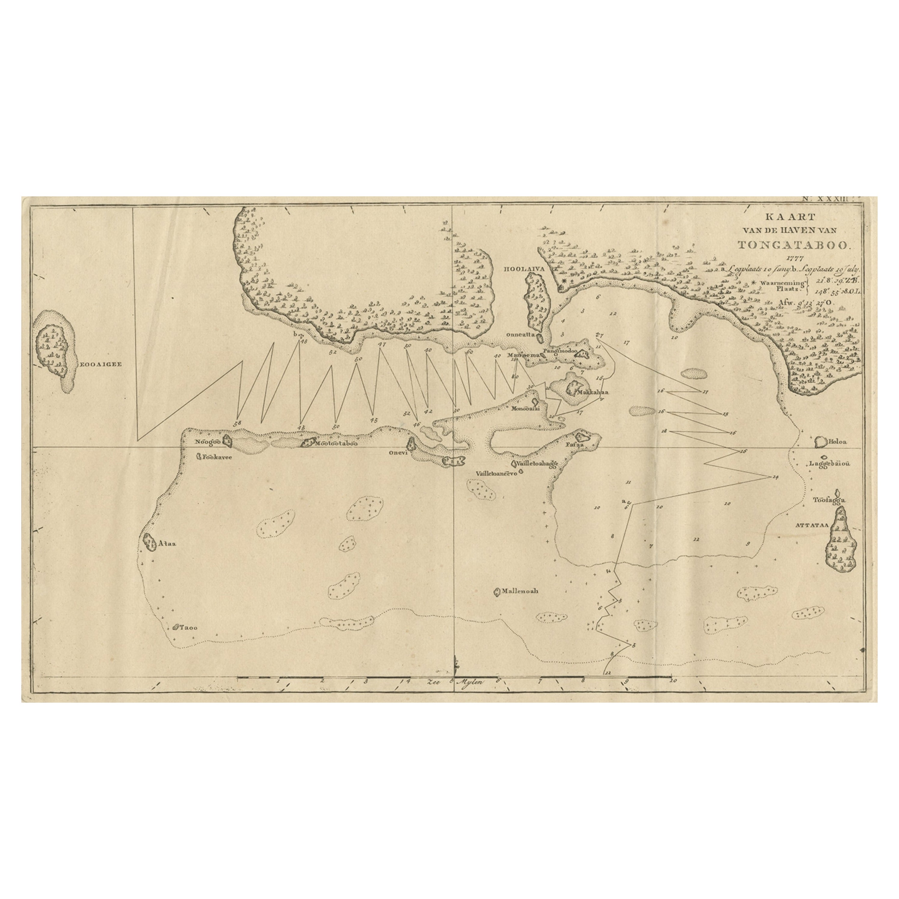
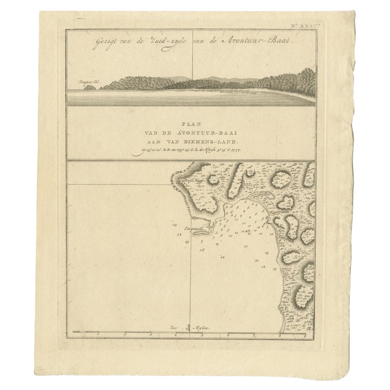
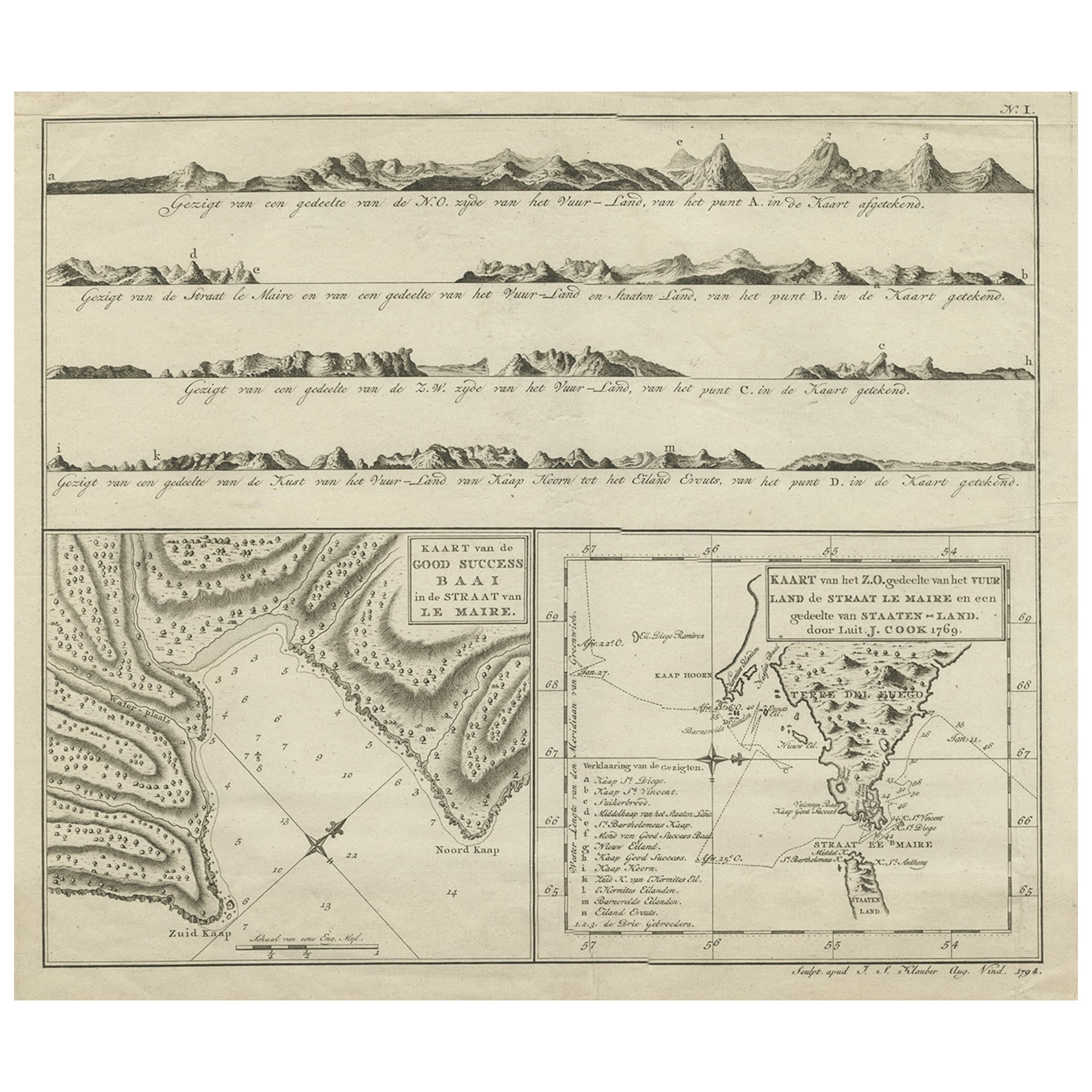
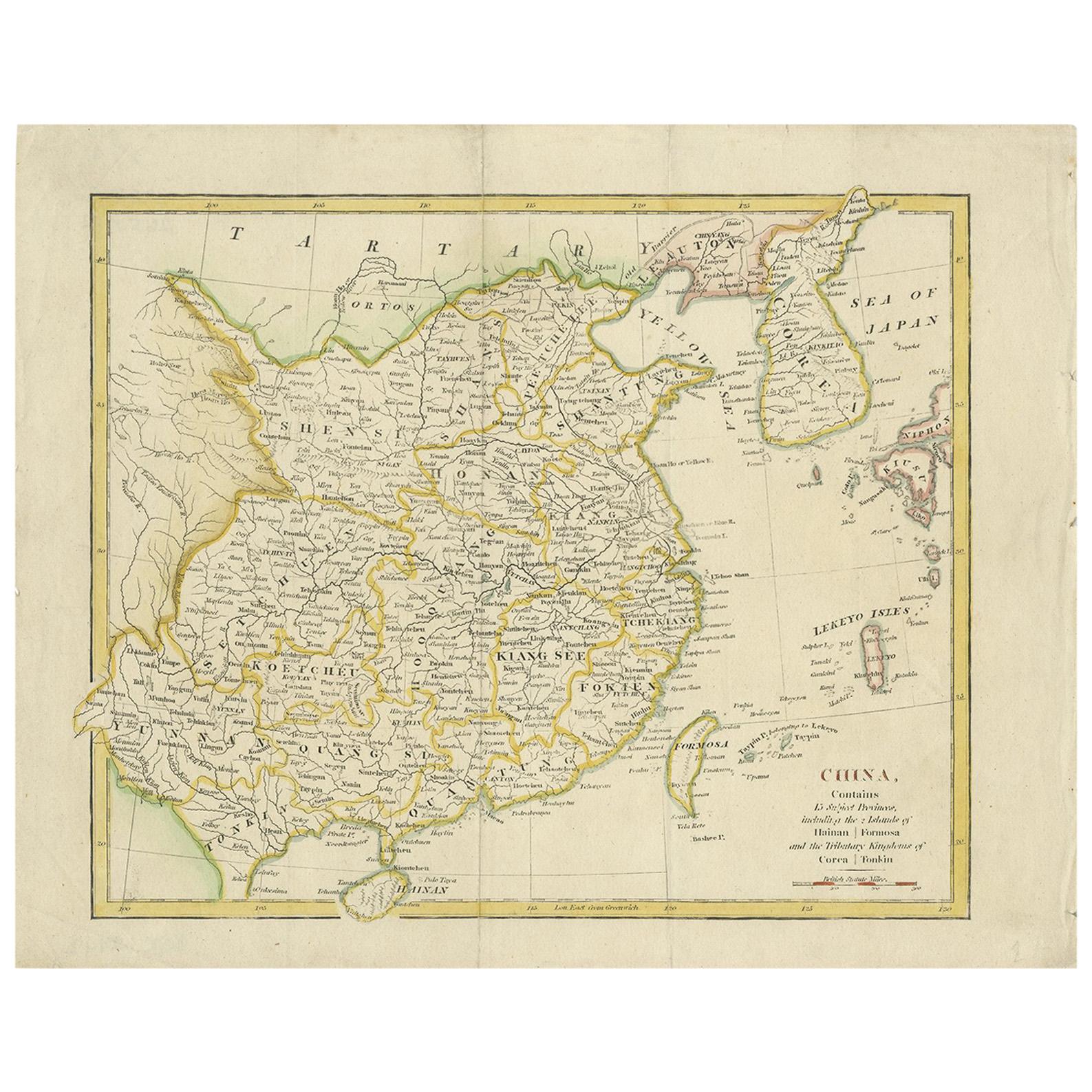
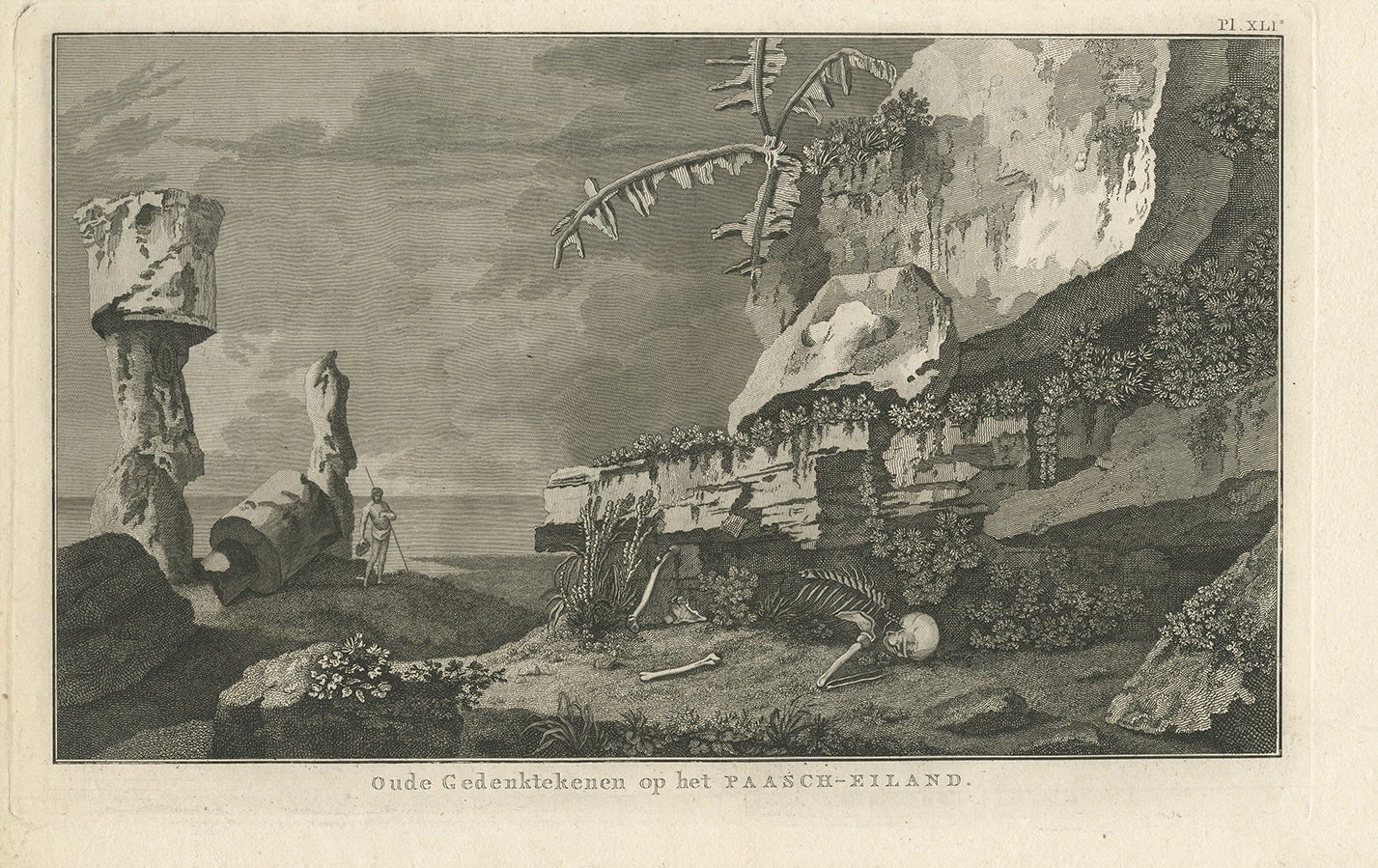
Antique Map of Easter Island, Polynesia, 1803
View Similar Items


Want more images or videos?
Request additional images or videos from the seller
1 of 6
Antique Map of Easter Island, Polynesia, 1803
About the Item
- Dimensions:Height: 11.42 in (29 cm)Width: 9.26 in (23.5 cm)Depth: 0 in (0.01 mm)
- Materials and Techniques:
- Period:
- Date of Manufacture:1803
- Condition:
- Seller Location:Langweer, NL
- Reference Number:Seller: BG-11487-451stDibs: LU3054326172152
About the Seller
5.0
Platinum Seller
These expertly vetted sellers are 1stDibs' most experienced sellers and are rated highest by our customers.
Established in 2009
1stDibs seller since 2017
1,949 sales on 1stDibs
More From This SellerView All
- Antique Map of the Island of Tahiti, Polynesia, 1803Located in Langweer, NLAntique map Tahiti titled 'Kaart van het Eiland Otahiti'. Antique map of the Island of Tahiti, Polynesia. Originates from 'Reizen Rondom de Waereld door James Cook (..)'. Art...Category
Antique Early 1800s Maps
MaterialsPaper
 $735 Sale Price24% Off
 - Antique Map of Suffren Island by Cook, 1803Located in Langweer, NLAntique map Australia titled 'Gezigt van het Eil. Suffren'. Antique map of Suffren Island. Originates from 'Reizen Rondom de Waereld door James C...Category
Antique 19th Century Maps
MaterialsPaper
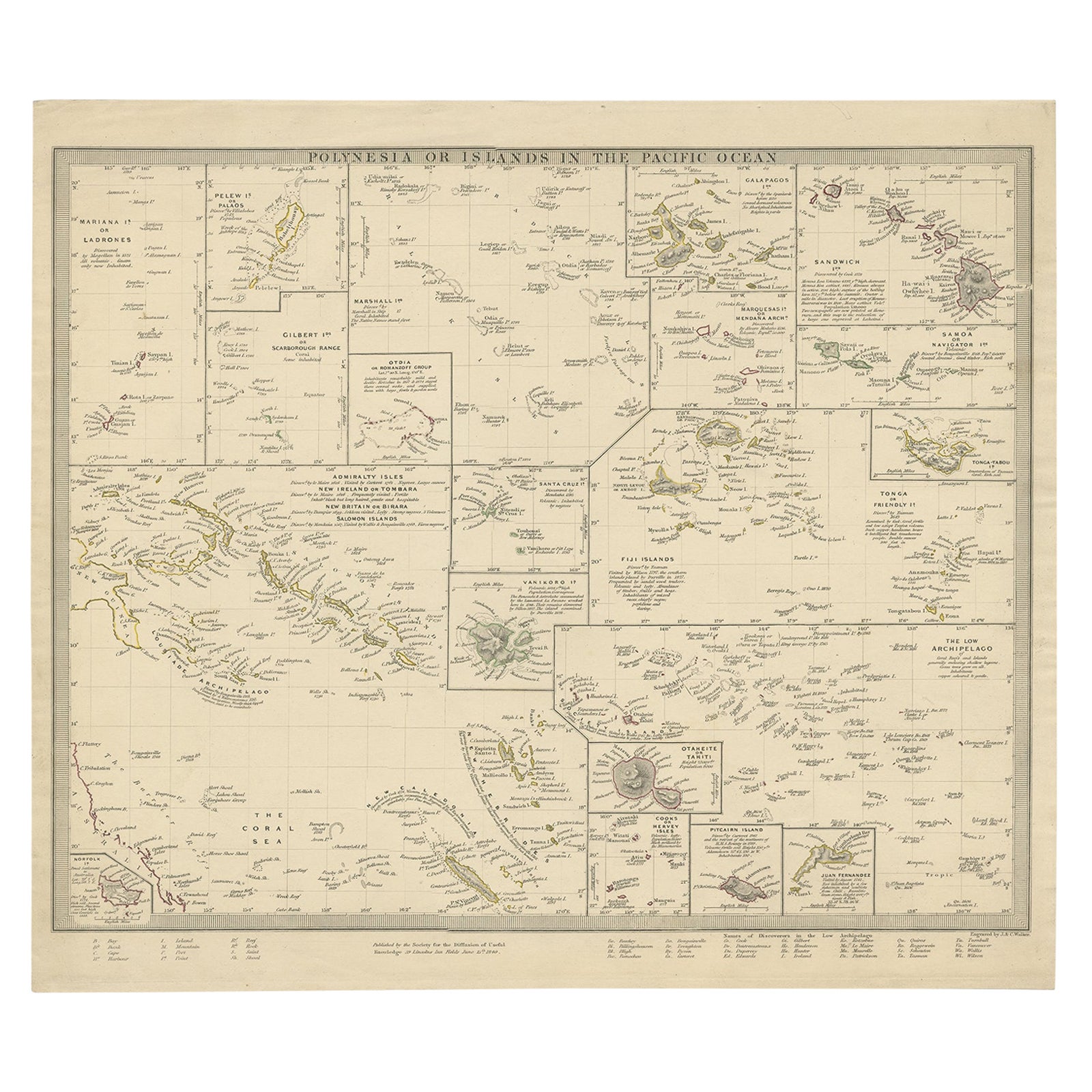
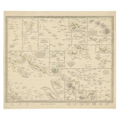
- Antique Map of Polynesia with Details of Many Islands, 1840Located in Langweer, NLAntique map titled 'Polynesia or Islands in the Pacific Ocean'. This map depicts various islands including the Lousiade Archipelago, Tahiti, Pitcairn Island, Juan Fernandez, The lo...Category
Antique 19th Century Maps
MaterialsPaper
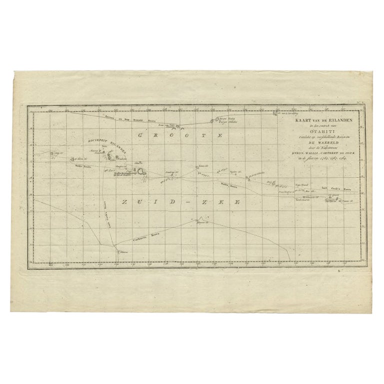
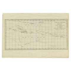
- Antique Map of French Polynesia by Cook Showing His Route, 1803Located in Langweer, NLAntique map Tahiti titled 'Kaart van de Eilanden in den omtrek van Otahiti (..)'. Antique map of French Polynesia with the tracks around the island of Tahiti by Captain Byron, Wallis...Category
Antique 19th Century Maps
MaterialsPaper
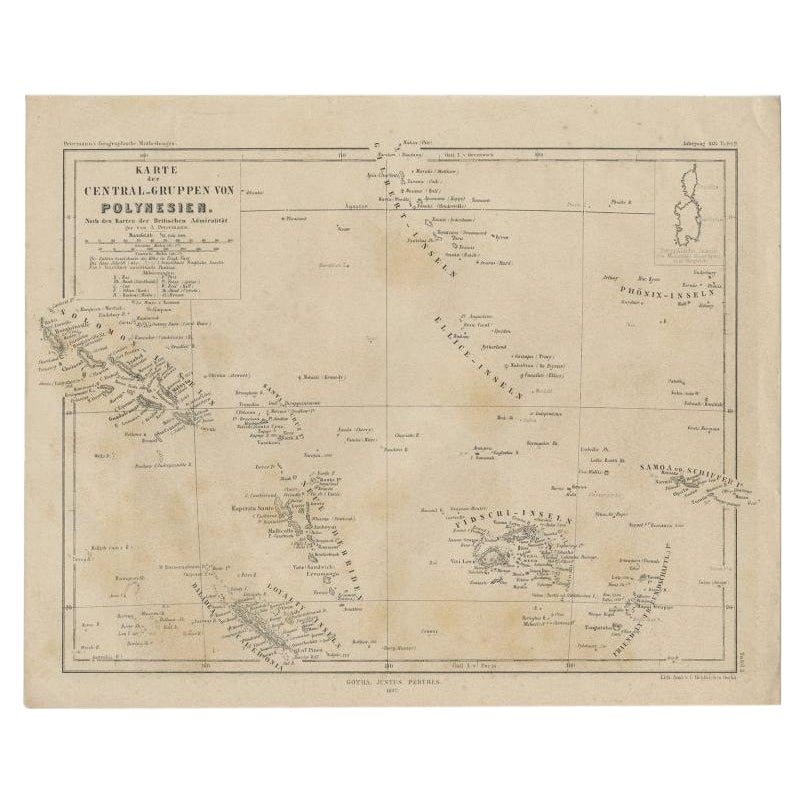
- Antique Map of Eastern Polynesia, 1849Located in Langweer, NLAntique map titled 'Ost-Polynesien'. Interesting variant issue, with large detailed insets top right of Hawaii volcanos near Kilauea. Insets lower right of Honolulu harbour, island o...Category
Antique Mid-19th Century Maps
MaterialsPaper
 $154 Sale Price30% Off
 - Antique Map of Western Polynesia, 1849Located in Langweer, NLAntique map titled 'Ost-Polynesien'. Detailed map of the western Pacific extending from the Celebes to Samoa and including part of Australia. Insets of...Category
Antique Mid-19th Century Maps
MaterialsPaper
 $154 Sale Price30% Off

You May Also Like
- Antique Map of Principality of MonacoBy Antonio Vallardi EditoreLocated in Alessandria, PiemonteST/619 - "Old Geographical Atlas of Italy - Topographic map of ex-Principality of Monaco" - ediz Vallardi - Milano - A somewhat special edition ---Category
Antique Late 19th Century Italian Other Prints
MaterialsPaper
 $228 Sale Price74% Off
 - Original Antique Map of Italy. C.1780Located in St Annes, LancashireGreat map of Italy Copper-plate engraving Published C.1780 Unframed.Category
Antique Early 1800s English Georgian Maps
MaterialsPaper

- Original Antique Map of Asia. C.1780Located in St Annes, LancashireGreat map of Asia Copper-plate engraving Published C.1780 Two small worm holes to right side of map Unframed.Category
Antique Early 1800s English Georgian Maps
MaterialsPaper

- Original Antique Map of India. C.1780Located in St Annes, LancashireGreat map of India Copper-plate engraving Published C.1780 Three small worm holes to right side of map and one bottom left corner Unframed.Category
Antique Early 1800s English Georgian Maps
MaterialsPaper

- Original Antique Map of Italy. Arrowsmith. 1820Located in St Annes, LancashireGreat map of Italy Drawn under the direction of Arrowsmith Copper-plate engraving Published by Longman, Hurst, Rees, Orme and Brown, 1820 Unframed.Category
Antique 1820s English Maps
MaterialsPaper

- Original Antique Map of South America. C.1780Located in St Annes, LancashireGreat map of South America Copper-plate engraving Published C.1780 Two small worm holes to left side of map Unframed.Category
Antique Early 1800s English Georgian Maps
MaterialsPaper

Recently Viewed
View AllMore Ways To Browse
Antique Easter
James Cook Map
Antique Easter Collectibles
Antique Furniture Long Island
Antique Map London
Antique London Maps
Antique London Map
London Antique Maps
Antique Maps London
London Antique Map
London Map Antique
Ship Map
Map Of Britain
Antique Law Office Furniture
Antique Maps Of London
Antique Map Of London
Antique And Collectable Fairs
Antique Maps Amsterdam