Items Similar to City View of Nuremberg, Germany: An 18th Century Hand-Colored Map by M. Seutter


Want more images or videos?
Request additional images or videos from the seller
1 of 13
City View of Nuremberg, Germany: An 18th Century Hand-Colored Map by M. Seutter
About the Item
An 18th century hand-colored city view of Nuremburg, Germany entitled "Geometrischer Grundris der des Heiligen Römischen Reichs Freyen Stadt Nürnberg" by Matthaus Seutter from his "Atlas novus sive tabulae geographicae totius orbis faciem", published in Augsburg, Germany in 1740.
This beautiful and colorful plan of the city of Nuremberg depicts the city walls and ramparts, as well as buildings and streets in great detail. Buildings, including churches, administration buildings and Nuremburg Castle are numbered and named in accompanying legends. The artistic title cartouche is located in the upper center, with a figure on the left and an eagle on the right, wearing a crown and holding a royal scepter, sword and the royal apple topped by a cross. The crown, sword and apple are highlighted in gold. An engraved depiction of Mercury sitting on a mileage marker is in the lower left. He is waving to a passing rider leading a horse drawn cart, who waves back. His helmut and sceptor are highlighted in gold. A large coat of arms is present on the right and four small coat-of-arms are placed just beyond the city walls. A prominent area of German text occupies the lower right corner.
This large colorful copper-plate hand-colored map is printed on thick chain-linked paper with wide margins. The margins may have been previously professionally reinforced on the verso and the center fold smoothed. The sheet measures 22" high and 24.25" wide. The map is in excellent condition.
Matthäus Seutter (1685-1757) was the son of a goldsmith in Augsburg, Germany. He studied in Nuremberg and following his schooling, was apprenticed as a brewer. Realizing that his future was elsewhere, he moved to Nuremberg where he became an apprentice engraver to the prominent publisher and cartographer Johann Baptiste Homann. Upon returning to Augsburg, he started his own publishing firm in 1710, creating maps, atlases, and globes. By 1732, Seutter was one of the most prolific publishers of his era and was given the title of “Imperial Geographer” to the German Emperor Charles VI. Seutter's most well-known works are the "Atlas Geographicus oder Accurate Vorstellung der ganzen Welt" (Geographical Atlas or an Accurate Depiction of the Whole World) in 1725, "Grosser Atlas" (Large Atlas) in the 1734, and "Atlas Minor" (Small Atlas) in 1744. Following his death in 1757 his son Albrecht Karl, his son-in-law Conrad Tobias Lotter, and his business partner Johann Michael Probst ran the printing business.
- Creator:Matthew Seutter (Artist)
- Dimensions:Height: 22 in (55.88 cm)Width: 24.25 in (61.6 cm)Depth: 0.13 in (3.31 mm)
- Materials and Techniques:Paper,Engraved
- Place of Origin:
- Period:
- Date of Manufacture:1740
- Condition:Additions or alterations made to the original: The sheet margins may have been previously professionally and expertly reinforced on the verso and the center fold smoothed.
- Seller Location:Alamo, CA
- Reference Number:
About the Seller
5.0
Vetted Seller
These experienced sellers undergo a comprehensive evaluation by our team of in-house experts.
1stDibs seller since 2020
12 sales on 1stDibs
- ShippingRetrieving quote...Ships From: Alamo, CA
- Return PolicyA return for this item may be initiated within 7 days of delivery.
More From This SellerView All
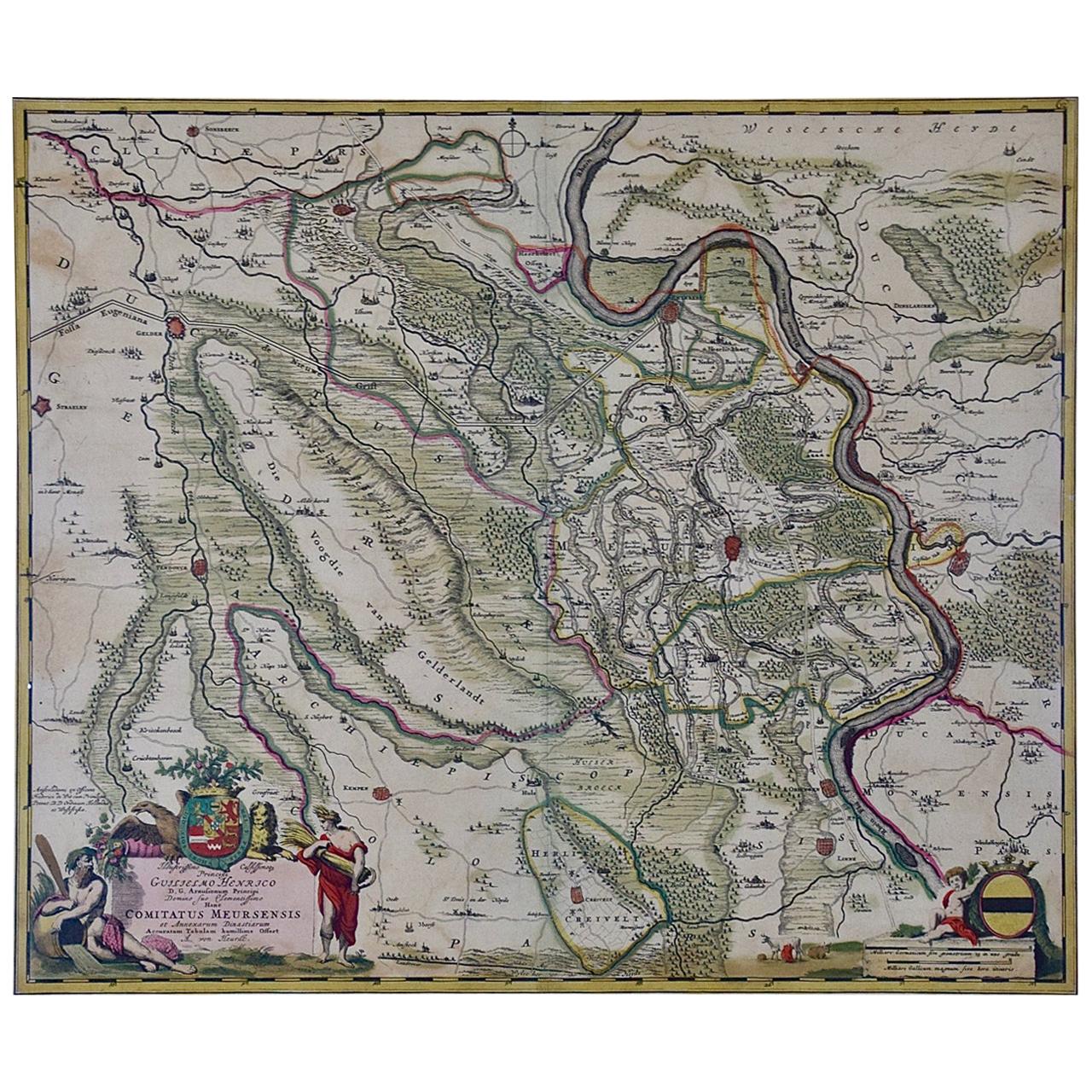
- Germany West of the Rhine: A Hand-colored 18th Century Map by de WitBy Frederick de WitLocated in Alamo, CAThis original 18th century hand-colored map of the county of Moers, Germany entitled "Illustrissimo Celsissmo Principi GUILIELMO HENRICO D.G. Arausionum Principi Domino suo Clementis...Category
Antique Early 18th Century Dutch Maps
MaterialsPaper
- 18th Century Hand-Colored Homann Map of Germany, Including Frankfurt and BerlinBy Johann Baptist HomannLocated in Alamo, CAAn 18th century hand-colored map entitled "Tabula Marchionatus Brandenburgici et Ducatus Pomeraniae quae sunt Pars Septentrionalis Circuli Saxoniae Superioris" by Johann Baptist Homa...Category
Antique Early 18th Century German Maps
MaterialsPaper
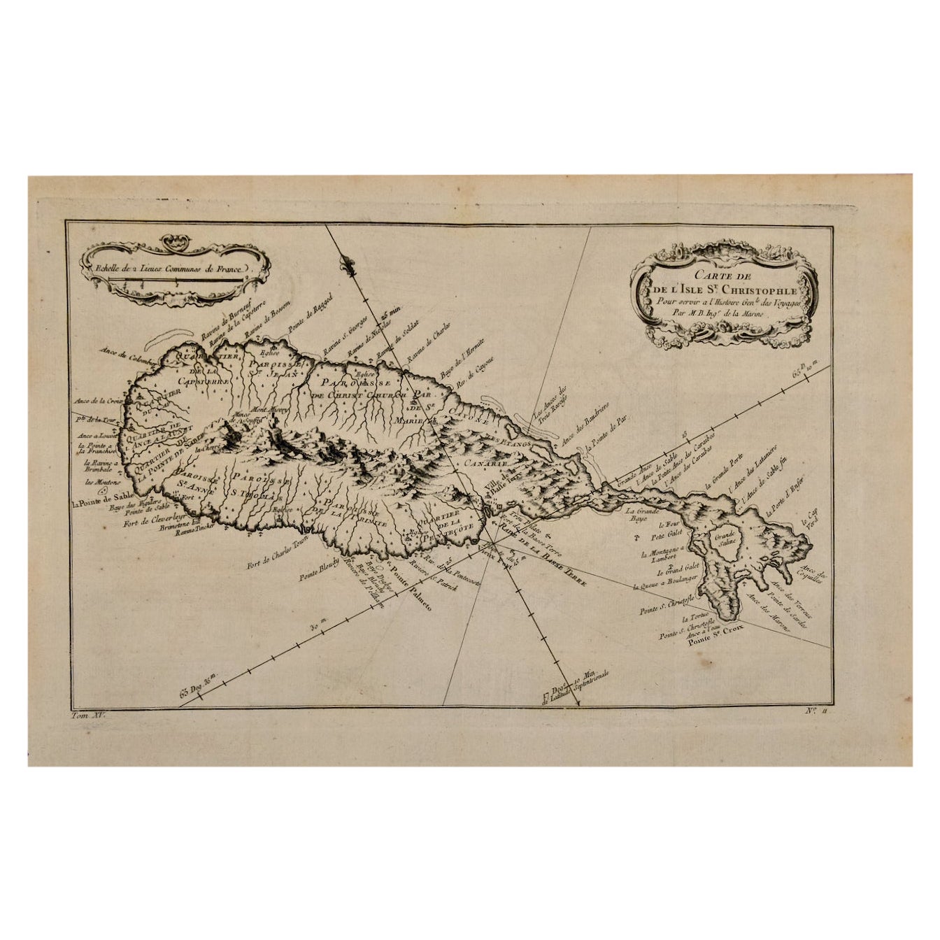
- St. Christophe 'St. Kitts' Island: An 18th Century Hand-colored Map by BellinBy Jacques-Nicolas BellinLocated in Alamo, CAJacques Bellin's copper-plate map of the Caribbean island of Saint Kitts entitled "Carte De De l'Isle St. Christophe Pour servir á l'Histoire Genle. des V...Category
Antique Mid-18th Century French Maps
MaterialsPaper
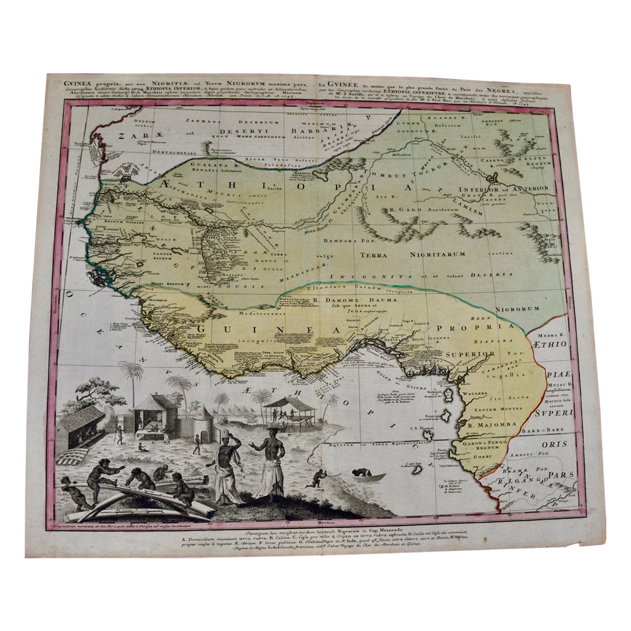
- West Africa Entitled "Guinea Propria": An 18th Century Hand Colored Homann MapBy Johann Baptist HomannLocated in Alamo, CAThis is a scarce richly hand colored copper plate engraved map of Africa entitled "Guinea Propria, nec non Nigritiae vel Terrae Nigrorum Maxima Pars" by Johann Baptist Homann (1664-1...Category
Antique Mid-18th Century German Maps
MaterialsPaper
- 18th Century Hand Colored Map of Spain and Portugal by VisscherBy Nicolaes Visscher IILocated in Alamo, CAThis is an early 18th century map of Spain and Portugal, with attractive original hand-coloring, entitled "Hispaniae et Portugalliae Regna per Nicolaum Visscher cum Privilegio Ordinu...Category
Antique Early 18th Century Dutch Maps
MaterialsPaper
- 18th Century French Map and City View of Joppe/Jaffa 'Tel Aviv' by SansonBy Nicolas SansonLocated in Alamo, CAAn original antique engraving entitled "Joppe; in ’t Hebreeusch by ouds Japho; hedendaags Japha, of Jaffa; volgens d’aftekening gedaan 1668", by Nicholas Sanson d'Abbeville (1600 - 1667). This is a view of the city of Joppe (in Hebrew Japho), now called Japha or Jaffa, the harbor portion of modern day Tel Aviv, Israel as it appeared in 1668 . It depicts a very busy harbor with numerous boats. A large ship on the left appears to be firing its canons and a small ship on the right appears to be sitting very low in the water, either heavily loaded with cargo or sinking. The town is seen on the far shore with a fortress on a hill across in the background. The map is printed from the original Sanson copperplate and was published in 1709 by his descendants. The map is presented in an ornate brown wood frame embellished by gold-colored leaves and gold inner trim with a double mat; the outer mat is cream-colored and the inner mat is black. There is a central vertical fold, as issued. There are two small spots in the lower margin and one in the upper margin, as well as two tiny spots adjacent to the central fold. 1717 is written below the date 1668 in the inscription. The map is otherwise in very good condition. Another map of the "Holy Land" (by Claes Visscher in 1663), with an identical style frame and mat is available. This pair of maps would make a wonderful display grouping. Please see Reference #LU5206220653552. A discount is available for the purchase of the pair of maps. Artist: Nicholas Sanson d'Abbeville (1600-1667) and his descendents were important French cartographer's active through the 17th century. Sanson started his career as a historian and initially utilized cartography to illustrate his historical treatises. His maps came to the attention of Cardinal Richelieu and then King Louis XIII of France, who became a supporter and sponsor. He subsequently appointed Sanson 'Geographe Ordinaire du Roi' the official map maker to the king. Sanson not only created maps for the king, but advised him on geographical issues and curated his map collection...Category
Antique Early 18th Century French Maps
MaterialsPaper


You May Also Like
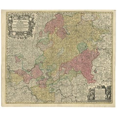
- Antique Map of Northern Germany by M. Seutter, circa 1730By Matthew SeutterLocated in Langweer, NLAntique map titled 'Saxoniae Inferioris Circulus'. Old map of the northern part of Germany by M. Seutter. Covering the area of Lower Saxony, Mecklenburg-Vorpommern and Schleswig-Hols...Category
Antique Mid-18th Century Maps
MaterialsPaper
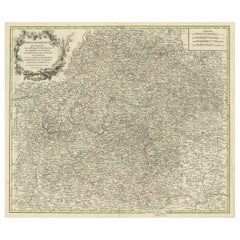
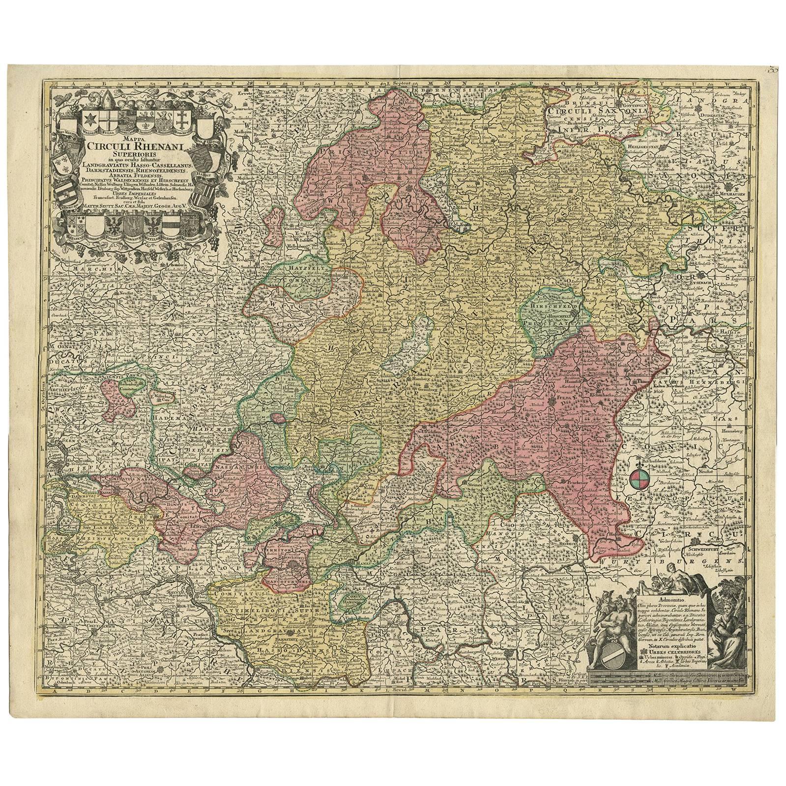
- Hand-Colored Antique Map of part of Germany by M. Seutter, c. 1730By Matthew SeutterLocated in Langweer, NLAntique map titled 'Mappa Circuli Rhenani Superioris (..). Original map with hand coloring of part of Germany. It includes the region of Kassel, Göttingen, Eisenach, Schweinfurt, Wer...Category
Antique Mid-18th Century Maps
MaterialsPaper
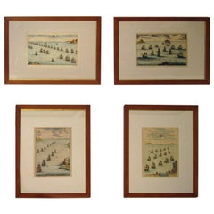
- 18th century Set Hand Colored Nautical EngravingsBy M. OgierLocated in Savannah, GASigned M. Ogier (Fecit:by), this set of four hand colored engravings is part of a larger edition of plates. These plates are numbered PL 16, 347, 365 and 386. The subject is probably...Category
Antique 18th Century Unknown Elizabethan Prints
MaterialsGlass, Wood, Paper
- Antique Map of Greece by Seutter or Lotter, 'c.1740'Located in Langweer, NLAntique map titled 'Graecia pars Septentrionalis'. Original antique map of Greece, uncommon. Signed cum Gratia et Privil. S.R.I. Vicariatus (..)'. Published by Seutter or Lotter, cir...Category
Antique Mid-18th Century Maps
MaterialsPaper
- Map of the Circle of Franconia, Germany Bamberg, Wurtzburg and Nuremberg, 1757Located in Langweer, NLAntique map titled 'Cercle de Franconie (..)'. Map of the Circle of Franconia, Germany. Centered on Bamberg, Wurtzburg and Nuremberg. This map originates from 'Atlas Universel (..)'. Artists and Engravers: Gilles Robert de Vaugondy (1688 - 1766), also known as Le Sieur or Monsieur Robert, and his son, Didier Robert de Vaugondy (c.1723 - 1786), were leading mapmakers in France during the 18th century. In 1757, they published The Atlas Universel, one of the most important atlases of the 18th century. To produce the atlas, the Vaugondys integrated older sources with more modern surveyed maps...Category
Antique 1750s Maps
MaterialsPaper
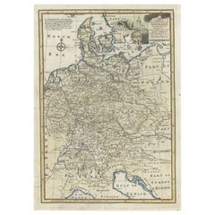
- Antique Map of Germany During the Mid-18th Century, Published in 1747Located in Langweer, NLAntique map Germany titled 'A New & Accurate Map of Germany'. It covers Germany during the mid-18th century, which included all of modern day Germany, Austria, Switzerland, Czech Rep...Category
Antique 18th Century Maps
MaterialsPaper