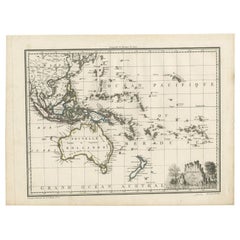
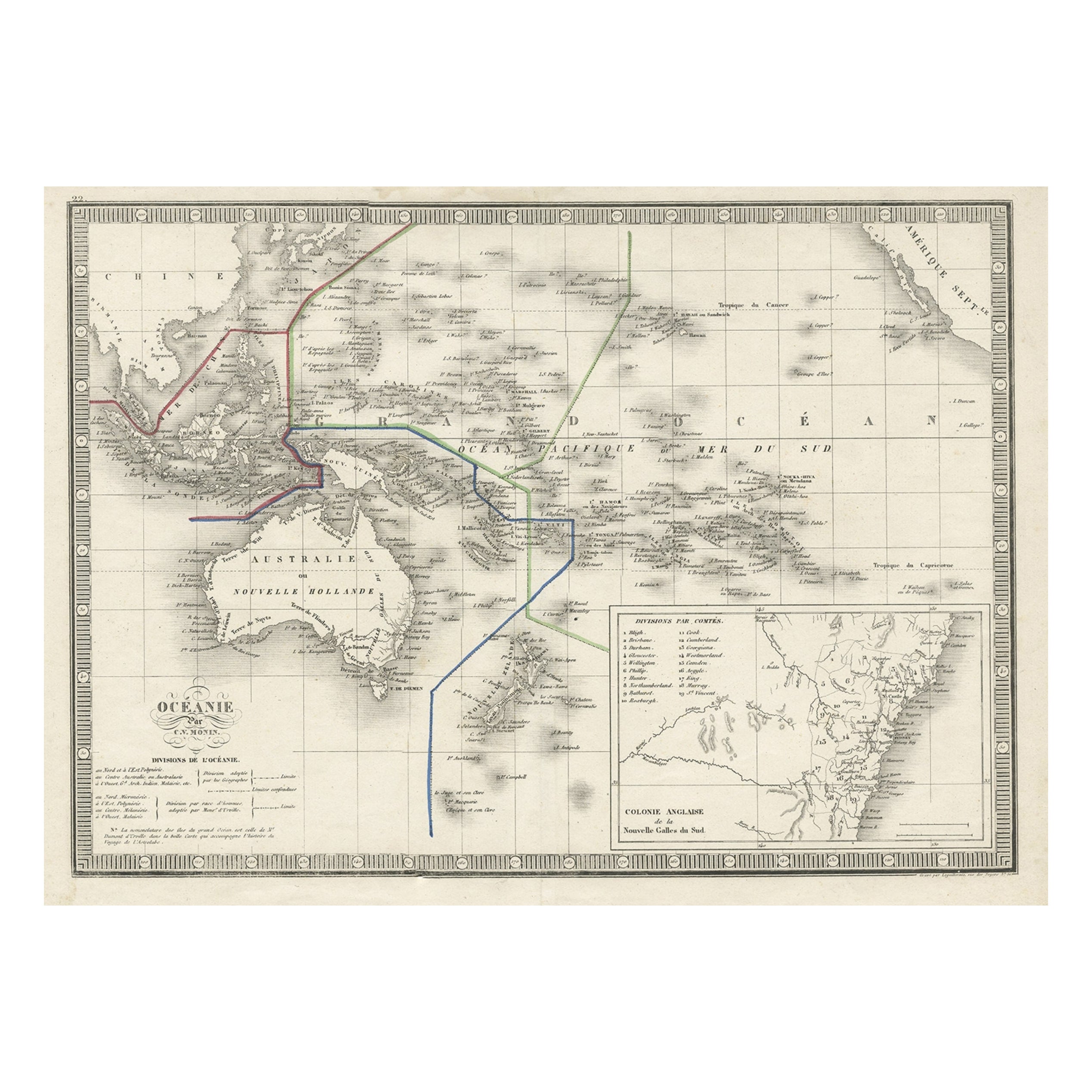
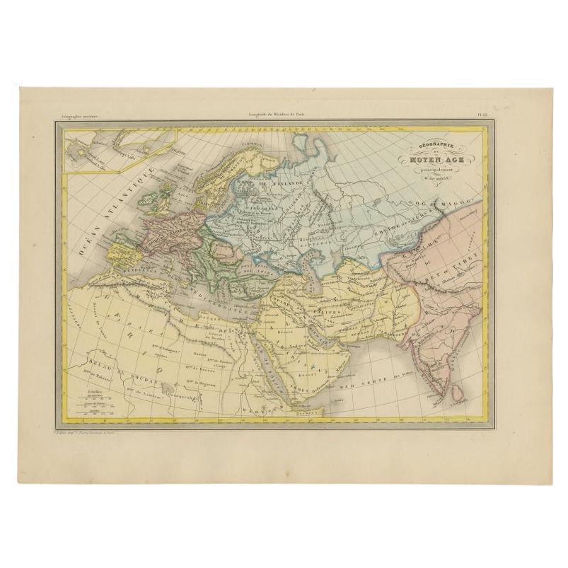
Antique Map of Oceania by Malte-Brun, 1812
View Similar Items


Want more images or videos?
Request additional images or videos from the seller
1 of 5
Antique Map of Oceania by Malte-Brun, 1812
About the Item
- Dimensions:Height: 9.85 in (25 cm)Width: 13.39 in (34 cm)Depth: 0.02 in (0.5 mm)
- Materials and Techniques:
- Period:
- Date of Manufacture:1812
- Condition:Wear consistent with age and use. General age-related toning, please study images carefully.
- Seller Location:Langweer, NL
- Reference Number:Seller: BG-100621stDibs: LU3054316252991
About the Seller
5.0
Platinum Seller
These expertly vetted sellers are 1stDibs' most experienced sellers and are rated highest by our customers.
Established in 2009
1stDibs seller since 2017
1,949 sales on 1stDibs
More From This SellerView All
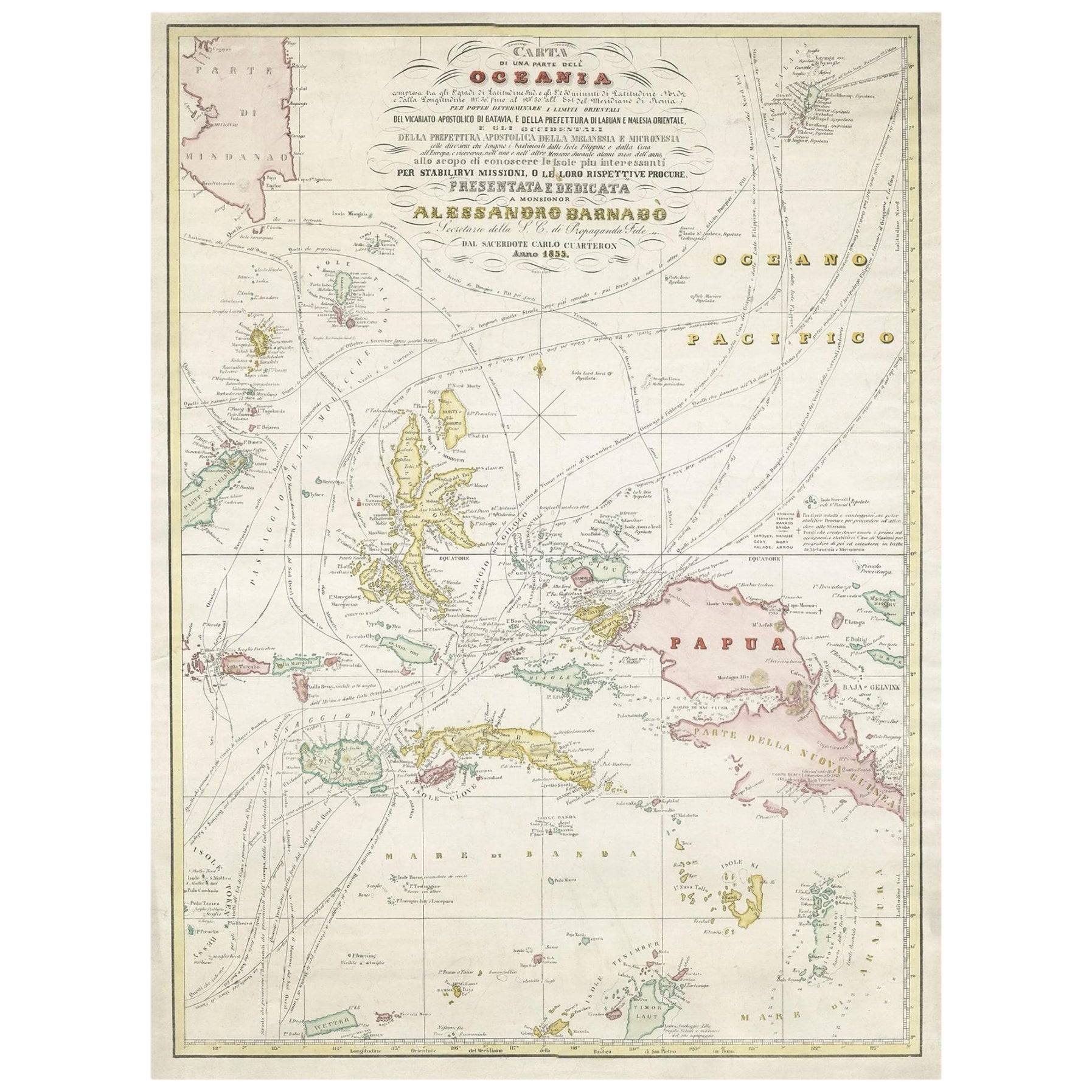
- Antique Map of Oceania by Balbi '1847'Located in Langweer, NLAntique map titled 'Océanie'. Original antique map of Oceania. This map originates from 'Abrégé de Géographie (..)' by Adrien Balbi. Published 1847.Category
Antique Mid-19th Century Maps
MaterialsPaper
- Antique Map of Oceania by Levasseur, '1875'Located in Langweer, NLAntique map titled 'Carte générale de l'Océanie'. Large map of Oceania. This map originates from 'Atlas de Géographie Moderne Physique et Politique' by A. Levasseur. Published 1875.Category
Antique Late 19th Century Maps
MaterialsPaper
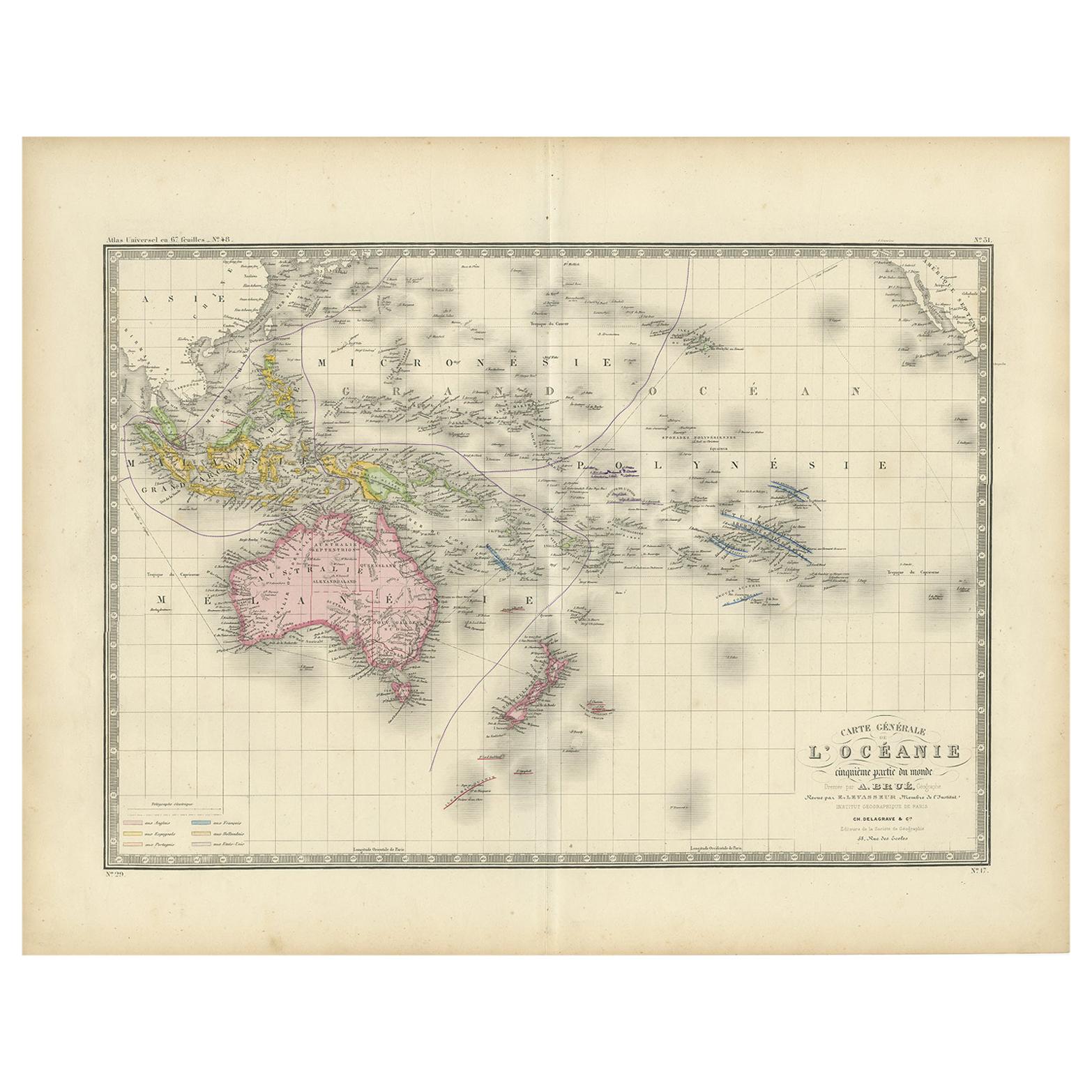
- Antique Map of Oceania by Levasseur, circa 1860Located in Langweer, NLAntique map titled 'Carte générale de l'Océanie'. Large map of Oceania including New Zealand, Australia, Polynesia, Micronesia and the East Indies. This map originates from 'Atlas Un...Category
Antique Mid-19th Century Maps
MaterialsPaper
 $220 Sale Price20% Off
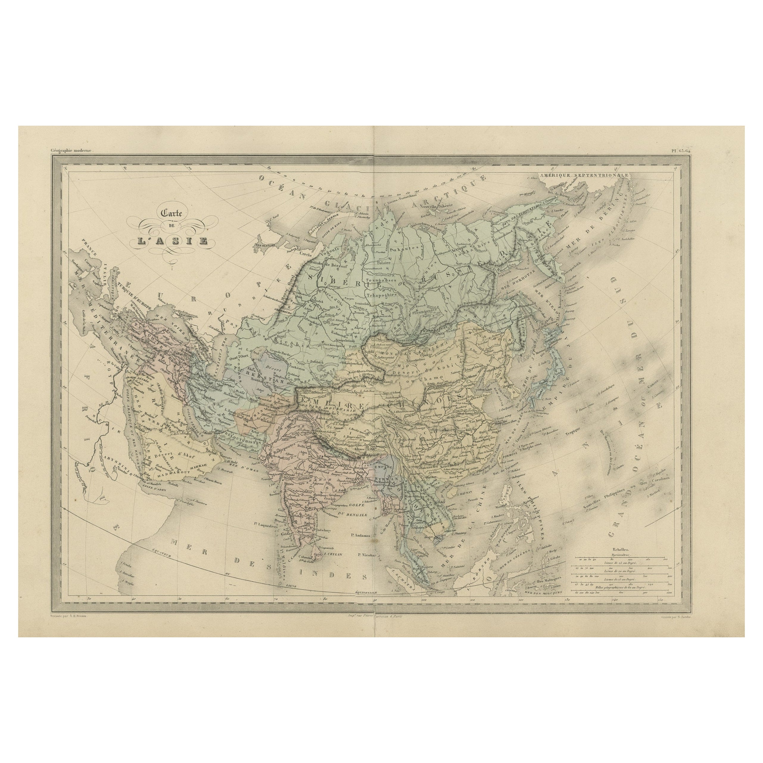
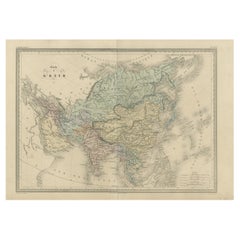
 - Antique Map of Asia by Malte-Brun, 1880Located in Langweer, NLMap Pl. 63 - 64: 'Carte de l'Asie.' This map shows Asia. This original antique map originates from 'Atlas de la Geographie Universelle ou Description de toutes les parties du monde s...Category
Antique 19th Century Maps
MaterialsPaper
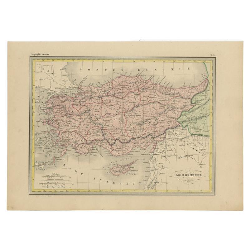
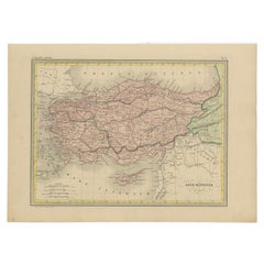
- Antique Map of Asia Minor by Malte-Brun, 1847Located in Langweer, NLAntique map titled 'Asie Mineure Ancienne'. This is an original antique map of Asia Minor from Malte Brun's "" Atlas de Géographie Universelle"", revised by...Category
Antique 19th Century Maps
MaterialsPaper
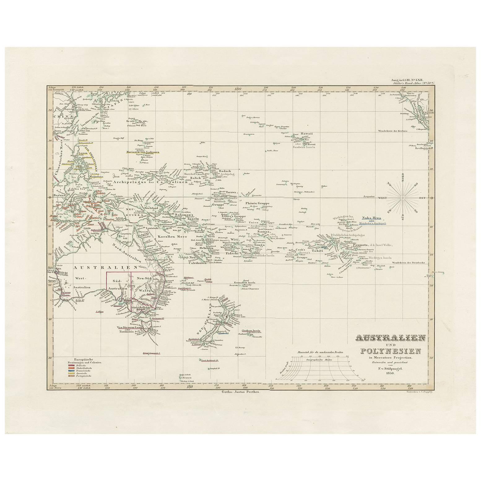
- Antique Map of Australia, New Zealand and Oceania by F. von Stülpnagel, 1850Located in Langweer, NLAntique map titled 'Australien und Polynesien in Mercators Projection'. A map of Australia, New Zealand and Oceania. This includes Fiji, Tahiti and several other island groups in the...Category
Antique Mid-19th Century Maps
MaterialsPaper
 $169 Sale Price30% Off


You May Also Like
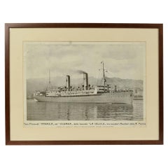
- 1930s Antique Nautical Print Depicting Oceania ship by Adolfo Barabino GenovaLocated in Milan, ITLithograph on paper published by S.A.I.G, Adolfo Barabino Genova depicting the Oceania steamer. Title of the lithograph “America and Oceania Steamboats of the La Veloce Company, Auxi...Category
Vintage 1930s Italian Nautical Objects
MaterialsWood, Paper
- Antique Map of Italy by Andriveau-Goujon, 1843By Andriveau-GoujonLocated in New York, NYAntique Map of Italy by Andriveau-Goujon, 1843. Map of Italy in two parts by Andriveau-Goujon for the Library of Prince Carini at Palazzo Carini i...Category
Antique 1840s French Maps
MaterialsLinen, Paper
 $3,350 / set
 - Antique Map of Principality of MonacoBy Antonio Vallardi EditoreLocated in Alessandria, PiemonteST/619 - "Old Geographical Atlas of Italy - Topographic map of ex-Principality of Monaco" - ediz Vallardi - Milano - A somewhat special edition ---Category
Antique Late 19th Century Italian Other Prints
MaterialsPaper
 $228 Sale Price74% Off
 - Original Antique Map of Russia By Arrowsmith. 1820Located in St Annes, LancashireGreat map of Russia Drawn under the direction of Arrowsmith Copper-plate engraving Published by Longman, Hurst, Rees, Orme and Brown, 1820 Unframed.Category
Antique 1820s English Maps
MaterialsPaper

- Original Antique Map of Belgium by Tallis, Circa 1850Located in St Annes, LancashireGreat map of Belgium Steel engraving Many lovely vignettes Published by London Printing & Publishing Co. ( Formerly Tallis ), C.1850 Origin...Category
Antique 1850s English Maps
MaterialsPaper
- Original Antique Map of China by Thomas Clerk, 1817Located in St Annes, LancashireGreat map of China Copper-plate engraving Drawn and engraved by Thomas Clerk, Edinburgh. Published by Mackenzie And Dent, 1817 Unframed.Category
Antique 1810s English Maps
MaterialsPaper


Recently Viewed
View AllMore Ways To Browse
De Nile Antiques
Serbia Map
1859 Asia Map
W. & A.K. Johnston On Sale
Yugoslavia Map
Antique Map Of Republic Of Texas
Atlas School Supply On Sale
Charente Map
F Colton
Ithaca Antique Map
Port Antonio Map
Rand McNally & Co. On Sale
Rand Mcnally Map Of California
Rand Mcnally Map Of Colorado
Map Of German
Antique Old World Maps
Paris Antique Map
Old French Map