
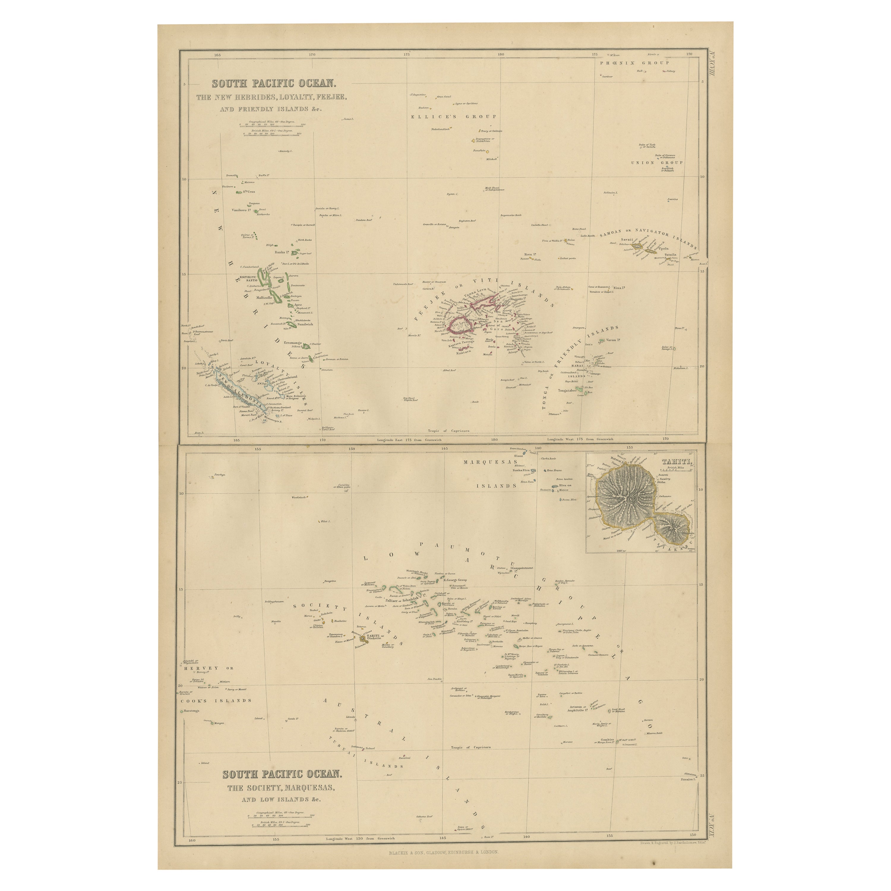
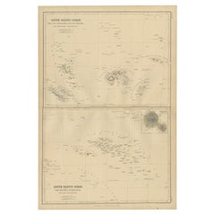
Antique Map of Oceania and the Pacific Ocean by A & C. Black, 1870
View Similar Items


Want more images or videos?
Request additional images or videos from the seller
1 of 6
Antique Map of Oceania and the Pacific Ocean by A & C. Black, 1870
About the Item
- Dimensions:Height: 17.52 in (44.5 cm)Width: 23.63 in (60 cm)Depth: 0.02 in (0.5 mm)
- Materials and Techniques:
- Period:
- Date of Manufacture:1870
- Condition:Wear consistent with age and use. General age-related toning. Small tear/damage near New Zealand, some foxing, Please study image carefully.
- Seller Location:Langweer, NL
- Reference Number:Seller: BG-12784-541stDibs: LU3054325442252
About the Seller
5.0
Platinum Seller
These expertly vetted sellers are 1stDibs' most experienced sellers and are rated highest by our customers.
Established in 2009
1stDibs seller since 2017
1,933 sales on 1stDibs
More From This SellerView All
- Antique Map of the Islands in the Pacific Ocean by Wyld, '1845'Located in Langweer, NLAntique map titled 'Islands in the Pacific Ocean'. Original antique map of the islands in the Pacific Ocean. This map originates from 'An Atlas of the World, Comprehending Separate M...Category
Antique Mid-19th Century Maps
MaterialsPaper
- Antique Map of South Pacific Ocean by W. G. Blackie, 1859Located in Langweer, NLAntique map titled 'South Pacific Ocean'. Original antique map of South Pacific Ocean with inset Map of Tahiti. This map originates from ‘The Imperial Atlas of Modern Geography’. Pub...Category
Antique Mid-19th Century Maps
MaterialsPaper
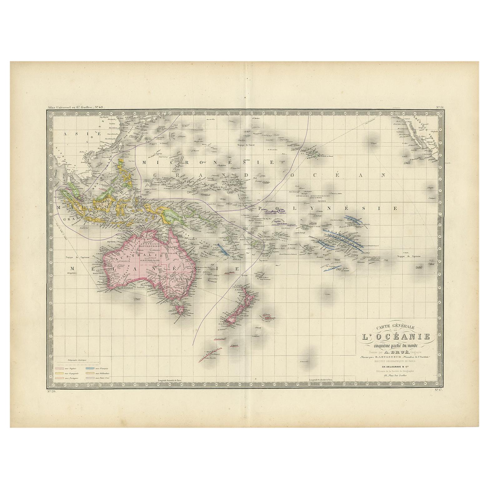
- Antique Map of Oceania by Levasseur, '1875'Located in Langweer, NLAntique map titled 'Carte générale de l'Océanie'. Large map of Oceania. This map originates from 'Atlas de Géographie Moderne Physique et Politique' by A. Levasseur. Published 1875.Category
Antique Late 19th Century Maps
MaterialsPaper
- Antique Map of Oceania by Balbi '1847'Located in Langweer, NLAntique map titled 'Océanie'. Original antique map of Oceania. This map originates from 'Abrégé de Géographie (..)' by Adrien Balbi. Published 1847.Category
Antique Mid-19th Century Maps
MaterialsPaper
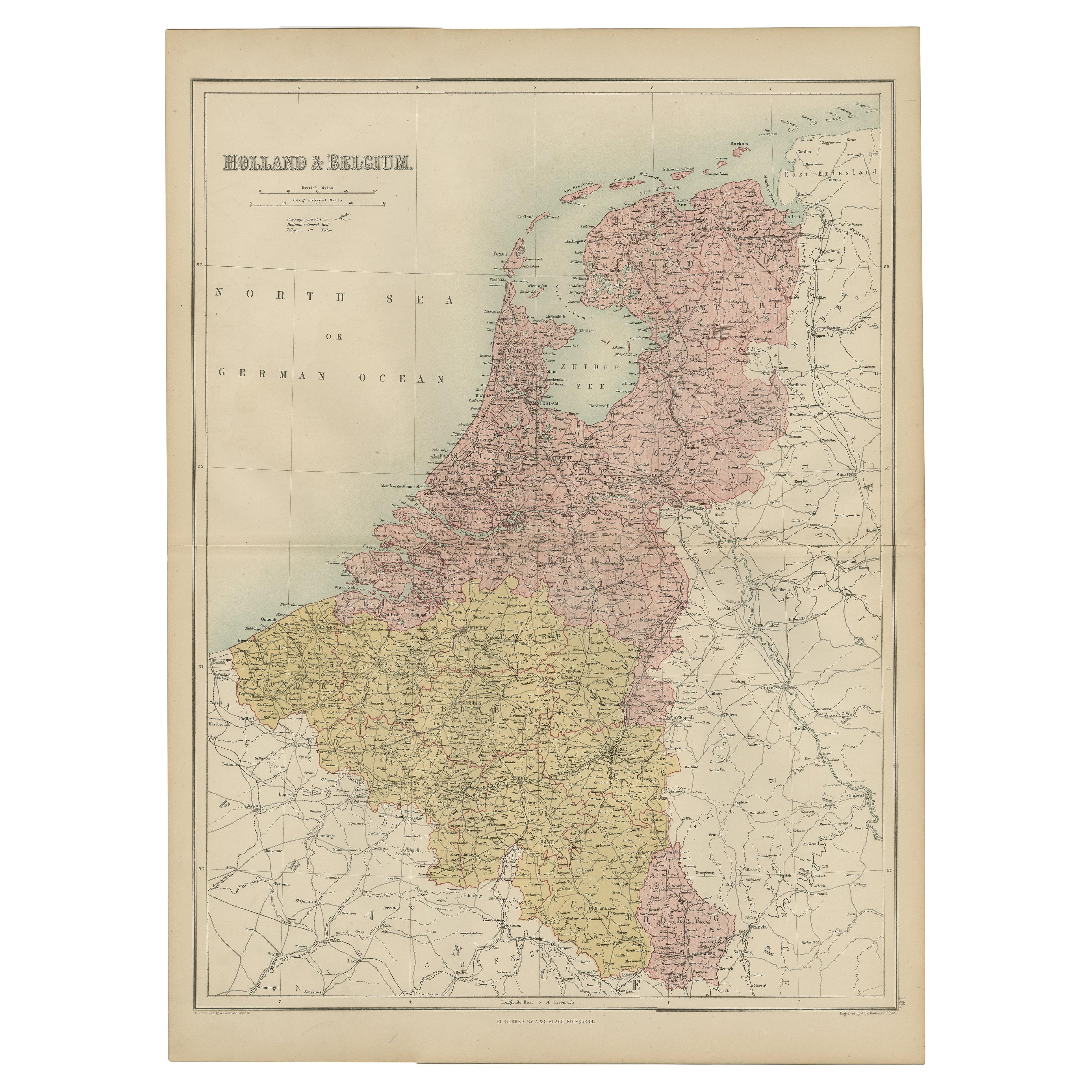
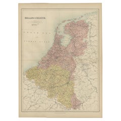
- Antique Map of The Netherlands and Belgium by A & C, Black, 1870Located in Langweer, NLAntique map titled 'Holland & Belgium'. Original antique map of Map of The Netherlands and Belgium. This map originates from ‘Black's General Atlas of The World’. Published by A & C....Category
Antique Late 19th Century Maps
MaterialsPaper
- Antique Map of the East Indies by A & C. Black, 1870Located in Langweer, NLAntique map titled 'Indian Archipelago and Further India including Burmah, Siam, Anam &c'. Original antique map of Indian Archipelago and Further India. This map originates from ‘Bla...Category
Antique Late 19th Century Maps
MaterialsPaper


You May Also Like
- Large Original Antique Map of The Pacific Ocean, Fullarton, C.1870Located in St Annes, LancashireGreat map of The Pacific Ocean From the celebrated Royal Illustrated Atlas Lithograph by Swanston. Original color. Published by Fullarton,...Category
Antique 1870s Scottish Maps
MaterialsPaper
- Original Antique Map of The World by Thomas Clerk, 1817Located in St Annes, LancashireGreat map of The Eastern and Western Hemispheres On 2 sheets Copper-plate engraving Drawn and engraved by Thomas Clerk, Edinburgh. Published by Mackenzie And Dent, 1817 ...Category
Antique 1810s English Maps
MaterialsPaper
- Original Antique Map of The Netherlands, Engraved by Barlow, Dated 1807Located in St Annes, LancashireGreat map of Netherlands Copper-plate engraving by Barlow Published by Brightly & Kinnersly, Bungay, Suffolk. Dated 1807 Unframed.Category
Antique Early 1800s English Maps
MaterialsPaper
- Map of the Republic of GenoaLocated in New York, NYFramed antique hand-coloured map of the Republic of Genoa including the duchies of Mantua, Modena, and Parma. Europe, late 18th century. Dimension: 25...Category
Antique Late 18th Century European Maps
- Antique Map of Italy by Andriveau-Goujon, 1843By Andriveau-GoujonLocated in New York, NYAntique Map of Italy by Andriveau-Goujon, 1843. Map of Italy in two parts by Andriveau-Goujon for the Library of Prince Carini at Palazzo Carini i...Category
Antique 1840s French Maps
MaterialsLinen, Paper
 $3,350 / set
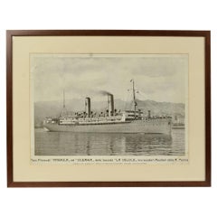
 - 1930s Antique Nautical Print Depicting Oceania ship by Adolfo Barabino GenovaLocated in Milan, ITLithograph on paper published by S.A.I.G, Adolfo Barabino Genova depicting the Oceania steamer. Title of the lithograph “America and Oceania Steamboats of the La Veloce Company, Auxi...Category
Vintage 1930s Italian Nautical Objects
MaterialsWood, Paper


Recently Viewed
View AllMore Ways To Browse
Pacific Ocean Antique Map
Antique Furniture In Edinburgh
Victorian Tear
Antique Maps Framed
Antique Map Framers
Antique Framed Maps
Map Globe
Globe Map
Framed Antique Maps
Framed Antique Map
Framing Antique Maps
Jacques Antiques
Antique Map New
Africa Map
Map Of Africa
Large Metal Cross
Maps Of Africa
Antique German Map