Items Similar to Antique Map of the course of the Don & Voga rivers

Want more images or videos?
Request additional images or videos from the seller
1 of 5
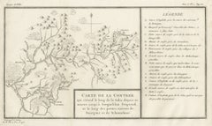
Antique Map of the course of the Don & Voga rivers
About the Item
Antique map titled 'Chart of the Course of The Don & the Volga through the Region of The Kosaks'. SW Russia & Ukraine: interesting map showing the course of the Don & Voga rivers through the Cossack regions. This map originates from Gentleman's Magazine published July 1786.
- Dimensions:Height: 8.39 in (21.3 cm)Width: 9.85 in (25 cm)Depth: 0.02 in (0.5 mm)
- Materials and Techniques:
- Period:
- Date of Manufacture:1786
- Condition:Please study image carefully.
- Seller Location:Langweer, NL
- Reference Number:
About the Seller
5.0
Platinum Seller
These expertly vetted sellers are 1stDibs' most experienced sellers and are rated highest by our customers.
Established in 2009
1stDibs seller since 2017
1,916 sales on 1stDibs
Typical response time: <1 hour
- ShippingRetrieving quote...Ships From: Langweer, Netherlands
- Return PolicyA return for this item may be initiated within 14 days of delivery.
More From This SellerView All
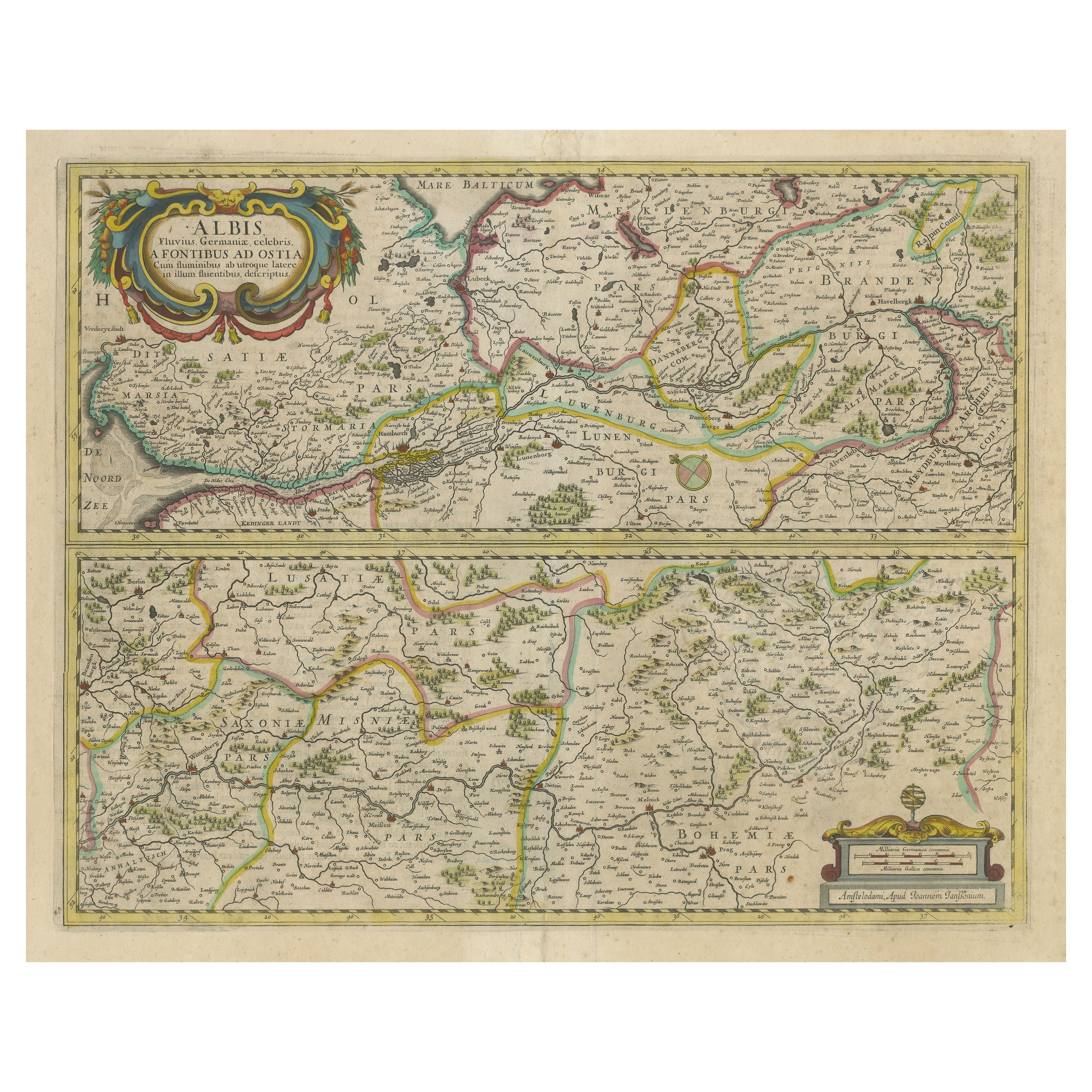
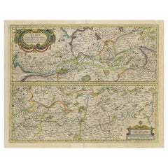
- Antique Map of the of the Course of the Albis River 'or Elbe River'By Johannes JanssoniusLocated in Langweer, NLAntique map titled 'Albis Fluvius Germaniae celebris A Fontiubus Ad Ostia, Cum Fluminibus ab utroque latere in illum fluenibus descriptus'. Detailed map of the course of the Albis Ri...Category
Antique Mid-17th Century Maps
MaterialsPaper
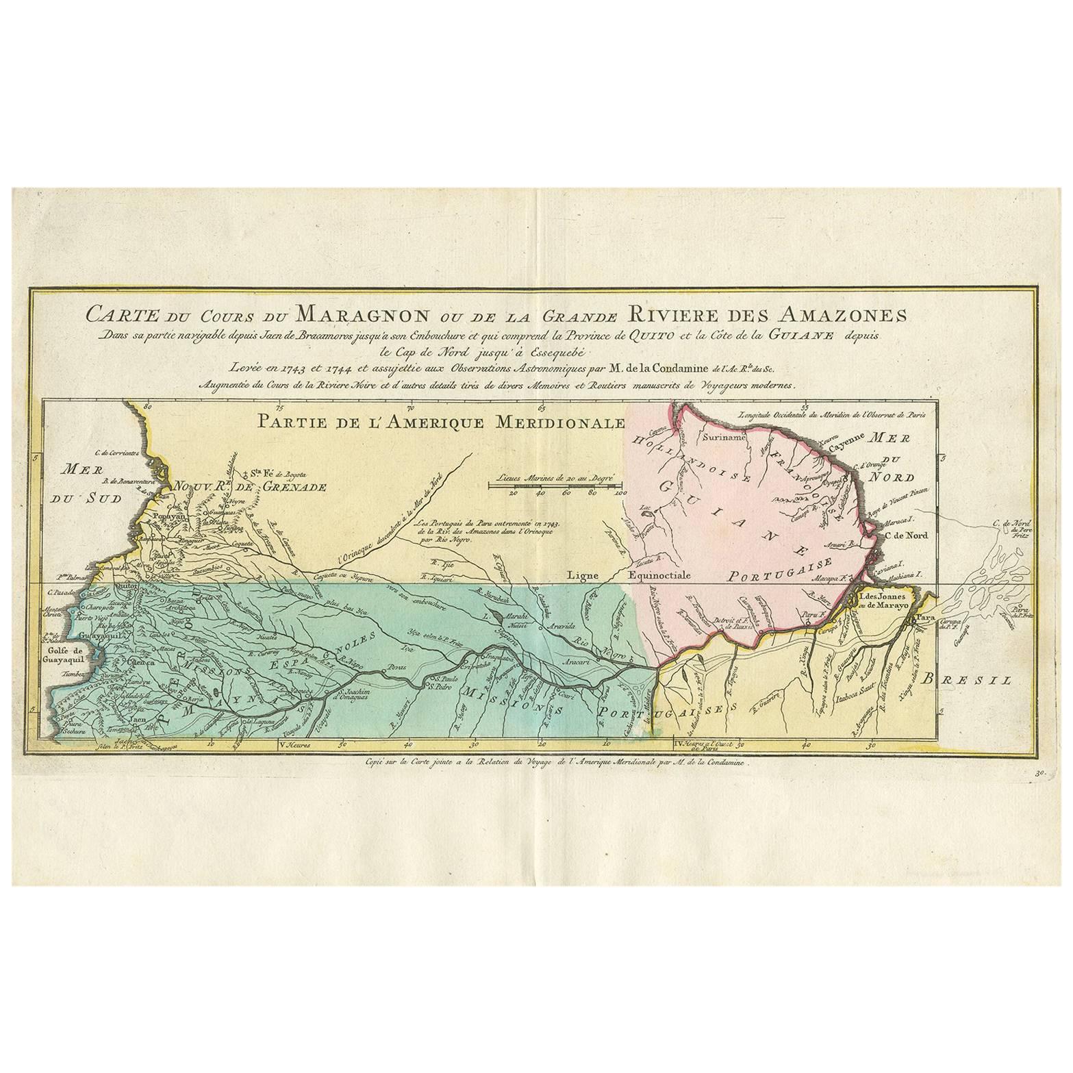
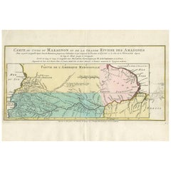
- Antique Map of the Course of the Amazon River by E. Van Harrevelt, 1773Located in Langweer, NLDetailed regional map, showing the course of the Amazon River from the Andes to the Atlantic. This map originates from 'Atlas portatif pour servir à l'intelligence de l'histoire phil...Category
Antique Late 18th Century Maps
MaterialsPaper
- Antique Map of Egypt and the Nile RiverLocated in Langweer, NLAntique map titled 'Egypten nach dem Zustand der alten Zeit vorgestellt'. This uncommon and richly detailed map of Egypt features hundreds of place names along the Nile. The Sinai Pe...Category
Antique Mid-18th Century Maps
MaterialsPaper
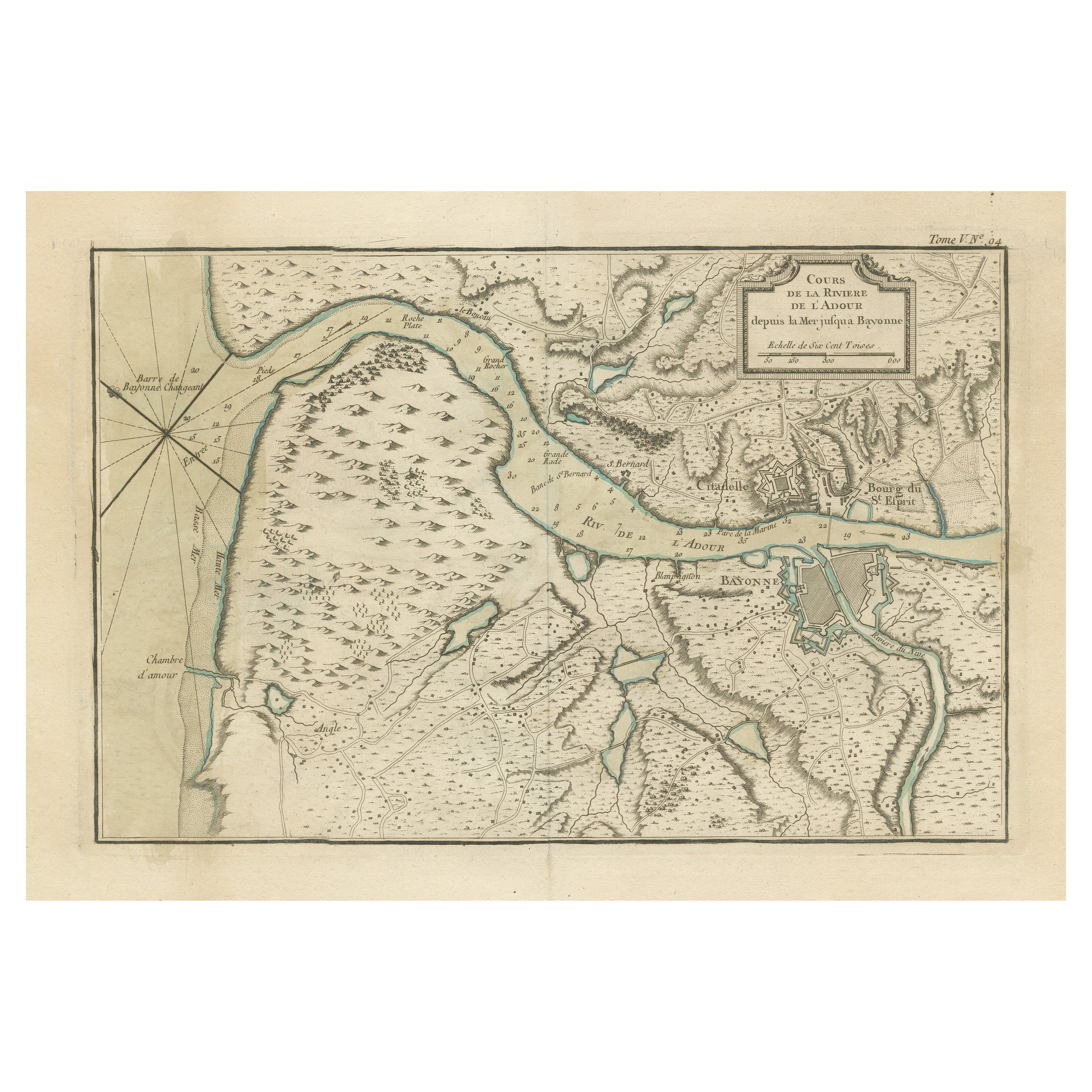
- Antique Map of the Adour River, Near Bayonne, FranceLocated in Langweer, NLAntique map titled 'Cours de la riviere de l'Adour depuis la mer jusqua Bayonne'. Original old map of the Adour river, near Bayonne, France. This map originates from 'Le Petit Atlas ...Category
Antique Mid-18th Century Maps
MaterialsPaper
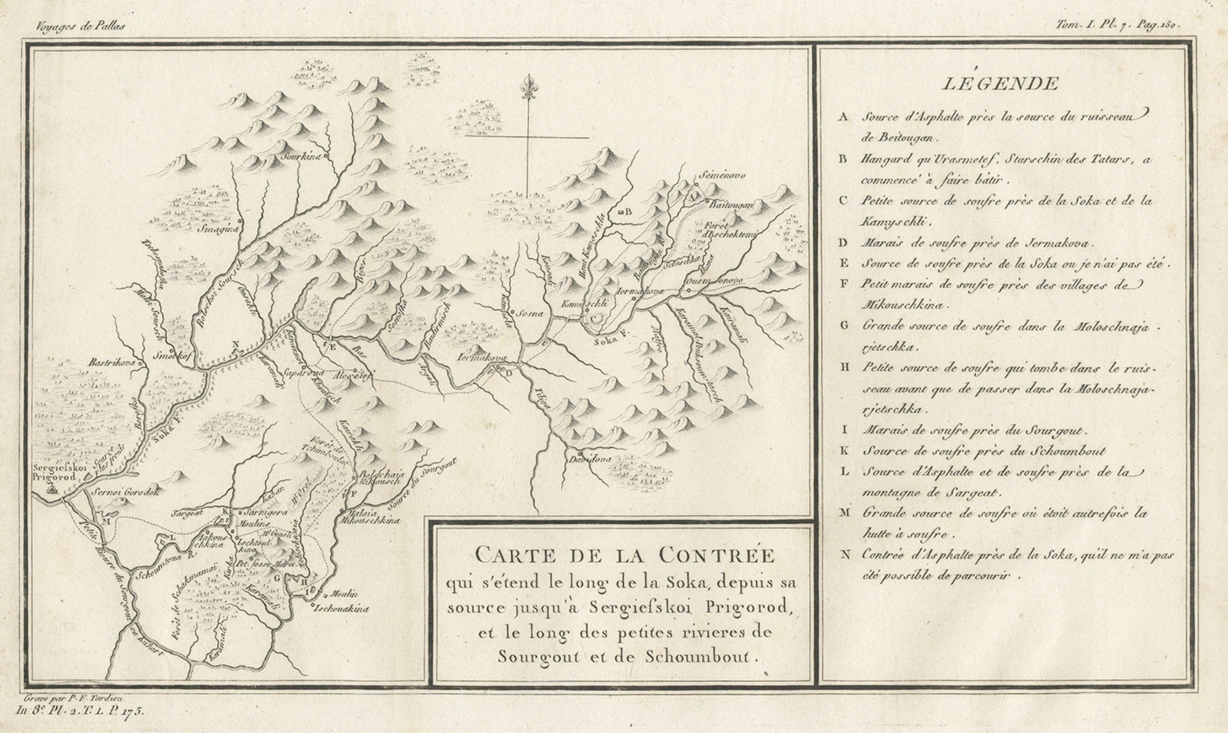
- Antique Map of the Region of the Sok River in Russia, 1794Located in Langweer, NLAntique map titled 'Carte de la Contrée qui s’étend le long de la Soka, depuis sa source jusquá Sergiefskoi Prigorod et le long des petites rivieres de Sourgout et de Schoumbout’. ...Category
Antique 18th Century Maps
MaterialsPaper
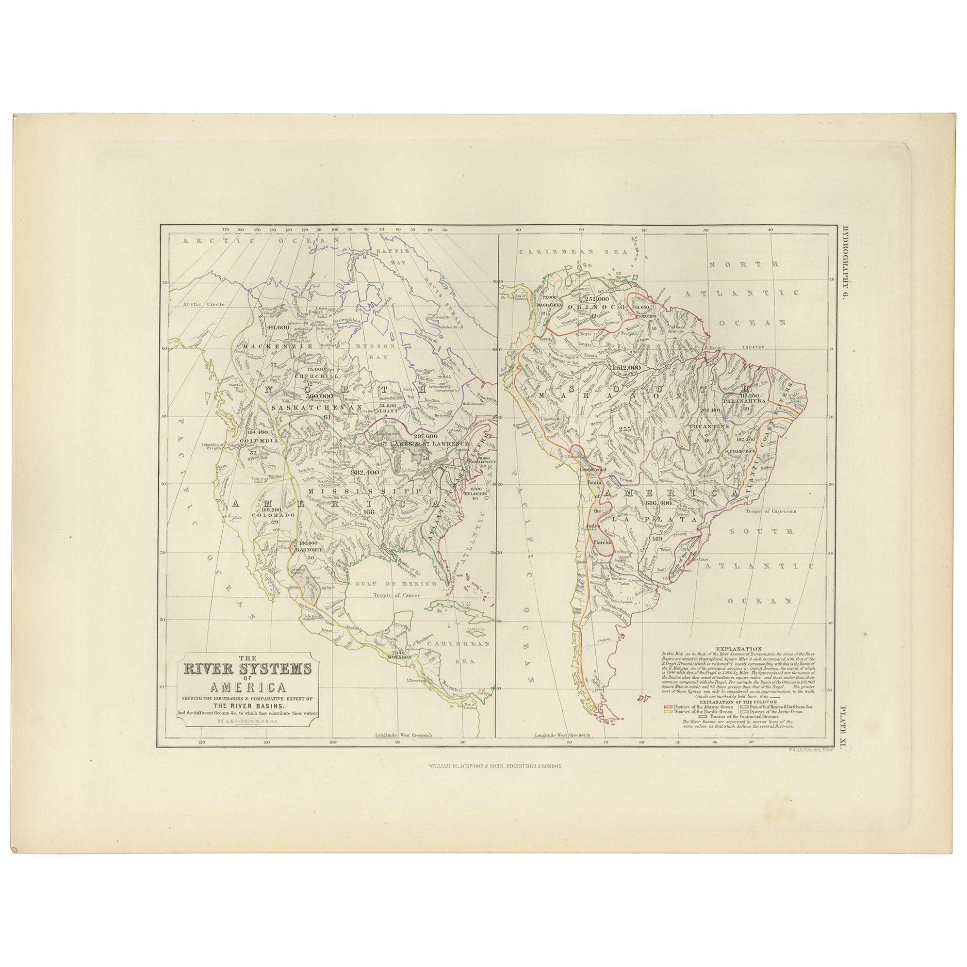
- Antique Map of the River Systems of America by Johnston, '1850'Located in Langweer, NLAntique map titled 'The River Systems of America showing the boundaries and comparative extent of the river basins'. Original antique map of the river systems of America. This map or...Category
Antique Mid-19th Century Maps
MaterialsPaper

You May Also Like
- Map of the Republic of GenoaLocated in New York, NYFramed antique hand-coloured map of the Republic of Genoa including the duchies of Mantua, Modena, and Parma. Europe, late 18th century. Dimension: 25...Category
Antique Late 18th Century European Maps
- Antique Map of Principality of MonacoBy Antonio Vallardi EditoreLocated in Alessandria, PiemonteST/619 - "Old Geographical Atlas of Italy - Topographic map of ex-Principality of Monaco" - ediz Vallardi - Milano - A somewhat special edition ---Category
Antique Late 19th Century Italian Other Prints
MaterialsPaper
- Antique 18th Century Map of the Province of Pensilvania 'Pennsylvania State'Located in Philadelphia, PAA fine antique of the colony of Pennsylvania. Noted at the top of the sheet as a 'Map of the province of Pensilvania'. This undated and anonymous map is thought to be from the Gentleman's Magazine, London, circa 1775, although the general appearance could date it to the 1760's. The southern boundary reflects the Mason-Dixon survey (1768), the western boundary is placed just west of Pittsburgh, and the northern boundary is not marked. The map has a number of reference points that likely refer to companion text and appear to be connected to boundaries. The western and southern boundaries are marked Q, R, S, for example. A diagonal line runs from the Susquehanna R to the Lake Erie P. A broken line marked by many letters A, B, N, O, etc., appears in the east. There are no latitude or longitude markings, blank verso. Framed in a shaped contemporary gilt wooden frame and matted under a cream colored matte. Bearing an old Graham Arader Gallery...Category
Antique 18th Century British American Colonial Maps
MaterialsPaper
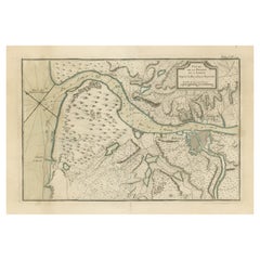
- Map "Estuary- Mouth of the Thames"Located in Alessandria, PiemonteST/426 - Antique French Map of the estuary of the Thames, map dated 1769 - "Mape of the entrance of the Thames. Designed by filing of Navy cards fo...Category
Antique Mid-18th Century French Other Prints
MaterialsPaper
- Original Antique Map of Italy. C.1780Located in St Annes, LancashireGreat map of Italy Copper-plate engraving Published C.1780 Unframed.Category
Antique Early 1800s English Georgian Maps
MaterialsPaper

- Original Antique Map of Asia. C.1780Located in St Annes, LancashireGreat map of Asia Copper-plate engraving Published C.1780 Two small worm holes to right side of map Unframed.Category
Antique Early 1800s English Georgian Maps
MaterialsPaper


