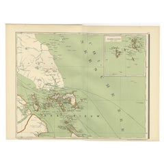
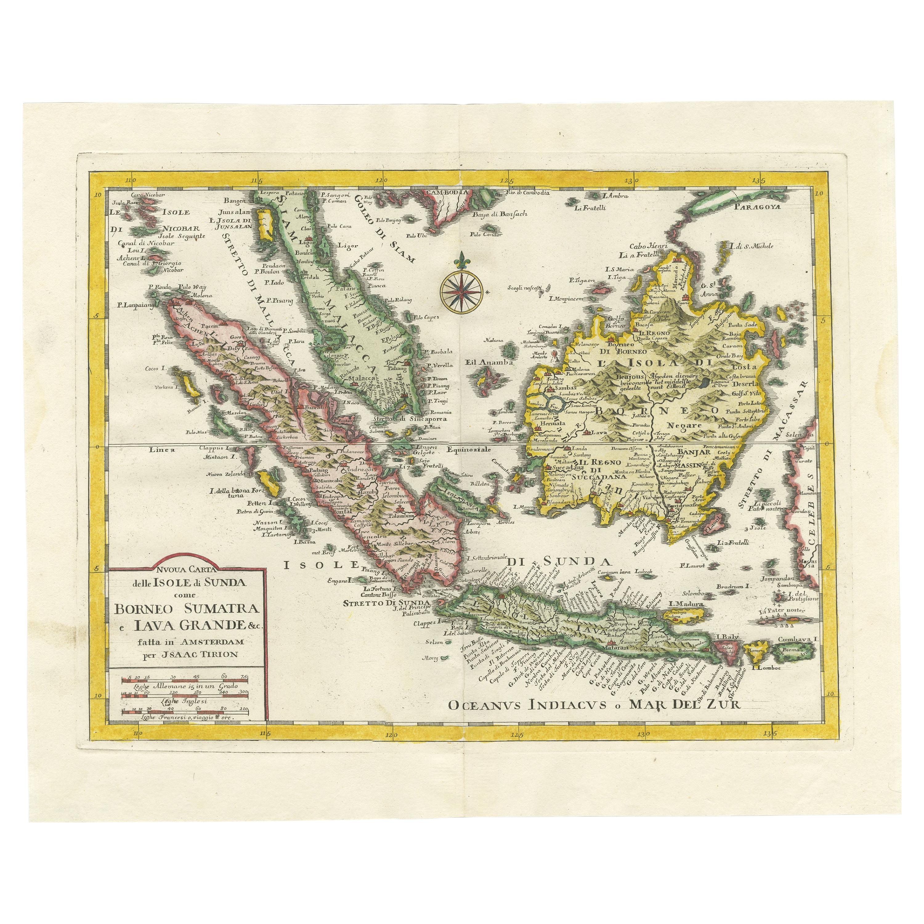
Antique Map of the Riau Islands and Singapore by Dornseiffen, 1900
View Similar Items


Want more images or videos?
Request additional images or videos from the seller
1 of 5
Antique Map of the Riau Islands and Singapore by Dornseiffen, 1900
About the Item
- Dimensions:Height: 15.32 in (38.9 cm)Width: 20.44 in (51.9 cm)Depth: 0 in (0.01 mm)
- Materials and Techniques:
- Period:
- Date of Manufacture:1900
- Condition:Condition: Very good, general age-related toning. Please study image carefully.
- Seller Location:Langweer, NL
- Reference Number:Seller: BG-06669-101stDibs: LU3054327927102
About the Seller
5.0
Platinum Seller
These expertly vetted sellers are 1stDibs' most experienced sellers and are rated highest by our customers.
Established in 2009
1stDibs seller since 2017
1,947 sales on 1stDibs
More From This SellerView All
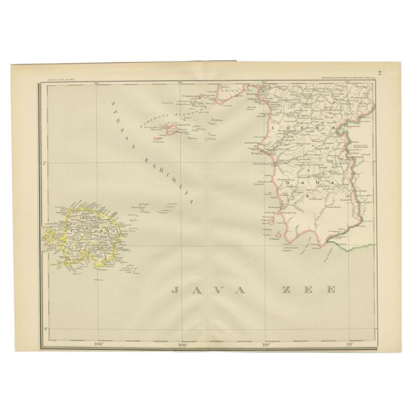
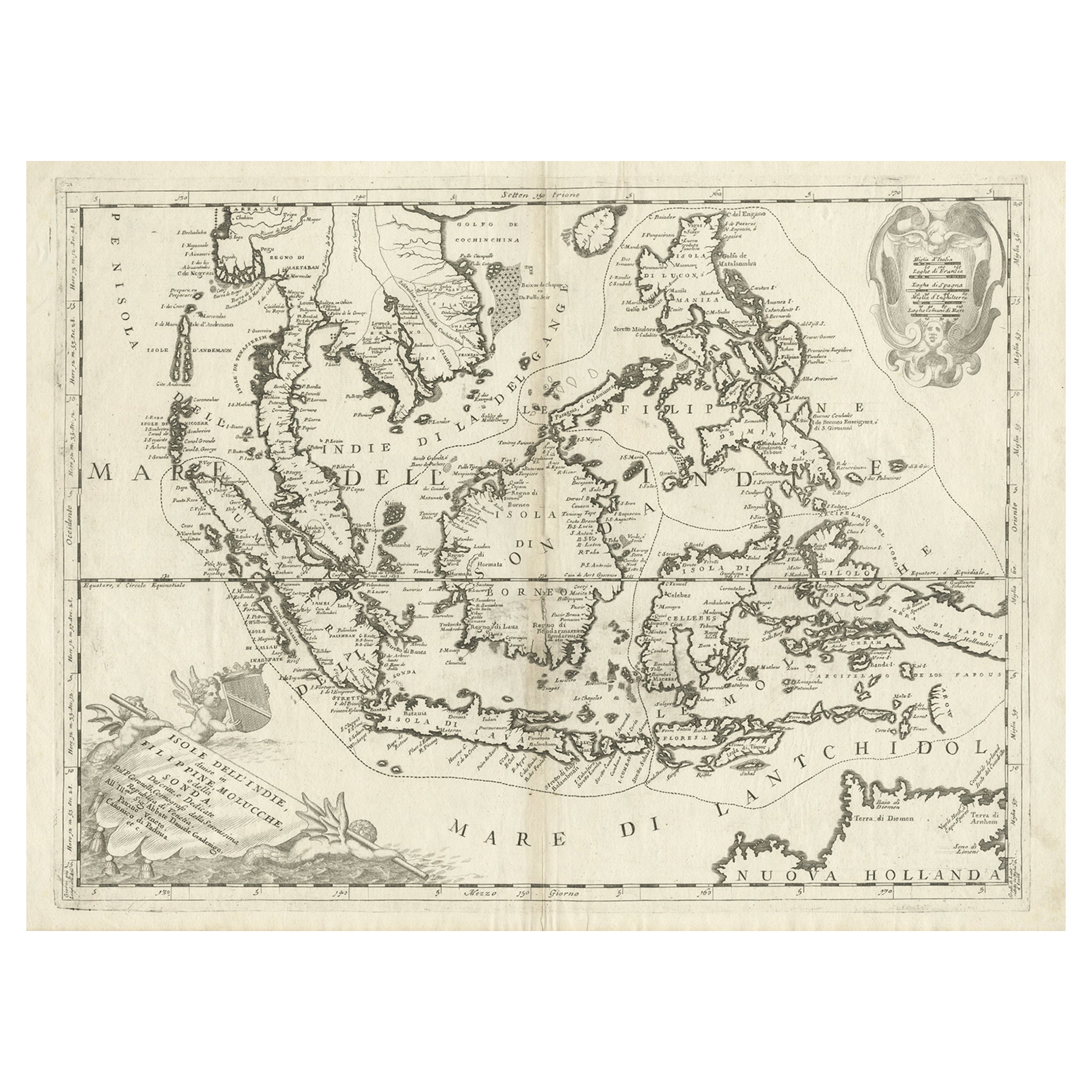
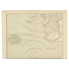
- Antique Map of the Java Sea by Dornseiffen, 1900Located in Langweer, NLAntique map of the Java Sea. Also depicts Bilitung, the Karimata Islands and Sukadana, Borneo. This map originates from 'Atlas van Nederlandsch Oost- en West-Indië' by I. Dornseiffen...Category
20th Century Maps
MaterialsPaper
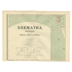
- Antique Map of the Batu Islands by Dornseiffen, 1900Located in Langweer, NLAntique map of the Batu Islands with the large title 'Soematra, Bangka en de Riouw-Lingga Archipel'. This map originates from 'Atlas van Nederlandsch Oost- en West-Indië' by I. Dorns...Category
20th Century Maps
MaterialsPaper
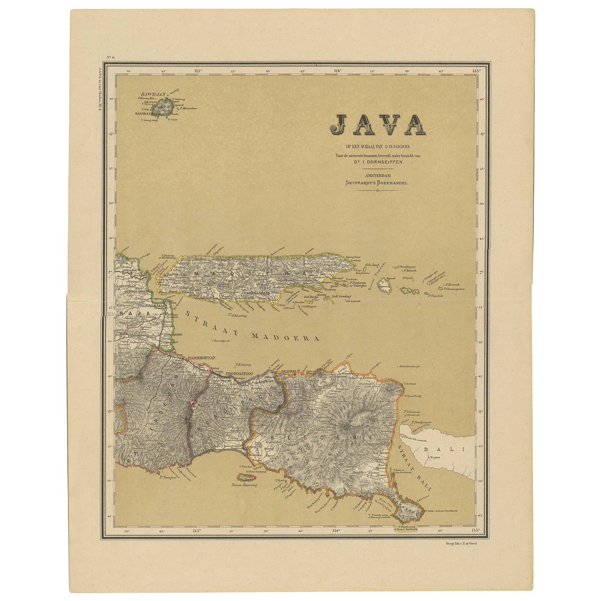
- Antique Map of Java in 4 sheets by Dornseiffen, 1884Located in Langweer, NLDetailed map of Java in 4 sheets, with an inset map of Batavia (Jakarta). This map originates from 'Atlas van Nederlandsch Oost- en West-Indie' by Dr. I. Dornseiffen. Published by Se...Category
Antique Late 19th Century Maps
MaterialsPaper
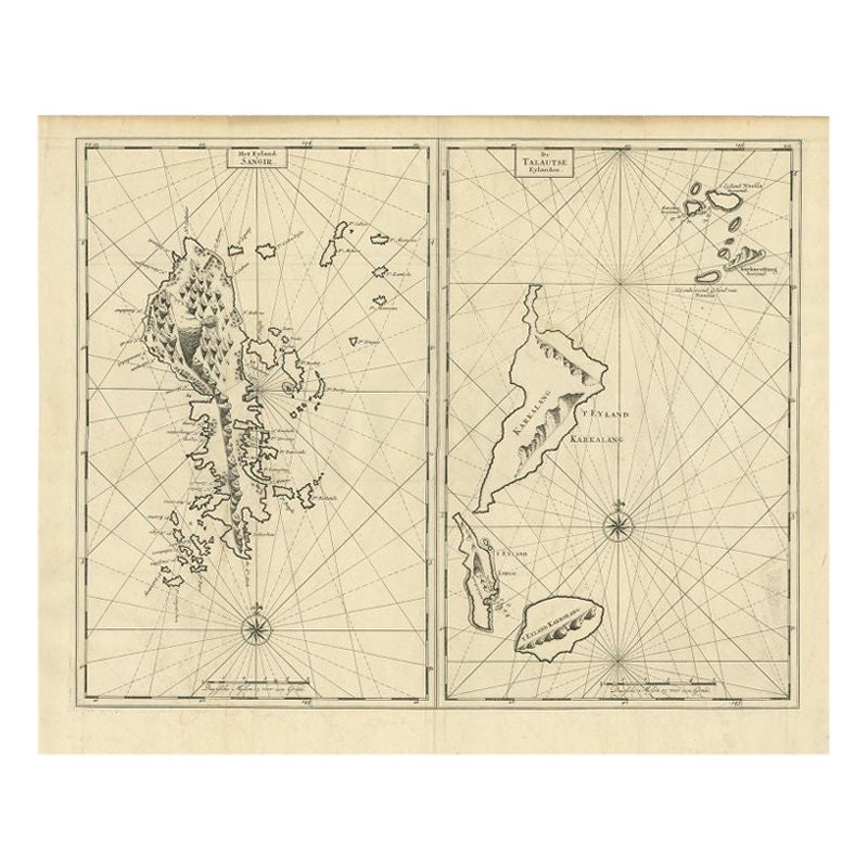
- Antique Map of Sangir Island and the Talaud Islands by Valentijn, 1726Located in Langweer, NLAntique map titled 'Het Eyland Sangir & De Talautse Eylanden'. Two maps on one sheet. To the left, a map of Sangir Island, Indonesia. To the right, a map of the Talaud Islands, Indon...Category
Antique 18th Century Maps
MaterialsPaper
 $457 Sale Price20% Off
 - Antique Map of the Islands of the Atlantic by J. TallisLocated in Langweer, NLA highly decorative and detailed mid-19th century map of the Islands of the Atlantic -- including the Azores, Madeira, Bermuda, the Canary Islands and the Cape Verde Islands -- which...Category
Antique Mid-19th Century Maps
MaterialsPaper
 $263 Sale Price20% Off
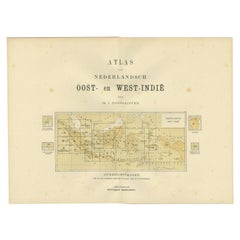
 - Antique Map of the East Indies by Dornseiffen, 1900Located in Langweer, NLTitle page of 'Atlas van Nederlandsch Oost- en West-Indië' by I. Dornseiffen. It shows the regions of the various maps included in this atlas. Included are the Dutch East Indies and ...Category
20th Century Maps
MaterialsPaper

You May Also Like
- Hand-Colored 18th Century Homann Map of Denmark and Islands in the Baltic SeaBy Johann Baptist HomannLocated in Alamo, CAAn 18th century copper plate hand-colored map entitled "Insulae Danicae in Mari Balthico Sitae utpote Zeelandia, Fionia, Langelandia, Lalandia, Falstria, Fembria Mona" created by Joh...Category
Antique Early 18th Century German Maps
MaterialsPaper
- Original Antique Map of The World by Thomas Clerk, 1817Located in St Annes, LancashireGreat map of The Eastern and Western Hemispheres On 2 sheets Copper-plate engraving Drawn and engraved by Thomas Clerk, Edinburgh. Published by Mackenzie And Dent, 1817 ...Category
Antique 1810s English Maps
MaterialsPaper
- Original Antique Map of The Netherlands, Engraved by Barlow, Dated 1807Located in St Annes, LancashireGreat map of Netherlands Copper-plate engraving by Barlow Published by Brightly & Kinnersly, Bungay, Suffolk. Dated 1807 Unframed.Category
Antique Early 1800s English Maps
MaterialsPaper
- Map of the Republic of GenoaLocated in New York, NYFramed antique hand-coloured map of the Republic of Genoa including the duchies of Mantua, Modena, and Parma. Europe, late 18th century. Dimension: 25...Category
Antique Late 18th Century European Maps
- Antique Map of Italy by Andriveau-Goujon, 1843By Andriveau-GoujonLocated in New York, NYAntique Map of Italy by Andriveau-Goujon, 1843. Map of Italy in two parts by Andriveau-Goujon for the Library of Prince Carini at Palazzo Carini i...Category
Antique 1840s French Maps
MaterialsLinen, Paper
 $3,350 / set
 - Antique Map of Principality of MonacoBy Antonio Vallardi EditoreLocated in Alessandria, PiemonteST/619 - "Old Geographical Atlas of Italy - Topographic map of ex-Principality of Monaco" - ediz Vallardi - Milano - A somewhat special edition ---Category
Antique Late 19th Century Italian Other Prints
MaterialsPaper
 $228 Sale Price74% Off


Recently Viewed
View AllMore Ways To Browse
Singapore Vintage Furniture
Map Of Singapore
Singapore Map
Vintage Map Of Singapore
Indonesia Map Vintage
Indonesia Vintage Map
Antique Map Singapore
Captain Cook
Norwegian Antiques
Antique Etched Windows
Antique Furniture South Australia
Map Of Mexico
East India Map
Louis Atlas
Large Antique Compass
Royal Britannia
Antique Maps Of Russia
Antique New England Maps