
Antique Map of the Society Islands by Cook, 1803
View Similar Items


Want more images or videos?
Request additional images or videos from the seller
1 of 6
Antique Map of the Society Islands by Cook, 1803
About the Item
- Dimensions:Height: 10.04 in (25.5 cm)Width: 20.67 in (52.5 cm)Depth: 0 in (0.01 mm)
- Materials and Techniques:
- Period:
- Date of Manufacture:1803
- Condition:Condition: Good, general age-related toning and some foxing. Please study image carefully.
- Seller Location:Langweer, NL
- Reference Number:Seller: BG-11487-61stDibs: LU3054329625602
About the Seller
5.0
Platinum Seller
These expertly vetted sellers are 1stDibs' most experienced sellers and are rated highest by our customers.
Established in 2009
1stDibs seller since 2017
1,919 sales on 1stDibs
More From This SellerView All
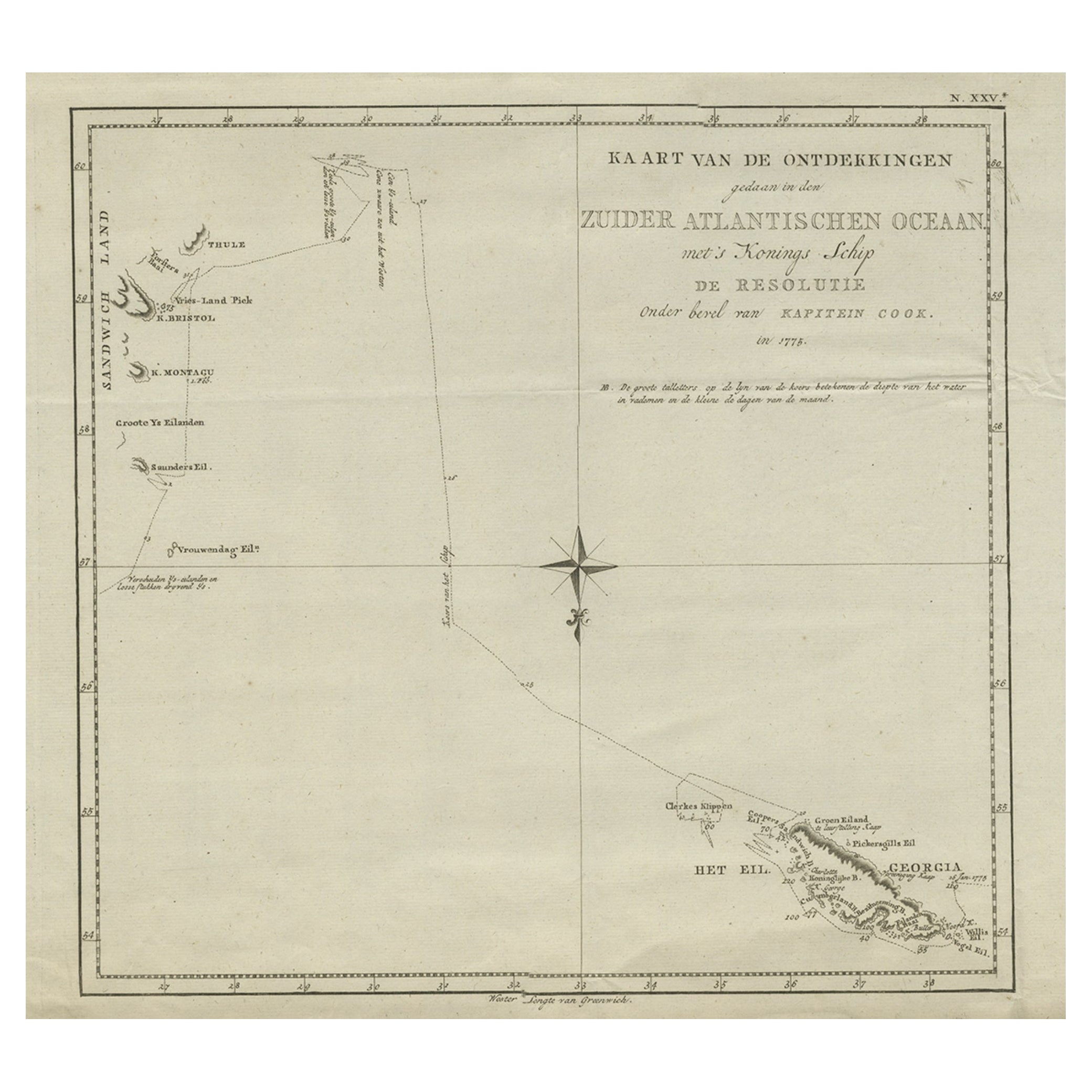
- Antique Map of Suffren Island by Cook, 1803Located in Langweer, NLAntique map Australia titled 'Gezigt van het Eil. Suffren'. Antique map of Suffren Island. Originates from 'Reizen Rondom de Waereld door James C...Category
Antique 19th Century Maps
MaterialsPaper
- Antique Map of the Harbour of Taloo by J. Cook, 1803By James CookLocated in Langweer, NLAntique map French Polynesia titled 'Schets van de Havenen aan de Noord Zijde van Eimeo'. Plan of the harbour of Taloo in the Island of Moorea, one of the Society Islands, French Polynesia. Originates from 'Reize rondom de Waereld door James Cook...Category
Antique Early 19th Century Dutch Maps
MaterialsPaper
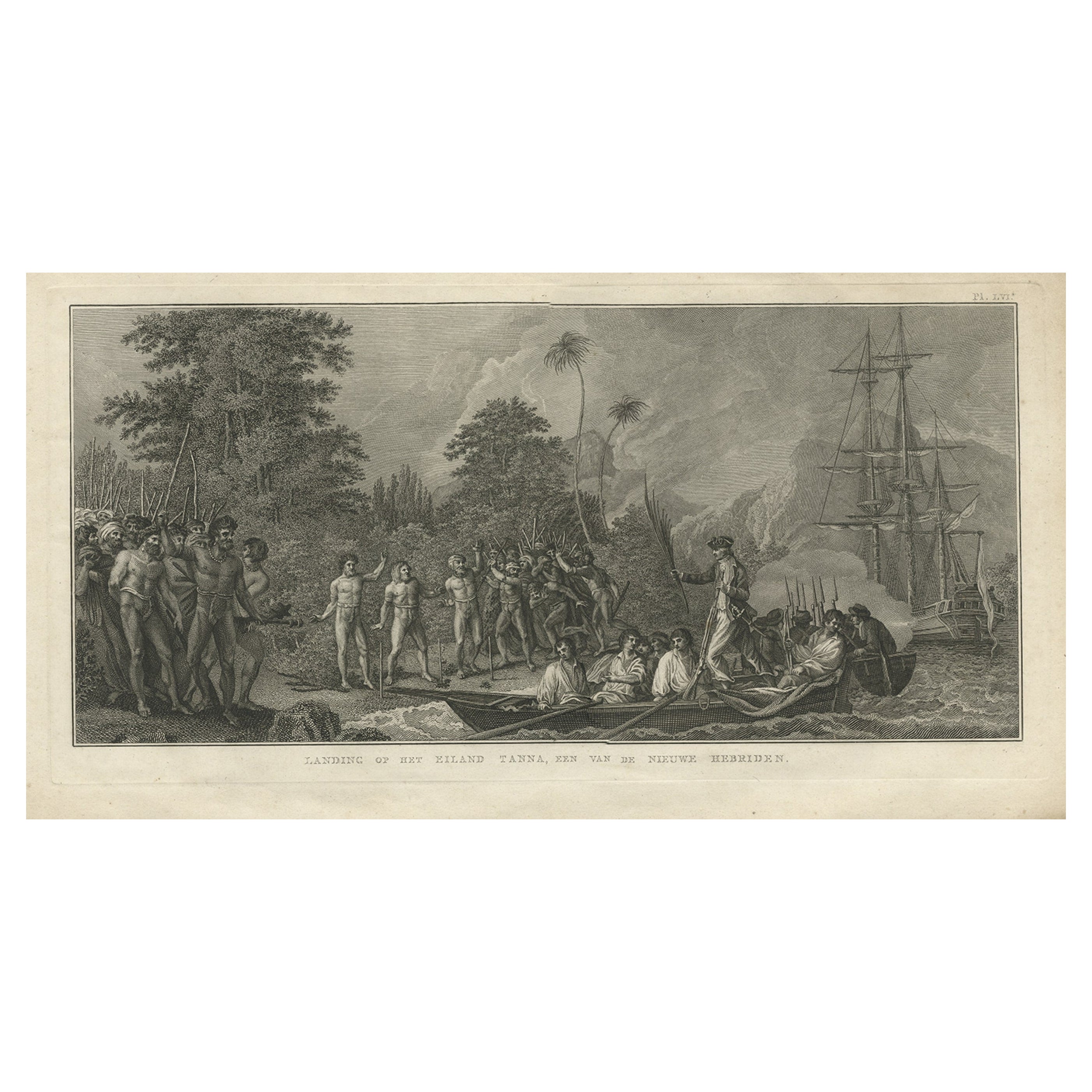
- Antique Print of the Landing at Tanna Island by Cook, 1803Located in Langweer, NLAntique print New Hebrides titled 'Landing op het Eiland Tanna, een van de Nieuwe Hebriden'. Antique print depicting the landing at one of the islands of the New Hebrides, Vanuatu. O...Category
Antique 19th Century Prints
MaterialsPaper
- Antique Map of the Island of Tahiti, Polynesia, 1803Located in Langweer, NLAntique map Tahiti titled 'Kaart van het Eiland Otahiti'. Antique map of the Island of Tahiti, Polynesia. Originates from 'Reizen Rondom de Waereld door James Cook (..)'. Art...Category
Antique Early 1800s Maps
MaterialsPaper
 $730 Sale Price24% Off
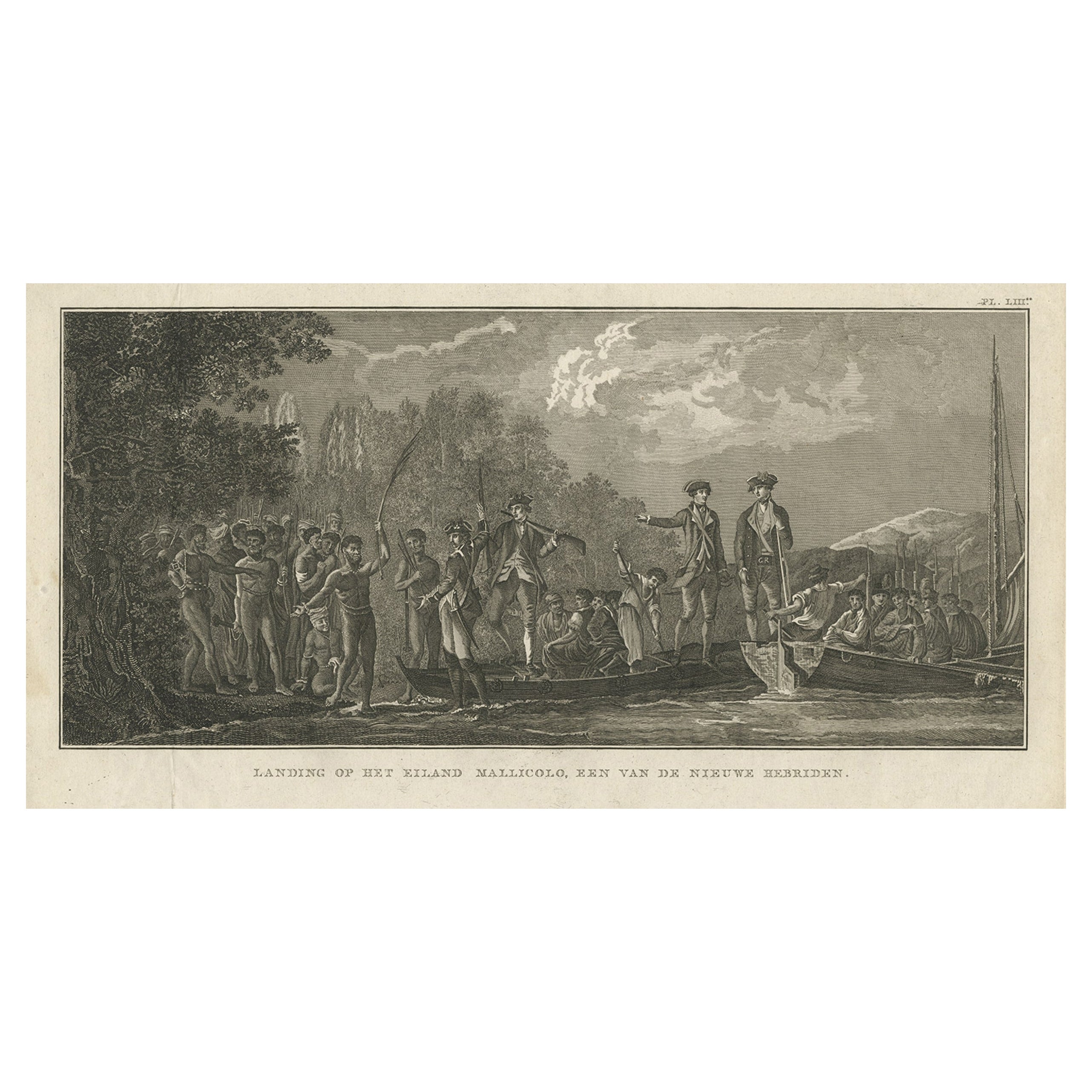
 - Antique Print of the Landing at Malakula Island, Vanuatu, by Cook, 1803Located in Langweer, NLAntique print New Hebrides titled 'Landing op het Eiland Mallicolo, een van de Nieuwe Hebriden'. Antique print depicting the landing at one of the islands of the New Hebrides, Vanuat...Category
Antique 19th Century Prints
MaterialsPaper
- Antique Map of the Friendly Islands by Cook, 1803Located in Langweer, NLAntique map Friendly Islands titled 'Kaart van de Vrienden-Eilanden'. Antique map of the Friendly Islands depicting Rotterdam or Anamocka, Middelburg or Eaoowe and Amsterdam or Tonga...Category
Antique 19th Century Maps
MaterialsPaper


You May Also Like
- Captain Cook's Exploration of Tahiti 18th C. Hand-Colored Map by BellinBy Jacques-Nicolas BellinLocated in Alamo, CAThis beautiful 18th century hand-colored copper plate engraved map is entitled "Carte de l'Isle de Taiti, par le Lieutenant J. Cook" was created by Jacques Nicolas Bellin and publish...Category
Antique Mid-18th Century French Maps
MaterialsPaper
- Original Antique Map of The World by Thomas Clerk, 1817Located in St Annes, LancashireGreat map of The Eastern and Western Hemispheres On 2 sheets Copper-plate engraving Drawn and engraved by Thomas Clerk, Edinburgh. Published by Mackenzie And Dent, 1817 ...Category
Antique 1810s English Maps
MaterialsPaper
- Original Antique Map of The Netherlands, Engraved by Barlow, Dated 1807Located in St Annes, LancashireGreat map of Netherlands Copper-plate engraving by Barlow Published by Brightly & Kinnersly, Bungay, Suffolk. Dated 1807 Unframed.Category
Antique Early 1800s English Maps
MaterialsPaper
- Map of the Republic of GenoaLocated in New York, NYFramed antique hand-coloured map of the Republic of Genoa including the duchies of Mantua, Modena, and Parma. Europe, late 18th century. Dimension: 25...Category
Antique Late 18th Century European Maps
- Hand-Colored 18th Century Homann Map of Denmark and Islands in the Baltic SeaBy Johann Baptist HomannLocated in Alamo, CAAn 18th century copper plate hand-colored map entitled "Insulae Danicae in Mari Balthico Sitae utpote Zeelandia, Fionia, Langelandia, Lalandia, Falstria, Fembria Mona" created by Joh...Category
Antique Early 18th Century German Maps
MaterialsPaper
- Antique Map of Italy by Andriveau-Goujon, 1843By Andriveau-GoujonLocated in New York, NYAntique Map of Italy by Andriveau-Goujon, 1843. Map of Italy in two parts by Andriveau-Goujon for the Library of Prince Carini at Palazzo Carini i...Category
Antique 1840s French Maps
MaterialsLinen, Paper
 $3,350 / set


Recently Viewed
View AllMore Ways To Browse
Antique Island Furniture
Antique Cook
1803 Furniture
Rare Van Cleef
Fox Door
Cook Islands
Antique Van Cleef
James Cook Map
Hand Painted Antique Map
Antique Furniture Depot
17th Century Scottish
Antique Road Maps
Antique Road Map
Antique Map Of Mexico
Antique Maps Of Mexico
Antique Style Atlas
Nautical Map
Nautical Maps