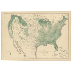
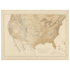
Antique Map of the Woodland of the United States, 1874
View Similar Items


Want more images or videos?
Request additional images or videos from the seller
1 of 6
Antique Map of the Woodland of the United States, 1874
About the Item
- Dimensions:Height: 21.66 in (55 cm)Width: 31.11 in (79 cm)Depth: 0.02 in (0.5 mm)
- Materials and Techniques:
- Period:
- Date of Manufacture:1874
- Condition:Original folding line. General age-related toning, minor wear. Blank verso, please study image carefully.
- Seller Location:Langweer, NL
- Reference Number:Seller: BG-11875-421stDibs: LU3054319792742
About the Seller
5.0
Platinum Seller
These expertly vetted sellers are 1stDibs' most experienced sellers and are rated highest by our customers.
Established in 2009
1stDibs seller since 2017
1,929 sales on 1stDibs
More From This SellerView All
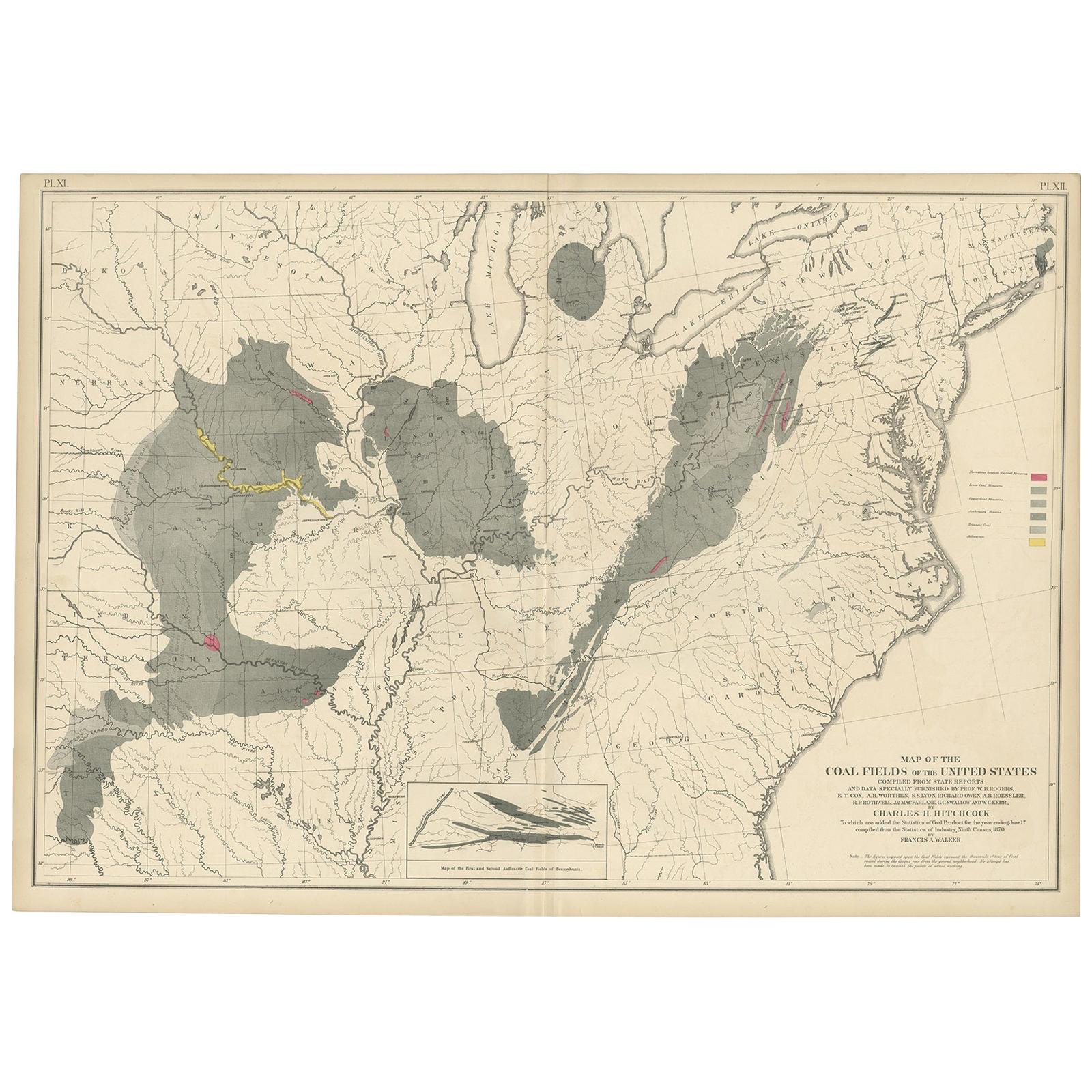
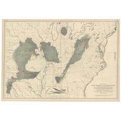
- Antique Map of the Coal Fields of the United States by Walker '1874'Located in Langweer, NLAntique map titled 'Map of the coal fields of the United States, compiled from state reports and data specially furnished by Prof. W.B. Rogers, E.T. Cox, A.H. Worthen, S.S. Lyon, Ric...Category
Antique Late 19th Century Maps
MaterialsPaper
 $655 Sale Price20% Off
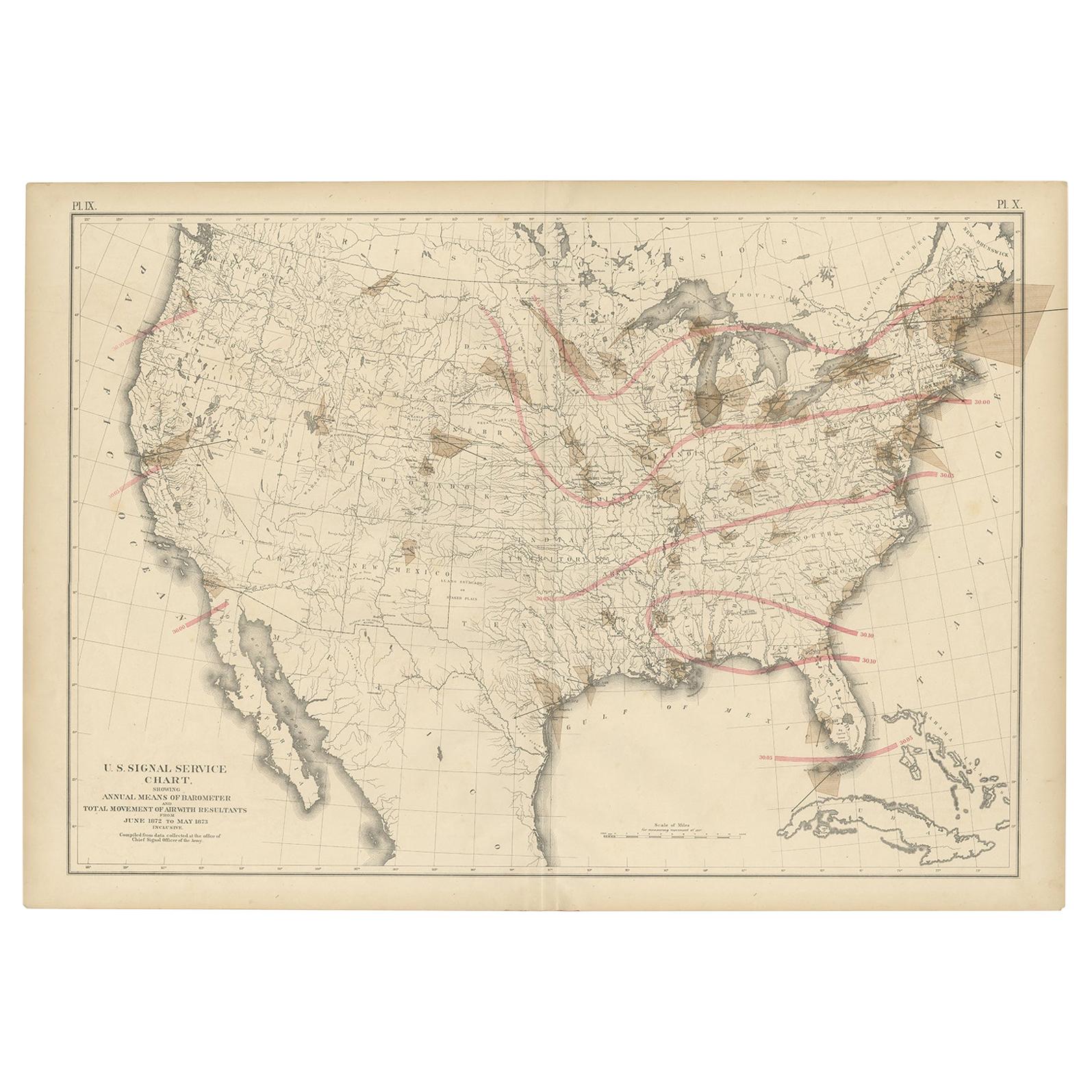
 - Pl. 9 Antique Map of the Air Movement of the United States by Walker '1874'Located in Langweer, NLAntique map titled 'U.S. Signal Service chart, showing annual means of barometer and total movement of air with resultants from June 1872 to May 1873 inclusive. Compiled from data co...Category
Antique Late 19th Century Maps
MaterialsPaper
 $437 Sale Price20% Off
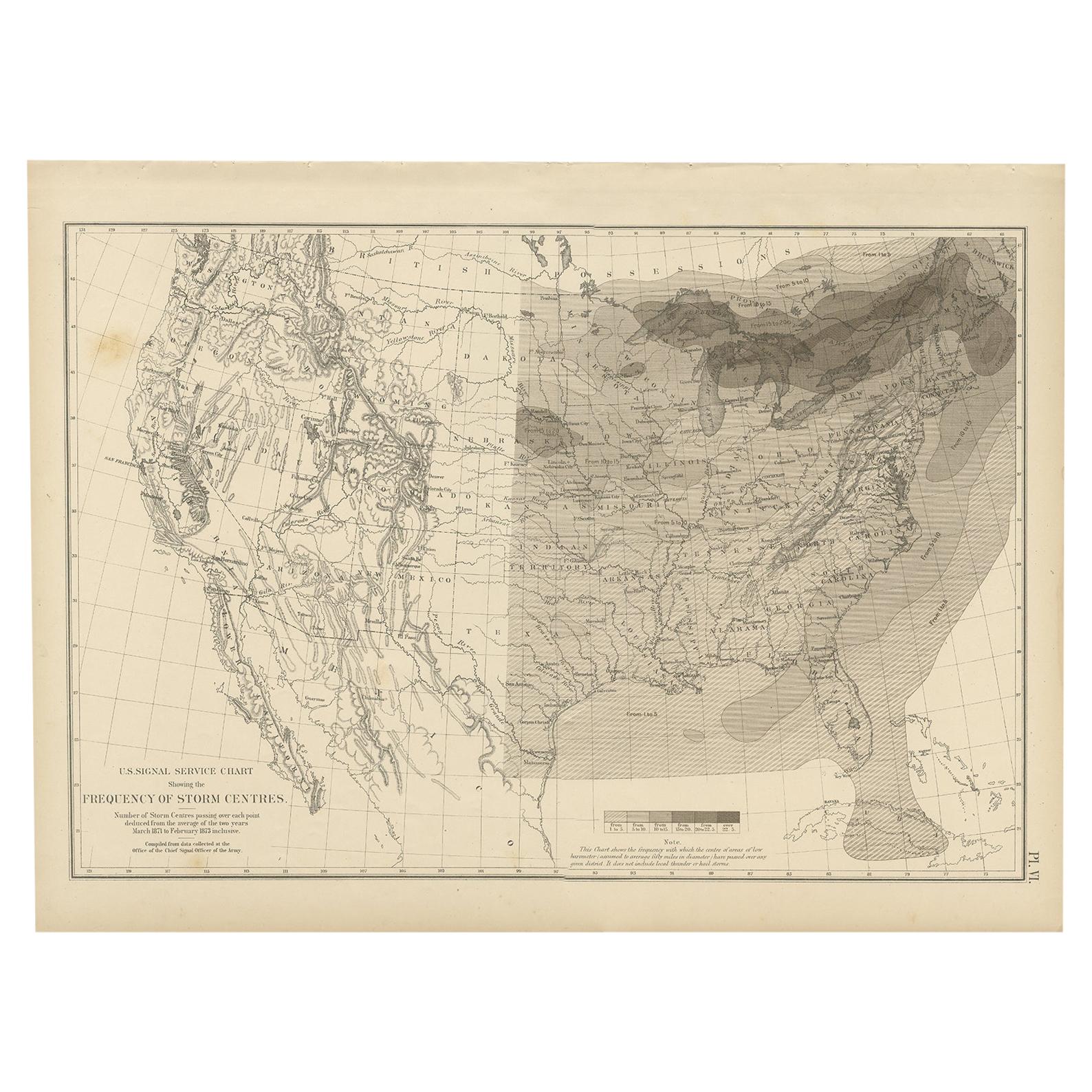
 - Antique Chart of the Storm Centres of the United States, 1874Located in Langweer, NLAntique chart titled 'U.S. Signal Service chart showing the frequency of storm centres. Number of storm centres passing over each point deduced from the average of the two years Marc...Category
Antique Late 19th Century Maps
MaterialsPaper
 $262 Sale Price40% Off
 - Small Map of the United StatesLocated in Langweer, NLAntique map titled 'Amérique septe. Physique'. Small map of the United States. lithographed by C. Callewaert brothers in Brussels circa 1870.Category
Antique Mid-19th Century Maps
MaterialsPaper
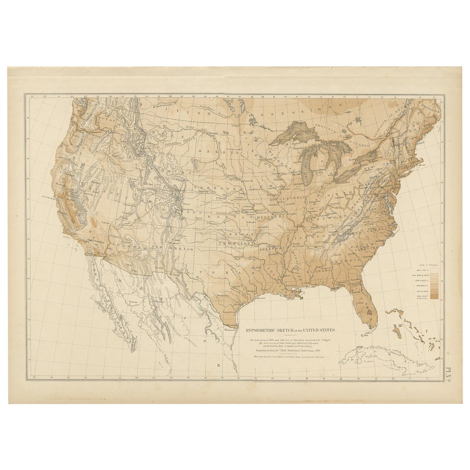
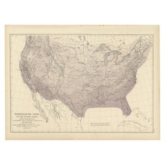
- Pl. 9 Antique Hypsometric Sketch of the United States by Walker, 1874Located in Langweer, NLAntique chart titled 'Hypsometric sketch of the United States. The level curves of 400 and 800 feet of elevation constructed by A. Guyot. The level curves of 2000, 4000 and 8000 feet...Category
Antique Late 19th Century Maps
MaterialsPaper
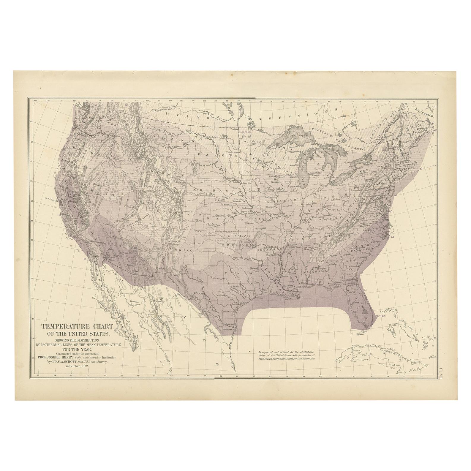
- Pl. 7 Antique Temperature Chart of the United States by Walker, 1874Located in Langweer, NLAntique chart titled 'Temperature chart of the United States. Showing the distribution by isothermal lines of the mean temperature for the year. Constructed under the direction of Pr...Category
Antique Late 19th Century Maps
MaterialsPaper

You May Also Like
- Original Antique Map of United States, Grattan and Gilbert, 1843Located in St Annes, LancashireGreat map of United States Drawn and engraved by Archer Published by Grattan and Gilbert. 1843 Original colour Unframed.Category
Antique 1840s English Maps
MaterialsPaper
- N.E. View of the United States Capitol, Washington, DC Antique Proof Print 1858Located in Colorado Springs, COThis engraved print shows a view of the United States Capitol Building, in Washington, D.C. The print depicts the neoclassical building from the northeast orientation, with a bustling street scene in front. The steel engraving is a proof printing, drawn and engraved by Henry Sartain and published in 1858. Plans began in May 1854 to build a new cast-iron dome for the United States Capitol. The then-architect of the Capitol Thomas Walter and his team were sold on the aesthetics of a new dome, as well as the utility of a fire-proof one. A year later, on March 3, 1855, President Franklin Pierce...Category
Antique 1850s American Prints
MaterialsPaper
- Original Antique Map of The United States of America, circa 1890Located in St Annes, LancashireGreat map of the USA By The Stanford's Geographical Establishment Original colour Unframed.Category
Antique 1890s English Victorian Maps
MaterialsPaper
- Large Original Antique Map of the United States of America. 1891By Rand McNally & Co.Located in St Annes, LancashireFabulous map of The United States Original color By Rand, McNally & Co. Dated 1891 Unframed Free shipping.Category
Antique 1890s American Maps
MaterialsPaper
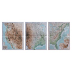
- Large Vintage Maps of the United States, in 3 Sections, 1920Located in St Annes, LancashireGreat maps of the USA in 3 sections Unframed Original color By John Bartholomew and Co. Edinburgh Geographical Institute Published, circa 1920 The measurements given is for just...Category
Vintage 1920s British Maps
MaterialsPaper
- Map of the Republic of GenoaLocated in New York, NYFramed antique hand-coloured map of the Republic of Genoa including the duchies of Mantua, Modena, and Parma. Europe, late 18th century. Dimension: 25...Category
Antique Late 18th Century European Maps


Recently Viewed
View AllMore Ways To Browse
Cartier 1730
Christoph Weigel On Sale
Dao Antique Map
Devonia Antique
Eso Antique Map
Eso Antique Maps
J Karte
M S Merian
Nicolaes Visscher II On Sale
W. & A.K. Johnston On Sale
Willem Blaeu On Sale
Yemen 1789
Andalusia Map
Atlas School Supply On Sale
Old Teak Petite Artisan
Rand Mcnally Map Of California
Rand Mcnally Map Of Colorado
Vintage Butcher Shop Poster