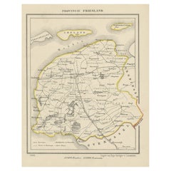
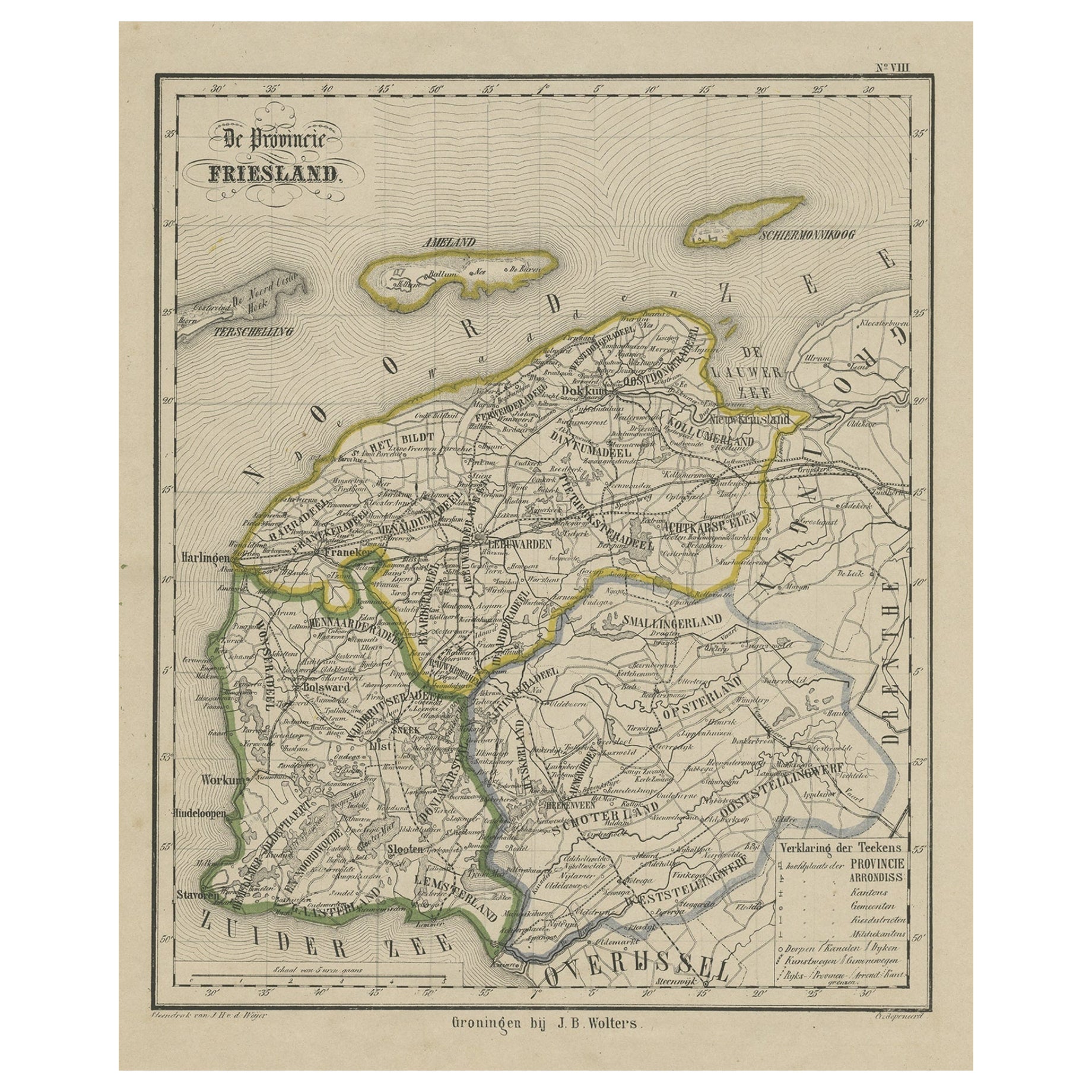
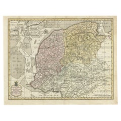
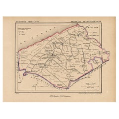
Antique Print of the Province of Friesland, The Netherlands, 1868
View Similar Items

Want more images or videos?
Request additional images or videos from the seller
1 of 5
Antique Print of the Province of Friesland, The Netherlands, 1868
About the Item
About the Seller
5.0
Recognized Seller
These prestigious sellers are industry leaders and represent the highest echelon for item quality and design.
Gold Seller
Premium sellers maintaining a 4.3+ rating and 24-hour response times
Established in 2009
1stDibs seller since 2017
2,464 sales on 1stDibs
Typical response time: 1 hour
Authenticity Guarantee
In the unlikely event there’s an issue with an item’s authenticity, contact us within 1 year for a full refund. DetailsMoney-Back Guarantee
If your item is not as described, is damaged in transit, or does not arrive, contact us within 7 days for a full refund. Details24-Hour Cancellation
You have a 24-hour grace period in which to reconsider your purchase, with no questions asked.Vetted Professional Sellers
Our world-class sellers must adhere to strict standards for service and quality, maintaining the integrity of our listings.Price-Match Guarantee
If you find that a seller listed the same item for a lower price elsewhere, we’ll match it.Trusted Global Delivery
Our best-in-class carrier network provides specialized shipping options worldwide, including custom delivery.More From This Seller
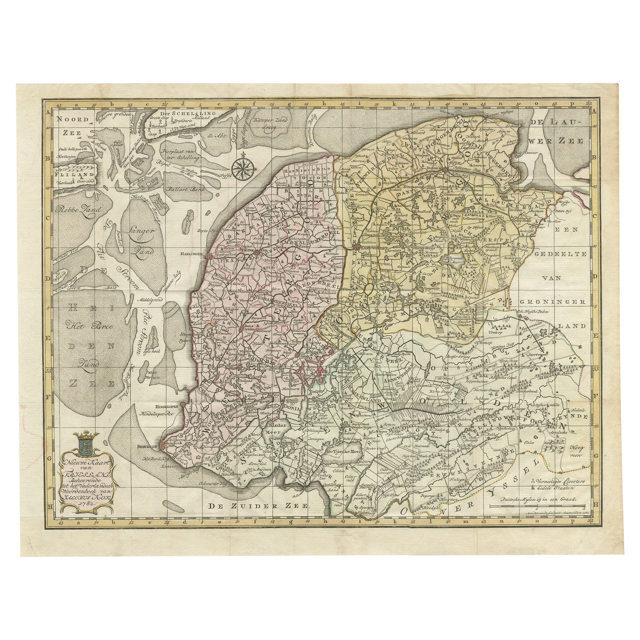
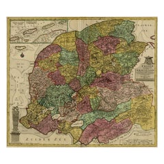
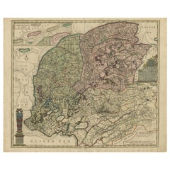
View AllAntique Map of Province Friesland, The Netherlands, 1787
Located in Langweer, NL
Antique map titled 'Nieuwe Kaart van Friesland behoorende tot het Vaderlandsch Woordenboek van Jacobus Kok'. Original antique map of the province of Friesland, the Netherlands. This ...
Category
Antique 18th Century Maps
Materials
Paper
$398 Sale Price
20% Off
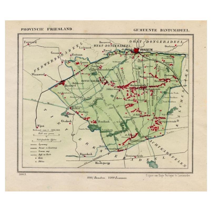
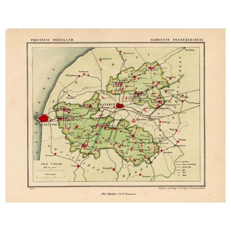
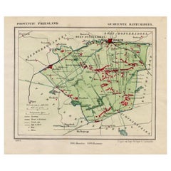
Antique Map of Dantumadeel, Friesland, The Netherlands, 1868
Located in Langweer, NL
Antique map titled 'Provincie Friesland - Gemeente Dantumadeel'. Map of the township of Dantumadeel including Birdaard, Rinsumageest, Veenwouden and many other villages. This map ori...
Category
Antique 19th Century Maps
Materials
Paper
$100 Sale Price
20% Off
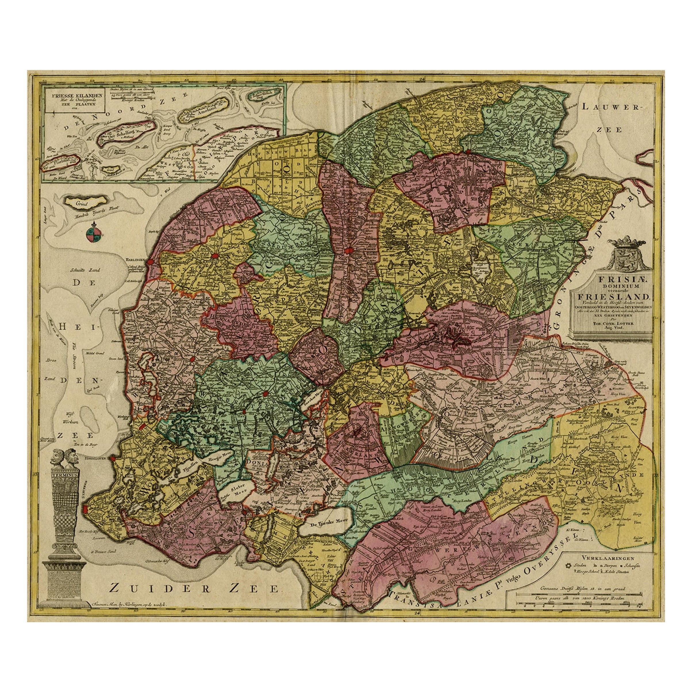
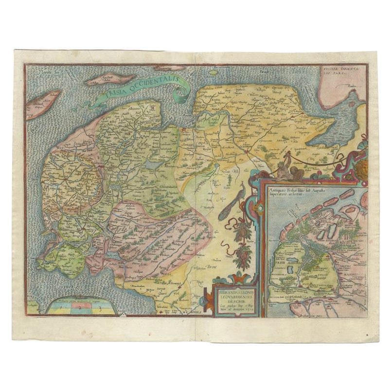
Antique Map of the Province of Friesland, The Netherlands, c.1760
Located in Langweer, NL
Antique map titled 'Frisiae Dominium vernacule Friesland, verdeeld in de Hoofd-deelen van Oostergoo, Westergoo en Sevenwolden, Als ook der XI Steden Zynde noch onderscheiden in XXX G...
Category
Antique 18th Century Maps
Materials
Paper
$505 Sale Price
20% Off
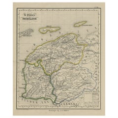
Antique Map of Friesland, Province in The Netherlands, 1864
Located in Langweer, NL
Antique map titled 'De Provincie Friesland'. Map of the province of Friesland, the Netherlands. This map originates from 'F. C. Brugsma's Atlas van het Koninkrijk der Nederlanden (.....
Category
Antique 19th Century Maps
Materials
Paper
$130 Sale Price
20% Off
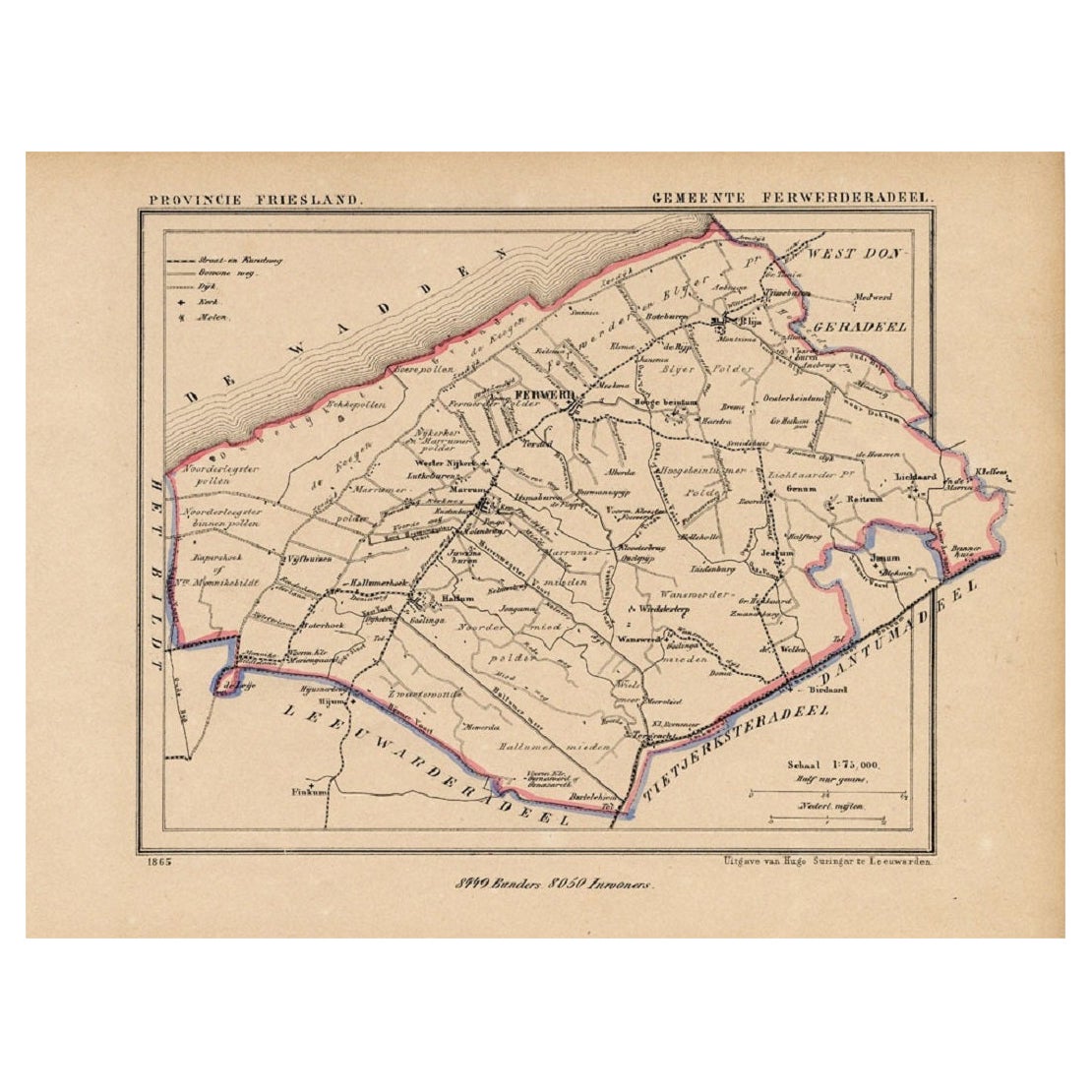
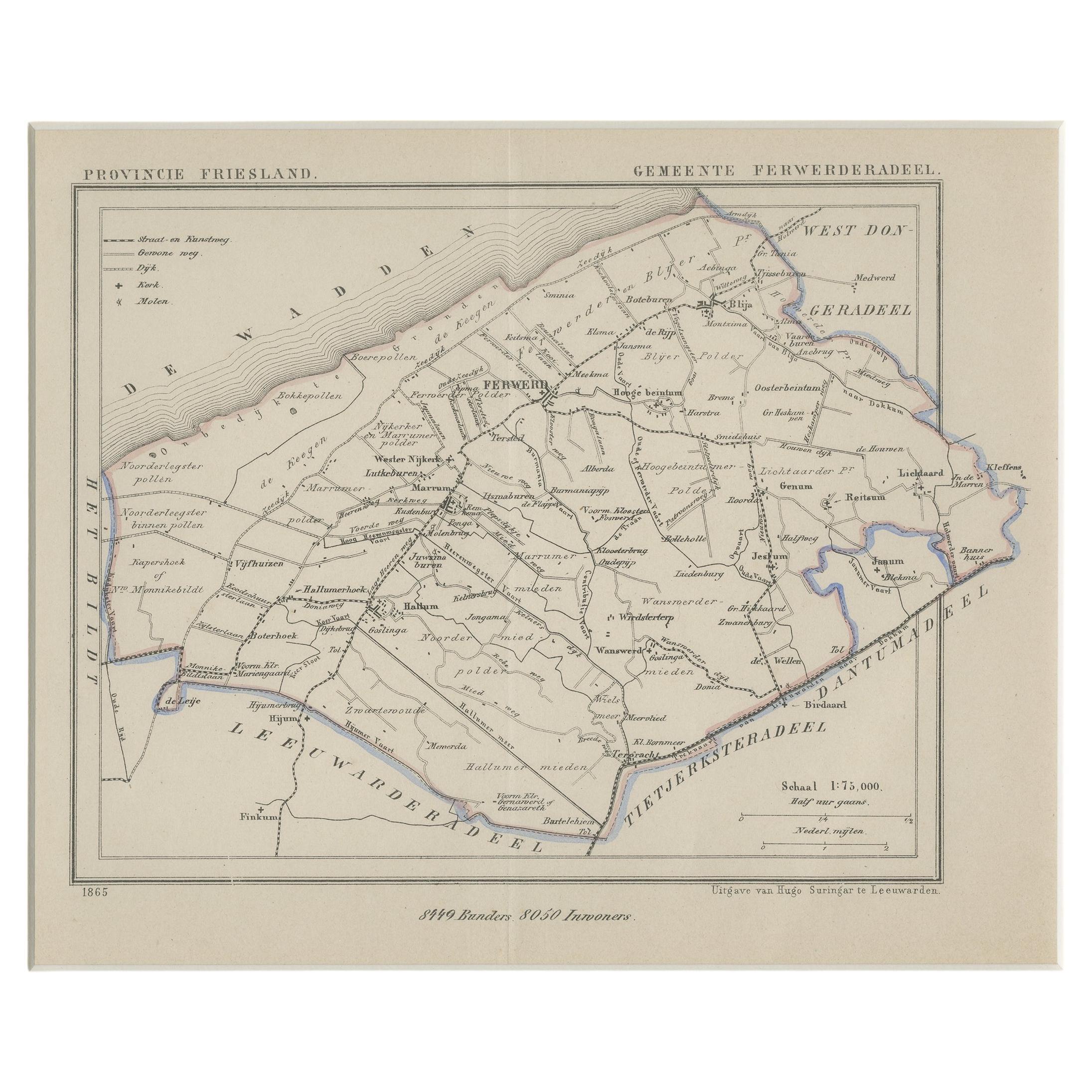
Antique Map of the County Ferwerderadeel, Friesland, The Netherlands, 1868
Located in Langweer, NL
Antique map titled 'Provincie Friesland - Gemeente Ferwerderadeel'. Map of the township of Ferwerderadeel including Ferwerd, Blija and many other villages. This map originates from '...
Category
Antique 19th Century Maps
Materials
Paper
$148 Sale Price
20% Off
Antique Map of the Province of Friesland in The Netherlands, 1718
Located in Langweer, NL
Antique map titled 'Frisiae Dominium vernacule Friesland (..)'.
Original antique map of Friesland, the Netherlands. Originates from 'Uitbeelding van de Heerlijkheid van Friesland...
Category
Antique 18th Century Maps
Materials
Paper
$697 Sale Price
20% Off
You May Also Like
1868 The Moonstone
By Wilkie Collins
Located in Bath, GB
A beautiful first edition set of Wilkie Collin's important sensation mystery novel, very scarce to see a set of all first editions volumes.
The sought after first edition, first sta...
Category
Antique 1860s British Books
Materials
Paper
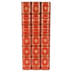
$16,439
Antique 18th Century Map of the Province of Pensilvania 'Pennsylvania State'
Located in Philadelphia, PA
A fine antique of the colony of Pennsylvania.
Noted at the top of the sheet as a 'Map of the province of Pensilvania'.
This undated and anonymous map is thought to be from the Gentleman's Magazine, London, circa 1775, although the general appearance could date it to the 1760's.
The southern boundary reflects the Mason-Dixon survey (1768), the western boundary is placed just west of Pittsburgh, and the northern boundary is not marked.
The map has a number of reference points that likely refer to companion text and appear to be connected to boundaries. The western and southern boundaries are marked Q, R, S, for example. A diagonal line runs from the Susquehanna R to the Lake Erie P. A broken line marked by many letters A, B, N, O, etc., appears in the east.
There are no latitude or longitude markings, blank verso.
Framed in a shaped contemporary gilt wooden frame and matted under a cream colored matte.
Bearing an old Graham Arader Gallery...
Category
Antique 18th Century British American Colonial Maps
Materials
Paper

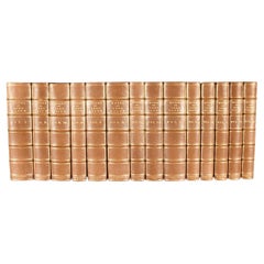
1868-1901 The Works of Francis Bacon, Baron Veralum
By Francis Bacon
Located in Bath, GB
A fine fourteen volume collection of the works of Sir Francis Bacon, uniformly bound in half morocco, and from the library of industrialist and philanthropist Andrew Carnegie.
A bea...
Category
Antique 19th Century British Books
Materials
Paper
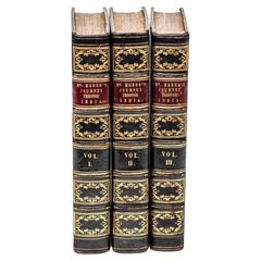
3 Volumes. Reginald Heber, Journey Through the Upper Province of India.
Located in New York, NY
3 Volumes. Reginald Heber, The Narrative of a Journey Through the Upper Provinces of India from Calcutta to Bombay 1824-1825. Second Edition. Bound in full navy morocco. The raised b...
Category
Antique Early 19th Century English Books
Materials
Leather
1868 Map of the Upper Part of the Island of Manhattan Above 86th Street
By Wm. Rogers Mfg. Co.
Located in San Francisco, CA
This wonderful piece of New York City history is over 150 years old. It depicts 86th street and above. It was lithographed by WC Rogers and company. It was made to show what was the Battle of Harlem during the Revolutionary war...
Category
Antique 1860s American American Colonial Maps
Materials
Paper

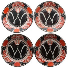
Wilhelmina, Queen of the Netherlands, 1898 Inauguration Commemorative Plates
By Petrus Regout
Located in Sharon, CT
Offering four hand-painted Wilhelmina, “1890-1948” Inauguration plates, manufactured in 1898 by Petrus Regout & Co., Maastricht, Holland.
Category
Antique 1890s Dutch Art Nouveau Historical Memorabilia
Materials
Ceramic
Recently Viewed
View AllMore Ways To Browse
Bentwood Sling Chair
Bergere Chairs 8
Biedermeier Bedside Tables
Biedermeier Tilt Top Table
Bing And Grondahl Tea
Birdcage Regency
Bitossi Side Table
Black Acrylic Chairs
Black And White Marble Ashtray
Black Herman Miller Bench
Black Roly Poly
Black Transferware
Blade Console
Block Blue Armchair
Blue Leather Sectional
Blue Willow Bowl
Blue Willow Japan
Bobbin Bench