Items Similar to Antique Print with Views of Sir Charles Saunders Island and Other Islands, 1774

Want more images or videos?
Request additional images or videos from the seller
1 of 6
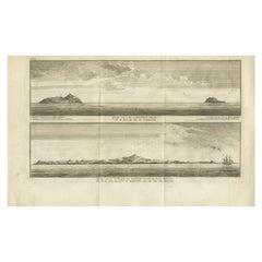
Antique Print with Views of Sir Charles Saunders Island and Other Islands, 1774
$308.06
$385.0720% Off
£228.07
£285.0920% Off
€256
€32020% Off
CA$426.53
CA$533.1620% Off
A$465.66
A$582.0820% Off
CHF 244.13
CHF 305.1620% Off
MX$5,655.67
MX$7,069.5920% Off
NOK 3,048.77
NOK 3,810.9620% Off
SEK 2,878.85
SEK 3,598.5720% Off
DKK 1,948.98
DKK 2,436.2320% Off
About the Item
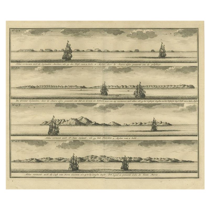
Explore the captivating world of the 18th century with this exquisite antique print titled 'Isles de Sir Charles Saunder Latitude (...)'. I A journey through time as you delve into the coastal views of Sir Charles Saunders Island, Osnaburg Island (now known as Mehetia in French Polynesia), Boscawens Island (modern-day Tafahi in Tonga), Admiral Keppel's Island (Niuatoputapu), and Wallis Island (Uvea).
This remarkable map is a precious relic from the French edition of 'An Account of the Voyages Undertaken by the Order of His Present Majesty for Making Discoveries in the Southern Hemisphere' by John Hawkesworth, dating back to approximately 1774. A window into the age of exploration and discovery, this antique map invites you to relive the adventures of early explorers and marvel at the uncharted territories of the past.
- Dimensions:Height: 10.75 in (27.3 cm)Width: 13.12 in (33.3 cm)Depth: 0.02 in (0.5 mm)
- Materials and Techniques:Paper,Engraved
- Period:
- Date of Manufacture:circa 1774
- Condition:General age-related toning. Minor wear and soiling, blank verso. Please study image carefully.
- Seller Location:Langweer, NL
- Reference Number:Seller: BG-12707-991stDibs: LU3054334403422
About the Seller
5.0
Recognized Seller
These prestigious sellers are industry leaders and represent the highest echelon for item quality and design.
Platinum Seller
Premium sellers with a 4.7+ rating and 24-hour response times
Established in 2009
1stDibs seller since 2017
2,641 sales on 1stDibs
Typical response time: <1 hour
- ShippingRetrieving quote...Shipping from: Langweer, Netherlands
- Return Policy
Authenticity Guarantee
In the unlikely event there’s an issue with an item’s authenticity, contact us within 1 year for a full refund. DetailsMoney-Back Guarantee
If your item is not as described, is damaged in transit, or does not arrive, contact us within 7 days for a full refund. Details24-Hour Cancellation
You have a 24-hour grace period in which to reconsider your purchase, with no questions asked.Vetted Professional Sellers
Our world-class sellers must adhere to strict standards for service and quality, maintaining the integrity of our listings.Price-Match Guarantee
If you find that a seller listed the same item for a lower price elsewhere, we’ll match it.Trusted Global Delivery
Our best-in-class carrier network provides specialized shipping options worldwide, including custom delivery.More From This Seller
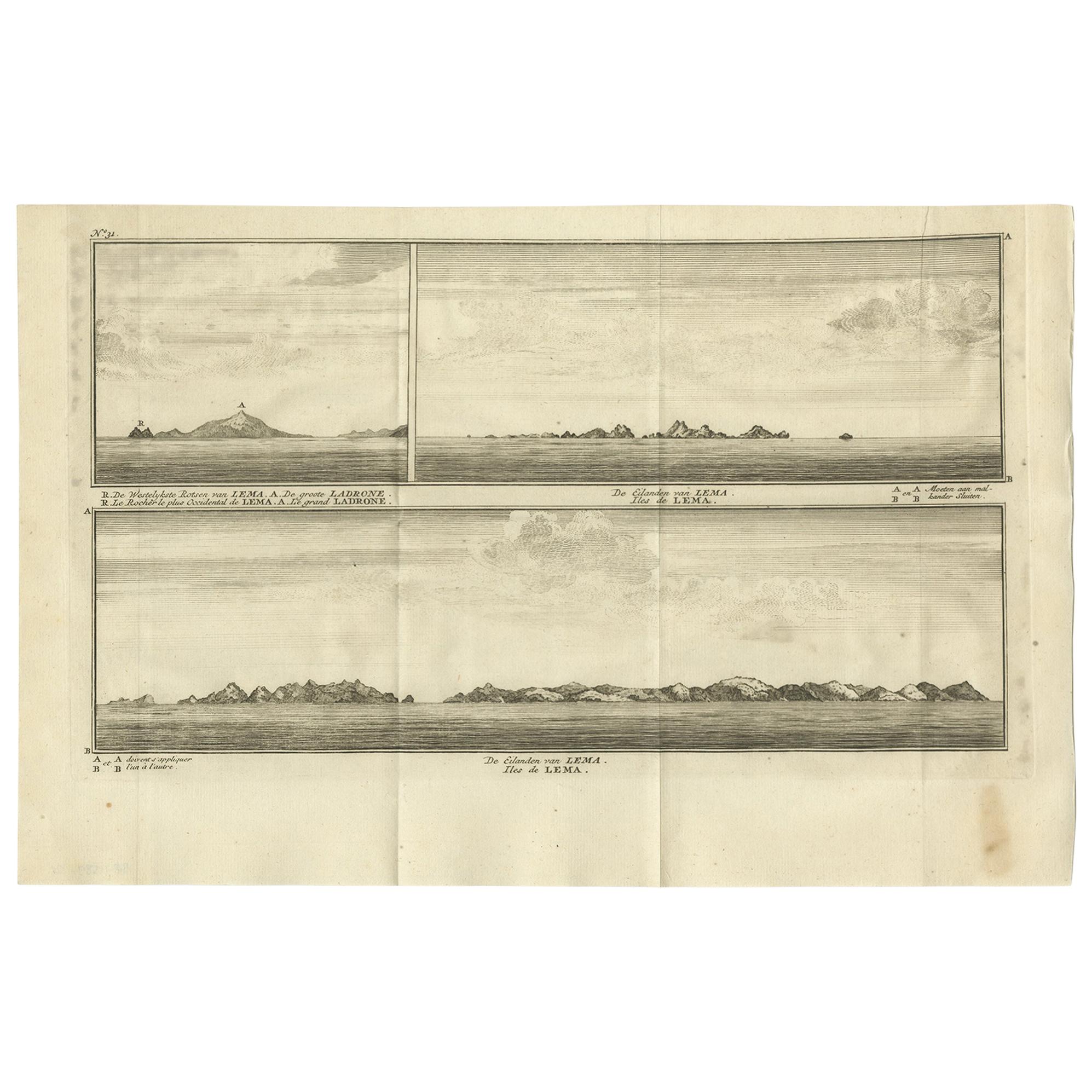
View AllAntique Print with Views of the Lema Islands by Anson '1749'
Located in Langweer, NL
Antique print titled 'Iles de Lema (..)'. Various views of the Lema Islands, part of the Wanshan Archipelago, formerly known as the Ladrones Islands, part of Xiangzhou District in Zh...
Category
Antique Mid-18th Century Prints
Materials
Paper
$192 Sale Price
46% Off
Views of Saunders, Osnaburg, Boscawens, Admiral Keppel's & Wallis Island, c.1774
Located in Langweer, NL
Antique print titled 'Isles de Sir Charles Saunder Latitude (..)'.
Coastal views of Sir Charles Saunders Island ; Osnaburg Island [Mehetia, in French Polynesia] ; Boscawens Islan...
Category
Antique 1770s Maps
Materials
Paper
$394 Sale Price
20% Off
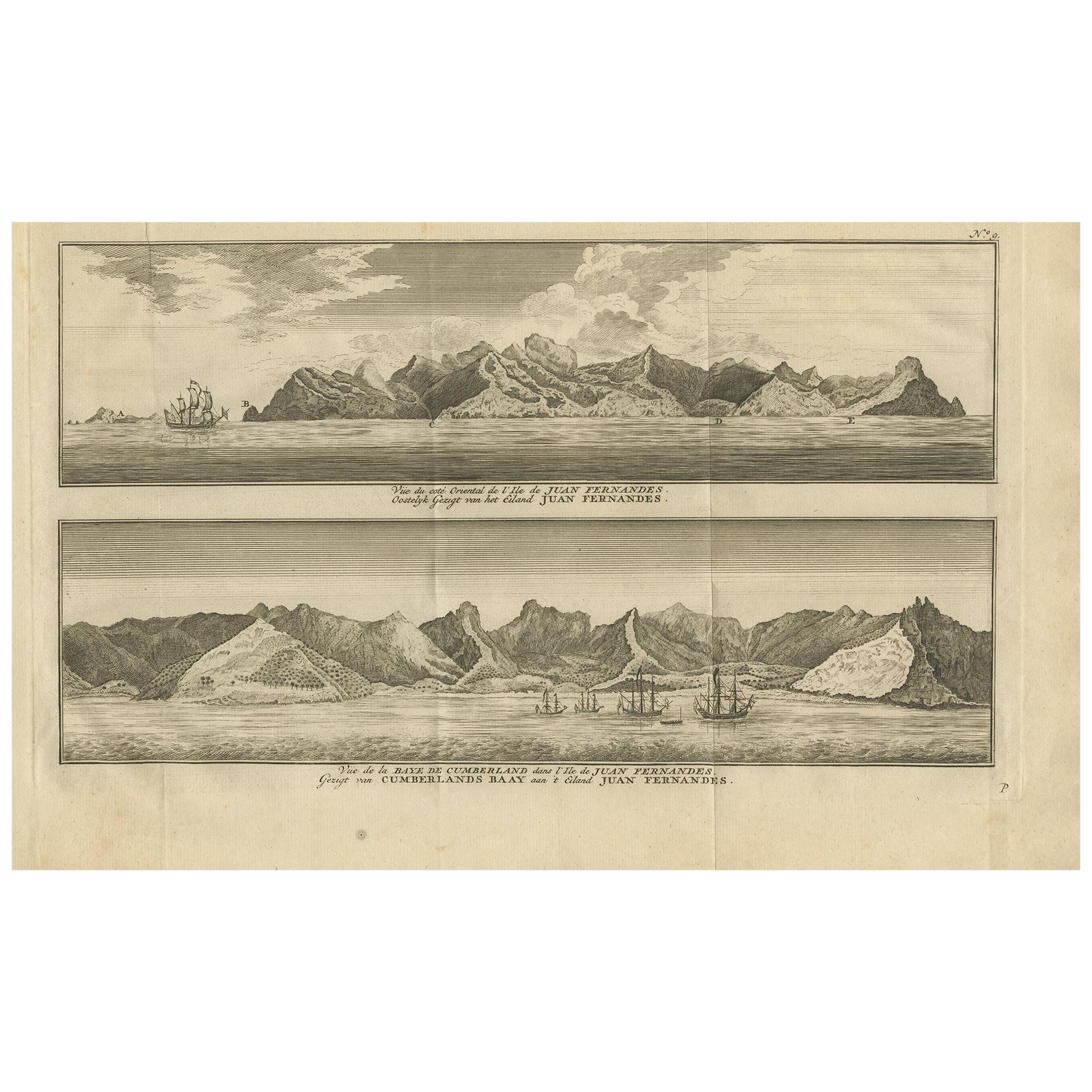
Antique Print of Cumberland Bay and Juan Fernandez Island by Anson, 1749
Located in Langweer, NL
Antique print titled 'Vue du cote oriental de l'Ile de Juan Fernandes.' 'Vue de la Baye de Cumberland dans l'Ile de Juan Fernandes.' Eastern view of Juan Fernandez Island; View of th...
Category
Antique Mid-18th Century Prints
Materials
Paper
$182 Sale Price
39% Off
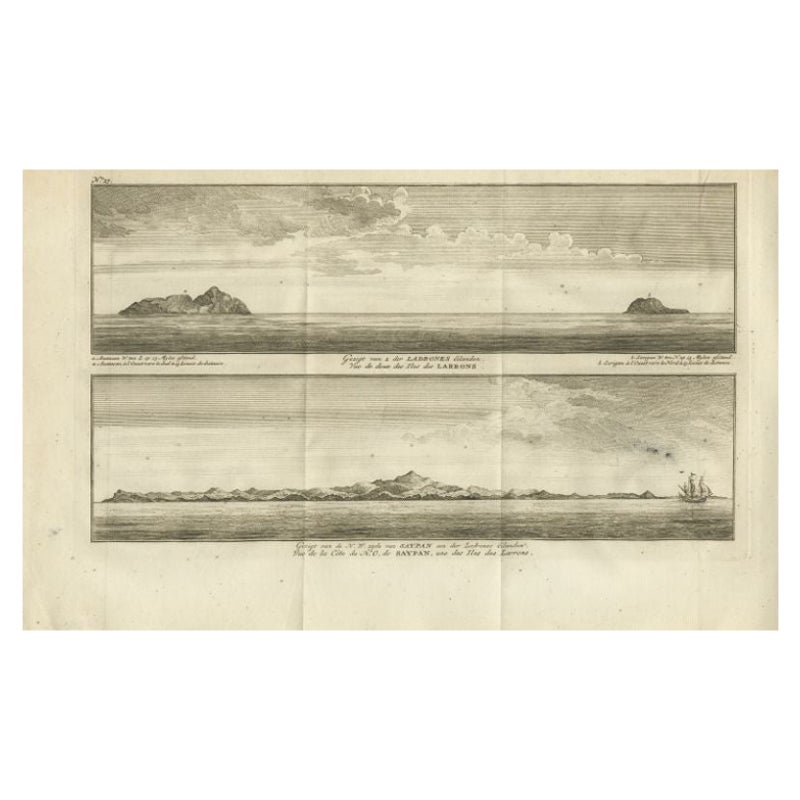
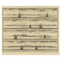
Antique Print with Views of the Ladrones Islands and Saipan by Anson, 1749
Located in Langweer, NL
Antique print titled 'Gezigt van 2 der Ladrones Eilanden' and 'Gezigt van de N.W. zyde van Saypan'. Coastal views of the Ladrones Islands and the island of Saipan. This print origina...
Category
Antique 18th Century Prints
Materials
Paper
$221 Sale Price
29% Off
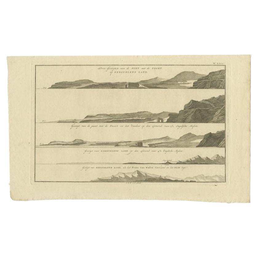
Antique Print with Views of Kerguelens Island by Cook, 1803
Located in Langweer, NL
Antique print Kerguelen Islands titled 'Drie gezichten van de punt met de poort op Kerguelens Land'. Four views of Kerguelens Island/Desolation Islands, discovered by the Frenchman M...
Category
Antique 19th Century Prints
Materials
Paper
$231 Sale Price
20% Off
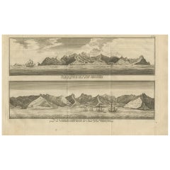
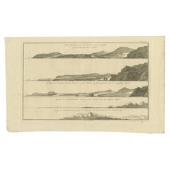
Antique Print of the Islands of Marken, New Ireland & Others, 1726
Located in Langweer, NL
Antique print titled 'De Kust van Nova Guinea tot aan deze bogt (..)'. Four engravings on one sheet showing panoramic views of the islands of Marken, the Groene islands, Sint Jans island and New Ireland...
Category
Antique 18th Century Prints
Materials
Paper
$298 Sale Price
20% Off
You May Also Like
Original Antique Map of South America. C.1780
Located in St Annes, Lancashire
Great map of South America
Copper-plate engraving
Published C.1780
Two small worm holes to left side of map
Unframed.
Category
Antique Early 1800s English Georgian Maps
Materials
Paper

St. Christophe (St. Kitts): Bellin 18th Century Hand Colored Map
Located in Alamo, CA
Jacques Bellin's copper-plate map of the Caribbean island of Saint Kitts entitled "Carte De De l'Isle St. Christophe Pour servir á l'Histoire Genle. des V...
Category
1740s Other Art Style Landscape Prints
Materials
Engraving

Engraving Print from the Panckoucke Encyclopédie Nautical Subject 1782-1832
Located in Milan, IT
Print by engraving on copper plate from the Panckoucke Encyclopédie méthodique, end of the 18th century,volume Marine Planches (more than 1,500 figures dealing with all subjects on the marina: planes, construction, carpentry, tree trunks, armaments of maneuvers, ropes, sails, artillery, ship maneuvers and combat tactics). This is the plate no. n. 24, pag. 69 fig. 341 ; with frame cm 38.3 x 31.5. Ship ropes are depicted. The Print has the "Benard direxit...
Category
Antique 1790s French Nautical Objects
Materials
Paper
Antique French Map of Asia Including China Indoneseia India, 1783
Located in Amsterdam, Noord Holland
Very nice map of Asia. 1783 Dedie au Roy.
Additional information:
Country of Manufacturing: Europe
Period: 18th century Qing (1661 - 1912)
Condition: Overall Condition B (Good Used)...
Category
Antique 18th Century European Maps
Materials
Paper

$648 Sale Price
20% Off
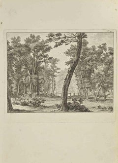
Landscape - Etching by Nicholas Cochin - 1755
Located in Roma, IT
Landscape is an etching realized by Nicholas Cochin in 1755.
Good conditions.
The artwork is depicted through confident strokes.
The etching was rea...
Category
1750s Modern Figurative Prints
Materials
Etching
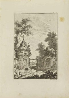
Landscape - Etching by Pierre Quentin Chedel - 1755
By Pierre Quentin Chedel
Located in Roma, IT
Landscape is an etching realized by Pierre Quentin Chedel in 1755.
Good conditions.
Signed on Plate.
The artwork is depicted through confident strokes.
The etching was realized f...
Category
1750s Figurative Prints
Materials
Etching
More Ways To Browse
French Polynesia
Vintage Long Island Map
Vintage World Map Desk
Vintage World Map Mirror
Antique Furniture Toledo Ohio
Antique Maps Washington Dc
Blaeu World Map
Cape Cod Map
F Colton
Irish Antiques 16th Century
Ithaca Antique Map
Leonard Jones
Russia Globe
Salt Lake City Used Furniture
World Map Copper
Luxury Modern Carpet
French Directoire Furniture
French Earthenware