Items Similar to Bird's Eye Plan of the Ancient City of Jerusalem Based on Old Records, c.1725
Want more images or videos?
Request additional images or videos from the seller
1 of 5
Bird's Eye Plan of the Ancient City of Jerusalem Based on Old Records, c.1725
$620.31
$775.3920% Off
£458.61
£573.2620% Off
€520
€65020% Off
CA$853.23
CA$1,066.5420% Off
A$948.42
A$1,185.5320% Off
CHF 497.14
CHF 621.4320% Off
MX$11,582.51
MX$14,478.1420% Off
NOK 6,206.53
NOK 7,758.1620% Off
SEK 5,839.19
SEK 7,298.9820% Off
DKK 3,958.75
DKK 4,948.4420% Off
About the Item
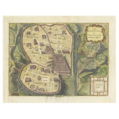
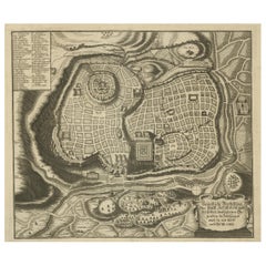
Antique map titled 'Beschryving van het oude Jeruzalem volgens Villalpandus.'
Bird's eye plan of the ancient city of Jerusalem based on Villalpando's foundation map. The plan shows only the major religious sites, uncluttered by habitations and is beautifully engraved to show the surrounding topography. This plate originates from: 'Het algemeen groot historisch, oordeelkundig, chronologisch, geografisch, en letterlyk naam- en woord-boek, van den gantschen H. Bijbel. Dienende tot de gedenk-stukken der Jooden en andere oudheden, ter opheldering der H. Schrift ... Nu in't Nederduitsch overgezet, merkelyk vermeerdert, en met aanmerkingen verrykt, door Mattheus Gargon.' and it's additons: 'Byvogzel tot het algemeen groot ... Naam- en woord-boek ... En nu in zuiver Nederduitsch overgezet, merkelyk vermeerdert, en metv aanmerkingen verrykt, door Jakob van Ostade en Arn. Henr. Westerhovius.', by Augustines Calmet, published in Leiden, Amsterdam, by Samuel Luchtmans, R. & J. Wetstein en Smith 1725-1731. This is a reknown encyclopaedic dictionary on all aspects of the history, geography and culture of the Bible and Biblical times. This Dutch translation originates from Calmet's work in French including: 'Commentaire littéral sur tous les livres de l'Ancien et du Nouveau Testament ...', first published in Paris in 1707. Artists and Engravers: Made by 'Antoine Augustin Calmet' after an anonymous artist. Author: Antoine Augustin Calmet (1672-1757), French Benedictine. Translation by: translation by Mattheus Gargon (1661-1728), a minister in Vlissingen. Engravings in this work by A. de Putter, F. van Bleyswyk, M. Pool, Ph. van Gunst, etc.
Artist: Made by 'Antoine Augustin Calmet' after an anonymous artist. Author: Antoine Augustin Calmet (1672-1757), French Benedictine. Translation by: translation by Mattheus Gargon (1661-1728), a minister in Vlissingen. Engravings in this work by A. de Putter, F. van Bleyswyk, M. Pool, Ph. van Gunst, etc.
Condition: Good, given age. A few minor crinkles. Original middle fold as issued. General age-related toning and/or occasional minor defects from handling. Please study image carefully.
Date: c.1725
Overall size: 51.3 x 42.5 cm.
Image size: 43.7 x 30.5 cm.
- Dimensions:Height: 20.2 in (51.3 cm)Width: 16.74 in (42.5 cm)Depth: 0 in (0.01 mm)
- Materials and Techniques:
- Period:
- Date of Manufacture:circa 1725
- Condition:Condition: Good, given age. A few minor crinkles. Original middle fold as issued. General age-related toning and/or occasional minor defects from handling. Please study image carefully.
- Seller Location:Langweer, NL
- Reference Number:Seller: PCT-614571stDibs: LU3054326362142
About the Seller
5.0
Recognized Seller
These prestigious sellers are industry leaders and represent the highest echelon for item quality and design.
Platinum Seller
Premium sellers with a 4.7+ rating and 24-hour response times
Established in 2009
1stDibs seller since 2017
2,604 sales on 1stDibs
Typical response time: <1 hour
- ShippingRetrieving quote...Shipping from: Langweer, Netherlands
- Return Policy
Authenticity Guarantee
In the unlikely event there’s an issue with an item’s authenticity, contact us within 1 year for a full refund. DetailsMoney-Back Guarantee
If your item is not as described, is damaged in transit, or does not arrive, contact us within 7 days for a full refund. Details24-Hour Cancellation
You have a 24-hour grace period in which to reconsider your purchase, with no questions asked.Vetted Professional Sellers
Our world-class sellers must adhere to strict standards for service and quality, maintaining the integrity of our listings.Price-Match Guarantee
If you find that a seller listed the same item for a lower price elsewhere, we’ll match it.Trusted Global Delivery
Our best-in-class carrier network provides specialized shipping options worldwide, including custom delivery.More From This Seller
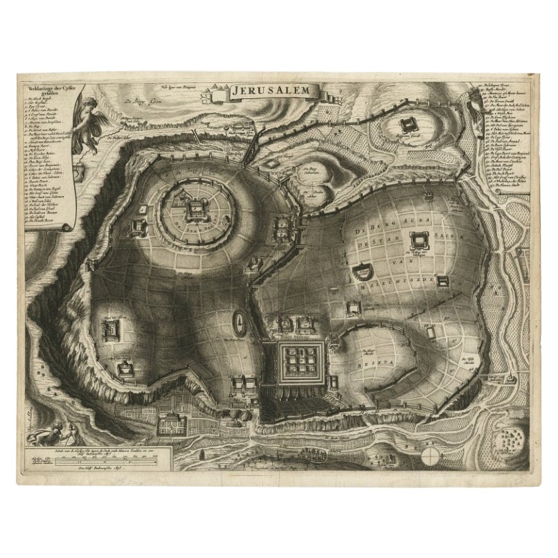
View AllAntique Detailed Map of Jerusalem in Israël with Extensive Key and Scale, 1698
Located in Langweer, NL
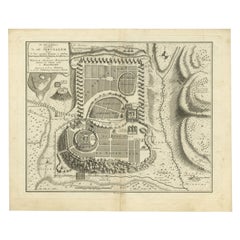
Antique map titled 'Jerusalem.'
Plan of the ancient city of Jerusalem. With extensive key and scale. Source unknown, to be determined.
Artists and Engravers: Made by 'Cornelis de...
Category
Antique 17th Century Maps
Materials
Paper

$620 Sale Price
20% Off
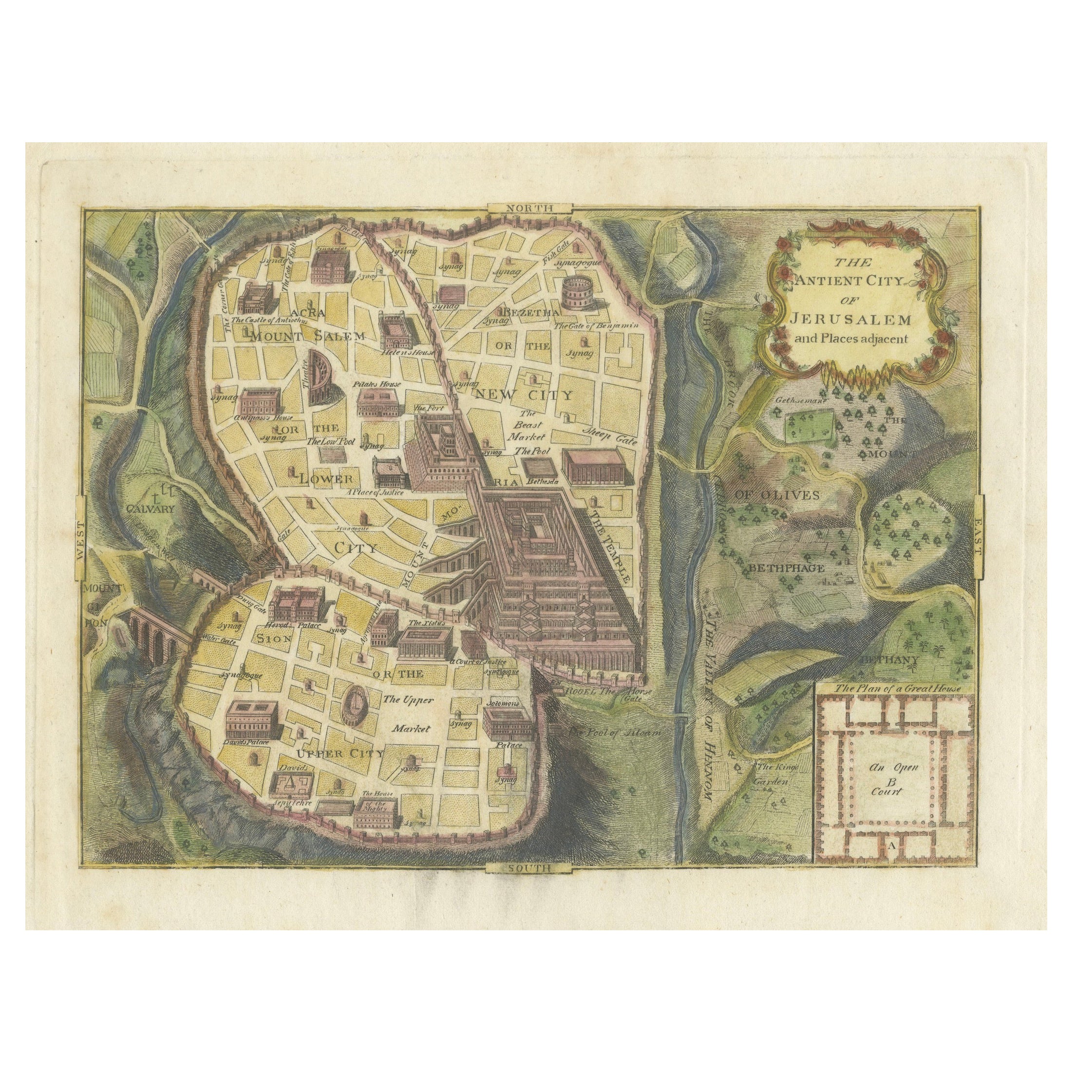
The Antient City of Jerusalem and Places Adjacent, Hand-Colored Map, 1699
Located in Langweer, NL
Title: "1699 Hand-Colored Bird's-Eye Plan of Jerusalem with Ancient and Biblical Landmarks"
This beautifully hand-colored, imaginary bird's-eye plan of Jerusalem, published in 1699,...
Category
Antique 1690s Maps
Materials
Paper
$248 Sale Price
20% Off
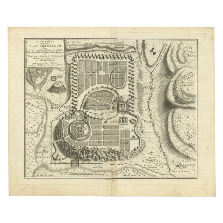
Bird's-Eye Plan of Jerusalem in Israël, a Rare Original Engraving, 1750
Located in Langweer, NL
Antique map titled 'De VIIde Landkaart Verbeeldende de Stad Jerusalem Beneven de daar Omgelegen Bergen en Dalen (..).'
Bird's-eye plan of Jerusalem in Israel. This map shows the mo...
Category
Antique 18th Century Maps
Materials
Paper
$715 Sale Price
20% Off
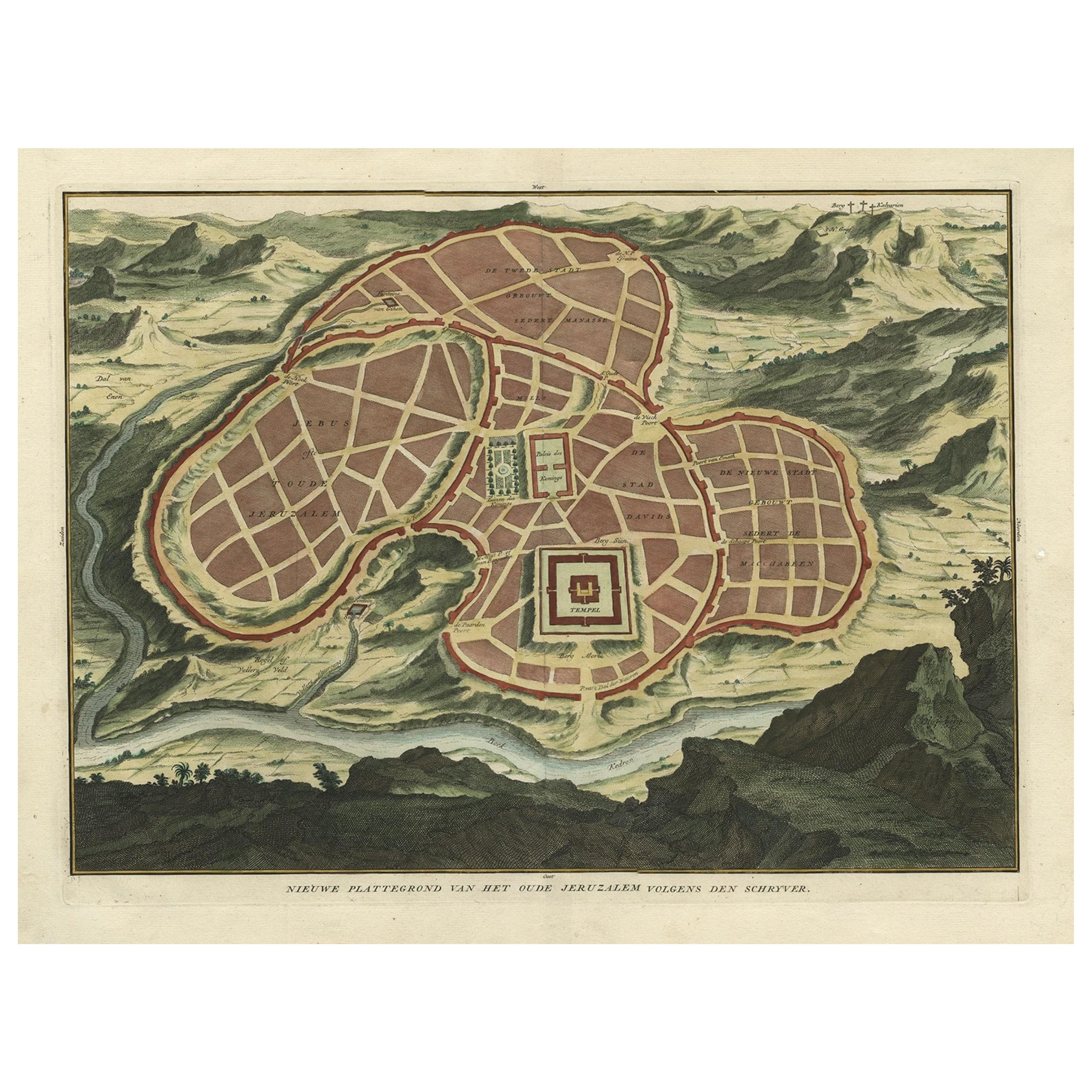
Antique Map of Ancient Jerusalem, depicting The Temple of Solomon, c.1725
Located in Langweer, NL
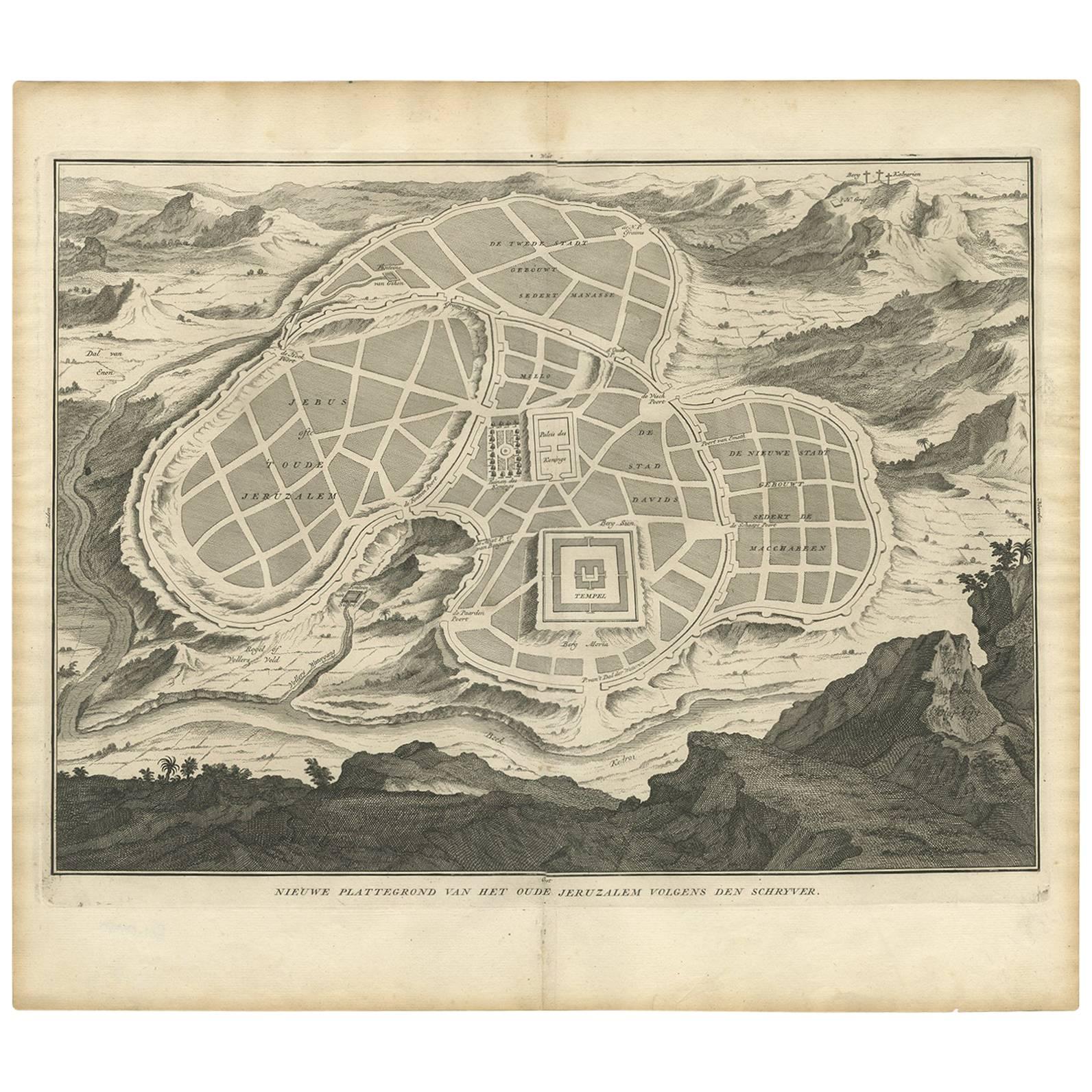
Antique map titled 'Nieuwe Plattegrond van het Oude Jeruzalem Volgens den Schryver.'
Bird's-eye view of the ancient city of Jerusalem shows its divisions with prominent depiction...
Category
Antique 18th Century Maps
Materials
Paper

$811 Sale Price
20% Off
Rare Town Plan of Jerusalem, Includes an Extensive Key to Locations etc, 1708
Located in Langweer, NL
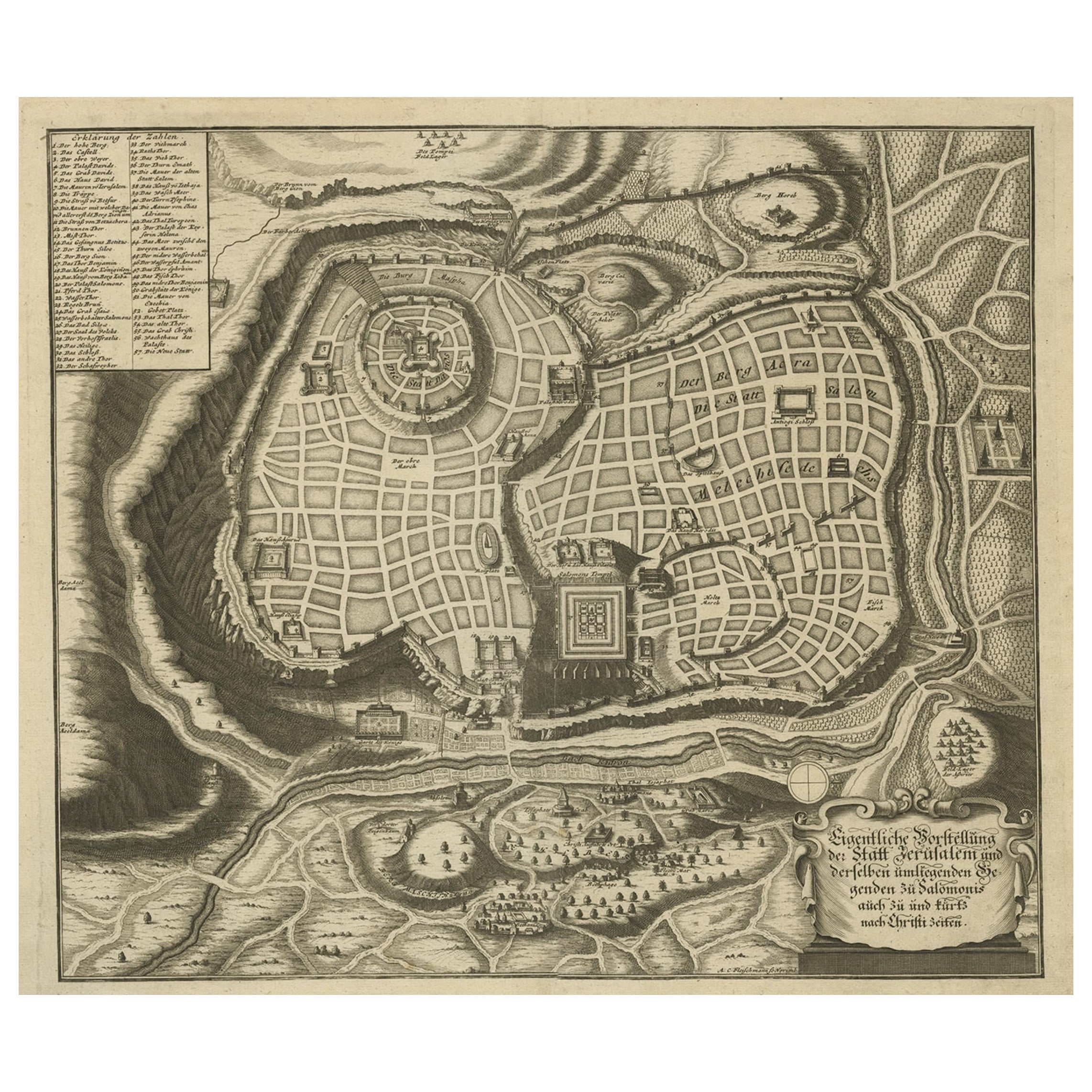
Antique map titled 'Eigentliche Vorstellung der Statt Jerusalem und derselben umliegenden Gegenden zu Salomonis auch zu und kurtz nach Christi Zeiten.'
Rare town plan...
Category
Antique Early 1700s Religious Items
Materials
Paper
$1,097 Sale Price
20% Off
Antique Map of the Ancient City of Jerusalem by A. Calmet, 1725
Located in Langweer, NL
Antique map, titled: 'Nieuwe Plattegrond van het Oude Jeruzalem Volgens den Schryver.' - Bird's-eye view of the ancient city of Jerusalem shows its divisions with prominent depiction...
Category
Antique Early 18th Century Prints
Materials
Paper
$248 Sale Price
20% Off
You May Also Like
Map of Biblical Jerusalem
Located in New York, NY
Original copper engraving hand-colored at the time of publication. Nuremberg, 1720.
Category
1720s Prints and Multiples
Materials
Paper
Original Antique Map or City Plan of Geneva, Switzerland. Circa 1835
Located in St Annes, Lancashire
Nice map of Geneva
Drawn and engraved by J.Dower
Published by Orr & Smith. C.1835
Unframed.
Free shipping
Category
Antique 1830s English Maps
Materials
Paper

17th-18th Century Siege of Graves Mapping Engraving By Willian III
Located in Kingston, NY
RARE French 17th-18th Century Enhanced Siege of Graves Mapping Engraving BY William III, also widely known as William of Orange,
The Siege of Grave in Dutch Brabant started by Monsie...
Category
Antique 17th Century French Prints
Materials
Paper

18th Century Map of Rome & Surrounding Vicinity
Located in New Orleans, LA
Intriguing framed map of Rome and the surrounding vicinity featuring detailed cartography, ornamental illustrations, and text index at the bottom. A great, historical conversation pi...
Category
Antique 18th Century Italian Antiquities
Materials
Paper
1597 German Map of Alexandria by Georg Braun and Frans Hogenberg
By Georg Braun and Frans Hogenberg
Located in Chapel Hill, NC
1597 Map of Alexandria by Georg Braun and Frans Hogenberg, Germany. From "Civitas Orbis Terrarum", part 2, published in Cologne by Bertram Buchholz. Printed in 2 parts. Title: "Alexa...
Category
Antique 16th Century German Renaissance Maps
Materials
Paper

17th Century Toulouse, Savve, Sommieres Topographical Map by Iohan Peeters
Located in New York, NY
Fine topographical 17th century map of Toulouse, Savve and Sommieres by Iohan Peeters
Beautiful engraving of the capital of France's Occitanie Region, Toulouse, called La Ville Rose- the Pink City, for the terracotta bricks used in its many buildings, giving the city a distinct apricot-rose hue. An important cultural and educational center, the city's residents included Nobel Prize winners and world renown artists- Henri de Toulouse-Lautrec, Henri Martin, Jean-Auguste-Dominique Ingres, Antonin Mercie, Alexandre Falguiere and more recently Cyril Kongo...
Category
Antique 17th Century Dutch Maps
Materials
Paper

More Ways To Browse
Antique French Bible
Antique Map Of Jerusalem
Map Of Jerusalem
Antique Putters
Ancient Bible
Caribbean Colonial Furniture
Antique Maps West Indies
California Island Map
Pirate Antique
Map Of Holy Land
Antique Blackwood Furniture
Antique Macedonia
Antique Maps Of New York City
Victorian Compass
Antique Maps Caribbean Islands
Hungary Map
Cartographer Tool
Goa Furniture