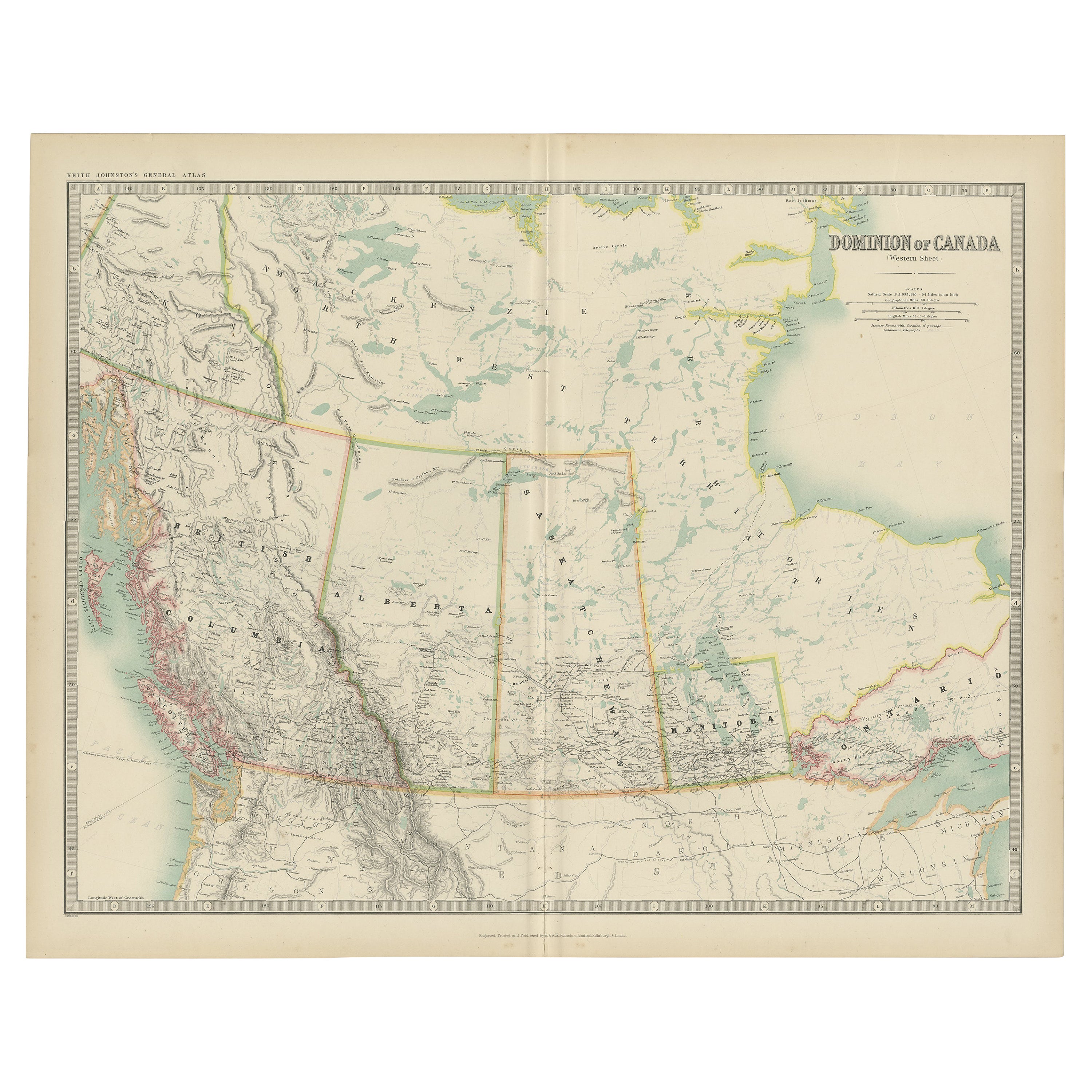
Items Similar to Canada Map 1903 - Dominion of Canada, West Central Sheet
Want more images or videos?
Request additional images or videos from the seller
1 of 10
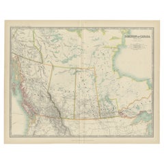
Canada Map 1903 - Dominion of Canada, West Central Sheet
$404.76
£300.85
€340
CA$558.87
A$619.74
CHF 325.63
MX$7,572.20
NOK 4,074.06
SEK 3,824.20
DKK 2,588.93
About the Item
Title: Canada Map 1903 - Dominion of Canada, West Central Sheet
Description:
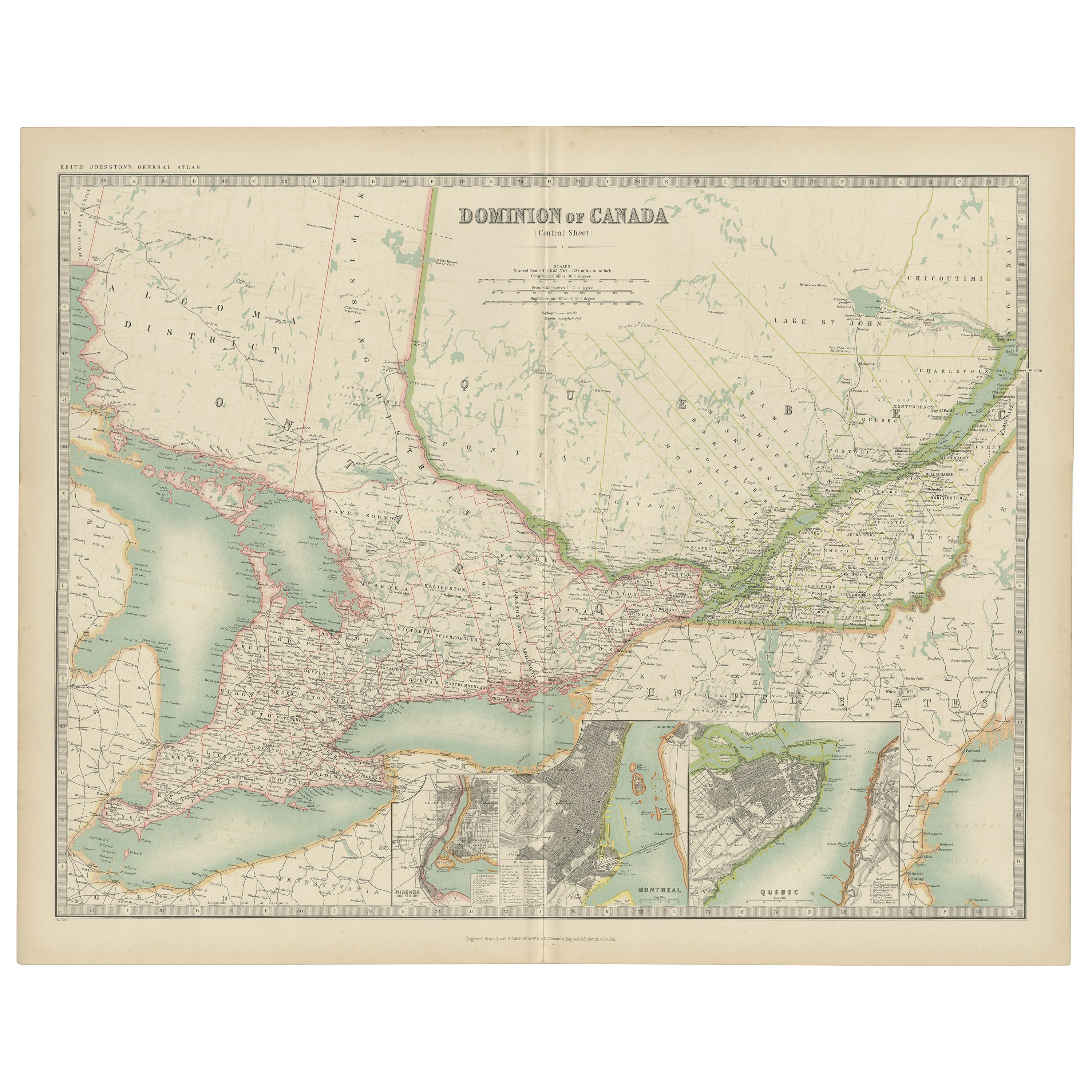
This fascinating 1903 map of the Dominion of Canada’s West Central regions by T.R. Johnston offers a vivid glimpse into the geographical and political landscape of early 20th-century Canada. It captures the expansive territory stretching across the heart of the Canadian Shield and the Hudson Bay basin. The map’s meticulous detail highlights key features including the Hudson Bay, parts of Manitoba, Saskatchewan, and Ontario, as well as the vast networks of rivers and lakes that define this rugged landscape.
Railway lines, postal routes, and settlements are intricately marked, reflecting the growing infrastructure that was pivotal for trade and migration during the era. The beautifully engraved coastlines and precise border delineations reveal the cartographer’s commitment to accuracy and artistry. The elegant typography and muted color palette add to its classic appeal, making it an exceptional example of antique cartography.
This map not only showcases the physical terrain but also speaks to the spirit of exploration and the consolidation of the Canadian territories during this dynamic period in history. It is a testament to the country’s rich natural resources and the challenges of development in remote and sparsely populated areas.
Condition:
This antique map is in excellent condition, with some mild toning typical of age. The colors remain bright, and there are no major tears or foxing, making it ideal for display or as part of a historical collection.
Framing Tips:
To highlight the natural tones of the map, consider a warm wooden frame, such as walnut or oak, with a cream or pale mat to create a subtle contrast. A protective UV-filtering glass will help preserve the delicate details and coloration, ensuring that this historical piece continues to inspire for years to come.
- Dimensions:Height: 18.51 in (47 cm)Width: 14.49 in (36.8 cm)Depth: 0.01 in (0.2 mm)
- Materials and Techniques:
- Period:
- Date of Manufacture:1903
- Condition:This antique map is in excellent condition, with some mild toning typical of age. The colors remain bright, and there are no major tears or foxing, making it ideal for display or as part of a historical collection.
- Seller Location:Langweer, NL
- Reference Number:Seller: BG-13577-431stDibs: LU3054345291602
About the Seller
5.0
Recognized Seller
These prestigious sellers are industry leaders and represent the highest echelon for item quality and design.
Platinum Seller
Premium sellers with a 4.7+ rating and 24-hour response times
Established in 2009
1stDibs seller since 2017
2,609 sales on 1stDibs
Typical response time: <1 hour
- ShippingRetrieving quote...Shipping from: Langweer, Netherlands
- Return Policy
Authenticity Guarantee
In the unlikely event there’s an issue with an item’s authenticity, contact us within 1 year for a full refund. DetailsMoney-Back Guarantee
If your item is not as described, is damaged in transit, or does not arrive, contact us within 7 days for a full refund. Details24-Hour Cancellation
You have a 24-hour grace period in which to reconsider your purchase, with no questions asked.Vetted Professional Sellers
Our world-class sellers must adhere to strict standards for service and quality, maintaining the integrity of our listings.Price-Match Guarantee
If you find that a seller listed the same item for a lower price elsewhere, we’ll match it.Trusted Global Delivery
Our best-in-class carrier network provides specialized shipping options worldwide, including custom delivery.More From This Seller
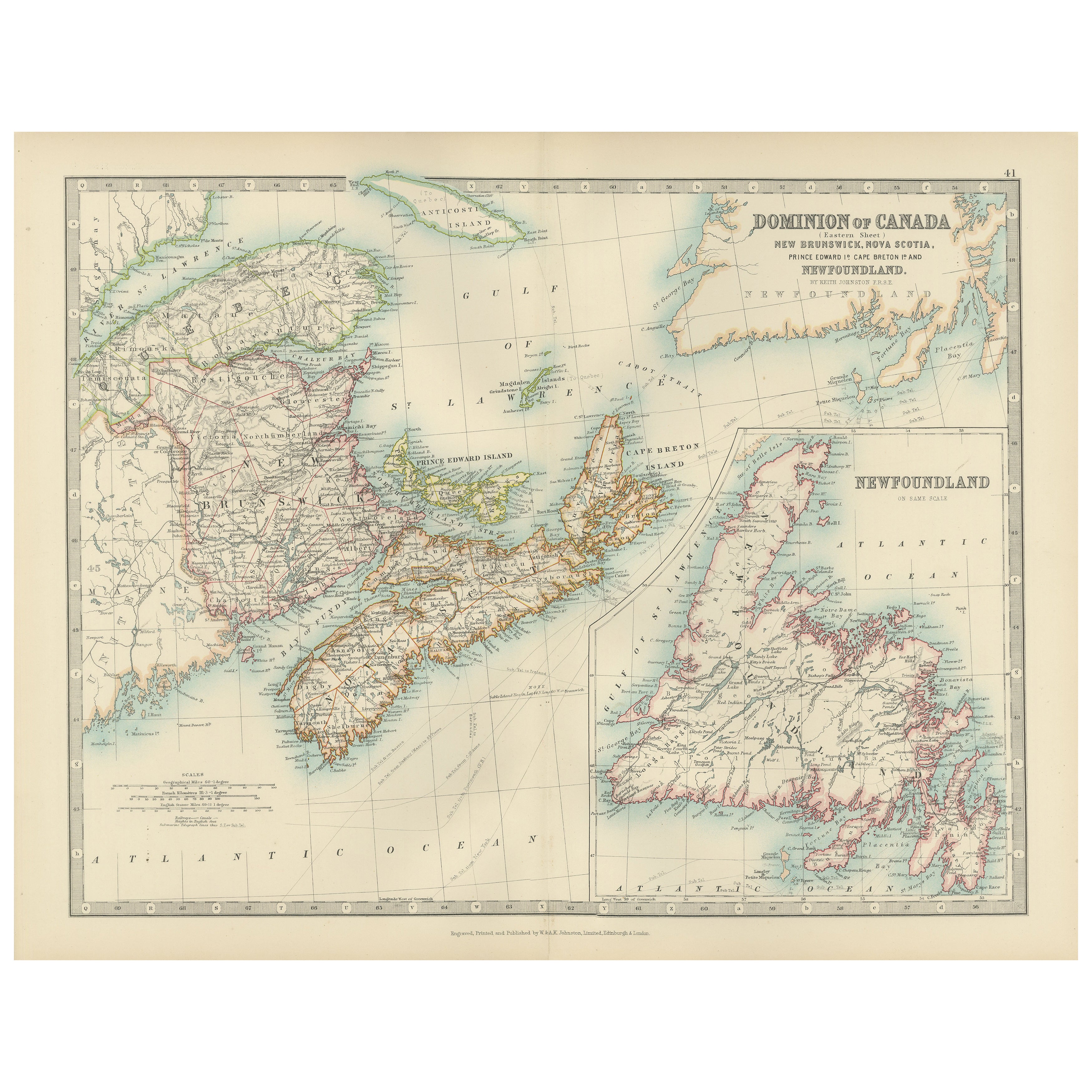
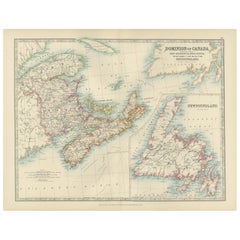
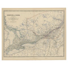
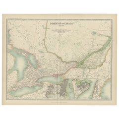
View AllCanada Dominion Map 1903 - A Detailed View of Eastern Canada and Newfoundland
Located in Langweer, NL
North America, 1903 - A Colorful Historical Map with Detailed Borders
This attractive map of North America was engraved, printed, and published by W. & A.K. Johnston in 1903. A wond...
Category
Early 20th Century Maps
Materials
Paper
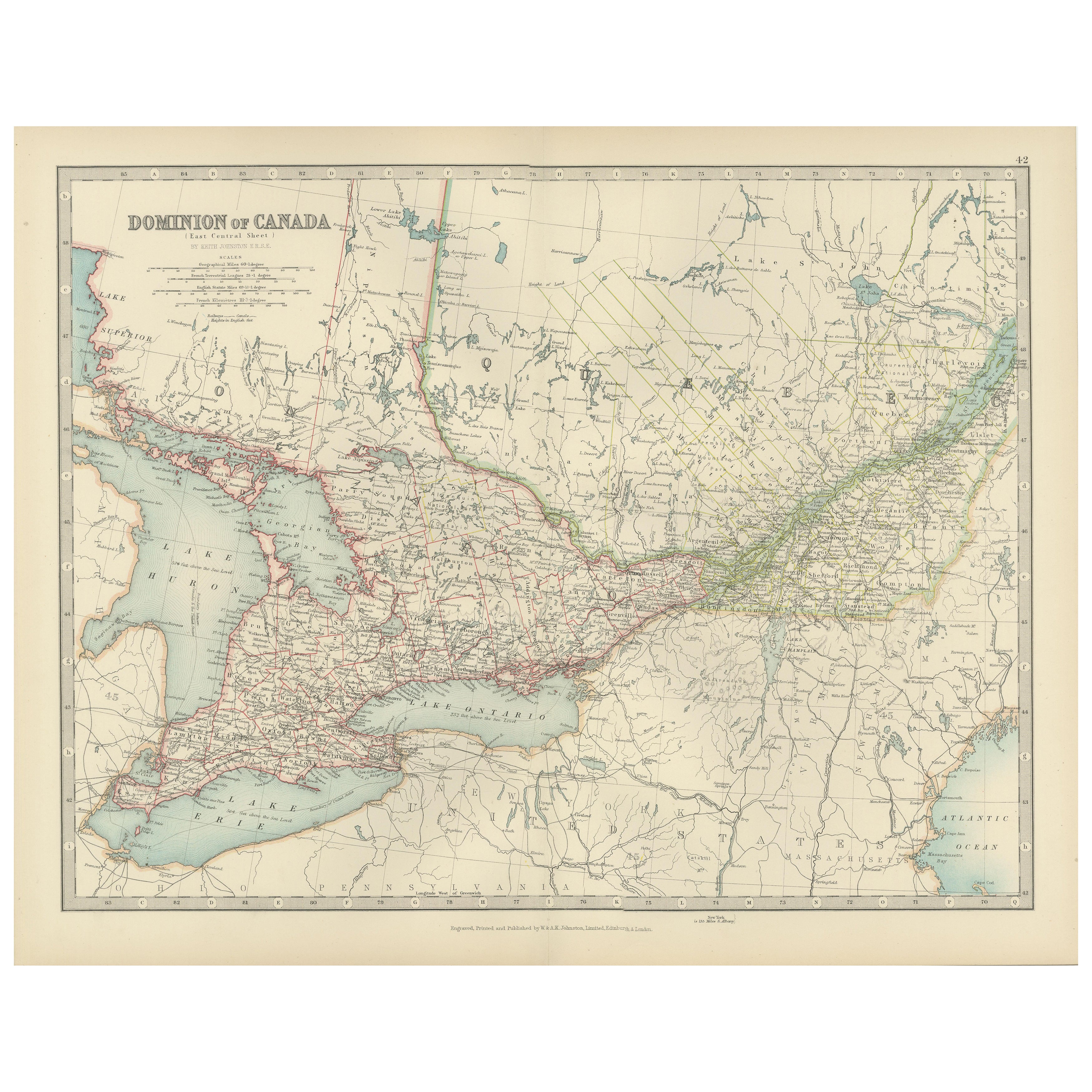
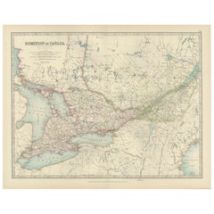
Canada Map 1903 - East Central Dominion - Ontario, Quebec & More
Located in Langweer, NL
Canada Map 1903 - East Central Dominion - Ontario, Quebec & More
This captivating antique map, titled "Dominion of Canada (East Central Sheet)" and published in 1903 by Keith Johnst...
Category
Early 20th Century Maps
Materials
Paper
Antique Map of Canada by Johnston '1909'
Located in Langweer, NL
Antique map titled 'Dominion of Canada'. Original antique map of Canada. This map originates from the ‘Royal Atlas of Modern Geography’. Publishe...
Category
Early 20th Century Maps
Materials
Paper
$238 Sale Price
20% Off
Old Original Antique Map of Western Canada, 1882
Located in Langweer, NL
Antique map titled 'Dominion of Canada'.
Old map of Western Canada. This map originates from 'The Royal Atlas of Modern Geography, Exhibiting, in a ...
Category
Antique 1880s Maps
Materials
Paper
$266 Sale Price
20% Off
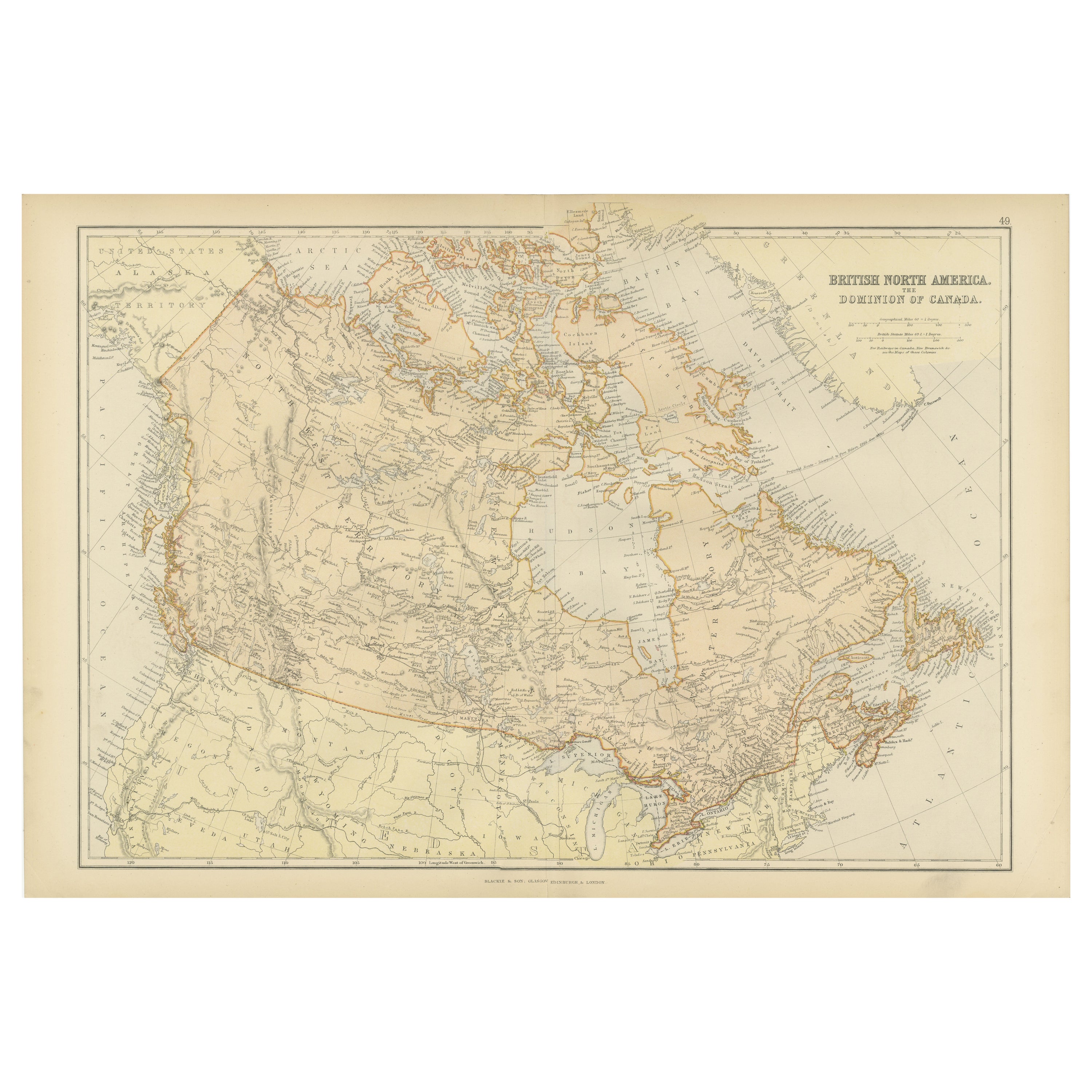
Antique Map of British North America, The Dominion of of Canada, 1882
Located in Langweer, NL
This map is titled "British North America, Dominion of Canada," from the 1882 Blackie Atlas. It features the geographical area that comprises modern-day Canada, with notable features...
Category
Antique 1880s Maps
Materials
Paper

$238 Sale Price
20% Off
Free Shipping
Antique Map of Canada by Johnston '1909'
Located in Langweer, NL
Antique map titled 'Dominion of Canada'. Original antique map of Canada. With inset maps of Niagara, Montreal, Quebec. This map originates from t...
Category
Early 20th Century Maps
Materials
Paper
$238 Sale Price
20% Off
You May Also Like
Canada and Newfoundland. Century Atlas antique vintage map
Located in Melbourne, Victoria
'The Century Atlas. Dominion of Canada and Newfoundland.'
Original antique map, 1903.
Central fold as issued. Map name and number printed on the reverse corners.
Sheet 29.5cm by 40...
Category
Early 20th Century Victorian More Prints
Materials
Lithograph

Manitoba, British Columbia and NW Territories, Canada. Century Atlas antique map
Located in Melbourne, Victoria
'The Century Atlas. Manitoba, British Columbia and the Northwest Territories, Canada, North America.'
Original antique map, 1903.
Central fold as issued. Map name and number printe...
Category
Early 20th Century Victorian More Prints
Materials
Lithograph

Large Original Vintage Map of North America, circa 1920
Located in St Annes, Lancashire
Great map of North America
Original color. Good condition
Published by Alexander Gross
Unframed.
Category
Vintage 1920s English Edwardian Maps
Materials
Paper

Quebec. Canada. Century Atlas antique vintage map
Located in Melbourne, Victoria
'The Century Atlas. Quebec'
Original antique map, 1903.
Inset maps 'Sketch Map of Quebec', Quebec and Vicinity; and 'Montreal and Vicinity'.
Central fo...
Category
Early 20th Century Victorian More Prints
Materials
Lithograph

North America. Century Atlas antique vintage map
Located in Melbourne, Victoria
'The Century Atlas. North America'
Original antique map, 1903.
Central fold as issued. Map name and number printed on the reverse corners.
Sheet 40cm by 29.5cm.
Category
Early 20th Century Victorian More Prints
Materials
Lithograph

Original Antique Map of the American State of Michigan ( Northern Part ), 1903
Located in St Annes, Lancashire
Antique map of Michigan ( Northern part )
Published By A & C Black. 1903
Original colour
Good condition
Unframed.
Free shipping
Category
Antique Early 1900s English Maps
Materials
Paper

More Ways To Browse
Antique Hudson Bay
Painted Bar Stools
3x5 Rugs
Tufted Bar
Green Oushak
Pelle Pelle Leather
Antique Marble Top Hall Table
Bent Plywood
Antique Column Base
Bureau Desk
Low Black Coffee Table
Porcelain Modern Hand Painted
Dining Tables With Brass Inlay
Louis Marble Top Side Table
Palace Size Carpet
Armchair In France
Blue Kilim Vintage
Contemporary Side Tables And Stools