Maps
Maps For Sale
Color: Gold
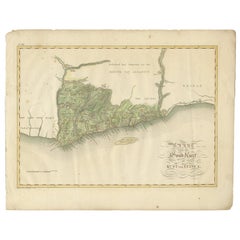
Antique Map of the Dutch Gold Coast in Africa by Van den Bosch '1818'
Located in Langweer, NL
Antique map titled 'Kaart van de Goud-Kust of Kust van Guina'. A rare and attractive early 19th century Dutch map of the Dutch Gold Coast. The Dutch Gold Co...
Category
Early 19th Century Antique Maps
Materials
Paper
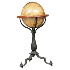
Important Late 19th C. Terrestrial Globe on Stand for H.B. Nims After Copley
Located in Bridgeport, CT
Manufactured for H.B. Nims & Co., Troy New York, last quarter 19th c. After the original engravings by Charles Copley done in 1852.
Printed paper on wood with brass/ bronze meridian ring and a flat circular printed center horizon ring on wood labeled with the months of the year with notes. Mounted on a fine leafy iron baluster...
Category
Late 19th Century American Victorian Antique Maps
Materials
Bronze, Iron
Rare Engraving of Dutch and Danish Forts on the West African Gold Coast, 1744
Located in Langweer, NL
Antique print, titled: 'The Dutch Fort Croevecoeur (…).'
A four panel plate showing forts on the West African Gold Coast, Ghana; a) The Dutch Fort Croevecoeur at Accra, b) The Danish Fort Christiaenburgh at Accra, c) Cape Ruygehoeck or Duyvelsbergh, d) The Prospect of the Village and Coast of Lay, the mount Redonda being at NNE. Ussher Fort is a fort in Accra, Ghana. It was built by the Dutch in 1649 as Fort Crevecoeur. From: "A Collection of Voyages and Travels" published by John and Awnsham Churchill in London in 1744.
Artists and Engravers: Made by 'Johannes Kip' after 'A. Churchill'. Johannes Kip (b Amsterdam, 1653; d London, 1722). Dutch draughtsman, engraver and dealer, active in England. He was a pupil of Bastiaen Stopendaal (1636–1707) from 1668 to 1670. His earliest dated engravings are of 1672 (e.g. the Siege of Groningen , Hollstein, no. 4), and he supplied numerous plates for books published from that date onwards. His work brought him into contact with the court of William of Orange and in 1686 he produced six plates depicting William of Orange, his Wife and Attendants near The Hague (Hollstein, no. 5). Shortly after the Glorious Revolution of 1688 Kip followed the court to England. After settling in Westminster, he worked extensively for London publishers, engraving works after Francis Barlow, Caius Gabriel Cibber (e.g. Interior of the Danish Church in London , 1697; Hollstein, no. 6) and other London-based artists. His engravings were principally destined for book illustrations. The work for which Kip is best remembered is his large corpus...
Category
1740s Antique Maps
Materials
Paper
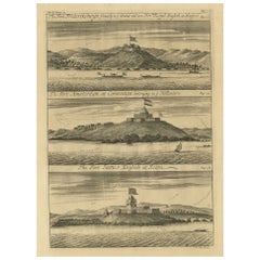
Copperplate Engraving Showing Forts on the West African Gold Coast, Ghana, 1744
Located in Langweer, NL
Antique print, titled: 'The Fort Fredricksburg formerly to ye Danes and now Fort Royal (…).' - A three panel copperplate engraving showing three forts on the West African Gold Coast, Ghana; a) The Fort Fredricksburgh formerly to ye Danes and now Fort Royal. English at Manfroe, b) The Fort Amsterdam at Cormentyn belonging to ye Hollanders, c) The Fort James, English at Accra. From: "A Collection of Voyages and Travels" published by John and Awnsham Churchill in London in 1744.
Artists and Engravers: Made by 'Johannes Kip' after 'A. Churchill'. Johannes Kip (b Amsterdam, 1653; d London, 1722). Dutch draughtsman, engraver and dealer, active in England. He was a pupil of Bastiaen Stopendaal (1636–1707) from 1668 to 1670. His earliest dated engravings are of 1672 (e.g. the Siege of Groningen , Hollstein, no. 4), and he supplied numerous plates for books published from that date onwards. His work brought him into contact with the court of William of Orange and in 1686 he produced six plates depicting William of Orange, his Wife and Attendants near The Hague (Hollstein, no. 5). Shortly after the Glorious Revolution of 1688 Kip followed the court to England. After settling in Westminster, he worked extensively for London publishers, engraving works after Francis Barlow, Caius Gabriel Cibber (e.g. Interior of the Danish Church in London , 1697; Hollstein, no. 6) and other London-based artists. His engravings were principally destined for book illustrations. The work for which Kip is best remembered is his large corpus...
Category
1740s Antique Maps
Materials
Paper
Related Items
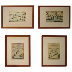
18th century Set Hand Colored Nautical Engravings
By M. Ogier
Located in Savannah, GA
Signed M. Ogier (Fecit:by), this set of four hand colored engravings is part of a larger edition of plates. These plates are numbered PL 16, 347, 365 and 386. The subject is probably...
Category
18th Century Unknown Elizabethan Antique Maps
Materials
Glass, Wood, Paper
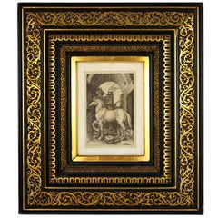
Albrecht Dürer "The Small Horse, " 19th Century Copper Plate Engraving
Located in Barcelona, ES
"The Small Horse" copper plate engraving by Albrecht Dürer, circa 1505.
This is a 19th century engraving, printed in black on laid paper, framed by a beautiful gilt and ebonized carv...
Category
Late 19th Century French Renaissance Antique Maps
Materials
Wood, Paper
H 19.3 in W 16.93 in D 3.15 in
Vintage Terrestrial Globe, 1970s, Czechoslovakia
Located in Prague 8, CZ
This Vintage Terrestrial globe was made in the 1970s in the former Czechoslovakia for school supply.
It's made of plastic, wood and cardboard. It´s in good Vintage condition.
M...
Category
Late 20th Century Czech Mid-Century Modern Maps
Materials
Iron
American Terrestrial Globe on Gilt Tripod Stand, Gilman Joslin, Boston C. 1850
Located in Hollywood, SC
American Terrestrial Brass Meridian Globe mounted on a turned bulbous gilt ringed and red stenciled tripod stand, Gilman Joslin, Boston. Mid 19th Century
Globe is 39" Tall / 16" Diam...
Category
1850s American American Empire Antique Maps
Materials
Brass
H 39 in W 22 in D 16 in
Antique 19th C. W & A K Johnston 18" Celestial Library Floor Globe Stand 1879
Located in Portland, OR
A very fine antique Celestial floor globe on stand by W. & A.K. Johnston, 1879.
Representation of stars and constellations as they would appear on a sphere (Celestial sphere) of inf...
Category
1870s Victorian Antique Maps
Materials
Brass
Antique Cylinder Sundial Late 19th Century
Located in Firenze, IT
Shipping policy No additional costs will be added to this order. Shipping costs will be totally covered by the seller (customs duties included).
A boxwood cylinder sundial, also kn...
Category
Late 19th Century British Late Victorian Antique Maps
Materials
Wood, Paper
17th Century Hand-Colored Map of West Africa by Mercator/Hondius
Located in Alamo, CA
A 17th century hand-colored map entitled "Guineae Nova Descriptio" by Gerard Mercator and Jodocus Hondius, published in their 'Atlas Minor' in Amsterdam in 1635. It is focused on the...
Category
Mid-17th Century Dutch Antique Maps
Materials
Paper
Antique 1755 Copperplate Engraving Westminster Bridge Lambeth Survey of London
Located in Dayton, OH
Antique hand colored riverscape / landscape copperplate engraving based on a painting by Jacob Maurer and engraved by Paul Fourdrinier - A View of Westminster Bridge from Lambeth, published according to Act of Parliament 1754 for Stowe’s Survey of London. BIO: Paul Fourdrinier sometimes referred to as Peter or Pierre Fourdrinier, was an 18th Century engraver in England. Paul Fourdrinier, engraver and printseller, was born on 20 December 1698 in Groningen in the Netherlands, the son of Jacques Fourdrinier and his wife, Jeanne Theroude, Huguenot refugees from Dieppe, Normandy. He was a pupil of Bernard Picart at Amsterdam for six years, and came to England in 1720. He was employed in engraving portraits and book illustrations. He also engraved two works by Peter Monamy, marine paintings displayed in Vauxhall Gardens. The engravings were published in 1743, but may have been executed earlier. Starting in 1742 Fourdrinier produced a series of books consisting of numerous folding charts showing "The Succession of Colonels to all his Majesties Land Forces from their Rise to 1742", as well as many other details of British military and naval personnel. The 2004 edition of the Oxford Dictionary of National Biography makes it clear that in the 19th century edition of the Dictionary of National Biography this engraver's works and career were assigned to two individuals, Peter (or Pierre) and Paul Fourdrinier. Peter/Pierre is now seen to be a fictitious individual resulting from an accidental misnaming of Paul. Paul Fourdrinier is mentioned as the engraver of some of the works listed above, and he has been identified with the Paul Fourdrinier who was of the parish of St. Martin's-in-the-Fields, married to Susanna Grolleau, and who died in January or February 1758. The couple had at least five children, including a son Henry Fourdrinier, whose daughter, or granddaughter, Jemima Fourdrinier was the mother of Cardinal John Henry Newman...
Category
Mid-18th Century British Colonial Antique Maps
Materials
Paper
H 18 in W 24 in D 0.75 in
Original Antique Map of The World by Thomas Clerk, 1817
Located in St Annes, Lancashire
Great map of The Eastern and Western Hemispheres
On 2 sheets
Copper-plate engraving
Drawn and engraved by Thomas Clerk, Edinburgh.
Published by Mackenzie And Dent, 1817
...
Category
1810s English Antique Maps
Materials
Paper
19th Century German Miniature Pocket Terrestrial Globe
Located in Essex, MA
A miniature 19th century 3.5 inch diameter pocket terrestrial globe by C. Abel-Klinger, Nuremberg, Germany, in English for the English speaking markets. Signed with cartouche reading...
Category
1880s German Antique Maps
Materials
Brass
Antique Kittinger 8-inch Terrestrial World Globe on a Mahogany Wooden Stand
Located in Philadelphia, PA
A fine, antique 8 inch terrestrial globe.
Manufactured by Kittinger Company, Inc. (in collaboration with the publishers W. & A.K. Johnston, Ltd. of Edinburgh, Scotland).
On a turne...
Category
Early 20th Century Maps
Materials
Mahogany, Gesso, Wood, Paper
H 18 in W 11.5 in D 11.5 in
Original Antique Map of The Netherlands, Engraved by Barlow, Dated 1807
Located in St Annes, Lancashire
Great map of Netherlands
Copper-plate engraving by Barlow
Published by Brightly & Kinnersly, Bungay, Suffolk.
Dated 1807
Unframed.
Category
Early 1800s English Antique Maps
Materials
Paper
No Reserve
H 8 in W 10 in D 0.07 in
Previously Available Items
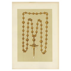
Antique Print of a Gold Rosary and Crucifix by Gibb, 1890
Located in Langweer, NL
Antique print titled 'Gold Rosary and Crucifix of Mary Queen of Scots'. Chromolithographic plate originating from 'The Royal House of Stuart. Illustrated by a Series of Forty Plates ...
Category
19th Century Antique Maps
Materials
Paper
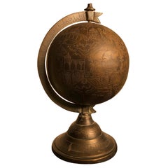
Antique Bronze Celestial Globe Sphere Engraved Holy Islamic Sites, Mumbai
Located in South Burlington, VT
An unusual one-of-a-kind bronze globe or sphere Intricately engraved in commemoration of the holy sites of Islam , India, early 20th century.
Provenance: Old Massachusetts collecti...
Category
Early 20th Century Indian Maps
Materials
Bronze
Rouge Marble Globe Clock
Located in New Orleans, LA
This extraordinary globe clock is an impeccable example of the complex artistry of French timepieces. The terrestrial globe is rendered in painstaking deta...
Category
19th Century French Other Antique Maps
Materials
Marble, Silver, Bronze
1848 Gold and Quicksilver District of California Map
Located in Colorado Springs, CO
Published on July 25, 1848, this map shows the location of key gold and quicksilver (mercury, in the form of cinnabar) deposits in the territory of California. The map details the Sacramento Valley, San Francisco, and the Sierra Nevada Mountains in California.
The first gold strikes occurred at Sutter’s Mill, on the American River in northern California. Soon after the initial find, prospectors began streaming into California in hordes. As such, demand was high for cartographic knowledge of the region.
The map displays the basic topography of California, showing mountains, rivers, bays, and mountain passes in hachures. Its principal purpose was to highlight the latest information on mineral deposits and the exact locations where gold and quicksilver had been discovered, with engraved inscriptions like “Sub soil contains Gold, covered with Live Oak”, “Gold found on this Creek”, or “The hills more or less colored with Cinnabar”.
This map accompanied Col. R.B. Mason's 1848 report on the recent discovery of gold along the Sacramento River, and is one the earliest obtainable map of the California gold regions. The cartographer of this map was Edward Otho Cresap Ord (1818–1883), a Union general in the American Civil War, and the map was printed by Peter S. Duval (circa 1805−1886), a leading Philadelphia...
Category
1840s American Antique Maps
Materials
Paper
Recently Viewed
View AllMore Ways To Browse
Antique Sailing Map
Antique Sailing Maps
Bay Area Antique Furniture
West Coat Of Arms
Greek Asia Minor
Hemisphere World Map
Speed Map
Antique Maps Canada
Antique Map Canada
Canada Antique Map
Malaysian Antique
West Indies Map
Blaeu World Map
Charing Cross
Antique Maps Of Canada
Bali Map
Antique Portuguese Plates
Map Of Brazil
