Items Similar to Colton's Map of Illinois, with an Inset of Chicago

Want more images or videos?
Request additional images or videos from the seller
1 of 6
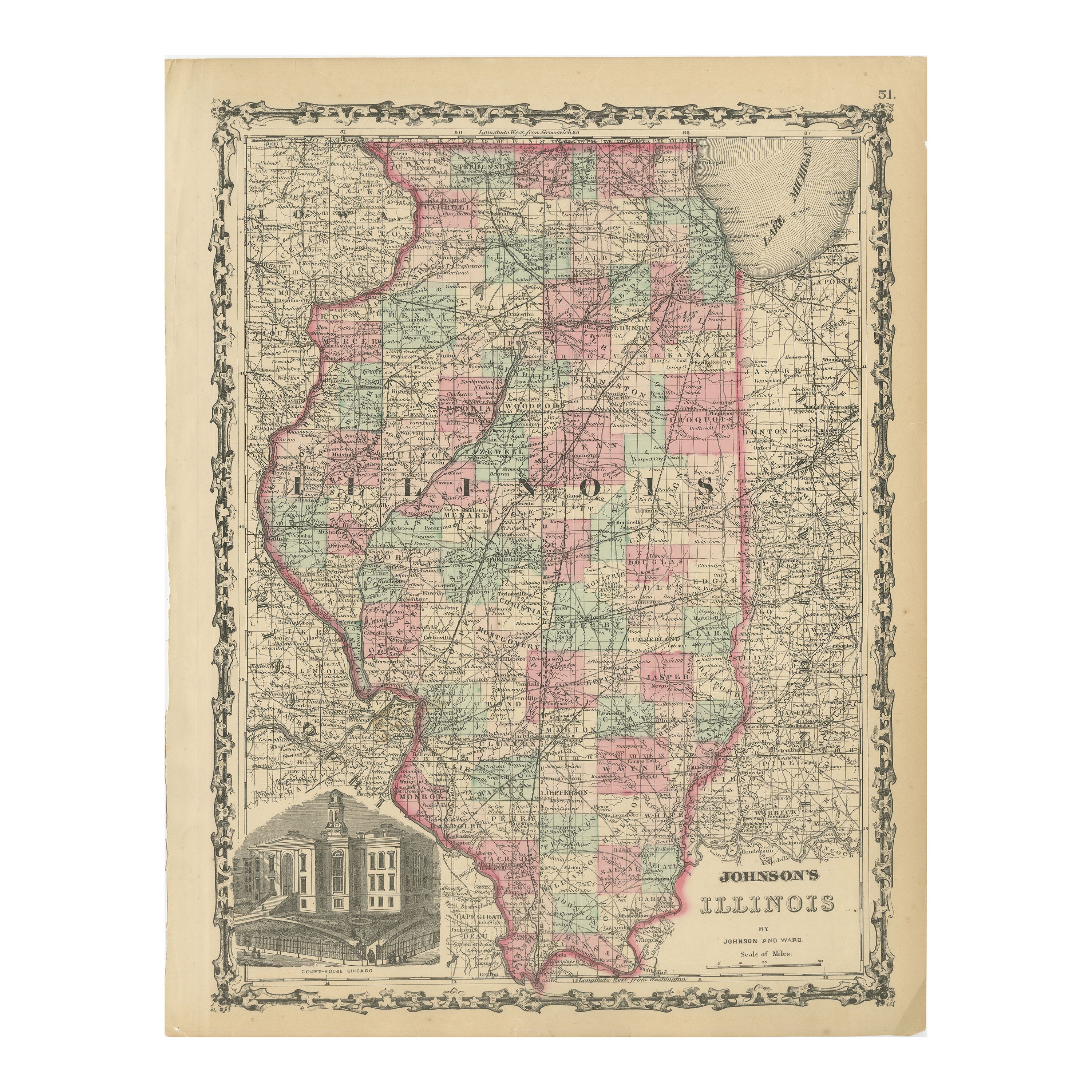
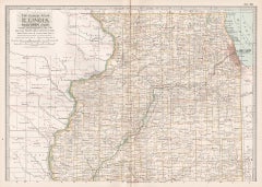
Colton's Map of Illinois, with an Inset of Chicago
$231.04
$288.8020% Off
£171.05
£213.8220% Off
€192
€24020% Off
CA$319.89
CA$399.8720% Off
A$349.25
A$436.5620% Off
CHF 183.10
CHF 228.8720% Off
MX$4,241.76
MX$5,302.1920% Off
NOK 2,286.58
NOK 2,858.2220% Off
SEK 2,159.14
SEK 2,698.9220% Off
DKK 1,461.74
DKK 1,827.1720% Off
About the Item
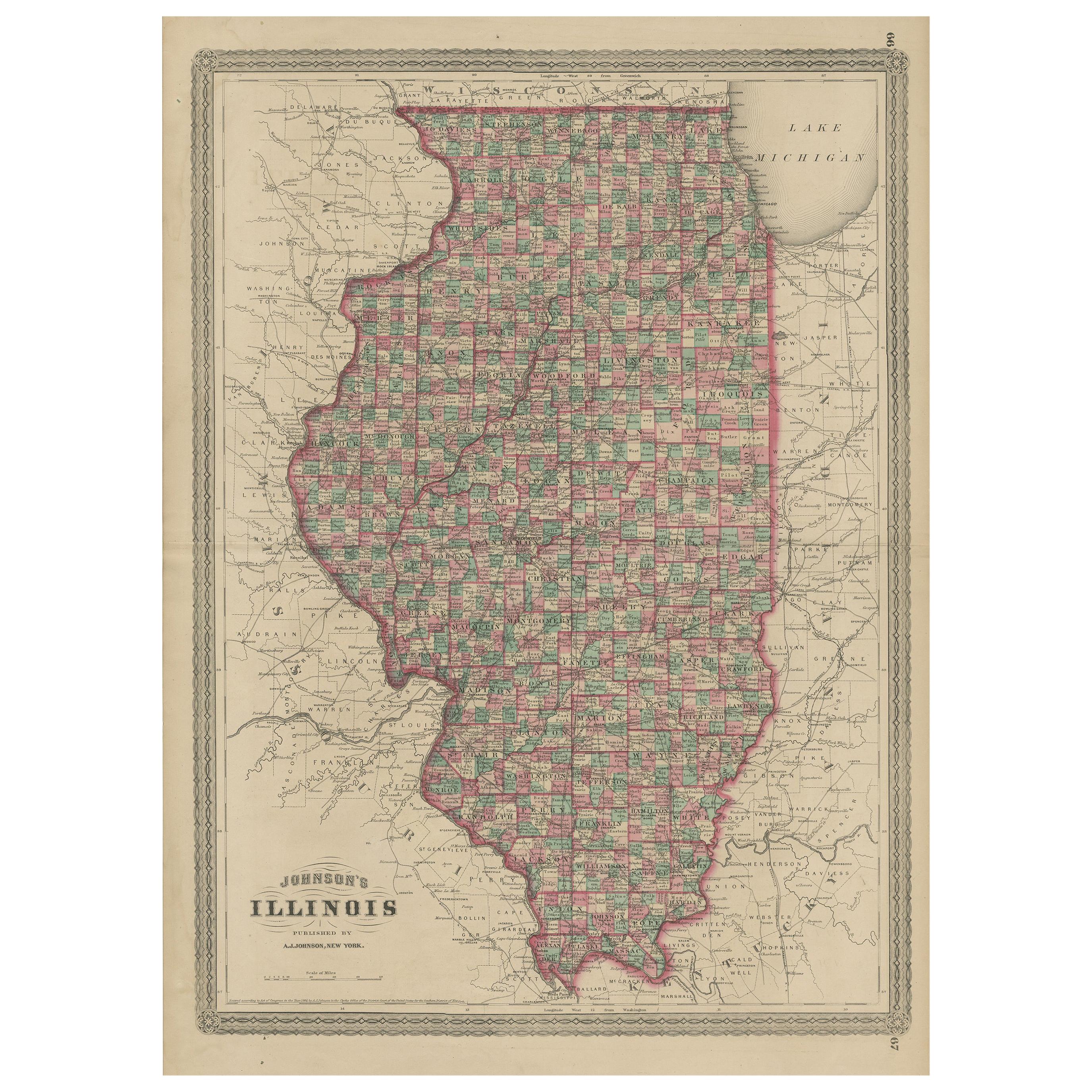
Antique map titled 'Colton's Illinois'. Antique map of Illinois, a state in the Midwestern United States. With an inset map of of Cook County & Vicinity of Chicago. Published 1867.
Joseph Hutchins Colton (July 5, 1800 – July 29, 1893), known professionally as J.H. Colton, founded an American mapmaking company which was an international leader in the map publishing industry between 1831 and 1890.
J.H. Colton Company maps were printed using engraved steel plates, which produced higher quality prints than maps made with less costly wax engravings. They were often individually hand water-colored and were recognized for their decorative borders.
- Dimensions:Height: 26.78 in (68 cm)Width: 17.52 in (44.5 cm)Depth: 0.02 in (0.5 mm)
- Materials and Techniques:
- Period:
- Date of Manufacture:1867
- Condition:Repaired. Wear consistent with age and use. Strong toning. Original folding line. Shows wear and soiling. English text on verso. Two repairs on small tears in bottom margin and a repaired split on folding line. Please study images carefully.
- Seller Location:Langweer, NL
- Reference Number:Seller: BG-13191-41stDibs: LU3054331100542
About the Seller
5.0
Recognized Seller
These prestigious sellers are industry leaders and represent the highest echelon for item quality and design.
Platinum Seller
Premium sellers with a 4.7+ rating and 24-hour response times
Established in 2009
1stDibs seller since 2017
2,641 sales on 1stDibs
Typical response time: <1 hour
- ShippingRetrieving quote...Shipping from: Langweer, Netherlands
- Return Policy
Authenticity Guarantee
In the unlikely event there’s an issue with an item’s authenticity, contact us within 1 year for a full refund. DetailsMoney-Back Guarantee
If your item is not as described, is damaged in transit, or does not arrive, contact us within 7 days for a full refund. Details24-Hour Cancellation
You have a 24-hour grace period in which to reconsider your purchase, with no questions asked.Vetted Professional Sellers
Our world-class sellers must adhere to strict standards for service and quality, maintaining the integrity of our listings.Price-Match Guarantee
If you find that a seller listed the same item for a lower price elsewhere, we’ll match it.Trusted Global Delivery
Our best-in-class carrier network provides specialized shipping options worldwide, including custom delivery.More From This Seller
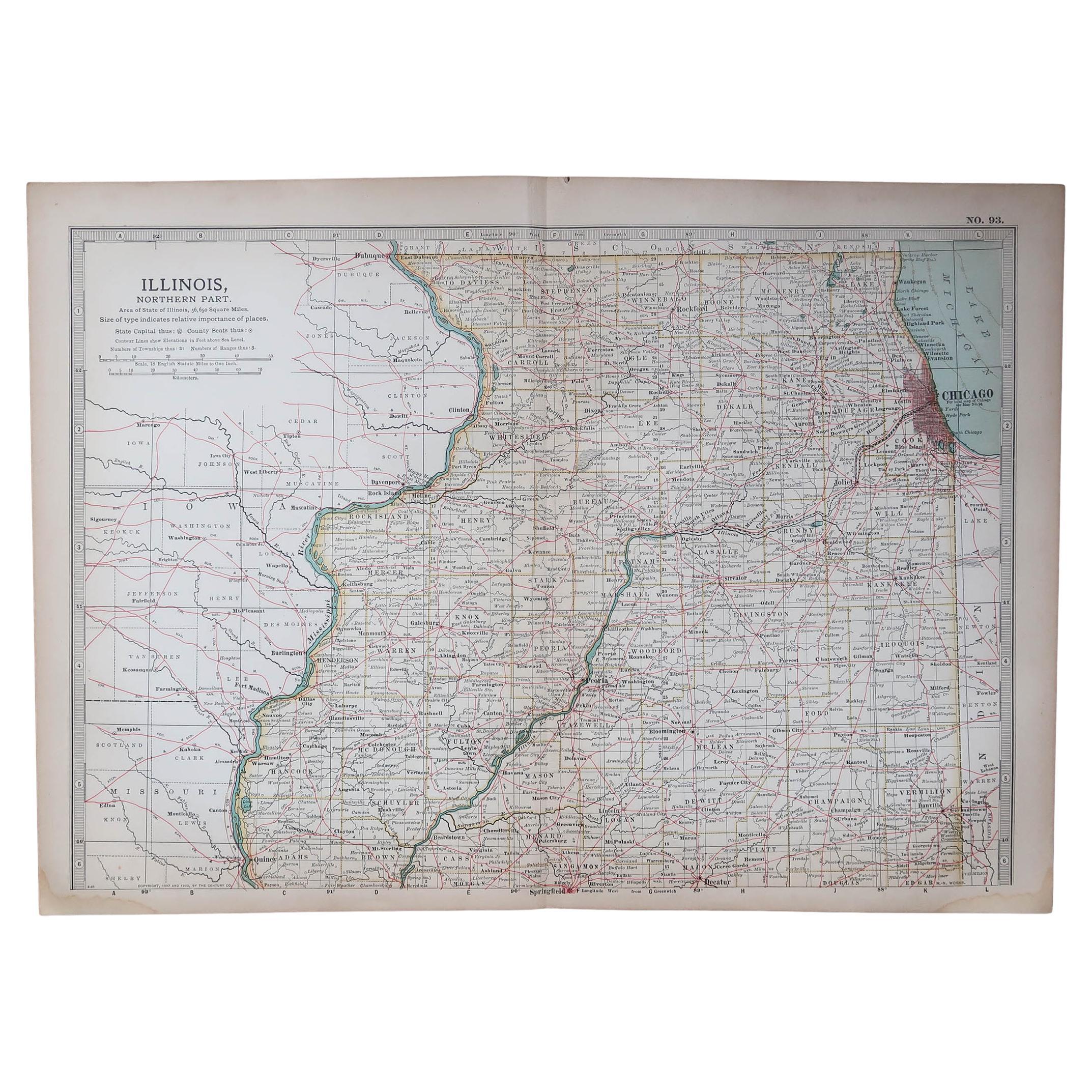
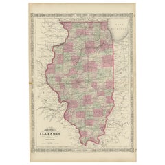
View AllAntique Map of Illinois by Johnson, 1872
Located in Langweer, NL
Antique map titled 'Johnson's Illinois'. Original map of Illinois. This map originates from 'Johnson's New Illustrated Family Atlas of the World' by A....
Category
Antique Late 19th Century Maps
Materials
Paper

$240 Sale Price
20% Off
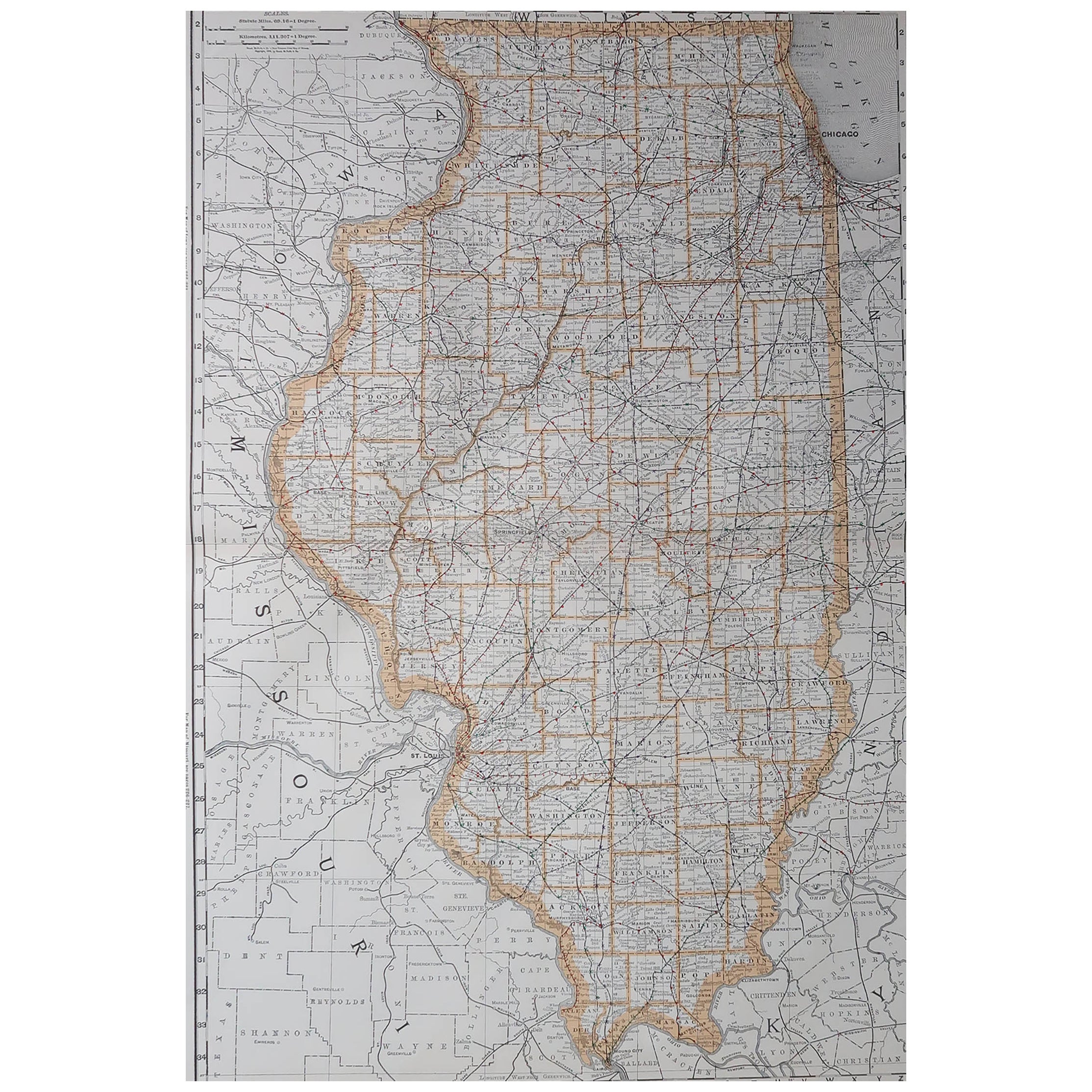
Rare 1864 Civil War Era Map of Illinois with Lake Michigan Detail
Located in Langweer, NL
Title: Rare 1864 Civil War Era Map of Illinois with Lake Michigan Detail
Description: This intricately detailed antique map, titled "Johnson's Illinois," was published in 1864 by Jo...
Category
Antique 1860s Maps
Materials
Paper
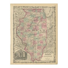
Johnson’s Illinois Map, USA c.1864 – Hand-Colored with Chicago Courthouse View
Located in Langweer, NL
Johnson’s Illinois Map, USA c.1864 – Hand-Colored with Chicago Courthouse View
This is a finely engraved and hand-colored map titled Johnson’s Illinois, published by Johnson and War...
Category
Antique Mid-19th Century American Maps
Materials
Paper
Decorative 1864 Civil War Era Map of Indiana with Lake Michigan Detail
Located in Langweer, NL
Title: Rare 1864 Civil War Era Map of Indiana with Lake Michigan Detail
Description: This finely detailed antique map, titled "Johnson's Indiana," was published in 1864 by Johnson a...
Category
Antique 1860s Maps
Materials
Paper

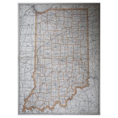
Antique Map of Indiana by Johnson, 1872
Located in Langweer, NL
Antique map titled 'Johnson's Indiana'. Original map of Indiana. This map originates from 'Johnson's New Illustrated Family Atlas of the World' by A.J. ...
Category
Antique Late 19th Century Maps
Materials
Paper

$180 Sale Price
40% Off
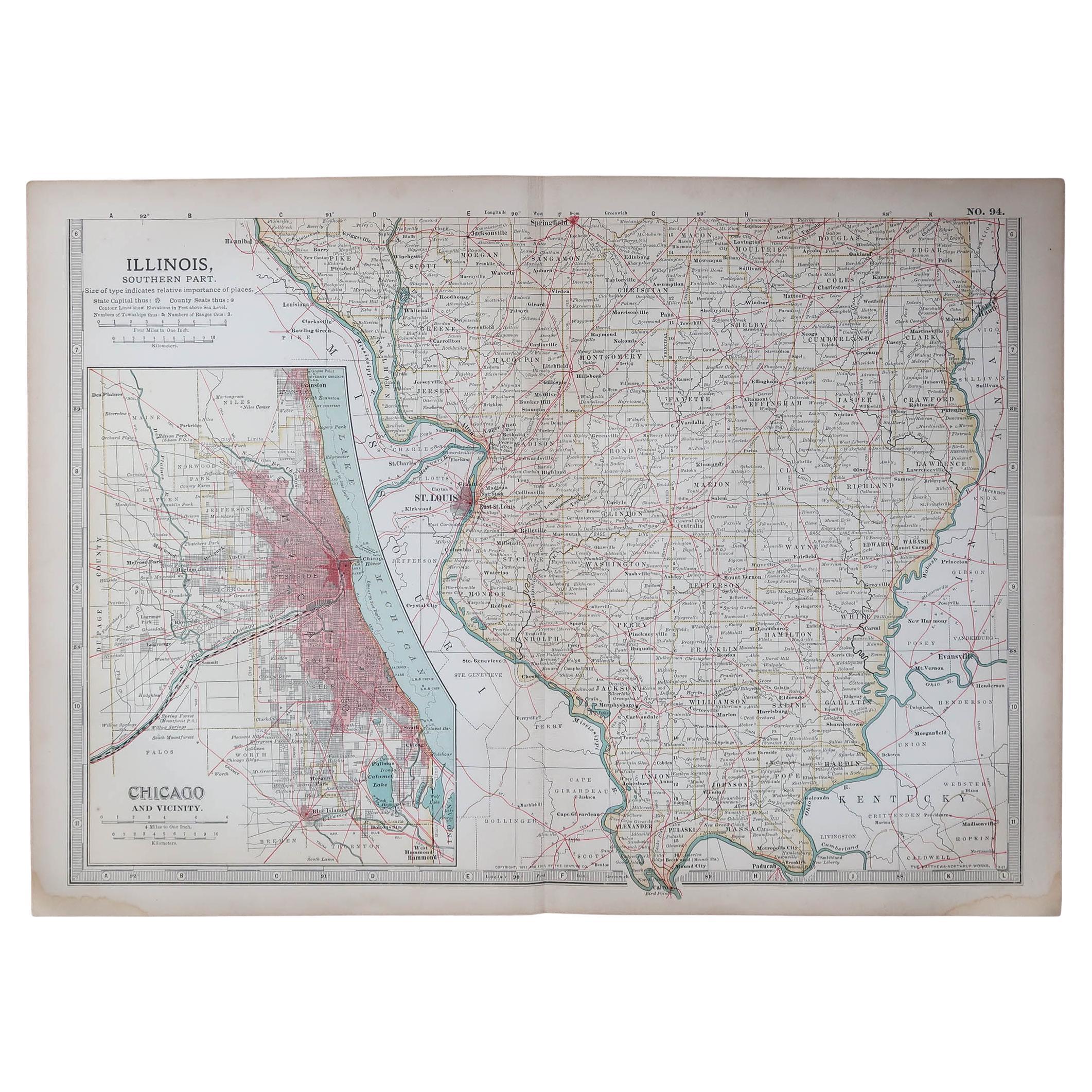
Antique Map of St. Louis and Chicago
Located in Langweer, NL
Antique map titled 'The City of St. Louis Missouri - The City of Chicago Illinois'. Dual map on single page showing St. Louis and Chicago. Finely produ...
Category
Antique Mid-19th Century Maps
Materials
Paper

$144 Sale Price
20% Off
You May Also Like
Original Antique Map of the American State of Illinois ( Northern Part ), 1903
Located in St Annes, Lancashire
Antique map of Illinois ( Northern part )
Published By A & C Black. 1903
Original colour
Good condition
Unframed.
Free shipping
Category
Antique Early 1900s English Maps
Materials
Paper

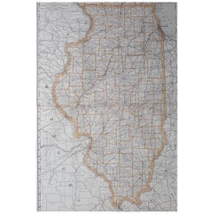
Large Original Antique Map of Illinois, USA, 1894
By Rand McNally & Co.
Located in St Annes, Lancashire
Fabulous map of Illinois
Original color
By Rand, McNally & Co.
Published, 1894
Unframed
Free shipping.
Category
Antique 1890s American Maps
Materials
Paper
Original Antique Map of the American State of Illinois ( Southern Part ), 1903
Located in St Annes, Lancashire
Antique map of Illinois ( Southern part )
Published By A & C Black. 1903
Original colour
Good condition
Unframed.
Free shipping
Category
Antique Early 1900s English Maps
Materials
Paper

Illinois, Northern Part. USA. Century Atlas state antique vintage map
Located in Melbourne, Victoria
'The Century Atlas. Illinois, Northern Part'
Original antique map, 1903.
Central fold as issued. Map name and number printed on the reverse corners.
Sheet 29.5cm by 40cm.
Category
Early 20th Century Victorian More Prints
Materials
Lithograph
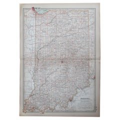
Large Original Antique Map of Indiana, USA, 1894
By Rand McNally & Co.
Located in St Annes, Lancashire
Fabulous map of Indiana.
Original color.
By Rand, McNally & Co.
Published, 1894.
Unframed.
Free shipping.
Category
Antique 1890s American Maps
Materials
Paper
Original Antique Map of the American State of Indiana, 1903
Located in St Annes, Lancashire
Antique map of Indiana
Published By A & C Black. 1903
Original colour
Good condition
Unframed.
Free shipping
Category
Antique Early 1900s English Maps
Materials
Paper
More Ways To Browse
Midcentury Furniture Chicago
Antique Furniture Illinois
Coronelli Globe
Denoyer Geppert Anatomy
E Fletcher
Framed Africa Maps
Gabon Antique Map
Hudson River Map
Lancashire Map
Map Of Barbados
Nova Hollandia
Used Furniture Cleveland Ohio
Vintage Bartholomew Maps
1820 World Map
Aden Yemen
Antique Map New Orleans
Dakota Johnson
French School Map