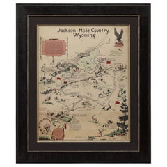
"Jackson Hole Country, Wyoming" Vintage Pictorial Map by Harold Hopkinson, 1956
View Similar Items


Want more images or videos?
Request additional images or videos from the seller
1 of 5
"Jackson Hole Country, Wyoming" Vintage Pictorial Map by Harold Hopkinson, 1956
About the Item
- Dimensions:Height: 30.5 in (77.47 cm)Width: 25.5 in (64.77 cm)Depth: 1.5 in (3.81 cm)
- Materials and Techniques:
- Place of Origin:
- Period:
- Date of Manufacture:1956
- Condition:Wear consistent with age and use.
- Seller Location:Colorado Springs, CO
- Reference Number:Seller: M2931stDibs: LU909719045122
About the Seller
4.9
Platinum Seller
Premium sellers with a 4.7+ rating and 24-hour response times
Established in 2010
1stDibs seller since 2011
453 sales on 1stDibs
Typical response time: 1 hour
Authenticity Guarantee
In the unlikely event there’s an issue with an item’s authenticity, contact us within 1 year for a full refund. DetailsMoney-Back Guarantee
If your item is not as described, is damaged in transit, or does not arrive, contact us within 7 days for a full refund. Details24-Hour Cancellation
You have a 24-hour grace period in which to reconsider your purchase, with no questions asked.Vetted Professional Sellers
Our world-class sellers must adhere to strict standards for service and quality, maintaining the integrity of our listings.Price-Match Guarantee
If you find that a seller listed the same item for a lower price elsewhere, we’ll match it.Trusted Global Delivery
Our best-in-class carrier network provides specialized shipping options worldwide, including custom delivery.More From This Seller
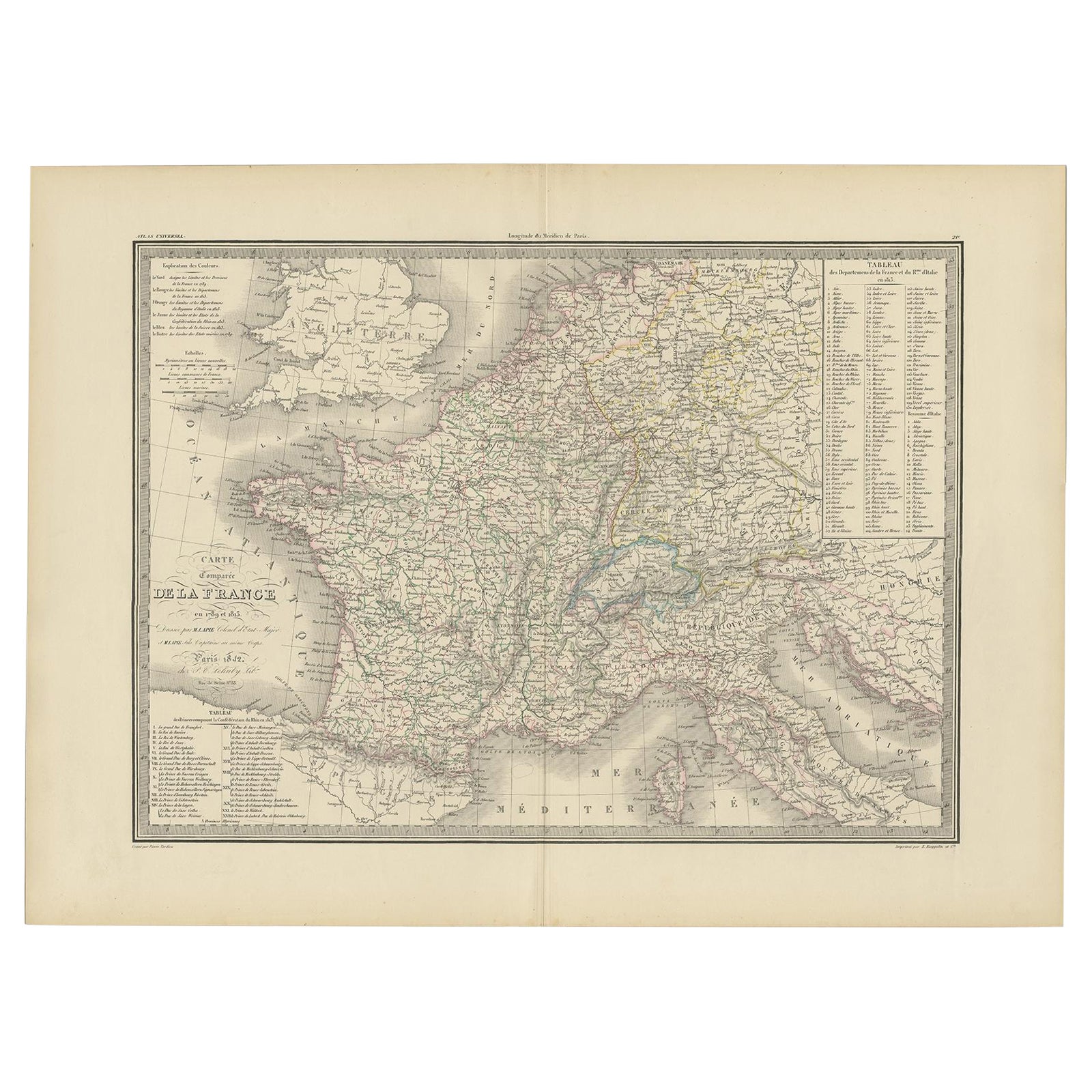
View All1812 United States Map, by Pierre Tardieu, Antique French Map Depicting the U.S.
By Pierre François Tardieu
Located in Colorado Springs, CO
1812 "United States of Nth America -- Carte des Etats-Unis De L'Amerique Septentrionale" Two-Sheet Map by Tardieu
This attractive map, published in Paris in 1812, is one of the most rare large format maps from the period. It features a view of the East Coast of the U.S. from Maryland to just below South Carolina. Additionally, Ellicott’s plan for the City of Washington D.C. is included at the top right and an illustration of Niagara Falls is shown at the bottom right with a description in both French and English. This extremely detailed map not only depicts the mountainous regions of the southeastern U.S., but also includes names of regions, rivers, and towns.
Based on the first state of Arrowsmith’s 4-sheet map of the United States, this map is completely engraved by Tardieu in Paris and showcases high quality engravings. This detailed map of the recently independent United States includes one of the largest and earliest examples of the Ellicott plan of Washington DC.
The artist, Pierre François Tardieu (PF Tardieu) was a very well-known map engraver, geographer, and illustrator. Awarded a bronze medal by King Louis-Phillipe for the accuracy and beauty of his map-making, Tardieu produced many fine works including maps of Louisiana...
Category
Antique 1810s French Maps
Materials
Paper

1846 "North America" Map, Engraved by I. Dower
Located in Colorado Springs, CO
Presented is an original 1846 map of “North America.” The map was drawn and engraved by I. Dower and published in London by Orr & Company. The map depicts North America, to include G...
Category
Antique 1840s English Victorian Maps
Materials
Paper

1864 Map of North America, Antique Hand-Colored Map, by Adolphe Hippolyte Dufour
Located in Colorado Springs, CO
Offered is a map of North America entitled Amerique du Nord from 1864. This rare, separately published wall map was produced by Adolphe Hippolyte Dufour. This map includes vibrant an...
Category
Antique 1860s French Maps
Materials
Paper

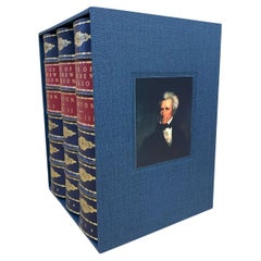
Life of Andrew Jackson by James Parton 3-Volume Leather Set, 1876
Located in Colorado Springs, CO
Parton, James. Life of Andrew Jackson. Boston: James R. Osgood and Company, 1876. Three volume set, later printing. Rebound in ¼ calf and matching blue cloth boards with gilt titles, stamps, and raised bands to spine. With matching archival blue cloth slip case with ribbon and inlaid portrait of Jackson on the cover.
Presented is an 1876 printing of James Parton’s three volume biography of President Andrew Jackson. First published in 1859-60 by Mason Brothers of New York, this is a later printing by Boston-based James R. Osgood and Company. James Parton's biography of the life of Andrew Jackson is one of the most important and best accounts on the early American president. In fact, Bunn and Williams call this work "the first serious biography of the [Jackson]" (Bunn).
Parton’s biography appeared in print amid the escalating political crisis of 1860, providing readers and pundits with a historical lens through which to view current events. Born in England and raised primarily in the United States, James Parton (1822-1891) was among the leading biographers of the mid-nineteenth century. His Life of Horace Greeley (1855) and Life and Times of Aaron Burr (1857) garnered widespread acclaim, and he would later publish books on Benjamin Butler...
Category
Antique 1870s North American Books
Materials
Leather
1855 "New-York City & County Map" by Charles Magnus
By Charles Magnus
Located in Colorado Springs, CO
This is a beautiful hand-colored map titled “New York City & County Map with Vicinity entire Brooklyn, Williamsburgh, Jersey City &c.” The work was published in 1855 by Charles Magnu...
Category
Antique 1850s American Maps
Materials
Paper

Plan of Paris, France, by A. Vuillemin, Antique Map, 1845
Located in Colorado Springs, CO
This large and detailed plan of Paris was published by Alexandre Vuillemin in 1845. The map conveys a wonderful amount of information and is decorated throughout with pictorial vigne...
Category
Antique 1840s American Maps
Materials
Paper

You May Also Like
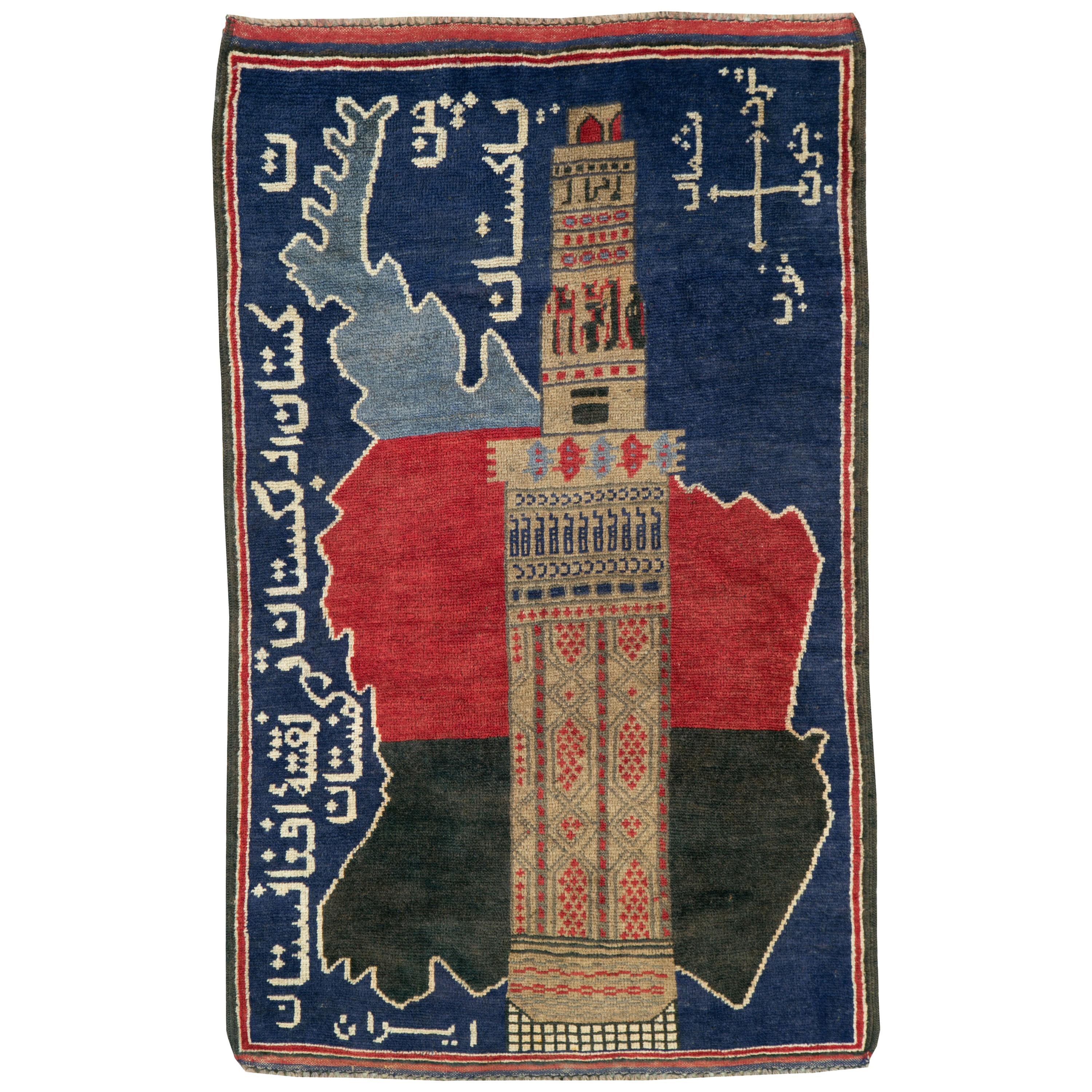
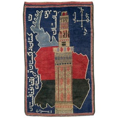
Vintage Afghan Pictorial Map Rug
Located in New York, NY
A vintage Afghan Pictorial map rug from the mid-20th century.
Measures: 3' 0" x 4' 10"
Category
Mid-20th Century Afghan Folk Art Central Asian Rugs
Materials
Wool
$660 Sale Price
20% Off
Gold Leaf Foil Pictorial Plan Map of the West Country of England Antique Style
Located in West Sussex, Pulborough
We are delighted to offer for sale this lovely Antique style pictorial plan map of the West Country of England etched in gold leaf foil
This is a very interesting and decorative p...
Category
20th Century English Adam Style Maps
Materials
Gold Leaf

$304 Sale Price
20% Off
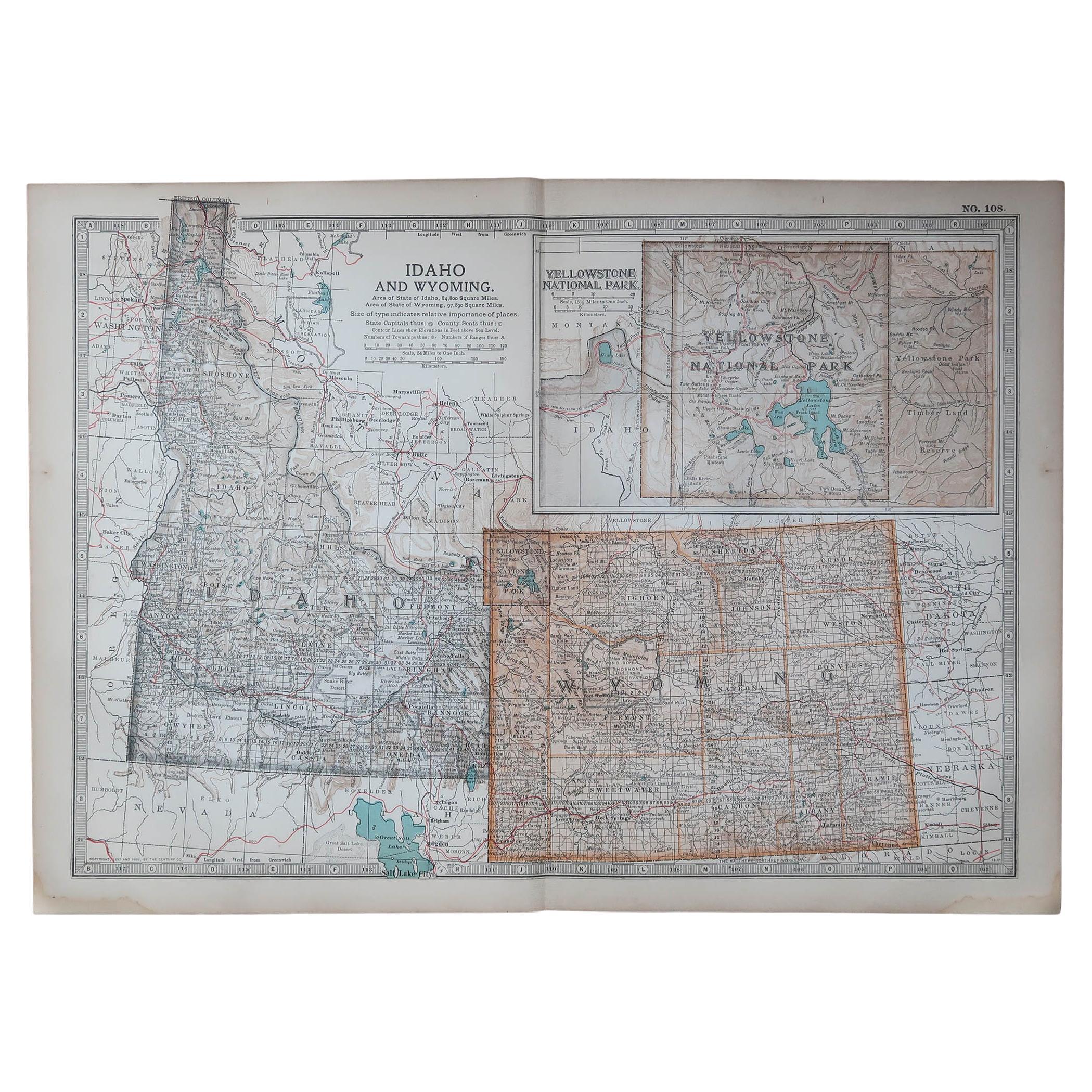
Original Antique Map of the American State of Idaho & Wyoming, 1903
Located in St Annes, Lancashire
Antique map of Idaho and Wyoming
Published By A & C Black. 1903
Original colour
Good condition
Unframed.
Free shipping
Category
Antique Early 1900s English Maps
Materials
Paper

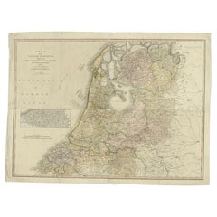
Antique Map of the Low Countries by Cary, 1813
Located in Langweer, NL
Antique map of the Netherlands titled 'A New Map of the United Provinces comprehending Holland, Zealand, Utrecht, Gelders, Over Yssel, Friesland and Groningen (..)'. Scarce re-editio...
Category
Antique 19th Century Maps
Materials
Paper
$493 Sale Price
20% Off
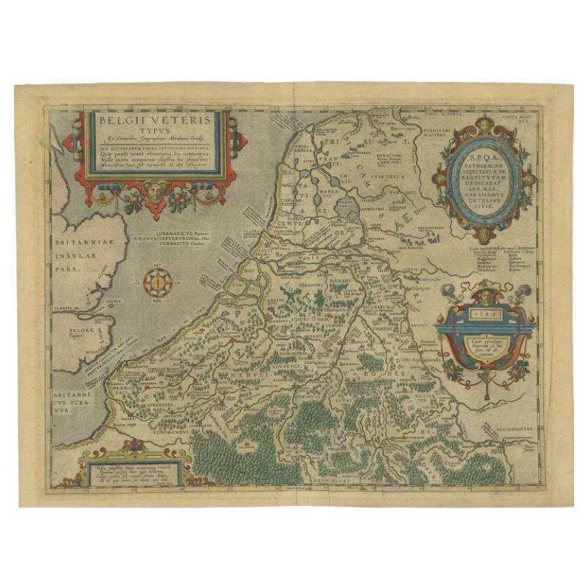
Antique Map of the Low Countries by Ortelius, 1584
By Abraham Ortelius
Located in Langweer, NL
Antique map titled 'Belgii Veteris Typus'. Beautiful map of the Low Countries, extending to the English Channel and part of Britain. This map originates from Ortelius' 'Theatrum Orbi...
Category
Antique 16th Century Maps
Materials
Paper
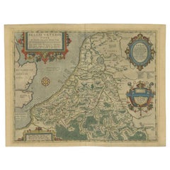
$555 Sale Price
20% Off
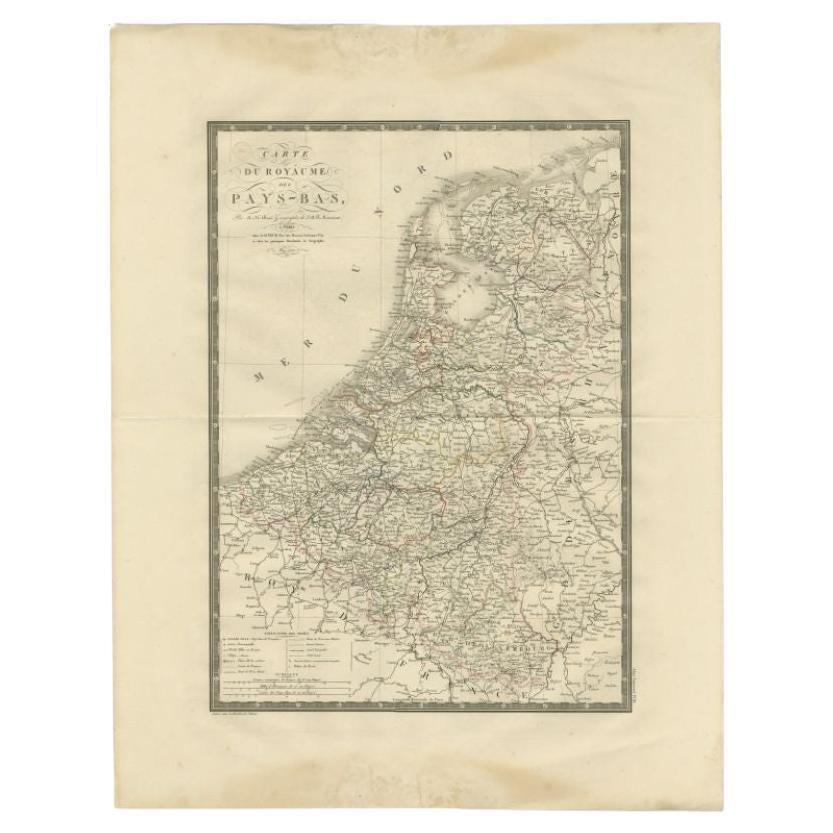
Antique Map of the Low Countries by Brué, 1822
Located in Langweer, NL
Antique map titled 'Carte du Royaume des Pays-Bas'. Large format map of the Low Countries. This map originates from 'Atlas Universel', published 1822...
Category
Antique 19th Century Maps
Materials
Paper
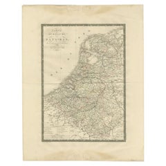
$162 Sale Price
20% Off