Items Similar to Large Antique Map of Gaul, or France in Ancient Roman Times
Want more images or videos?
Request additional images or videos from the seller
1 of 6
Large Antique Map of Gaul, or France in Ancient Roman Times
About the Item
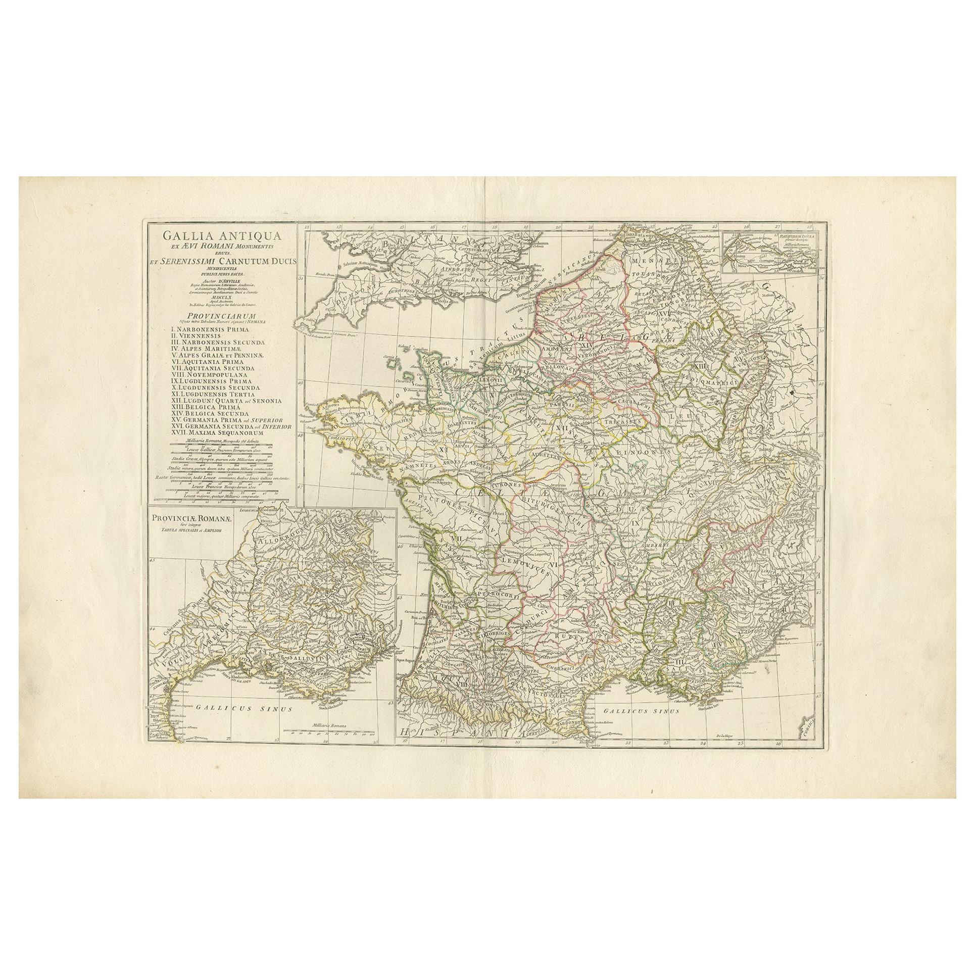
Original antique map titled 'Gallia Antiqua ex Aevi Romani Monumentis (..)'. Large map of Gaul, or France in ancient Roman times, showing Roman provinces. Inset bottom left a detailed map of Roman Provence. Published by D'Anville, circa 1760.
- Dimensions:Height: 22.37 in (56.8 cm)Width: 32.49 in (82.5 cm)Depth: 0.02 in (0.5 mm)
- Materials and Techniques:
- Period:
- Date of Manufacture:circa 1760
- Condition:Wear consistent with age and use. General age-related toning. Original folding line. Shows some wear and staining, blank verso. Please study images carefully.
- Seller Location:Langweer, NL
- Reference Number:Seller: BG-12763-11stDibs: LU3054331150382
About the Seller
5.0
Recognized Seller
These prestigious sellers are industry leaders and represent the highest echelon for item quality and design.
Gold Seller
Premium sellers maintaining a 4.3+ rating and 24-hour response times
Established in 2009
1stDibs seller since 2017
2,469 sales on 1stDibs
Typical response time: <1 hour
- ShippingRetrieving quote...Shipping from: Langweer, Netherlands
- Return Policy
Authenticity Guarantee
In the unlikely event there’s an issue with an item’s authenticity, contact us within 1 year for a full refund. DetailsMoney-Back Guarantee
If your item is not as described, is damaged in transit, or does not arrive, contact us within 7 days for a full refund. Details24-Hour Cancellation
You have a 24-hour grace period in which to reconsider your purchase, with no questions asked.Vetted Professional Sellers
Our world-class sellers must adhere to strict standards for service and quality, maintaining the integrity of our listings.Price-Match Guarantee
If you find that a seller listed the same item for a lower price elsewhere, we’ll match it.Trusted Global Delivery
Our best-in-class carrier network provides specialized shipping options worldwide, including custom delivery.More From This Seller
View AllAntique Map of France in Ancient Roman Times, 1880
Located in Langweer, NL
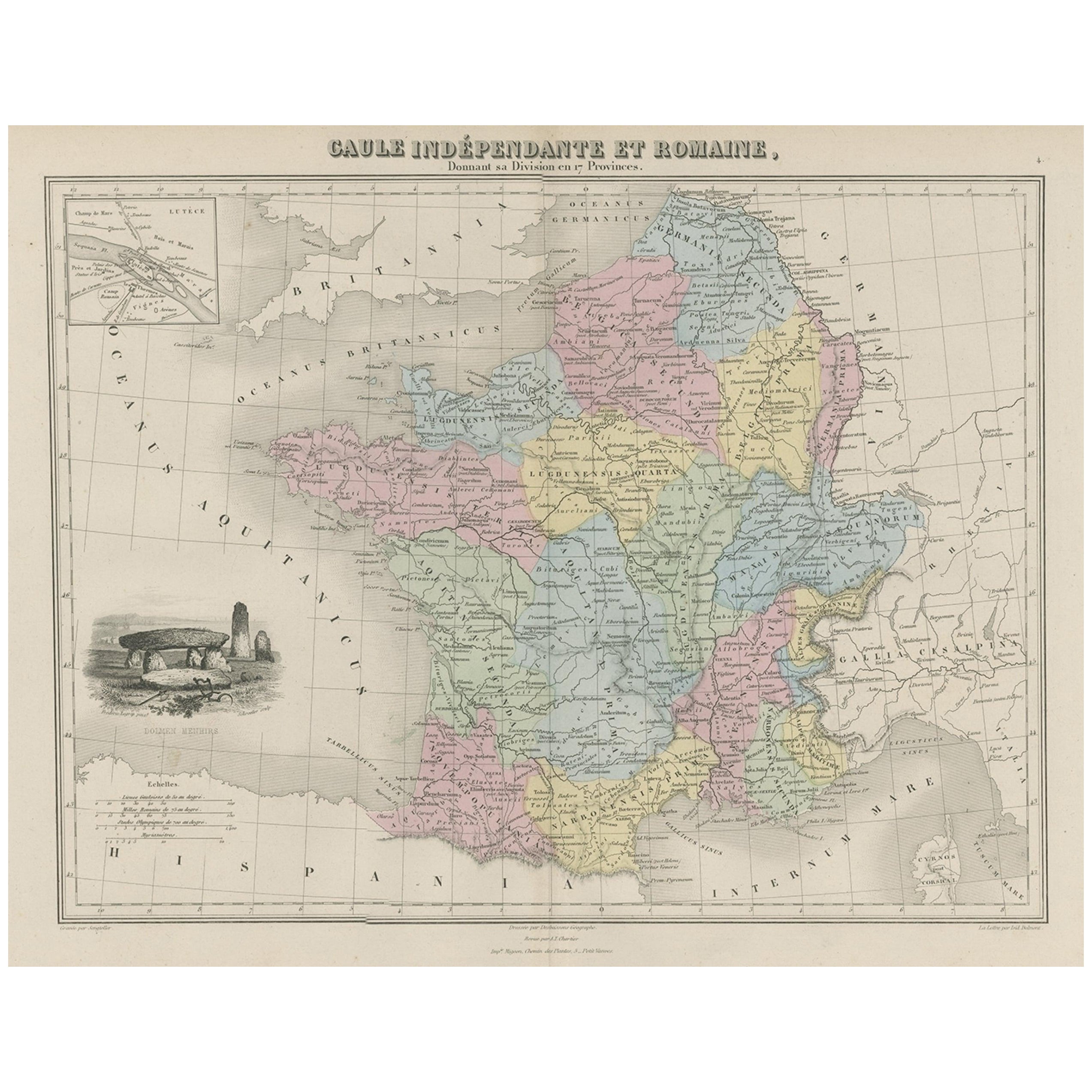
Antique map titled 'Gaule indépendante et Romaine'.
Old map of Gaul or France in ancient Roman times. The map covers from the southern part of England (Britannia) to the north of S...
Category
Antique 19th Century Maps
Materials
Paper
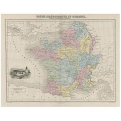
$179 Sale Price
20% Off
Antique Map of France in Ancient Roman Times by d'Anville 'c.1795'
Located in Langweer, NL
Antique map titled 'Gallia Antiqua ex Aevi Romani Monumentis (..)'. Original, large, map of France in ancient Roman times. Bottom left, a large inset shows Gallia's southern most Rom...
Category
Antique Late 18th Century Maps
Materials
Paper

$659 Sale Price
30% Off
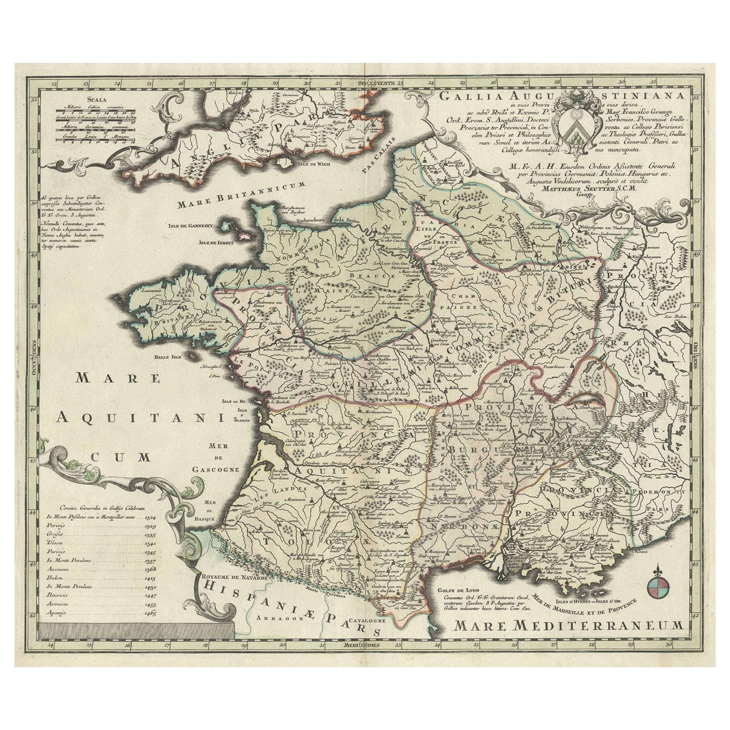
Large Antique Map of Gaul under Roman Rule, ca.1760
Located in Langweer, NL
Antique map titled 'Gallia Augustiniana in suas provincias divisa (..)'. Large antique map of Roman Gaul, it refers to Gaul under provincial rule in ...
Category
Antique 1760s Maps
Materials
Paper

$395 Sale Price
20% Off
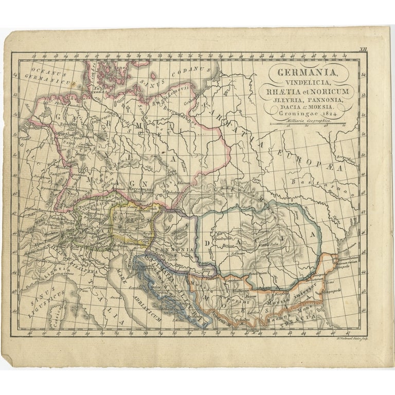
Antique Map of Germany in Roman Times, Showing Roman Provinces, 1825
Located in Langweer, NL
Antique map titled 'Germania, Vindelicia, Rhaetia et Noricum Jllyria, Pannonia, Dacie & Moesia'. Old map of Germany and surroundings originating from 'Atlas der Oude Wereld'. Artists...
Category
Antique 19th Century Maps
Materials
Paper
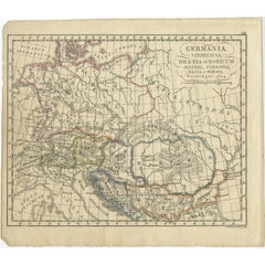
$115 Sale Price
20% Off
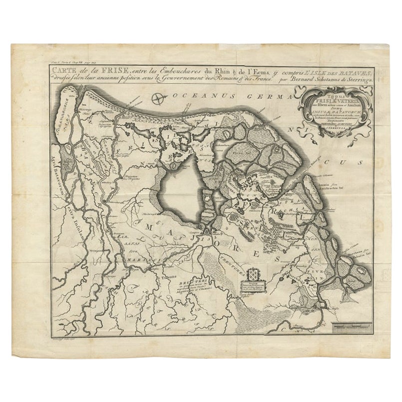
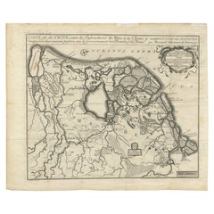
Rare Antique Map of Friesland in Roman Times, Published 1778
Located in Langweer, NL
Antique map titled 'Carte de la Frise, entre les Embouchures du Rhin & de l'Eems, ij compris l'isle Bataves, dressée selon leur ancienne position le Gouvernement des Romains & des Fr...
Category
Antique 18th Century Maps
Materials
Paper
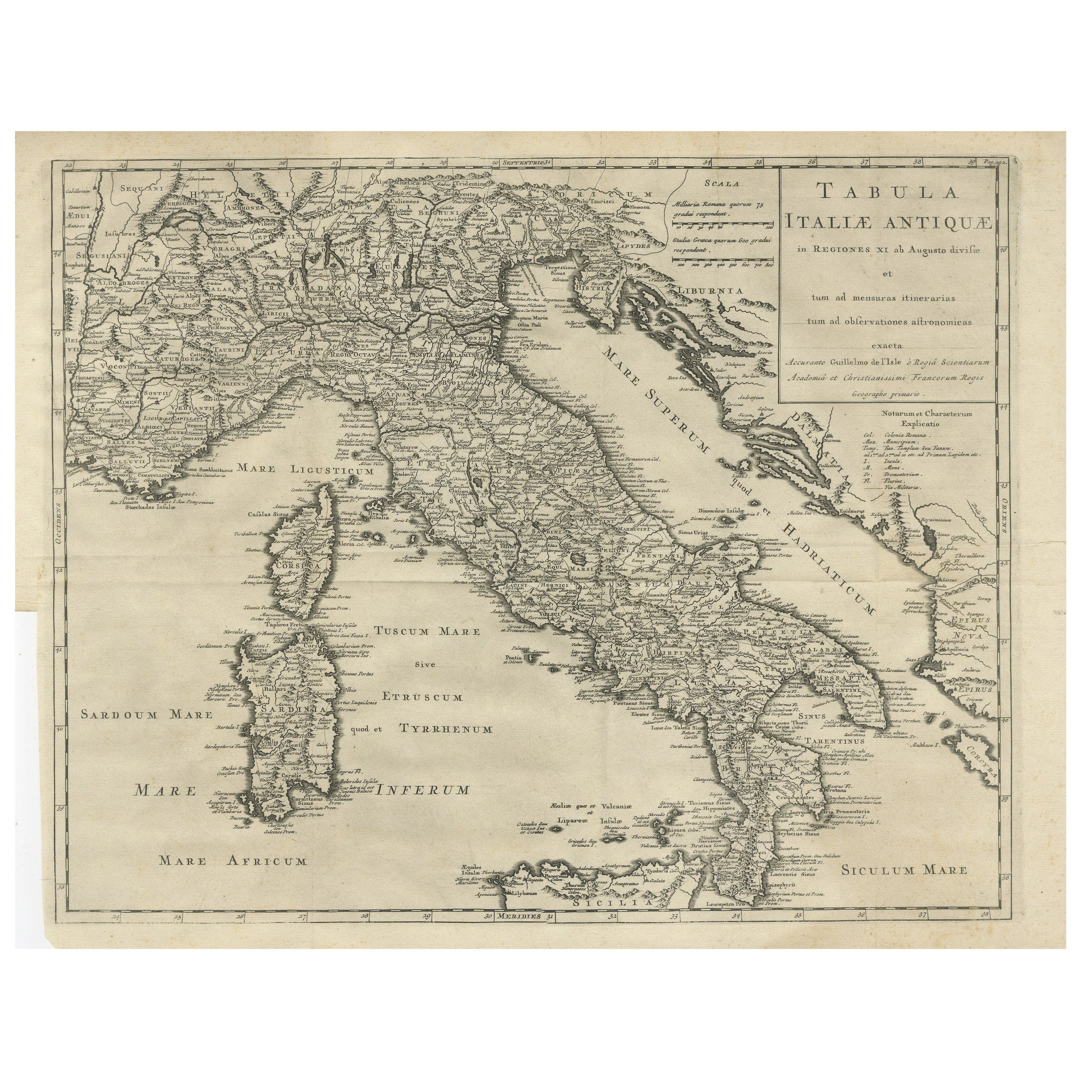
Antique Engraved Map of Italy in Roman Times, ca.1730
Located in Langweer, NL
Plain engr. map of Italy according to the division of Emperor Augustus by G. Delisle.
Title: "Tabula Italiae Antiquae In Regiones XI Ab Augusto Divisae Et Tum Ad Mensuras Itinerari...
Category
Antique 1730s Maps
Materials
Paper
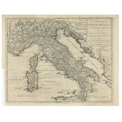
$640 Sale Price
20% Off
You May Also Like
Original Antique Map of Ancient Greece, Achaia, Corinth, 1786
Located in St Annes, Lancashire
Great map of Ancient Greece. Showing the region of Thessaly, including Mount Olympus
Drawn by J.D. Barbie Du Bocage
Copper plate engraving by P.F Tardieu
Original hand color...
Category
Antique 1780s French Other Maps
Materials
Paper

Original Antique Map of Ancient Greece- Boeotia, Thebes, 1787
Located in St Annes, Lancashire
Great map of Ancient Greece. Showing the region of Boeotia, including Thebes
Drawn by J.D. Barbie Du Bocage
Copper plate engraving by P.F T...
Category
Antique 1780s French Other Maps
Materials
Paper

Antique Map of Principality of Monaco
By Antonio Vallardi Editore
Located in Alessandria, Piemonte
ST/619 - "Old Geographical Atlas of Italy - Topographic map of ex-Principality of Monaco" -
ediz Vallardi - Milano -
A somewhat special edition ---
Category
Antique Late 19th Century Italian Other Prints
Materials
Paper

Original Antique Map of Europe, Arrowsmith, 1820
Located in St Annes, Lancashire
Great map of Europe
Drawn under the direction of Arrowsmith.
Copper-plate engraving.
Published by Longman, Hurst, Rees, Orme and Brown, 1820
...
Category
Antique 1820s English Maps
Materials
Paper

Original Antique Map of China, Arrowsmith, 1820
Located in St Annes, Lancashire
Great map of China
Drawn under the direction of Arrowsmith
Copper-plate engraving
Published by Longman, Hurst, Rees, Orme and Brown, 1820
Unfr...
Category
Antique 1820s English Maps
Materials
Paper

Original Antique Map of Hungary, Arrowsmith, 1820
Located in St Annes, Lancashire
Great map of Hungary
Drawn under the direction of Arrowsmith.
Copper-plate engraving.
Published by Longman, Hurst, Rees, Orme and Brown, 1820
Unframed.
Category
Antique 1820s English Maps
Materials
Paper

Recently Viewed
View AllMore Ways To Browse
Ralph Lauren Woven Chair
Raymond Loewy Chair
Redwood Coffee Tables
Reed And Barton Creamer
Reed And Barton Teapot
Reed Barton Deco
Reed Barton Tray
Relish Dish
Retro Vintage Yellow Chair
Retro Yellow Formica Table
Rh Couch
Rh Sofas
Rhinoceros Porcelain
Rick Owens Dining Table
Rifle Bayonet
Ritts Acrylic
Robert Burns Antique
Robert Lansing