Items Similar to Map of Ireland: Early 19th Century - from the 1802 Tardieu Atlas

Want more images or videos?
Request additional images or videos from the seller
1 of 8
Map of Ireland: Early 19th Century - from the 1802 Tardieu Atlas
$417.33
$521.6620% Off
£312.33
£390.4120% Off
€352
€44020% Off
CA$575.74
CA$719.6820% Off
A$640.25
A$800.3120% Off
CHF 336.27
CHF 420.3420% Off
MX$7,827.69
MX$9,784.6220% Off
NOK 4,190.28
NOK 5,237.8520% Off
SEK 3,950.31
SEK 4,937.8820% Off
DKK 2,679.60
DKK 3,349.5020% Off
About the Item
Antique Map Description
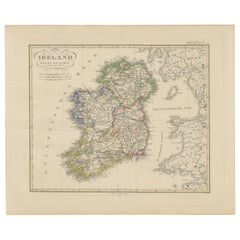
**Title:** Carte d'Irlande
**Publication Details:**
- **Atlas Title:** Nouvel Atlas Universel de Géographie Ancienne et Moderne
- **Purpose:** For the Nouvelle Edition de la Géographie de Guthrie
- **Mapmakers:** P. F. Tardieu, with contributions from various geographical works
- **Publisher:** Chez Hyacinthe Langlois, Libraire, quai des Augustins, n° 45
- **Year:** An VII - 1802 (French Revolutionary Calendar)
**Geographical Scope:**
This antique map illustrates Ireland, providing a detailed representation of its counties, towns, and topographical features.
**Map Features:**
- **Regions Displayed:** Entire island of Ireland, including all its counties.
- **Notable Regions and Territories:** Counties of Ireland, such as Leinster, Ulster, Munster, and Connaught.
- **Seas and Bodies of Water:** Irish Sea (Mer d'Irlande), St. George's Channel (Canal de St. George), and the Atlantic Ocean.
- **Topographical Details:** Includes mountain ranges, rivers, and other significant geographical features as understood in the early 19th century.
- **Cartographic Style:** Detailed engraving with hand-colored boundaries, emphasizing both historical accuracy and artistic presentation.
**Purpose and Use:**
This map serves as a detailed visual representation of the geographical and political landscape of Ireland, reflecting the geographical understanding and cartographic style of the early 19th century. It is part of a larger atlas that includes 60 maps, providing a comprehensive view of both ancient and modern geography as known in 1802.
### Condition Report
The map is in good condition with minor age-related wear. Hand-colored boundaries are well-preserved, enhancing the clarity of regions and features. Slight fold lines and edge wear are visible, with some age spots.
### Coloring
The hand-colored boundaries on the map highlight regions and territories, adding clarity and visual appeal, typical of early 19th-century cartographic practices.
- Dimensions:Height: 16.23 in (41.2 cm)Width: 22.25 in (56.5 cm)Depth: 0.01 in (0.2 mm)
- Materials and Techniques:Paper,Engraved
- Period:
- Date of Manufacture:1802
- Condition:Good condition with age-related wear. Hand-colored boundaries are well-preserved. Small tear in fold line, easy to repair. Fold lines and edge wear are visible, with some age spots, mostly in border. Study the scans carefully.
- Seller Location:Langweer, NL
- Reference Number:Seller: BG-13769-111stDibs: LU3054340559762
About the Seller
5.0
Recognized Seller
These prestigious sellers are industry leaders and represent the highest echelon for item quality and design.
Platinum Seller
Premium sellers with a 4.7+ rating and 24-hour response times
Established in 2009
1stDibs seller since 2017
2,609 sales on 1stDibs
Typical response time: <1 hour
- ShippingRetrieving quote...Shipping from: Langweer, Netherlands
- Return Policy
Authenticity Guarantee
In the unlikely event there’s an issue with an item’s authenticity, contact us within 1 year for a full refund. DetailsMoney-Back Guarantee
If your item is not as described, is damaged in transit, or does not arrive, contact us within 7 days for a full refund. Details24-Hour Cancellation
You have a 24-hour grace period in which to reconsider your purchase, with no questions asked.Vetted Professional Sellers
Our world-class sellers must adhere to strict standards for service and quality, maintaining the integrity of our listings.Price-Match Guarantee
If you find that a seller listed the same item for a lower price elsewhere, we’ll match it.Trusted Global Delivery
Our best-in-class carrier network provides specialized shipping options worldwide, including custom delivery.More From This Seller
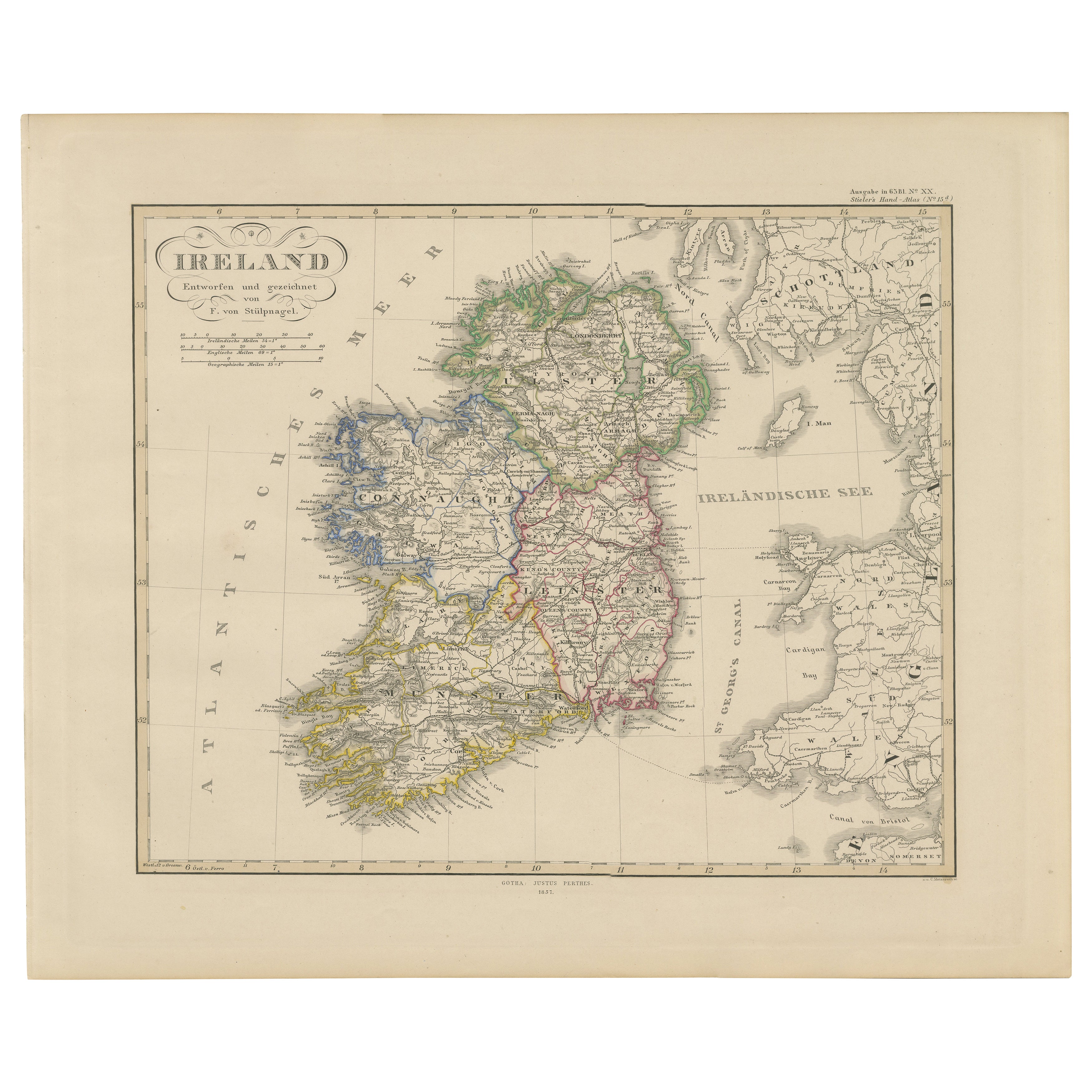
View AllIreland Map – Provincial and County Divisions 1851
Located in Langweer, NL
Ireland Map – Provincial and County Divisions 1851
This fine antique print shows Ireland titled simply “Ireland,” published in 1851 by Justus Perthes in Gotha as part of Adolf Stiel...
Category
Antique Mid-19th Century German Maps
Materials
Paper
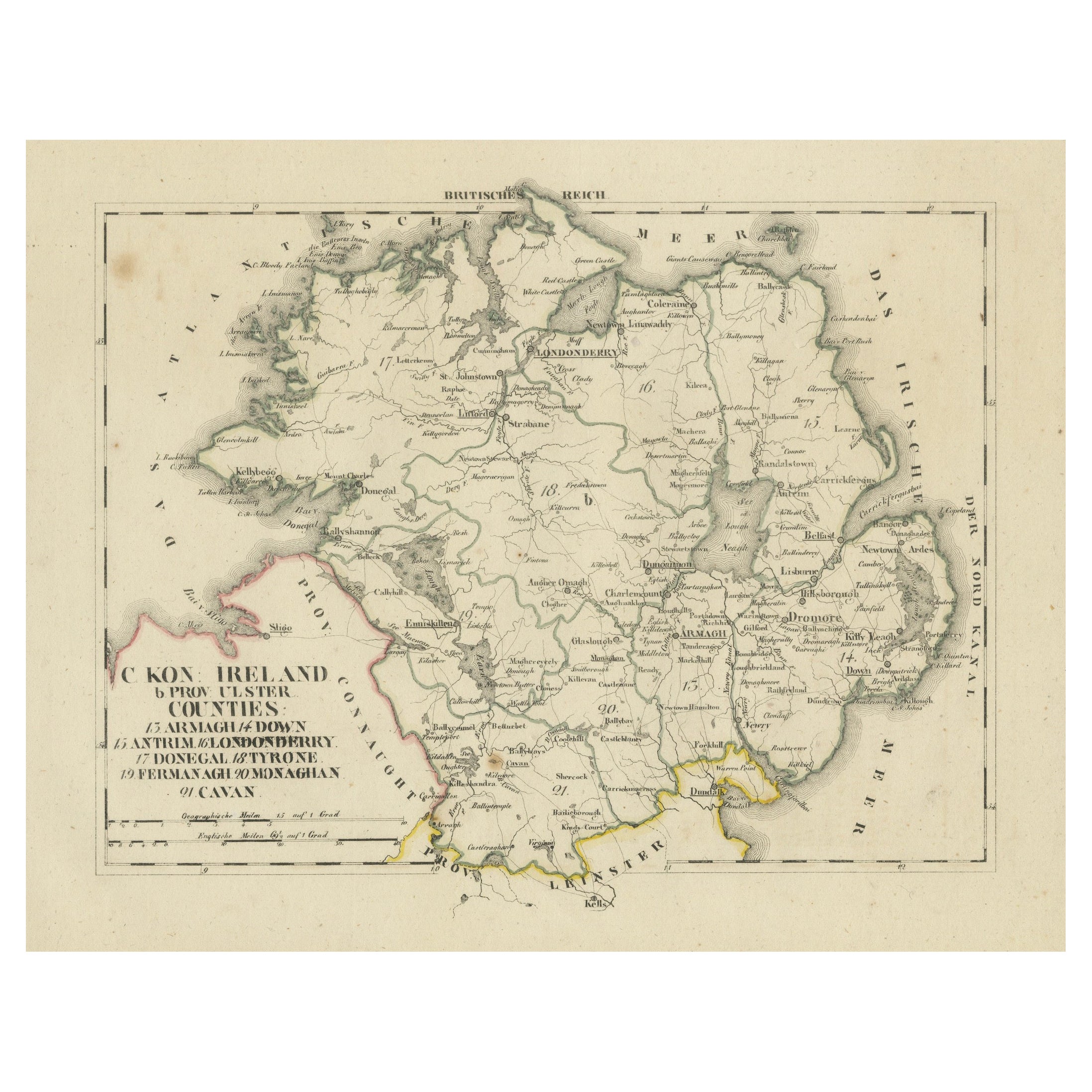
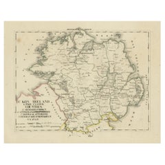
Antique 1830 Map of Ulster, Ireland with Armagh, Down, Antrim, Donegal, Tyrone
Located in Langweer, NL
Title: Antique 1830 Map of Ulster, Ireland with Armagh, Down, Antrim, Donegal, and Tyrone
Description: This 1830 German-language map, titled Britisches Reich – C. Kon: Ireland, ...
Category
Antique 1830s Maps
Materials
Paper
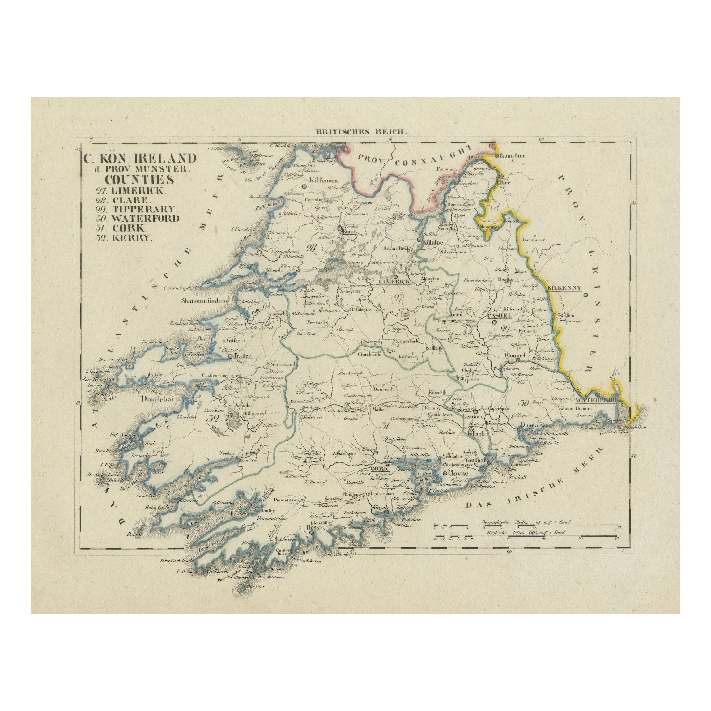
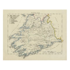
Antique 1830 Map of Munster, Ireland with Limerick, Cork, Kerry and Tipperary
Located in Langweer, NL
Title: Antique 1830 Map of Munster, Ireland with Limerick, Cork, Kerry, and Tipperary
Description: This 1830 German-language map, titled Britisches Reich – C. Kon: Ireland, focu...
Category
Antique 1830s Maps
Materials
Paper
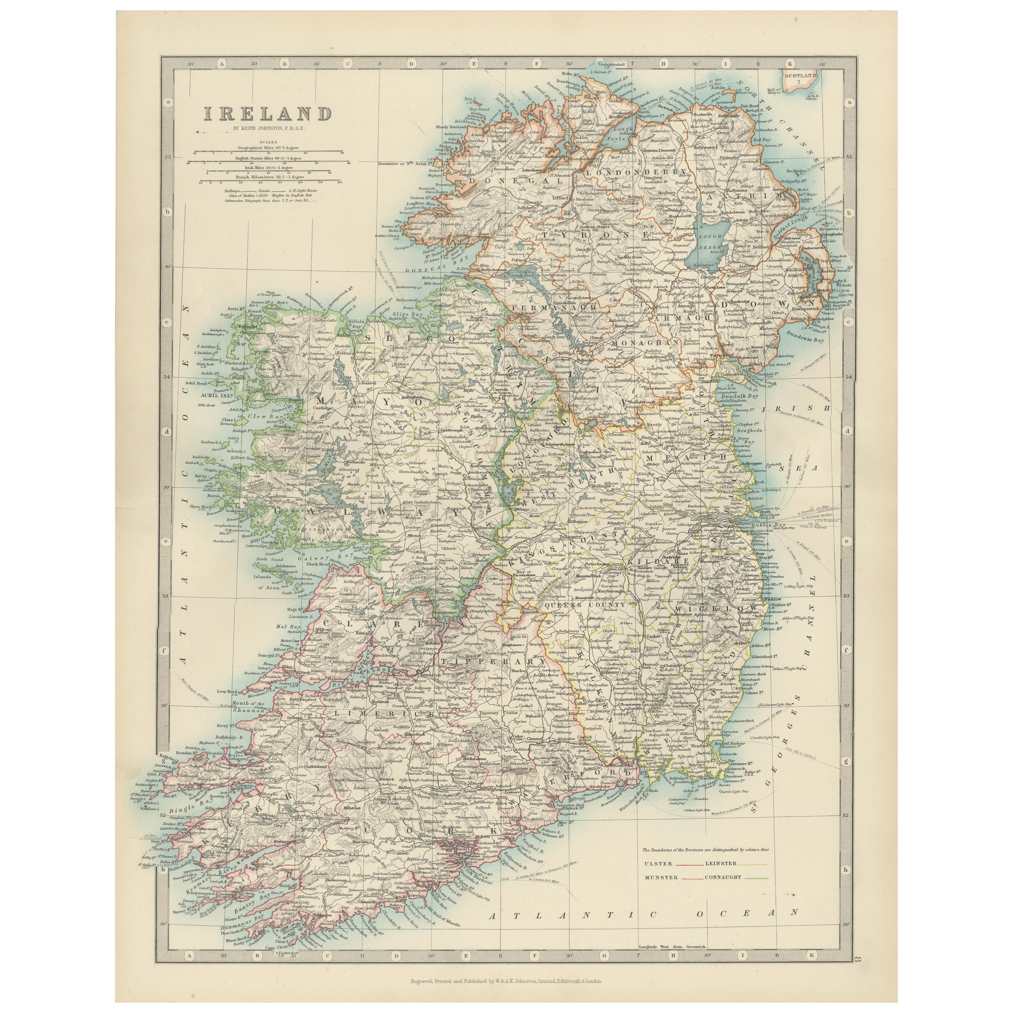
Antique Map of Ireland, 1903, with Intricate County Boundaries & Coastal Details
Located in Langweer, NL
Title: Antique Map of Ireland, 1903, with Intricate County Boundaries and Coastal Detail
Description:
This antique map of Ireland, engraved and published in 1903 by the esteemed W. ...
Category
Early 20th Century Maps
Materials
Paper

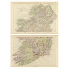
1882 Cartographic Views of Ireland's North and South Regions
Located in Langweer, NL
Title: 1882 Maps of Ireland: Northern and Southern Regions
These two maps provide a detailed representation of Ireland as it was in 1882, divided into the northern and southern regi...
Category
Antique 1880s Maps
Materials
Paper
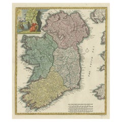
Decorative Hand-Coloured Antique Map of the Four Irish Provinces, Ireland, c1718
Located in Langweer, NL
Title: Regni Hiberniae Accurata Tabula per Hermanum Moll
Decorative map of the four Irish provinces, Ireland, 1718, by Christoph Weigel (with credit to Herman Moll), engraved by Mi...
Category
Antique 1710s Maps
Materials
Paper
$806 Sale Price
20% Off
You May Also Like
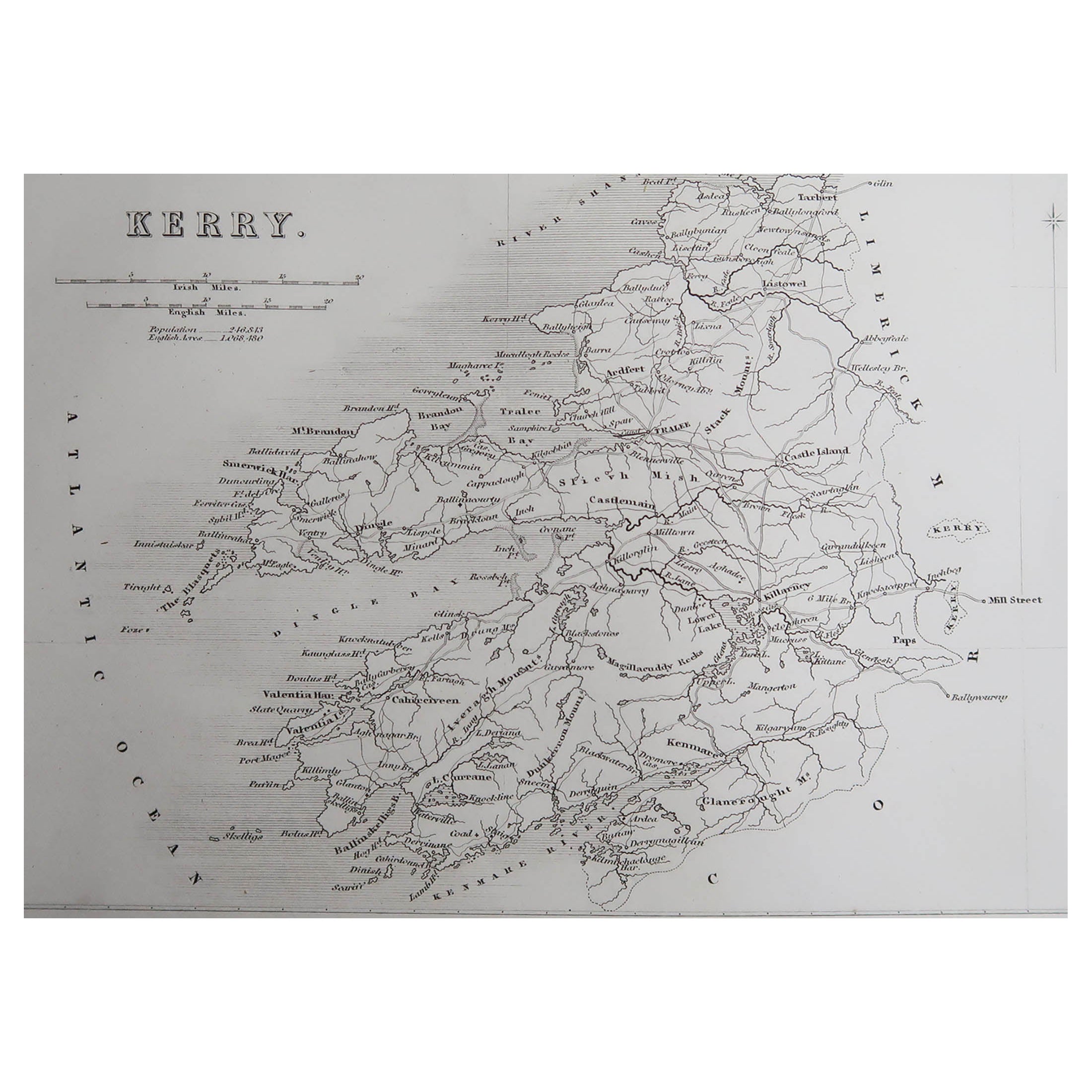
Original Antique Map of Ireland- Kerry. C.1840
Located in St Annes, Lancashire
Great map of Kerry
Steel engraving
Drawn under the direction of A.Adlard
Published by How and Parsons, C.1840
Unframed.
Category
Antique 1840s English Maps
Materials
Paper

Large Original Antique Map of Ireland. C.1900
Located in St Annes, Lancashire
Fabulous map of Ireland
Original color.
Engraved and printed by the George F. Cram Company, Indianapolis.
Published, C.1900.
Unframed.
Free shipping.
Category
Antique 1890s American Maps
Materials
Paper

Original Antique Map of Ireland- Tipperary and Waterford. C.1840
Located in St Annes, Lancashire
Great map of Tipperary and Waterford
Steel engraving
Drawn under the direction of A.Adlard
Published by How and Parsons, C.1840
Unframed.
Category
Antique 1840s English Maps
Materials
Paper

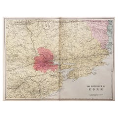
Large Original Antique Map of the Environs of Cork, Ireland, circa 1880
Located in St Annes, Lancashire
Great map of The Environs of Cork
Published circa 1880
Unframed
Free shipping.
Category
Antique 1880s Scottish Maps
Materials
Paper
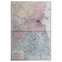
Large Original Antique Map of The Environs of Dublin, Ireland, circa 1880
Located in St Annes, Lancashire
Great map of The Environs of Dublin
Published circa 1880
Unframed
Free shipping.
Category
Antique 1880s Scottish Maps
Materials
Paper
Southeastern Ireland: A 17th Century Hand Colored Map by Mercator and Hondius
By Gerard Mercator
Located in Alamo, CA
A 17th century copperplate hand-colored map entitled "The Second Table of Ireland, Udrone" by Gerard Mercator and Jodocus Hondius, published in Amsterdam in 1635 in 'Cosmographicall ...
Category
1630s Landscape Prints
Materials
Engraving

More Ways To Browse
Silver Over Copper
Vintage Barware Glasses
Coffee Table Black Italian Modern
Christofle America
Iranian Silk Rug Carpet
Poul Moller
Tables With Inlaid Wood
World War Table
Antonio Jacobsen
Ariston Chairs
Coffee Tables Europe
Marble Top Dining Tables
Nordiska Argentina
Pink And Black Rug
Black Wooden Chair
Orrefors Embassy
Black Ebonized
Elios Chair