Items Similar to Massive Vintage Wall Map of the Soviet Union 'Sowjetunion' by Karl Wenschow


Want more images or videos?
Request additional images or videos from the seller
1 of 16
Massive Vintage Wall Map of the Soviet Union 'Sowjetunion' by Karl Wenschow
$540
$67520% Off
£407.30
£509.1220% Off
€470.43
€588.0420% Off
CA$756.58
CA$945.7220% Off
A$841.27
A$1,051.5920% Off
CHF 440.42
CHF 550.5320% Off
MX$10,276.28
MX$12,845.3420% Off
NOK 5,534.31
NOK 6,917.8920% Off
SEK 5,206.13
SEK 6,507.6620% Off
DKK 3,511.76
DKK 4,389.7120% Off
About the Item
A massive vintage wall map of the Soviet Union (Sowjetunion) published by Karl Wenschow in Munich, Germany, circa 1950s. The map was distributed by Denoyer-Geppert and measures 96" x 68"; it is presented on a wood roll up bar. #2864.
- Creator:Denoyer-Geppert (Maker),Karl Wenschow (Illustrator)
- Dimensions:Height: 68 in (172.72 cm)Width: 96 in (243.84 cm)Depth: 0.2 in (5.08 mm)
- Materials and Techniques:
- Place of Origin:
- Period:
- Date of Manufacture:1950s
- Condition:Wear consistent with age and use. Minor losses. Minor fading. The map is in fair condition with a number of creases and stains on the bottom edge. It has a great vintage look.
- Seller Location:San Diego, CA
- Reference Number:Seller: #28641stDibs: LU936633249162
About the Seller
4.9
Platinum Seller
Premium sellers with a 4.7+ rating and 24-hour response times
Established in 2000
1stDibs seller since 2012
4,224 sales on 1stDibs
Typical response time: <1 hour
- ShippingRetrieving quote...Shipping from: San Diego, CA
- Return Policy
Authenticity Guarantee
In the unlikely event there’s an issue with an item’s authenticity, contact us within 1 year for a full refund. DetailsMoney-Back Guarantee
If your item is not as described, is damaged in transit, or does not arrive, contact us within 7 days for a full refund. Details24-Hour Cancellation
You have a 24-hour grace period in which to reconsider your purchase, with no questions asked.Vetted Professional Sellers
Our world-class sellers must adhere to strict standards for service and quality, maintaining the integrity of our listings.Price-Match Guarantee
If you find that a seller listed the same item for a lower price elsewhere, we’ll match it.Trusted Global Delivery
Our best-in-class carrier network provides specialized shipping options worldwide, including custom delivery.More From This Seller
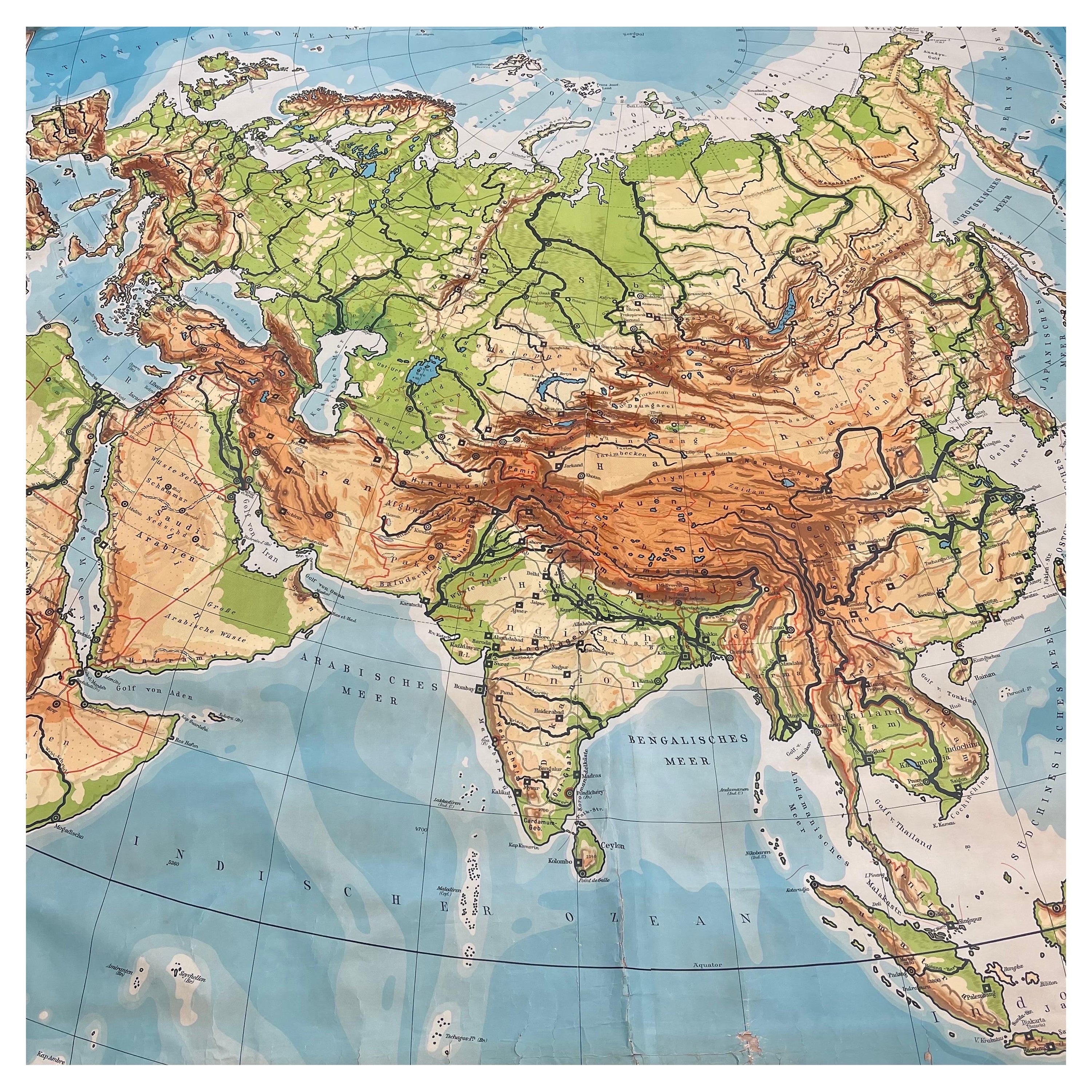
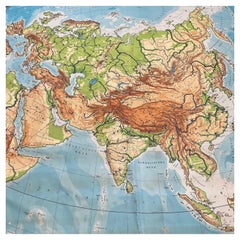
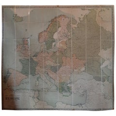
View AllHuge Europe and Asia Vintage Wall Map
Located in San Diego, CA
A huge Europe and Asia vintage wall map, circa 1950s. The map is in fair vintage condition and measures 78"W x 73"H". #2863
Category
Mid-20th Century American Maps
Materials
Paper
$380 Sale Price
20% Off
Vintage "View of the Center of Paris Taken from the Air" Lithograph Map
Located in San Diego, CA
A very stylish "View of the Center of Paris Taken from the Air" lithograph map published by the Paris Ministry of Tourism, circa early 1950s. The piece measures 27" x 43" and shows...
Category
20th Century French Mid-Century Modern Prints
Materials
Paper

$680 Sale Price
20% Off
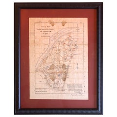
Antique Map of the Royal Botanic Garden & Arboretum Kew in London, England
Located in San Diego, CA
A very nice antique map of the Royal Botanic Garden & Arboretum in London, England, circa 1880s. The map itself measures 12" x 16" and is professionall...
Category
Antique Late 19th Century English Prints
Materials
Paper
$900 Sale Price
25% Off
Antique Map of California as an Island "The 5 Californias" by Robert de Vaugondy
Located in San Diego, CA
A very nice and rare antique map entitled "Carte de la Californie Suivant" (The 5 Californias), by Didier Robert de Vaugondy of Paris, circa 1772. The map itself measures 15.5" x 13...
Category
Antique Mid-19th Century American Maps
Materials
Paper

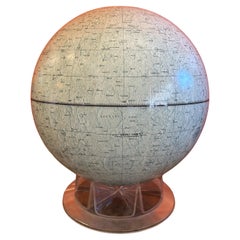
Vintage Mid-Century 12" Lunar Globe on Lucite Stand by Replogle
By Replogle Globes
Located in San Diego, CA
A super cool by vintage 12" lunar globe on lucite stand by Replogle Globes Inc. of Chicago, circa 1970s. The globe is in very good vintage condition and measures 12"D x 14"H. #3865
Category
Mid-20th Century American Mid-Century Modern Globes
Materials
Plastic, Paper
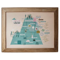
Ivan Bartlett Chicago Painting from The Ambassador East Hotel 1951
By Ivan Bartlett, Dorothy Liebes
Located in San Diego, CA
Painting on board of Chicago landmarks by Ivan Bartlett from 1951 that hung in the Ambassador East Hotel (see period photo from the Liebes Archive). In 1951 designer and weaver Doro...
Category
Vintage 1950s American Mid-Century Modern Paintings
Materials
Wood, Paint
You May Also Like
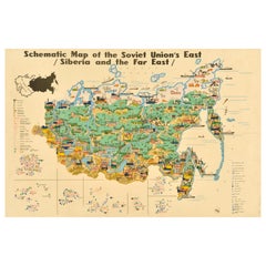
Original Vintage Illustrated Map Poster Schematic Map Soviet Union USSR Russia
Located in London, GB
Original vintage illustrated map poster - Schematic Map of the Soviet Union's East Siberia and the Far East - featuring forests, rivers, mount...
Category
Vintage 1960s Russian Posters
Materials
Paper
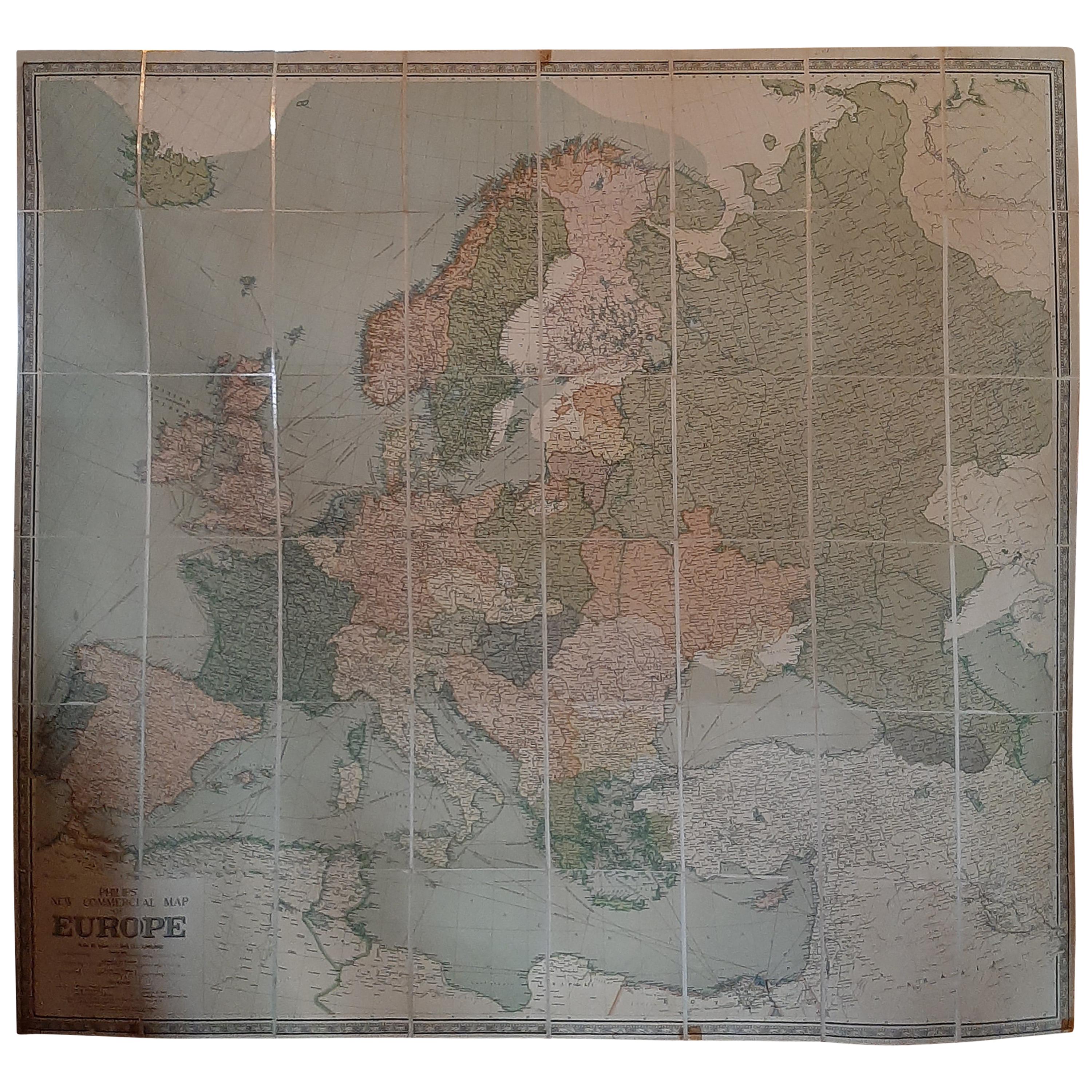
Large Wall Map of Europe by George Philip & Son, circa 1920
Located in Langweer, NL
Antique map titled 'Philips' New Commercial Map of Europe'. Very large wall map of Europe including the North African coast and Turkey. Decorative bord...
Category
Early 20th Century Maps
Materials
Linen, Paper
$2,089 Sale Price
30% Off
Antique Map of Russia and Surroundings by Stieler, 1874
Located in Langweer, NL
Antique map titled 'Nord- & Mittal-Asien, Ubersicht des Russischen Reiches.' A map of Russia in scale 1:20.000.000. The depicted area spans from Iran and Sweden in the left edge of t...
Category
Antique 19th Century Maps
Materials
Paper

$66 Sale Price
20% Off
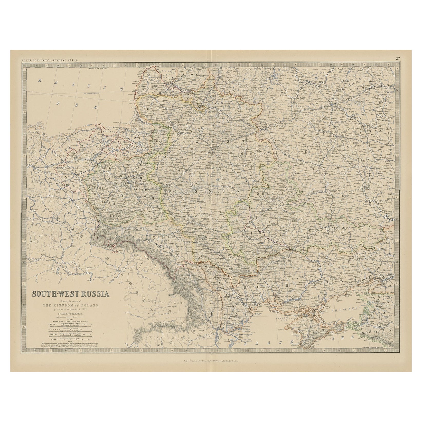
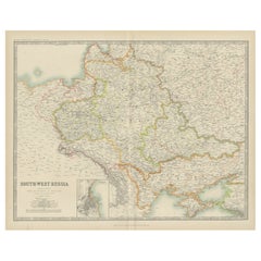
Old Map of Southern Russia, Incl the Extent of the Kingdom of Poland, 1882
Located in Langweer, NL
Antique map titled 'South-West Russia'.
Old map of southern Russia, also showing the extent of the Kingdom of Poland. This map originates from 'The Royal Atlas of Modern Geography...
Category
Antique 1880s Maps
Materials
Paper

$324 Sale Price
20% Off
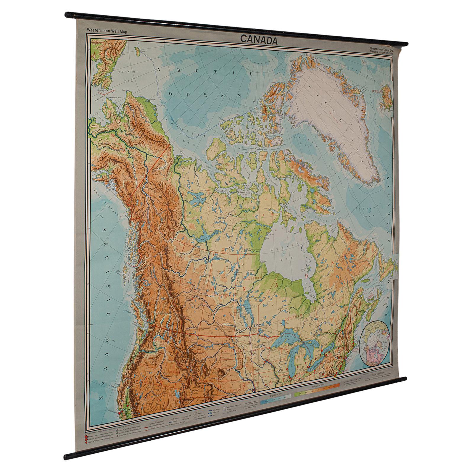
Very Large Vintage Map of Canada, German, Education, Institution, Cartography
Located in Hele, Devon, GB
This is a very large vintage map of Canada. A German, quality printed educational or institution map, dating to the mid 20th century, circa 1965....
Category
Mid-20th Century German Maps
Materials
Paper

Antique Map of South-West Russia by Johnston (1909)
Located in Langweer, NL
Antique map titled 'South-West Russia'. Original antique map of South-West Russia. With inset map of Odessa. This map originates from the ‘Royal Atlas of Modern Geography’. Published...
Category
Early 20th Century Maps
Materials
Paper
$238 Sale Price
20% Off