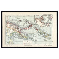
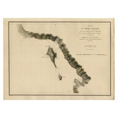
Old German Map of the New-Guinea and Bismarck Archipelago, 1895
View Similar Items

Want more images or videos?
Request additional images or videos from the seller
1 of 5
Old German Map of the New-Guinea and Bismarck Archipelago, 1895
About the Item
- Dimensions:Height: 6.3 in (16.01 cm)Width: 9.6 in (24.39 cm)Depth: 0.001 in (0.03 mm)
- Materials and Techniques:
- Period:
- Date of Manufacture:1895
- Condition:
- Seller Location:Langweer, NL
- Reference Number:Seller: PCT-163381stDibs: LU3054325635552
About the Seller
5.0
Platinum Seller
These expertly vetted sellers are 1stDibs' most experienced sellers and are rated highest by our customers.
Established in 2009
1stDibs seller since 2017
1,947 sales on 1stDibs
More From This SellerView All
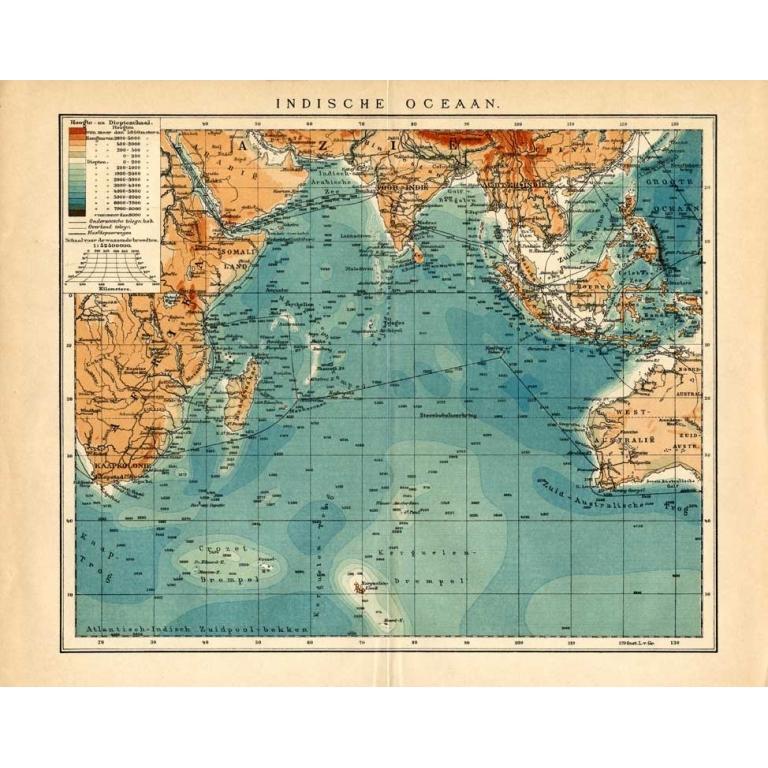
- Antique Map of New Ireland Island in the Bismarck Archipelago, New Guinea, 1772Located in Langweer, NLAntique map titled 'Nova Hibernia'. Antique map of New Ireland, an island in the Bismarck Archipelago, New Guinea. Lying just north of New Britain, from which it is separated by St. ...Category
Antique 18th Century Maps
MaterialsPaper
 $193 Sale Price20% Off
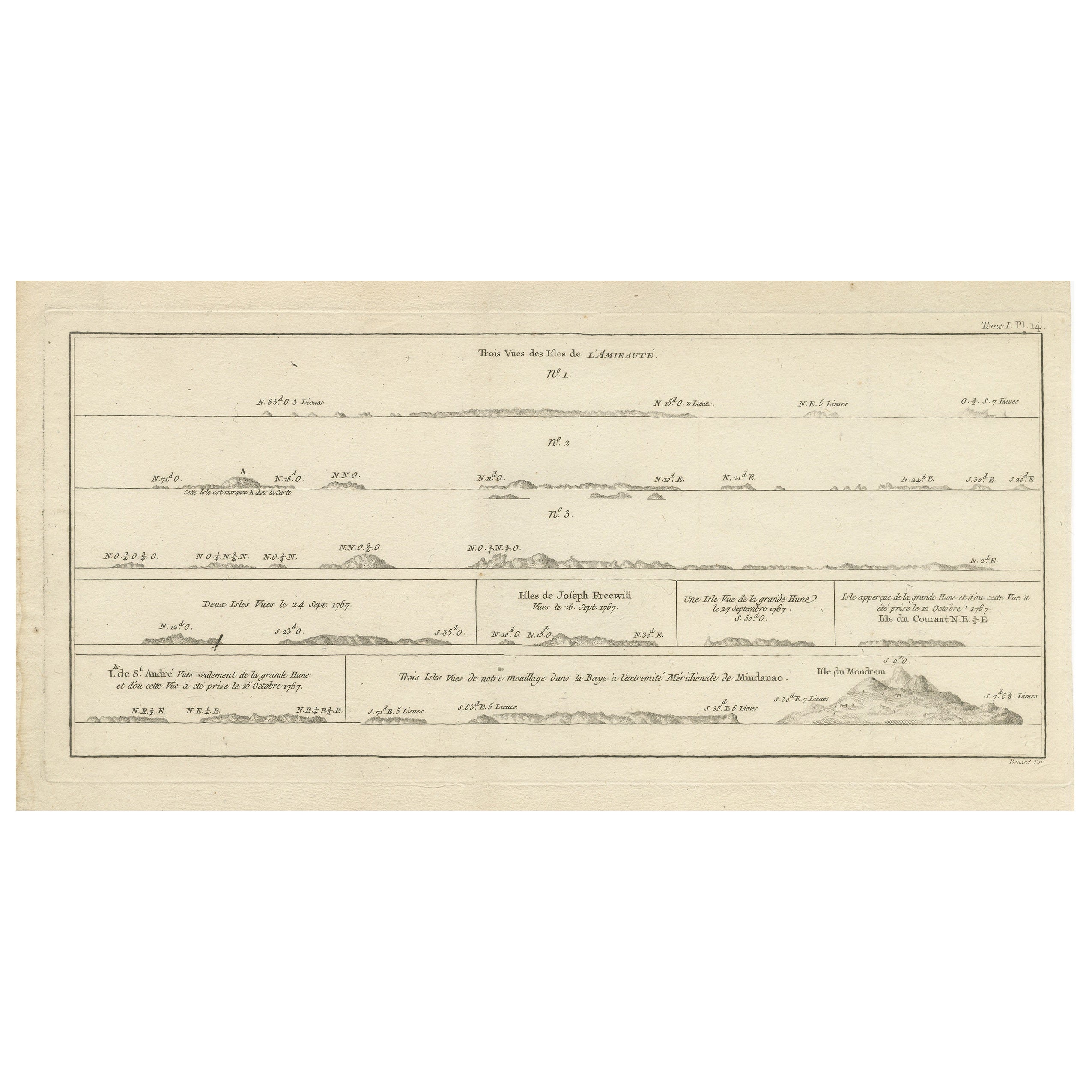
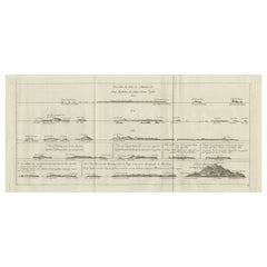
 - Antique Map of the Admiralty Islands, Bismarck ArchipelagoLocated in Langweer, NLAntique map titled 'Trois Vues des Isles de l'Amirauté'. Several coastal views of the Admiralty Islands, Bismarck Archipelago, to the north of New Guinea in the South Pacific Ocean. ...Category
Antique Late 18th Century Maps
MaterialsPaper
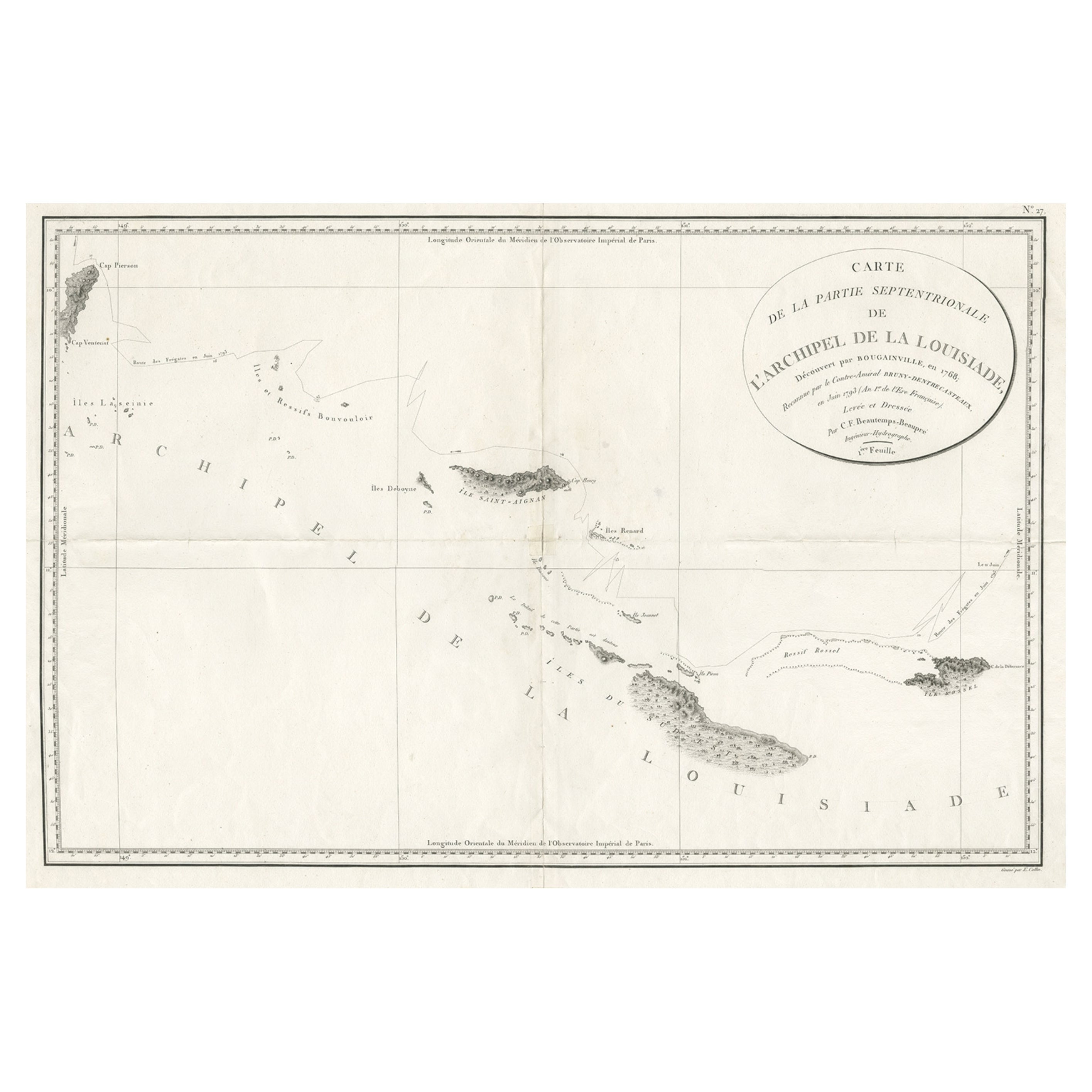
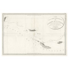
- Uncommon Rare Map Showing The Louisiade Archipelago, Papua New Guinea, ca.1798Located in Langweer, NLAntique map titled 'Carte de la Partie Septentrionale de l'Archipel de la Louisiade'. Uncommon map showing the area around the Louisiade Archipelago, named for Louis XV by Louis ...Category
Antique 1790s Maps
MaterialsPaper
 $738 Sale Price20% Off
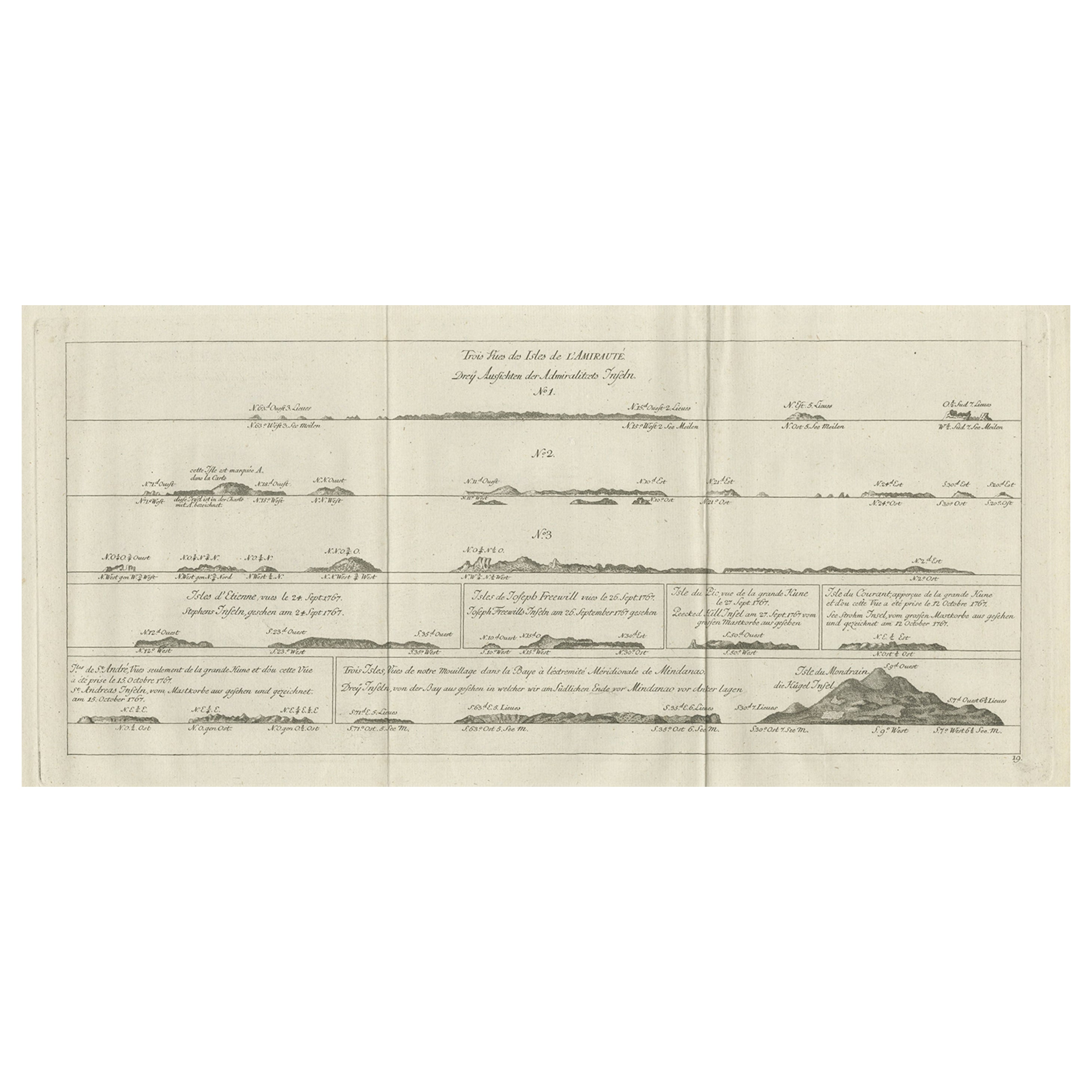
 - Original Antique Engraving of the Admiralty Islands 'Bismarck Archipelago', 1774Located in Langweer, NLAntique print titled 'Trois Vues des Isles de l'Amirauté (..)'. Several coastal views of the Admiralty Islands. Originates from 'Geschichte der See-Reisen und Entdeckungen im Süd-Mee...Category
Antique 18th Century Prints
MaterialsPaper
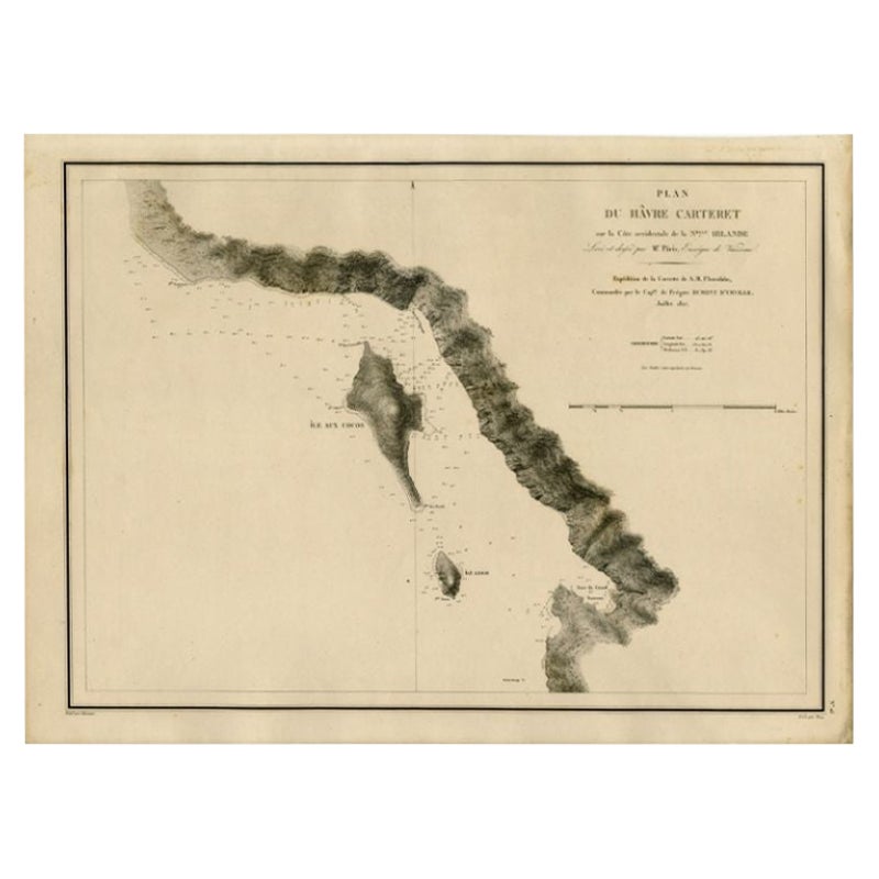
- Antique Map of the Coast of New Ireland, Earlier Part of German New Guinea, 1833Located in Langweer, NLAntique map titled 'Plan du Havre Carteret sur la Cote occidentale de la Nelle Irlande. Expedition de la Corvette de S.M. l'Astrolabe, Commandee par le CAP ne de Fregate Dumont D'Urville. Juillet 1827.' A chart of the coast of Latangai Island (then known as New Ireland), with Lamassa Island (identified as Ile Cocos), and a second island identified as Ile Leigh. Shows soundings and height profile. New Ireland, also New Mecklenburg, is the Northeastern Province of Papua New Guinea. Map no. 26 from Dumont D'Urville's "Voyage de la Corvette l'Astrolabe - Atlas"", published in Paris: J. Tastu, 1833. New Ireland or Latangai, is a large island in Papua New Guinea, approximately 7,404 km2 (2,859 sq mi) in area with c. 120,000 people. It is named after the island of Ireland. It is the largest island of New Ireland Province, lying northeast of the island of New Britain. Both islands are part of the Bismarck Archipelago, named after Otto von Bismarck...Category
Antique 19th Century Maps
MaterialsPaper
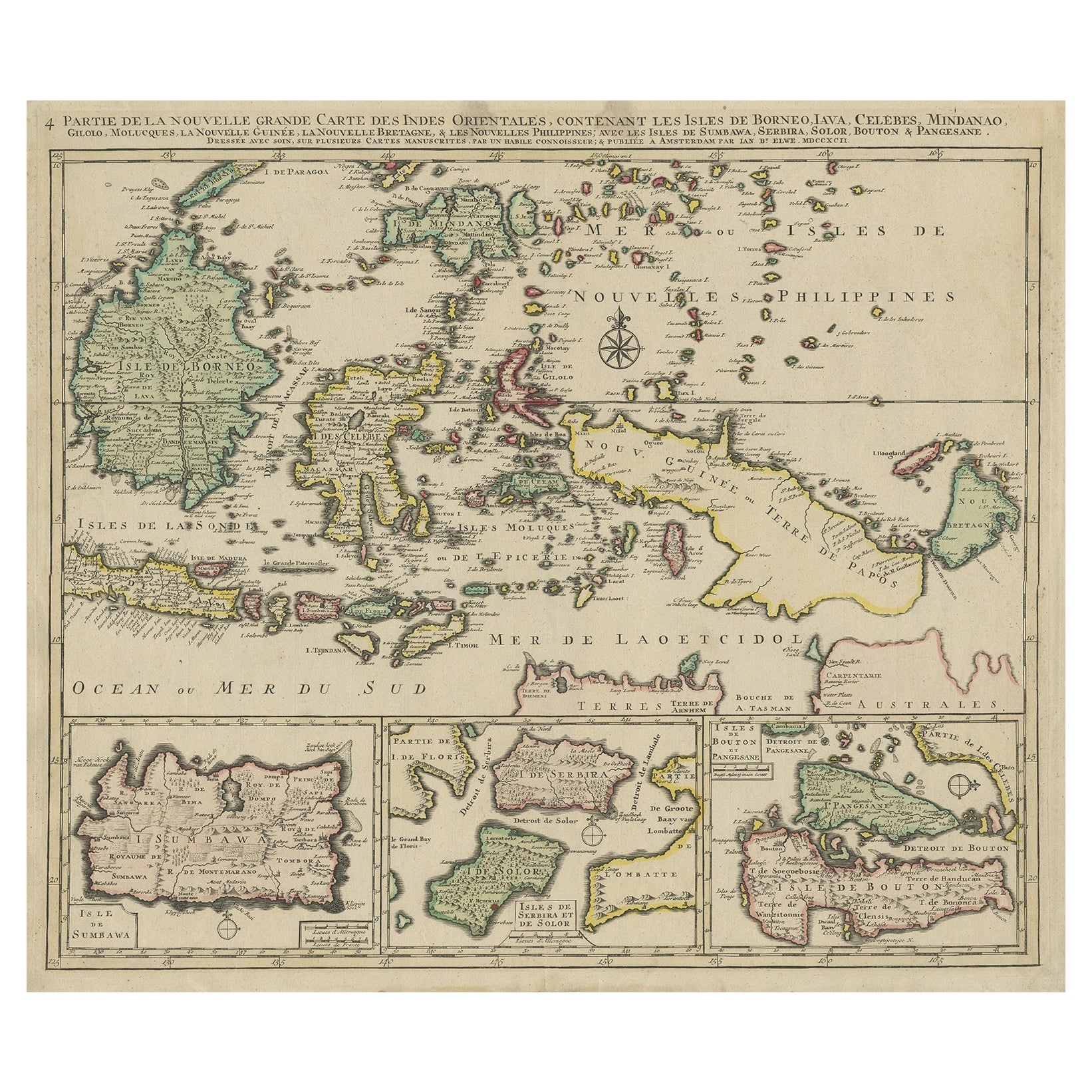
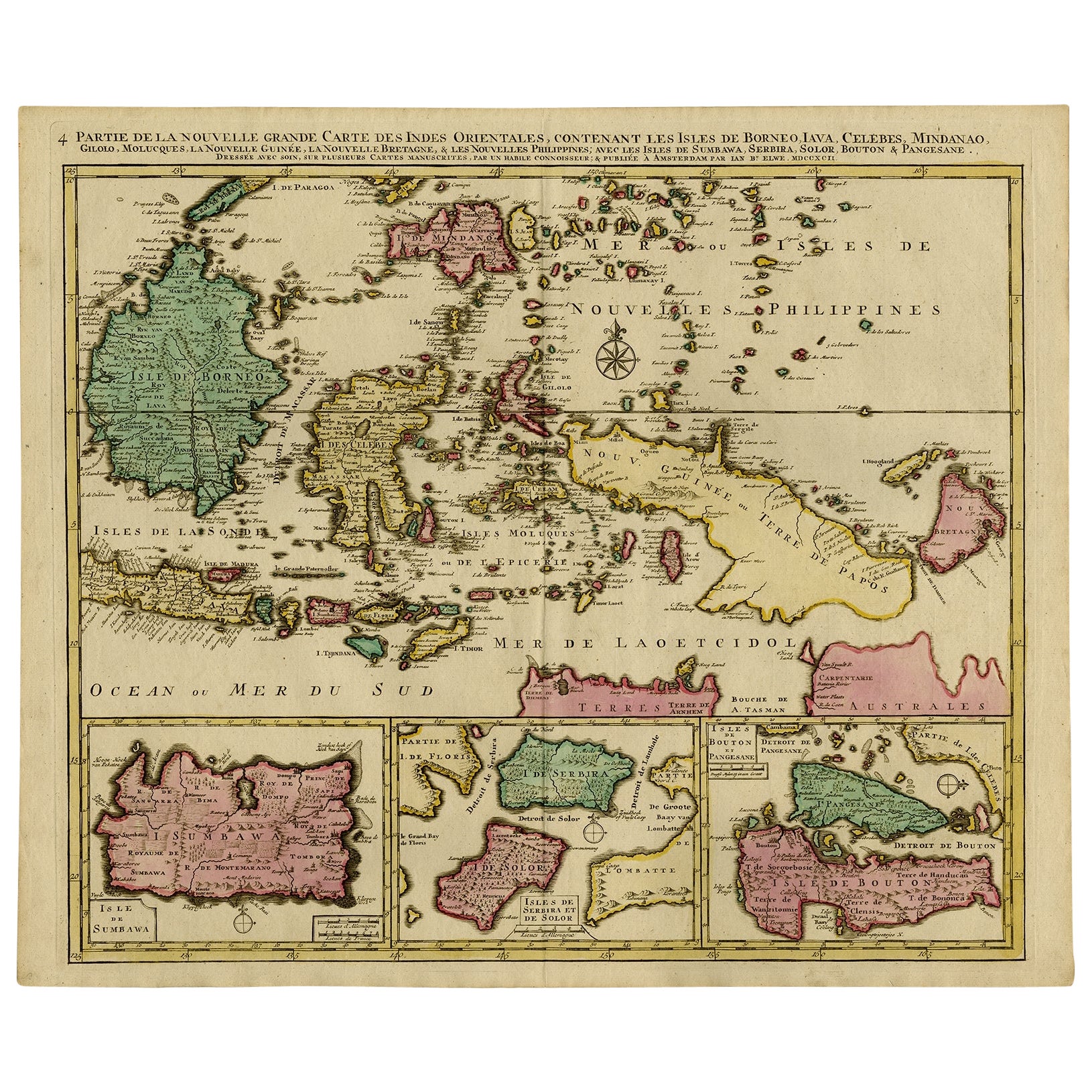
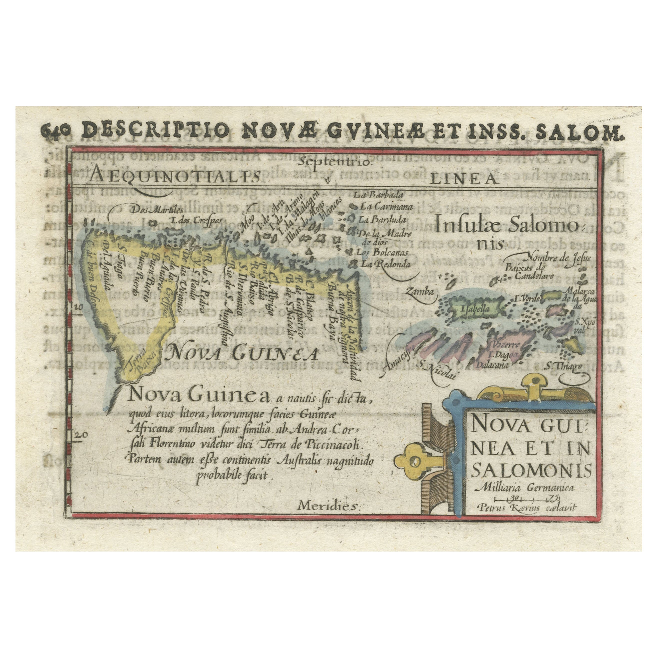
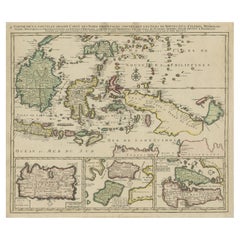
- Old Map of the East Indonesian Islands Borneo, Celebes, New Guinea, Bali, 1792Located in Langweer, NLAntique map titled 'Partie de la Nouvelle Grande Carte des Indes Orientales, contenant les Isles de Borneo, Iava, Celebes, Mindanao (..)'. Detailed map of the Indonesian islands ...Category
Antique 1790s Maps
MaterialsPaper
 $1,099 Sale Price20% Off

You May Also Like
- 1863 "Lloyd's New Map of the United States, the Canadas, and New Brunswick"Located in Colorado Springs, COPresented is “Lloyd's New Map of the United States, the Canadas and New Brunswick, From the latest Surveys, Showing Every Railroad & Station Finished to June 1863, and the Atlantic and Gulf Coasts.” A large, Civil War-era hanging map of the United States and adjacent territories, this map covers the area from the Atlantic Ocean and extends as far west as the 103 meridian, to “Dacotah,” Nebraska, Kansas, "Indian Territory," and Texas. The southern continuation of Florida is shown in an inset map along the right margin. This map was published by J. T. Lloyd, in New York, in 1863. According to the publisher’s marking at lower right, this map was originally issued in two states: "in Sheets, Colored" for 50 cents, and "Varnished nicely, with Rollers" for $1. Throughout the map, the counties are colored and the towns and cities well labeled. A reference key in the bottom margin provides symbols for railroads, turnpikes and wagon roads, state capitals, cities and towns, and village post offices. As emphasized in the map’s title, this map is especially notable for the countless railway lines and stations depicted, with distances noted between points, listing “every railroad and finished station to June 1863.” Additionally, two shipping agents and their routes are drawn out of New York City. The map includes details of the steamship routes into New York and Philadelphia from Liverpool and on to California and Oregon via an overland Nicaraguan trek, presumably to assist gold rush emigrants. This expansive and impressive map depicts the eastern half of the United States in the third year of the Civil War. In order not to recognize the legitimacy of the Confederate States of America, each state is shown in the same manner as the Union states. The only indication that the American Civil War was in progress when this map was published is a printed notice that Gideon Wells, Secretary of the Navy, wishes to acquire a quote on 100 copies of Lloyd’s Mississippi River map...Category
Antique 1860s American Maps
MaterialsLinen, Wood, Paper
- Old Nautical Map of CorsicaLocated in Alessandria, PiemonteST/556/1 - Old map of Corsica isle, surveyed by Captain Hell, of the French Royal Navy in 1824, engraved and published on 1874, with additions and corre...Category
Antique Early 19th Century English Other Prints
MaterialsPaper
 $351 Sale Price20% Off
 - Old Horizontal Map of EnglandBy TassoLocated in Alessandria, PiemonteST/520 - Old rare Italian map of England, dated 1826-1827 - by Girolamo Tasso, editor in Venise, for the atlas of M.r Le-Sage.Category
Antique Early 19th Century Italian Other Prints
MaterialsPaper
 $237 Sale Price20% Off
 - East German MapBy VEB Hermann HaackLocated in Baltimore, MDA brilliantly colourful map of the Leipzig, Karl Marx Stadt and Dresden area in the former German Democratic Republic by VEB Hermann Haack of Gotha.Category
Vintage 1970s German Maps
 $295 Sale Price25% Off
 - Antique German Bible 1738 Martin Luther Old and New Testament European GermanyLocated in Greer, SCCollectible antique German Luther Bible, also known as " Lutherbibel " in Germany. The Lutherbibel is a German translation by the Protestant reformer Martin Luther, a New Testament t...Category
Antique Mid-18th Century German Other Books
MaterialsWood, Paper
- 1840 "New Map of the City of New York With Part of Brooklyn & Williamsburg"Located in Colorado Springs, COPresented is a hand-colored, engraved folding map titled "New Map of the City of New York With Part of Brooklyn & Williamsburg" by J. Calvin Smith. The map was issued bound in the bo...Category
Antique 1840s American Maps
MaterialsPaper