American Maps
2
to
2
2
2
2
80
30
1
20
7
2
11
4
3
1
2
1
2
2
2
1
1
Period: 1940s
Place of Origin: American
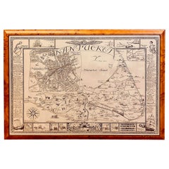
Vintage Map of Nantucket Town by Ruth Haviland Sutton, 1946
Located in Nantucket, MA
Vintage Map of Nantucket Town by Ruth Haviland Sutton, 1946, a classic vintage tourist map of Nantucket Island showing historic landmarks and geogr...
Category
1940s Other Vintage American Maps
Materials
Paper
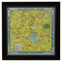
1948 "A Hysterical Map of Yellowstone National Park" by Jolly Lindgren, 2nd Ed.
Located in Colorado Springs, CO
Presented is a second edition printing of Jolly Lindgren’s “Hysterical Map of Yellowstone National Park.” This comical pictorial map highlights the famous Yellowstone National Park. ...
Category
1940s Vintage American Maps
Materials
Paper
Related Items
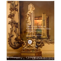
Collection of Evelyn Annenberg Hall, 640 Park Ave Christie's, NY, 2006, 1st Ed
Located in valatie, NY
Collection of Evelyn Annenberg Hall from 640 Park Ave: Christie's, New York, 17 May, 2006. Louis XIV, XV and XVI Furniture, Chinese Porcelains, 18th & 19th c bronzes, antique rugs an...
Category
Early 2000s American Maps
Materials
Paper
H 10.5 in W 8.25 in D 0.5 in
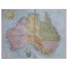
Large Original Vintage Map of Australia, circa 1920
Located in St Annes, Lancashire
Great map of Australia
Original color. Good condition
Published by Alexander Gross
Unframed.
Category
1920s Vintage American Maps
Materials
Paper
Forest Park Letter Pressed Map with Embossed Trails in Salvaged Fir Frame
Located in Portland, OR
Beautiful Minimalist limited edition letter pressed topographic map of Portland's Forest Park with gold embossed hiking and running trails by designer Allison Bryan. Forest Park is on of the United State's largest urban forest reserves, and was developed by landscape designers John Charles Olmsted and his brother Frederick Law Olmsted...
Category
2010s Organic Modern American Maps
Materials
Fir
Antique Map of Russia by N. Sanson, 1705
Located in Langweer, NL
A strongly engraved map of European Russia showing its political divisions, major topographical features, cities and towns. Extends to the Sea of Azov and the tip of the Caspian Sea ...
Category
Early 18th Century Antique American Maps
Materials
Paper
Japanese Puzzle Bank Portrays A Building Bank "National Savings Bank" Circa 1948
Located in Incline Village, NV
Quite an unusual piece for bank collectors or just for those seeking a unique collectible. This is a coin bank made of all wood; walnut and inlay here and there with a green painted ...
Category
1940s Folk Art Vintage American Maps
Materials
Wood
H 4.25 in W 4.5 in D 3 in
Coronation Plate Queen Elizabeth II June 2nd 1953 Burleigh Ware Burslem England
Located in North Hollywood, CA
Coronation Plate Queen Elizabeth II June 2nd 1953 Burleigh Ware Burslem England.
Beautiful plate commemorating the Coronation of Her Majesty Queen E...
Category
Late 20th Century Elizabethan American Maps
Materials
Porcelain
Large Original Vintage Map of Mexico, circa 1920
Located in St Annes, Lancashire
Great map of Mexico
Original color.
Good condition
Published by Alexander Gross
Unframed.
Category
1920s Edwardian Vintage American Maps
Materials
Paper
1970s Vintage Town and Country Surfboard by Ed Angulo
Located in Haleiwa, HI
1979 Town & Country surfboard made by Ed Angulo. Features a gorgeous red tinted deck/rails with dual T&C laminates and boxed single fin setup. A remarkable example of a 1970s surfboard made under the iconic Town and Country surfboards...
Category
1970s Vintage American Maps
Materials
Fiberglass, Foam, Softwood
1990s Vintage Town & Country shortboard by Ned McMann
Located in Haleiwa, HI
1994 Town & Country (T&C) surfboard shaped by Ned McMann. Features uncommon Hawaiiana T&C logos with matching artwork along the rails. Glassed-on thruster (tri-fins). Comes with the original Town & Country surfboard sock and leg leash. A superb example of a well cared for vintage surfboard in original condition, shaped under the iconic Town & Country surfboards label.
Town & Country Surf Designs (also known as T&C) is a world famous manufacturer of surfboards. T&C started in 1971 with a single store founded by Craig Sugihara in Pearl City, Hawaii. T&C would later expand into a world recognized brand featuring a full line of surf wear and accessories with retail stores across the globe, in countries such as Australia, Japan, and Brazil. The golden age for T&C was the 1980s. During this time, team riders Christian...
Category
1990s American Maps
Materials
Fiberglass, Foam
National Gallery of Art, Washington by John Walker
Located in valatie, NY
National Gallery of Art, Washington by John Walker. Published by Harry N. Abrams Incorporated, New York, NY, 1975. Hardcover with dust jacket. Director Eme...
Category
1970s Vintage American Maps
Materials
Paper
The Illustrated Map of the Var Department from the Atlas National Illustré, 1856
Located in Langweer, NL
This original hand-colored map is from the "Atlas National Illustré," a work by Victor Levasseur, a French geographer and cartographer known for his richly illustrated maps.
The map...
Category
1850s Antique American Maps
Materials
Paper
H 14.18 in W 20.87 in D 0 in
Large Original Vintage Map of Italy, circa 1920
Located in St Annes, Lancashire
Great map of Italy.
Original color. Good condition.
Published by Alexander Gross.
Unframed.
Category
1920s Vintage American Maps
Materials
Paper
Previously Available Items
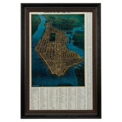
1945, "Supervue of New York City"
Located in Colorado Springs, CO
This bird’s eye view of New York City was published in 1945 by the Supervue Map and Guide Organization. The map shows the roads and major points of interest, which, coupled with a detailed index surrounding the map, helped tourists locate key attractions, historical sites, steamship piers, parks and squares, and bridges.
The map was originally issued folded into printed paper covers with black and white photographic images of the city. On the verso of the map are small black and white maps...
Category
1940s Vintage American Maps
Materials
Paper
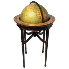
Vintage World Globe on Mahogany Stand
Located in Lambertville, NJ
Handsome Scholarly world globe with a Regency style mahogany base. The globe is 16 inches in diameter, circa 1940, Chicago. Perfect addition to a library or study.
Category
1940s Regency Vintage American Maps
Materials
Mahogany
"Geographically Correct Map of the United States" Vintage Map, circa 1940
Located in Colorado Springs, CO
This large map of the United States was issued by Rand McNally and Company on behalf of the Union Pacific Railroad. The map embraces the whole of the United States, illustrating the ...
Category
1940s Vintage American Maps
Materials
Paper
1948 Official "Texas Brags" Vintage Map of North America
Located in Colorado Springs, CO
This is a uniquely Texas-centered, tongue-in-cheek map of the United States, published in 1948. The map reflects a massive Texas, prominently occupying the center and south of the United States, with all other states squeezed to the northeast and northwest. In fact, the Northeastern states are humorously shown as "unannexed territory" and the western states as "ceded territory."
The map is populated with decorative accents and colorful, humorous pictographs. They include a tornado, called "interpanhandle wheat harvester", the “orneriest rattlesnakes", and a rodeo cowboy described as “the man that couldn't be throw'd and the horse that couldn't be rode." The pictographs boast the best of everything in Texas: "prickliest pears," "most cantankerous coyotes," “unloansome pines,” and similar. Along the border illustrations are depictions of Texas life and history, including The Alamo and San Jacinto Monument as well as more modern skyscrapers. The map is drawn to a scale of “1 inch = 5 Texas Grapefruit.”
The map was published in Texas by John Randolph with Mark Storm...
Category
1940s Vintage American Maps
Materials
Paper
Framed New York Central Railway Map Original from 1943 with Railway Label
By Baker, Jones, Hausauer, Inc. 1
Located in Ottawa, Ontario
Framed New York Central Railway Map Original from 1943 With Railway Label, The map is by Baker, Jones, Hausauer, Inc. Buffalo, N.Y. The map covers all line...
Category
1940s Mid-Century Modern Vintage American Maps
Materials
Paper
H 26.5 in W 41 in D 0.75 in
Weber Costello Deco Airplane Base Black Oceans Globe
Located in Highland, IN
One of the most dynamic and desirable vintage globe designs, this wonderful piece has the striking black oceans and a chrome base in the form of a stylized airplane. It is in very go...
Category
1940s Art Deco Vintage American Maps
Materials
Stainless Steel, Chrome
World Map
Located in Surrey, BC
Large world map, mfg by the Rand McNally Co, Chicago showing political areas.
Category
1940s Vintage American Maps
Materials
Paper, Wood
Military Teaching Globe
Located in Los Angeles, CA
20th c. military teaching globe with chalk board continents
Category
1940s Vintage American Maps
Materials
Brass, Iron
Recently Viewed
View AllMore Ways To Browse
Greek Asia Minor
Antique Maps Canada
Antique Map Canada
Canada Antique Map
West Indies Map
Antique Portuguese Plates
Map Huge
Antique Maps Of Canada
Bali Map
Antique Map South Africa
Antique Map Of South Africa
South Africa Antique Map
Map Of West Indies
Belgium Army
Sweden Antique Map
Belgian Army
Cornelius Company
Antique Nautical Maps
