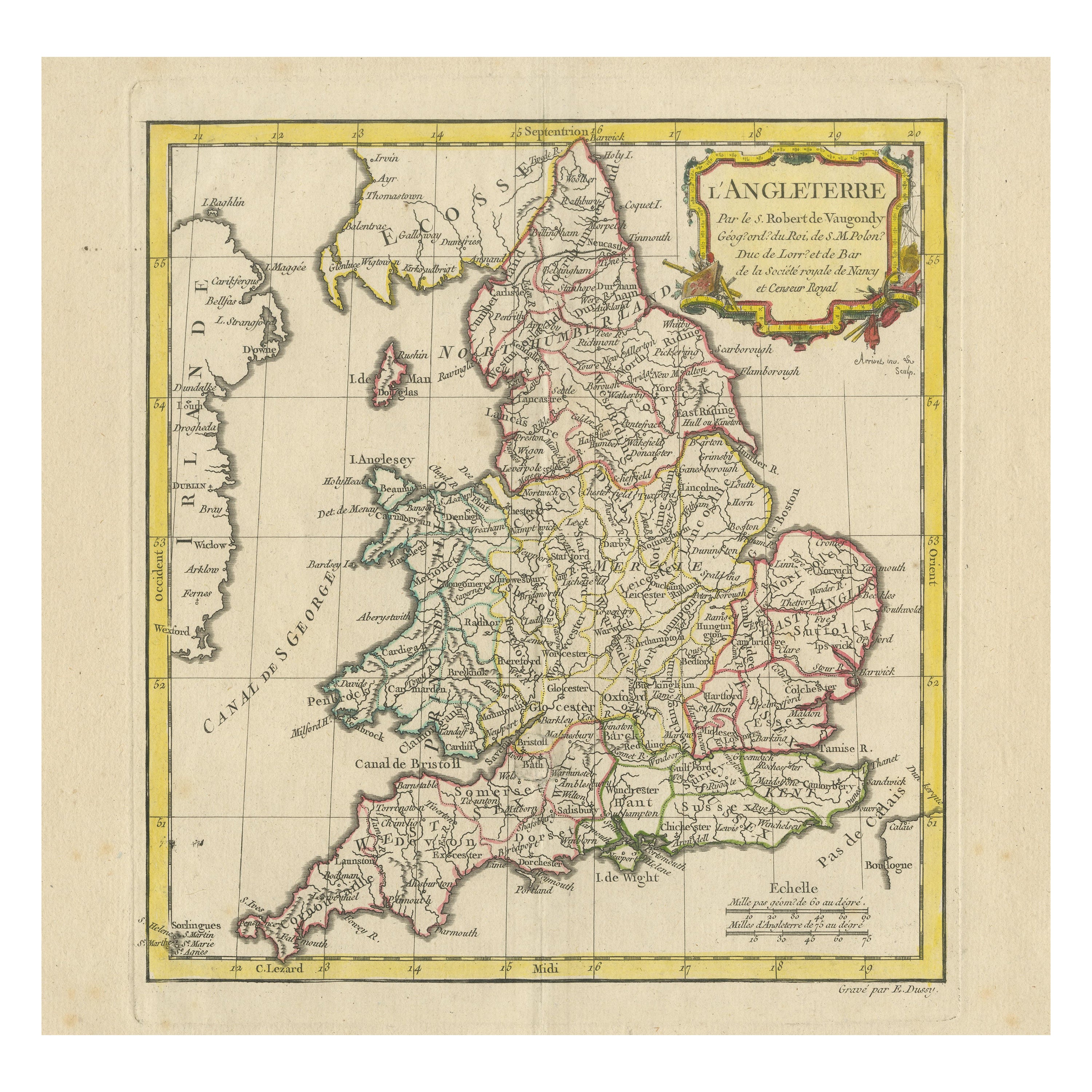
Original Antique Map of the North of England. H.Moll. Dated, 1700
View Similar Items


Want more images or videos?
Request additional images or videos from the seller
1 of 5
Original Antique Map of the North of England. H.Moll. Dated, 1700
About the Item
- Dimensions:Height: 13.5 in (34.29 cm)Width: 15.75 in (40.01 cm)Depth: 0.07 in (1.78 mm)
- Style:Other (In the Style Of)
- Materials and Techniques:Paper,Other
- Place of Origin:
- Period:1700-1709
- Date of Manufacture:1700
- Condition:Wear consistent with age and use.
- Seller Location:St Annes, GB
- Reference Number:1stDibs: LU1836332760442
About the Seller
4.9
Platinum Seller
Premium sellers with a 4.7+ rating and 24-hour response times
1stDibs seller since 2016
3,087 sales on 1stDibs
Typical response time: 1 hour
Associations
International Confederation of Art and Antique Dealers' Associations
Authenticity Guarantee
In the unlikely event there’s an issue with an item’s authenticity, contact us within 1 year for a full refund. DetailsMoney-Back Guarantee
If your item is not as described, is damaged in transit, or does not arrive, contact us within 7 days for a full refund. Details24-Hour Cancellation
You have a 24-hour grace period in which to reconsider your purchase, with no questions asked.Vetted Professional Sellers
Our world-class sellers must adhere to strict standards for service and quality, maintaining the integrity of our listings.Price-Match Guarantee
If you find that a seller listed the same item for a lower price elsewhere, we’ll match it.Trusted Global Delivery
Our best-in-class carrier network provides specialized shipping options worldwide, including custom delivery.More From This Seller
View AllOriginal Antique Map of Switzerland, Engraved By Barlow, Dated 1807
Located in St Annes, Lancashire
Great map of Switzerland
Copper-plate engraving by Barlow
Published by Brightly & Kinnersly, Bungay, Suffolk.
Dated 1807
Unframed.
Category
Antique Early 1800s English Maps
Materials
Paper

Original Antique Map of The World by Thomas Clerk, 1817
Located in St Annes, Lancashire
Great map of The Eastern and Western Hemispheres
On 2 sheets
Copper-plate engraving
Drawn and engraved by Thomas Clerk, Edinburgh.
Published by Mackenzie And Dent, 1817
...
Category
Antique 1810s English Maps
Materials
Paper

Original Antique Map of Ancient Greece, Achaia, Corinth, 1786
Located in St Annes, Lancashire
Great map of Ancient Greece. Showing the region of Thessaly, including Mount Olympus
Drawn by J.D. Barbie Du Bocage
Copper plate engraving by P.F Tardieu
Original hand color...
Category
Antique 1780s French Other Maps
Materials
Paper

Original Antique Map of Spain and Portugal, circa 1790
Located in St Annes, Lancashire
Super map of Spain and Portugal
Copper plate engraving by A. Bell
Published, circa 1790.
Unframed.
Category
Antique 1790s English Other Maps
Materials
Paper

Original Antique Map of Ancient Greece- Boeotia, Thebes, 1787
Located in St Annes, Lancashire
Great map of Ancient Greece. Showing the region of Boeotia, including Thebes
Drawn by J.D. Barbie Du Bocage
Copper plate engraving by P.F T...
Category
Antique 1780s French Other Maps
Materials
Paper

Original Antique Map of Ireland- Kerry. C.1840
Located in St Annes, Lancashire
Great map of Kerry
Steel engraving
Drawn under the direction of A.Adlard
Published by How and Parsons, C.1840
Unframed.
Category
Antique 1840s English Maps
Materials
Paper

You May Also Like
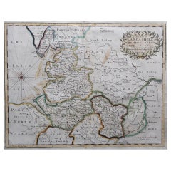
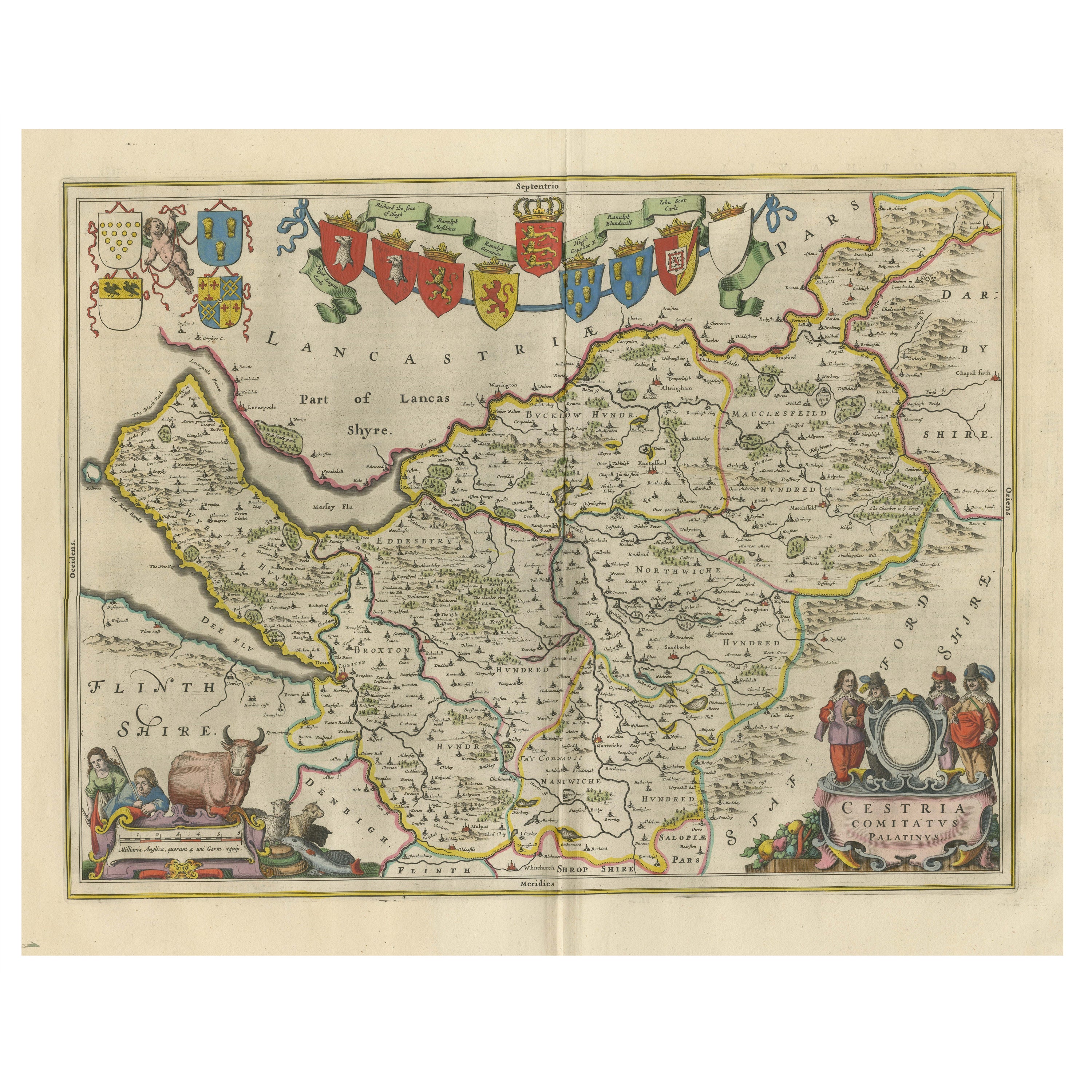
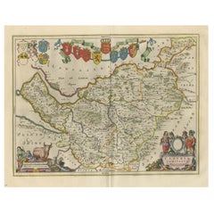
Antique Map of Cheshire, North West England
By Joan (Johannes) Blaeu
Located in Langweer, NL
Antique map titled 'Cestria comitatus Palatinus'. Original old map of Cheshire, Northwest England. Published circa 1665 by J. Blaeu. Willem Jansz. Blaeu and his son Joan Blaeu are th...
Category
Antique Mid-17th Century Maps
Materials
Paper
$1,116 Sale Price
20% Off
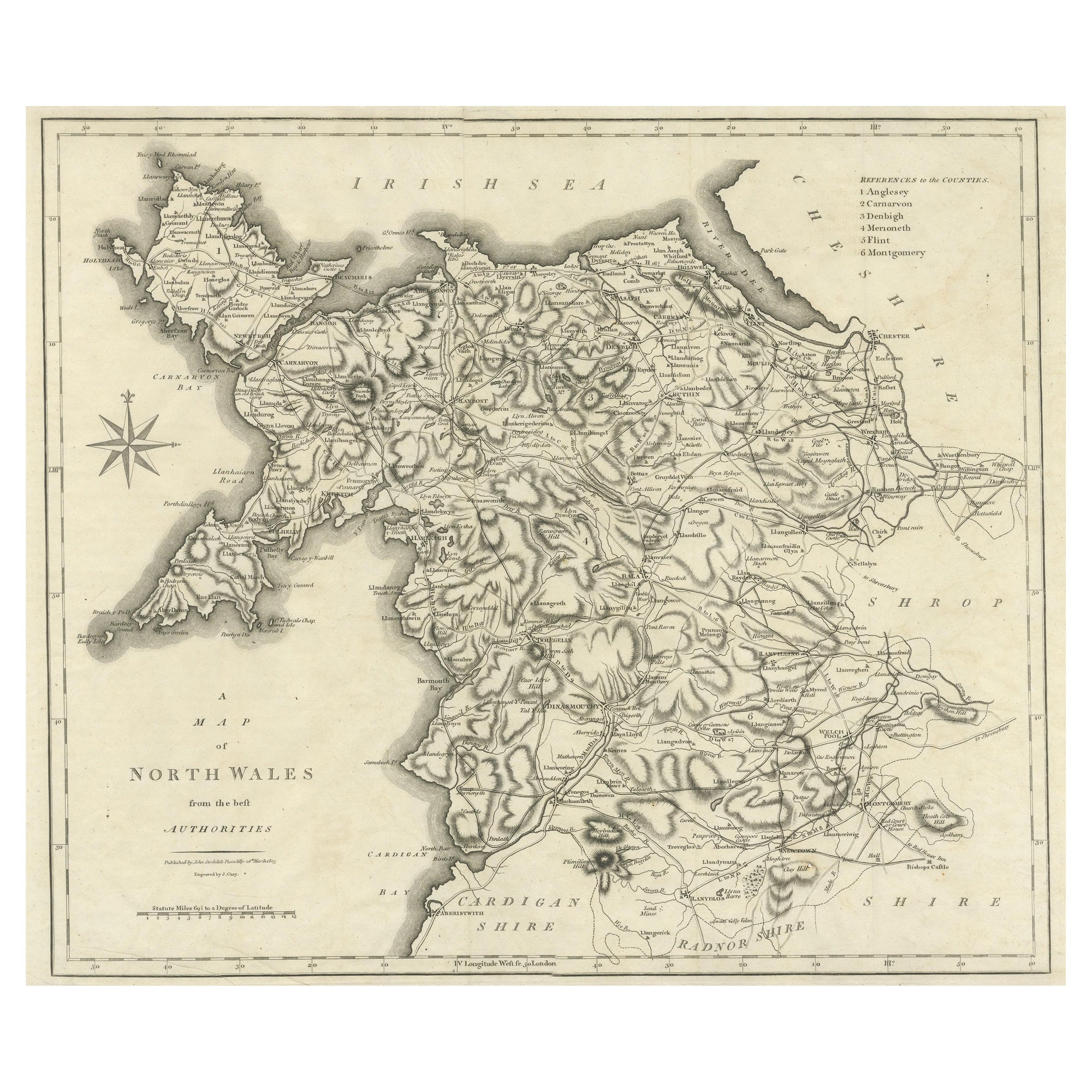
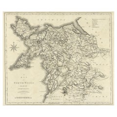
Large Antique County Map of North Wales, England
Located in Langweer, NL
Antique map titled 'A Map of North Wales from the best Authorities'. Original old county map of North Wales, England. Engraved by John Cary. Originates from 'New British Atlas' by Jo...
Category
Antique Early 19th Century Maps
Materials
Paper
$167 Sale Price
20% Off
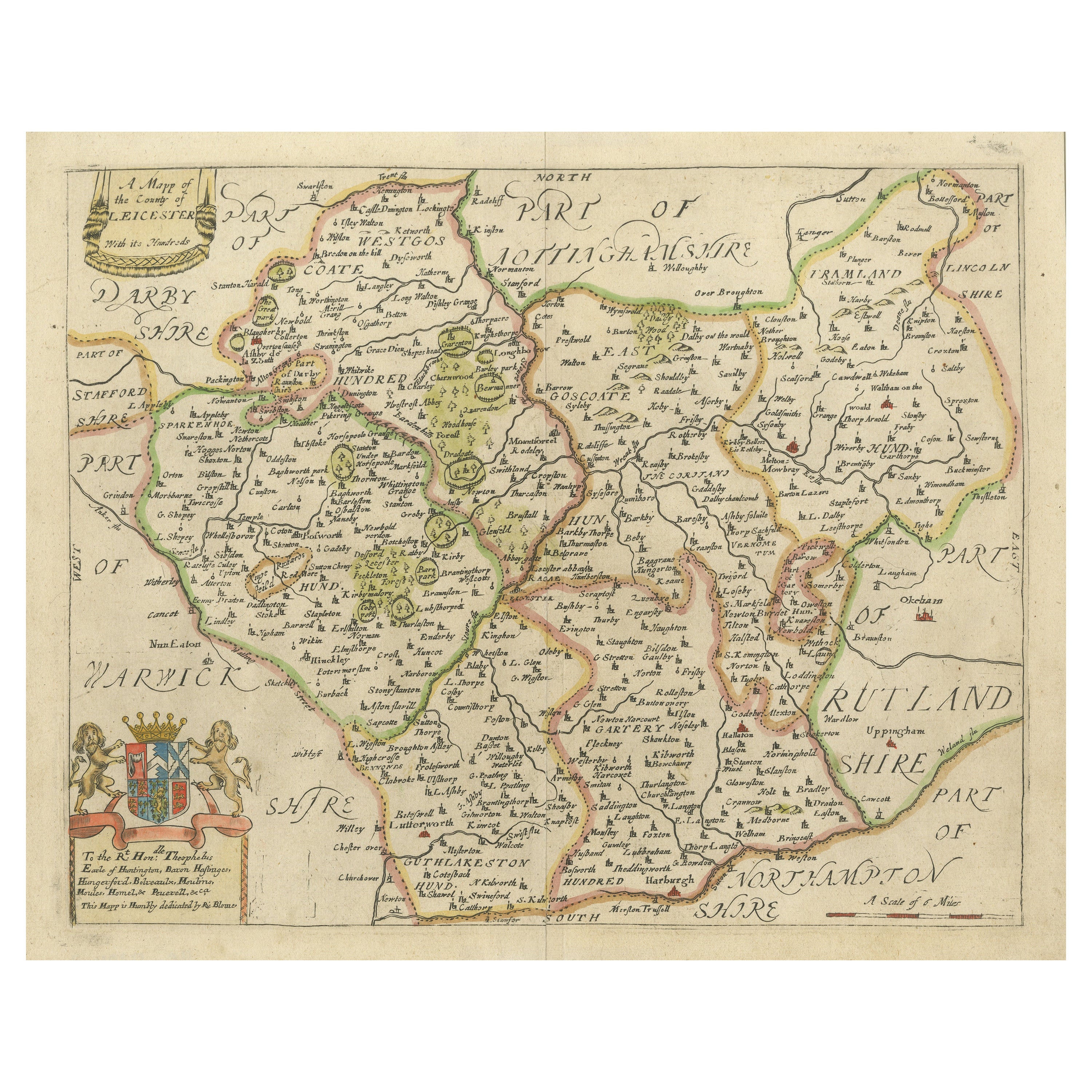
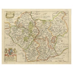
Original Antique Map of Leicestershire, England
Located in Langweer, NL
Antique map titled 'A Mapp of the Country of Leicester'. Original old map of Leicestershire, England. This map originates from 'Britannia: or, a Geographical Description of the Kingd...
Category
Antique Late 17th Century Maps
Materials
Paper
$409 Sale Price
20% Off
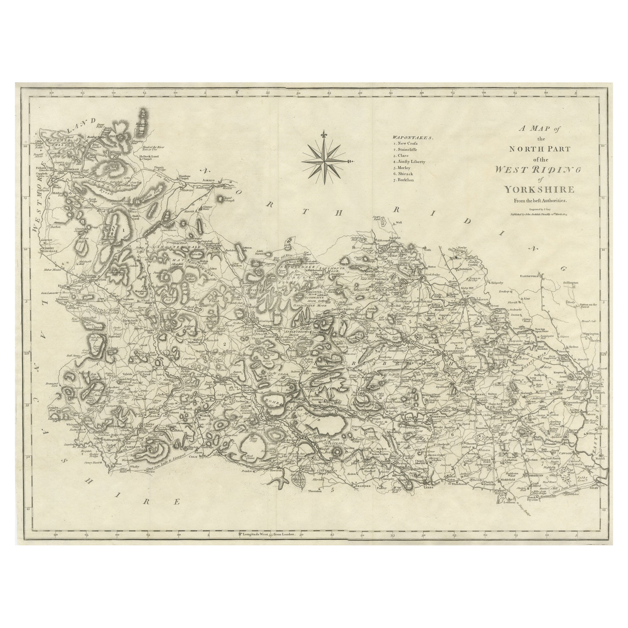
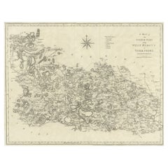
Large Antique County Map of the West Riding of Yorkshire 'North Part', England
Located in Langweer, NL
Antique map titled 'A Map of the North Part of the West Riding of Yorkshire from the best Authorities'. Original old county map of the north part of the West Riding of Yorkshire, Eng...
Category
Antique Early 19th Century Maps
Materials
Paper
$260 Sale Price
20% Off
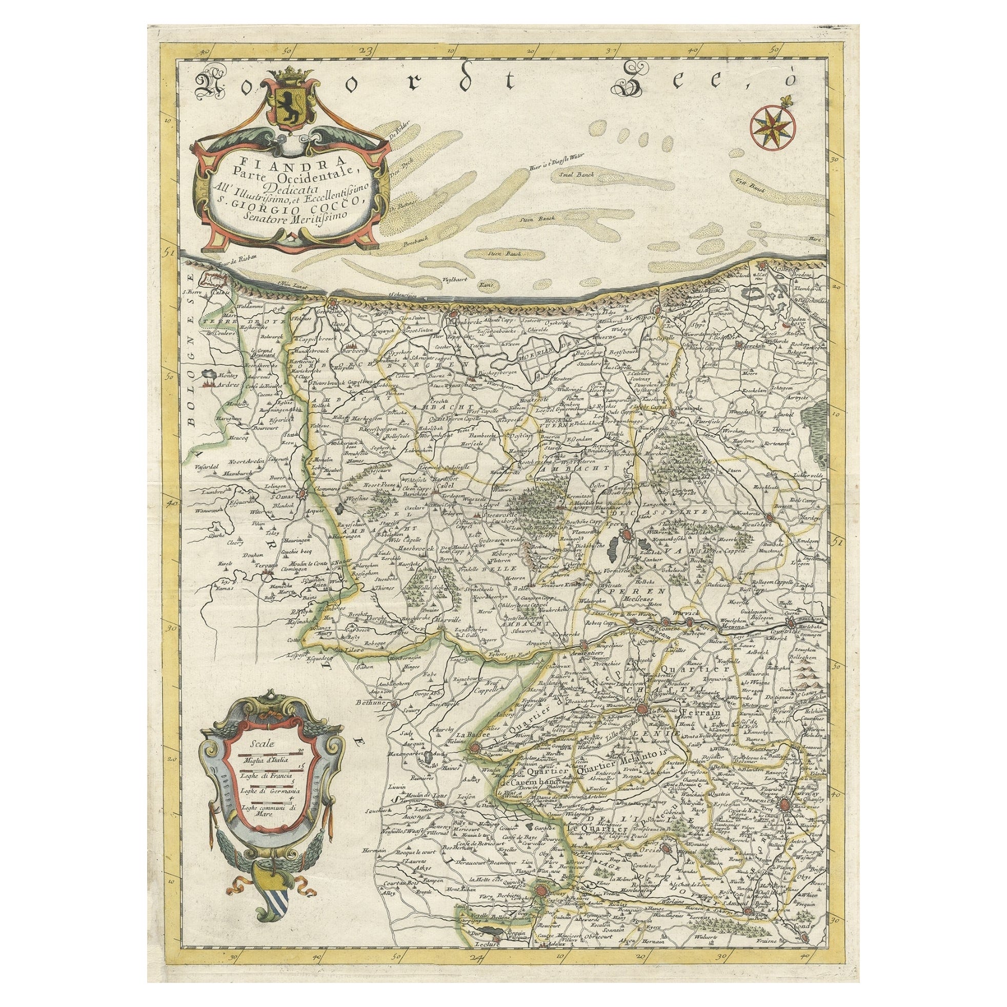
Decorative Original Antique Map of the North of Flanders, Belgium, 1697
Located in Langweer, NL
Antique map titled 'Fiandra Parte Occidentale (..)'.
Depicts northern part of Flanders, from North Sea, extends through the northern region of France to the cities of Douai and V...
Category
Antique 1690s Maps
Materials
Paper
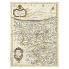
$855 Sale Price
20% Off
Original Antique Map of England and Wales
Located in Langweer, NL
Antique map titled 'A New and Correct Map of England and Wales from the Latest and Best Improvements'. Original antique map of England and Wales. Printed by Alex Hogg, London for George Henry Millar's 'New, Complete and Universal System...
Category
Antique Late 18th Century Maps
Materials
Paper

$223 Sale Price
20% Off