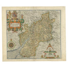
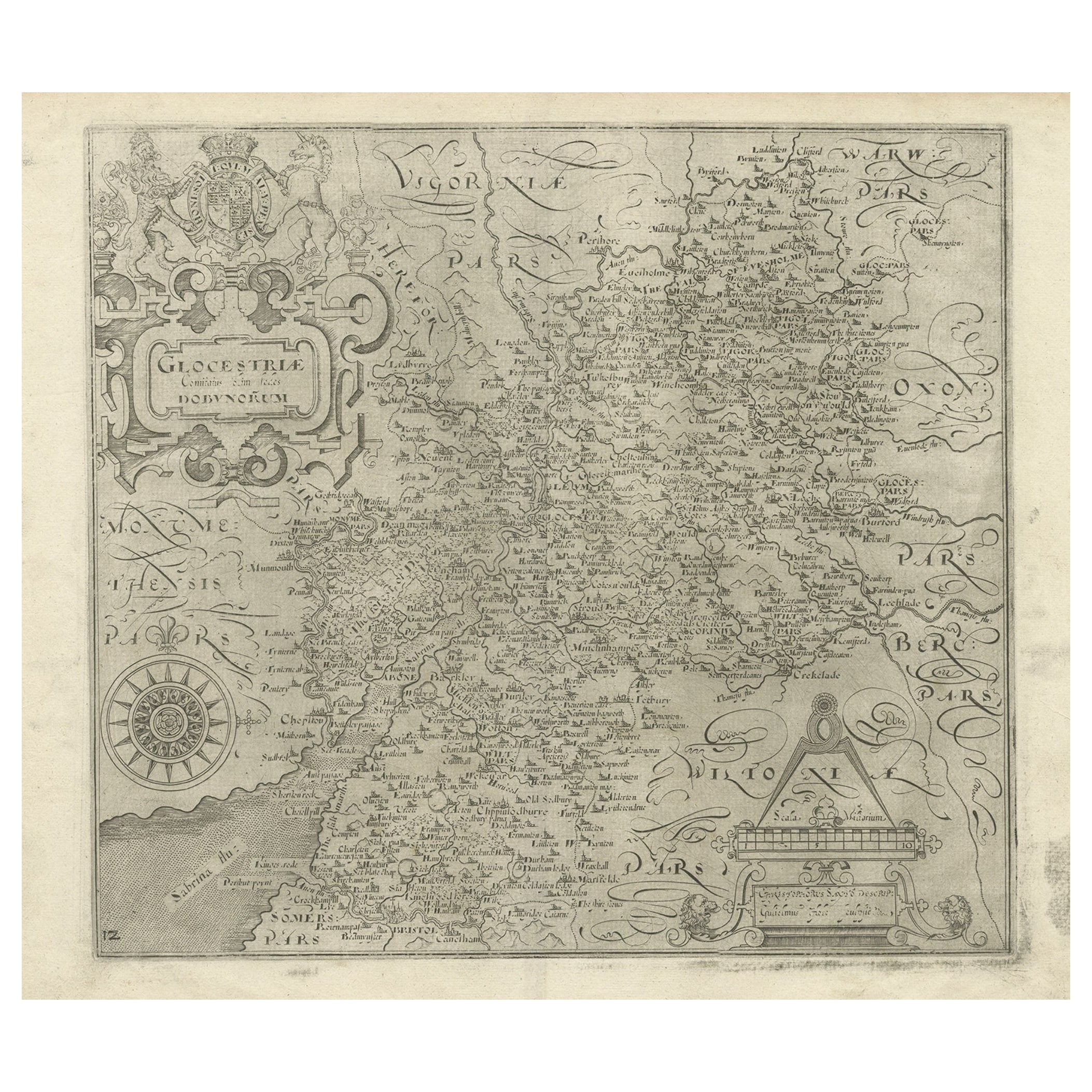
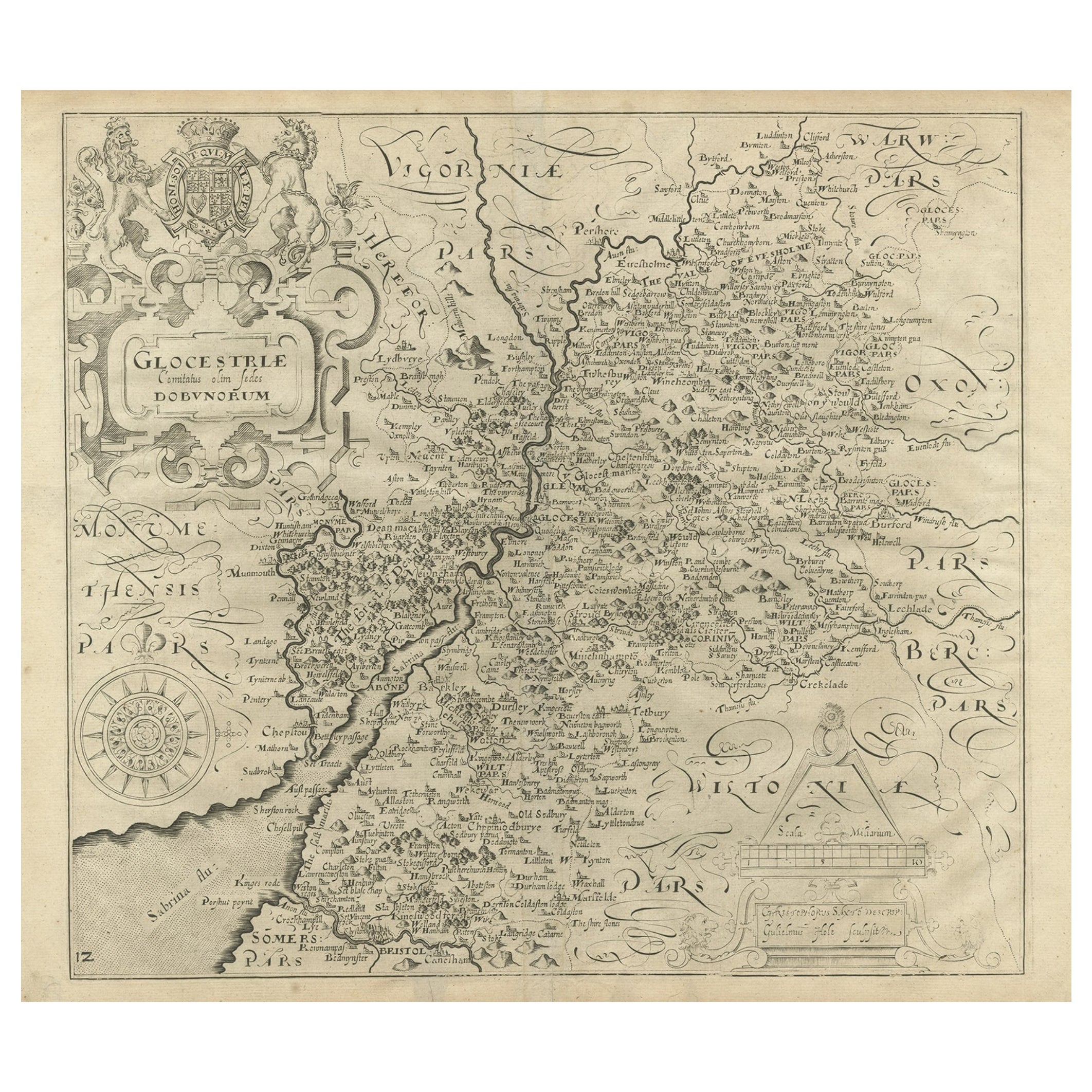
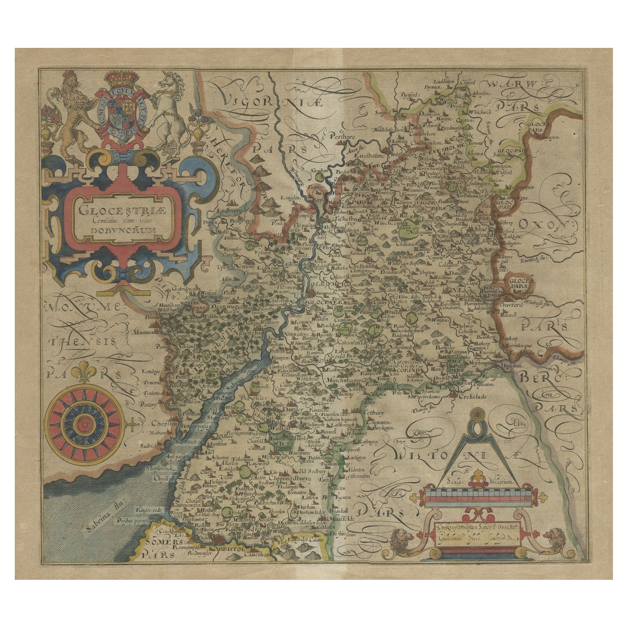
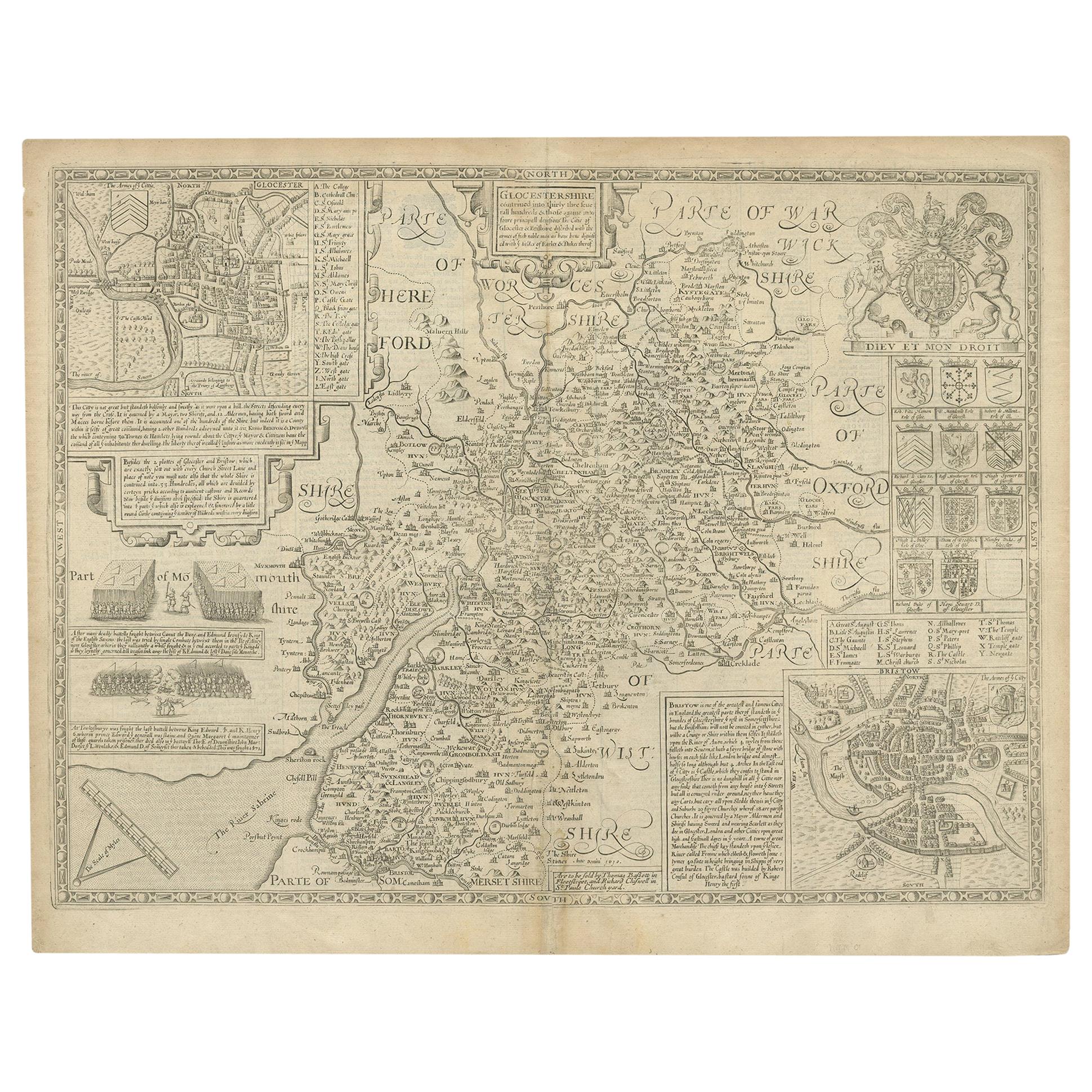
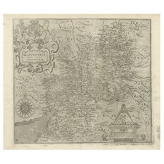
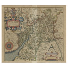
Original Antique Map with Rich Decorations of Gloucestershire, England, c.1637
View Similar Items


Want more images or videos?
Request additional images or videos from the seller
1 of 5
Original Antique Map with Rich Decorations of Gloucestershire, England, c.1637
About the Item
- Dimensions:Height: 12.6 in (32 cm)Width: 14.57 in (37 cm)Depth: 0 in (0.01 mm)
- Materials and Techniques:
- Period:
- Date of Manufacture:circa 1637
- Condition:
- Seller Location:Langweer, NL
- Reference Number:Seller: BG-12705-261stDibs: LU3054326283252
About the Seller
5.0
Platinum Seller
These expertly vetted sellers are 1stDibs' most experienced sellers and are rated highest by our customers.
Established in 2009
1stDibs seller since 2017
1,938 sales on 1stDibs
More From This SellerView All
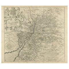
- Antique Copper Engraved Map of Gloucestershire in England, 1637Located in Langweer, NLAntique map titled 'Glocestriae comitatus olim sedes Dobunorum'. Map of Gloucestershire, England. This map originates from Camden?s 'Britannia' ...Category
Antique 17th Century Maps
MaterialsPaper
- Antique Map of Gloucestershire in Britain by Camden, 1637Located in Langweer, NLAntique map titled 'Glocestriae comitatus olim sedes Dobunorum'. Map of Gloucestershire, England. This map originates from Camden?s 'Britannia' ...Category
Antique 17th Century Maps
MaterialsPaper
 $315 Sale Price20% Off
 - Antique Map of Gloucestershire by Camden, c.1607Located in Langweer, NLAntique map titled 'Glocestriae comitatus olim sedes Dobunorum'. Map of Gloucestershire, England. This map originates from Camden?s 'Britannia' ...Category
Antique 17th Century Maps
MaterialsPaper
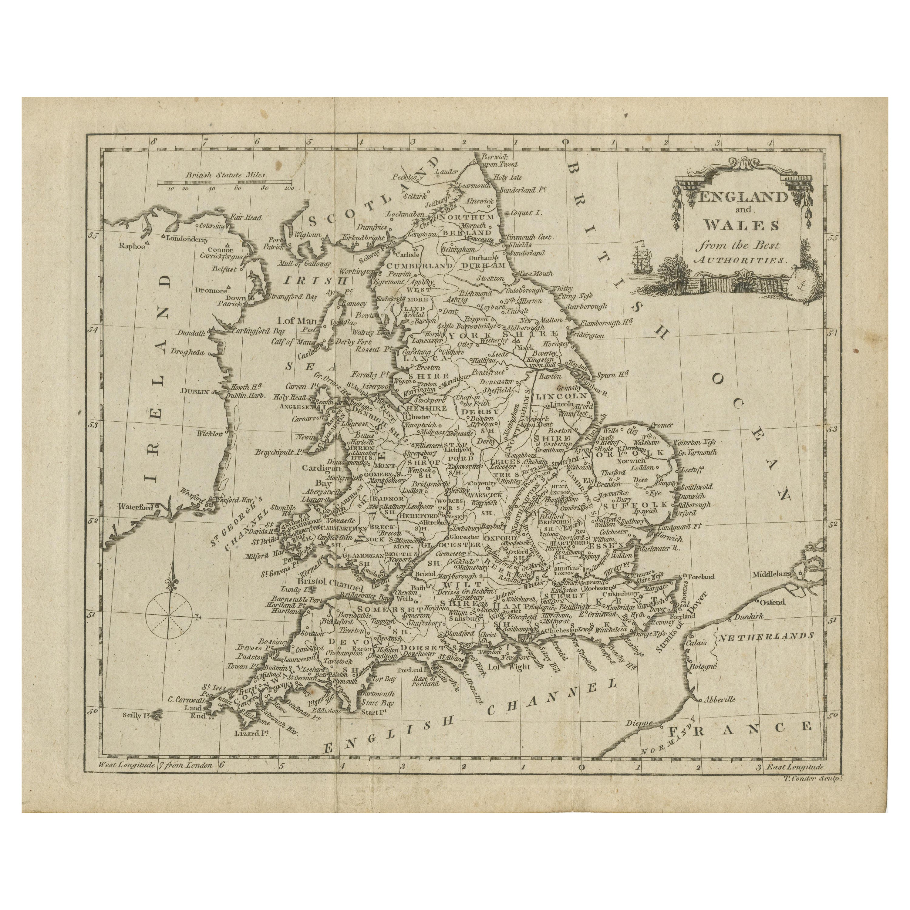
- Original Antique Map of England with Hand ColoringLocated in Langweer, NLAntique map titled 'Engand'. Original old map of England. Engraved by W. Milton. Published by John Mc. Gowan, circa 1829.Category
Antique Mid-19th Century Maps
MaterialsPaper
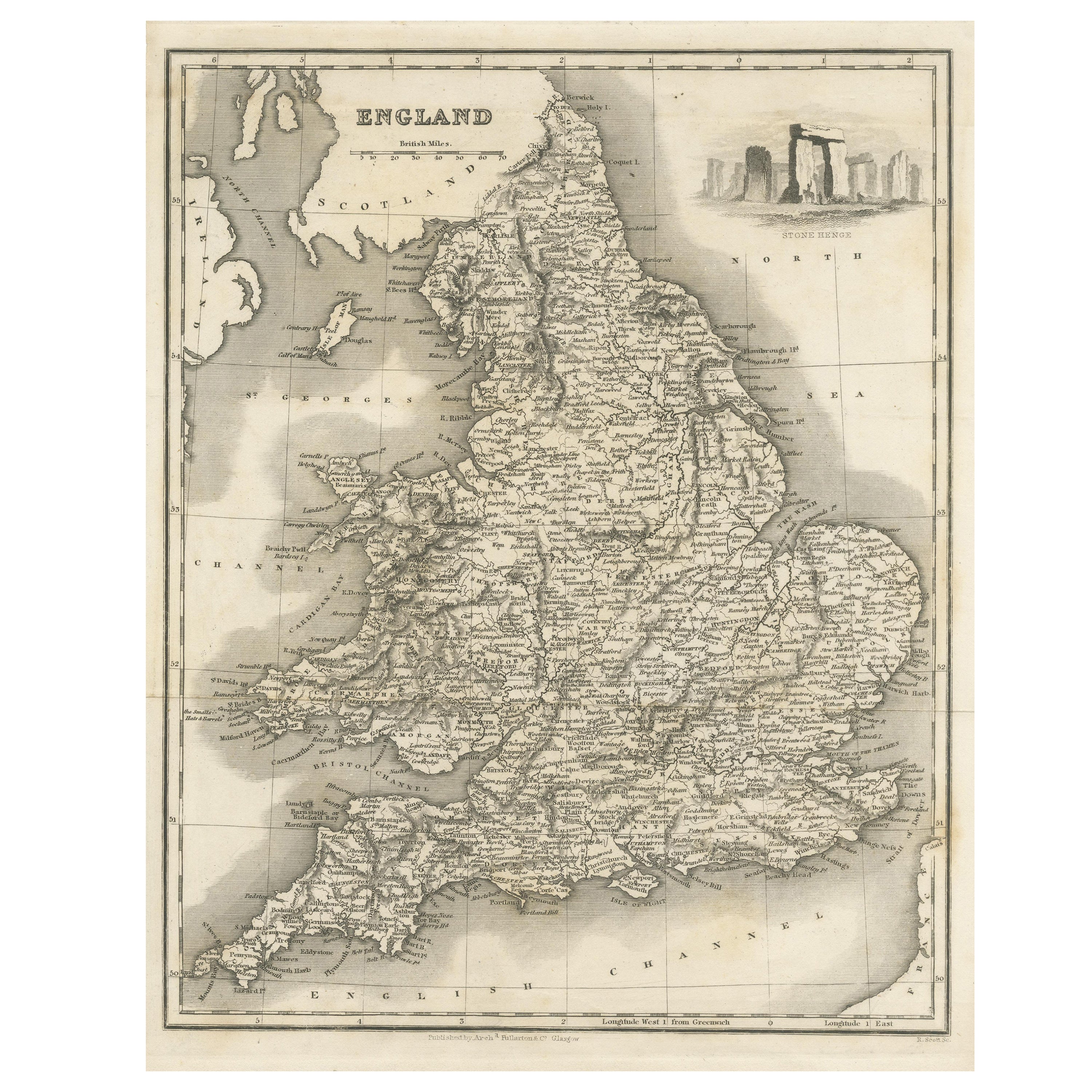
- Original Antique Map of England with Outline ColoringLocated in Langweer, NLAntique map titled 'Angleterre'. Original old map of England with outline coloring. Source unknown, to be determined. Published circa 1830.Category
Antique Mid-19th Century Maps
MaterialsPaper
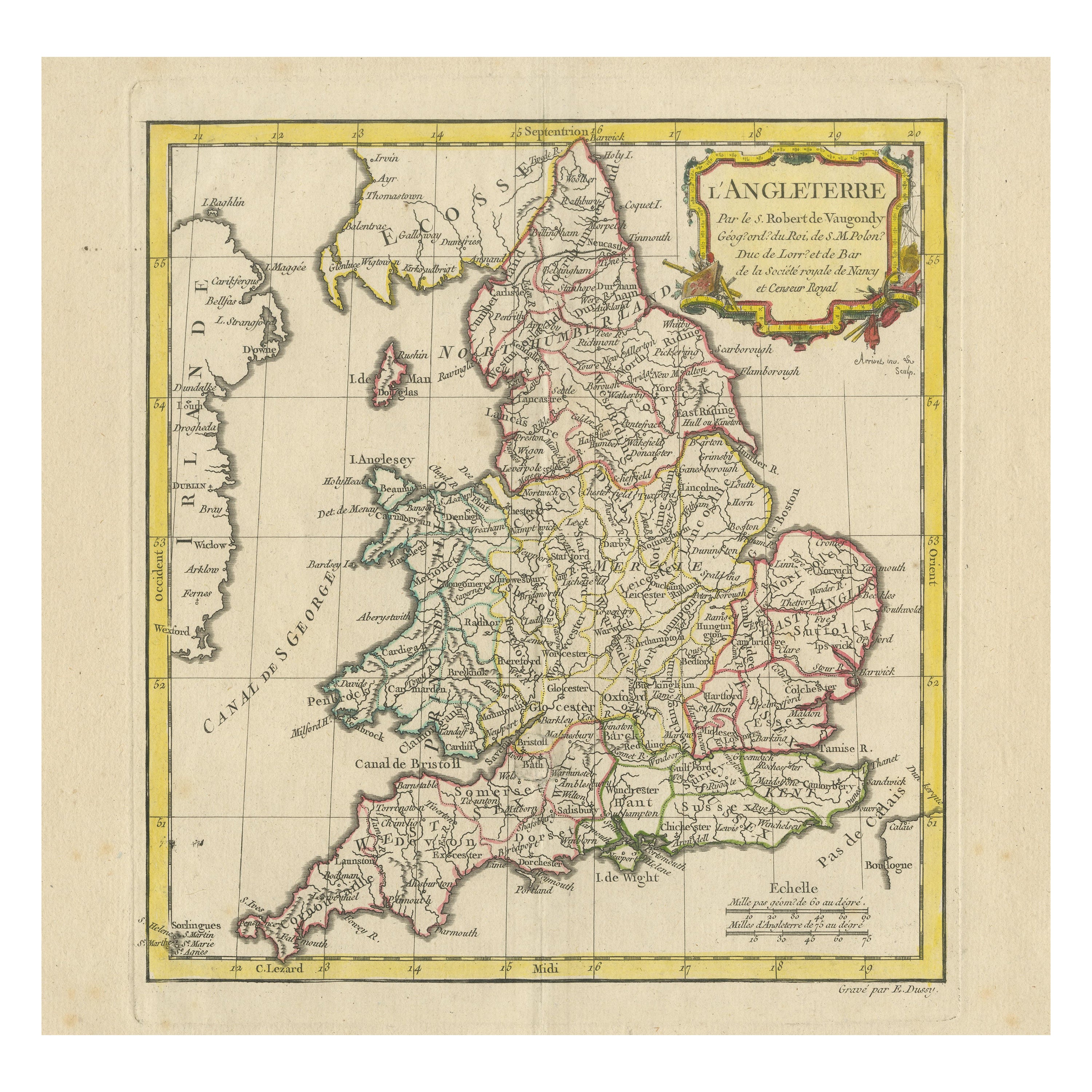
- Original Antique Map of England with Decorative CartoucheLocated in Langweer, NLAntique map titled 'l'Angleterre (..)'. Original antique map of England, with beautiful hand coloring and decorative cartouche. This map originates from 'Nouvel Atlas Portatif destin...Category
Antique Late 18th Century Maps
MaterialsPaper


You May Also Like
- Old Horizontal Map of EnglandBy TassoLocated in Alessandria, PiemonteST/520 - Old rare Italian map of England, dated 1826-1827 - by Girolamo Tasso, editor in Venise, for the atlas of M.r Le-Sage.Category
Antique Early 19th Century Italian Other Prints
MaterialsPaper
 $236 Sale Price20% Off
 - Original Antique Map of Italy. C.1780Located in St Annes, LancashireGreat map of Italy Copper-plate engraving Published C.1780 Unframed.Category
Antique Early 1800s English Georgian Maps
MaterialsPaper

- Original Antique Map of Asia. C.1780Located in St Annes, LancashireGreat map of Asia Copper-plate engraving Published C.1780 Two small worm holes to right side of map Unframed.Category
Antique Early 1800s English Georgian Maps
MaterialsPaper

- Original Antique Map of India. C.1780Located in St Annes, LancashireGreat map of India Copper-plate engraving Published C.1780 Three small worm holes to right side of map and one bottom left corner Unframed.Category
Antique Early 1800s English Georgian Maps
MaterialsPaper

- Original Antique Map of China, Arrowsmith, 1820Located in St Annes, LancashireGreat map of China Drawn under the direction of Arrowsmith Copper-plate engraving Published by Longman, Hurst, Rees, Orme and Brown, 1820 Unfr...Category
Antique 1820s English Maps
MaterialsPaper

- Original Antique Map of Canada, Arrowsmith, 1820Located in St Annes, LancashireGreat map of Canada. Drawn under the direction of Arrowsmith. Copper-plate engraving. Published by Longman, Hurst, Rees, Orme and Brown, 1820 ...Category
Antique 1820s English Maps
MaterialsPaper

Recently Viewed
View AllMore Ways To Browse
Galicia Map
Santa Cruz Solomon Islands
Antique Maps Sumatra
Original Antique Map Of World
Georg Barque
F V Hayden
Dirk Hartog
Serbia Map
Maps Rochester
Yorkshire Ridings Map
Antique Wisconsin Maps
Carte Egypte Antique
Charlotte Reine
Idaho Map
Warwickshire Antique Map
Antique Furniture Manitoba
Auge En Pierre
Antique Map Bermuda