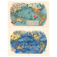
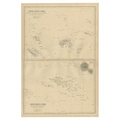
Pair of Miguel Covarrubias Pacific Maps, 1939
View Similar Items


1 of 10
Pair of Miguel Covarrubias Pacific Maps, 1939
About the Item
- Creator:Miguel Covarrubias (Artist)
- Dimensions:Height: 21.5 in (54.61 cm)Width: 34 in (86.36 cm)Depth: 0.01 in (0.26 mm)
- Materials and Techniques:
- Place of Origin:
- Period:
- Date of Manufacture:1939
- Condition:Wear consistent with age and use. original center crease in Fauna and Flora.
- Seller Location:New York, NY
- Reference Number:Seller: 163522/6661stDibs: LU138224302023
You May Also Like
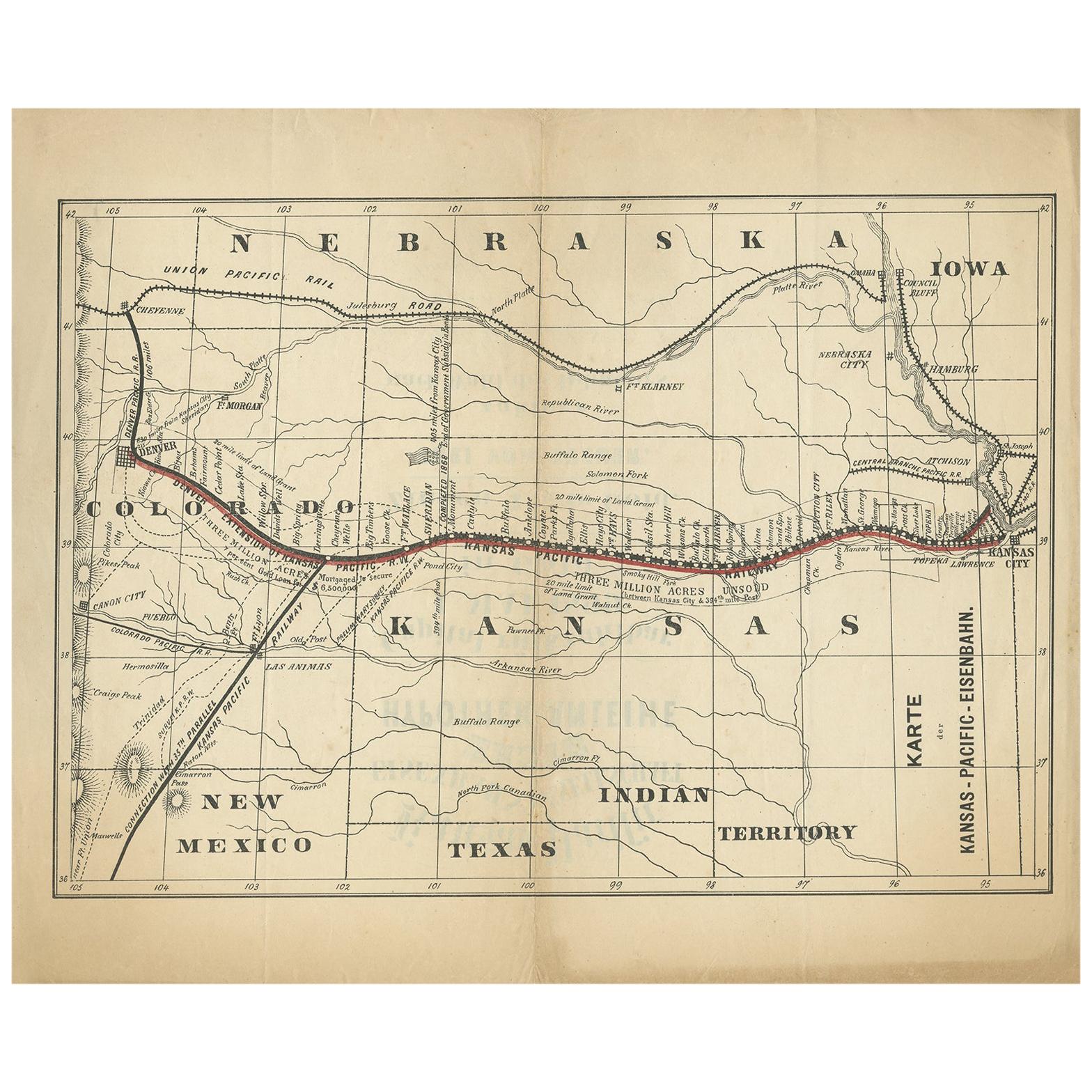
- Antique Map of the Kansas Pacific Railroad, circa 1900Located in Langweer, NLAntique map titled 'Karte der Kansas-Pacific-Eisenbahn'. Lithographed map of the Kansas Pacific railroad. German text on verso which reads 'Kansas Pacific Eisenbahn Gesellschaft erst...Category
Early 20th Century Maps
MaterialsPaper
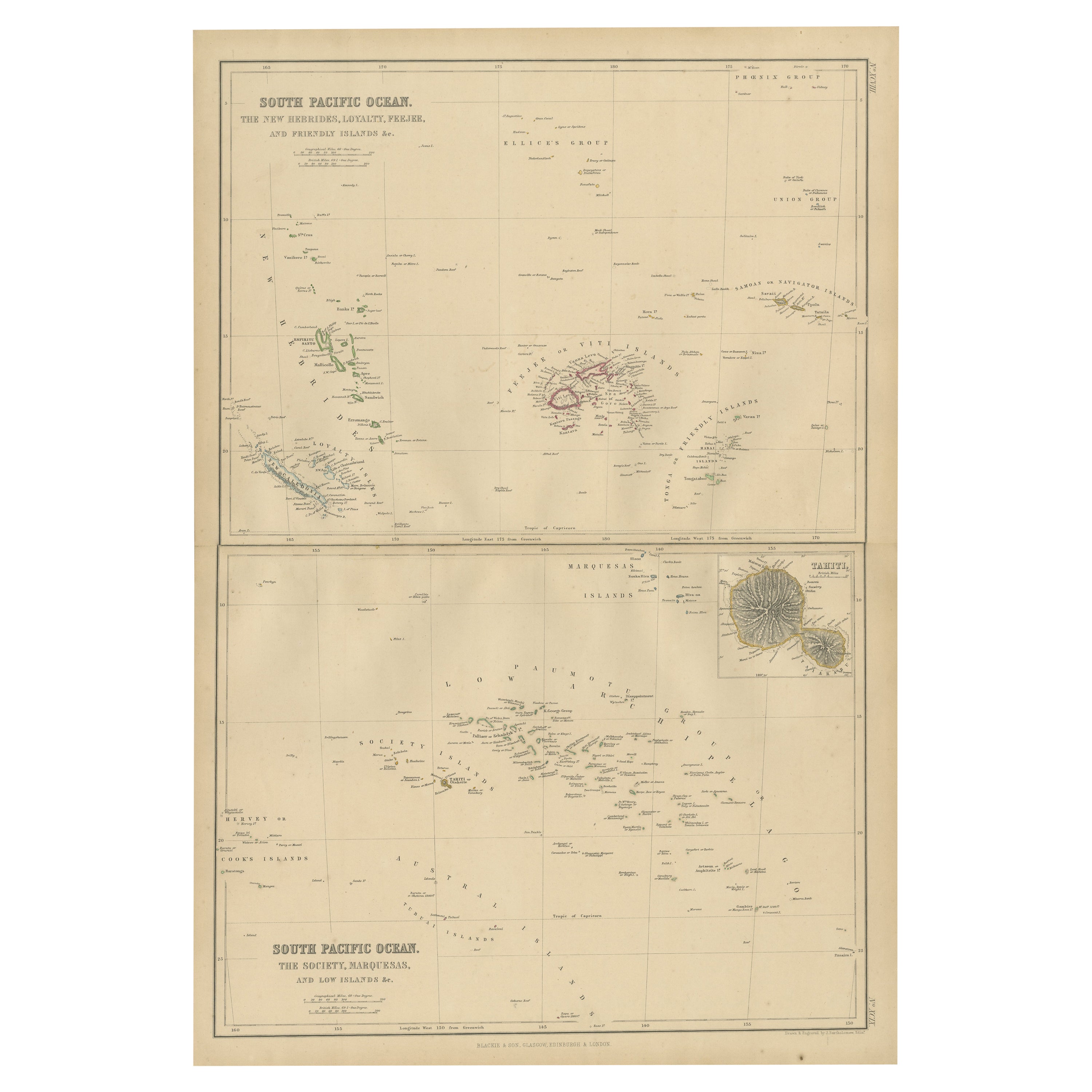
- Antique Map of South Pacific Ocean by W. G. Blackie, 1859Located in Langweer, NLAntique map titled 'South Pacific Ocean'. Original antique map of South Pacific Ocean with inset Map of Tahiti. This map originates from ‘The Imperial Atlas of Modern Geography’. Pub...Category
Antique Mid-19th Century Maps
MaterialsPaper
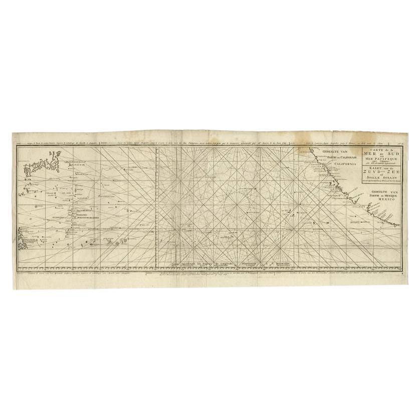
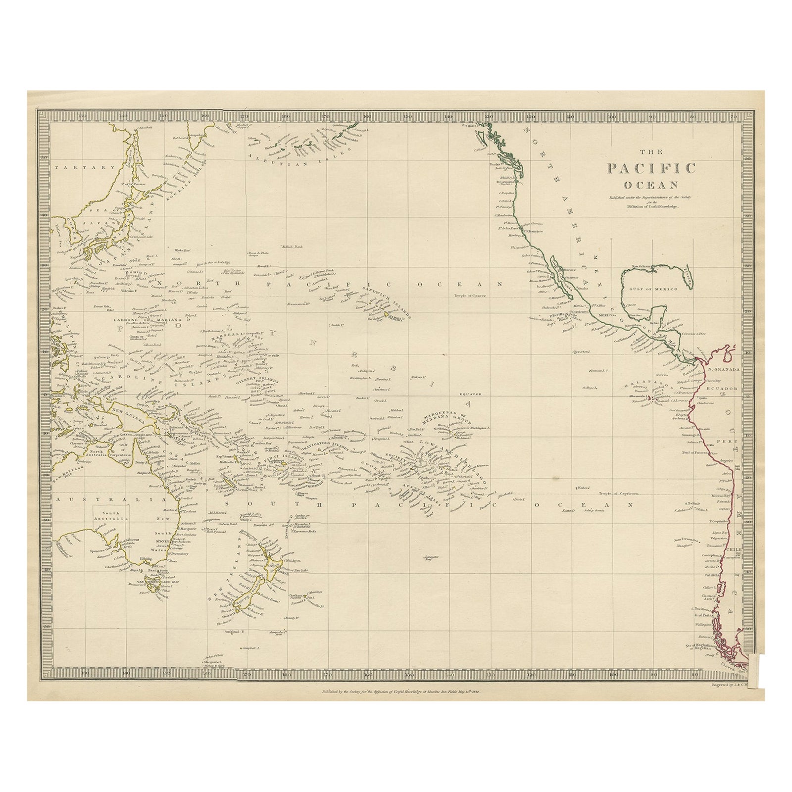
- Antique Map of the Pacific Ocean by Anson, 1765Located in Langweer, NLAntique map titled 'Carte de la Mer du Sud ou Mer Pacifique - Kaart van de Zuyd-Zee of stille oceaan (..)'. Nautical chart of the Pacific Ocean depicting the trade routes used by Spanish Galleons from Acapulco in Mexico to Manila in the Philippines. In particular this chart depicts the voyages of the Spanish Nostra Seigniora de Cabadonga and the British Navy Commodore George Anson. Anson succeed in capturing the Spanish treasure...Category
Antique 18th Century Maps
MaterialsPaper
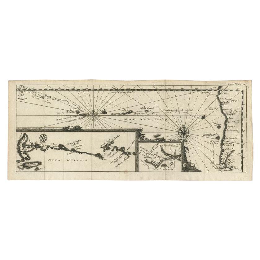
- Antique Map of the Pacific Ocean by Renneville, 1702Located in Langweer, NLAntique map, untitled. A map of the Pacific Ocean, with the coast of Peru in the right edge and the outline of New Guinea in the left edge. In betwe...Category
Antique 18th Century Maps
MaterialsPaper
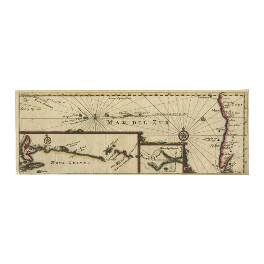
- Antique Map of the Pacific Ocean by Renneville, 1725Located in Langweer, NLRare map of the Southern Pacific, illustrating Le Maire's tracks, extending from the La Maire Straits to Nova Guinea, with a large inset of the northern Coastline of New Guinea and a...Category
Antique 18th Century Maps
MaterialsPaper
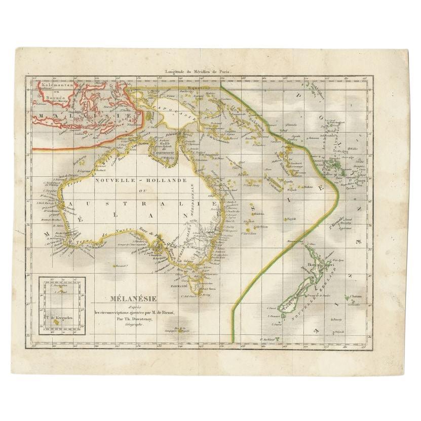
- Antique Map of the Pacific Ocean by Rienzi, 1836Located in Langweer, NLAntique map titled 'Mélanésie'. Map of the Pacific ocean around Australia, including Java, Timor, the Solomon Islands and New Zealand. This print or...Category
Antique 19th Century Maps
MaterialsPaper


Recently Viewed
View AllMore Ways To Browse
Mexico Map Vintage
Mexico Vintage Map
Vintage Map Of Mexico
San Francisco Map Vintage
San Francisco Vintage Map
Map San Francisco
Map Of San Francisco
Covarrubias Miguel
Atlas China
Antique Maps Wales
Antique Furniture South East London
Antique Map Of Wales
Antique Maps Of Wales
Antique Island Caribbean
Antique Map Wales
Teak Sphere
Atlas Stand
Antique Battle Maps