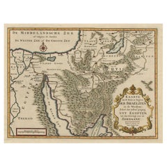
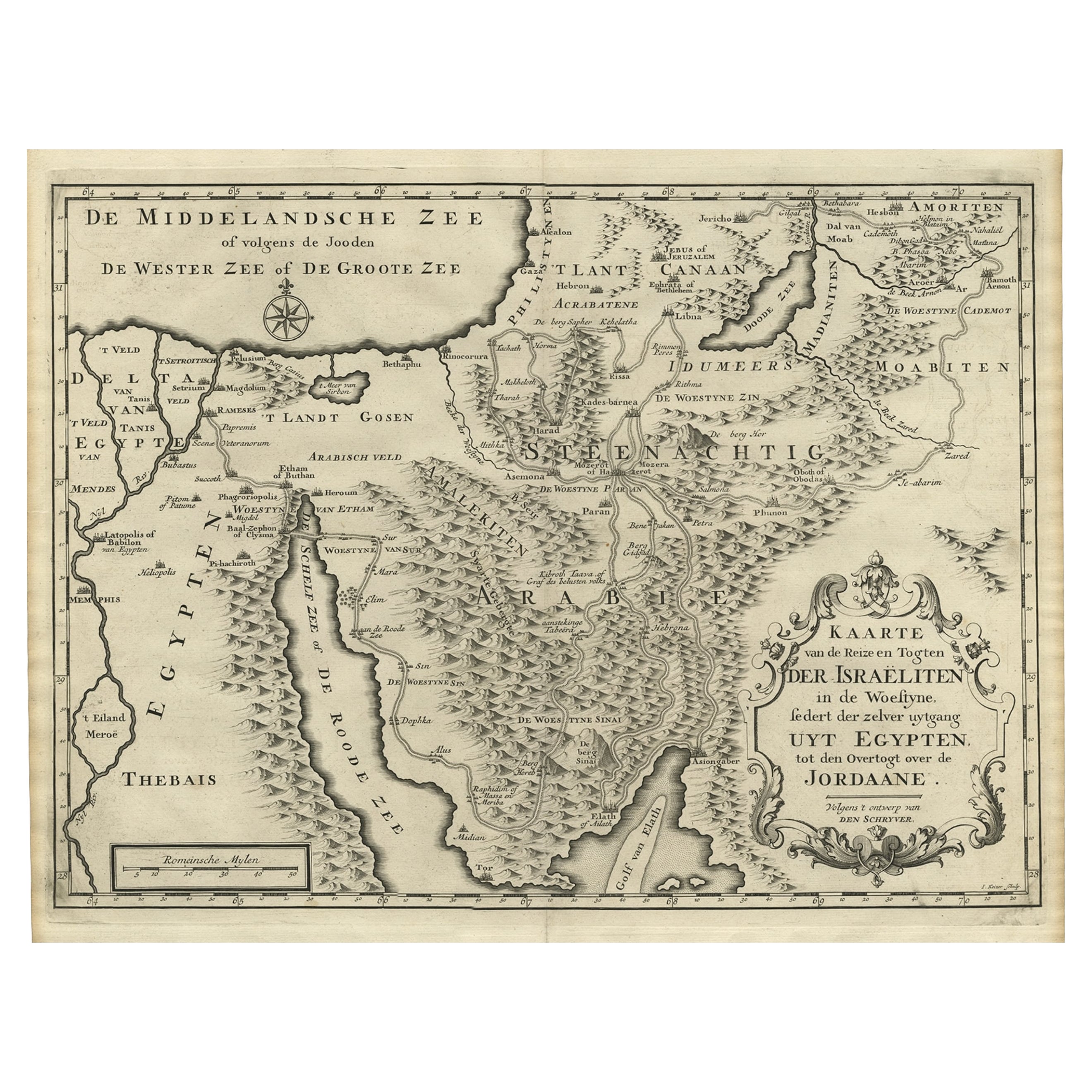
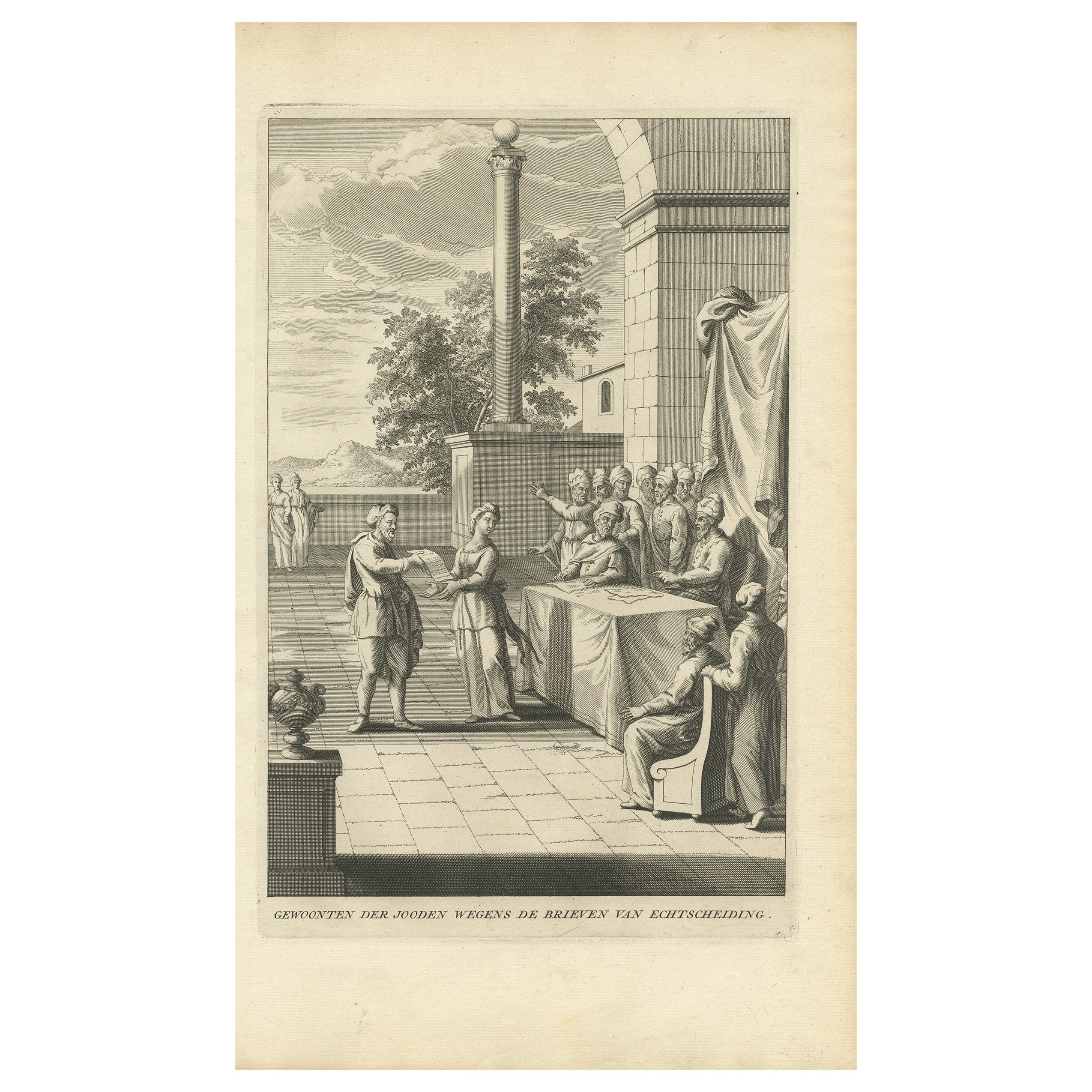
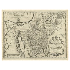
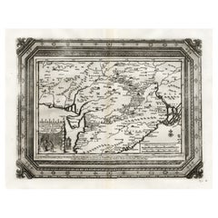
The Perigrination Showing Routes of the Israelites from Egypt to Jordan, ca.1725
View Similar Items

Want more images or videos?
Request additional images or videos from the seller
1 of 5
The Perigrination Showing Routes of the Israelites from Egypt to Jordan, ca.1725
About the Item
- Dimensions:Height: 16.62 in (42.2 cm)Width: 19.41 in (49.3 cm)Depth: 0 in (0.02 mm)
- Materials and Techniques:
- Period:1720-1729
- Date of Manufacture:circa 1725
- Condition:Condition: Very good, given age. Original middle fold as issued. General age-related toning and/or occasional minor defects from handling. Please study image carefully.
- Seller Location:Langweer, NL
- Reference Number:Seller: PCT-61454 1stDibs: LU3054326942542
About the Seller
5.0
Platinum Seller
These expertly vetted sellers are 1stDibs' most experienced sellers and are rated highest by our customers.
Established in 2009
1stDibs seller since 2017
1,916 sales on 1stDibs
More From This SellerView All
- Scarce Middle East and Arabia Map Showing The Exodus of the Israelites, 1725Located in Langweer, NLAntique map titled 'Kaarte van de reize en togten der Israeliten in de woestyne, sedert der zelver uytgang uyt Egypten, tot den overtogt over de Jordaane.' Scarce map of the Middle East and Arbabia. It shows the exodus...Category
Antique 1720s Maps
MaterialsPaper
 $958 Sale Price34% Off
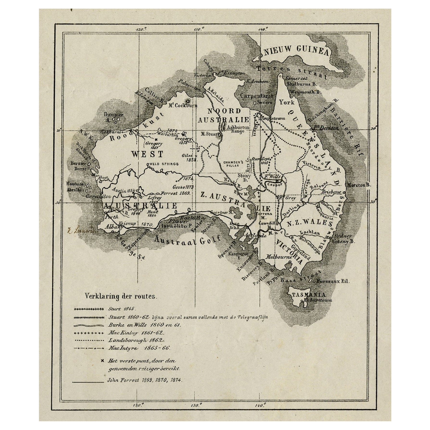
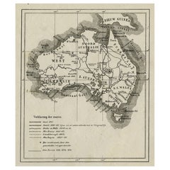
 - Old Map of Australia Showing The Routes of the Main Explorers, ca.1900Located in Langweer, NLAntique print, untitled. This map shows Australia with the routes of explorers in the continent and marking the furthest point reached.. Source unknown, to be determined. Artists ...Category
Antique Early 1900s Maps
MaterialsPaper
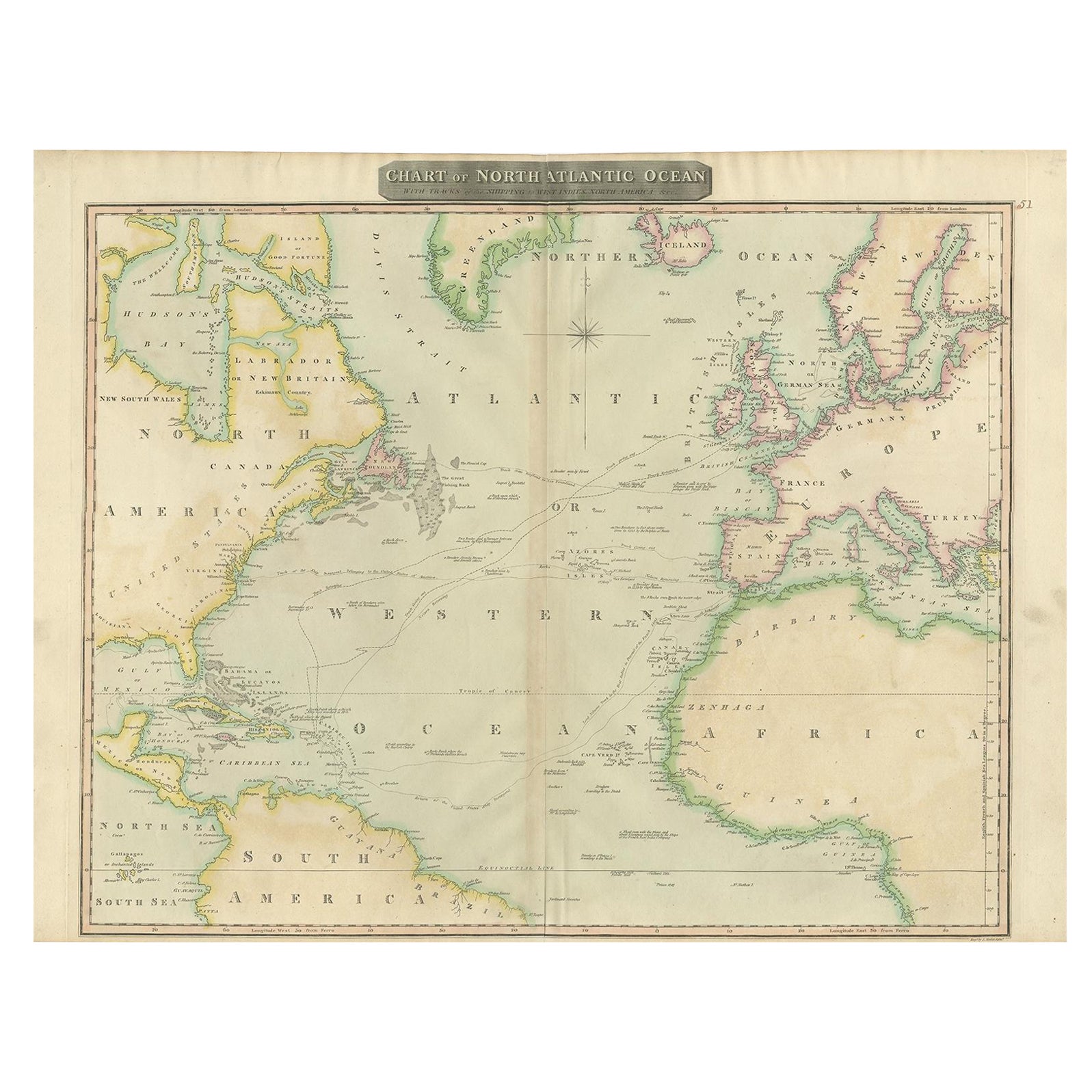
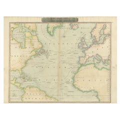
- Interesting Map of the Atlantic Showing Nelson's and Trade Routes, 1817By John ThomsonLocated in Langweer, NLAntique map titled 'Chart of the North Atlantic Ocean with Tracks of the Shipping to West Indies, North America, &cc'. Large map of the Atlantic, showing the tracks of the ships trad...Category
Antique 19th Century Maps
MaterialsPaper
 $480 Sale Price20% OffFree Shipping
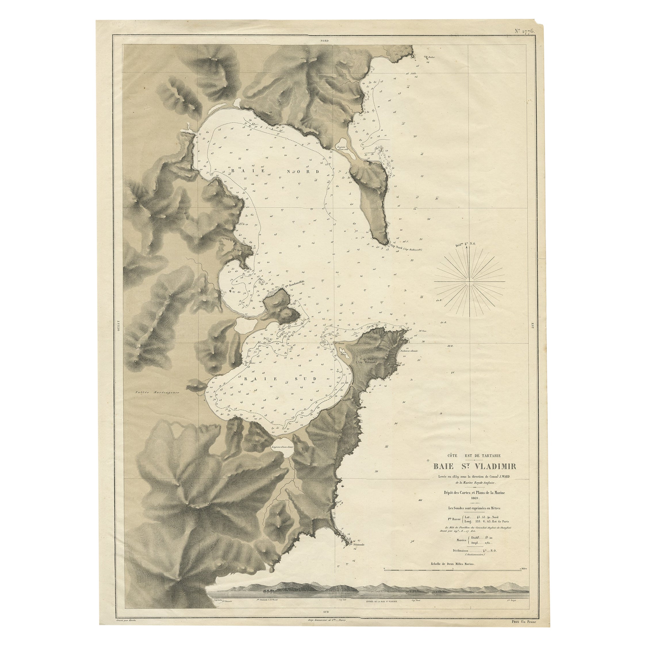
 - Rare Map of the Bay of St. Vladimir 'Russia' Showing the Route of J. Ward, 1869Located in Langweer, NLAntique map titled 'Côte est de Tartarie Baie St. Vladimir'. Map of the Bay of St. Vladimir (Russia) showing the route of J. Ward. Including a coastal view. Source unknown, to be...Category
Antique 1860s Maps
MaterialsPaper
 $637 Sale Price20% Off
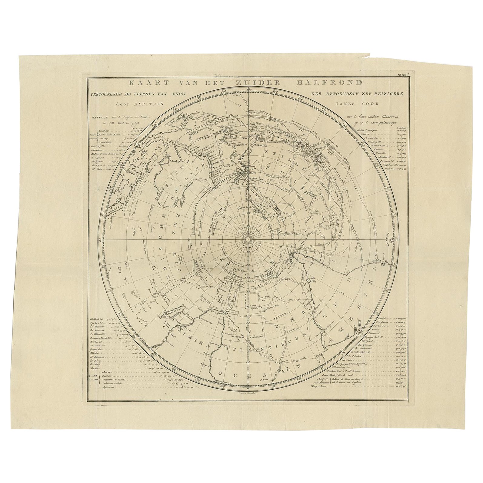
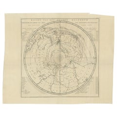
 - Antique Chart of the Southern Pole, Showing Three Routes of Captain Cook, 1803Located in Langweer, NLAntique map titled 'Kaart van het Zuider Halfrond'. Circular chart within a square frame centred on the southern pole. It shows southern parts of South America, South Africa and Mada...Category
Antique 19th Century Prints
MaterialsPaper
 $838 Sale Price20% Off
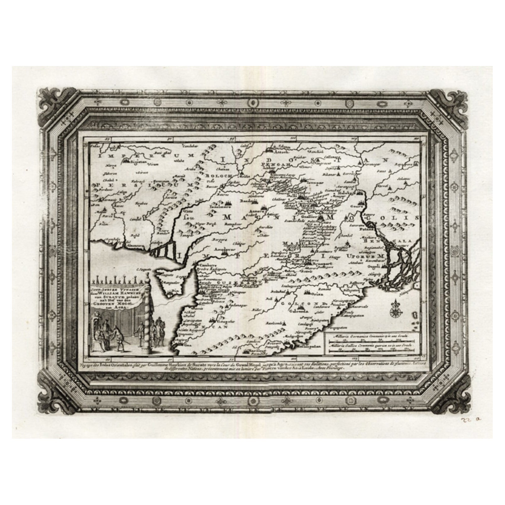
 - Rare Antique Map of the Moghul Empire, ca.1725Located in Langweer, NLAntique map titled 'Oost-Indize Voyagie door William Hawkins van Suratte gedaan na 't Hof van den Grooten Mogol tot Agra. - Voyage des Indes Orientales...Category
Antique 1720s Maps
MaterialsPaper
You May Also Like
- Internet_Art: From the Birth of the Web to the Rise of NFTsLocated in New York City, NYA leading figure in the world of networked culture explores the artists and events that defined the mass medium of our time Since 1989, the year the World Wide Web was born, the art world has grappled with the rise of networked culture. This unprecedented survey of the artists and innovators in this area from 1989 to today is interwoven with the personal narrative of one of the leading voices on the digital world. In this book, Omar Kholeif, whose prolific career parallels the growth of the internet, tells the story of this mass medium and how it has fostered new possibilities for artists, both analog and digital. The book showcases work spanning a range of media from legendary artists including Lawrence Abu Hamdan, Lynn Hershman Leeson, Nam June Paik, Heather Phillipson, and Wu Tsang...Category
21st Century and Contemporary Italian Books
MaterialsPaper
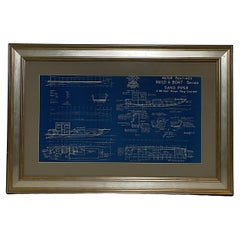
- Boat Blueprint Showing the Sand PiperLocated in Norwell, MAMotor Boating Publishing plan for a thirty foot day cruiser. Designd by William Atkin. The vessel is shown in great detail. Circa 1937 matted and framed. Weight: 7 lbs. Overall Dime...Category
Vintage 1930s North American Nautical Objects
MaterialsPaper
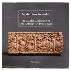
- Modernism Foretold: the Nadler Collection of Late Antique Art from Egypt, 1/500Located in valatie, NYModernism Foretold: The Nadler Collection of Late Antique Art from Egypt, 1/500 by Asen Kirin, Katherine Leigh Marsengill, Georgia Museum of Art. Georgia Museum of Art, 2020. 1st Ed hardcover with dust jacket. "This exhibition catalogue features an extraordinary assembly of objects dating from the 3rd to the 8th century CE that belong to Emanuel and Anna Nadler of New York City and Palm Beach. The Nadler family has long been one of the most important collectors of Coptic art...Category
21st Century and Contemporary American Books
MaterialsPaper
- The Fendi Set: From Bloomsbury to BorgheseBy Rizzoli International PublicationsLocated in New York, NYAn enchanting exploration of the creative inspiration of the Bloomsbury Set on Kim Jones’s artistic direction of the fashion house Fendi. In September 2020, Kim Jones was named head of Fendi’s couture...Category
21st Century and Contemporary Books
MaterialsPaper
 $135 / item
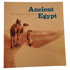
 - The American Discovery of Ancient Egypt 1995Located in North Hollywood, CAThe American Discovery of Ancient Egypt 1995. Essays, edited by Nancy Thomas. A survey of the achievements of American Egyptology featuring such enterpris...Category
Late 20th Century Egyptian Moorish Books
MaterialsPaper
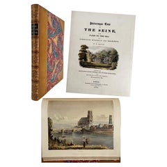
- Picturesque Tour of the Seine, from Paris to the Sea / Ackermann, First EditionLocated in Middletown, NYOne of the great 19th-century English color plate books illustrating the scenery along the Seine. Sauvan, Jean Baptiste Balthazar. Picturesque Tour of the Seine, from Paris to the Sea; with Particulars Historical and Descriptive. London: R. Ackermann, 1821. First Edition. 4to, 13 1/2 x 11 (343 x 280 mm), pp. x, 177, title vignette and 24 hand colored aquatints, map. Later three-quarter yellow levant morocco with fillets, spine decorated in gilt with 5 raised bands and black title label; marbled boards and endpapers, a.e.g.. Spine and boards in very good condition, binding tight and square, text and plates with very occasional spotting. [Abbey, Travel 90; Tooley 445; Bobins, Exotic and the Beautiful II: 548] Condition: Near fine. This is a first printing of one of the great nineteenth-century English color plate books illustrating the scenery along the Seine from Paris to Le Havre. Luminous impressions of the plates, beautifully hand-colored. Engraved by Thomas Sutherland (1785 – 1825) and Daniel Havell (1785 – 1826) from sketches and drawings by Augustus Pugin (1812 – 1852) and John Gendall (1790 – 1865), the illustrations also include a vignette on the title page representing the Château de Rosny (home of the Duchess of Berry...Category
Antique Early 19th Century English Books
MaterialsLeather, Paper

Recently Viewed
View AllMore Ways To Browse
Jordan Antique Map
Antique Putters
Antique Putter
Cartier 1730
Christoph Weigel On Sale
Dao Antique Map
Devonia Antique
Eso Antique Map
Eso Antique Maps
J Karte
M S Merian
Nicolaes Visscher II On Sale
W. & A.K. Johnston On Sale
Willem Blaeu On Sale
Yemen 1789
Andalusia Map
Atlas School Supply On Sale
Old Teak Petite Artisan