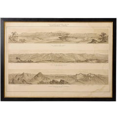
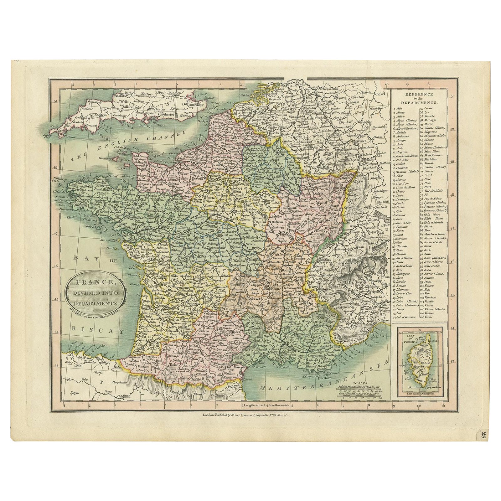
Pike's Peak Topographical Map Showing Colorado Mountain Ranges, circa 1877
View Similar Items


Want more images or videos?
Request additional images or videos from the seller
1 of 2
Pike's Peak Topographical Map Showing Colorado Mountain Ranges, circa 1877
About the Item
- Dimensions:Height: 26 in (66.04 cm)Width: 39 in (99.06 cm)Depth: 1.5 in (3.81 cm)
- Period:
- Date of Manufacture:1877
- Condition:Wear consistent with age and use.
- Seller Location:Colorado Springs, CO
- Reference Number:Seller: M114B1stDibs: LU90976106643
About the Seller
4.9
Platinum Seller
Premium sellers with a 4.7+ rating and 24-hour response times
Established in 2010
1stDibs seller since 2011
447 sales on 1stDibs
Authenticity Guarantee
In the unlikely event there’s an issue with an item’s authenticity, contact us within 1 year for a full refund. DetailsMoney-Back Guarantee
If your item is not as described, is damaged in transit, or does not arrive, contact us within 7 days for a full refund. Details24-Hour Cancellation
You have a 24-hour grace period in which to reconsider your purchase, with no questions asked.Vetted Professional Sellers
Our world-class sellers must adhere to strict standards for service and quality, maintaining the integrity of our listings.Price-Match Guarantee
If you find that a seller listed the same item for a lower price elsewhere, we’ll match it.Trusted Global Delivery
Our best-in-class carrier network provides specialized shipping options worldwide, including custom delivery.More From This Seller
View All1904 "Nell's Topographical Map of the State of Colorado"
Located in Colorado Springs, CO
This highly detailed pocket map is a topographical map of the state of Colorado by Louis Nell from 1904. The map "has been compiled from all available...
Category
Antique Early 1900s American Maps
Materials
Leather, Paper

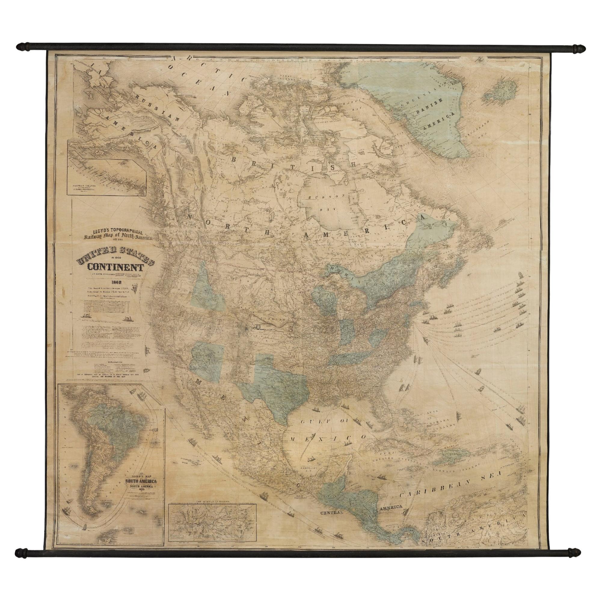
1868 "Lloyd's Topographical Railway Map of North America..." Hanging Wall Map
Located in Colorado Springs, CO
Presented is “Lloyd's Topographical Railway Map of North-America, or the United States Continent in 1900.” This map was published by J. T. Lloyd, in New York, in 1868. A large, hangi...
Category
Antique 1860s American Late Victorian Maps
Materials
Linen, Paper

1925 "Colorado" Map by L. L. Poates Eng. Co.
Located in Colorado Springs, CO
This is a detailed antique map of Colorado from 1925. The map was engraved by Leonard L. Poates, originally published in the "Poates Highway and Regional Guide of the United States." The map is colored, with county borders printed in blue and railroad routes criss-crossing the state in red. Along the left of the map is a list of “Counties in Colorado" and an extensive list of "Principal Cities and Towns in Colorado," both keyed. Prominent rivers are labeled, as well as the Southern Ute Indian Reservation south of Montezuma.
Prior to 1858, Colorado was mostly a stopping point for travelers on their way to California and Oregon. However, in the 1860s Colorado experienced its own gold rush shortly followed by a silver rush in the 1870s and 1880s. The sudden increase in population and introduction of railroads led to a boom in the area. President Ulysses S. Grant signed Proclamation 230 admitting the state of Colorado to the Union as the 38th state on August 1, 1876. Gold, silver, and especially coal mining continued in the state, and the population kept expanding. Colorado had a recorded population of 539,700 in 1900, 799,024 in 1910, and 939,629 in 1920.
Leonard L. Poates was an American engraver and publisher who started his own company, the L. L. Poates Engraving Company, in New York City around 1910. In addition to his own popular “Handy Atlas,””Complete Atlas of the World,” “Highway and Regional Guide of the United States,” and “Radio Map of the United States and Canada,” Poates and his company worked on maps for other publishing companies’ atlases, including those issued by P. F. Colliers and Son and Dodd, Mead & Co.
CONDITION:
Engraved map with original printed color. The map’s title “Colorado” is printed along the top of the map at center, “A Scale of Statue Miles” and “Scale of Kilometers” are presented just below the title, with copyright information at bottom right of the map’s border. Keyed list of Counties and Cities are printed at left. Paper is healthy, with very little toning. No tears or rips. Double-sided map, with California map...
Category
Vintage 1920s American Arts and Crafts Maps
Materials
Paper
Seven Falls Colorado Springs Antique Photographic Postcard, circa 1880
Located in Colorado Springs, CO
Presented is an antique photographic postcard of Seven Falls, Colorado, from 1880. Postcard production blossomed in the late 1800s and early 1900s, as railroads opened up much of the Western frontier to new and exciting travel opportunities.
Seven Falls is one of Colorado’s most captivating natural wonders. Located at the base of the Front Range, this magnificent series of waterfalls is situated in a 1,250-foot-wall box canyon between the towering Pillars of Hercules and boasts a 181-foot drop of falling water.
Seven Falls was originally part of land given to Nathan Colby in 1872 as part of the Homestead Act of 1862. The Homestead Act granted 160 acres of surveyed land to pioneers in the west, with claimants required to “improve” the plot by building a dwelling and cultivating the land. Mr. Colby promptly sold the track of land to James Hull...
Category
Antique 1880s American Historical Memorabilia
Materials
Paper

1854 Map of Massachusetts, Connecticut and Rhode Island, Antique Wall Map
Located in Colorado Springs, CO
This striking wall map was published in 1854 by Ensign, Bridgman & Fanning and has both full original hand-coloring and original hardware. This impression is both informative and highly decorative.
The states are divided into counties, outlined in red, green, and black, and subdivided into towns. Roads, canals, and railroad lines are prominently depicted, although they are not all labeled. The mapmakers also marked lighthouses, banks, churches, and prominent buildings, with a key at right. The map is an informative and comprehensive overview of the infrastructural development of New England prior to the Civil War. Physical geographies depicted include elevation, conveyed with hachure marks, rivers and lakes. The impression features an inset map of Boston...
Category
Antique 19th Century American Maps
Materials
Paper

1864 Map of North America, Antique Hand-Colored Map, by Adolphe Hippolyte Dufour
Located in Colorado Springs, CO
Offered is a map of North America entitled Amerique du Nord from 1864. This rare, separately published wall map was produced by Adolphe Hippolyte Dufour. This map includes vibrant an...
Category
Antique 1860s French Maps
Materials
Paper

You May Also Like
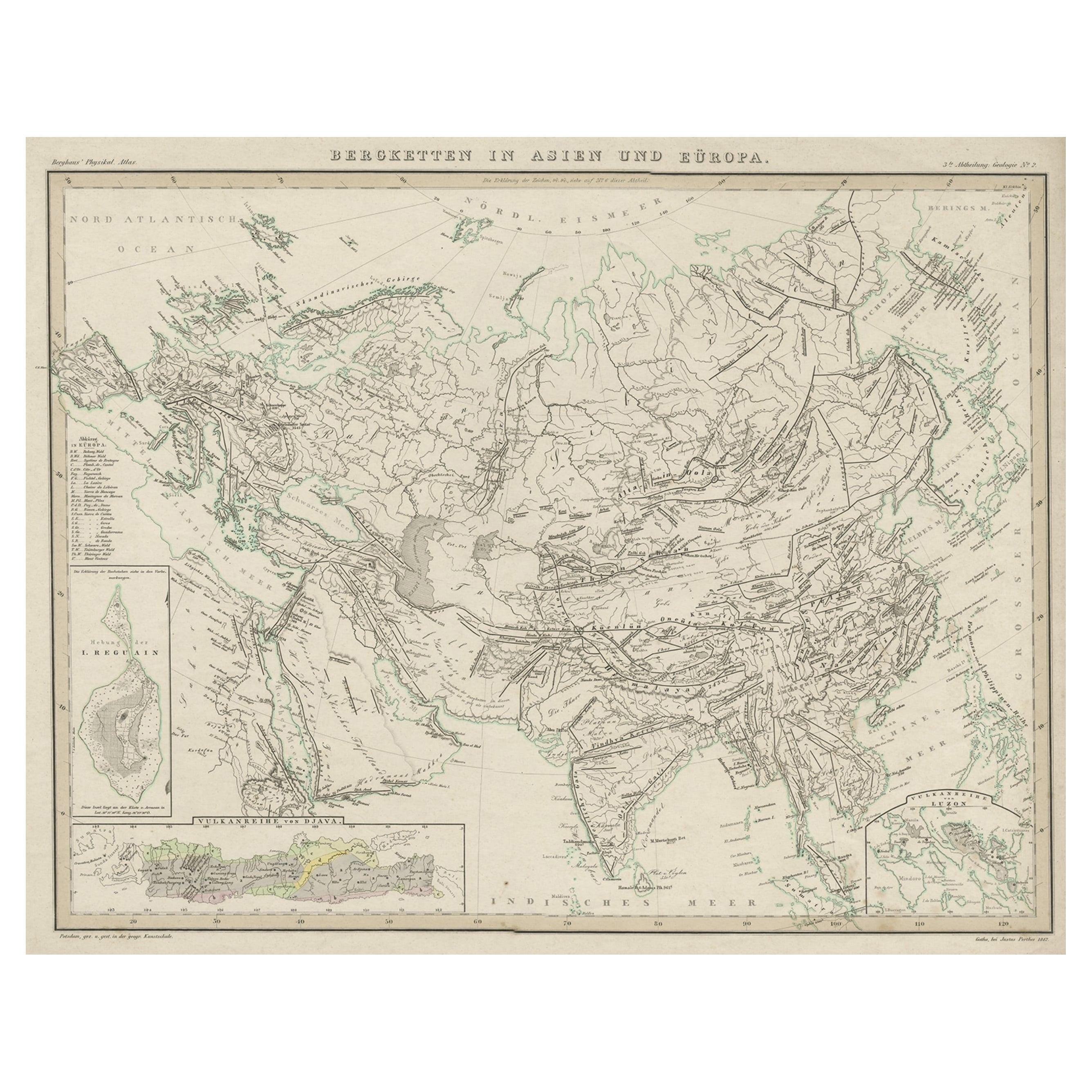
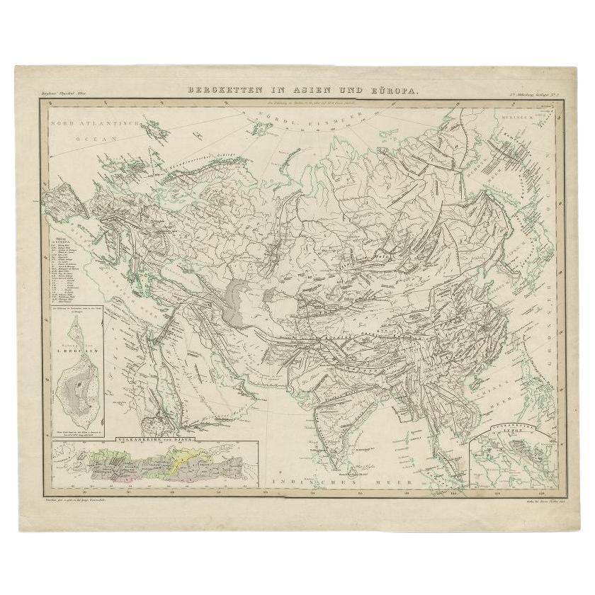
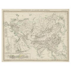
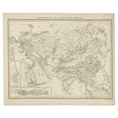
Original Antique Map Showing the Mountain Ranges in Asia and Europe, 1849
Located in Langweer, NL
Antique map titled 'Bergketten in Asien und Eüropa'. Original antique map showing the mountain ranges in Asia and Europe. In outline color with inset maps of Java, Luzon, and Reguain...
Category
Antique 1840s Maps
Materials
Paper
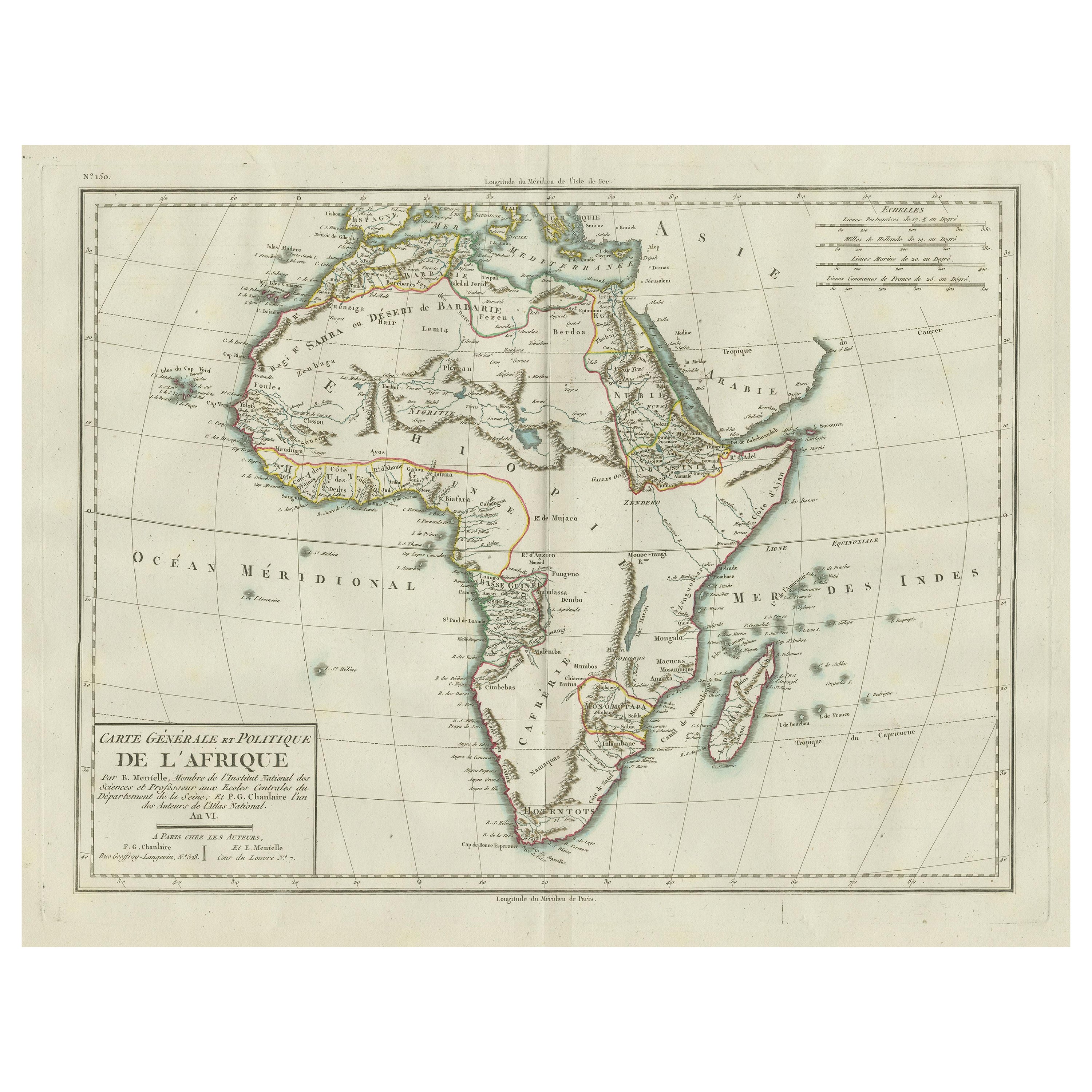
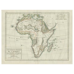
Antique Map of Africa with Mountain Ranges and other details
Located in Langweer, NL
Antique map titled 'Carte générale et Politique de l'Afrique'. Original antique map of Africa. Highlights numerous mountain ranges, lakes and rivers, regions, countries and places. P...
Category
Antique Late 18th Century Maps
Materials
Paper
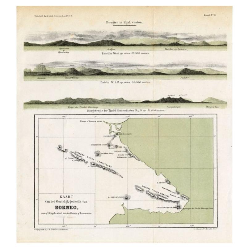
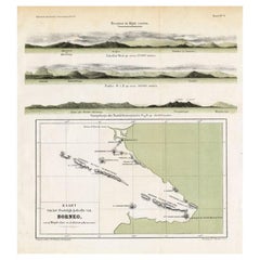
Antique Map of Eastern Borneo, Indonesia with Views of Mountain Ranges, c.1875
Located in Langweer, NL
Antique map titled 'Kaart van het Oostelijk gedeelte van Borneo.' (Map of the eastern part of Borneo.) This map shows the eastern part of Borneo, Indonesia. With views of mountain ra...
Category
Antique 19th Century Maps
Materials
Paper
$165 Sale Price
20% Off
Antique Map of the Mountain Ranges of Asia and Europe by Berghaus, 1849
Located in Langweer, NL
Antique map titled 'Bergketten in Asien und Eüropa'. Original antique map showing the mountain ranges in Asia and Europe. In outline color with inset maps of Java, Luzon, and Reguain...
Category
Antique 19th Century Maps
Materials
Paper
$257 Sale Price
20% Off
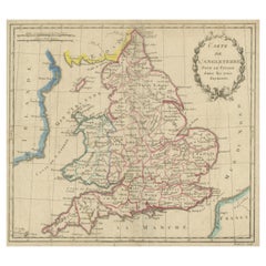
Antique Map of England, Also Showing Calais
Located in Langweer, NL
Antique map titled 'Carte de l'Angleterre pour le Voyage dans les trois Royaumes'. Original old map of England, also showing Calais. This map originates from 'Voyage dans les trois r...
Category
Antique Late 18th Century Maps
Materials
Paper
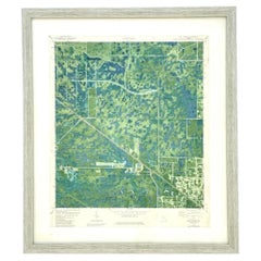
Vintage 50s Topographical Map of the Florida Keys
Located in west palm beach, FL
A fabulous vintage 50 original topographical map. A depiction of the Florida Keys and the surrounding waters. Part of a set of three maps. The other t...
Category
Mid-20th Century American Maps
Materials
Glass, Wood, Paper
Recently Viewed
View AllMore Ways To Browse
Scandinavian Wood Tray
Scroll Leg Stool
Set Of Staffordshire
Sheepskin Study Chairs
Small Antique Prayer Rug
Spinning Chair
Sweden Rack
The Lord Vintage Furniture
Trolley Oak
Turkish Kilim Runner Long
Two Seat Boucle Sofa
Upholstered Chinese Chair
Upholstered Console Table
Upholstery Tacks
Vanity Table Writing Desk
Velvet Sheen
Vermeil Flatware Set
Vintage Art Deco Glass Coffee Table