Items Similar to Rare Antique Map of Zeeland – Sleeswijk Atlas of the Netherlands, 1914


Want more images or videos?
Request additional images or videos from the seller
1 of 10
Rare Antique Map of Zeeland – Sleeswijk Atlas of the Netherlands, 1914
$251.41
£185.45
€210
CA$348.34
A$378
CHF 200.31
MX$4,635.96
NOK 2,478.77
SEK 2,342.31
DKK 1,599.11
About the Item
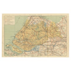
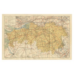
Antique Map of Zeeland – Sleeswijk Atlas, 1914
This antique map of Zeeland was published in 1914 in the Sleeswijk Atlas, one of the most widely used Dutch school atlases of the early 20th century. It depicts the province of Zeeland, with its characteristic delta landscape of islands, peninsulas, and waterways, as well as its close connection to the neighboring Belgian regions and the city of Antwerp.
The map shows Zeeland’s major islands and peninsulas, including Walcheren, Zuid-Beveland, Noord-Beveland, Schouwen-Duiveland, and Zeeuws-Vlaanderen. Important towns such as Middelburg, Vlissingen, Goes, Zierikzee, and Terneuzen are prominently marked, while Antwerp and Brussels are also included on the southern section of the sheet, underlining the strong cultural and economic ties of Zeeland with Belgium. The network of rivers, estuaries, and sea inlets such as the Westerschelde, Oosterschelde, and Hontsche Gat is carefully drawn, reflecting Zeeland’s defining relationship with water.
The legend (“Verklaring”) at the upper left provides symbols for railways, tramways, main and secondary roads, waterways, and administrative boundaries. Red lines highlight the railway system, which connected the islands and offered links to Belgium. This visualizes Zeeland at the beginning of the 20th century, just before the massive 20th-century engineering works such as the Delta Works reshaped its landscape.
Published by A. Sleeswijk in Bussum and lithographed by J. Smulders & Co. in The Hague, the map is part of the high-quality lithographic production typical of Dutch educational cartography in this period. Its clear design and soft color scheme made it suitable for classroom use, while today it provides collectors and historians with a valuable record of Zeeland’s geography in 1914.
Condition report: Very good condition with original centerfold as issued. Minor toning and light handling traces at the margins. Plate mark visible. Colors well preserved with sharp detail.
Framing tips: A soft ivory or pale beige mat will highlight the pastel tones, while a dark wood or thin black frame provides contrast for a clean, modern look. For a traditional presentation, a gilt frame enhances the historical charm and complements the map’s warm color palette.
Technique: Lithograph with original color
Maker: A. Sleeswijk, Bussum / J. Smulders & Co., The Hague, 1914
- Dimensions:Height: 14.3 in (36.3 cm)Width: 9.38 in (23.8 cm)Depth: 0.01 in (0.2 mm)
- Materials and Techniques:
- Place of Origin:
- Period:
- Date of Manufacture:circa 1914
- Condition:Condition report: Very good condition with original centerfold as issued. Minor toning and light handling traces at the margins. Plate mark visible. Colors well preserved with sharp detail.
- Seller Location:Langweer, NL
- Reference Number:Seller: BG-07094-31stDibs: LU3054346556562
About the Seller
5.0
Recognized Seller
These prestigious sellers are industry leaders and represent the highest echelon for item quality and design.
Platinum Seller
Premium sellers with a 4.7+ rating and 24-hour response times
Established in 2009
1stDibs seller since 2017
2,622 sales on 1stDibs
Typical response time: <1 hour
- ShippingRetrieving quote...Shipping from: Langweer, Netherlands
- Return Policy
Authenticity Guarantee
In the unlikely event there’s an issue with an item’s authenticity, contact us within 1 year for a full refund. DetailsMoney-Back Guarantee
If your item is not as described, is damaged in transit, or does not arrive, contact us within 7 days for a full refund. Details24-Hour Cancellation
You have a 24-hour grace period in which to reconsider your purchase, with no questions asked.Vetted Professional Sellers
Our world-class sellers must adhere to strict standards for service and quality, maintaining the integrity of our listings.Price-Match Guarantee
If you find that a seller listed the same item for a lower price elsewhere, we’ll match it.Trusted Global Delivery
Our best-in-class carrier network provides specialized shipping options worldwide, including custom delivery.More From This Seller
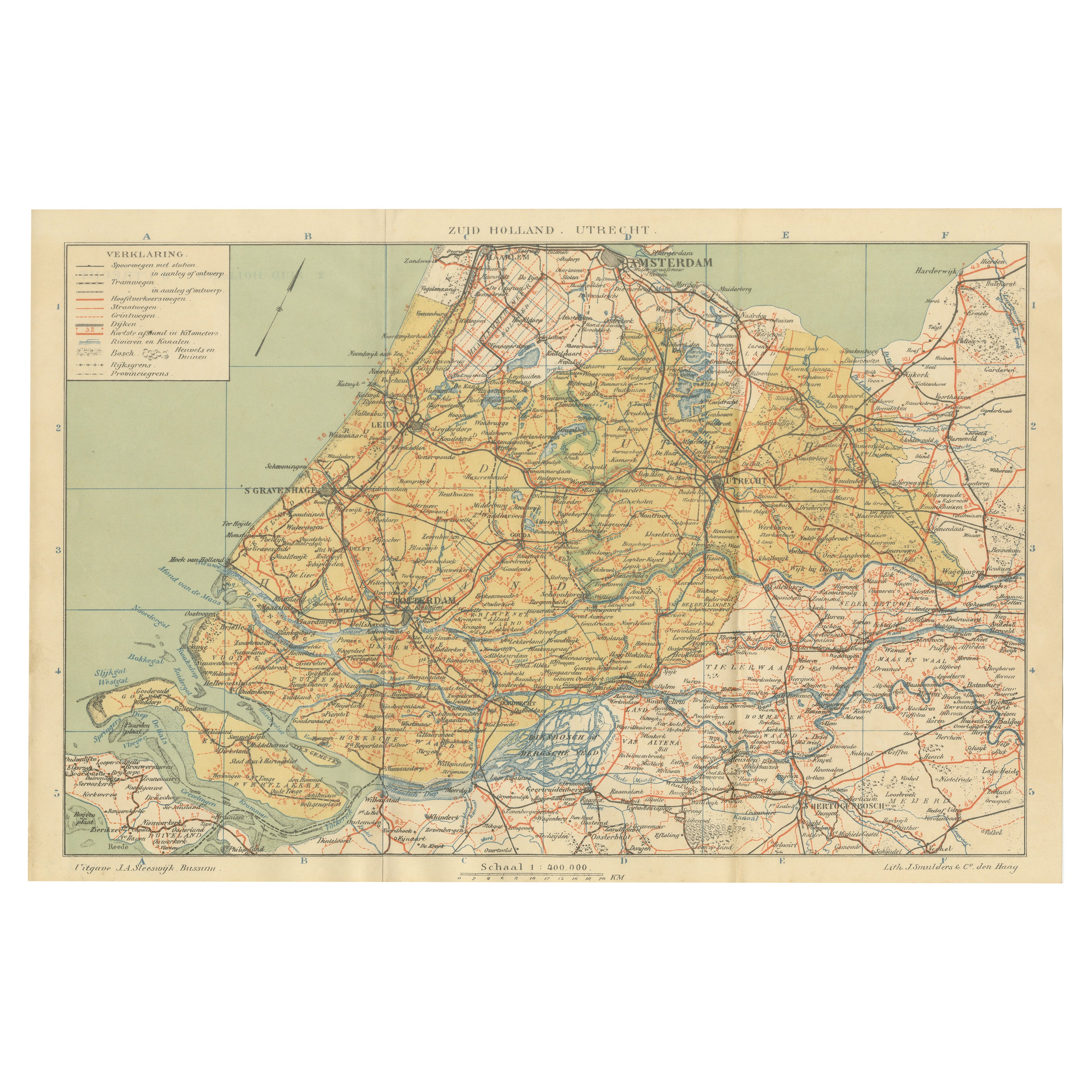
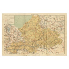
View AllAntique Dutch Map of Zuid-Holland & Utrecht – Sleeswijk Provincial Atlas, 1914
Located in Langweer, NL
Antique Map of Zuid-Holland & Utrecht – Sleeswijk Atlas, 1914
This antique map of Zuid-Holland and Utrecht was published in 1914 in the well-known Sleeswijk Atlas, a Dutch school at...
Category
Early 20th Century Dutch Maps
Materials
Paper
Antique Dutch Map of Gelderland – Sleeswijk Provincial Atlas, 1914
Located in Langweer, NL
Antique Map of Gelderland – Sleeswijk Atlas, 1914
Description:
This antique map of Gelderland was published in 1914 in the Sleeswijk Atlas, one of the most widely used Dutch school ...
Category
Early 20th Century Dutch Maps
Materials
Paper
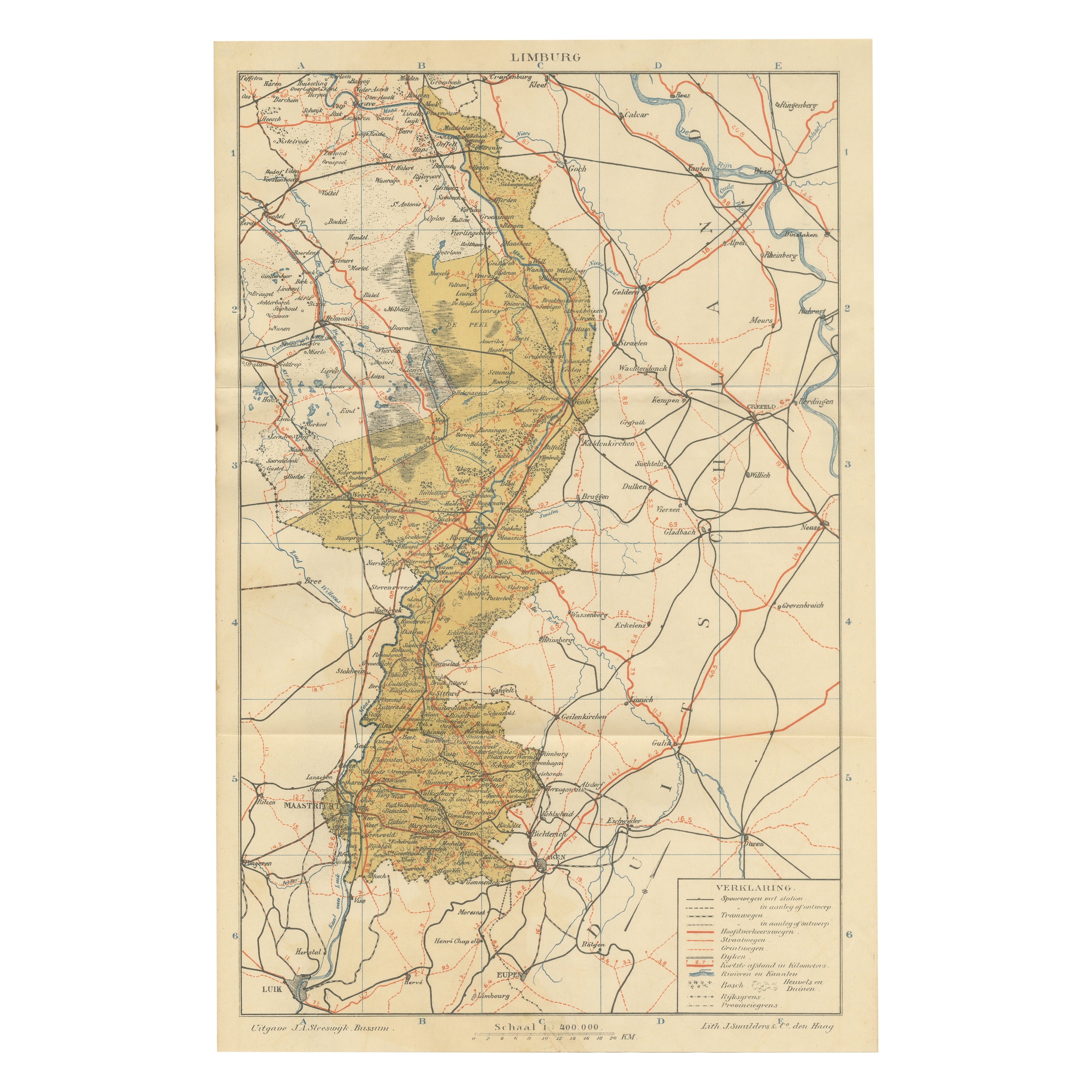
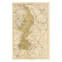
Rare Antique Map of Limburg – Sleeswijk Atlas of the Netherlands, 1914
Located in Langweer, NL
Antique Map of Limburg – Sleeswijk Atlas, 1914
Description:
This antique map of Limburg was published in 1914 in the Sleeswijk Atlas, a widely used Dutch school atlas of the early 2...
Category
Early 20th Century Dutch Maps
Materials
Paper
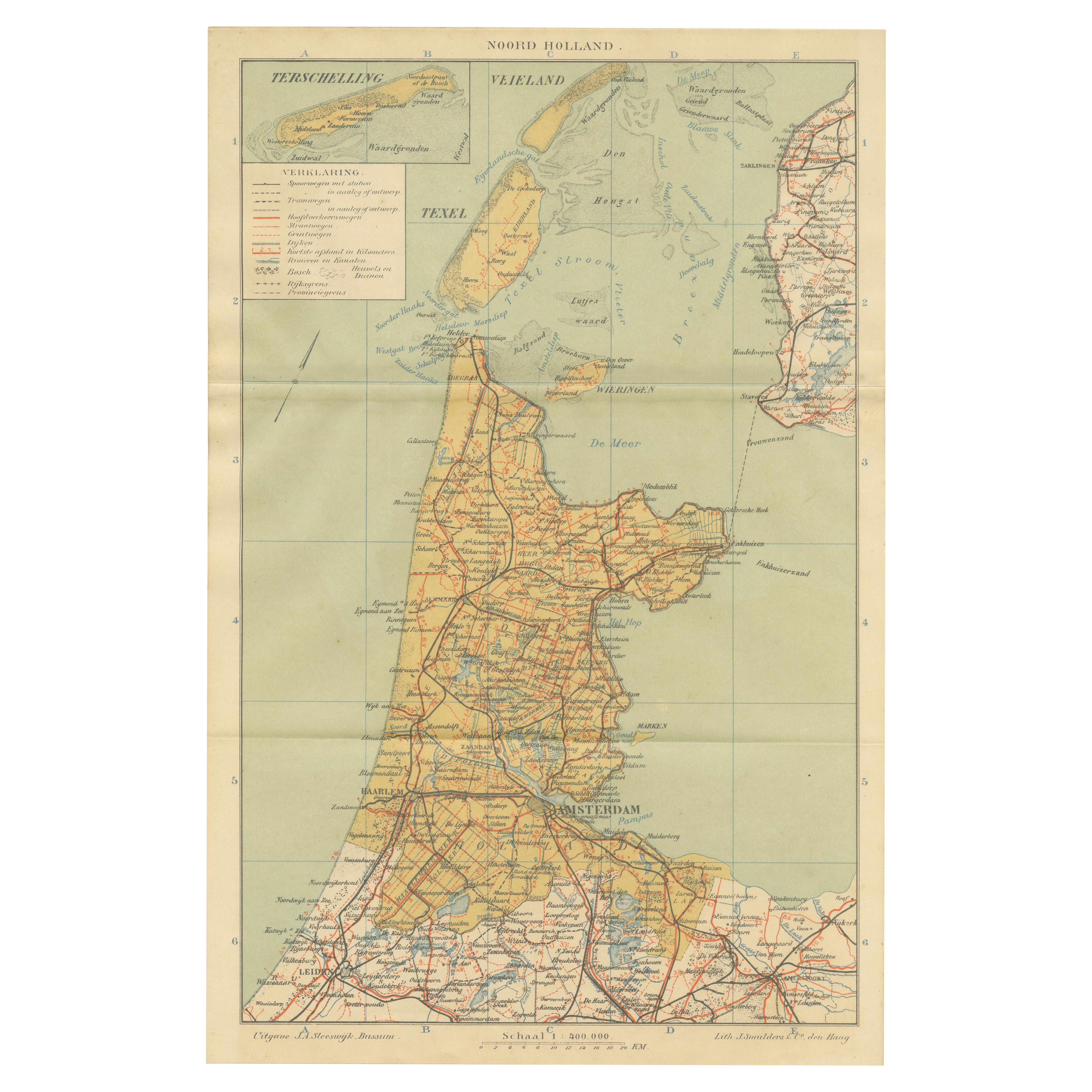
Antique Dutch Map – Province of Noord-Holland from Sleeswijk Atlas, 1914
Located in Langweer, NL
Antique Map of Noord-Holland – Sleeswijk Atlas, 1914
This finely detailed antique map of Noord-Holland was published in 1914 as part of the Sleeswijk Atlas, an important Dutch schoo...
Category
Early 20th Century Dutch Maps
Materials
Paper

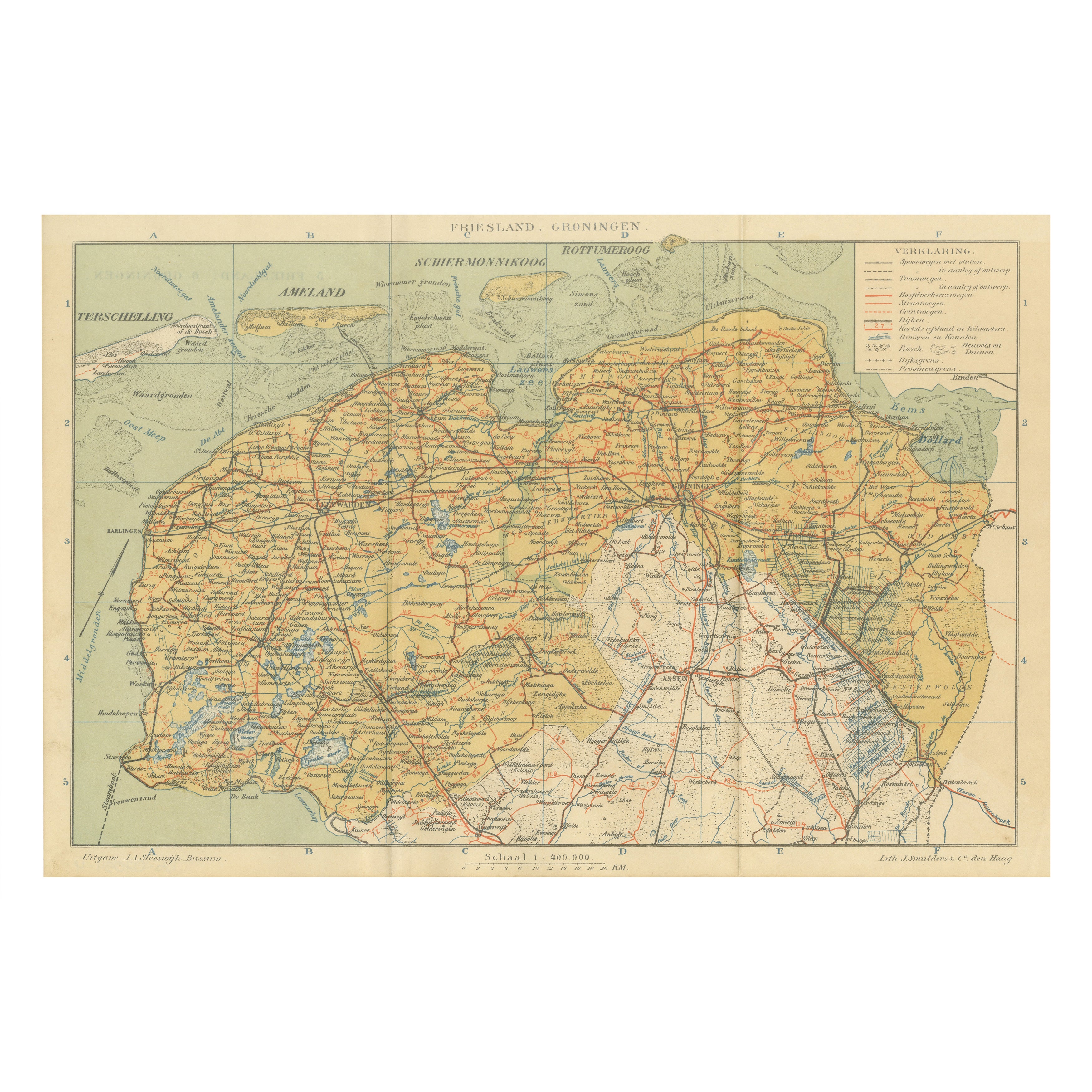
Antique Map of Friesland & Groningen – Sleeswijk Atlas Dutch Provinces, 1914
Located in Langweer, NL
Antique Map of Friesland & Groningen – Sleeswijk Atlas, 1914
Description:
This antique map of Friesland and Groningen was published in 1914 in the Sleeswijk Atlas, a Dutch school at...
Category
Early 20th Century Dutch Maps
Materials
Paper
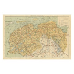
Rare Antique Map of Noord-Brabant – Sleeswijk Atlas of the Netherlands, 1914
Located in Langweer, NL
Antique Map of Noord-Brabant – Sleeswijk Atlas, 1914
Description:
This antique map of Noord-Brabant was published in 1914 in the Sleeswijk Atlas, a prominent Dutch school atlas that...
Category
Early 20th Century Dutch Maps
Materials
Paper
You May Also Like
The Netherlands (Holland), Belgium and Luxemburg. Century Atlas antique map
Located in Melbourne, Victoria
'The Century Atlas. The Netherlands (Holland), Belgium and Luxemburg.'
Original antique map, 1903.
Inset maps of 'Amsterdam' and 'Brussels'.
Central fold as issued. Map name and num...
Category
Early 20th Century Victorian More Prints
Materials
Lithograph

1752 Vaugoundy Map of Flanders : Belgium, France, and the Netherlands, Ric.a002
Located in Norton, MA
Large Vaugoundy Map of Flanders:
Belgium, France, and the Netherlands
Colored -1752
Ric.a002
Description: This is a 1752 Didier Robert de Vaugondy map of Flanders. The map de...
Category
Antique 17th Century Unknown Maps
Materials
Paper

Denmark. Century Atlas antique vintage map
Located in Melbourne, Victoria
'The Century Atlas. Denmark'
Original antique map, 1903.
Inset maps of 'Faroe Islands', 'Iceland' and 'Copenhagen'.
Central fold as issued. Map name and number printed on the reve...
Category
Early 20th Century Victorian More Prints
Materials
Lithograph

France, Northern Part. Century Atlas antique map
Located in Melbourne, Victoria
'The Century Atlas. France, Northern Part.'
Original antique map, 1903.
Inset maps of 'France in Provinces' and 'Paris and Vicinity'.
Central fold as issued. Map name and number pr...
Category
Early 20th Century Victorian More Prints
Materials
Lithograph

1643 Willem&Joan Blaeu Map NW Flanders "Flandriae Teutonicae Pars Prientalior
Located in Norton, MA
1643 Willem and Joan Blaeu map of northwest Flanders, entitled
"Flandriae Teutonicae Pars Prientalior,"
Ric0012
" Authentic" - Map of the northwest Fl...
Category
Antique 17th Century Dutch Maps
Materials
Paper

German Empire, Northern Part. Century Atlas antique vintage map
Located in Melbourne, Victoria
'The Century Atlas. German Empire, Northern Part.'
Original antique map, 1903.
Central fold as issued. Map name and number printed on the reverse corne...
Category
Early 20th Century Victorian More Prints
Materials
Lithograph
