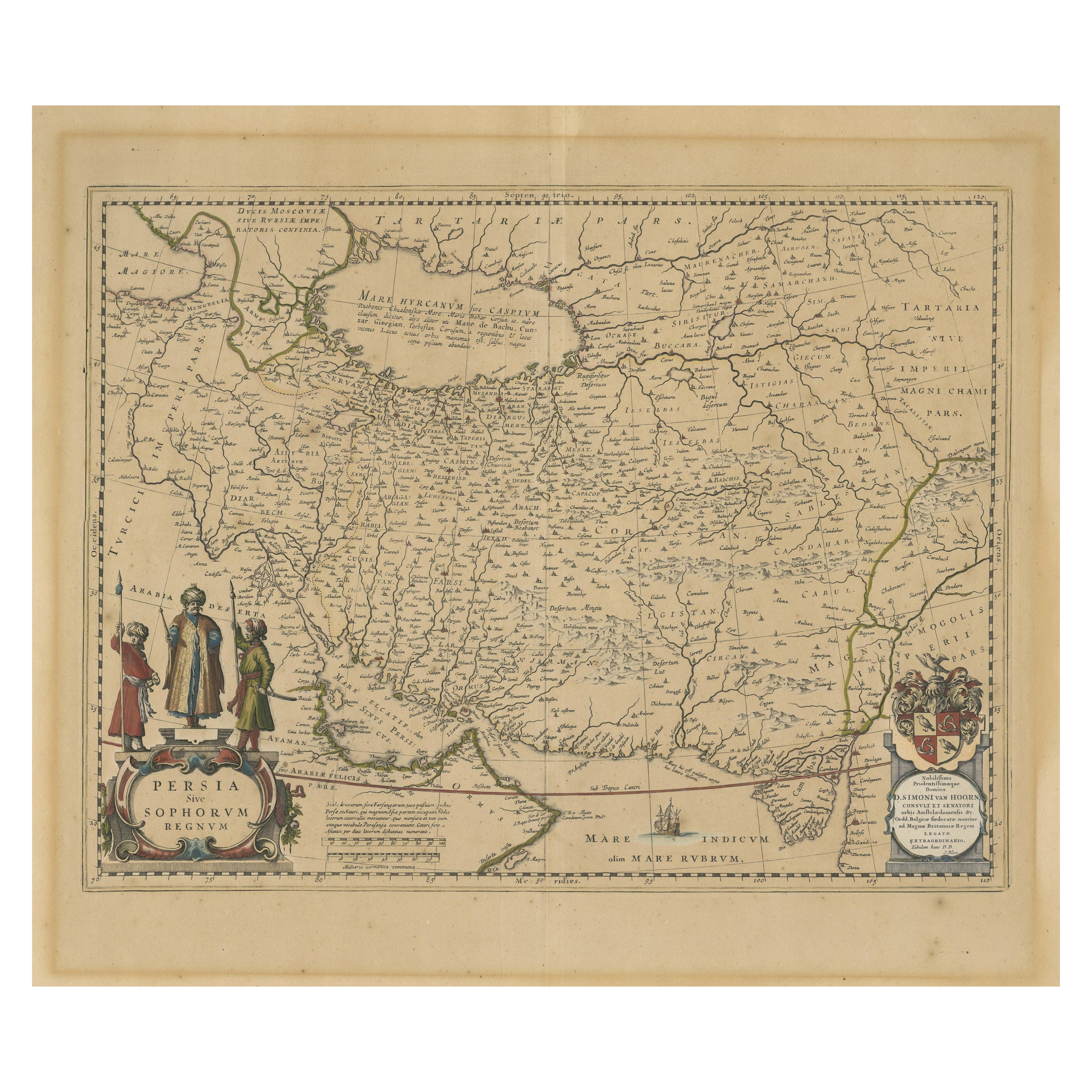
Items Similar to Safavid Splendor: Antique Map of Persia During the Safavid Dynasty, circa 1645

Want more images or videos?
Request additional images or videos from the seller
1 of 6
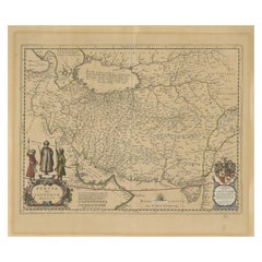
Safavid Splendor: Antique Map of Persia During the Safavid Dynasty, circa 1645
About the Item
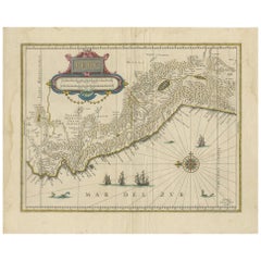
The antique map of Persia titled 'Persia sive Sophorum Regnum' is a remarkable historical document. Here are the key details and features of the map:
1. **Geographic Coverage**:
- The map provides a detailed representation of the Persian Empire during the time of the Safavid dynasty.
- It covers a vast expanse of territory, extending from the Caucasus region in the north to India in the east.
- The map also includes the Persian Gulf coastline of the Arabian Peninsula.
2. **Cartographic Details**:
- This map is known for its meticulous cartographic details, including the depiction of geographical features, rivers, mountains, and hundreds of tiny villages.
- The level of detail offers valuable insights into the landscape and settlements of the Persian Empire.
3. **Historical Context**:
- The map reflects the geopolitical boundaries and extent of the Persian Empire during the Safavid dynasty, providing historical context for the region during the 17th century.
4. **Cartouche**:
- The title cartouche of the map is adorned with an illustration that features the emperor and two soldiers. This decorative element adds artistic and historical richness to the map.
5. **Signature**:
- The map bears the signature of Merian at the lower right corner. This likely refers to the mapmaker or publisher associated with the production of the map.
6. **Publication Date**:
- The map is estimated to have been published circa 1645, making it a valuable historical artifact from the mid-17th century.
7. **Historical Significance**:
- This antique map is historically significant as it provides a visual representation of the Persian Empire during a specific period, offering insights into its territorial extent and geographical features.
8. **Artistic and Aesthetic Appeal**:
- The map is known for its handsome design and artistic elements, including the depiction of the emperor and soldiers on the cartouche.
Overall, the 'Persia sive Sophorum Regnum' antique map is not only a valuable historical reference but also a visually captivating piece of cartographic art. It serves as a window into the Safavid Persian Empire and the mapping practices of the 17th century.
- Dimensions:Height: 13.59 in (34.5 cm)Width: 15.36 in (39 cm)Depth: 0.02 in (0.5 mm)
- Materials and Techniques:
- Period:Mid-17th Century
- Date of Manufacture:circa 1645
- Condition:Wear consistent with age and use. General age-related toning, some wear and soiling. Original folding line. Blank verso. Please study images carefully.
- Seller Location:Langweer, NL
- Reference Number:
About the Seller
5.0
Platinum Seller
These expertly vetted sellers are 1stDibs' most experienced sellers and are rated highest by our customers.
Established in 2009
1stDibs seller since 2017
1,922 sales on 1stDibs
Typical response time: <1 hour
- ShippingRetrieving quote...Ships From: Langweer, Netherlands
- Return PolicyA return for this item may be initiated within 14 days of delivery.
More From This SellerView All
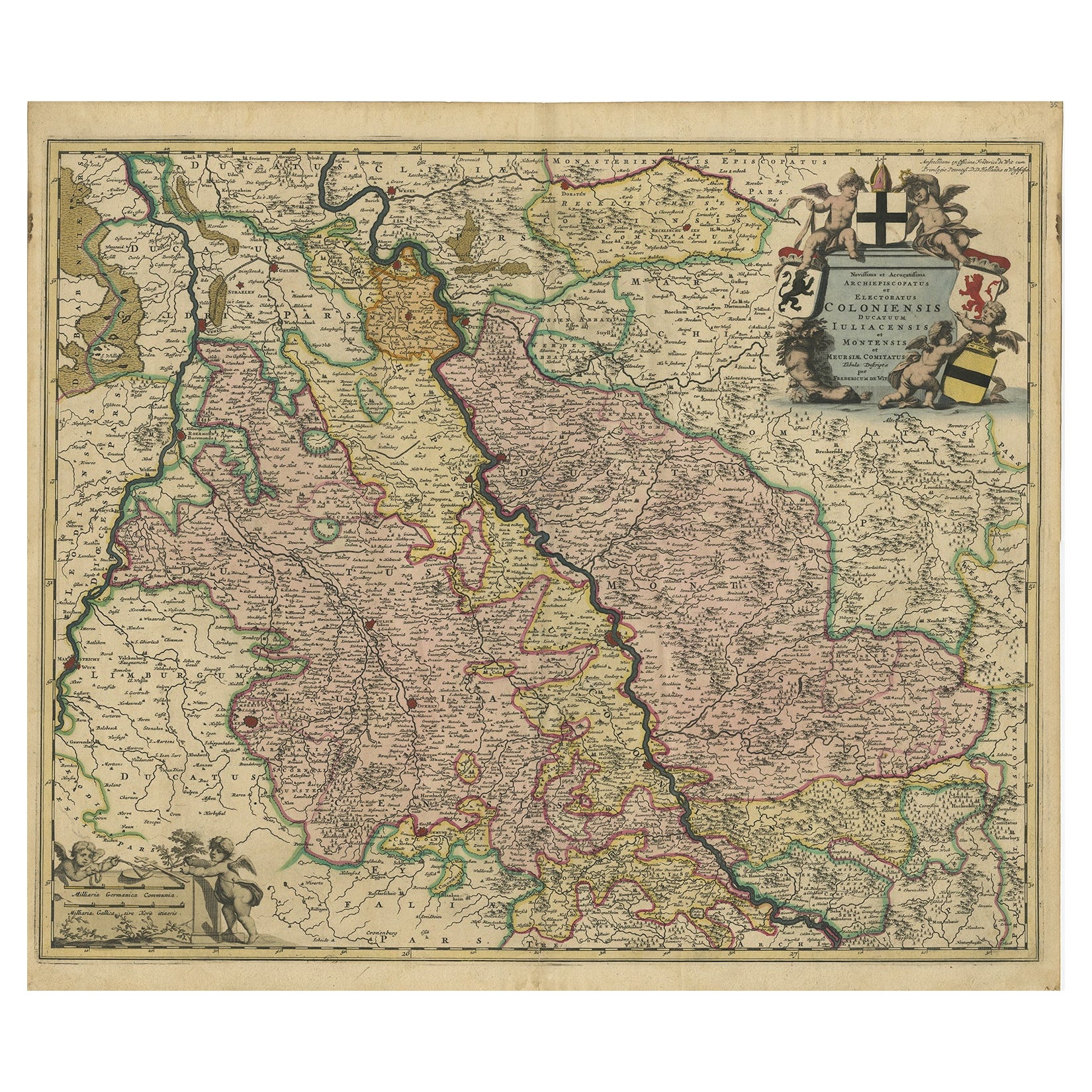
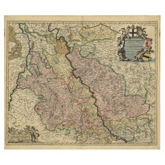
- Rhine Splendor: Antique Map of the Lower Rhine Region, circa 1680Located in Langweer, NLThe antique map titled 'Novissima et Accuratissima Archiepiscopatus et Electoratus Coloniensis Ducatuum Iuliancensis et Montensis et Meursiae Comitatus' is a handsome and detailed ma...Category
Antique 1680s Maps
MaterialsPaper
- Antique Map of Persia by A. Zatta, circa 1785Located in Langweer, NLAntique map titled 'L'Impero della Persia diviso ne suoi Stati'. The Empire of Persia divided into its states. Originates from 'Atlante Novissimo, illustrato ed accresciuto sulle oss...Category
Antique Late 18th Century Maps
MaterialsPaper
- Antique Map of Persia, Also Showing the Indus River, circa 1673By Joan (Johannes) BlaeuLocated in Langweer, NLAntique map titled 'Persia sive Sophorum Regnum'. Original old map of Persia. The map extends from the Eastern Mediterranean to Tacalistan and the Indus River and the Dalanguer Mount...Category
Antique Late 17th Century Maps
MaterialsPaper
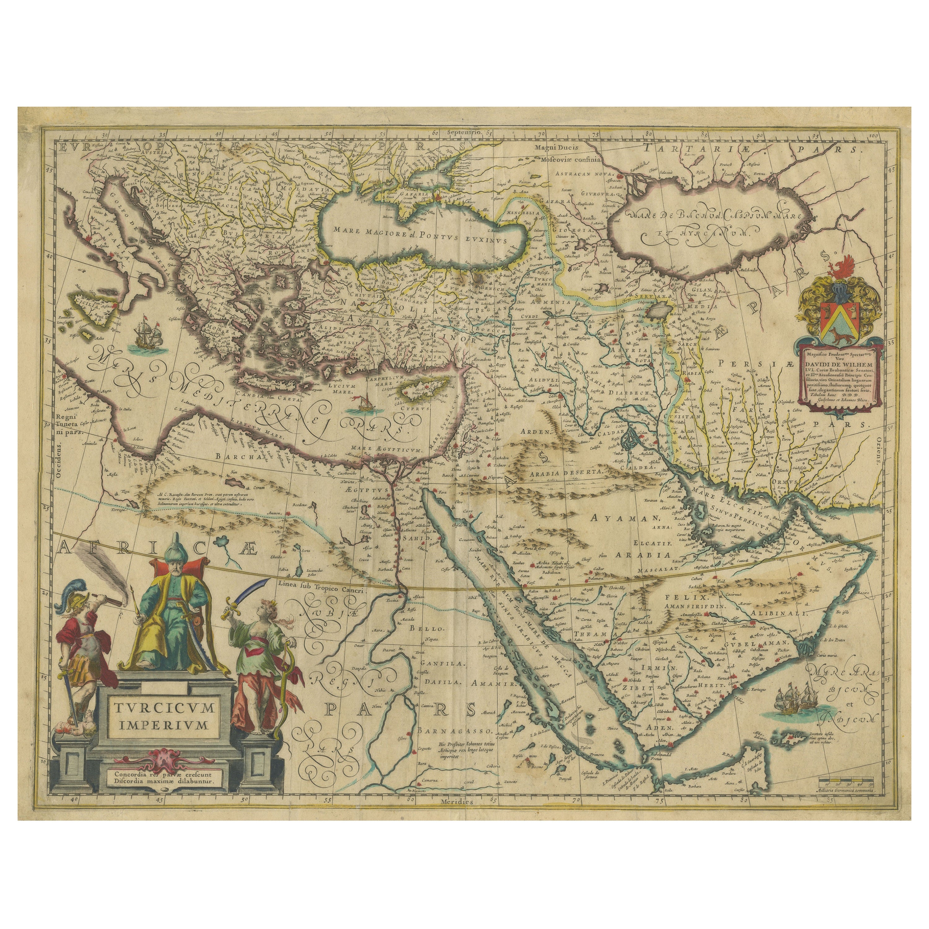
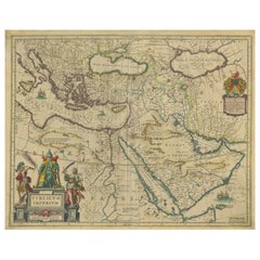
- Imperial Splendor: Antique Map of the Ottoman Empire by Blaeu, circa 1640Located in Langweer, NLThe antique map titled 'Turcicum Imperium' is an original old map of the Ottoman Empire, historically and colloquially known as the Turkish Empire. Here are the key features and deta...Category
Antique Mid-17th Century Maps
MaterialsPaper
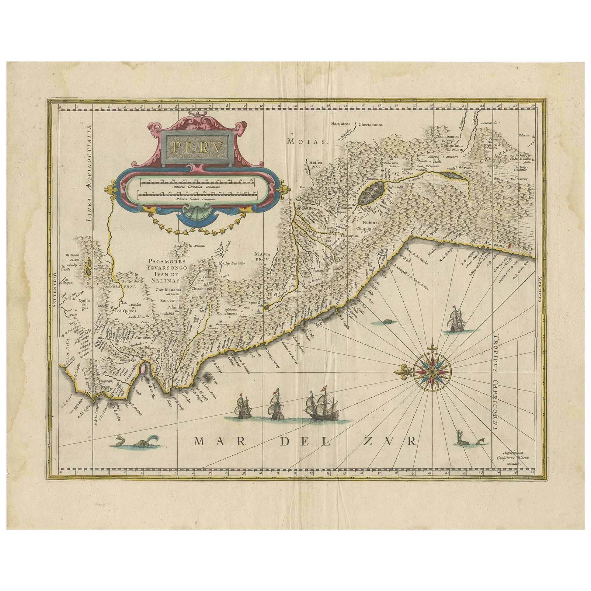
- Antique Map of Peru in South America by Blaeu, circa 1645Located in Langweer, NLAntique map titled 'Peru'. Original antique map of Peru. With cartouche, compass rose, ships and two sea-monsters. Published by W. Blaeu, circa 1645.Category
Antique Mid-17th Century Maps
MaterialsPaper
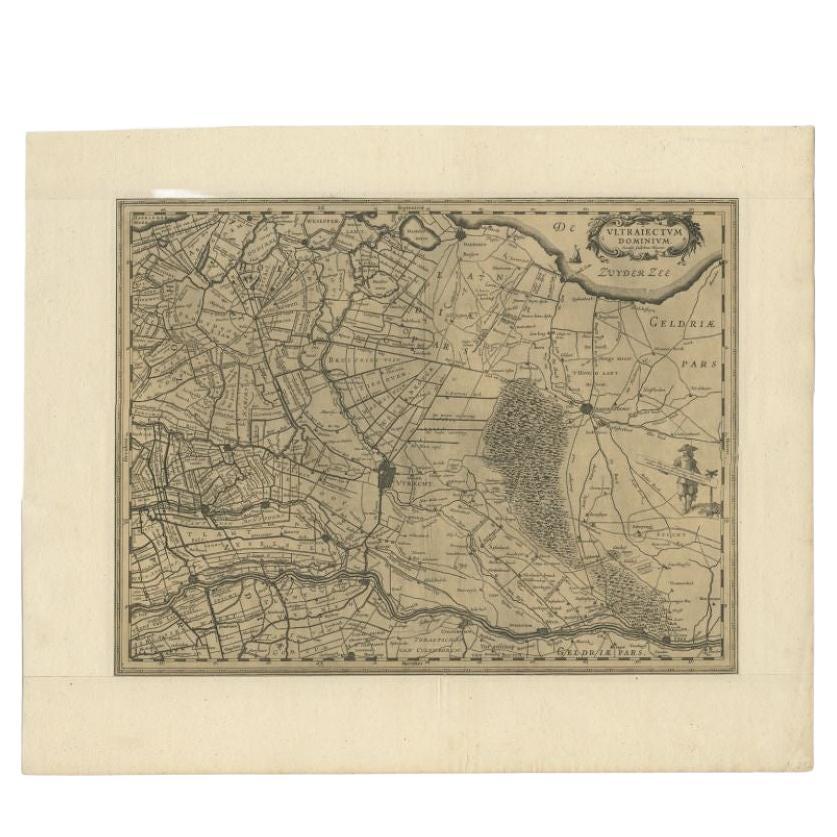
- Original Antique Map of Utrecht in the Netherlands by Blaeu, C.1645Located in Langweer, NLAntique map titled 'Ultraiectum Dominium'. Old map of the province of Utrecht, the Netherlands. This map originates from 'Theatrum Orbis Terrarum (..)'. Artists and Engravers: Wi...Category
Antique 17th Century Maps
MaterialsPaper


You May Also Like
- Original Antique Map of South America, circa 1830Located in St Annes, LancashireGreat map of South America Copper plate engraving Published by Butterworth, Livesey & Co., circa 1830 Unframed.Category
Antique Early 1800s English Other Maps
MaterialsPaper
- Original Antique Map of Spain and Portugal, circa 1790Located in St Annes, LancashireSuper map of Spain and Portugal Copper plate engraving by A. Bell Published, circa 1790. Unframed.Category
Antique 1790s English Other Maps
MaterialsPaper
- Original Antique Map of Belgium by Tallis, Circa 1850Located in St Annes, LancashireGreat map of Belgium Steel engraving Many lovely vignettes Published by London Printing & Publishing Co. ( Formerly Tallis ), C.1850 Origin...Category
Antique 1850s English Maps
MaterialsPaper
- Map of the Republic of GenoaLocated in New York, NYFramed antique hand-coloured map of the Republic of Genoa including the duchies of Mantua, Modena, and Parma. Europe, late 18th century. Dimension: 25...Category
Antique Late 18th Century European Maps
- Antique Map of Principality of MonacoBy Antonio Vallardi EditoreLocated in Alessandria, PiemonteST/619 - "Old Geographical Atlas of Italy - Topographic map of ex-Principality of Monaco" - ediz Vallardi - Milano - A somewhat special edition ---Category
Antique Late 19th Century Italian Other Prints
MaterialsPaper
- Original Antique Map of The World by Thomas Clerk, 1817Located in St Annes, LancashireGreat map of The Eastern and Western Hemispheres On 2 sheets Copper-plate engraving Drawn and engraved by Thomas Clerk, Edinburgh. Published by Mackenzie And Dent, 1817 ...Category
Antique 1810s English Maps
MaterialsPaper


