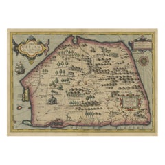
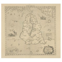
Stunning Antique Map of the Island Ceylon or Sri Lanka
View Similar Items


Want more images or videos?
Request additional images or videos from the seller
1 of 7
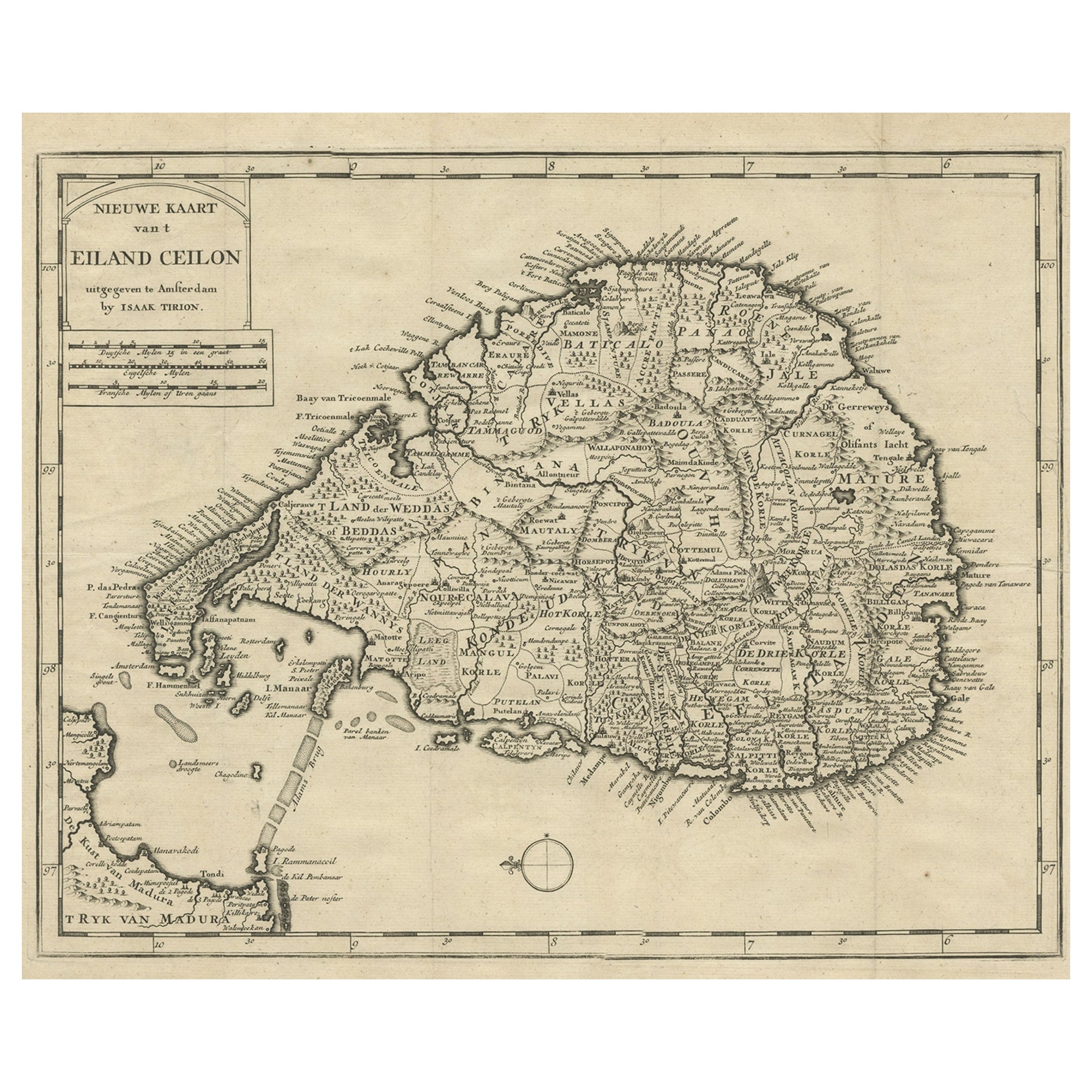
Stunning Antique Map of the Island Ceylon or Sri Lanka
About the Item
- Creator:Gerard Mercator (Artist)
- Dimensions:Height: 15.56 in (39.5 cm)Width: 20.67 in (52.5 cm)Depth: 0.02 in (0.5 mm)
- Materials and Techniques:
- Period:Early 17th Century
- Date of Manufacture:1606
- Condition:Wear consistent with age and use. General age-related toning. Original folding line, latin text on verso. Minor wear, one very small defect just outside the map border. Please study images carefully.
- Seller Location:Langweer, NL
- Reference Number:Seller: BG-133111stDibs: LU3054331030372
About the Seller
5.0
Platinum Seller
These expertly vetted sellers are 1stDibs' most experienced sellers and are rated highest by our customers.
Established in 2009
1stDibs seller since 2017
1,933 sales on 1stDibs
More From This SellerView All
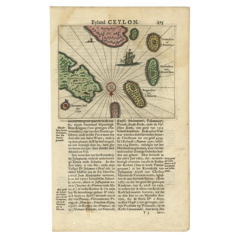
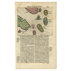
- Antique 17th Century Map of the Islands Near Ceylon or Sri Lanka, 1672Located in Langweer, NLAntique map titled 'Eyland Ceylon.' Map of the islands near Ceylon or Sri Lanka. Dutch text on verso. Source unknown, to be determined. Artists and Engravers: Philip Baldaeus (1632-...Category
Antique 17th Century Maps
MaterialsPaper
 $192 Sale Price30% Off
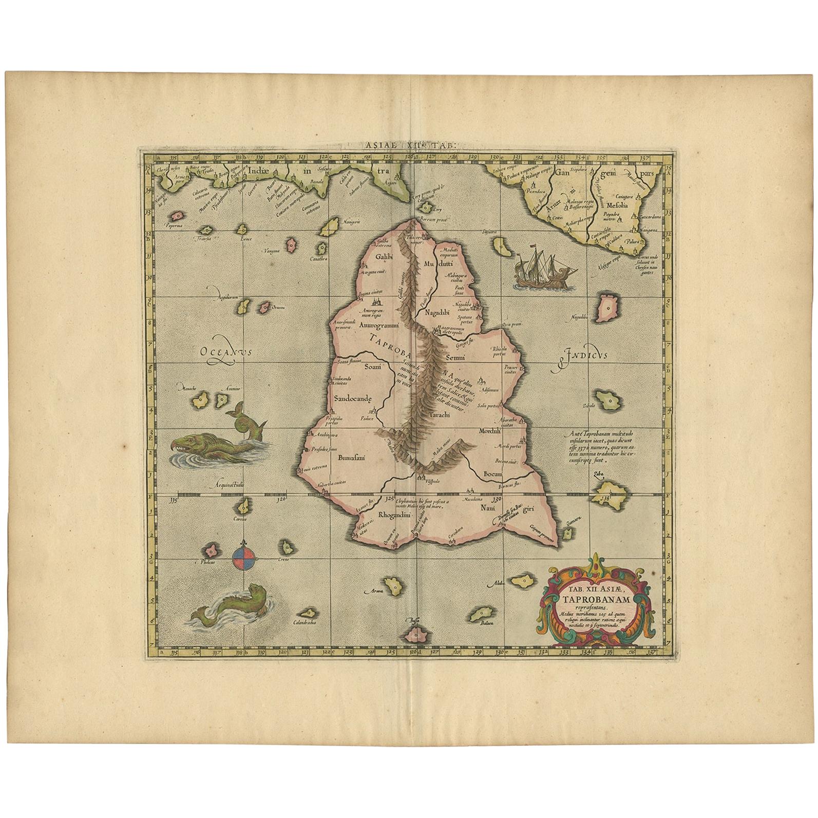
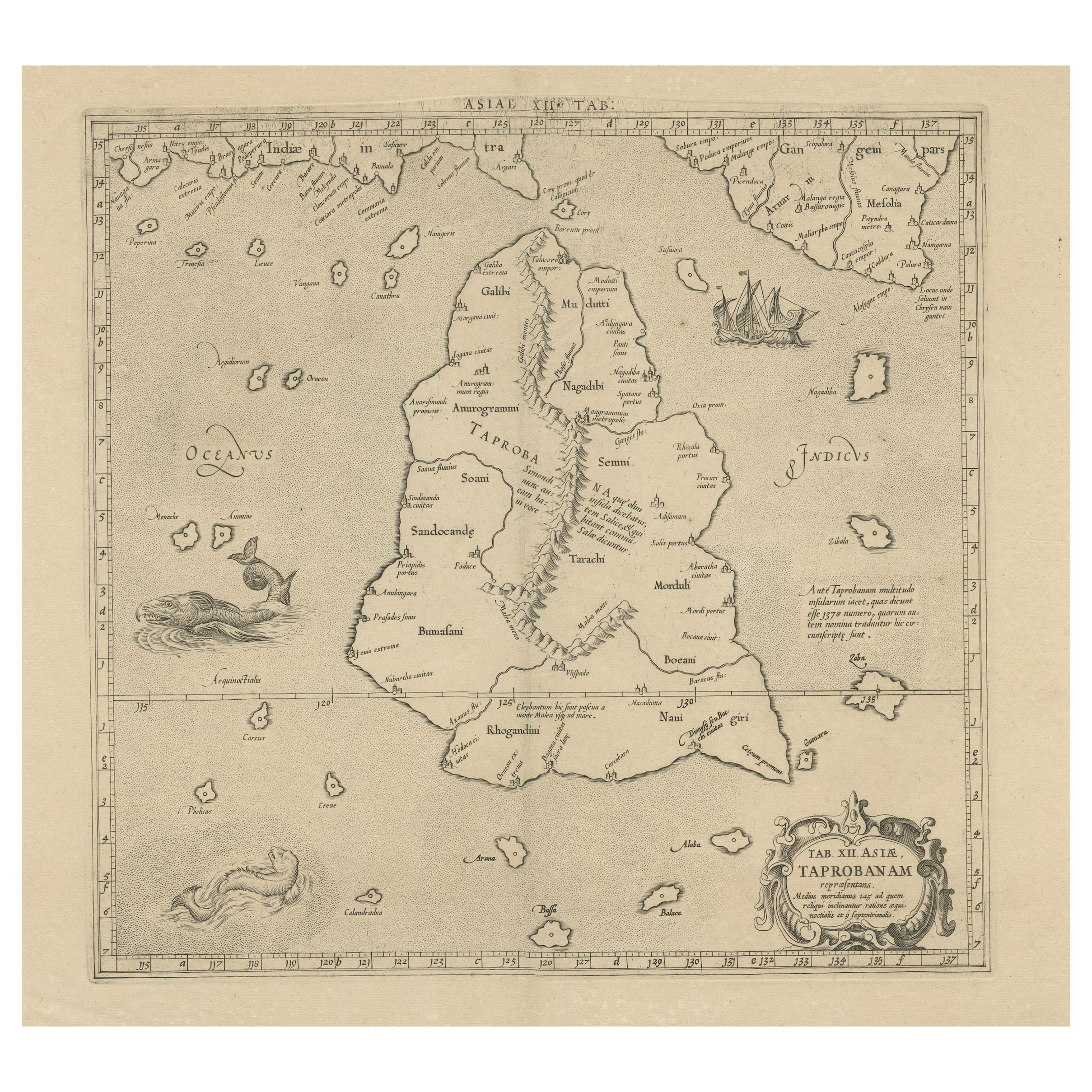
 - Antique Map of Ceylon or Sri Lanka by Ptolemy/Mercator, circa 1695Located in Langweer, NLAntique map titled 'Tab XII Asiae Taprobanam'. Ptolemaic map of Taprobana (Sri Lanka). Ptolemy drew on the accounts of travelers and sailors and though the information was secondhand and often inaccurate it represented the most advanced account of the world's geography at that time. This map depicts the island with the typical misconceptions of Ptolemy with the island straddling the Equator and nearly divided by a ridge of mountains. A small part of India is incorrectly shown in the northeast corner of the map. The stipple engraved sea is filled with an oriental ship...Category
Antique Late 17th Century Maps
MaterialsPaper
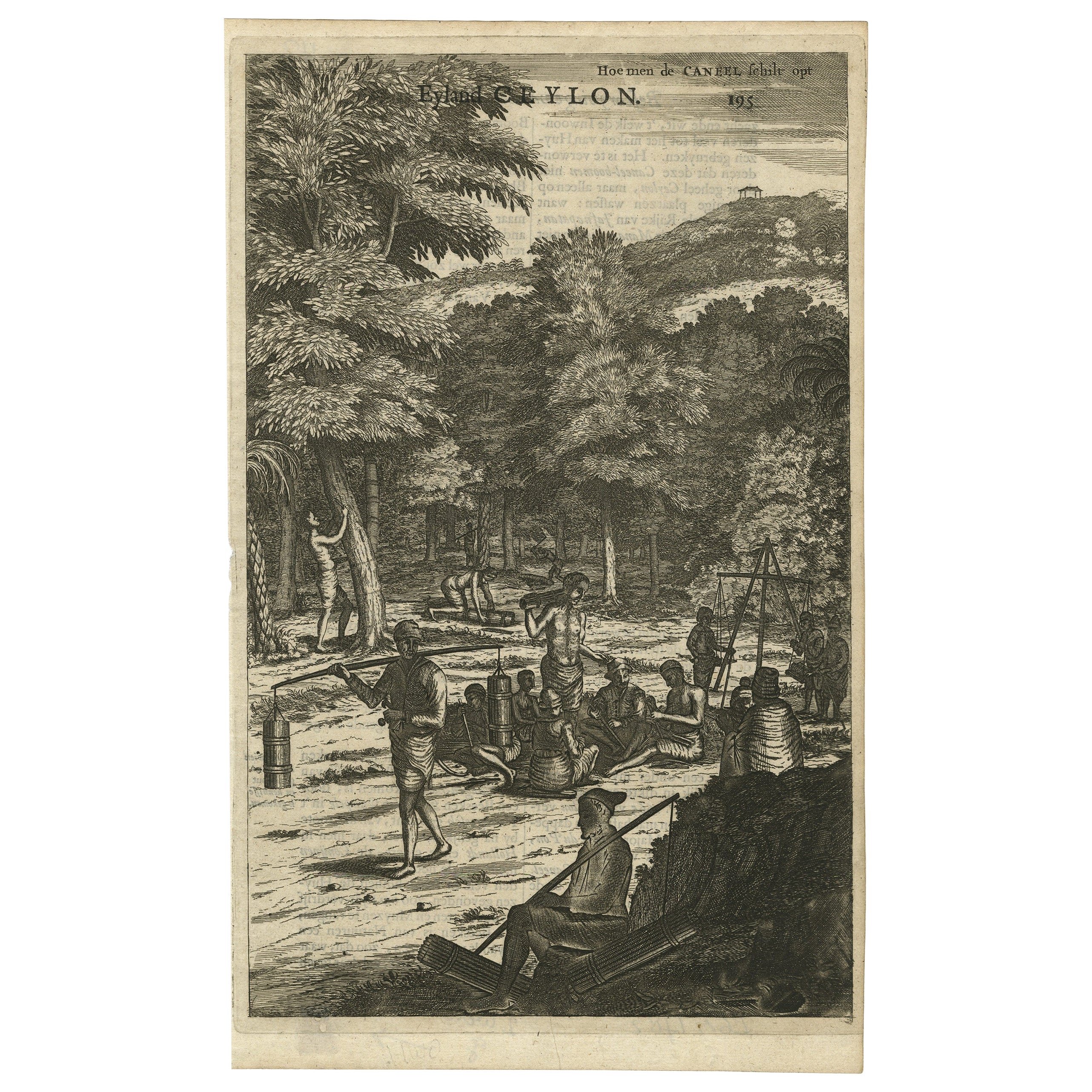
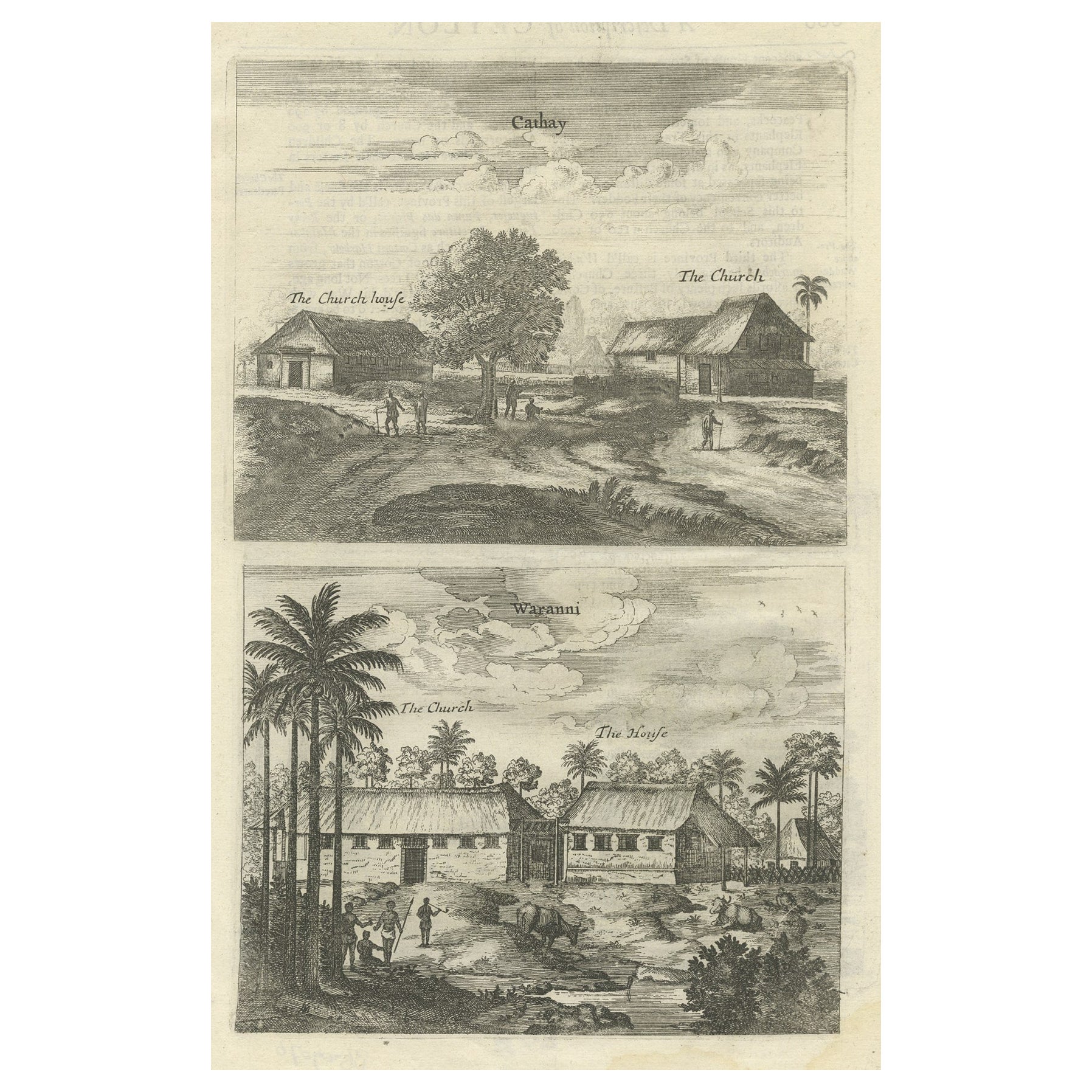
- Old Print of Farmers Harvesting Cinnamon on the Island Ceylon or Sri Lanka, 1672Located in Langweer, NLAntique print, titled: 'Hoe men de Caneel schilt opt Eyland Ceylon.' This rare original plate shows a group of farmers harvesting cinnamon on the island of Ceylon / Sri Lanka. Du...Category
Antique 1670s Prints
MaterialsPaper
 $333 Sale Price20% Off
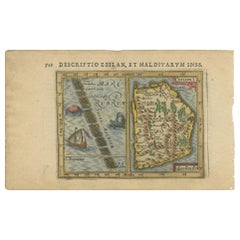
 - Antique Miniature Map of Ceylon 'Sri Lanka' and the Maldives by Bertius, 1618Located in Langweer, NLAntique map titled 'Descriptio Zeilan, et Maldivarum Inss'. Rare, original antique miniature map of Ceylon/Sri Lanka and the Maldives. This map originate...Category
Antique Early 17th Century Maps
MaterialsPaper
 $439 Sale Price20% Off
 - Rare Original Antique Ptolemy Map of Ceylon, Present Day Sri LankaLocated in Langweer, NLOriginal antique map titled 'Tab XII Asiae Taprobanam (..)'. For this map of Toprobana (Sri Lanka), Ptolemy drew on the accounts of travelers and sailors and though the information was secondhand and often inaccurate, it represented the most advanced account of the world's geography at that time. This map depicts the island with the typical misconceptions of the period with the enlarged island straddling the Equator and nearly divided by a ridge of mountains. A small part of India is incorrectly shown in the northeast corner of the map and a spurious coastline labeled Gangem fills the upper right corner. The stipple engraved sea contains an oriental ship...Category
Antique Late 17th Century Maps
MaterialsPaper
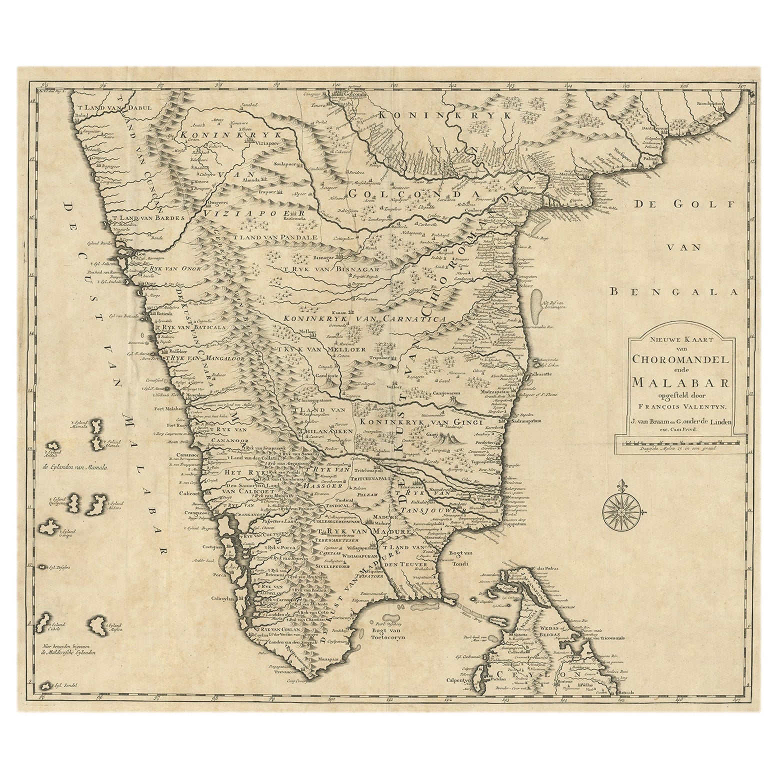
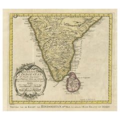
- Original Antique Map of Southern India and Ceylon 'Present-Day Sri Lanka'By Jakob van der SchleyLocated in Langweer, NLAntique map titled 'Suite de la Carte de l'Indoustan (..) - Vervolg van de Kaart van Hindoestan (..)'. Original antique map of Southern India and Ceylon (present-day Sri Lanka). This...Category
Antique Mid-18th Century Maps
MaterialsPaper

You May Also Like
- 17th Century Hand-Colored Map of Southeastern England by Mercator and HondiusBy Gerard MercatorLocated in Alamo, CAA 17th century copperplate hand-colored map entitled "The Sixt Table of England" by Gerard Mercator and Jodocus Hondius, published in Amsterdam in 1635 in 'Cosmographicall Descriptio...Category
Antique Mid-17th Century Dutch Maps
MaterialsPaper
- 17th Century Hand-Colored Map of Valencia and Murcia, Spain by Mercator/HondiusBy Gerard MercatorLocated in Alamo, CAA 17th century hand-colored map entitled "Regni Valentiae Typus, Valentia and Murcia" by Gerard Mercator and Joducus Hondius, published in Amsterdam in 1635 in 'Cosmographicall Descr...Category
Antique Mid-17th Century Dutch Maps
MaterialsPaper
- Map of the Republic of GenoaLocated in New York, NYFramed antique hand-coloured map of the Republic of Genoa including the duchies of Mantua, Modena, and Parma. Europe, late 18th century. Dimension: 25...Category
Antique Late 18th Century European Maps
- Hand-Colored 18th Century Homann Map of Denmark and Islands in the Baltic SeaBy Johann Baptist HomannLocated in Alamo, CAAn 18th century copper plate hand-colored map entitled "Insulae Danicae in Mari Balthico Sitae utpote Zeelandia, Fionia, Langelandia, Lalandia, Falstria, Fembria Mona" created by Joh...Category
Antique Early 18th Century German Maps
MaterialsPaper
- Antique Map of Principality of MonacoBy Antonio Vallardi EditoreLocated in Alessandria, PiemonteST/619 - "Old Geographical Atlas of Italy - Topographic map of ex-Principality of Monaco" - ediz Vallardi - Milano - A somewhat special edition ---Category
Antique Late 19th Century Italian Other Prints
MaterialsPaper
 $228 Sale Price74% Off
 - Northern Scotland: A 16th Century Hand-colored Map by MercatorBy Gerard MercatorLocated in Alamo, CAA framed hand-colored 16th century map of Northern Scotland by Gerard Mercator entitled "Scotiae pars Septentrionalis", published in Amsterdam in 1636. It is a highly detailed map of the northern part of Scotland, with the northwest Highlands and the cities Inverness and Aberdeen, as well as the Orkney Islands and the Hebrides. There is a decorative title cartouche in the upper left corner. The map is presented in an antiqued brown wood...Category
Antique 16th Century Dutch Maps
MaterialsPaper


Recently Viewed
View AllMore Ways To Browse
Antique Map Orient
Antique Ships Compass
Ship Compass Antique
Antique Ship Compass
Antique Sailing Map
Antique Sailing Maps
17th Century Elephant
Ceylon Map
Antique Map Ceylon
Lanka Map
Sri Lanka Maps
Sri Lankan Map
Sri Lanka Map
Antique Sri Lanka Map
Victorian Fence
Battle Maps
Russian Antique Plates
Floor Vase Wood