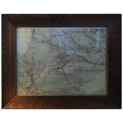
Topographical Map of the Pennsylvania Mountains in a Quarter Sawn Oak Frame
View Similar Items


1 of 20
Topographical Map of the Pennsylvania Mountains in a Quarter Sawn Oak Frame
About the Item
- Dimensions:Height: 1 in (2.54 cm)Width: 18.5 in (46.99 cm)Depth: 15 in (38.1 cm)
- Style:American Craftsman (Of the Period)
- Materials and Techniques:
- Place of Origin:
- Period:
- Date of Manufacture:1870
- Condition:Wear consistent with age and use. The map and frame are in good condition.
- Seller Location:Chicago, IL
- Reference Number:1stDibs: LU848812552611
You May Also Like
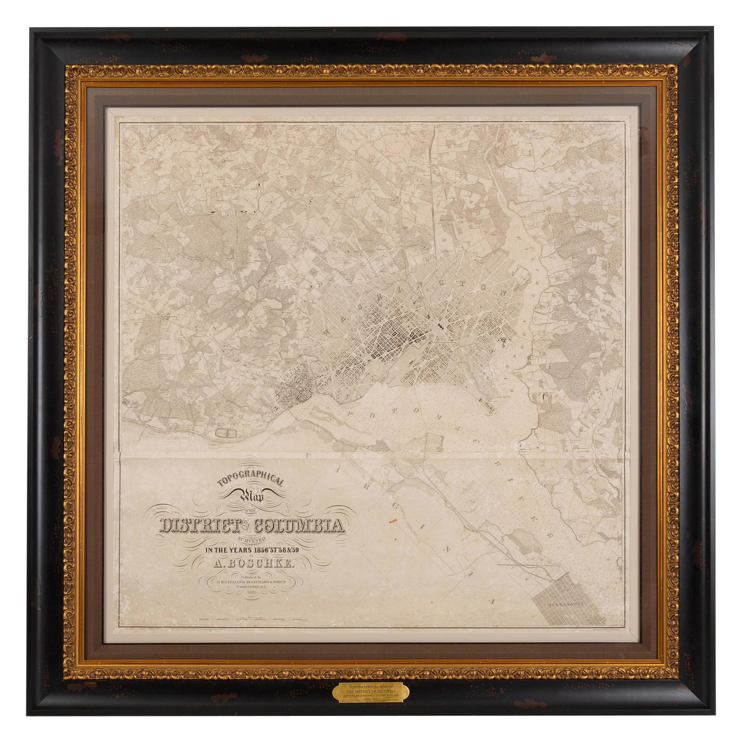
- 1861 Topographical Map of the District of Columbia, by Boschke, Antique MapLocated in Colorado Springs, COPresented is an original map of Albert Boschke's extremely sought-after "Topographical Map of the District of Columbia Surveyed in the Years 1856 ...Category
Antique 1860s American Historical Memorabilia
MaterialsPaper
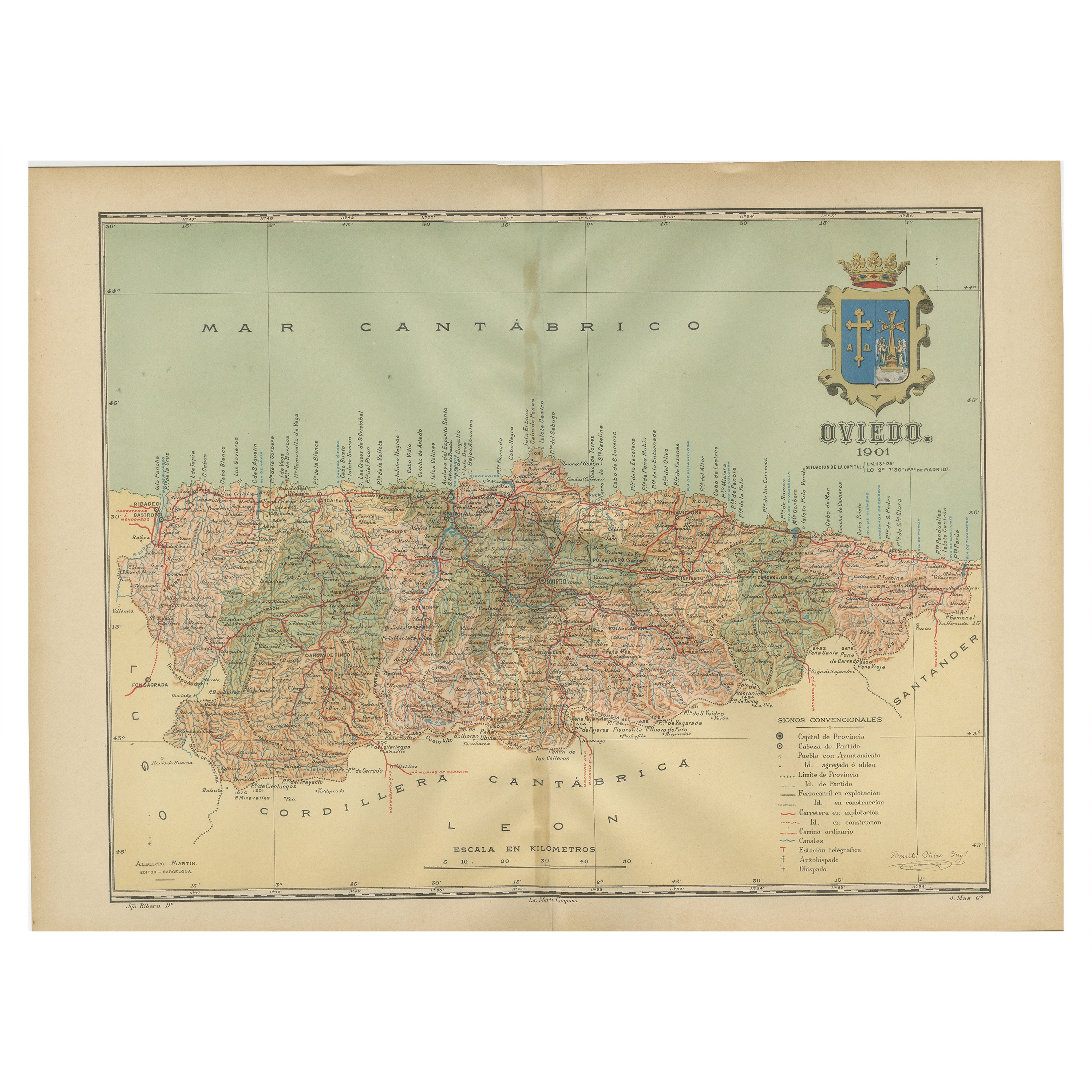
- The Lay of the Land: A 1901 Topographic Map of Oviedo, AsturiasLocated in Langweer, NLThe province depicted on the historical map on offer, Oviedo, corresponds to the modern-day autonomous community of Asturias in northwestern Spain. Here are some points about Asturia...Category
Antique Early 1900s Maps
MaterialsPaper
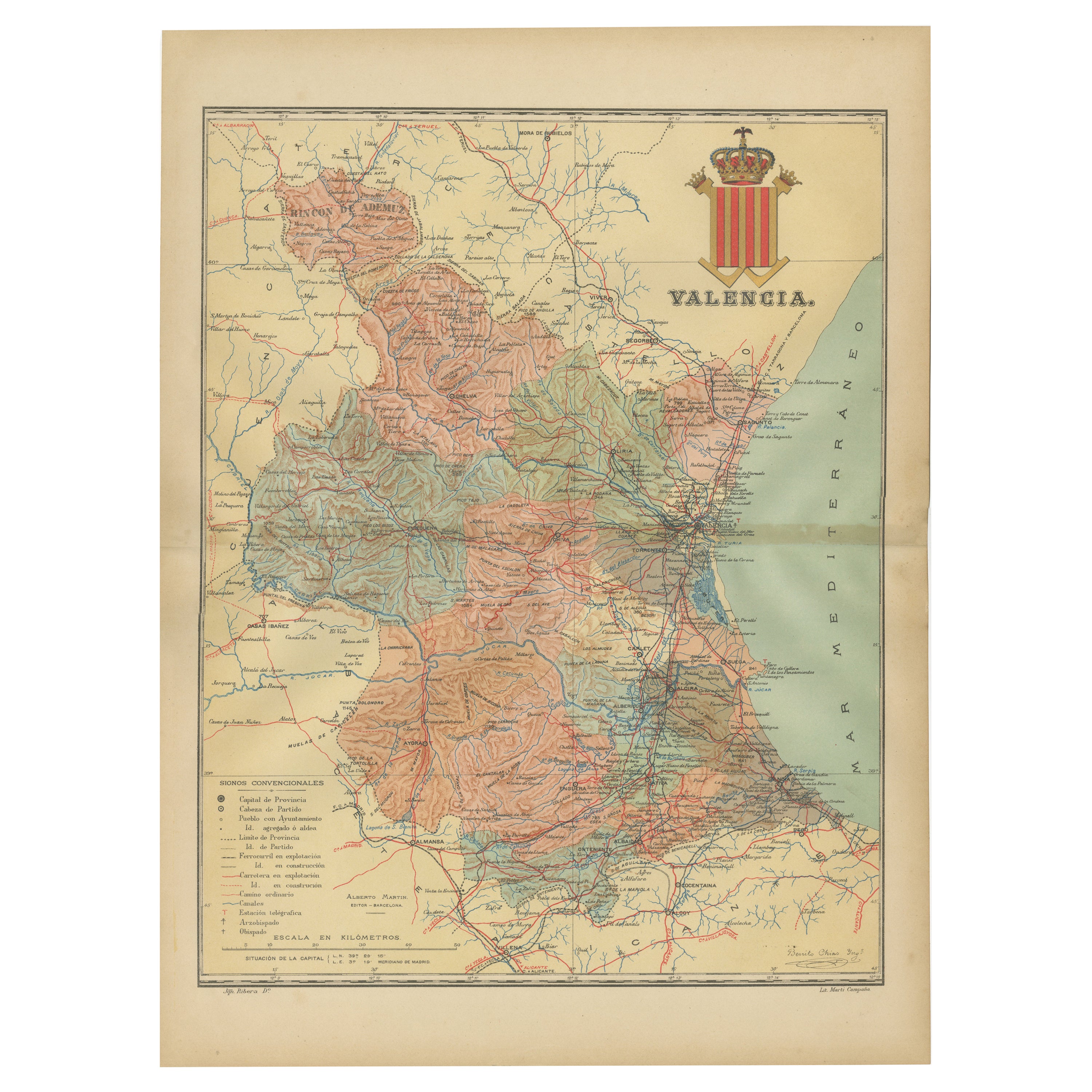
- Topographical and Infrastructure Map of the Province of Valencia, 1901Located in Langweer, NLA historical map of the province of Valencia, dated 1901. The map includes intricate details such as topographical features, with mountain ranges and river systems prominently marked...Category
Antique Early 1900s Maps
MaterialsPaper
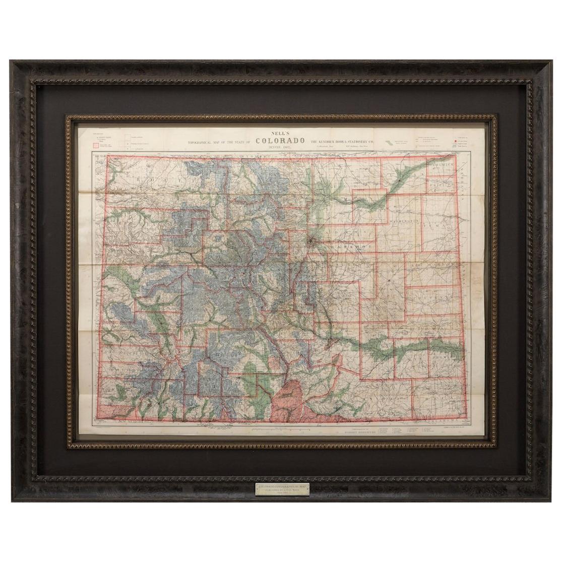
- 1907 Map of Colorado, Antique Topographical Map, by Louis NellLocated in Colorado Springs, COThis highly detailed pocket map is a topographical map of the state of Colorado by Louis Nell from 1907. The map "has been complied from all availabl...Category
Antique Early 1900s American Maps
MaterialsPaper
- Orense in Depth: A 1902 Topographical Map of Galicia's Mountainous ProvinceLocated in Langweer, NLThe map is a detailed cartographic representation of the province of Orense (Ourense in Galician), located in the northwest of Spain, as it was in 1902. Here's a brief description an...Category
Antique Early 1900s Maps
MaterialsPaper
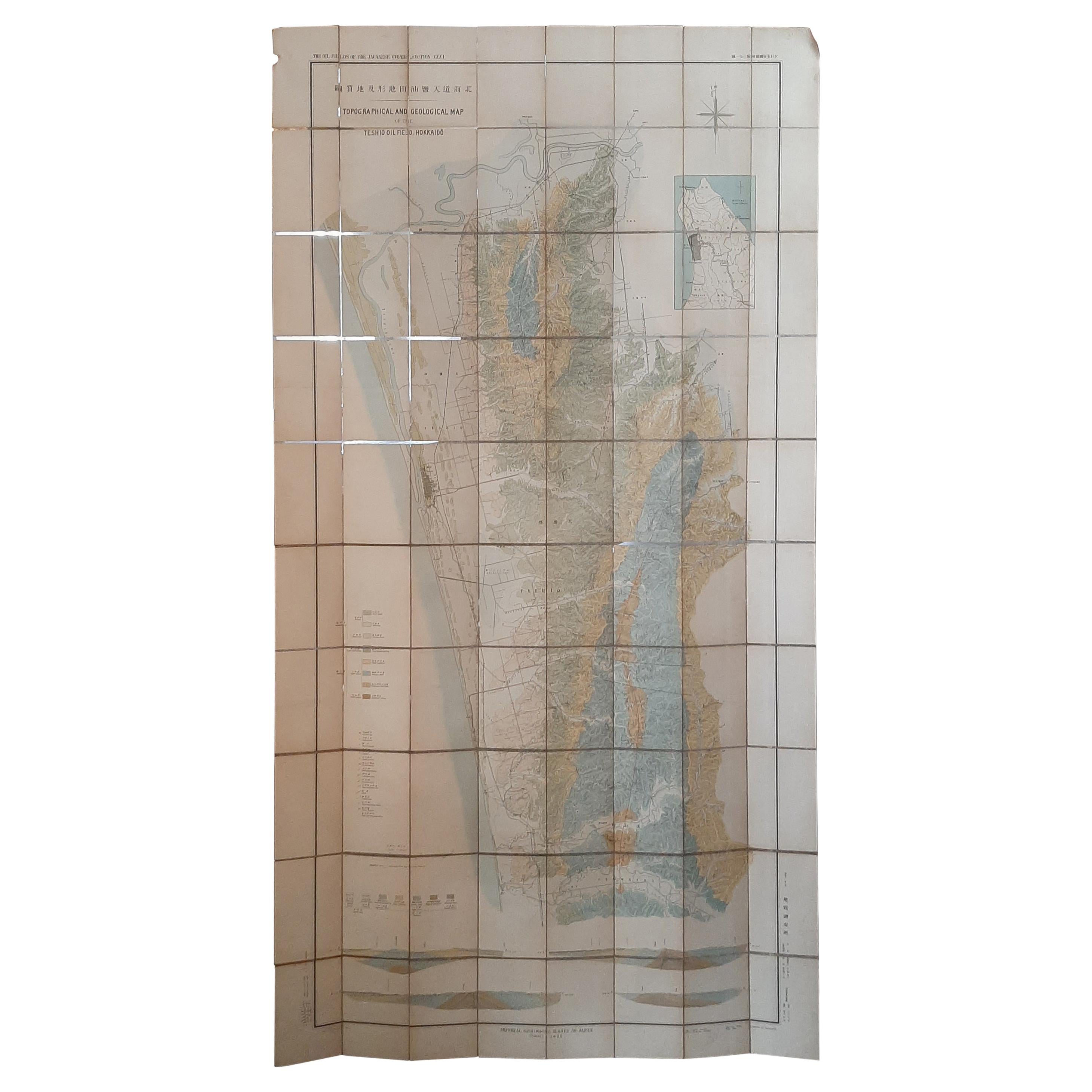
- Large Topographical and Geological Map of the Teshio Oil Field, '1936'Located in Langweer, NLTopographical and geological map of the Teshio oil field. Shows location of oil well, oil sand, natural gas, coal, Sulphur spring, anticlinal axis, prof...Category
20th Century Maps
MaterialsLinen, Paper
 $1,055 Sale Price20% Off


