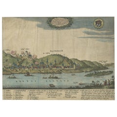
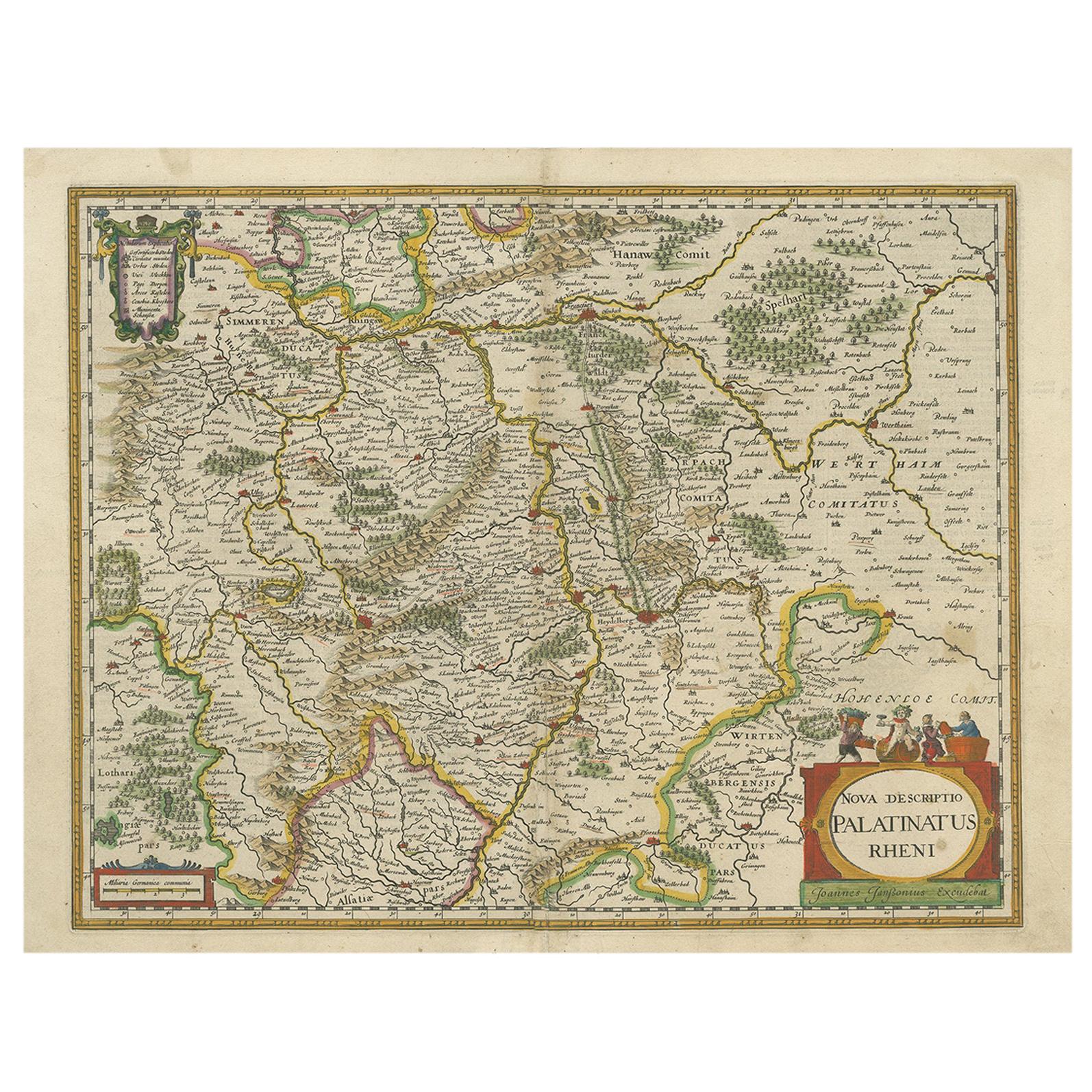
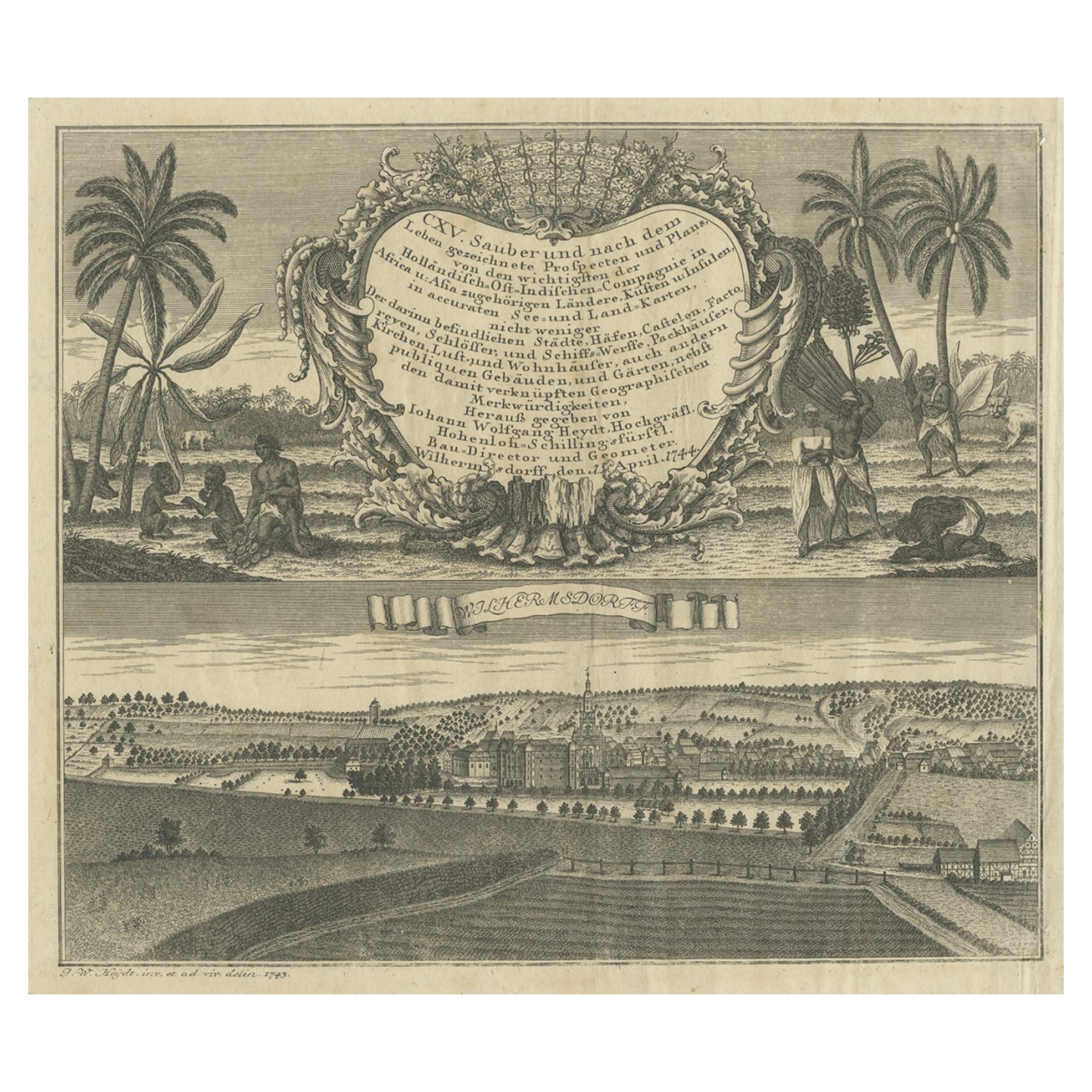
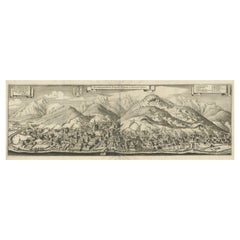
View of Bacharach, Mainz-Bingen District in Rhineland-Palatinate, Germany, 1650
View Similar Items
Want more images or videos?
Request additional images or videos from the seller
1 of 5
View of Bacharach, Mainz-Bingen District in Rhineland-Palatinate, Germany, 1650
Price:$286.32
About the Item
- Dimensions:Height: 9.85 in (25 cm)Width: 13.39 in (34 cm)Depth: 0 in (0.02 mm)
- Materials and Techniques:
- Period:1650-1659
- Date of Manufacture:circa 1650
- Condition:Wear consistent with age and use. Condition: Fair, image trimmed and margins extended/mounted. Shows visible wear and small defects. General age-related toning, blank verso. Please study image carefully.
- Seller Location:Langweer, NL
- Reference Number:Seller: JAK-1262 1stDibs: LU3054327058712
About the Seller
5.0
Recognized Seller
These prestigious sellers are industry leaders and represent the highest echelon for item quality and design.
Gold Seller
Premium sellers maintaining a 4.3+ rating and 24-hour response times
Established in 2009
1stDibs seller since 2017
2,478 sales on 1stDibs
Typical response time: 1 hour
Authenticity Guarantee
In the unlikely event there’s an issue with an item’s authenticity, contact us within 1 year for a full refund. DetailsMoney-Back Guarantee
If your item is not as described, is damaged in transit, or does not arrive, contact us within 7 days for a full refund. Details24-Hour Cancellation
You have a 24-hour grace period in which to reconsider your purchase, with no questions asked.Vetted Professional Sellers
Our world-class sellers must adhere to strict standards for service and quality, maintaining the integrity of our listings.Price-Match Guarantee
If you find that a seller listed the same item for a lower price elsewhere, we’ll match it.Trusted Global Delivery
Our best-in-class carrier network provides specialized shipping options worldwide, including custom delivery.More From This Seller
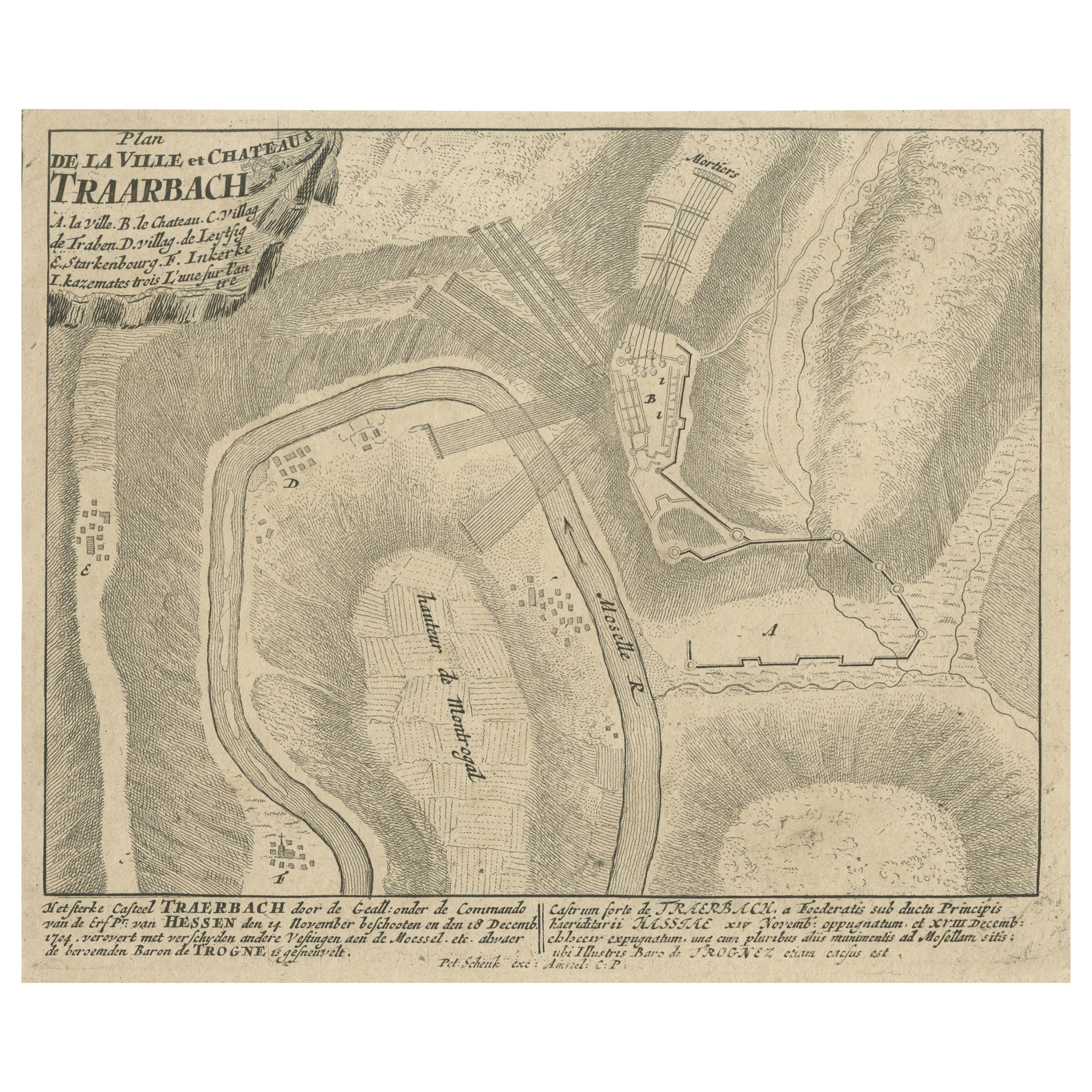
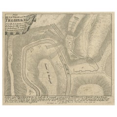
View AllOld Engraving of the Trarbach Battle in Rhineland-Palatinate, Germany, c.1710
Located in Langweer, NL
Rare antique print titled 'Plan de la Ville et Chateau Traarbach (..)'. Battle plan of Trarbach, Rhineland-Palatinate, Germany.
Published circa 1710 b...
Category
Antique 1710s Maps
Materials
Paper
$267 Sale Price
20% Off
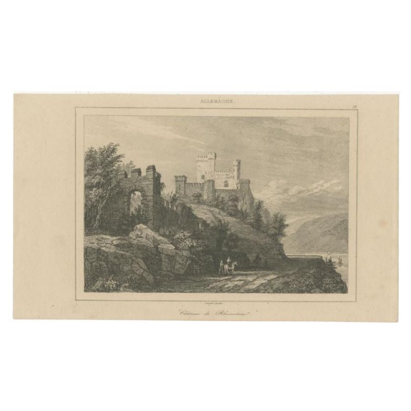
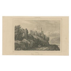
Antique Print of Rheinstein Castle in Rhineland-Palatinate, Germany, circa 1838
Located in Langweer, NL
Antique print titled 'Chateau de Rheinstein'. Original antique print of Rheinstein Castle, a castle near the town of Trechtingshausen in Rhineland-Palatinate, Germany. This print ori...
Category
Antique 19th Century Prints
Materials
Paper
$85 Sale Price
20% Off
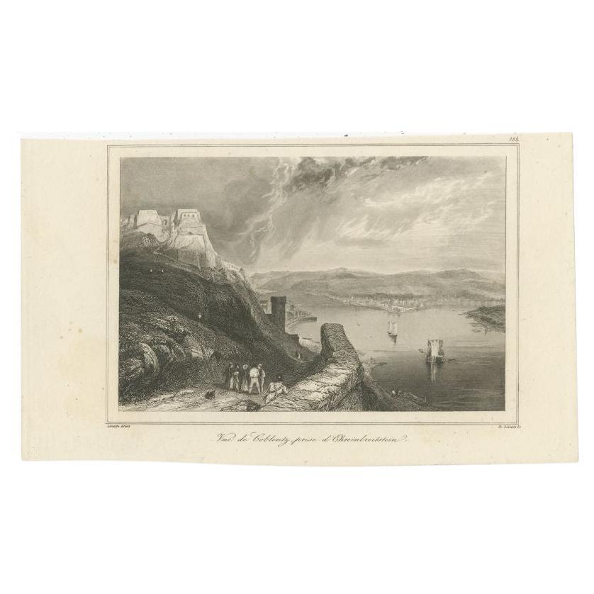
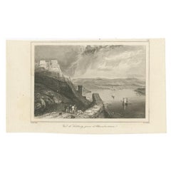
Antique Print of Ehrenbreitstein Fortress, Rhineland-Palatinates, Near Koblenz
Located in Langweer, NL
Antique print titled 'Vue de Coblentz, prise d'Ehreinbreitstein'. Original antique print of Ehrenbreitstein Fortress, a fortress in the German state of Rhineland-Palatinate, on the e...
Category
Antique 19th Century Prints
Materials
Paper
$124 Sale Price
20% Off
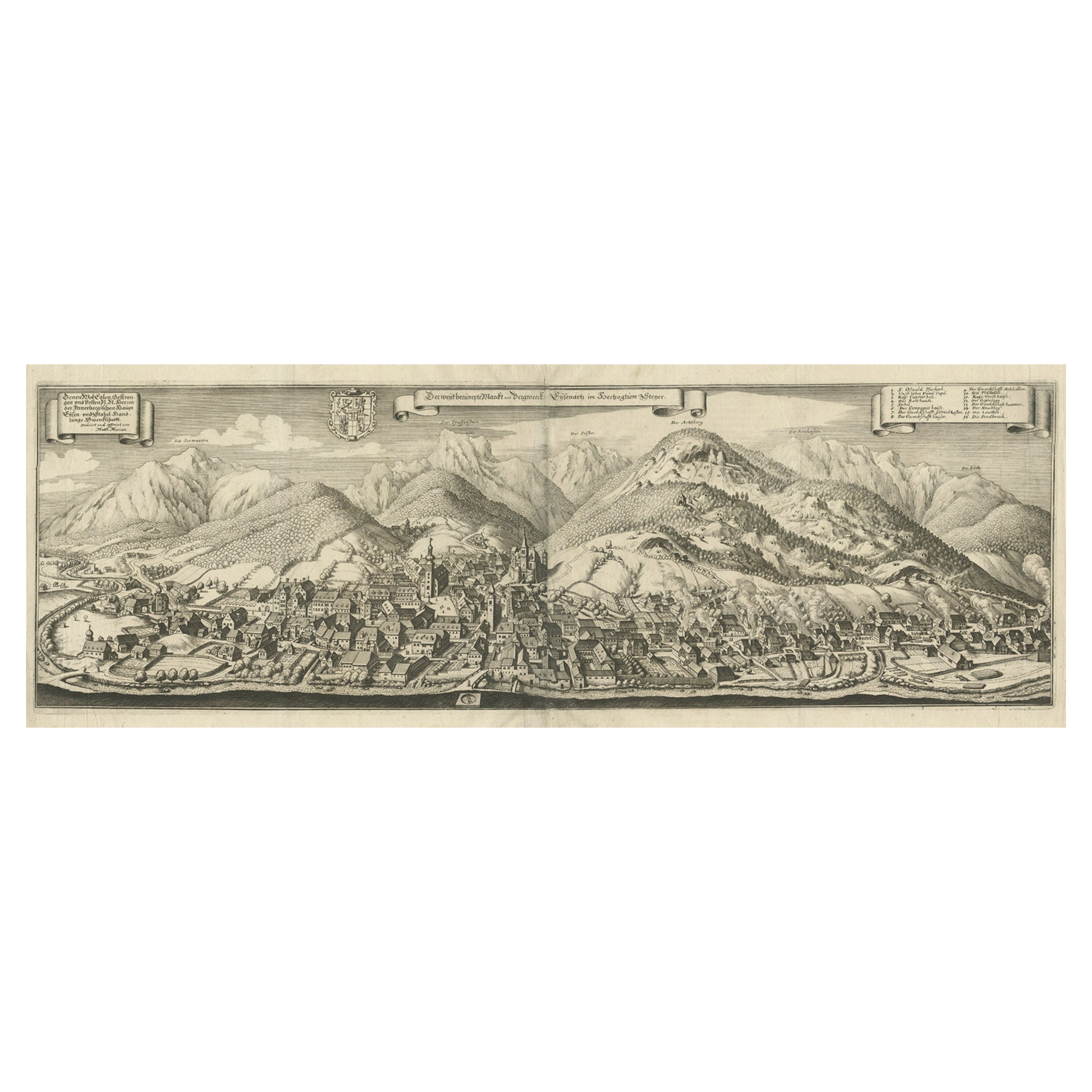
Large Panoramic View of Eisenerz, an Old Mining Town in Styria, Austria, c.1650
Located in Langweer, NL
Description: Antique print titled 'Der weyt berümpte Marckt und Bergwerck Eysenärtz im Hertzogtum Steyer'.
Large panoramic view of Eisenerz, an old mining town in the Austrian st...
Category
Antique 1650s Maps
Materials
Paper
$696 Sale Price
20% Off
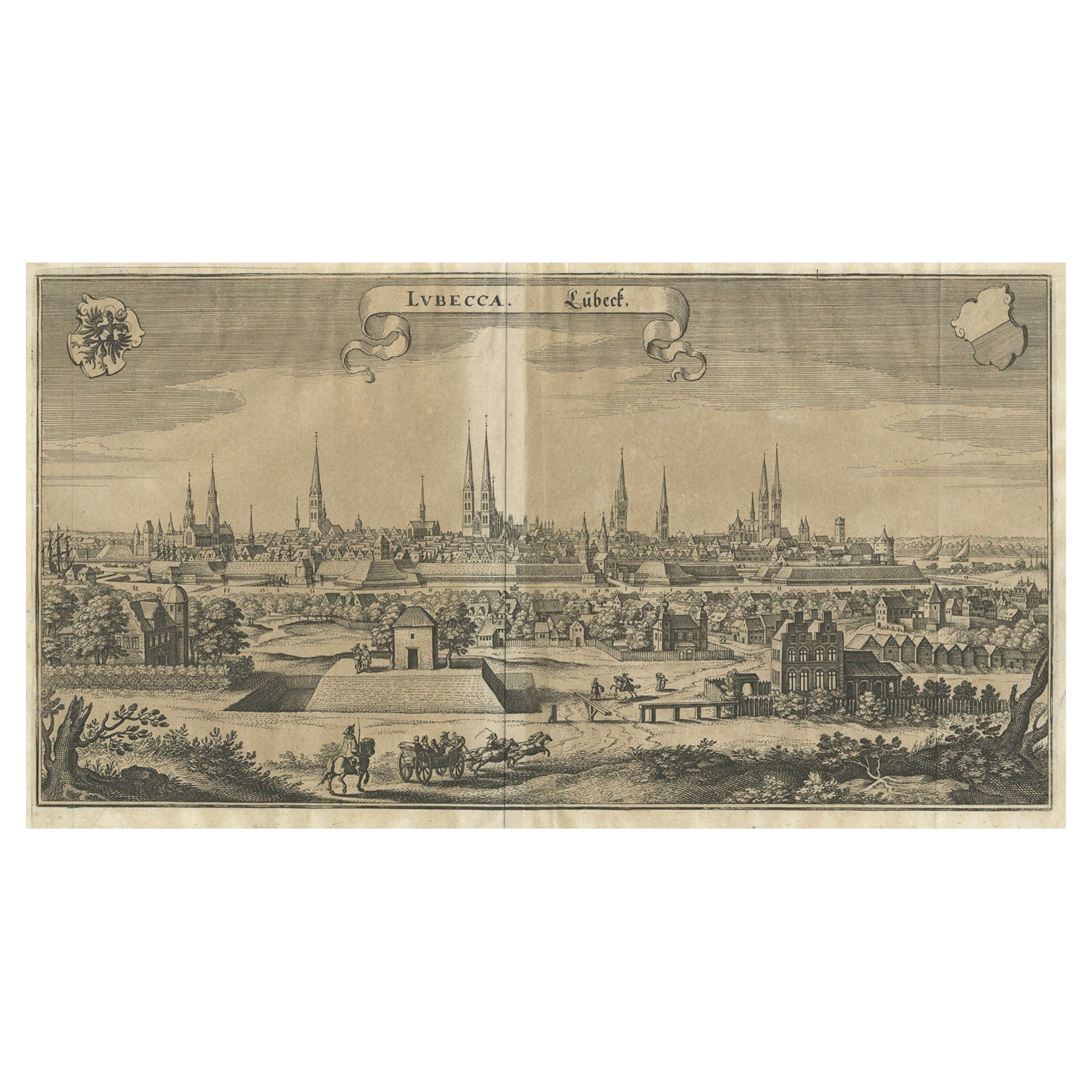
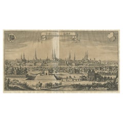
Antique Print of Hanseatic City of Lübeck in Northern Germany by Merian, c.1650
Located in Langweer, NL
Antique print titled 'Lubecca, Lübeck'. A bird's eye view of Lubeck, the northern German city in Schleswig-Holstein. This print originates from 'Topographia Saxoniae Inferioris'.
Ar...
Category
Antique 17th Century Prints
Materials
Paper
$372 Sale Price
20% Off
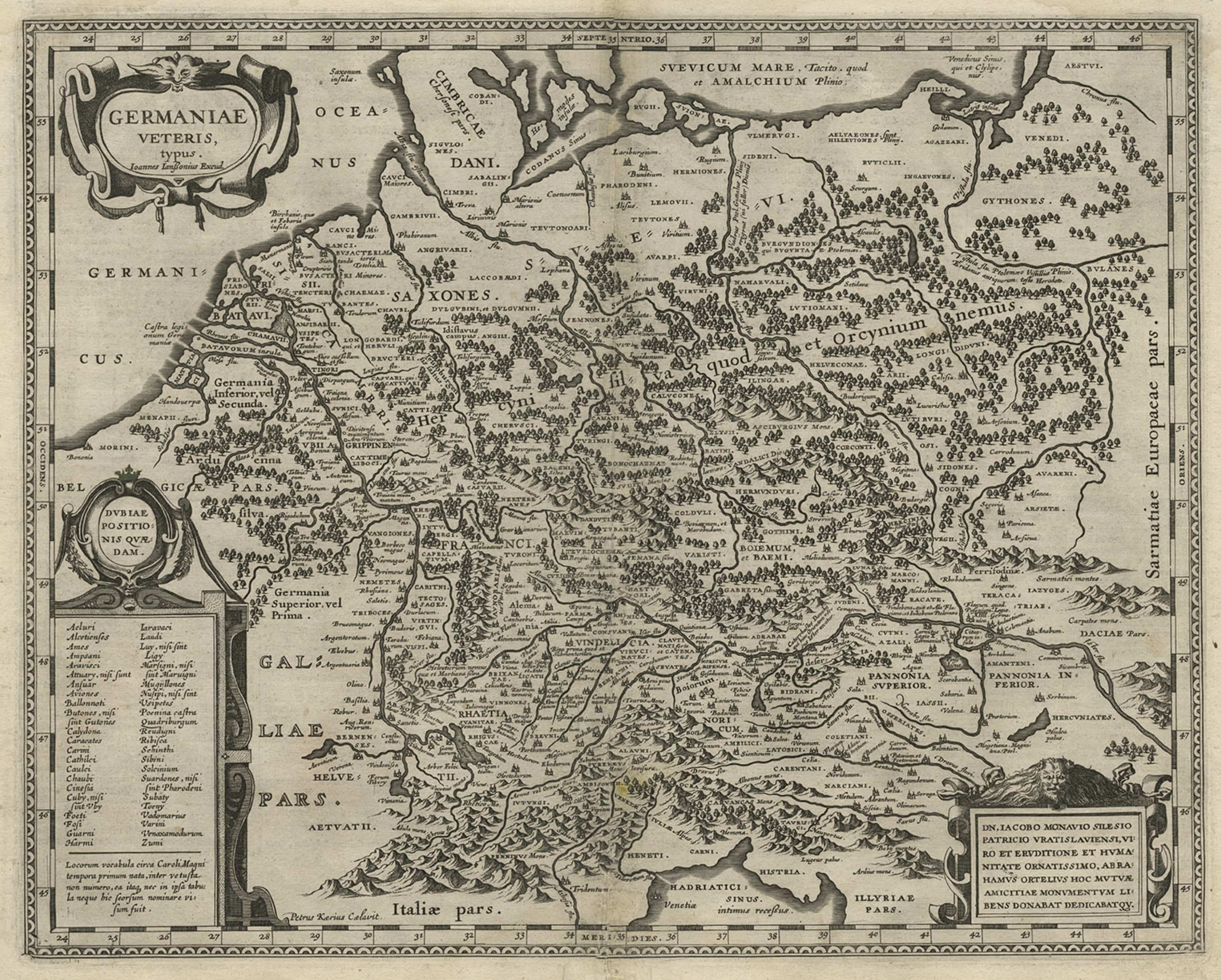
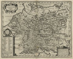
Original Rare Antique Map of the Ancient German Empire in Northern Europe, c1650
Located in Langweer, NL
Antique map titled 'Germaniae Veteris typus.'
Map of the ancient German Empire in Northern Europe, based upon an earlier map by Ortelius. Extends fr...
Category
Antique 1650s Maps
Materials
Paper
$629 Sale Price
20% Off
You May Also Like
City View of Nuremberg, Germany: An 18th Century Hand-Colored Map by M. Seutter
By Matthew Seutter
Located in Alamo, CA
An 18th century hand-colored city view of Nuremburg, Germany entitled "Geometrischer Grundris der des Heiligen Römischen Reichs Freyen Stadt Nürnberg" by Matthaus Seutter from his "A...
Category
Antique Mid-18th Century German Maps
Materials
Paper

Catalogue of Engraved Views, Plans, Etc., Of New York City, 1st Ed
Located in valatie, NY
A catalogue of engraved views, plans, etc., Of New York City, (The Collection of Percy R. Pyne II). Privately Printed by The De Vinne Press, New York, 1912. Limited to 100 copies. Gr...
Category
Early 20th Century American Books
Materials
Paper

17th Century Hand-Colored Map of a Region in West Germany by Janssonius
By Johannes Janssonius
Located in Alamo, CA
This attractive highly detailed 17th century original hand-colored map is entitled "Archiepiscopatus Maghdeburgensis et Anhaltinus Ducatus cum terris adjacentibus". It was published ...
Category
Antique Mid-17th Century Dutch Maps
Materials
Paper

Vintage "View of the Center of Paris Taken from the Air" Lithograph Map
Located in San Diego, CA
A very stylish "View of the Center of Paris Taken from the Air" lithograph map published by the Paris Ministry of Tourism, circa early 1950s. The piece measures 27" x 43" and shows...
Category
20th Century French Mid-Century Modern Prints
Materials
Paper

$680 Sale Price
20% Off
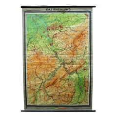
Vintage German Map Rhineland Rollable Wall Chart Poster Print
Located in Berghuelen, DE
A country core vintage pull-down map illustrating the popular German region of the Rhineland, published by Westermann. Colorful print on paper reinforced with canvas.
Measurements:
W...
Category
Vintage 1960s German Country Prints
Materials
Canvas, Wood, Paper
N.E. View of the United States Capitol, Washington, DC Antique Proof Print 1858
Located in Colorado Springs, CO
This engraved print shows a view of the United States Capitol Building, in Washington, D.C. The print depicts the neoclassical building from the northeast orientation, with a bustling street scene in front. The steel engraving is a proof printing, drawn and engraved by Henry Sartain and published in 1858.
Plans began in May 1854 to build a new cast-iron dome for the United States Capitol. The then-architect of the Capitol Thomas Walter and his team were sold on the aesthetics of a new dome, as well as the utility of a fire-proof one. A year later, on March 3, 1855, President Franklin Pierce...
Category
Antique 1850s American Prints
Materials
Paper

Recently Viewed
View AllMore Ways To Browse
Dieter Rams 620
Digsmed Denmark Tray
Dior Throw Blanket
Dog Ashtray
Don Shoemaker Sling Chair
Don Shoemaker Sling
Donut Mirror
Dragon Rope
Drapers Table Work Table
Drexel Heritage Side Table
Driftwood Console
Drummer Boy
Dudley Antique Silver
Duet Stand
Duncan Phyfe Pedestal Table
Dutch 1940 Armchair
Dutch Golden Age Maritime Art
Dux Pernilla