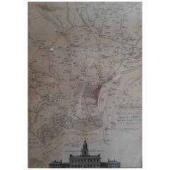
Matthew Albert Lotter 18th Century Map of Philadelphia
View Similar Items


1 of 10
Matthew Albert Lotter 18th Century Map of Philadelphia
About the Item
- Creator:Matthew Albert Lotter (Illustrator)
- Dimensions:Height: 34.5 in (87.63 cm)Width: 28.25 in (71.76 cm)Depth: 1 in (2.54 cm)
- Style:George III (Of the Period)
- Place of Origin:
- Period:1770-1779
- Date of Manufacture:1777
- Condition:Wear consistent with age and use. Foxing to the reverse (as seen in photos). Light foxing and minor fading to the front.
- Seller Location:Southfield, MI
- Reference Number:1stDibs: LU80952925452
You May Also Like
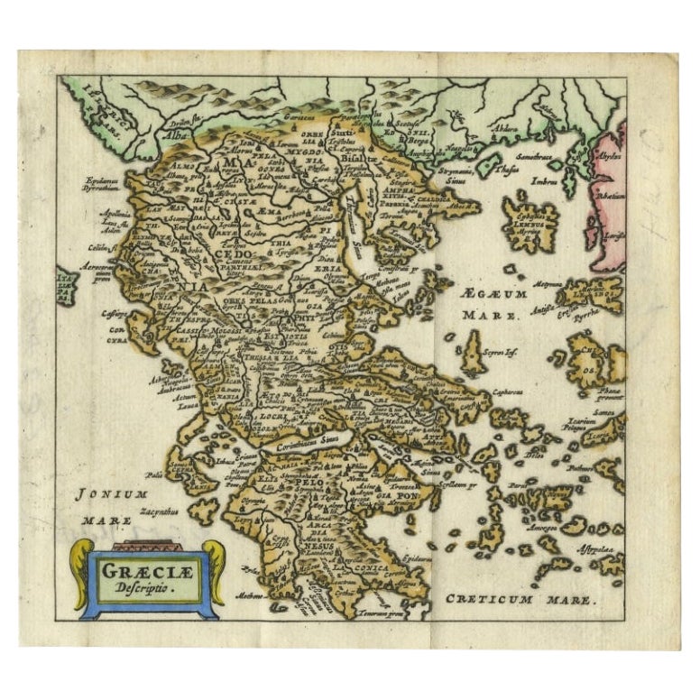
- Charming 18th Century Miniature Map of Greece, 1685Located in Langweer, NLAntique map titled 'Graeciae Descriptio.' Charming miniature map of Greece from the pocket atlas 'Introductionis in Universam Geographiam tam Veterem qu...Category
Antique 17th Century Maps
MaterialsPaper
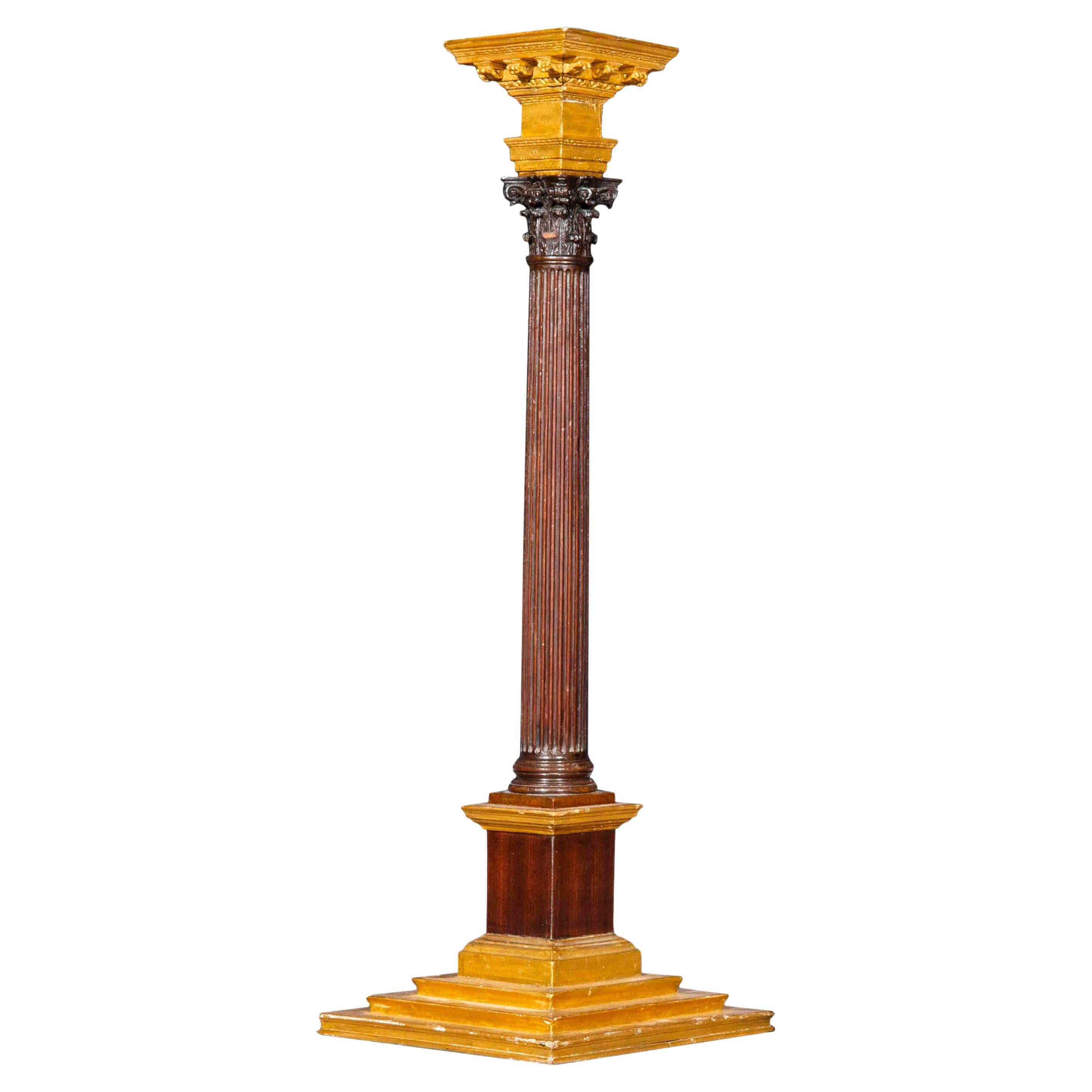
- 18th Century Architectural Model of a Corinthian ColumnLocated in London, GBAn extremely rare, exquisite Grand Tour-inspired architectural model of a Corinthian column England, third quarter of 18th century. Why we like it Exquisitely carved and having acce...Category
Antique Mid-18th Century English George III Architectural Models
MaterialsWood
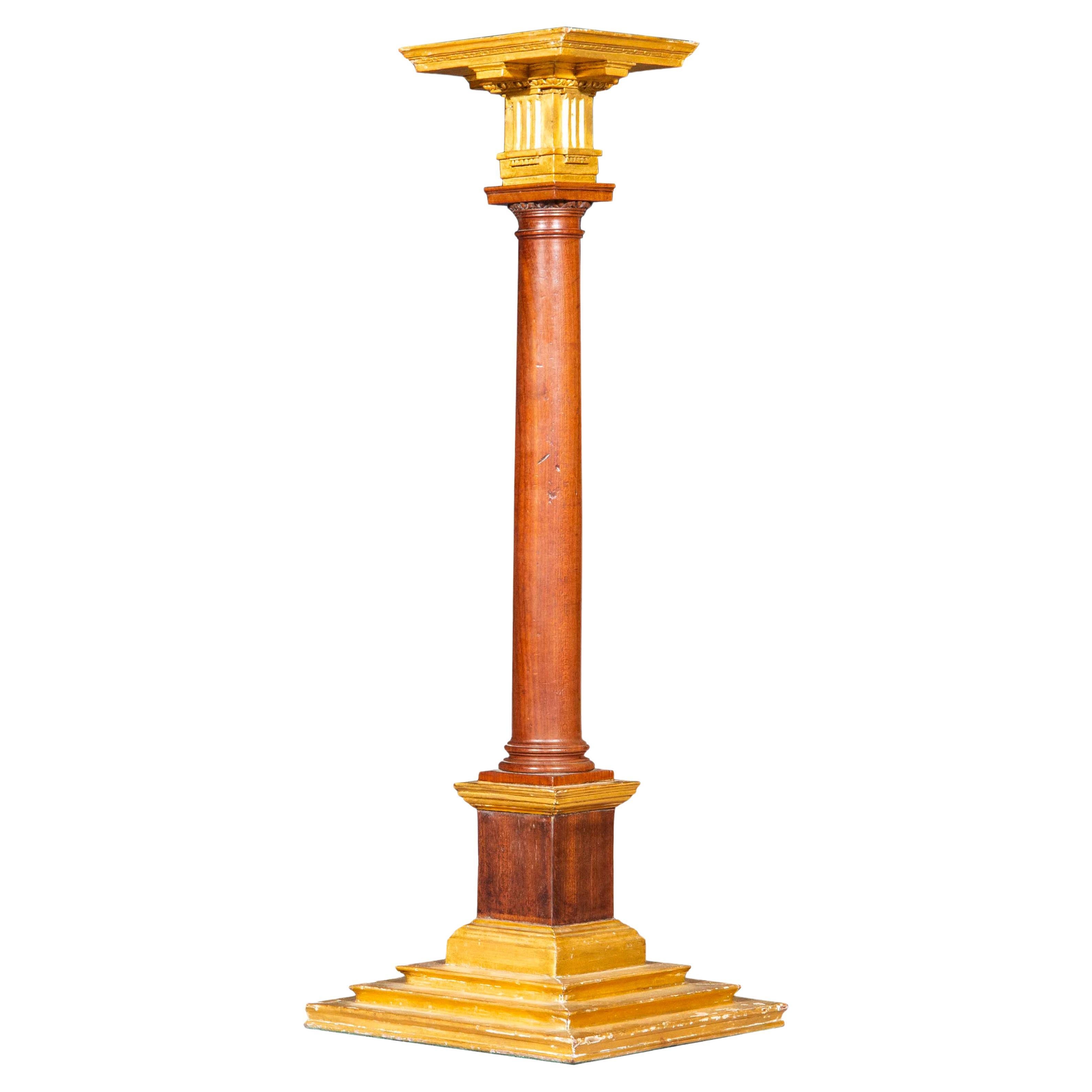
- 18th Century, Architectural Model of Doric ColumnLocated in London, GBAn extremely rare, exquisite architectural model of a Doric column England, third quarter of 18th century. Why we like it Exquisitely carved and having accents picked out in gold, this extremely rare survivor from the golden era of Classical architecture in Britain was perhaps intended for an architect's office, or for a study of a gentleman architect, such as Lord Burlington (1694–1753), who was famously known as the "Apollo of the Arts" and the "Architect Earl". Such exquisite and decorative objects were copied from ancient Greek and Roman originals, that aspiring architects could see and draw during their 'Grand Tour' in Italy, Greece, Ottoman Empire and etc. The only other comparable example of such rare objects that we came across was a set of three columns, previously owned by the late Sir Albert Richardson (1880–1964), architect, historian, writer, artist, teacher and sometime President of the Royal Academy – sold by Christie’s London, 19 September...Category
Antique Mid-18th Century English George III Architectural Models
MaterialsWalnut
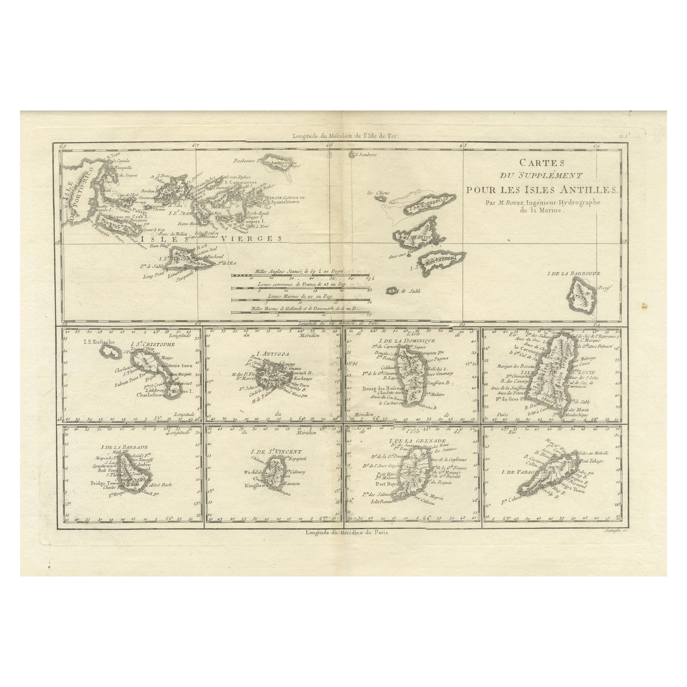
- 18th Century Antique Map of the Virgin Islands and Caribbean Inset MapsLocated in Langweer, NLA fascinating piece of cartographic history! The map, titled "Carte du supplément pour les Isles Antilles," featuring inset maps of various islands in the Caribbean, is from the "Atl...Category
Antique Late 18th Century Maps
MaterialsPaper
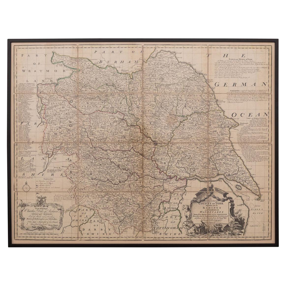
- 18th Century Emanuel Bowen Map of County of York, c.1740By Emanuel BowenLocated in Royal Tunbridge Wells, KentAntique 18th century British rare and original Emanuel Bowen (1694-1767) map of the County of York divided into its Ridings and subdivided into wapontakes, mounted in solid wood fram...Category
Antique Early 18th Century British Maps
MaterialsPaper

- Antique 18th Century Map of the Province of Pensilvania 'Pennsylvania State'Located in Philadelphia, PAA fine antique of the colony of Pennsylvania. Noted at the top of the sheet as a 'Map of the province of Pensilvania'. This undated and anonymous map is thought to be from the Gentleman's Magazine, London, circa 1775, although the general appearance could date it to the 1760's. The southern boundary reflects the Mason-Dixon survey (1768), the western boundary is placed just west of Pittsburgh, and the northern boundary is not marked. The map has a number of reference points that likely refer to companion text and appear to be connected to boundaries. The western and southern boundaries are marked Q, R, S, for example. A diagonal line runs from the Susquehanna R to the Lake Erie P. A broken line marked by many letters A, B, N, O, etc., appears in the east. There are no latitude or longitude markings, blank verso. Framed in a shaped contemporary gilt wooden frame and matted under a cream colored matte. Bearing an old Graham Arader Gallery...Category
Antique 18th Century British American Colonial Maps
MaterialsPaper


Recently Viewed
View AllMore Ways To Browse
Philadelphia 18th Century Furniture
Philadelphia Map
Antique Maps Philadelphia
Antique Maps Of Philadelphia
Antique Map Of Philadelphia
Nautical Chart Nautical Chart
Used Nautical Charts
Hemispheres Map
Portugal Map
Antique Travel Map
Map Of Portugal
Antique World Chart
Turkish Map
Antique Char
Map Of Great Britain
Hand Painted Antique Map
Antique Furniture Depot
Hemisphere Antiques