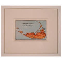
Nantucket Island Map
View Similar Items


Want more images or videos?
Request additional images or videos from the seller
1 of 11
Nantucket Island Map
About the Item
- Dimensions:Height: 8.75 in (22.23 cm)Width: 10.38 in (26.37 cm)
- Materials and Techniques:
- Place of Origin:
- Period:
- Date of Manufacture:circa 1952
- Condition:Wear consistent with age and use.
- Seller Location:Essex, MA
- Reference Number:1stDibs: LU83771676032
About the Seller
5.0
Vetted Professional Seller
Every seller passes strict standards for authenticity and reliability
Established in 1998
1stDibs seller since 2007
192 sales on 1stDibs
Authenticity Guarantee
In the unlikely event there’s an issue with an item’s authenticity, contact us within 1 year for a full refund. DetailsMoney-Back Guarantee
If your item is not as described, is damaged in transit, or does not arrive, contact us within 7 days for a full refund. Details24-Hour Cancellation
You have a 24-hour grace period in which to reconsider your purchase, with no questions asked.Vetted Professional Sellers
Our world-class sellers must adhere to strict standards for service and quality, maintaining the integrity of our listings.Price-Match Guarantee
If you find that a seller listed the same item for a lower price elsewhere, we’ll match it.Trusted Global Delivery
Our best-in-class carrier network provides specialized shipping options worldwide, including custom delivery.More From This Seller
View AllHerbert Matter Swiss Exhibition Poster on the History of Bathing and Swimming
By Herbert Matter
Located in Essex, MA
A large, original vintage Swiss exhibition poster by celebrated graphic designer, Herbert Matter, for an exhibition at the Museum of Art & Craft in Zu...
Category
Mid-20th Century Swiss Mid-Century Modern Posters
Materials
Paper
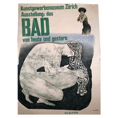
$1,400 Sale Price
20% Off
19th Century German Miniature Pocket Terrestrial Globe
By C. Abel-Klinger
Located in Essex, MA
A miniature 19th century 3.5 inch diameter pocket terrestrial globe by C. Abel-Klinger, Nuremberg, Germany, in English for the English speaking markets. Signed with cartouche reading...
Category
Antique 1880s German Scientific Instruments
Materials
Brass
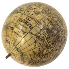
$1,230 Sale Price
50% Off
Hayward Veal Australian Nocturne Cityscape Painting
By Hayward Veal
Located in Essex, MA
An oil on board painting by Australian painter W. Hayward Veal (1913-1968), entitled Nocturne No. 4, depicting a night scene of a park and tree in the foreground with a man walking, ...
Category
Vintage 1940s Australian Mid-Century Modern Paintings
Materials
Pine, Masonite, Wood, Paint
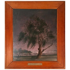
$1,152 Sale Price
41% Off
Wengen Swiss Ski Poster by P. Senn and P. Marti
By P. Senn and P. Marti
Located in Essex, MA
A striking pre-war collage ski poster featuring both photographic and graphic images advertising the alpine resort of Wengen, Switzerland, featuring an e...
Category
Vintage 1930s Swiss Posters
Materials
Paper

$1,520 Sale Price
30% Off
Giant French Horse Racing Poster Mural by Jacquot, circa 1930s
By Michel Jacquot
Located in Essex, MA
A rare, giant original French horse racing poster or mural, lithograph on paper, mounted on linen, in four panels joined to form one large image b...
Category
Vintage 1930s French Art Deco Posters
Materials
Linen, Paper
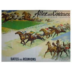
$7,600 Sale Price
56% Off
Black Forest Carved Walnut Hunting Presentation Cup
Located in Essex, MA
A beautifully crafted Black Forest hand carved walnut hunting presentation cup, the basket weave bowl supported by the figure of a gentleman hunter l...
Category
Antique 1870s German Black Forest Decorative Bowls
Materials
Walnut
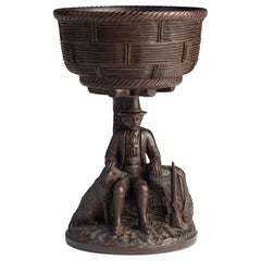
$880 Sale Price
67% Off
You May Also Like
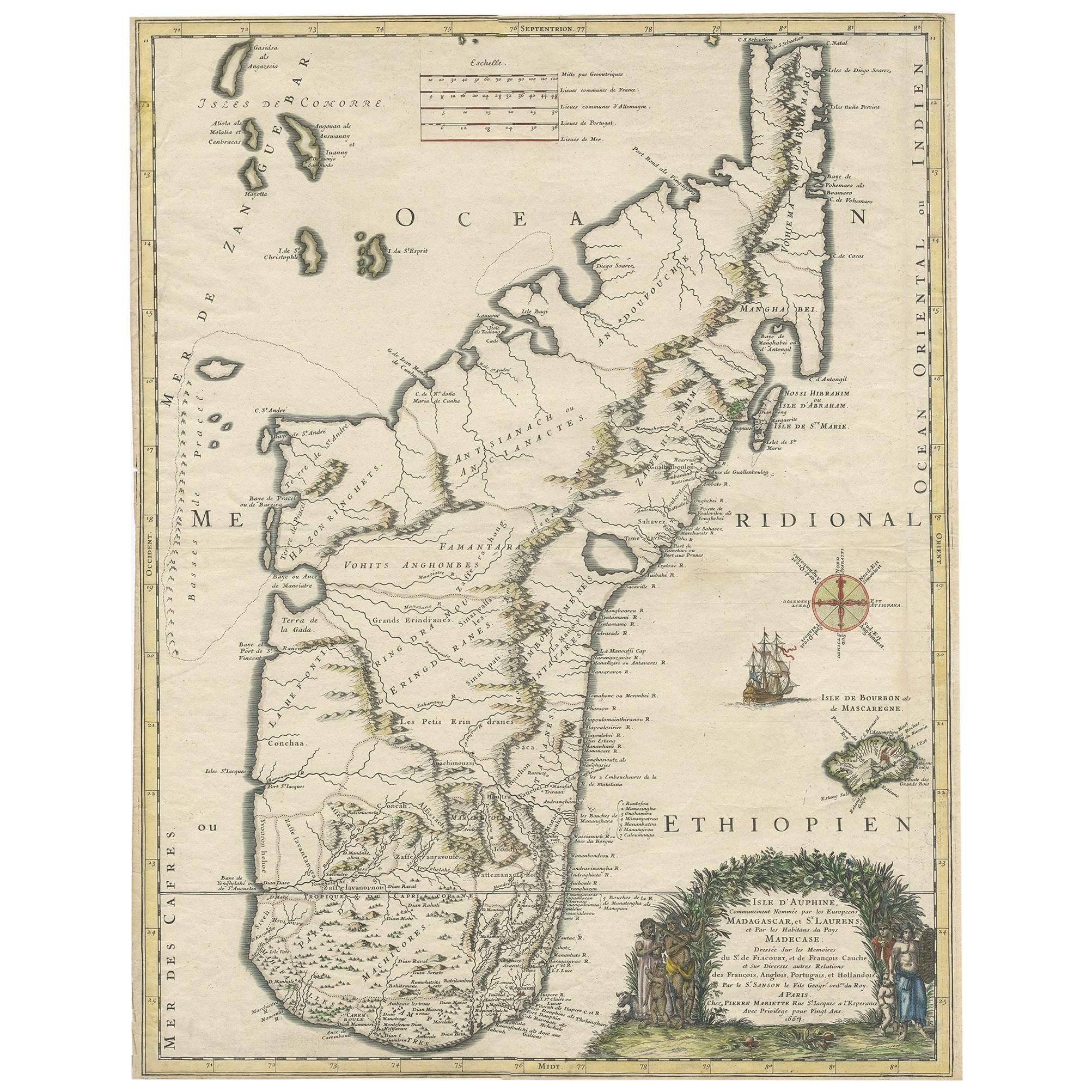
Beautiful Antique Map of Madagascar, The Comoros Islands & Reunion Island, 1667
Located in Langweer, NL
Antique map titled 'Isle d'Auphine, communement Nommée par les Europeens Madagascar, et St. Laurens, et par les Habitans du pays Madecase'.
Beautiful map of Madagascar...
Category
Antique 1660s Maps
Materials
Paper
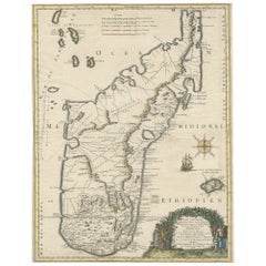
$839 Sale Price
20% Off
Antique Map of the Atlantic Islands, 1817
Located in Langweer, NL
Antique map titled 'Atlantic Islands'. Large map of the Atlantic Islands include the Cape Verde islands, Canary islands, Azore islands and Madeira islands. Also included a view of th...
Category
Antique Early 19th Century Maps
Materials
Paper

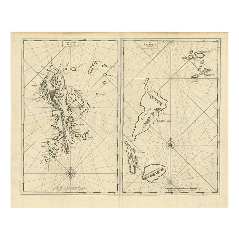
Antique Map of Sangir Island and the Talaud Islands by Valentijn, 1726
Located in Langweer, NL
Antique map titled 'Het Eyland Sangir & De Talautse Eylanden'. Two maps on one sheet. To the left, a map of Sangir Island, Indonesia. To the right, a map of the Talaud Islands, Indon...
Category
Antique 18th Century Maps
Materials
Paper
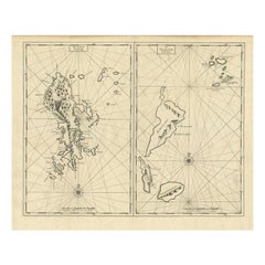
$479 Sale Price
20% Off
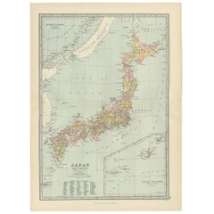
Antique Map of Japan, the Kurile Islands and Liu Kiu Islands, 1886
Located in Langweer, NL
The map is an exquisite piece, showcasing Japan's vibrant geography. Engraved by J. Bartholomew and published by George Philip & Son in London & Liverpool, it presents a detailed and...
Category
Antique Late 19th Century Maps
Materials
Paper
$110 Sale Price
20% Off
Antique Map of Coiba Island by Anson '1749'
Located in Langweer, NL
Antique map titled 'Plan van de Oost-Zyde van het Eiland Quibo'. Original antique map of the eastside of Coiba Island (Quibo), Panama, showing the shoreline around Port de Dames indi...
Category
Antique Mid-18th Century Maps
Materials
Paper

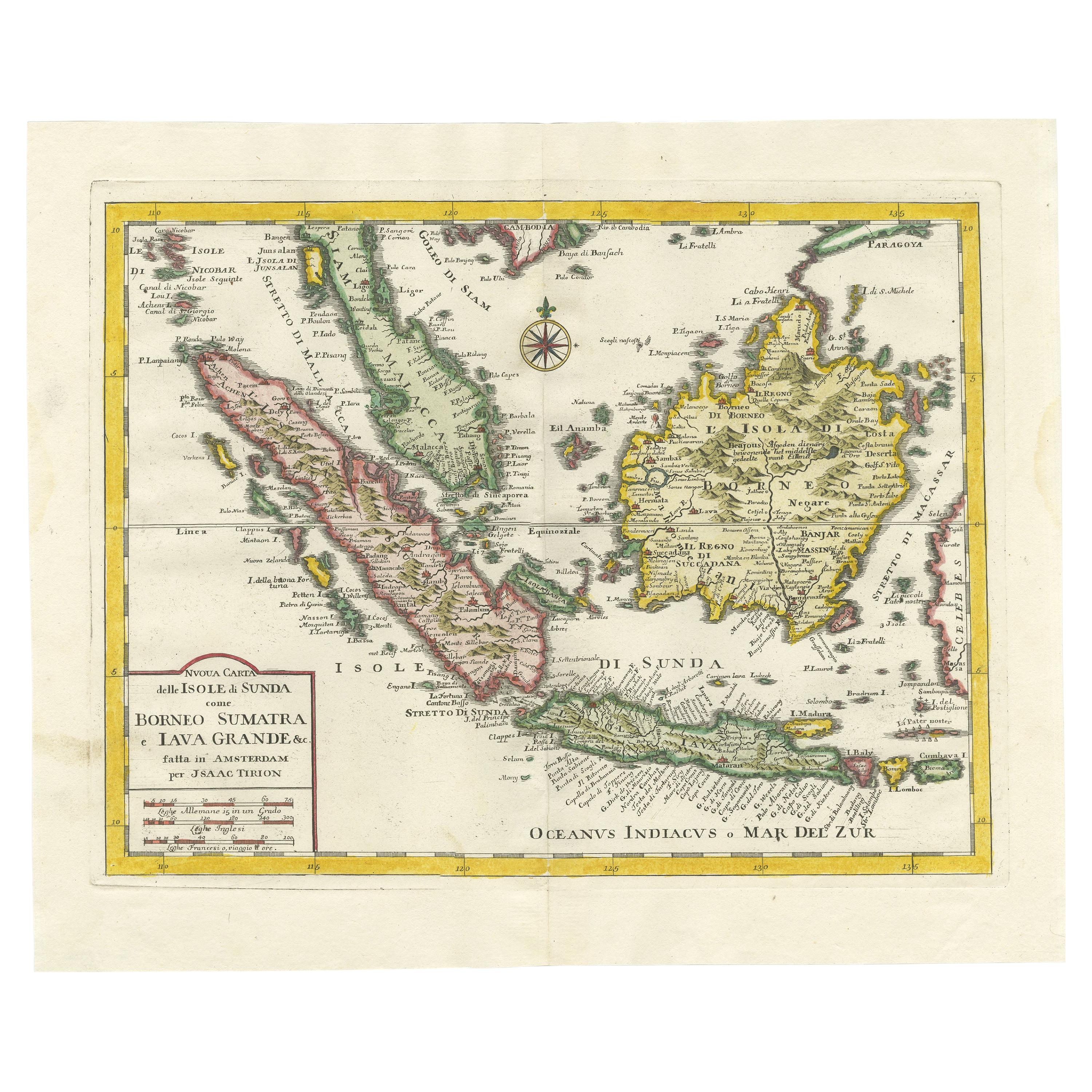
Antique Map of the Island Java, Indonesia, c.1650
Located in Langweer, NL
Antique map titled 'Insulae Iavae cum parte insularum Boreno Sumatrae (..)'.
Beautiful map of the island of Java and part of Borneo, Bali, Madura and Sumatra. With decorative carto...
Category
Antique 17th Century Maps
Materials
Paper

$2,999 Sale Price
20% Off