Items Similar to Antique Litograph of a Combat Between French and British Ships, 1844
Want more images or videos?
Request additional images or videos from the seller
1 of 6
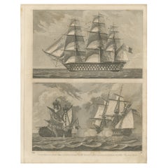
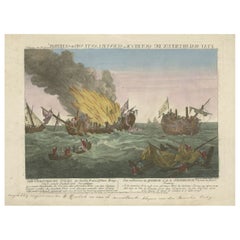
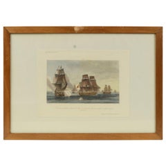
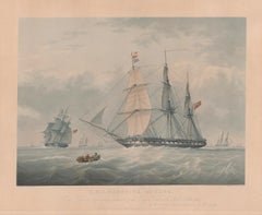
Antique Litograph of a Combat Between French and British Ships, 1844
$305.40
$381.7520% Off
£225.76
£282.2020% Off
€256
€32020% Off
CA$423.60
CA$529.5020% Off
A$461.82
A$577.2820% Off
CHF 244.02
CHF 305.0220% Off
MX$5,679.31
MX$7,099.1320% Off
NOK 3,034.16
NOK 3,792.6920% Off
SEK 2,856.26
SEK 3,570.3220% Off
DKK 1,949.31
DKK 2,436.6420% Off
About the Item
Antique print titled 'La Fregate la Courageuse et la Canonnière la Terréur'. This print illustrates the combat between French ships and the British ships.
Artists and Engravers: Lithographed after Jean Baptiste Henri Durand-Brager.
Condition: Good, general age-related toning. Two stamps an upper margin a bit short, please study image carefully.
About the Seller
5.0
Recognized Seller
These prestigious sellers are industry leaders and represent the highest echelon for item quality and design.
Platinum Seller
Premium sellers with a 4.7+ rating and 24-hour response times
Established in 2009
1stDibs seller since 2017
2,620 sales on 1stDibs
Typical response time: <1 hour
- ShippingRetrieving quote...Shipping from: Langweer, Netherlands
- Return Policy
Authenticity Guarantee
In the unlikely event there’s an issue with an item’s authenticity, contact us within 1 year for a full refund. DetailsMoney-Back Guarantee
If your item is not as described, is damaged in transit, or does not arrive, contact us within 7 days for a full refund. Details24-Hour Cancellation
You have a 24-hour grace period in which to reconsider your purchase, with no questions asked.Vetted Professional Sellers
Our world-class sellers must adhere to strict standards for service and quality, maintaining the integrity of our listings.Price-Match Guarantee
If you find that a seller listed the same item for a lower price elsewhere, we’ll match it.Trusted Global Delivery
Our best-in-class carrier network provides specialized shipping options worldwide, including custom delivery.More From This Seller
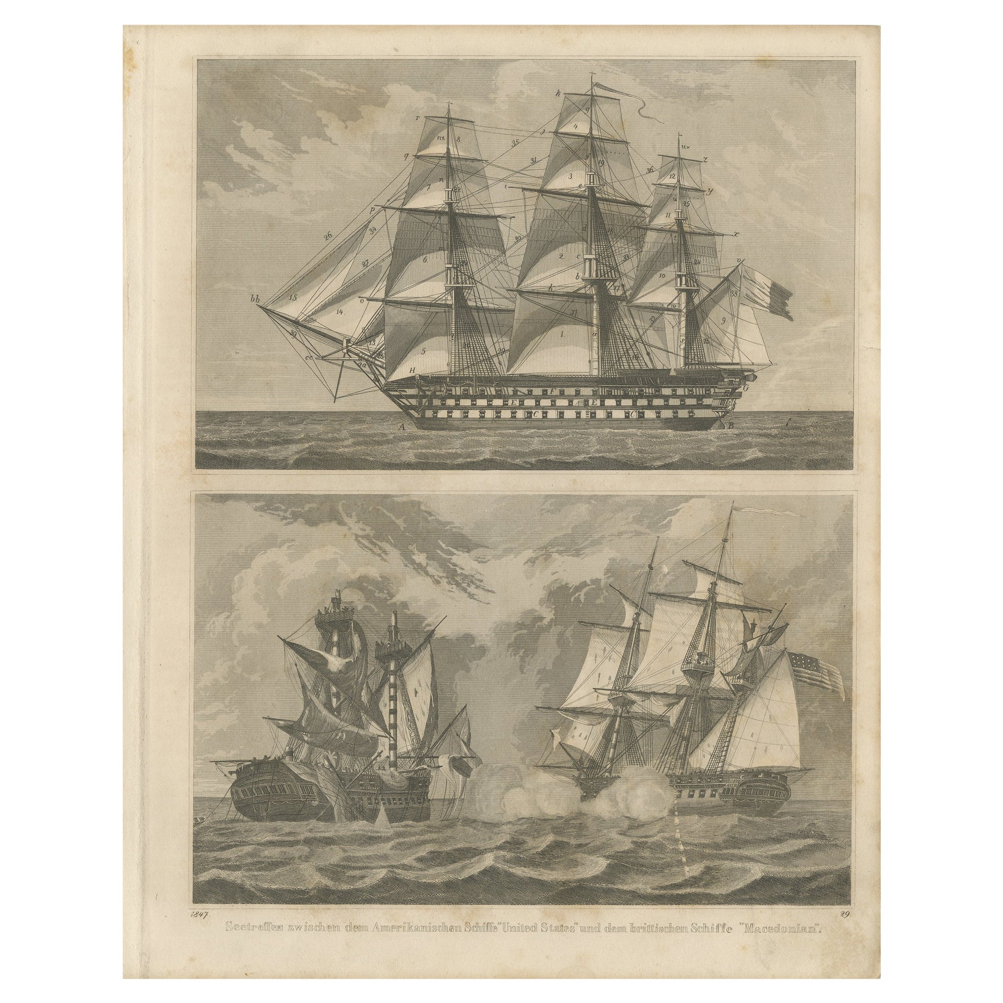
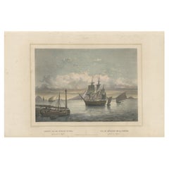
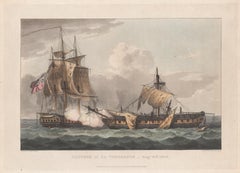
View AllAntique Sea Battle Print Between an American and a British Ship, 1847
Located in Langweer, NL
Description: Antique print titled 'Seetreffen zwischen dem Amerikanischen Schiffe 'United States' und dem Brittischen Schiffe 'Macedonian'.
Two images on one sheet. The upper ima...
Category
Antique 1840s Prints
Materials
Paper
$248 Sale Price
20% Off
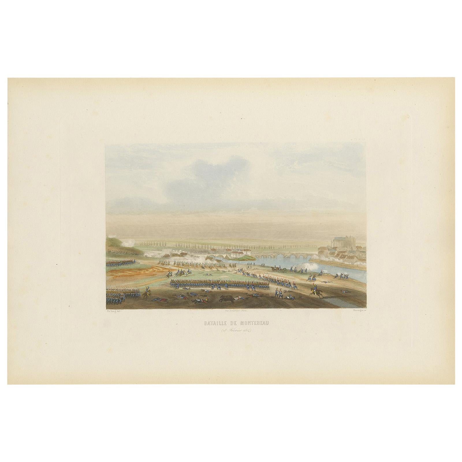
Antique Print of the Battle of Montereau 'circa 1860'
Located in Langweer, NL
Antique print titled 'Bataille de Montereau'. Steel engraving of the Battle of Montereau (1814). This print originates from 'Album de Vingt Batailles de la Révolution et de l'Empire'...
Category
Antique Mid-19th Century Prints
Materials
Paper
$167 Sale Price
20% Off
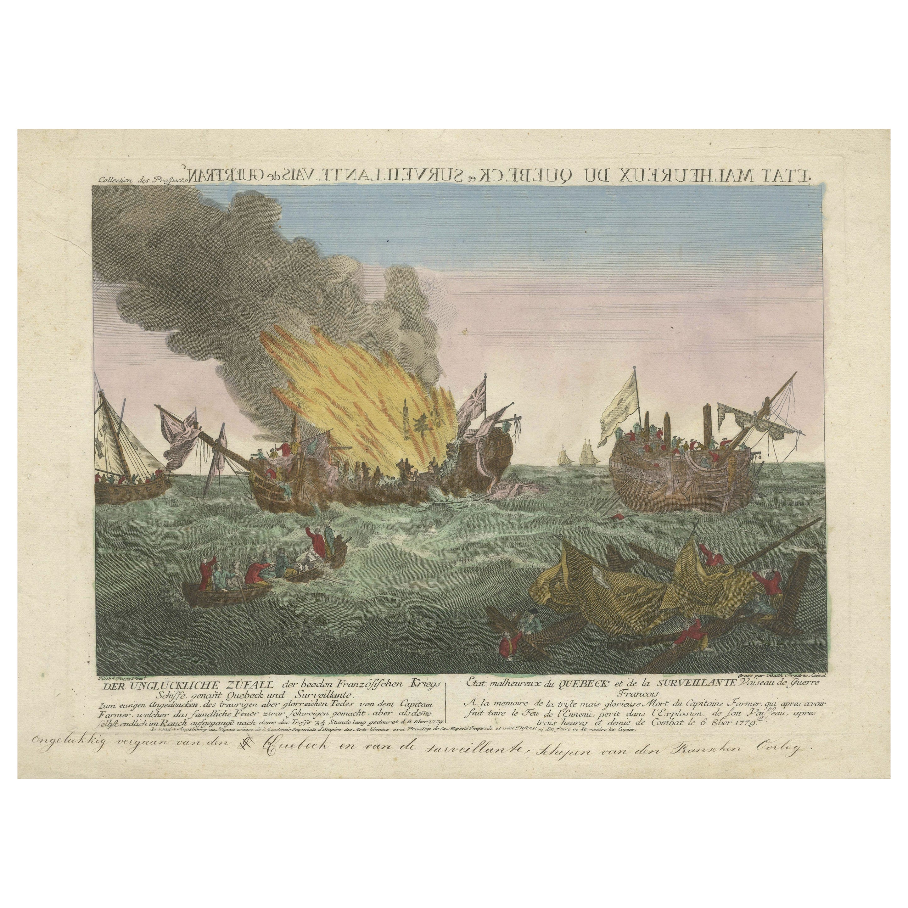
Rare Engraving of a Famous Battle Near Ushant Between the French and British
Located in Langweer, NL
Antique print titled 'Der ungluckliche Zufall der beeden Frazösischen Kriegs (..) - Etat malheureux de Quebeck et de la Surveillante (..)'. An engraving of a painting by Richard Paton of the three and a half hour long naval battle of 6 October 1779 which was fought off Ushant between HMS Quebec, under the command of Captain George Farmer, and the Surveillante, under the command of Captain Couédic de Kergoaler. The Quebec caught fire and exploded, and the British crew were rescued by the French. Captain George Farmer (b.1732) died in the battle. American War of Independence...
Category
Antique Late 18th Century Prints
Materials
Paper
$648 Sale Price
20% Off
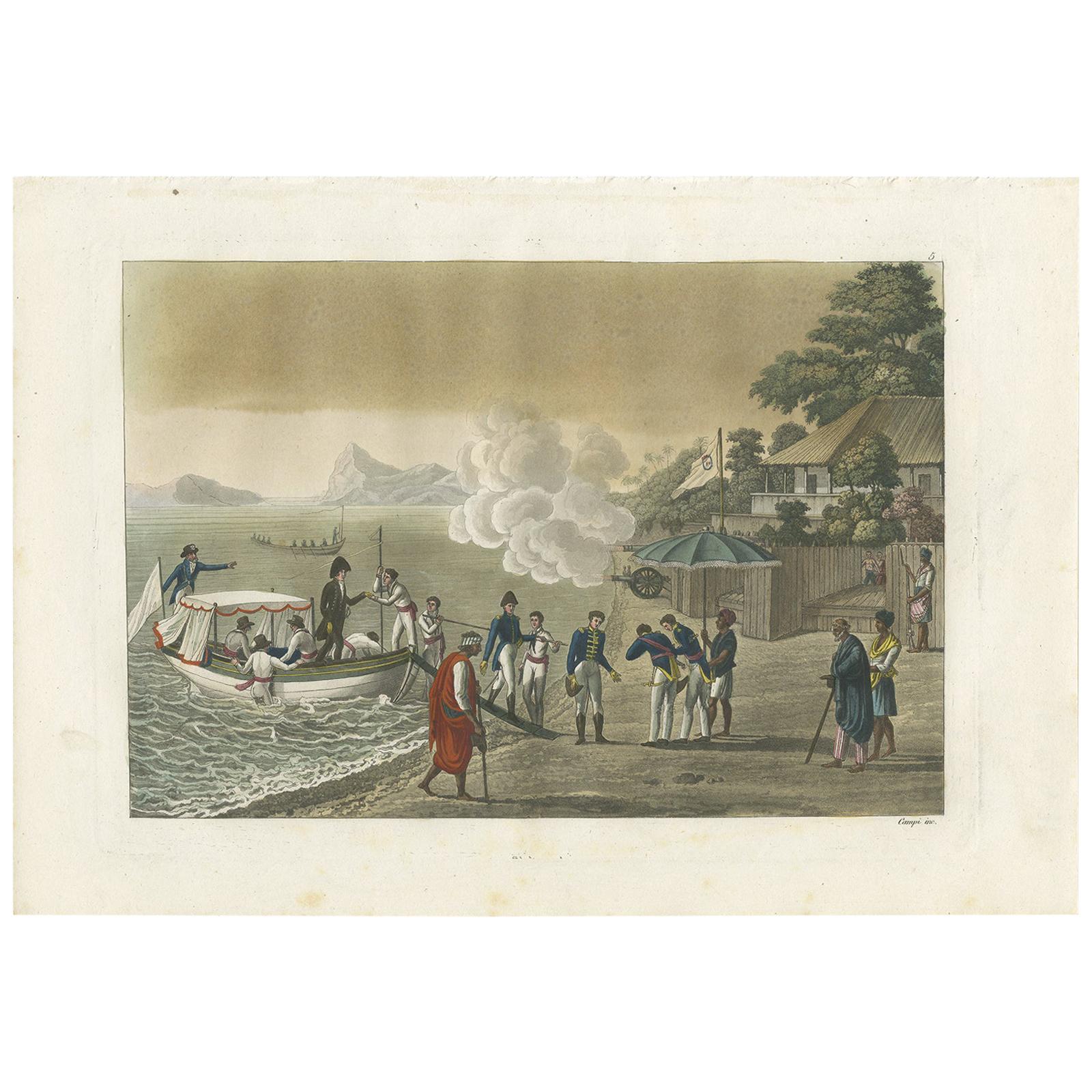
Antique Print of the Landing of French Troops on Timor by Ferrario, 1831
Located in Langweer, NL
Original antique print of the landing of French troops on Timor island. This print originates from 'Costume Antico e Moderno: Palestine, China, India, Oceania' by Ferrario. Published...
Category
Antique Mid-19th Century Prints
Materials
Paper

$238 Sale Price
20% Off
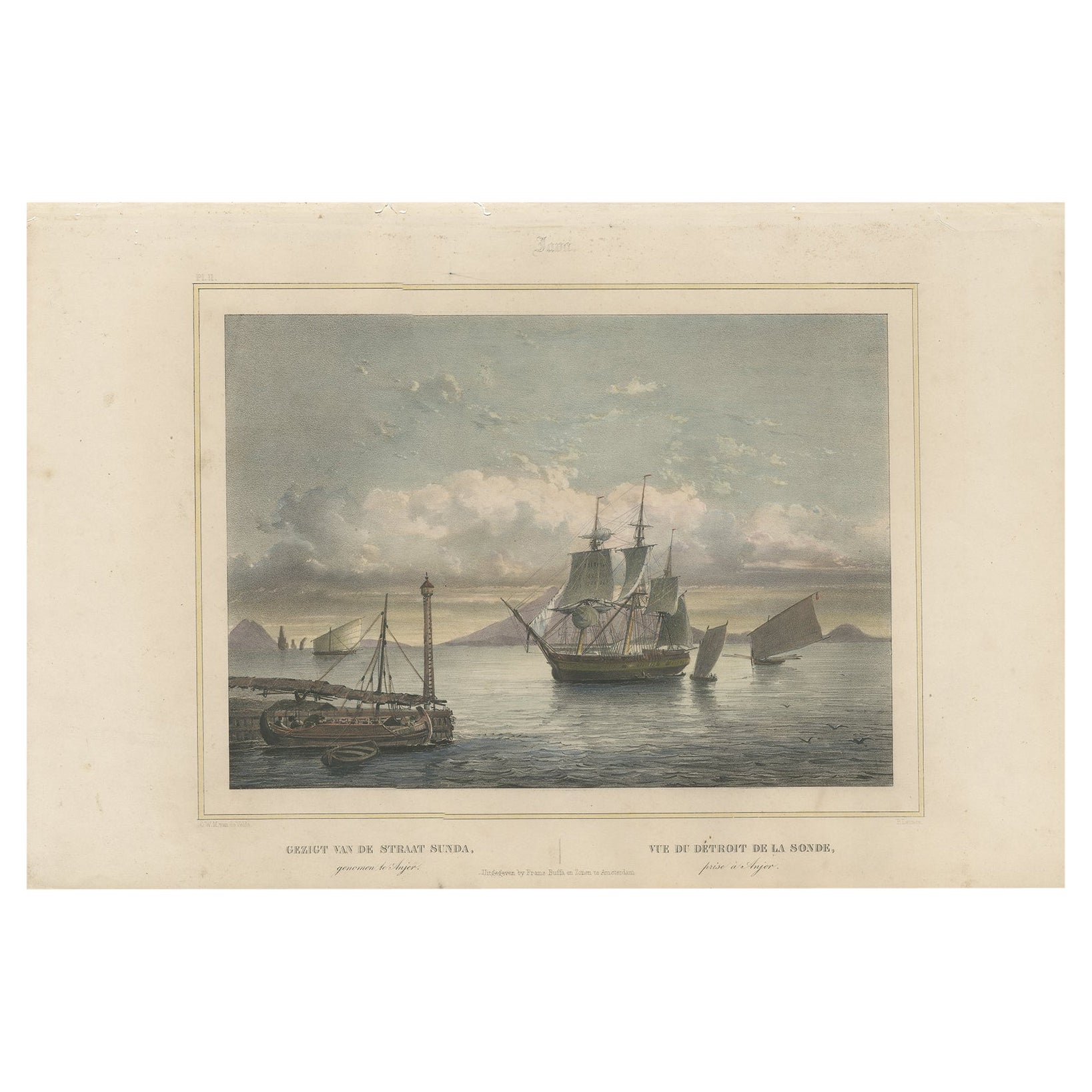
Old Print of Ships near Anyer & Krakatoa in the Sunda Straits, Indonesia, 1844
Located in Langweer, NL
Antique print titled 'Gezigt van de Straat Sunda - Vue du Détroit de la Sonde'.
Old print with a view of the Sunda straits with ships as seen from Anjer / Anyer on the Island of ...
Category
Antique 1840s Prints
Materials
Paper
$439 Sale Price
20% Off
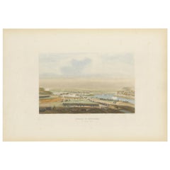
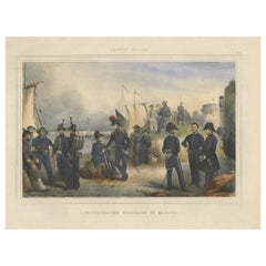
Handcolored Antique Print of the Marine Administration of the Belgium Army, 1833
Located in Langweer, NL
One nicely hand coloured print of an original serie of 23 plates, showing marine officers and soldiers discussing matters on the seaside. published in 1833. Rare.
From a serie of beautiful lithographed plates with Belgian military costumes after Madou and printed by Dero-Becker. Comes from a Belgian military costume album, dedicated to the Belgian King, and financed by subscribers, some 90 Belgian nobility and officers of the Belgian Army...
Category
Antique 1830s Arms, Armor and Weapons
Materials
Paper
$209 Sale Price
20% Off
You May Also Like
1900s Vintage Lithographic Print of the Naval Battle of Beziers, Oak Wood Frame
Located in Milan, IT
Lithographic print of the Naval Battle of Beziers on 10th July 1690, taken from the book Historical Gallery of Versailles 319bis. Skelton is the engraver. Original print by Victor Gilbert Théodore Gudin...
Category
Early 20th Century French Nautical Objects
Materials
Paper
1900 Vintage Lithographic Print of the French Frigate Minerva Oakwood frame
Located in Milan, IT
Lithographic print of the fight of the French frigate Minerva against two vessels and an English frigate on February 2nd, 1779, taken from the book Historical Gallery of Versailles 430. Chacoane is the engraver. Original print by Victor Gilbert Théodore Gudin...
Category
Early 20th Century French Nautical Objects
Materials
Paper
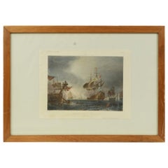
Capture of the La Vengeance, 1800. English Regency naval colour aquatint, 1816
By Thomas Whitcombe
Located in Melbourne, Victoria
Thomas Sutherland (1785-1838) after Thomas Whitcombe (1760-1824)
'Capture of the La Vengeance, Aug 21st, 1800'
Colour aquatint engraving from 'The N...
Category
Early 19th Century Victorian More Prints
Materials
Aquatint
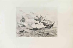
Combat Naval - Etching by Charles Longueville - 1870s
Located in Roma, IT
Combat Naval is a black and white etching realized by Charles Longueville (1829-1899) in 1870s.
Titled in the lower.
Image size: 30cmx22cm.
Very Good condition.
Signed on the low...
Category
1870s Modern Figurative Prints
Materials
Etching
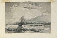
France Maritime - Lithograph by Camille Roqueplan - 19th century
Located in Roma, IT
France Maritime is an original print on paper realized by Camille Roqueplan in the mid-19th Century.
Signed on the plate and titled.
engraving.
Good conditions, with foxing.
Category
19th Century Modern Figurative Prints
Materials
Lithograph
HMS Warspite 50 Guns, English antique naval sailing ship aquatint print
Located in Melbourne, Victoria
'HMS Warspite 50 Guns', English English naval aquatint, with gum arabic highlights, by Edward Duncan after Nicholas Condy. Published by Ackermann & Co.
'Warspite' was built and lau...
Category
Early 1900s English School Landscape Prints
Materials
Lithograph
More Ways To Browse
Aurelia In A Red Bonnet
Avi Kiriaty
Bernard Munch
Bjorn Wiinblad Lithograph
Botero Hand Signed
Calder Artist Proof
Carol Summers Vintage Prints
Chagall Circus Signed
Charles Cobelle Signed Lithograph
Charles T Bowling
Christian Choisy
Clyde Connell
Cobelle Lithograph
Cracked Gesso
Cy Twombly Gaeta
E M Washington
Elsie Rice
English Prints 1800s