Items Similar to Antique Print of Bantam, Java, Indonesia by De Bry, c.1610

Want more images or videos?
Request additional images or videos from the seller
1 of 7
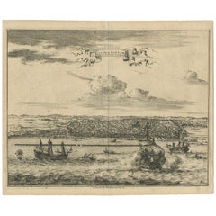
Antique Print of Bantam, Java, Indonesia by De Bry, c.1610
$360.42
$450.5320% Off
£269.74
£337.1720% Off
€304
€38020% Off
CA$497.23
CA$621.5420% Off
A$552.94
A$691.1820% Off
CHF 290.42
CHF 363.0220% Off
MX$6,760.28
MX$8,450.3520% Off
NOK 3,618.88
NOK 4,523.6020% Off
SEK 3,411.63
SEK 4,264.5320% Off
DKK 2,314.20
DKK 2,892.7520% Off
About the Item
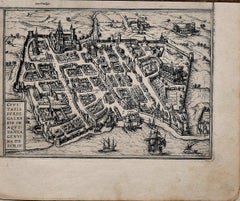
Untitled print of Bantam, former city and sultanate of Java, Indonesia. It lay near the site of the present-day city of Banten, on Banten Bay, at the extreme northwest of the island. This print originates from 'Indiae Orientalis Navigationes (..)' by J. Th. de Bry.
Artists and Engravers: Johann Theodor de Bry (1561 - 1623) was born in Liege in 1561, the eldest son of the engraver and publisher Theodor de Bry. It was from his father that Johann learned his craft, producing both engravings and etchings.
Condition: Fair, age-related toning. Light soiling, minor wear. Few small tears, blank verso. Please study image carefully.
Date: c.1610
Overall size: 31 x 20 cm.
Image size: 25 x 15.5 cm.
We sell original antique maps to collectors, historians, educators and interior decorators all over the world. Our collection includes a wide range of authentic antique maps from the 16th to the 20th centuries. Buying and collecting antique maps is a tradition that goes back hundreds of years. Antique maps have proved a richly rewarding investment over the past decade, thanks to a growing appreciation of their unique historical appeal. Today the decorative qualities of antique maps are widely recognized by interior designers who appreciate their beauty and design flexibility. Depending on the individual map, presentation, and context, a rare or antique map can be modern, traditional, abstract, figurative, serious or whimsical. We offer a wide range of authentic antique maps for any budget.
- Dimensions:Height: 7.88 in (20 cm)Width: 12.21 in (31 cm)Depth: 0 in (0.01 mm)
- Materials and Techniques:
- Period:
- Date of Manufacture:circa 1610
- Condition:Condition: Fair, age-related toning. Light soiling, minor wear. Few small tears, blank verso. Please study image carefully.
- Seller Location:Langweer, NL
- Reference Number:Seller: JAK-3081stDibs: LU3054329348952
About the Seller
5.0
Recognized Seller
These prestigious sellers are industry leaders and represent the highest echelon for item quality and design.
Platinum Seller
Premium sellers with a 4.7+ rating and 24-hour response times
Established in 2009
1stDibs seller since 2017
2,609 sales on 1stDibs
Typical response time: <1 hour
- ShippingRetrieving quote...Shipping from: Langweer, Netherlands
- Return Policy
Authenticity Guarantee
In the unlikely event there’s an issue with an item’s authenticity, contact us within 1 year for a full refund. DetailsMoney-Back Guarantee
If your item is not as described, is damaged in transit, or does not arrive, contact us within 7 days for a full refund. Details24-Hour Cancellation
You have a 24-hour grace period in which to reconsider your purchase, with no questions asked.Vetted Professional Sellers
Our world-class sellers must adhere to strict standards for service and quality, maintaining the integrity of our listings.Price-Match Guarantee
If you find that a seller listed the same item for a lower price elsewhere, we’ll match it.Trusted Global Delivery
Our best-in-class carrier network provides specialized shipping options worldwide, including custom delivery.More From This Seller
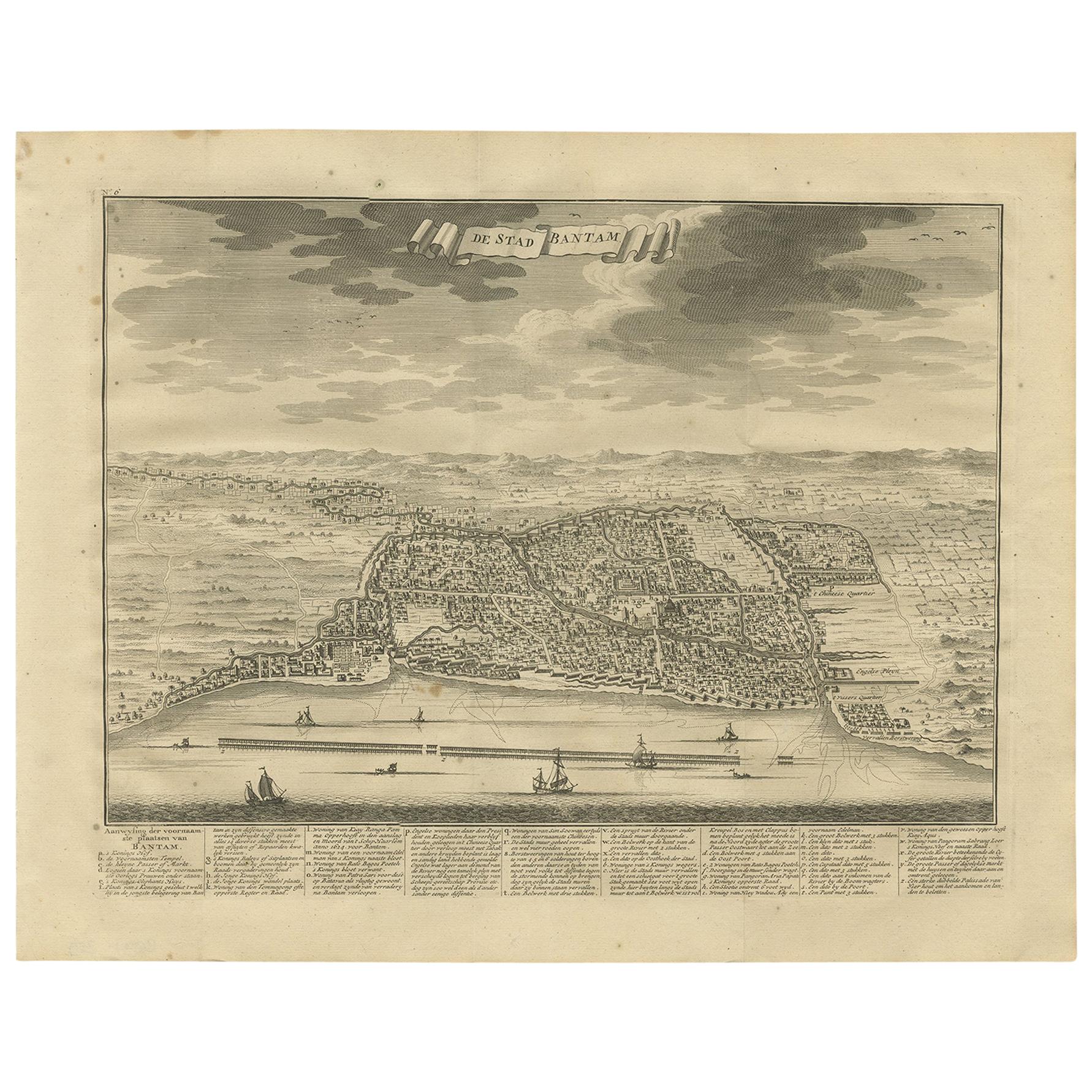
View AllAntique Print of Bantam or Banten, Java, Indonesia, '1726'
Located in Langweer, NL
Antique print titled 'De Stad Bantam'. Decorative town-view of the town of Bantam (Banten). In lower margin key a-z to the principal places in town. The Banten Sultanate was founded ...
Category
Antique Mid-18th Century Prints
Materials
Paper
$474 Sale Price
20% Off
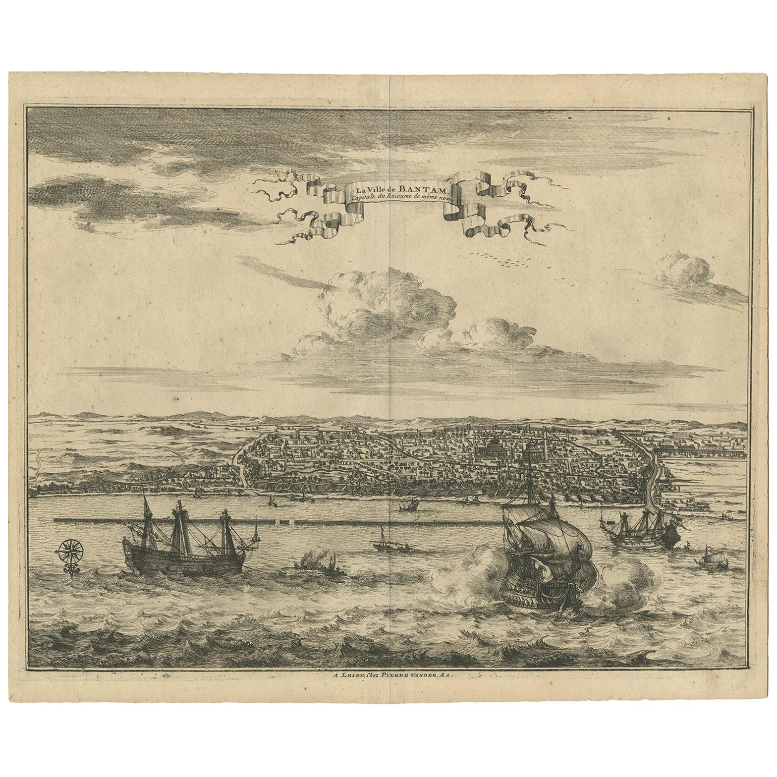
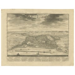
Antique Print of Bantam by Van der Aa, circa 1725
By Pieter Van Der Aa
Located in Langweer, NL
Antique print titled 'La Ville de Bantam capitale du Roiaume de meme nom'. A bird's eye view of the city Banten or Bantam near the western end of Java in Indonesia. Several tall ship...
Category
Antique Mid-18th Century Prints
Materials
Paper
$426 Sale Price
20% Off
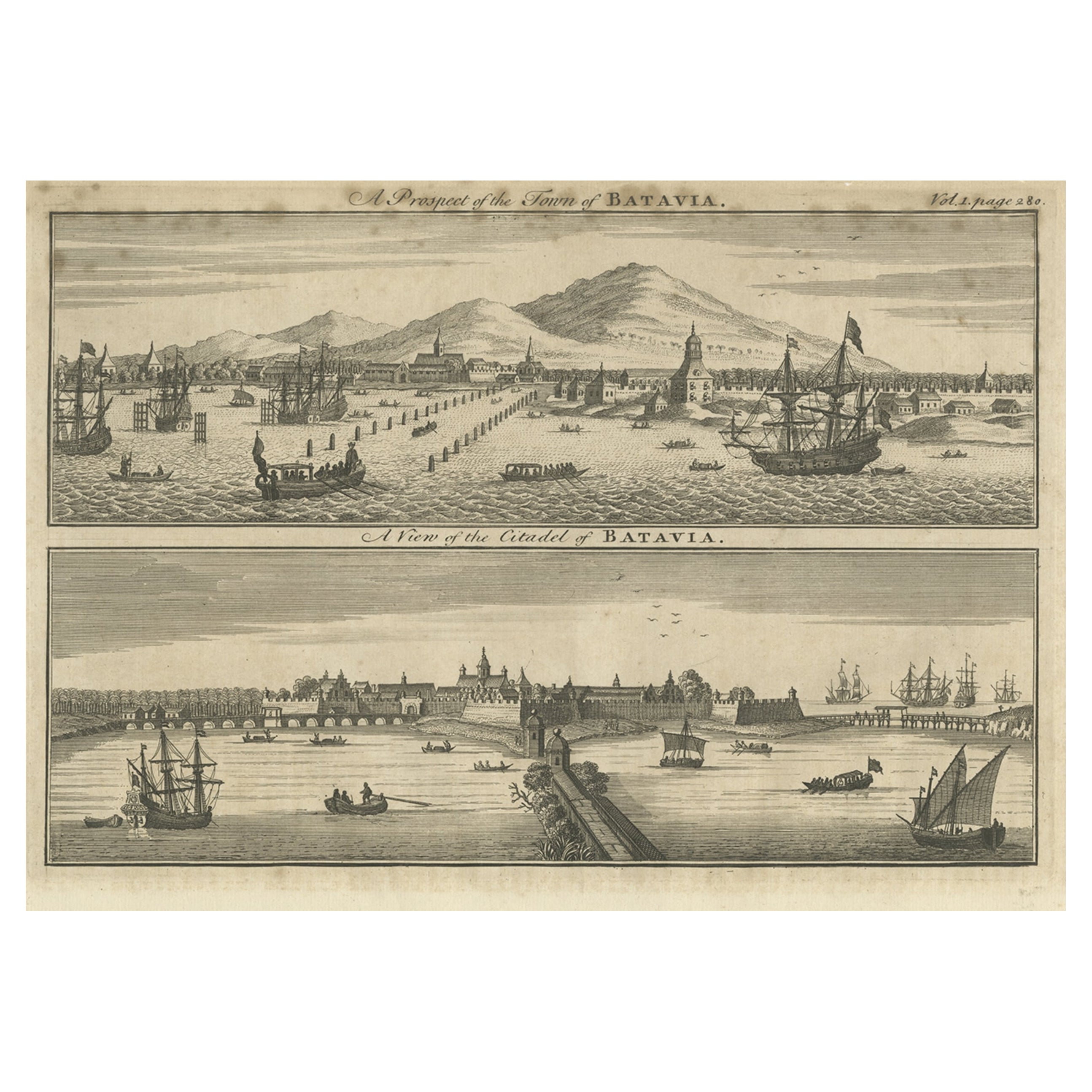
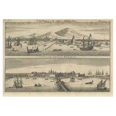
Antique Print of Batavia 'Jakarta', in the Dutch East Indies, 1744
Located in Langweer, NL
Two views on one plate titled 'A Prospect of The Town of Batavia (and) A View of the Citadel of Batavia'. Beautiful views of Batavia (Jakarta), Indonesia. The upper view shows the ci...
Category
Antique 18th Century Prints
Materials
Paper
$208 Sale Price
20% Off
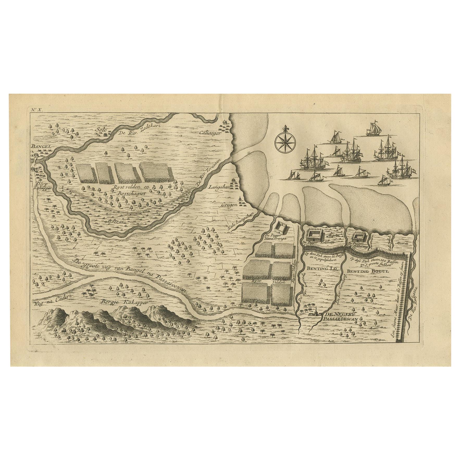
Antique Print of the Region around Pasuruan Indonesia by Valentijn '1726'
Located in Langweer, NL
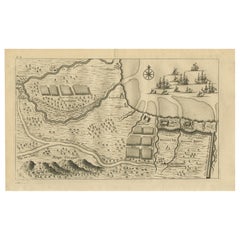
Antique print of the region around Pasuruan near Surabaya, Indonesia. It shows the location of rice fields, the village Bangil, as well as three places named Pagger (also Pagar), a cluster of buildings surrounded by a bamboo fence. The location of a earthen wall with pallisade and small cannons...
Category
Antique Mid-18th Century Prints
Materials
Paper
Antique Print of the Expedition of Govert Knol from Surabaya to Pangerang, 1750
Located in Langweer, NL
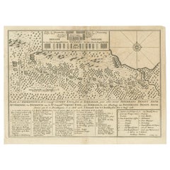
Antique print titled 'Aftekening der Expeditie van de Hr. Commissaris Govert Cnoll uyt Soerabaja, tot afhalinge van Pangerang Adepati Anom'. Map showing the expedition of Commissione...
Category
Antique Mid-18th Century Prints
Materials
Paper
$113 Sale Price
20% Off
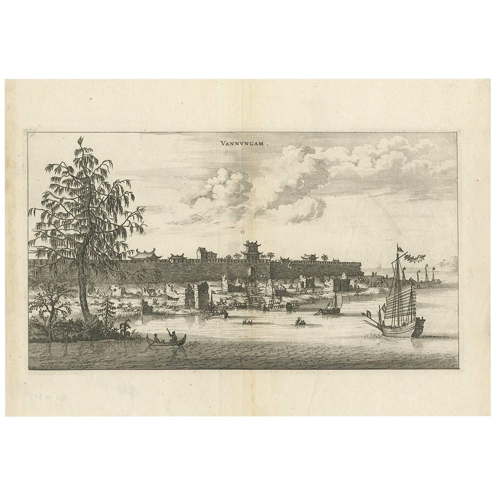
Antique Print of the City of Vannungam ‘China’ by J. Nieuhof, 1666
Located in Langweer, NL
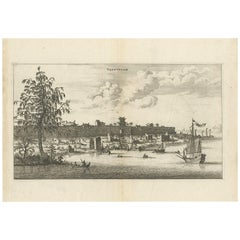
Antique print titled 'Vannungam'. This plate shows a view on the Chinese city of Vannungam with its rampartss. Several ships are depicted. Behind the city wall palm...
Category
Antique Mid-17th Century Prints
Materials
Paper
$265 Sale Price
20% Off
You May Also Like
Antique Voc Print Holland Malaysia Old Map Melaka History, 1663
Located in Amsterdam, Noord Holland
From my own collection I offer this impressive Antique print of the city of Malakka
A very interesting piece for collectors . It is an museum piece from the Dutch Institute of Orien...
Category
Antique 17th Century European Paintings
Materials
Paper

$293 Sale Price
20% Off
S.Juan de Puerto Rico - Etching by Johannes Janssonius - 1650s
By Johannes Janssonius
Located in Roma, IT
S.Juan de Puerto Rico is an ancient map realized in 1650 by Johannes Janssonius (1588-1664).
Good conditions.
From Atlantis majoris quinta pars, Orbem maritimum [Novus Atlas, volum...
Category
1650s Modern Figurative Prints
Materials
Etching
Map of Burdegalen - Original Etching by George Braun - 1575 ca.
Located in Roma, IT
This Burdegalen is an original etching realized in about 1575 by George Braun (1541 – 1622)
The state of preservation of the artwork is good and aged on the edges of the sheet with...
Category
16th Century More Prints
Materials
Etching
Original Antique Print After Jan Luyken, Amsterdam, Genesis XXXI, 1724
Located in St Annes, Lancashire
Wonderful copper-plate engraving after Jan Luyken
Published by Marten Schagen, Amsterdam. 1724
Text on verso
The measurement given is the paper size.
Category
Antique 1720s Dutch Renaissance Prints
Materials
Paper
Ancient Map - Zeilan - Etching by Johannes Janssonius - 1650s
By Johannes Janssonius
Located in Roma, IT
Ancient Map - Zeilan is an ancient map realized in 1650 by Johannes Janssonius (1588-1664).
The Map is Hand-colored etching, with coeval watercoloring.
...
Category
1650s Modern Figurative Prints
Materials
Etching

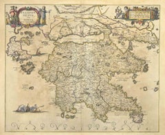
Peloponnesvs (Greece) - Etching by Johannes Janssonius - 1650s
By Johannes Janssonius
Located in Roma, IT
Peloponnesvs is an antique map realized in 1650 by Johannes Janssonius (1588-1664).
The Map is Hand-colored etching, with coeval watercoloring.
Good conditions with slight foxing.
...
Category
1650s Modern Figurative Prints
Materials
Etching
More Ways To Browse
Wmf Copper
17th Century French Pottery
1930s Antique Chest Of Drawers
1930s Chest Of Drawers Antique Furniture
4 Drawer File Cabinet
4 Drawer Filing Cabinet
70s Accent Chair
Adams Antiques
Alberto Giacometti Bird
American Iron Bed
American Poster Bed
Antique Bed Slats
Antique Brown Crock
Antique Cabin Decor
Antique Calendar Plates
Antique Double Bed Frame
Antique Enamel Kitchen Cabinets
Antique Hotel Key