Items Similar to Antique Print of Liège / Luik in Belgium by Braun & Hogenberg, 1575
Want more images or videos?
Request additional images or videos from the seller
1 of 6
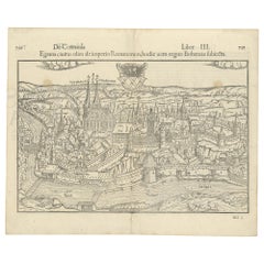
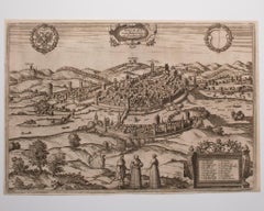
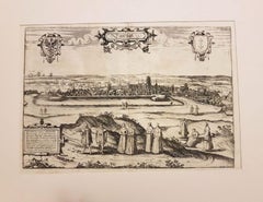
Antique Print of Liège / Luik in Belgium by Braun & Hogenberg, 1575
$1,283.37
$1,604.2120% Off
£946.68
£1,183.3520% Off
€1,072
€1,34020% Off
CA$1,778.18
CA$2,222.7220% Off
A$1,929.59
A$2,411.9920% Off
CHF 1,022.51
CHF 1,278.1420% Off
MX$23,665.49
MX$29,581.8720% Off
NOK 12,653.53
NOK 15,816.9120% Off
SEK 11,956.91
SEK 14,946.1420% Off
DKK 8,163.08
DKK 10,203.8420% Off
About the Item
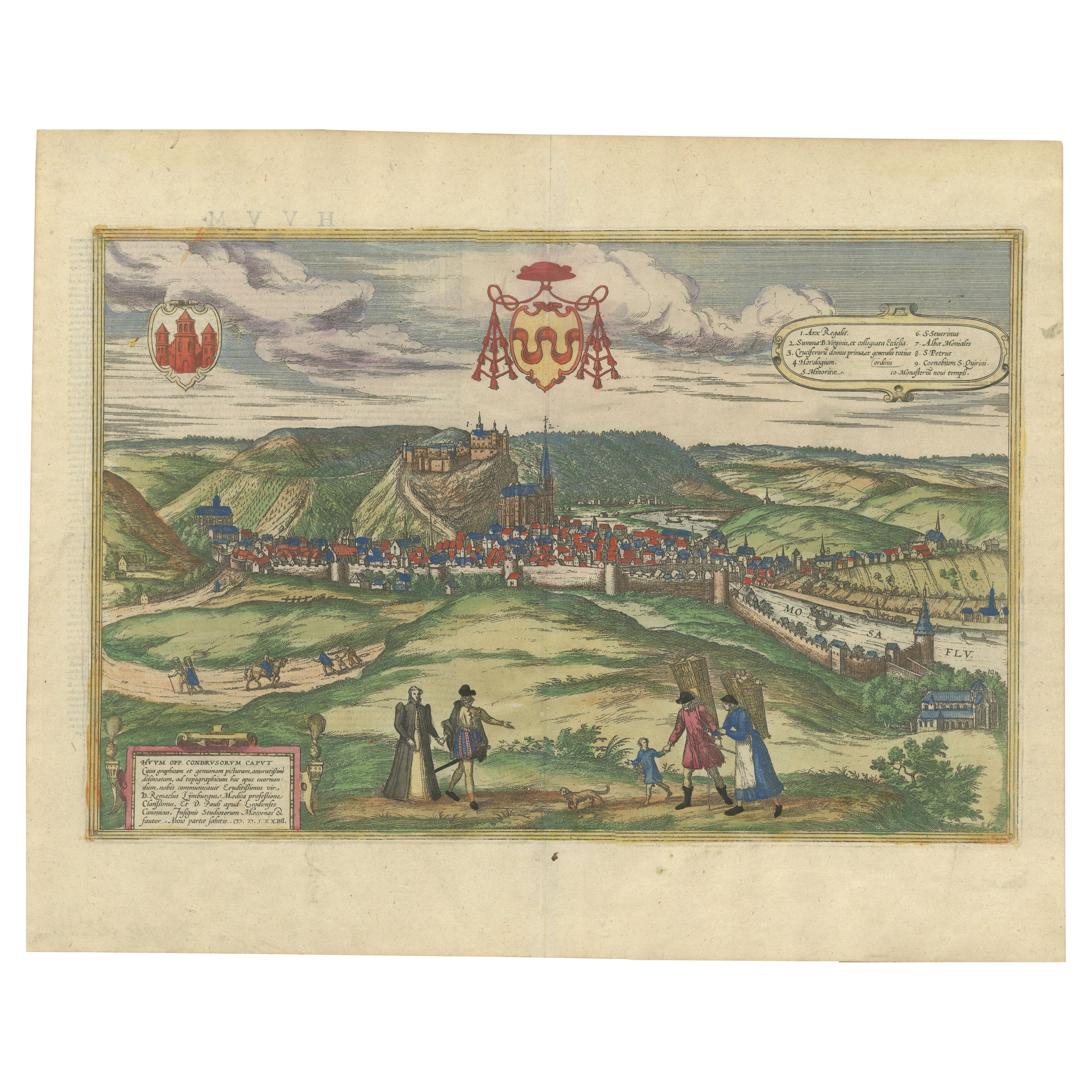
Antique print titled 'Leodium'. View of Liège / Luik, Belgium with surrounding hills and the city wall. With text explaining the origins of Liège, a cartouche expressing thanks to the bisshop of Liège, Gerhard von Groesbeck, and a key to locations. Originates from 'Civitates Orbis Terrarum'.
Artists and Engravers: Georg Braun (1542-1622), a German publisher and Frans Hogenberg issued the famous six volume town book "Civitates Orbis Terrarum" between 1572 and 1618. The volumes originally published in Latin, follow by German and French translations. Franz Hogenberg (1533-1588) was the son of a Munich engraver who settled in Malines. He engraved most of the plates for Ortelius' Theatrum and the majority of those in the Civitates, and may have been responsible for originating the project. Worked and died in Cologne/Germany. He was a prolific copper engraver and etching artist of maps and town views. In cooperation with Georg Braun he created the first four volumes of the Civitates Orbis Terrarum in 1572.
Condition: Good, Latin text on verso. General age-related toning. Minor wear, mainly on folding line and margins. Please study image carefully.
Date: 1575
Overall size: 59.5 x 40 cm.
Image size: 48 x 33 cm.
Antique prints have long been appreciated for both their aesthetic and investment value. They were the product of engraved, etched or lithographed plates. These plates were handmade out of wood or metal, which required an incredible level of skill, patience and craftsmanship. Whether you have a house with Victorian furniture or more contemporary decor an old engraving can enhance your living space. We offer a wide range of authentic antique prints for any budget.
- Dimensions:Height: 15.75 in (40 cm)Width: 15.56 in (39.5 cm)Depth: 0 in (0.01 mm)
- Materials and Techniques:
- Period:
- Date of Manufacture:1575
- Condition:Condition: Good, Latin text on verso. General age-related toning. Minor wear, mainly on folding line and margins. Please study image carefully.
- Seller Location:Langweer, NL
- Reference Number:Seller: BG-123871stDibs: LU3054329223592
About the Seller
5.0
Recognized Seller
These prestigious sellers are industry leaders and represent the highest echelon for item quality and design.
Platinum Seller
Premium sellers with a 4.7+ rating and 24-hour response times
Established in 2009
1stDibs seller since 2017
2,622 sales on 1stDibs
Typical response time: <1 hour
- ShippingRetrieving quote...Shipping from: Langweer, Netherlands
- Return Policy
Authenticity Guarantee
In the unlikely event there’s an issue with an item’s authenticity, contact us within 1 year for a full refund. DetailsMoney-Back Guarantee
If your item is not as described, is damaged in transit, or does not arrive, contact us within 7 days for a full refund. Details24-Hour Cancellation
You have a 24-hour grace period in which to reconsider your purchase, with no questions asked.Vetted Professional Sellers
Our world-class sellers must adhere to strict standards for service and quality, maintaining the integrity of our listings.Price-Match Guarantee
If you find that a seller listed the same item for a lower price elsewhere, we’ll match it.Trusted Global Delivery
Our best-in-class carrier network provides specialized shipping options worldwide, including custom delivery.More From This Seller
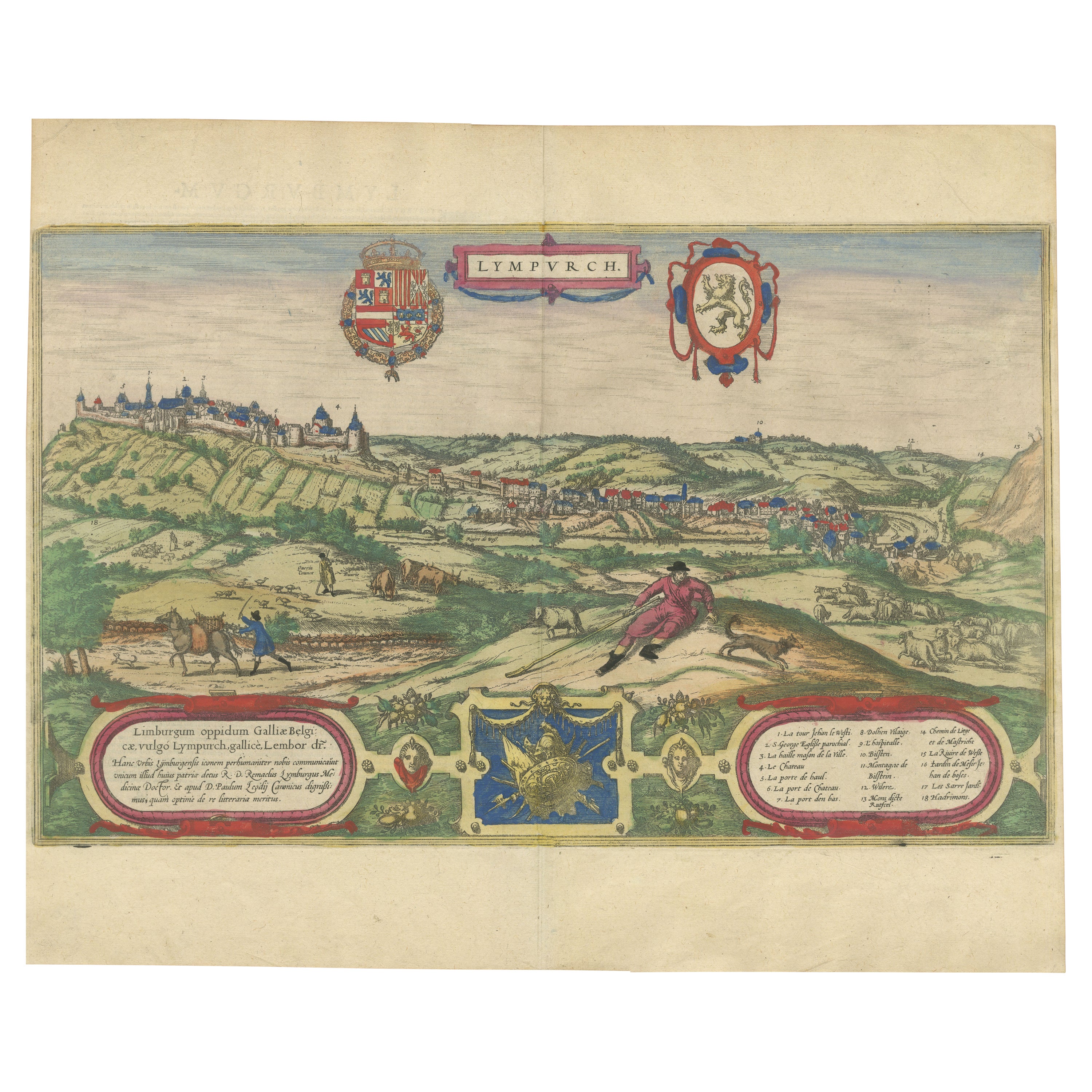
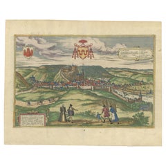
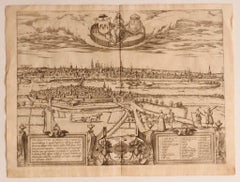
View AllLimburg Cityscape 1580: Historical Copper Engraving by Braun and Hogenberg
Located in Langweer, NL
Title: Limburgum Oppidum Galliae Belgicae, vulgo Lympurch, gallicè, Lembor Dr.
Type: Print (Copper Engraving)
Circa 1580
Technique: Colored Copper Engraving
Medium: Handmade Paper
S...
Category
Antique 16th Century German Maps
Materials
Paper

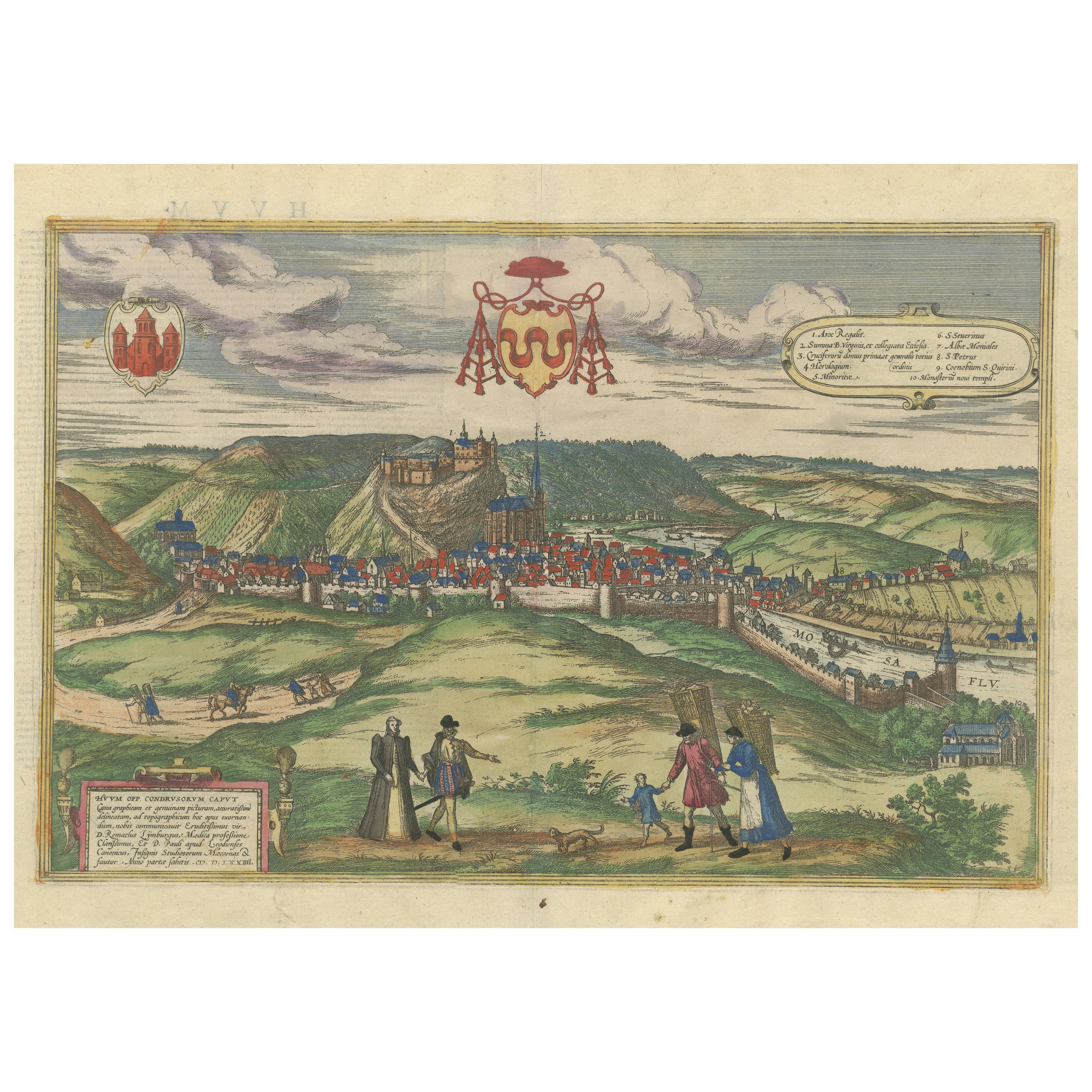
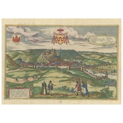
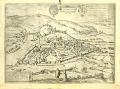
Original Antique Print of Huy in present day Belgium, Published circa 1580
Located in Langweer, NL
Antique print titled 'Huum Opp. Condrusorum Caput (..)'. Attractive bird’s eye view of Huy in present day Belgium. The view shows the city from the northeast. Huy, a municipality of ...
Category
Antique 16th Century Prints
Materials
Paper
$842 Sale Price
20% Off
Free Shipping
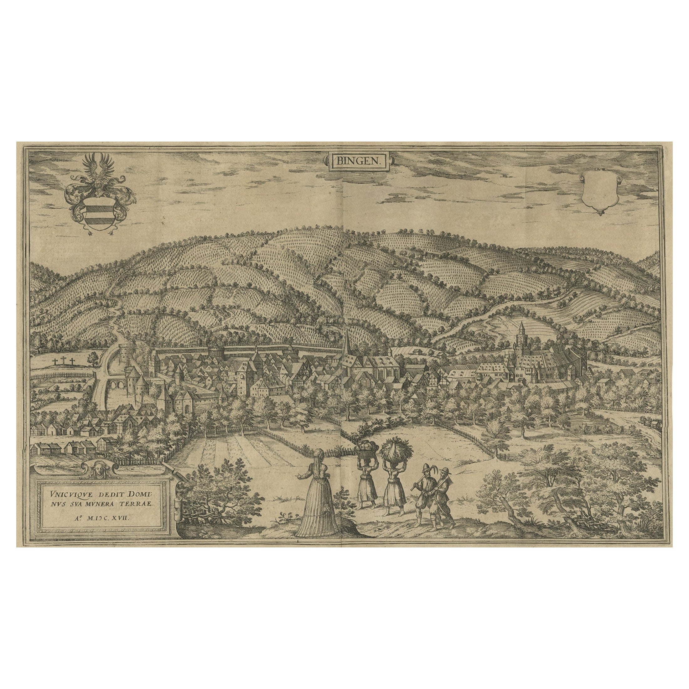
Antique Print of Büdingenin Germany by Braun & Hogenberg, 1617
Located in Langweer, NL
Antique map titled 'Bingen'. Bird's eye-view of Büdingen, Germany. The view shows a city surrounded by vineyards and well fortified with walls and moats. On the right is the castle w...
Category
Antique 17th Century Prints
Materials
Paper
$277 Sale Price
20% Off
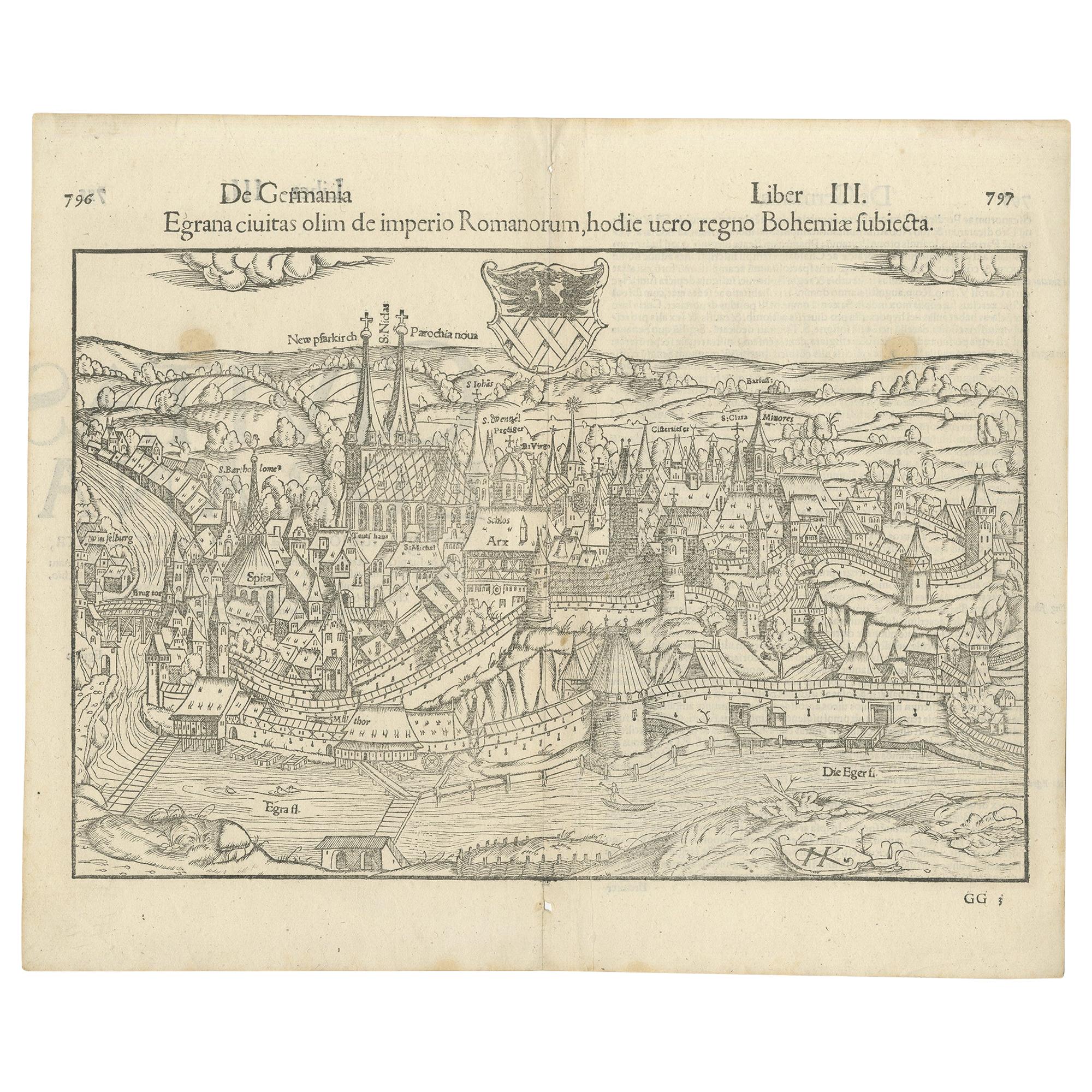
Antique Print with a View of the City of Eger 'Cheb' by Münster '1554'
Located in Langweer, NL
Antique print titled 'Egrana civitas olim de imperio Romanorum (..)'. Important early view of the walled town of Eger, or Cheb, in the Czech Republic, including the city's coat of ar...
Category
Antique 16th Century Prints
Materials
Paper
$383 Sale Price
20% Off
Huy (Huum) Cityscape 1574: Historical Copper Engraving by Braun & Hogenberg
Located in Langweer, NL
Title: Huum opp. condrusorum caput (...) Anno partae salutis 1574.
**Type:** Print (Colored Copper Engraving)
**Year:** Circa 1580
**Technique:** Colored Copper Engraving
**Medium:...
Category
Antique 16th Century Maps
Materials
Paper
$612 Sale Price
20% Off
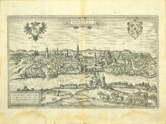
Antique Print of the City of Groningen, The Netherlands, by Münster, c.1600
By Sebastian Münster
Located in Langweer, NL
Antique print titled 'Groeninga'. View of the city of Groningen, the Netherlands. This map originates from 'Cosmographia' published by Münster.
Artists and Engravers: Sebastian Münster...
Category
Antique 16th Century Prints
Materials
Paper
$258 Sale Price
20% Off
You May Also Like
View of Namur (Belgium) - Etching by G. Braun and F. Hogenberg - Late 1500
By Franz Hogenberg
Located in Roma, IT
This View of Namvrcvm (the ancient city of Namur, Belgium) is an original etching realized by George Braun and Franz Hogenberg, as part of the famous Series "Civitates Orbis Terrarum...
Category
16th Century Figurative Prints
Materials
Etching
Schwäbisch Hall - Etching by G. Braun e F. Hogenberg- Late 16th Century
Located in Roma, IT
This Schwäbisch Hall is an original etching realized by George Braun and Frans Hogenberg, part of the famous series “Civitates Orbis Terrarum”"
The state of preservation of the art...
Category
16th Century Figurative Prints
Materials
Etching
View of Maastricht, The Netherlands -by G. Braun and F. Hogenberg - 16th Century
Located in Roma, IT
Map Traiectvm ad Mosam is original etching realized by Georg Braun and Franz Hogengerg between the end of the 16th and the first years of the 17th Century.
Dimension: 40 x 54
The ...
Category
16th Century Figurative Prints
Materials
Etching
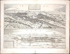
Prague and Egra, Antique Map from "Civitates Orbis Terrarum" - 1572-1617
By Franz Hogenberg
Located in Roma, IT
Braun G. & Hogenberg F., Praga, Egra, from the collection Civitates Orbis Terrarum, Cologne, T. Graminaeus, 1572-1617. Image dimensions: 39.5 x 47.5 cm. Dimensions: 41 x 52.5 cm.
Wo...
Category
16th Century Landscape Prints
Materials
Etching
View of Gorlitz - Etching by G. Braun and F. Hogenberg - Late 16th Century
By Franz Hogenberg
Located in Roma, IT
This View of Gorlitz is an original etching realized by George Braun and Franz Hogenberg as part of the Series "Civitates Orbis Terrarum".
The “Civitates Orbis Terrarum” (Atlas of C...
Category
16th Century Figurative Prints
Materials
Etching
Danzig, Antique Map from "Civitates Orbis Terrarum" - 1572-1617
By Franz Hogenberg
Located in Roma, IT
Braun G., Hogenberg F., Dantziat, from the collection Civitates Orbis Terrarum, Cologne, T. Graminaeus, 1572-1617.
Image dimensions: cm 32.8 x 47.9; dimensions: cm 42 x 55.3; passep...
Category
16th Century Landscape Prints
Materials
Etching
More Ways To Browse
Teak Temple
Thomas Day
Three Legged Stand
Tibetan Buddhist Art
Tibetan Coral
Tropical Bar
Tulip Cup
Tuning Fork
Used Stable Doors
Vertical Wall Art
Victorian Washstand
Vintage 3 Tiered Stand
Vintage Arzberg Porcelain
Vintage Baccarat Bowl
Vintage Built In
Vintage Furniture Regina
Vintage Pink Planter
Vintage Sunroom