Items Similar to Engraving of A Savage of the Admiralty Isles in the Bismarck Archipelago, 1801
Want more images or videos?
Request additional images or videos from the seller
1 of 6
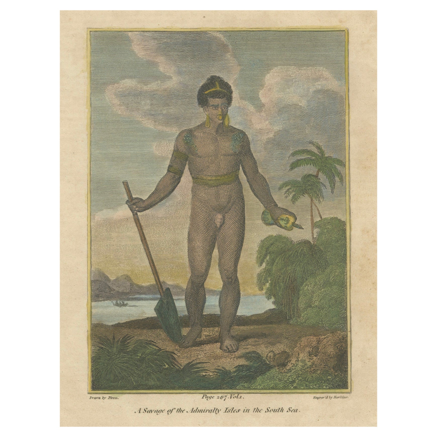
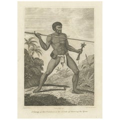
Engraving of A Savage of the Admiralty Isles in the Bismarck Archipelago, 1801
$323.81
$404.7620% Off
£240.68
£300.8520% Off
€272
€34020% Off
CA$447.09
CA$558.8720% Off
A$495.79
A$619.7420% Off
CHF 260.50
CHF 325.6320% Off
MX$6,057.76
MX$7,572.2020% Off
NOK 3,259.25
NOK 4,074.0620% Off
SEK 3,059.36
SEK 3,824.2020% Off
DKK 2,071.14
DKK 2,588.9320% Off
About the Item
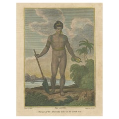
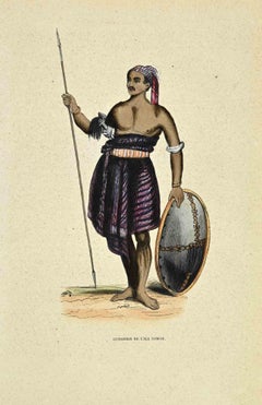
The 1801 engraving depicts a figure labeled as "A Savage of the Admiralty Isles in the South Sea." The image portrays a solitary indigenous man standing with a paddle in hand, exuding a sense of strength and resilience. His attire and adornments suggest a cultural significance, and the backdrop of tropical foliage and distant canoes speak to his connection with the natural environment of the Admiralty Islands. The engraving serves as a historical representation of the people from this region during the era of exploration.
In his left hand, the figure is potentially holding a headrest, which is a type of personal support device used to keep one's head elevated. Headrests were commonly used in various cultures, especially in regions of Africa and Oceania, and can serve as a pillow to protect elaborate hairstyles while sleeping. This object in the figure's hand is detailed with a pattern, indicating its cultural and possibly personal significance.
Description: This is a circa 1801 copperplate engraving from George Alexander Cooke's "Universal Geography" .
The print is part of George Alexander Cooke's comprehensive work "A Modern and Authentic System of Universal Geography." This book was a significant compilation of geographical knowledge during the late 18th century, offering descriptions and accounts of various parts of the world, influenced by the age of exploration. It includes narratives of famed explorers like Captain James Cook and Ferdinand Magellan, detailing their discoveries and journeys that expanded the European understanding of the globe. Cooke's work served as both a chronicle and reference for the territories and cultures encountered by these voyagers.
- Dimensions:Height: 10.44 in (26.5 cm)Width: 7.88 in (20 cm)Depth: 0 in (0.02 mm)
- Materials and Techniques:Paper,Engraved
- Period:
- Date of Manufacture:circa 1801
- Condition:Good. Two small black spots in top left outside of the plate mark and thus image. Aged paper with typically warm, yellowish-brown hue. This is not a reproduction but an original engraving. Study the image carefully.
- Seller Location:Langweer, NL
- Reference Number:Seller: BG-13597-101stDibs: LU3054337825312
About the Seller
5.0
Recognized Seller
These prestigious sellers are industry leaders and represent the highest echelon for item quality and design.
Platinum Seller
Premium sellers with a 4.7+ rating and 24-hour response times
Established in 2009
1stDibs seller since 2017
2,609 sales on 1stDibs
Typical response time: <1 hour
- ShippingRetrieving quote...Shipping from: Langweer, Netherlands
- Return Policy
Authenticity Guarantee
In the unlikely event there’s an issue with an item’s authenticity, contact us within 1 year for a full refund. DetailsMoney-Back Guarantee
If your item is not as described, is damaged in transit, or does not arrive, contact us within 7 days for a full refund. Details24-Hour Cancellation
You have a 24-hour grace period in which to reconsider your purchase, with no questions asked.Vetted Professional Sellers
Our world-class sellers must adhere to strict standards for service and quality, maintaining the integrity of our listings.Price-Match Guarantee
If you find that a seller listed the same item for a lower price elsewhere, we’ll match it.Trusted Global Delivery
Our best-in-class carrier network provides specialized shipping options worldwide, including custom delivery.More From This Seller
View AllSavage of the Admiralty Isles – Hand-Colored Ethnographic Engraving, c.1785
Located in Langweer, NL
Savage of the Admiralty Isles – Hand-Colored Ethnographic Engraving, c.1785
This striking hand-colored engraving, titled "A Savage of the Admiralty Isles in the South Sea," presents...
Category
Antique Late 18th Century English Prints
Materials
Paper
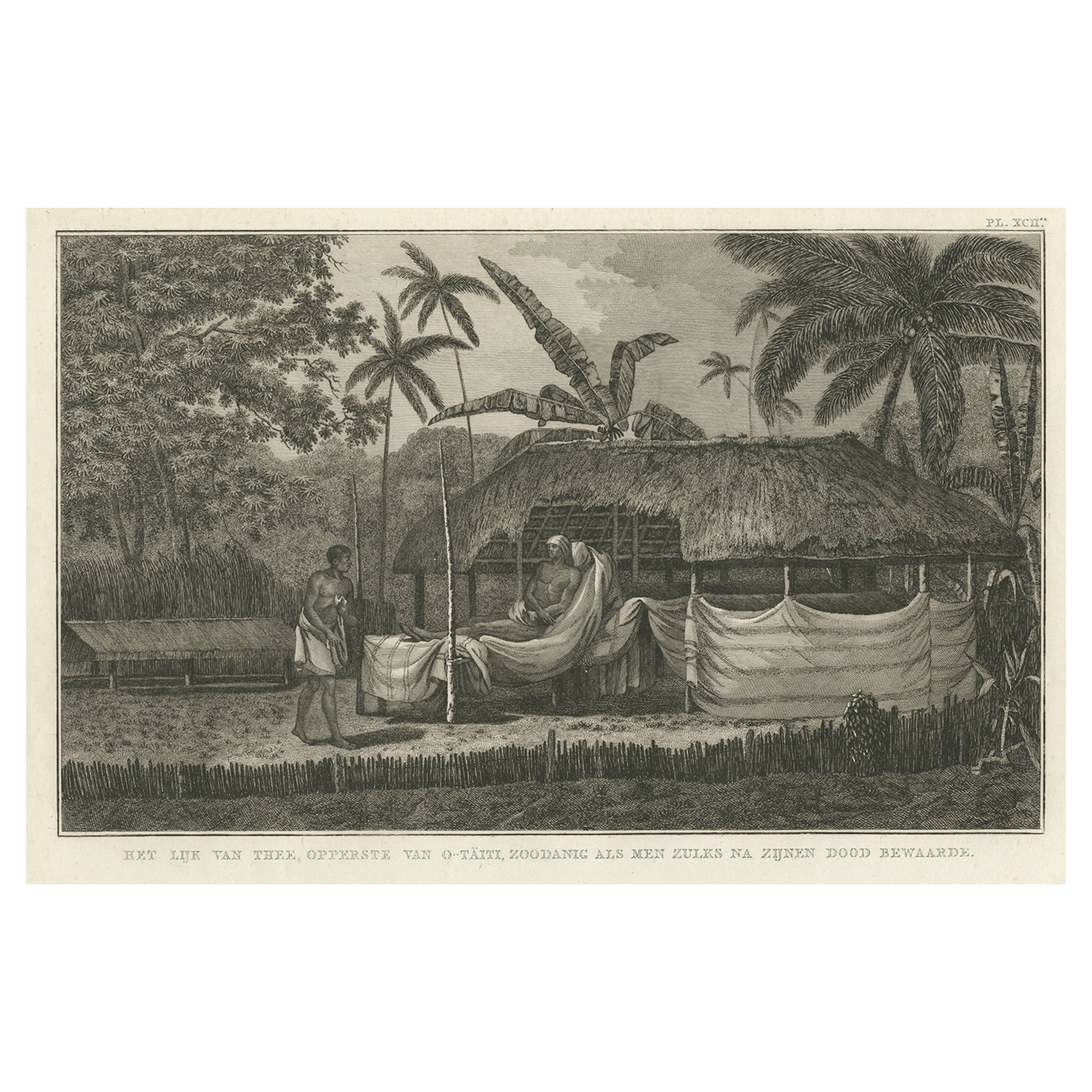
Antique Engraving of the Dead Chief of Tahiti Island in the Pacific, 1803
By James Cook
Located in Langweer, NL
Antique print titled 'Het Lijk van Thee, Opperste van O-Tahiti, zoodanig als men zulks na zijnen dood bewaarde'. Antique print depicting the remnents of Thee, Chief of Tahiti. Origin...
Category
Antique 19th Century Prints
Materials
Paper
$276 Sale Price
20% Off
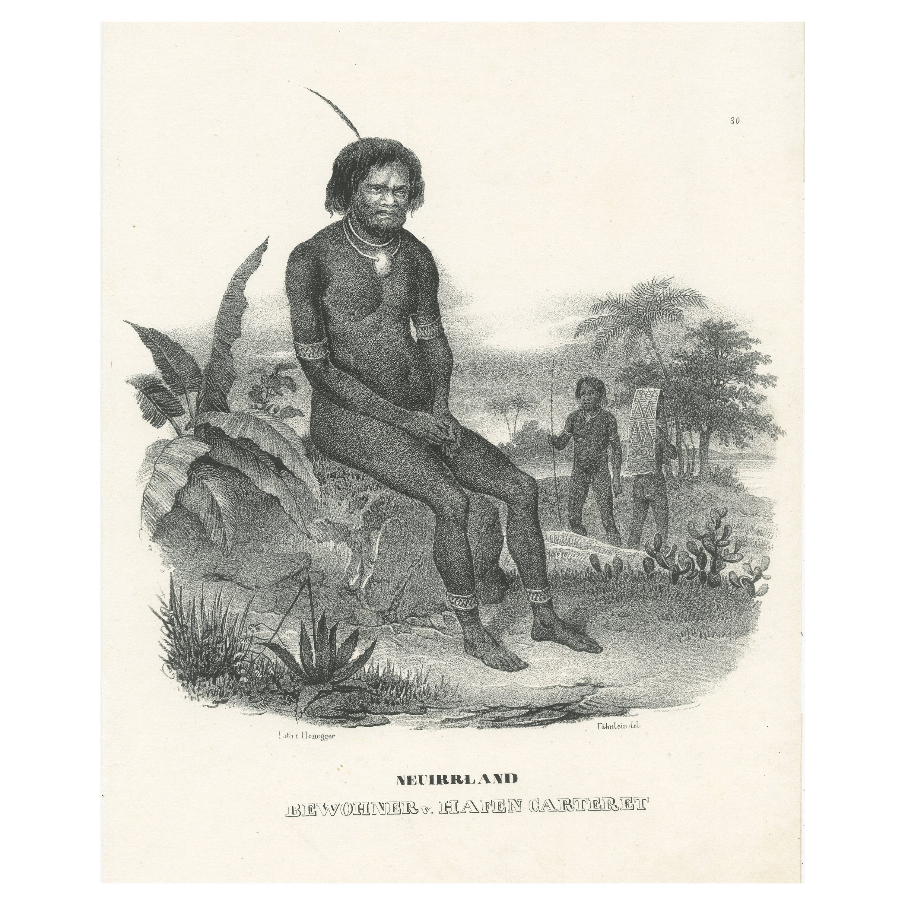
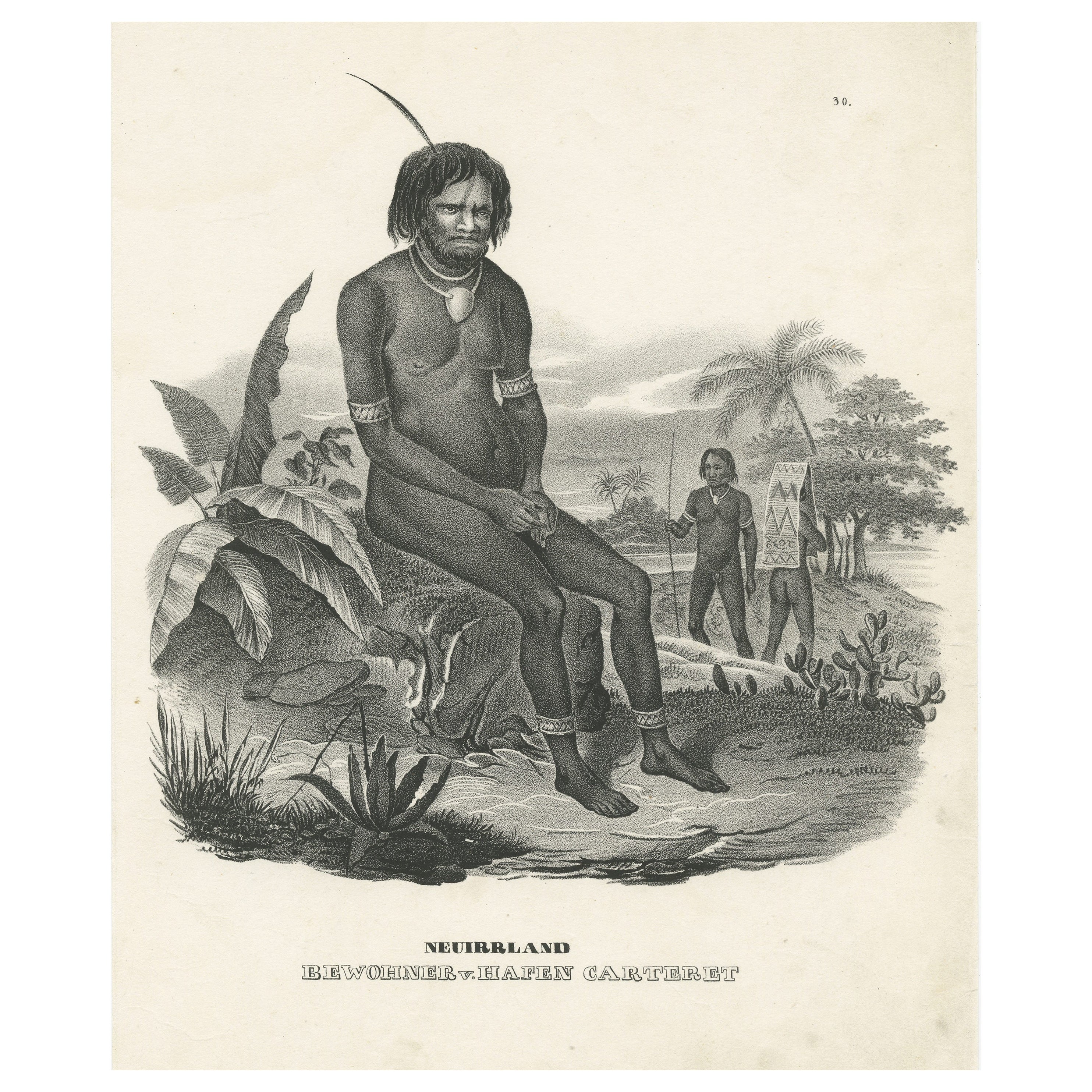
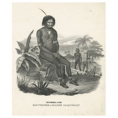
Antique Print of a Native of the Port of Carteret, Bismarck Archipelago
Located in Langweer, NL
Antique print titled 'Neuirrland, Bewohner v. Hafen Carteret'. Male native of the Bismarck Archipelago, seated on an overgrown rock, two fellow tribesmen on the right, one with a pla...
Category
Antique Mid-19th Century Prints
Materials
Paper

$295 Sale Price
20% Off
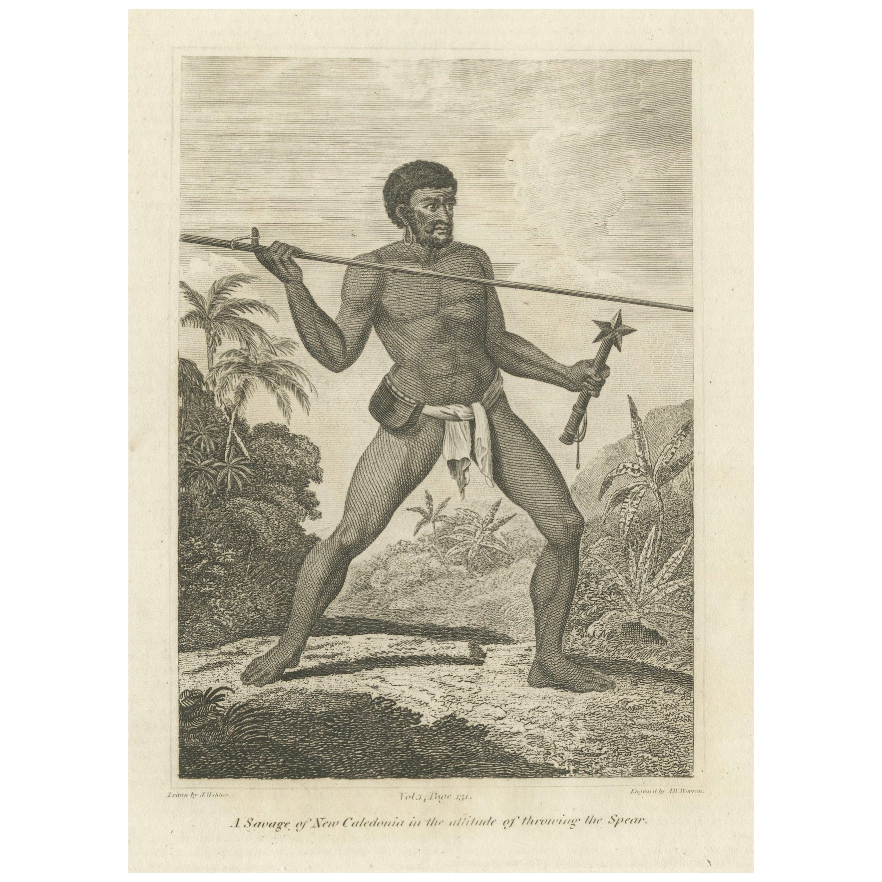
Vigilance in the Tropics: The Spear-Thrower of New Caledonia, 1801
Located in Langweer, NL
This engraving from George Alexander Cooke's "A Modern and Authentic System of Universal Geography" depicts a New Caledonian warrior in the poised position of throwing a spear. His muscular form and focused expression convey readiness and skill, characteristic of a people adept in the art of hunting and defense. The backdrop of tropical flora situates him within his native landscape, emphasizing the connection between the indigenous people and their environment in the Pacific archipelago of New Caledonia. The detailed artwork serves as a visual account from the age of exploration...
Category
Antique Early 1800s Prints
Materials
Paper
$419 Sale Price
20% Off
Free Shipping
Antique Print of a Native of the Bismarck Archipelago, Port of Carteret
Located in Langweer, NL
Antique print titled 'Neuirrland, Bewohner v. Hafen Carteret'. Male native of the Bismarck Archipelago, seated on an overgrown rock, two fellow tribesmen on the right, one with a pla...
Category
Antique Mid-19th Century Prints
Materials
Paper
$276 Sale Price
20% Off
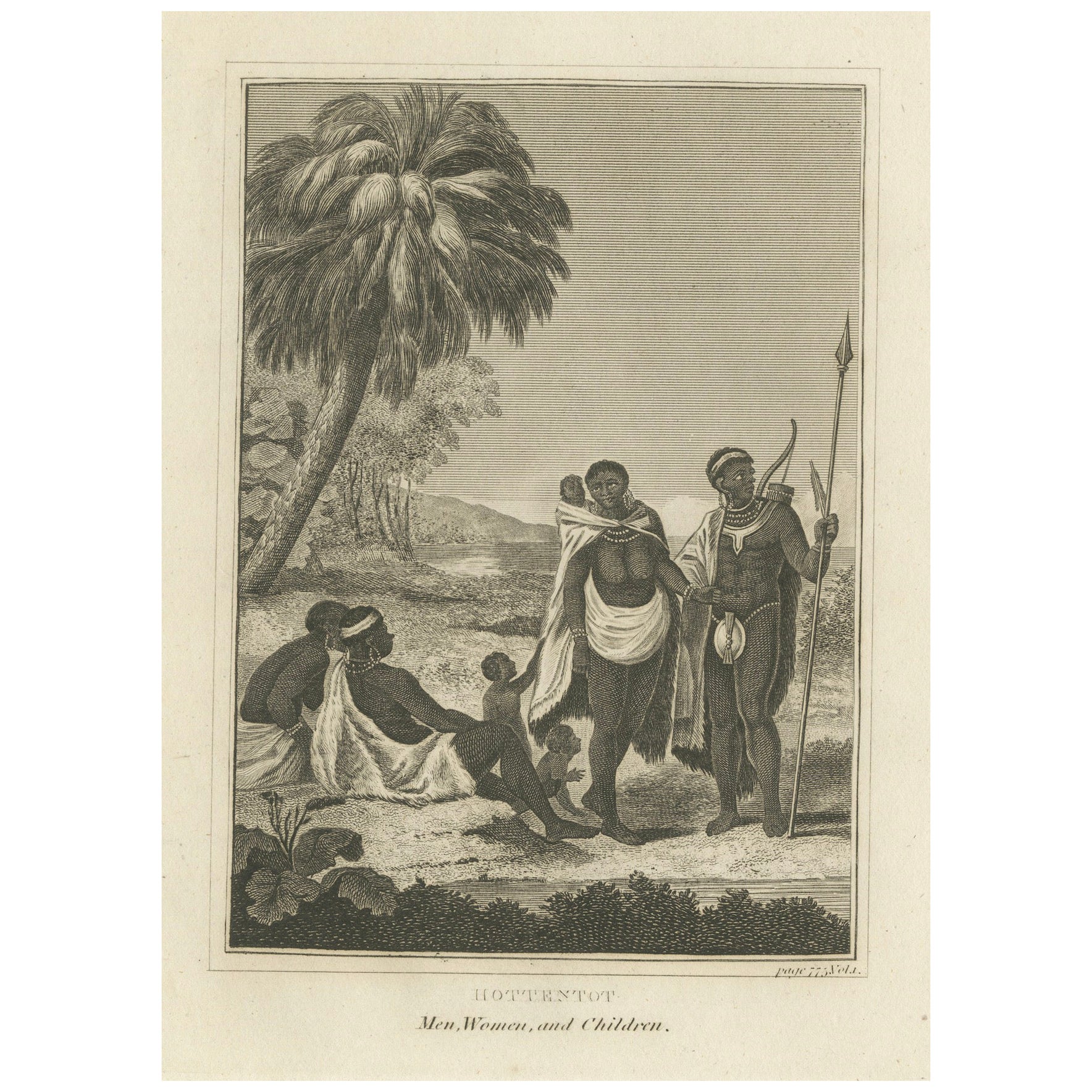
The Khoikhoi of Southwestern Africa, Original Engraving of circa 1801
Located in Langweer, NL
The print is an early 19th-century engraving depicting the Khoikhoi people, historically referred to as the Hottentots, which is an outdated term. The Khoikhoi are indigenous inhabit...
Category
Antique Early 1800s Prints
Materials
Paper
$323 Sale Price
20% Off
Free Shipping
You May Also Like
Noukahiwa - Lithograph by Auguste Wahlen - 1844
Located in Roma, IT
Noukahiwa is a hand colored lithographs realized by Auguste Wahlen in 1844.
Good conditions.
The artwork belongsto the Suite Moeurs, usages et costume...
Category
1840s Modern Figurative Prints
Materials
Lithograph
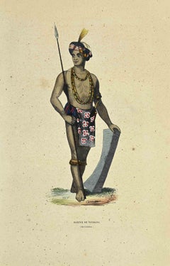
Harfur de Tondano - Lithograph by Auguste Wahlen - 1844
Located in Roma, IT
Harfur de Tondano is a hand colored lithograph realized by Auguste Wahlen in 1844.
Good conditions.
The artwork belongs to the Suite Moeurs, usages et costumes de tous les peuples ...
Category
1840s Modern Figurative Prints
Materials
Lithograph
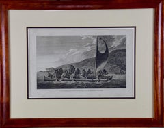
Sandwich Islands Canoe (Hawaii): Framed 18th C. Engraving Captain Cook's Journal
By John Webber
Located in Alamo, CA
"A Canoe of the Sandwich Islands, the Rowers Masked" is an engraving created by Charles Grignion, from a drawing by John Webber (1752-1793), who was the artist on Captain James Cook's 3rd and final voyage of discovery. It is Plate 65 in the atlas of "A Voyage to the Pacific Ocean Undertaken by the Command of His Majesty, for Making Discoveries in the Northern Hemisphere", the official British Admiralty sanctioned journal published upon completion of the voyage in London in 1784 by Strahan & Cadell.
This famous image of ten Hawaiian rowers transporting a priest who is carrying a feather-covered image of Kukailimoku, the Hawaiian god of war. The priests and paddlers are all wearing gourd masks in their double-hulled canoe with an upright lateen woven sail. Each hull was shaped from a single large Koa log harvested from island rainforests, where they were carved before being transported to the coast.
This engraving is presented in a Koa wood frame and a white mat. There are occasional faint spots, but the print is otherwise in very good condition. Koa is the same wood as was used to make the canoe. Koa wood is legendary in Hawaii. Not only is this amazing wood native to Hawaii, but it is known for the deep rich colors and varied grain pattern. Koa has an honored heritage in Hawaii and is highly revered and sacred. The word “koa” means “warrior” in Hawaiian. The warriors of King Kamehameha the Great, created canoes and weapons from a wood plentiful on the Big Island of Hawaii. This wood became synonymous with the warriors themselves, and it became known as koa. The frame measures 20.75" high, 26.75" wide and 0.88" deep.
There are three other engravings listed from the official journal of Captain Cook's 3rd voyage available that are presented in identical Koa wood frames and mat (LU117324682022, LU117324684052, LU117324684062). They would make a wonderful grouping for a display of 2, 3 or 4 prints. A discount is available for a grouping depending on the number of items included.
Hawaii was discovered by Captain Cook (1728-1779) during this voyage. Hawaii was originally called The Sandwich Islands in honor of The Earl of Sandwich...
Category
1780s Landscape Prints
Materials
Engraving
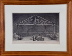
"King of the Friendly Islands" (Tonga); Engraving from Captain Cook's 3rd Voyage
By John Webber
Located in Alamo, CA
"Poulaho, King of the Friendly Islands, Drinking Kava" is an engraving created by William Sharp (1749-1824), from a drawing by John Webber (1752-1793), who was the artist on Captain James Cook's 3rd and final voyage of discovery. It was published in the atlas of "A Voyage to the Pacific Ocean Undertaken by the Command of His Majesty, for Making Discoveries in the Northern Hemisphere", the official British Admirality sanctioned journal published upon completion of the voyage in London in 1784 by Strahan & Cadell.
Captain Cook visited Tonga on his 3rd voyage, which he named The Friendly Islands because of the warm welcome he and his crew received, unlike some of the other more hostile Pacific islands. The engraving depicts Cook and his men observed a kava ceremony at the village of Mu’a on Tongatapu. King Paulaho sits in the centre foreground, his back to the spectator with a man kneeling before him. The ceremonial mat depicted behind Paulaho indicates that nobody was allowed to sit behind him. The figure in the centre holds a single cup, referring to the Tongan custom of offering the cup to the king first. Kava is native to the islands of the South Pacific and was first described for English readers in 1768 by Captain James Cook. The kava root has been used for centuries as a central feature of ceremonies and celebrations because it was able to bring about a calming and pleasant social atmosphere. The root was crushed and processed into coconut milk to become the focal ceremonial beverage, simply referred to as kava.
This engraving is presented in a Koa wood frame and a white mat. Koa wood is legendary in Hawaii. There are occasional faint spots, but the print is otherwise in very good condition. This amazing Koa wood is native to Hawaii and it is known for the deep rich colors and varied grain pattern. Koa has an honored heritage in Hawaii and is highly revered and sacred. The word “koa” means “warrior” in Hawaiian. The warriors of King Kamehameha the Great, created canoes and weapons from a wood plentiful on the Big Island of Hawaii. This wood became synonymous with the warriors themselves, and it became known as koa.
There are three other engravings listed from the official journal of Captain Cook's 3rd voyage available that are presented in identical Koa wood frames and mats (LU117324682422, LU117324684052, LU117324684032). They would make a wonderful grouping for a display of 2, 3 or 4 prints. A discount is available for a grouping depending on the number of items included.
Captain Cook is remembered as one of the greatest explorers and navigators in history. His explorations included Australia, New Zealand and islands of the South Pacific and the northwest coast of North America. Hawaii was discovered by Captain Cook during this voyage. Hawaii was originally called The Sandwich Islands in honor of The Earl of Sandwich...
Category
1780s Realist Figurative Prints
Materials
Engraving
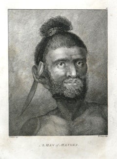
A Man of Mangea 1784 final voyage of Captain Cook by John Webber
By John Webber
Located in Paonia, CO
A Man of Mangea is from the 1784 First Edition Atlas Accompanying Capt. James Cook and King; Third and Final Voyage of Captain James Cook. John Webber (1752-1793) was the official a...
Category
1780s Realist Portrait Prints
Materials
Engraving
Guerrier de L'ile Sawoe - Lithograph by Auguste Wahlen - 1844
Located in Roma, IT
Guerrier de L'ile Sawoe is a hand colored lithographs realized by Auguste Wahlen in 1844.
Good condition.
The artwork belongs to the Suite Moeurs, usages et costumes de tous les pe...
Category
1840s Modern Figurative Prints
Materials
Lithograph
More Ways To Browse
George Cooke
Canoe Paddle
Versaille Urns
Vintage Bird Toy
Vintage Chime Clock
Vintage Flour
Vintage Glass Mixing Bowls
Vintage Hawaiian Pottery
Vintage Hippie Furniture
Vintage Tea Poster
Vintage Wet Bar
Vintage Yellow Teapot
Walnut Hairy Paw
Walter Lambert
Wind Up Doll
Wood Dowry Chest
Wooden Monkey Sculpture
Wrought Iron Balconies