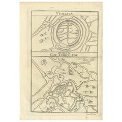
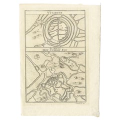
Items Similar to Map of Vusihyen, Hu Chew Fu and Hou-Tcheou-Fou, Historical Chinese Cities, 1754

Want more images or videos?
Request additional images or videos from the seller
1 of 6
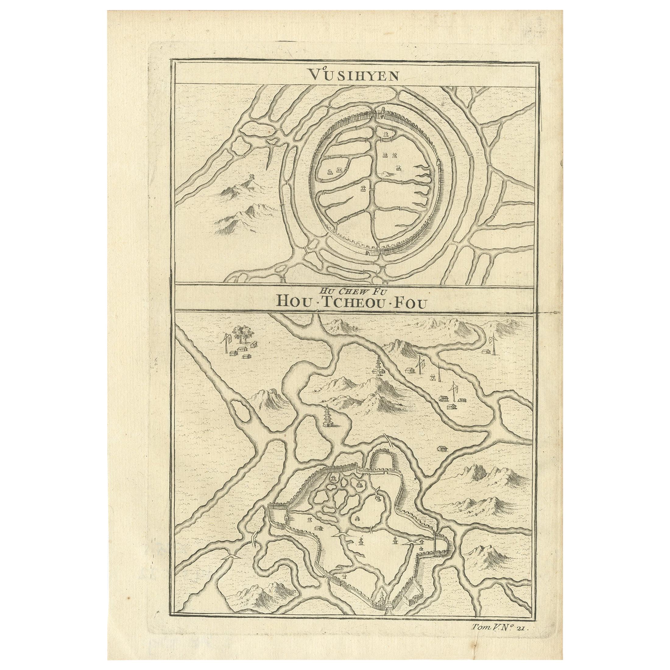
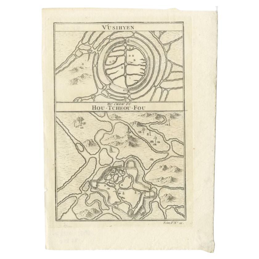
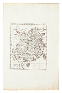
Map of Vusihyen, Hu Chew Fu and Hou-Tcheou-Fou, Historical Chinese Cities, 1754
$125.24
$156.5420% Off
£92.66
£115.8220% Off
€104
€13020% Off
CA$173.16
CA$216.4520% Off
A$190.11
A$237.6420% Off
CHF 99.18
CHF 123.9720% Off
MX$2,300.58
MX$2,875.7220% Off
NOK 1,243.07
NOK 1,553.8320% Off
SEK 1,171.30
SEK 1,464.1220% Off
DKK 791.86
DKK 989.8220% Off
About the Item
Given these specific names—Vusihyen, Hu Chew Fu, and Hou-Tcheou-Fou—it appears that the map depicts historical Chinese locations. These names are likely transliterations of Chinese names from the period. "Hu Chew Fu" might be an old Western spelling for what is known in modern pinyin as Huzhou, a city near Lake Tai in China. "Hou-Tcheou-Fou" could refer to a historical name for another city or region, also located in China.
More research needed.
More about the maker:
Jacques-Nicolas Bellin's contributions to cartography and hydrography set a precedent in mapmaking during the 18th century. His role as Hydrographer to the French Navy and later as the Official Hydrographer to the French King placed him at the forefront of maritime charting and exploration. The detail and accuracy of Bellin's maps reflected not only the scientific rigor of the time but also the French government's commitment to navigation, exploration, and colonial expansion.
His work on the "Neptune Francois," "Atlas Maritime," and "Hydrographie Francaise," among other important collections, helped to improve the accuracy of sea navigation and fostered a greater understanding of the world's geography. The fact that his maps were widely republished and copied is a testament to their value and the respect he commanded across Europe.
Bellin's smaller format maps, like those in the "Petit Atlas Maritime," and his contributions to Prévost's "Histoire Generale des Voyages," were invaluable to navigators, explorers, and scholars. His influence was such that it not only advanced French cartography but also the European cartographic tradition as a whole, leaving a legacy that would endure well beyond his lifetime.
- Dimensions:Height: 9.97 in (25.3 cm)Width: 7.05 in (17.9 cm)Depth: 0 in (0.02 mm)
- Materials and Techniques:Paper,Engraved
- Period:1750-1759
- Date of Manufacture:1754
- Condition:Good. General age-related toning and/or occasional minor defects from handling. Please study scan carefully.
- Seller Location:Langweer, NL
- Reference Number:Seller: BG-13600-471stDibs: LU3054338424992
About the Seller
5.0
Recognized Seller
These prestigious sellers are industry leaders and represent the highest echelon for item quality and design.
Platinum Seller
Premium sellers with a 4.7+ rating and 24-hour response times
Established in 2009
1stDibs seller since 2017
2,641 sales on 1stDibs
Typical response time: <1 hour
- ShippingRetrieving quote...Shipping from: Langweer, Netherlands
- Return Policy
Authenticity Guarantee
In the unlikely event there’s an issue with an item’s authenticity, contact us within 1 year for a full refund. DetailsMoney-Back Guarantee
If your item is not as described, is damaged in transit, or does not arrive, contact us within 7 days for a full refund. Details24-Hour Cancellation
You have a 24-hour grace period in which to reconsider your purchase, with no questions asked.Vetted Professional Sellers
Our world-class sellers must adhere to strict standards for service and quality, maintaining the integrity of our listings.Price-Match Guarantee
If you find that a seller listed the same item for a lower price elsewhere, we’ll match it.Trusted Global Delivery
Our best-in-class carrier network provides specialized shipping options worldwide, including custom delivery.More From This Seller
View AllAntique Map of Wuxi and Huzhou by Prévost '1746'
Located in Langweer, NL
Antique map titled 'Vusihyen. Hu Chew Fu'. Plans of Wuxi and Huzhou, China. Originates from Prévost's 'Histoire générale des voyages'.
Category
Antique Mid-18th Century Maps
Materials
Paper
$96 Sale Price
20% Off
Antique Map of Wuxi and Huzhou in China, 1746
Located in Langweer, NL
Antique map titled 'Vusihyen. Hu Chew Fu'. Plans of Wuxi and Huzhou, China. Originates from Prévost's 'Histoire générale des voyages'.
Artists and Engravers: Antoine François Prévo...
Category
Antique 18th Century Maps
Materials
Paper
$144 Sale Price
20% Off
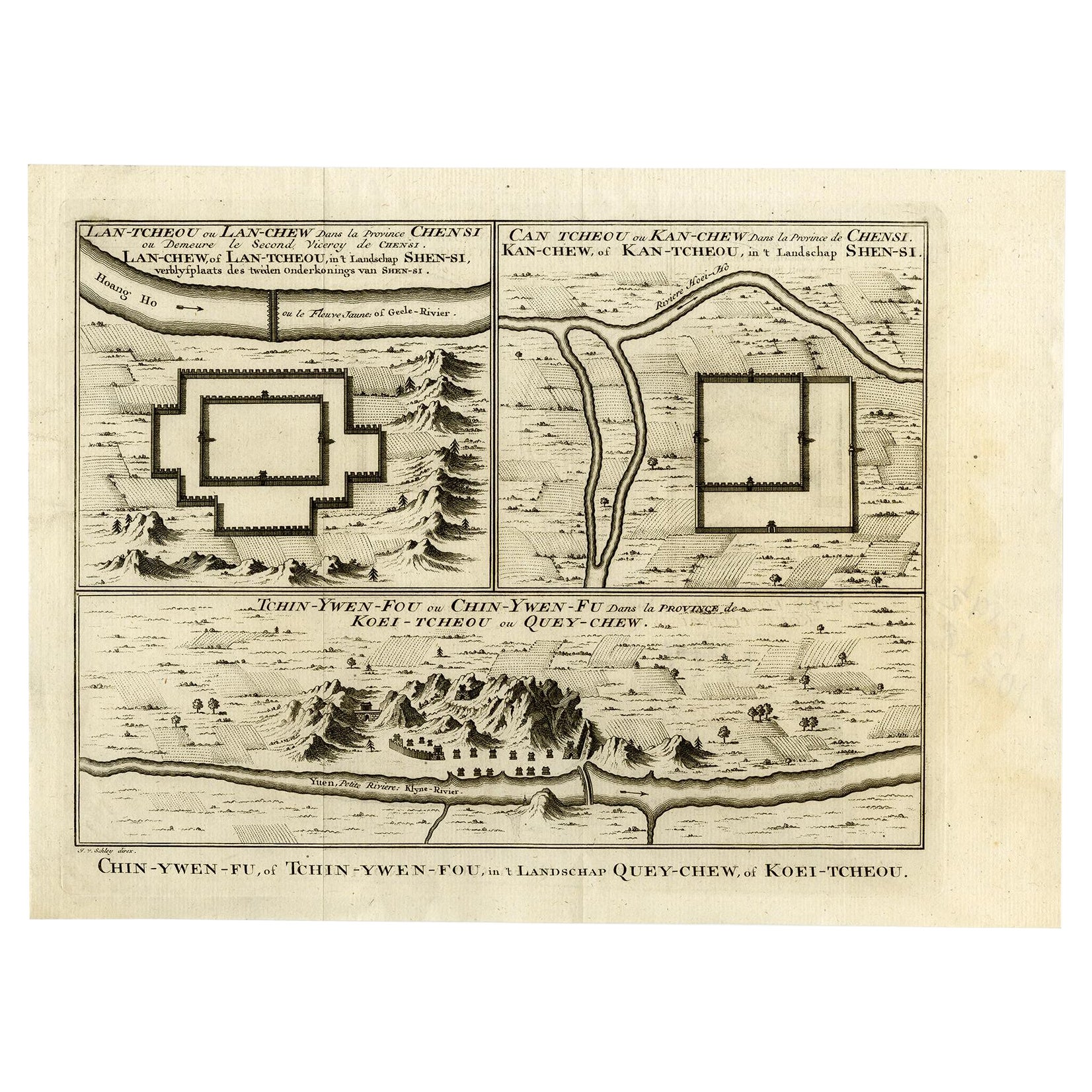
Antique Map of Three Chinese Cities in Chensi and Koei Tcheou, c.1758
Located in Langweer, NL
Antique map titled 'Lan-Tcheou ou Lan-Chew dan la province Chensi; Can Tcheou ou Kan-Chew dan la province de Chensi; Tchin-Ywe-Fou ou Chin-Ywen-Fu dans la province de Koei-Tcheou ou Quey-chew.' Three plans of old Chinese cities...
Category
Antique 18th Century Maps
Materials
Paper

$269 Sale Price
20% Off
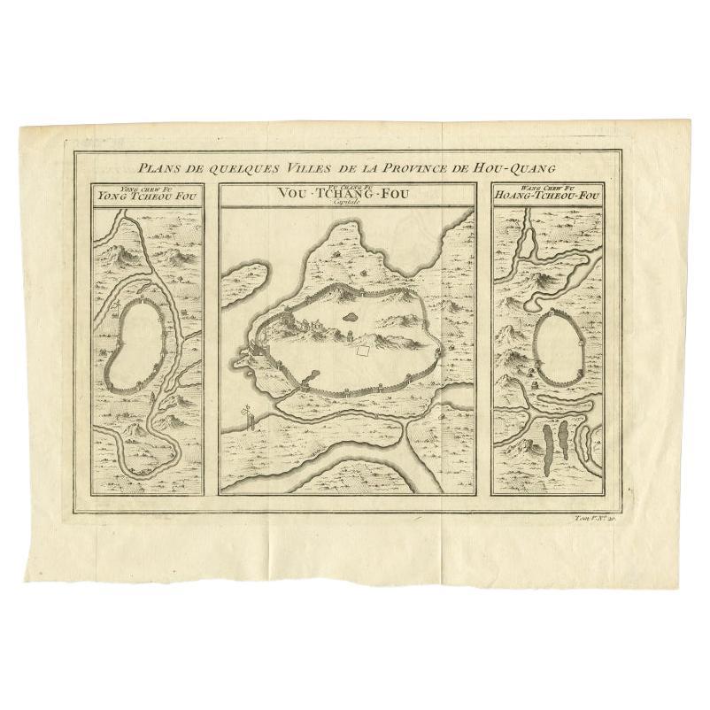
Antique Map of Cities in the Hubei and Hunan Provinces of China, 1755
By Jacques-Nicolas Bellin
Located in Langweer, NL
Antique print titled 'Plans de Quelques villes de la province de Hou-Quang.' Three bird's-eye view plans of walled cities in what are now China's Hubei (Hou-Quang) and Hunan Province...
Category
Antique 18th Century Maps
Materials
Paper

$279 Sale Price
20% Off
Antique Map of Cities in the Region of Hubei in China, 1758
Located in Langweer, NL
Antique map titled 'Plans de Quelques villes de la province de Hou-Quang.' Three plans of cities in a region named Hou-Quang (currently Hubei). While these maps by Van Schley after B...
Category
Antique 18th Century Maps
Materials
Paper

$308 Sale Price
20% Off
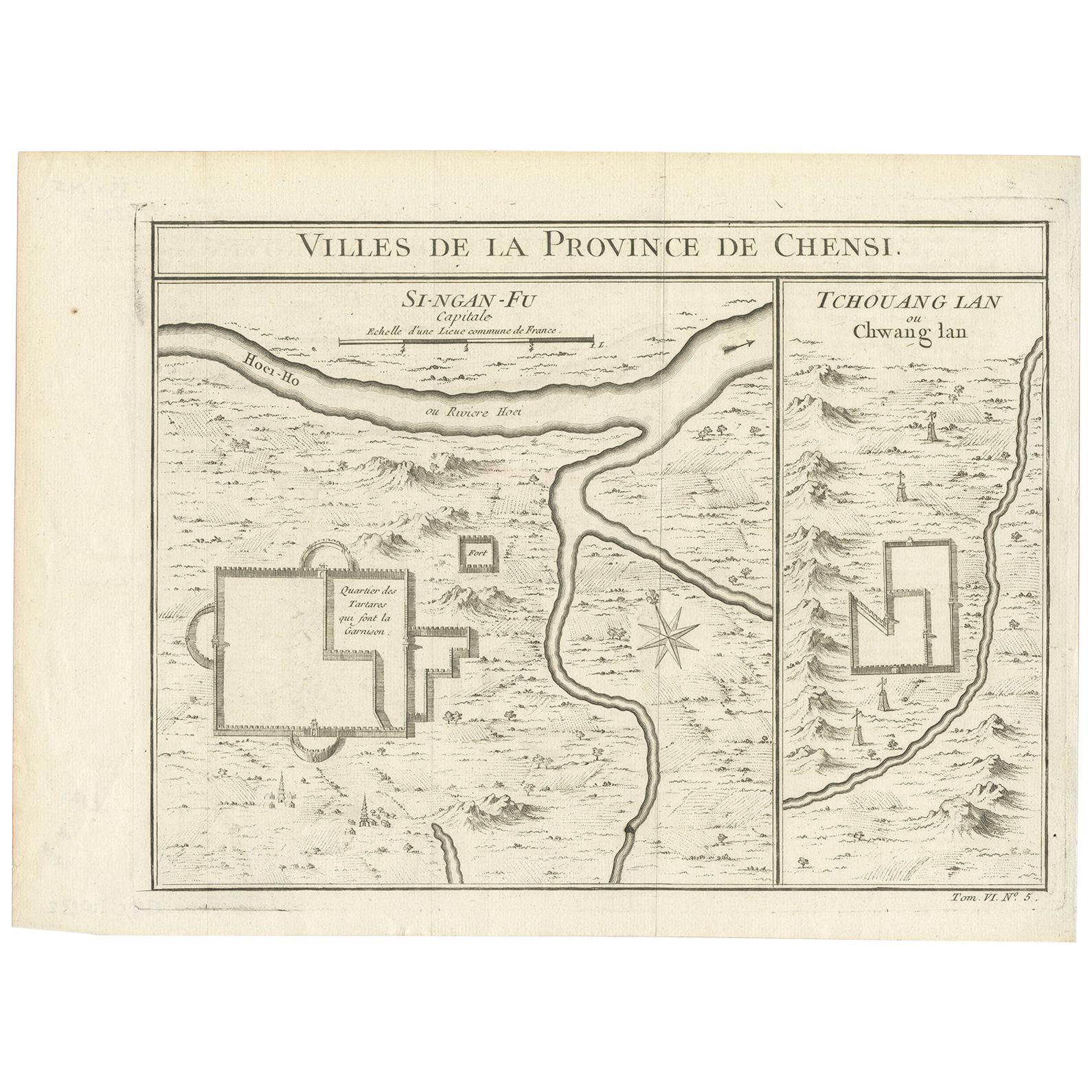
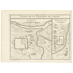
Antique Map of Si-Ngan-fu and Tchang Lan 'China' by Bellin '1748'
By Jacques-Nicolas Bellin
Located in Langweer, NL
Antique map China titled ‘Villes de la Province de Chensi’. Interesting set of two local town plans of "Si-Ngan-Fu: Capitale, Hoofdstad." and "Tchang...
Category
Antique Mid-18th Century Maps
Materials
Paper
$144 Sale Price
20% Off
You May Also Like
Antique French Map of Asia Including China Indoneseia India, 1783
Located in Amsterdam, Noord Holland
Very nice map of Asia. 1783 Dedie au Roy.
Additional information:
Country of Manufacturing: Europe
Period: 18th century Qing (1661 - 1912)
Condition: Overall Condition B (Good Used)...
Category
Antique 18th Century European Maps
Materials
Paper

$648 Sale Price
20% Off
Super Rare Antique French Map of Chine and the Chinese Empire, 1780
Located in Amsterdam, Noord Holland
Super Rare Antique French Map of Chine and the Chinese Empire, 1780
Very nice map of Asia. 1780 Made by Bonne.
Additional information:
Type: Map
...
Category
Antique 18th Century European Maps
Materials
Paper

$584 Sale Price
33% Off
Map of China - Etching - 19th Century
Located in Roma, IT
This map of China is an etching realized in 19th century.
The state of preservation of the artwork is excellent. At the top of the paper, the inscription...
Category
19th Century Figurative Prints
Materials
Etching
1635 Willem Blaeu Map of Northern France"Comitatvs Bellovacvm" Ric.a08
Located in Norton, MA
1635 Willem Blaeu map of northern France, entitled.
"Comitatvs Bellovacvm Vernacule Beavvais,"
Colored
Ric.a008
“COMITATVS BELLOVACVM…” Amsterdam: W...
Category
Antique 17th Century Unknown Maps
Materials
Paper

1627 Hondius Map "La Principaute d'Orange et Comtat de Ve", Ric.0003
Located in Norton, MA
1627 Hondius map entitled
"La Principaute d'Orange et Comtat de Venaissin,"
Original Hand-Colored
Description: From Johannes Janssonius's Atlantis Maioris Appendix of 1630.
...
Category
Antique 17th Century Unknown Maps
Materials
Paper

1627 Hendrik Hondius Map Entitled "Vltoniae Orientalis Pars, " Ric.a009
Located in Norton, MA
1627 Hendrik Hondius map entitled
"Vltoniae orientalis pars,"
Ric.a009
Title:
Vltoniae orientalis : pars
Title (alt.) :
Ultoniae orientalis pars
Creator:
Mercator, Gerh...
Category
Antique 17th Century Dutch Maps
Materials
Paper

More Ways To Browse
Antique Smoking Set
Antique Solingen
Antique Stable Door
Antique Staffordshire Cows
Antique Teapoy
Antique Wedgwood Dishes
Antique Wood Beams
Arabia Finland Kaj Franck
Arabic Plates
Art Deco Automobile
Art Deco Lizard
Art Nouveau Horn
Arte Vetraria Muranese (AVEM) On Sale
Ashford Marble
Ashley Wood
Asian Coins
Astronomical Clock
Austrian Pug