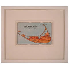
Nantucket Island Map
View Similar Items


Want more images or videos?
Request additional images or videos from the seller
1 of 11
Nantucket Island Map
About the Item
- Dimensions:Height: 8.75 in (22.23 cm)Width: 10.38 in (26.37 cm)
- Materials and Techniques:
- Place of Origin:
- Period:
- Date of Manufacture:circa 1952
- Condition:Wear consistent with age and use.
- Seller Location:Essex, MA
- Reference Number:1stDibs: LU83771676032
About the Seller
5.0
Vetted Seller
These experienced sellers undergo a comprehensive evaluation by our team of in-house experts.
Established in 1998
1stDibs seller since 2007
192 sales on 1stDibs
More From This SellerView All
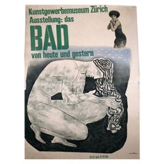
- Herbert Matter Swiss Exhibition Poster on the History of Bathing and SwimmingBy Herbert MatterLocated in Essex, MAA large, original vintage Swiss exhibition poster by celebrated graphic designer, Herbert Matter, for an exhibition at the Museum of Art & Craft in Zu...Category
Mid-20th Century Swiss Mid-Century Modern Posters
MaterialsPaper
- 19th Century German Miniature Pocket Terrestrial GlobeBy C. Abel-KlingerLocated in Essex, MAA miniature 19th century 3.5 inch diameter pocket terrestrial globe by C. Abel-Klinger, Nuremberg, Germany, in English for the English speaking markets. Signed with cartouche reading...Category
Antique 1880s German Scientific Instruments
MaterialsBrass
 $1,875 Sale Price25% Off
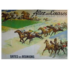
 - Giant French Horse Racing Poster Mural by Jacquot, circa 1930sBy Michel JacquotLocated in Essex, MAA rare, giant original French horse racing poster or mural, lithograph on paper, mounted on linen, in four panels joined to form one large image b...Category
Vintage 1930s French Art Deco Posters
MaterialsLinen, Paper
- Wengen Swiss Ski Poster by P. Senn and P. MartiBy P. Senn and P. MartiLocated in Essex, MAA striking pre-war collage ski poster featuring both photographic and graphic images advertising the alpine resort of Wengen, Switzerland, featuring an e...Category
Vintage 1930s Swiss Posters
MaterialsPaper
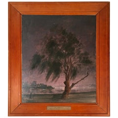
- Hayward Veal Australian Nocturne Cityscape PaintingBy Hayward VealLocated in Essex, MAAn oil on board painting by Australian painter W. Hayward Veal (1913-1968), entitled Nocturne No. 4, depicting a night scene of a park and tree in the foreground with a man walking, ...Category
Vintage 1940s Australian Mid-Century Modern Paintings
MaterialsPine, Masonite, Wood, Paint
- Louis XV Style Grey Painted Buffet a Deux Corps CabinetLocated in Essex, MAA very functional and attractive 19th century French Louis XV style grey and white painted two-part cabinet, a buffet a deux corps, great as a bar, china or linen cupboard, the remov...Category
Antique 19th Century French Louis XV Cabinets
MaterialsIron


You May Also Like
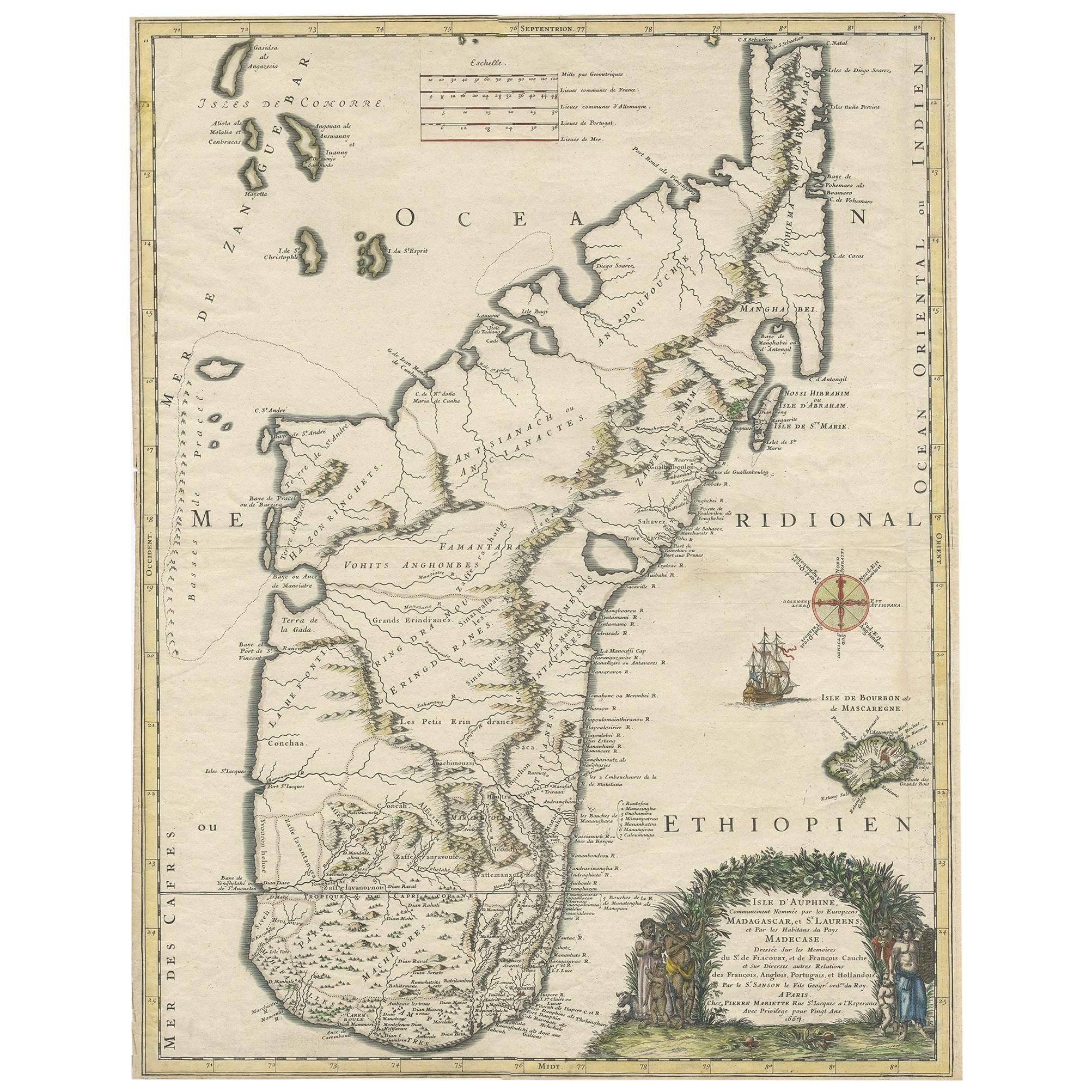
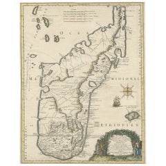
- Beautiful Antique Map of Madagascar, The Comoros Islands & Reunion Island, 1667Located in Langweer, NLAntique map titled 'Isle d'Auphine, communement Nommée par les Europeens Madagascar, et St. Laurens, et par les Habitans du pays Madecase'. Beautiful map of Madagascar...Category
Antique 1660s Maps
MaterialsPaper
 $801 Sale Price20% Off
 - Antique Map of the Atlantic Islands, 1817Located in Langweer, NLAntique map titled 'Atlantic Islands'. Large map of the Atlantic Islands include the Cape Verde islands, Canary islands, Azore islands and Madeira islands. Also included a view of th...Category
Antique Early 19th Century Maps
MaterialsPaper
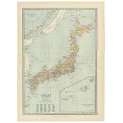
- Antique Map of Japan, the Kurile Islands and Liu Kiu Islands, 1886Located in Langweer, NLThe map is an exquisite piece, showcasing Japan's vibrant geography. Engraved by J. Bartholomew and published by George Philip & Son in London & Liverpool, it presents a detailed and...Category
Antique Late 19th Century Maps
MaterialsPaper
 $105 Sale Price20% Off
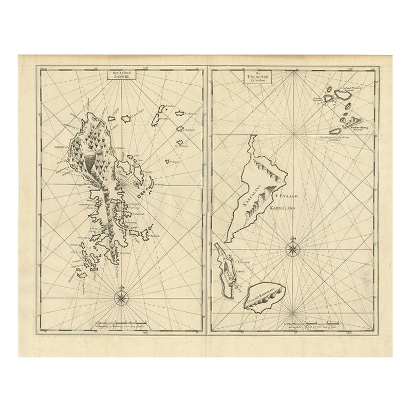
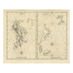
 - Antique Map of Sangir Island and the Talaud Islands by Valentijn, 1726Located in Langweer, NLAntique map titled 'Het Eyland Sangir & De Talautse Eylanden'. Two maps on one sheet. To the left, a map of Sangir Island, Indonesia. To the right, a map of the Talaud Islands, Indon...Category
Antique 18th Century Maps
MaterialsPaper
 $457 Sale Price20% Off
 - Antique Map of Coiba Island by Anson '1749'Located in Langweer, NLAntique map titled 'Plan van de Oost-Zyde van het Eiland Quibo'. Original antique map of the eastside of Coiba Island (Quibo), Panama, showing the shoreline around Port de Dames indi...Category
Antique Mid-18th Century Maps
MaterialsPaper
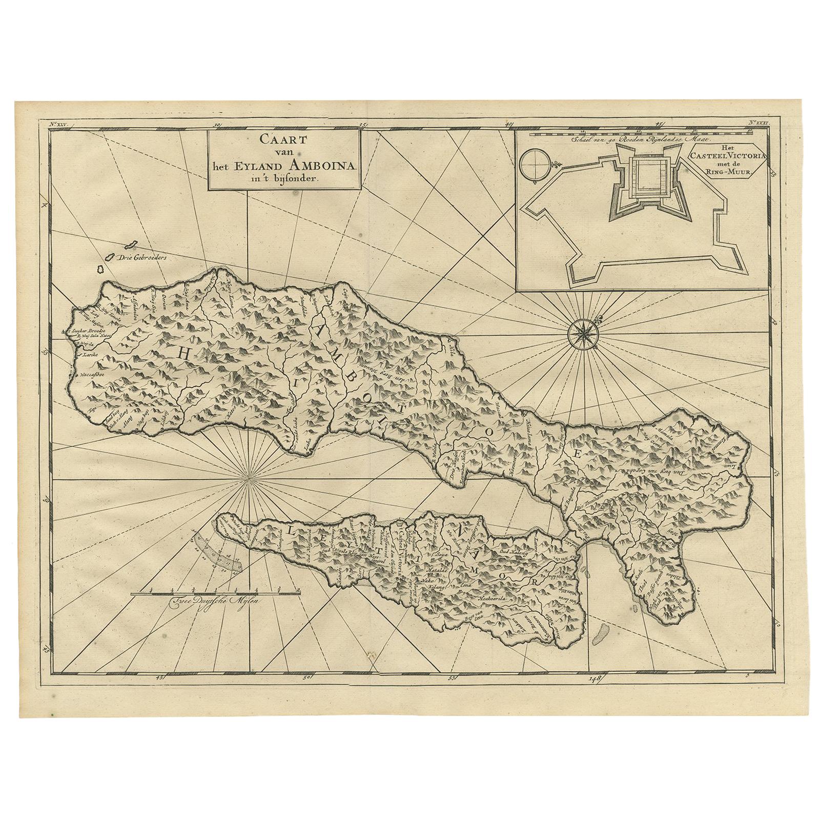
- Antique Map of Ambon Island by Valentijn, 1726By F. ValentijnLocated in Langweer, NLAntique map titled 'Caart van het Eyland Amboina in 't bijsonder'. Map of the Islands Ambon and Timor, one of the Moluccan Islands, Indonesia, with an inset of castle Victoria with t...Category
Antique Early 18th Century Dutch Maps
MaterialsPaper


