Items Similar to Original Lithograph with a Scene of a Village and Harbour in New Guinea, c.1836

Want more images or videos?
Request additional images or videos from the seller
1 of 7
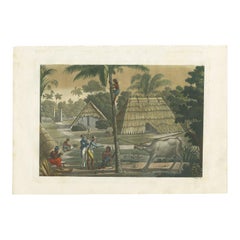
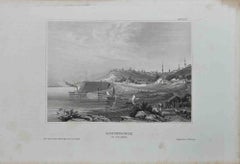
Original Lithograph with a Scene of a Village and Harbour in New Guinea, c.1836
$342.32
$427.9120% Off
£254.92
£318.6620% Off
€288
€36020% Off
CA$472.63
CA$590.7820% Off
A$523.97
A$654.9720% Off
CHF 275.37
CHF 344.2120% Off
MX$6,412.59
MX$8,015.7420% Off
NOK 3,439.08
NOK 4,298.8520% Off
SEK 3,227.92
SEK 4,034.9020% Off
DKK 2,192.74
DKK 2,740.9220% Off
About the Item
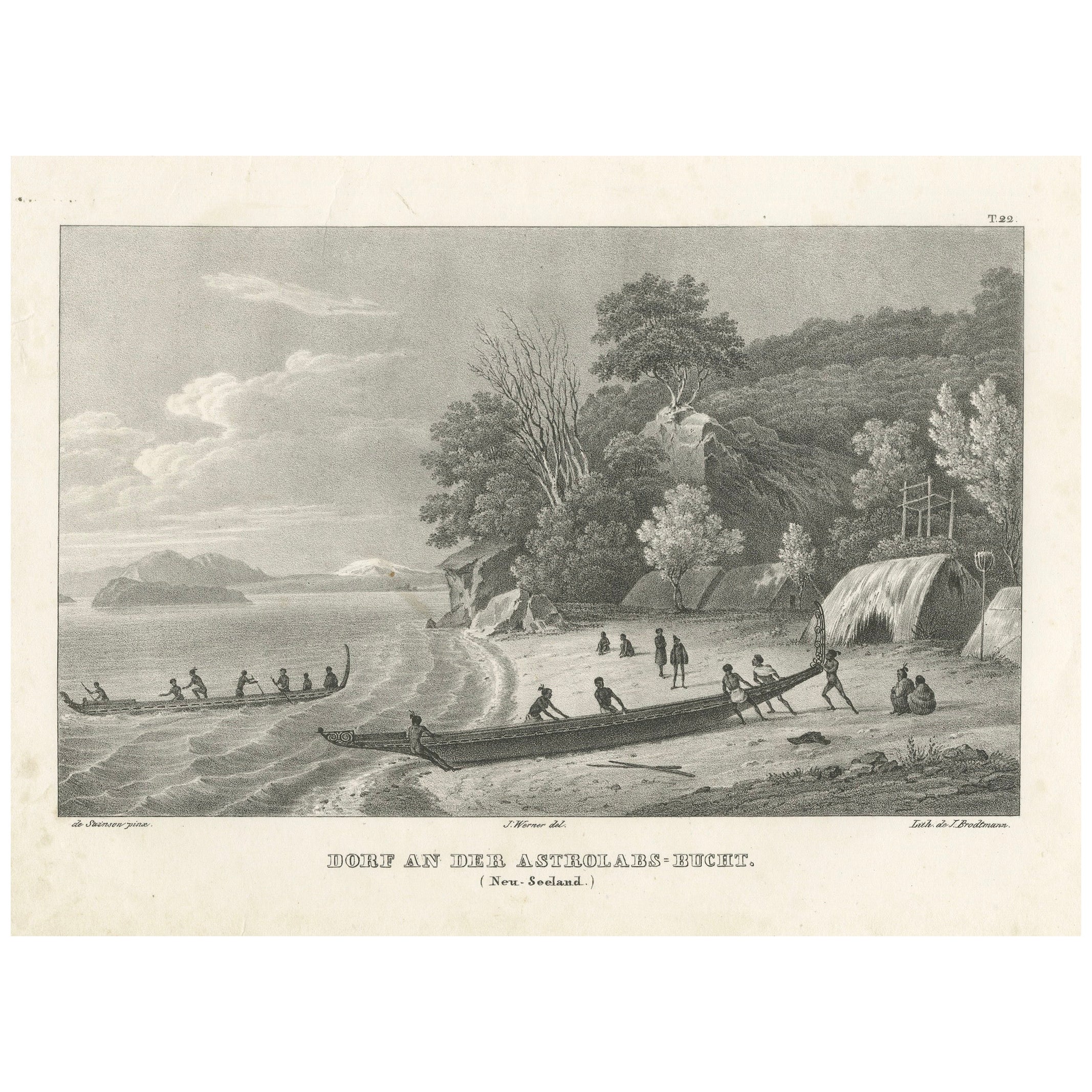
Antique print titled 'Ansicht des Dorfes Kuauï'. Im Dory Hafen.
Old print with a scene of a village and harbour in New Guinea. This print originates from 'Entdeckungs, Reise der Franzosischen Corvette Astrolabe Unternomen auf Befehl Konig Karls X'. These are the German titled views originally issued in Dumont d'Urville 'Voyage Autor du Monde'.
Artists and Engravers: Engraved by K.J. Brodtmann after L.A. de Sainson.
Condition: Good, some soiling. Blank verso, please study image carefully.
About the Seller
5.0
Recognized Seller
These prestigious sellers are industry leaders and represent the highest echelon for item quality and design.
Platinum Seller
Premium sellers with a 4.7+ rating and 24-hour response times
Established in 2009
1stDibs seller since 2017
2,609 sales on 1stDibs
Typical response time: <1 hour
- ShippingRetrieving quote...Shipping from: Langweer, Netherlands
- Return Policy
Authenticity Guarantee
In the unlikely event there’s an issue with an item’s authenticity, contact us within 1 year for a full refund. DetailsMoney-Back Guarantee
If your item is not as described, is damaged in transit, or does not arrive, contact us within 7 days for a full refund. Details24-Hour Cancellation
You have a 24-hour grace period in which to reconsider your purchase, with no questions asked.Vetted Professional Sellers
Our world-class sellers must adhere to strict standards for service and quality, maintaining the integrity of our listings.Price-Match Guarantee
If you find that a seller listed the same item for a lower price elsewhere, we’ll match it.Trusted Global Delivery
Our best-in-class carrier network provides specialized shipping options worldwide, including custom delivery.More From This Seller
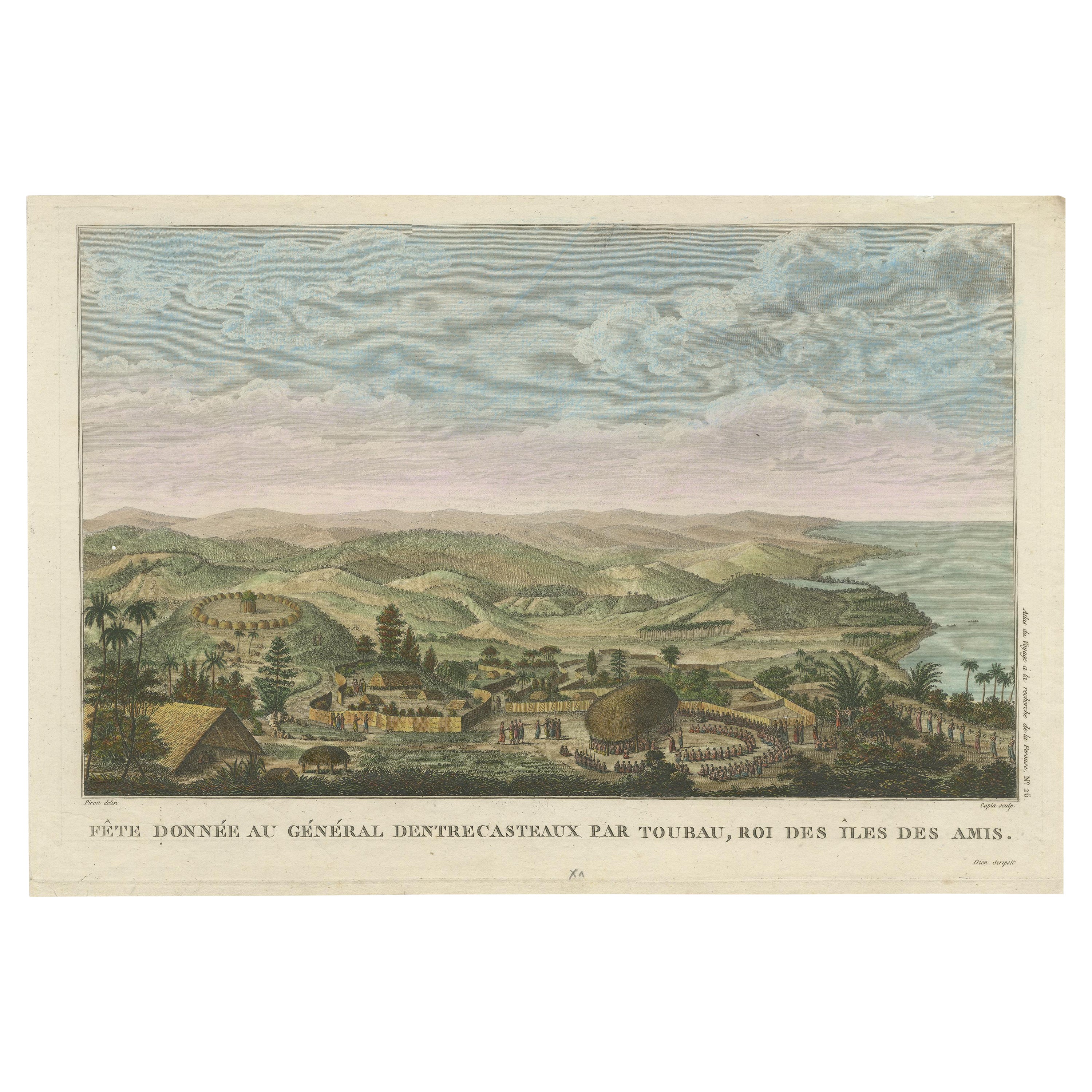
View AllBeautiful and Rare Original Antique Engraving of a Village in Tonga, 1817
Located in Langweer, NL
Fete donnee au General Dentrecasteaux par Toubau, Roi des Iles des Amis
Original antique engraving showing the party given to General Dentrecasteaux by Toubau, King of the Friendl...
Category
Antique 1810s Prints
Materials
Paper

$608 Sale Price
20% Off
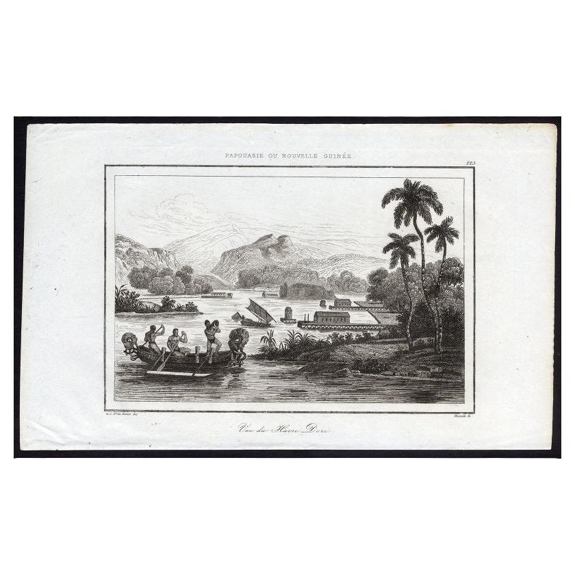
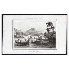
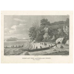
Antique Print of Dory Harbour, New Guinea, 1836
Located in Langweer, NL
Antique print titled 'Vue de Havre Dori - 223, Papouasie ou Nouvelle Guinee'. View of Dory Harbour, New Guinea. This print originates from M.G.L. Domeny de Rienzi's 'Oceanie, ou Cinq...
Category
Antique 19th Century Prints
Materials
Paper
$114 Sale Price
20% Off
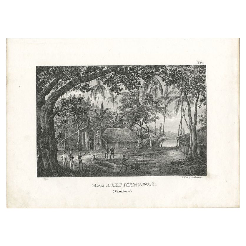
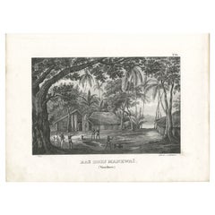
Antique Print of a Village in Vanikoro in the Solomon Islands, c.1836
Located in Langweer, NL
Antique print titled 'Das Dorf Manewaï'. Old print with a view of a village in Vanikoro in the Solomon Islands. This print originates from 'Entdeckungs, Reise der Franzosischen Corve...
Category
Antique 19th Century Prints
Materials
Paper
$180 Sale Price
20% Off
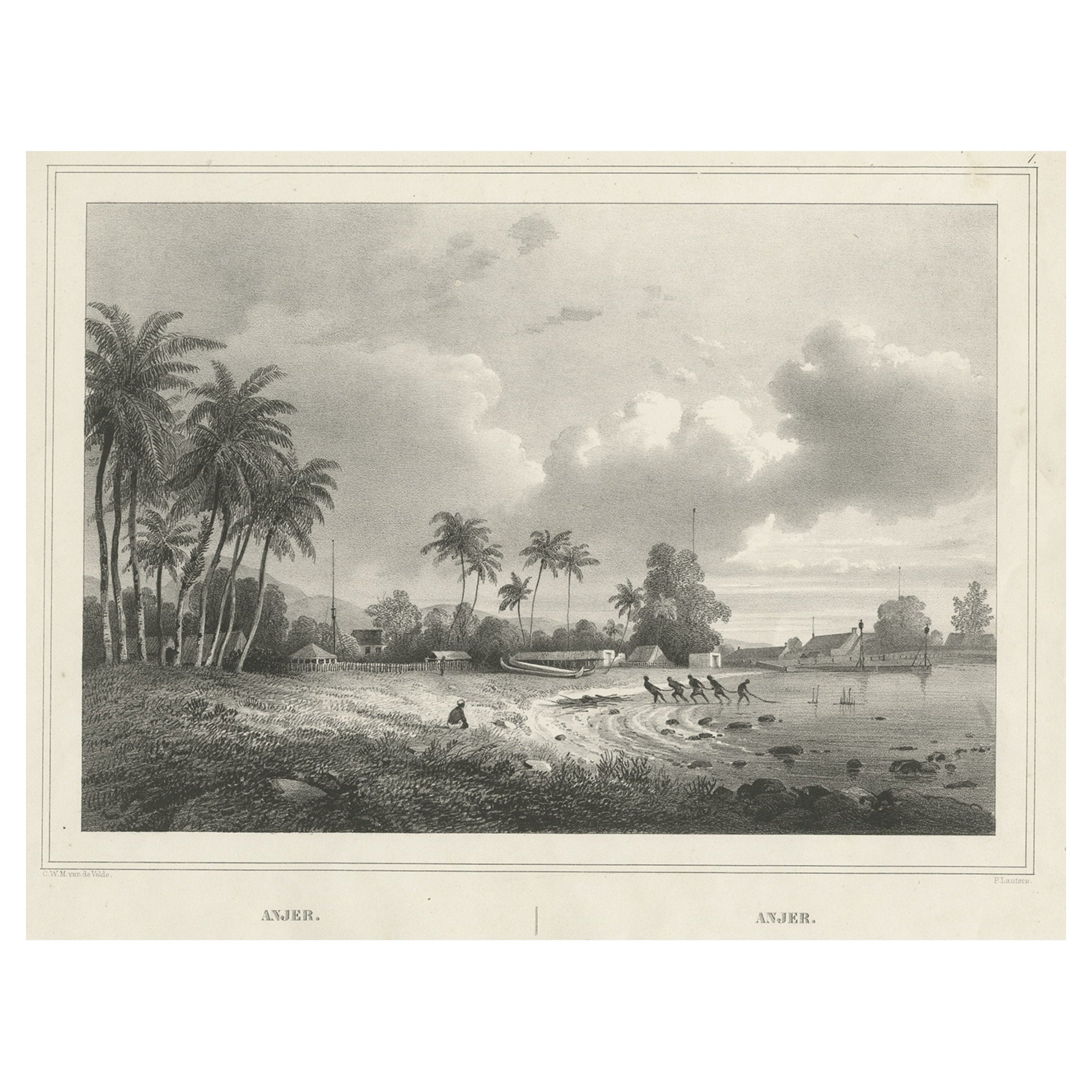
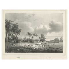
Old Print of Anjer or Anyer, Coastal Town in Banten, West Java, Indonesia, 1844
Located in Langweer, NL
Antique print titled 'Anjer - Anjer'. View of Anyer (also known as Anjer or Angier), a coastal town in Banten, formerly West Java, Indonesia. This print originates from 'Gezigten uit...
Category
Antique 1840s Prints
Materials
Paper
$427 Sale Price
20% Off
Antique Print of Timor Island Near Kupang by Ferrario, '1831'
Located in Langweer, NL
Original antique print with a view of Timor Island, near Kupang. This print originates from 'Costume Antico e Moderno: Palestine, China, India, Oceania' by Ferrario. Published 1831.
Category
Antique Mid-19th Century Prints
Materials
Paper
$237 Sale Price
20% Off
Engraving of a Maori Village Scene at Astrolabe Bay, New Zealand, ca.1836
Located in Langweer, NL
Title: Village Scene at Astrolabe Bay, New Zealand
Description: This finely detailed engraving captures a serene scene of a Maori village located along the shores of Astrolabe Bay...
Category
Antique 1830s Prints
Materials
Paper
You May Also Like
Ancient View of Batavia - Original Lithograph - Half of the 19th Century
Located in Roma, IT
Ancient View of Batavia is an original modern artwork realized in the first half of the 19th Century.
Original B/W Lithograph on Ivory Paper.
Inscripted on the lower margin in Ca...
Category
Early 19th Century Modern Landscape Prints
Materials
Lithograph
Scene at Colgong on the Ganges - Original Lithograph - Early 19th Century
Located in Roma, IT
Scene at Colgong on the Ganges is an original modern artwork realized in the first half of the 19th Century.
Original B/W Lithograph on Ivory Paper.
Inscripted on the lower margin...
Category
Early 19th Century Modern Figurative Prints
Materials
Lithograph
Ancient View of Bombay - Original Lithograph - Half of the 19th Century
Located in Roma, IT
Ancient View of Bombay is an original modern artwork realized in the first half of the 19th Century.
Original B/W Lithograph on Ivory Paper.
Inscripted on the lower margin in Cap...
Category
Early 19th Century Modern Landscape Prints
Materials
Lithograph

Landscape - Original Lithograph - 1856
Located in Roma, IT
Landscape is an Original Litograph realized by an unknown artist in 1856.
The little artwork is in good condition, except for darkened paper along the edges.
No signature, title in...
Category
19th Century Modern Figurative Prints
Materials
Lithograph
Ancient View of Rio Janeiro - Original Lithograph - Early 19th Century
Located in Roma, IT
Ancient View of Rio Janeiro is an original modern artwork realized in the first half of the 19th Century.
Original Lithograph on Ivory Paper.
Inscripted on the lower margin: Rio J...
Category
Early 19th Century Modern Figurative Prints
Materials
Lithograph

Ancient View of Havannah - Original Lithograph - Early 19th Century
Located in Roma, IT
Ancient View of Havannah is an original modern artwork realized in the first half of the 19th Century.
Original Lithograph on Ivory Paper.
Inscripted in capital letters on the lo...
Category
Early 19th Century Modern Figurative Prints
Materials
Lithograph
More Ways To Browse
Antique Plow
Antique Salt Bowls
Antique Shamrock
Antique Spring Scale
Antique Street Clock
Antique Thai Buddha Statue
Antique Trough Fountains
Antique Water Kettle
Antique Wood Santos Santo
Art Nouveau Room Divider
Art Nouveau Sugar Bowl
Barbara Barry For Baker
Beetle Model
Blue Swedish Chest
Bone Inlay Dresser
Brass Couple Sculpture
Bruksbo Rosewood
Car Wall Sculpture