Stamford / Westport Maps
to
5,258
242
9
4
3
6
9
9
9
5
4
3
2
1
9
9
9
1
Item Ships From: Stamford / Westport
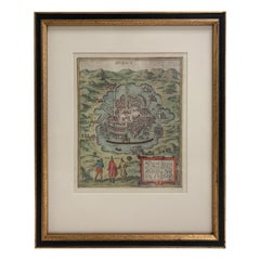
Mexico City by Braun & Hogenberg c. 1590
By Georg Braun and Frans Hogenberg
Located in Stamford, CT
Mexico by Braun & Hogenberg c. 1590
Category
Mid-19th Century European Spanish Colonial Antique Stamford / Westport Maps
Materials
Glass, Wood, Paper
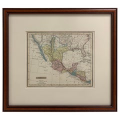
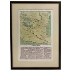
Framed 1838 Mexico & Gulf of Mexico Map
Located in Stamford, CT
Framed 1838 Mexico & Gulf of Mexico map. Printed by Fisher, Son & Co. of London in 1838. As found framed condition. Map has not been examined outside of th...
Category
1830s English American Classical Antique Stamford / Westport Maps
Materials
Glass, Wood, Paper
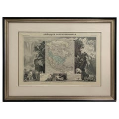
1847 Amerique Septentrionale Framed Map
Located in Stamford, CT
1847 Amerique Septentrionale Framed Map Illustrated by Raimond Bonheur. As found framed condition.
Category
1840s American American Classical Antique Stamford / Westport Maps
Materials
Glass, Wood, Paper
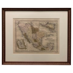
1834 Mexico & Guatemala Framed Map by H.S. Tanner
Located in Stamford, CT
1834 Mexico & Guatemala map of published by H.S. Tanner, Philadelphia, Pennsylvania. Engraved by J. Knight.
As found high end custom framing with carved wood frame, custom matting a...
Category
1830s American American Classical Antique Stamford / Westport Maps
Materials
Glass, Wood, Paper
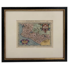
Framed Mercator Hondius Hispania Nova Atlas Minor Map
Located in Stamford, CT
Framed colored example of this decorative and important minature map. Newly framed in brown wood frame with gold trim.
Mercator Hondius “Atlas Minor” pu...
Category
17th Century Dutch Spanish Colonial Antique Stamford / Westport Maps
Materials
Glass, Wood, Paper
1826 Antigo Impero Messicano Mexico Hand Colored Framed Map
Located in Stamford, CT
1826 Antigo Impero Messicano Mexico Hand Colored Framed Map. As found black wood frame.
Category
1820s Mexican Spanish Colonial Antique Stamford / Westport Maps
Materials
Glass, Wood, Paper
1608 Hispaniae Novae Sive Magnae Vera Descriptio Framed Mexico Map
Located in Stamford, CT
1608 Hispaniae Novae Sive Magnae Vera Descriptio Framed Mexico Map. As found custom black wooden frame/ matting.
This map is based on the work of Abraham Ortelius as is an example o...
Category
Early 1600s Mexican Spanish Colonial Antique Stamford / Westport Maps
Materials
Glass, Wood, Paper
1705 Golfe de Mexico and Florida Framed Map
Located in Stamford, CT
Framed map of Mexico & Florida circa 1705, Paris. Small map with Mexico and the Gulf Coast. Inset text indicating Panama, Acapulco, Mexico City and the Mississippi. Extends North to ...
Category
Early 1700s French Spanish Colonial Antique Stamford / Westport Maps
Materials
Glass, Wood, Paper
Large 1856 Mexico & Guatemala Framed Map by Charles Desilver
Located in Stamford, CT
Large 1856 Mexico & Guatemala Framed map. Published by Charles Desilver, Philadelphia, Pennsylvania.
As found high end custom framing with black giltwood frame, custom matting and UV...
Category
1850s American American Classical Antique Stamford / Westport Maps
Materials
Glass, Wood, Paper
Related Items
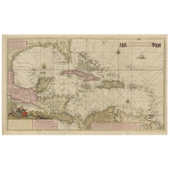
Engraving of a Map of Florida, the Gulf Coast, Caribbean & Central America, 1728
Located in Langweer, NL
This exceptional antique map, titled "Nouvelle Carte Marine de Toute les Cotes de l´Amerique" and alternatively known as "Nieuwe groote en seer Curieuse Paskaart van Geheel-WestIndie...
Category
Mid-18th Century European Antique Stamford / Westport Maps
Materials
Paper
H 24.61 in W 40.56 in D 0.02 in
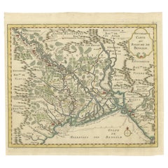
Detailed Regional Map of the Gulf of Bengal and the Lower Ganges River, ca.1750
Located in Langweer, NL
Title of this original and rare antique map: Nouvelle Carte Du Royaume De Bengale
Mapmaker: Jacques-Nicolas Bellin (1703-1772).
He was among the most important mapmakers of the eighteenth century. In 1721, at only the age of 18, he was appointed Hydrographer to the French Navy. In August 1741, he became the first Ingénieur de la Marine of the Dépôt des cartes...
Category
1750s Antique Stamford / Westport Maps
Materials
Paper
H 11 in W 13.5 in D 0.02 in
Braun Audio wall mounted audio system designed by Dieter Rams
By Dieter Rams, Braun
Located in Los Angeles, CA
Braun wall mounted audio system designed by Dieter Rams for Braun, 1960's/70's. Equip with Braun Audio 300/310, L46 wall speakers, and vintage Vitsoe ...
Category
Late 20th Century German Industrial Stamford / Westport Maps
Materials
Metal, Aluminum
Braun Stereo Atelier 1-81 by Dieter Rams + Braun L2 Speaker Pair 1958 RARE
By Dieter Rams, Braun
Located in Virginia Beach, VA
A rare stereo designed by Dieter Rams for Braun. The Braun Atelier 1-81 Stereo with am fm radio and record player paired with an exceedingly rare pair of...
Category
1950s German Mid-Century Modern Vintage Stamford / Westport Maps
Materials
Chrome
H 11.82 in W 23.04 in D 11.42 in
Braun FS-80 Television by Dieter Rams, 1964
By Braun, Dieter Rams
Located in Virginia Beach, VA
Braun FS-80 Television designed by Dieter Rams ca. 1964 in plastic, glass, and powder coated steel. A rare offering, these televisions rarely surface. Recently seen in the Apple TV a...
Category
1960s German Mid-Century Modern Vintage Stamford / Westport Maps
Materials
Plastic
Antique Print of Liège / Luik in Belgium by Braun & Hogenberg, 1575
Located in Langweer, NL
Antique print titled 'Leodium'. View of Liège / Luik, Belgium with surrounding hills and the city wall. With text explaining the origins of Liège, a cartouche expressing thanks to th...
Category
16th Century Antique Stamford / Westport Maps
Materials
Paper
Bird’s-Eye View of Basel from Braun & Hogenberg’s Civitates Orbis Terrarum, 1575
Located in Langweer, NL
Bird’s-Eye View of Basel from Braun & Hogenberg’s "Civitates Orbis Terrarum" (Circa 1572-1617)
This highly detailed map of Basel is a bird's-eye view, originally based on Sebastian Münster’s map...
Category
16th Century Antique Stamford / Westport Maps
Materials
Paper
H 16.15 in W 21.26 in D 0 in
Antique Map of the United States by Balbi '1847'
Located in Langweer, NL
Antique map titled 'Etats-Unis'. Original antique map of the United States. This map originates from 'Abrégé de Géographie (..)' by Ad...
Category
Mid-19th Century Antique Stamford / Westport Maps
Materials
Paper
Large Original Antique Map of Australia by Sidney Hall, 1847
Located in St Annes, Lancashire
Great map of Australia
Drawn and engraved by Sidney Hall
Steel engraving
Original colour outline
Published by A & C Black. 1847
Unframed
Free shipping.
Category
1840s Scottish Antique Stamford / Westport Maps
Materials
Paper
Antique Colored Belgium Map Flandria Gallica Flanders Henricus Hondius
Located in Dayton, OH
Antique hand colored map of Flanders, Belgium, engraved by Henricus Hondius.
Sans frame - 21.25” x 18”.
Category
19th Century Renaissance Antique Stamford / Westport Maps
Materials
Paper
H 20 in W 0.625 in D 23.375 in
Rare 1572 Map of Ancient Rome with Monuments by Ligorio, Braun & Hogenberg
Located in Langweer, NL
Rare 1572 Map of Ancient Rome with Monuments by Ligorio, Braun & Hogenberg
This remarkable 16th-century map, *Urbis Romae Situs cum ils quae adhuc Conspiciuntur Veter. Monumet Rel...
Category
16th Century Antique Stamford / Westport Maps
Materials
Paper
H 16.62 in W 21.86 in D 0.01 in
Works of Robert Burns 1834
Located in San Francisco, CA
The works of Robert Burns in 8 volumes bound in full blue calf and printed in Waterloo, 1834. One volume as is. Spines sun faded to green
Category
1830s English Antique Stamford / Westport Maps
Materials
Leather, Paper
Previously Available Items
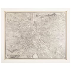
Vintage Map of Paris after the Original Turgot Plan of 1739
Located in Stamford, CT
Vintage map of Paris after the original Turgot Plan of 1739 in white frame.
Category
1950s Vintage Stamford / Westport Maps
Materials
Paper
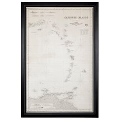
Rare Chart of the Caribbean Islands Published by James Imray & Son, London, 1866
Located in Stamford, CT
Rare chart of the Caribbean Islands published by James Imray & Son, London, 1866.
FW 1370.
Category
Mid-19th Century English Folk Art Antique Stamford / Westport Maps
Materials
Paper
H 44 in W 30 in D 1.5 in
Mid-19th Century Set of Three Charts of the West Coast
Located in Stamford, CT
Set of three mid-19th century maritime charts of the west coast of the United States from the famous U.S. Coast Survey project.
Included are San Die...
Category
1850s American Antique Stamford / Westport Maps
Materials
Paper
Early 19th Century Celestial Globe by Cary
By John & William Cary
Located in Greenwich, CT
Fine Georgian Celestial globe by J. & W. Cary of London, circa 1800, the mahogany Stand with ring turned urn shaft and standing on slipper feet, with co...
Category
1790s English George III Antique Stamford / Westport Maps
Materials
Mahogany, Paper
Turgot's 1739 "Plan de Paris"
By Michel Etienne Turgot
Located in Stamford, CT
A stunning 1950's copy ( 117/1000 ) of Turgot's 1739 "Plan de Paris". This remarkable map shows the whole of 18th century Paris and offers a wonderful pe...
Category
18th Century and Earlier French Antique Stamford / Westport Maps
Materials
Oak, Paper
Extremely Rare French and Indian War Period Powder Horn
Located in Greenwich, CT
Extremely rare Circa 1760 French and Indian War period powderhorn with a map of the water routes of New York depicting New York harbor, the Royal Block House Fort, Fort Stanwix and Fort Hartman, showing the Hudson and Mohawk rivers
Category
