Items Similar to Appalachian Trail Map

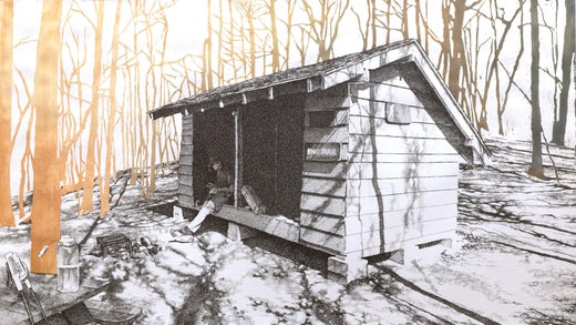
!["Roaring Fork Shelter, North Carolina, [ 35.805, -82.94978 ]" Appalachian Trail](https://a.1stdibscdn.com/a_1882/a_51063821570562019599/6_NC_roaring_fork_shelter_master.jpg)
![Pine Knob Shelter, Maryland, [ 39.54249, -77.60181 ]](https://a.1stdibscdn.com/a_1882/a_51063421570561671870/Pine_Knob_Shelter_Maryland_framed_master.jpg)

Want more images or videos?
Request additional images or videos from the seller
1 of 12
Sarah KaizarAppalachian Trail Map2017
2017
$750
£566
€647.99
CA$1,057.75
A$1,161.28
CHF 605.84
MX$14,053.06
NOK 7,593.27
SEK 7,154.85
DKK 4,837.07
About the Item
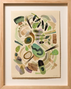
"Appalachian Trail Map" is an original pen and ink, acrylic wash artwork by Sarah Kaizar measuring 30"h x 24"w framed.
It’s an off-beat, diverse community that travels the nearly 2,200 miles of the Appalachian Trail, the oldest long-distance footpath in the country. In her "Hiker Trash" series, Sarah Kaizar captures, through her intricate pen-and-ink drawings, the character of the trail and its ubiquitous shelters as well as the array of hikers who find respite under those roofs.
Sarah Kaizar is an illustrator and designer living and working in Philadelphia. Sarah holds a BFA from Tyler School of Art, Temple University and has shown her work in galleries and museums in and around the Philadelphia area including 3rd Street Gallery, Delaware Contemporary, the Schuylkill Center for Environmental Education, and the Woodmere Art Museum.
- Creator:
- Creation Year:2017
- Dimensions:Height: 30 in (76.2 cm)Width: 24 in (60.96 cm)
- Medium:
- Movement & Style:
- Period:
- Condition:
- Gallery Location:Philadelphia, PA
- Reference Number:1stDibs: LU18825106512
Sarah Kaizar
Sarah Kaizar is an illustrator and designer living and working in Philadelphia. She holds a BFA from Tyler School of Art, Temple University. Kaizar has shown her work in galleries and museums in and around the Philadelphia area, including 3rd Street Gallery, Delaware Contemporary, the Schuylkill Center for Environmental Education and the Woodmere Art Museum.
About the Seller
5.0
Platinum Seller
Premium sellers with a 4.7+ rating and 24-hour response times
Established in 2010
1stDibs seller since 2015
414 sales on 1stDibs
Typical response time: <1 hour
Associations
Association of Women Art Dealers
- ShippingRetrieving quote...Shipping from: Philadelphia, PA
- Return Policy
Authenticity Guarantee
In the unlikely event there’s an issue with an item’s authenticity, contact us within 1 year for a full refund. DetailsMoney-Back Guarantee
If your item is not as described, is damaged in transit, or does not arrive, contact us within 7 days for a full refund. Details24-Hour Cancellation
You have a 24-hour grace period in which to reconsider your purchase, with no questions asked.Vetted Professional Sellers
Our world-class sellers must adhere to strict standards for service and quality, maintaining the integrity of our listings.Price-Match Guarantee
If you find that a seller listed the same item for a lower price elsewhere, we’ll match it.Trusted Global Delivery
Our best-in-class carrier network provides specialized shipping options worldwide, including custom delivery.More From This Seller
View All"Roaring Fork Shelter, North Carolina, [ 35.805, -82.94978 ]" Appalachian Trail
By Sarah Kaizar
Located in Philadelphia, PA
This drawing titled "Roaring Fork Shelter, North Carolina, [ 35.805, -82.94978 ]" is an original artwork by Sarah Kaizar made of pen and ink, and acrylic wash. Drawing from her experience hiking the Appalachian trailing...
Category
2010s Contemporary Figurative Drawings and Watercolors
Materials
Ink, Paper, Acrylic, Pen
!["Roaring Fork Shelter, North Carolina, [ 35.805, -82.94978 ]" Appalachian Trail](https://a.1stdibscdn.com/a_1882/a_51063821570562019599/6_NC_roaring_fork_shelter_master.jpg?width=240)
Pine Knob Shelter, Maryland, [ 39.54249, -77.60181 ]
By Sarah Kaizar
Located in Philadelphia, PA
"Pine Knob Shelter, Maryland, [ 39.54249, -77.60181 ]" is an original pen and ink, and acrylic wash artwork by Sarah Kaizar measuring 24"h x 30"w framed.
It’s an off-beat, diverse c...
Category
21st Century and Contemporary Contemporary Figurative Drawings and Water...
Materials
Ink, Paper, Acrylic, Pen
![Pine Knob Shelter, Maryland, [ 39.54249, -77.60181 ]](https://a.1stdibscdn.com/a_1882/a_51063421570561671870/Pine_Knob_Shelter_Maryland_framed_master.jpg?width=240)
Peru Peak, Vermont, [ 43.3012, -72.95184 ]
By Sarah Kaizar
Located in Philadelphia, PA
"Peru Peak, Vermont, [ 43.3012, -72.95184 ]" is an original pen and ink, and acrylic wash artwork by Sarah Kaizar measuring 24"h x 30"w framed.
It’s an off-beat, diverse community t...
Category
2010s Contemporary Figurative Drawings and Watercolors
Materials
Paper, Ink, Acrylic, Pen
![Peru Peak, Vermont, [ 43.3012, -72.95184 ]](https://a.1stdibscdn.com/a_1882/a_51064521570562480792/10_VT_peru_peak_shelter_master.jpg?width=240)
Parish route (original)
By Miriam Singer
Located in Philadelphia, PA
This piece titled "Parish route" is original artwork made from pencil, marker, acrylic, watercolor on paper by Miriam Singer. This piece measures 18"h x 22.5"w.
Miriam Singer grew ...
Category
21st Century and Contemporary Contemporary Landscape Drawings and Waterc...
Materials
Paper, Acrylic, Watercolor, Permanent Marker, Pencil
Knob Maul Shelter, Virginia, [ 37.0008, -8140446 ]
By Sarah Kaizar
Located in Philadelphia, PA
"Knob Maul Shelter, Virginia, [ 37.0008, -8140446 ]" is an original pen and ink, and acrylic wash artwork by Sarah Kaizar measuring 24"h x 30"w framed.
It’s an off-beat, diverse com...
Category
2010s Contemporary Figurative Drawings and Watercolors
Materials
Paper, Ink, Acrylic, Pen
![Knob Maul Shelter, Virginia, [ 37.0008, -8140446 ]](https://a.1stdibscdn.com/a_1882/a_51064721570562690167/19_VA_knob_maul_shelter_master.jpg?width=240)
"a path to becoming" Abstract, Collaged Monoprints, Watercolor
Located in Philadelphia, PA
This piece titled "a path to becoming" is an original piece by Cassie Normandy White and is made from collaged monoprints, microscopic scans, watercolo...
Category
21st Century and Contemporary Contemporary Mixed Media
Materials
Paper, Watercolor, Monoprint
You May Also Like
Antique 18th Century Map of the Province of Pensilvania 'Pennsylvania State'
Located in Philadelphia, PA
A fine antique of the colony of Pennsylvania.
Noted at the top of the sheet as a 'Map of the province of Pensilvania'.
This undated and anonymous map is thought to be from the Gentleman's Magazine, London, circa 1775, although the general appearance could date it to the 1760's.
The southern boundary reflects the Mason-Dixon survey (1768), the western boundary is placed just west of Pittsburgh, and the northern boundary is not marked.
The map has a number of reference points that likely refer to companion text and appear to be connected to boundaries. The western and southern boundaries are marked Q, R, S, for example. A diagonal line runs from the Susquehanna R to the Lake Erie P. A broken line marked by many letters A, B, N, O, etc., appears in the east.
There are no latitude or longitude markings, blank verso.
Framed in a shaped contemporary gilt wooden frame and matted under a cream colored matte.
Bearing an old Graham Arader Gallery...
Category
Antique 18th Century British American Colonial Maps
Materials
Paper

Redrawn Map
Located in Toronto, ON
12" x 12" Unframed
Original
Hand Signed by Erin Lofton
Category
21st Century and Contemporary Mixed Media
Materials
Mixed Media
$1,350
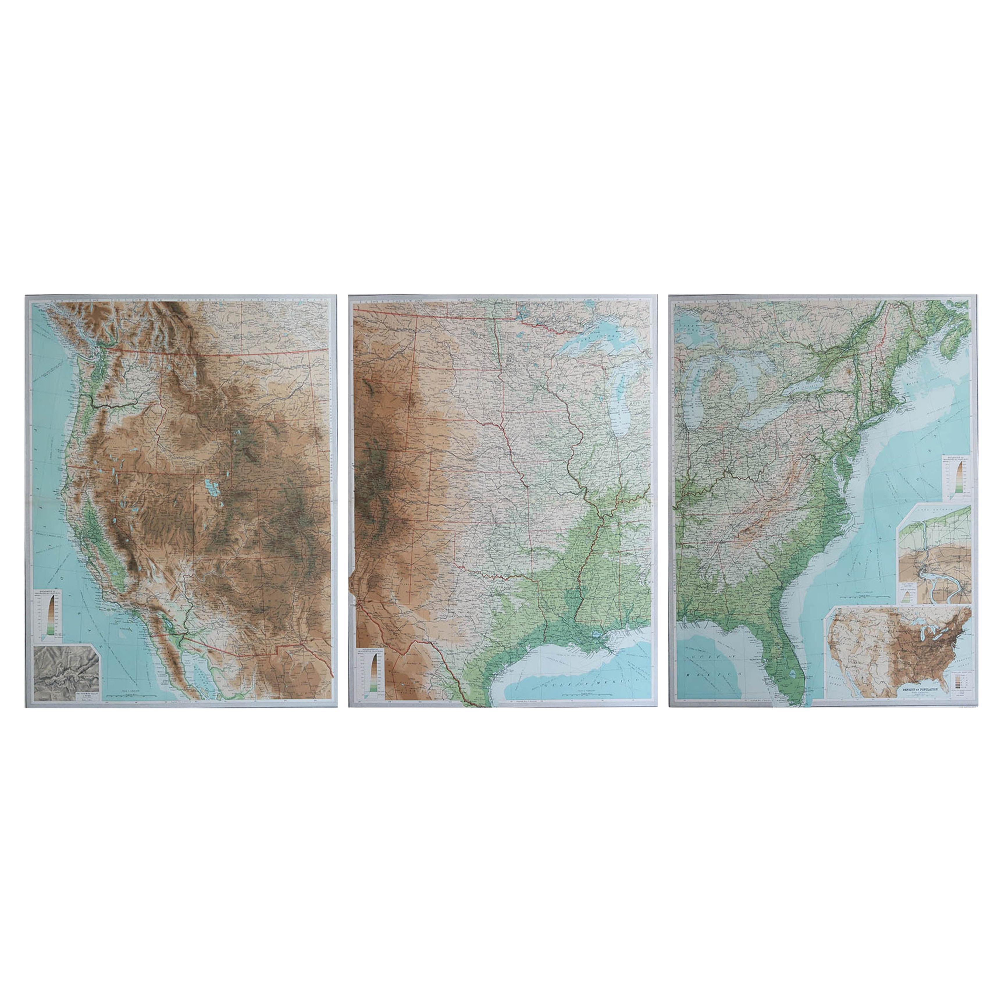
Large Vintage Maps of the United States, in 3 Sections, 1920
Located in St Annes, Lancashire
Great maps of the USA in 3 sections
Unframed
Original color
By John Bartholomew and Co. Edinburgh Geographical Institute
Published, circa 1920
The measurements given is for just...
Category
Vintage 1920s British Maps
Materials
Paper

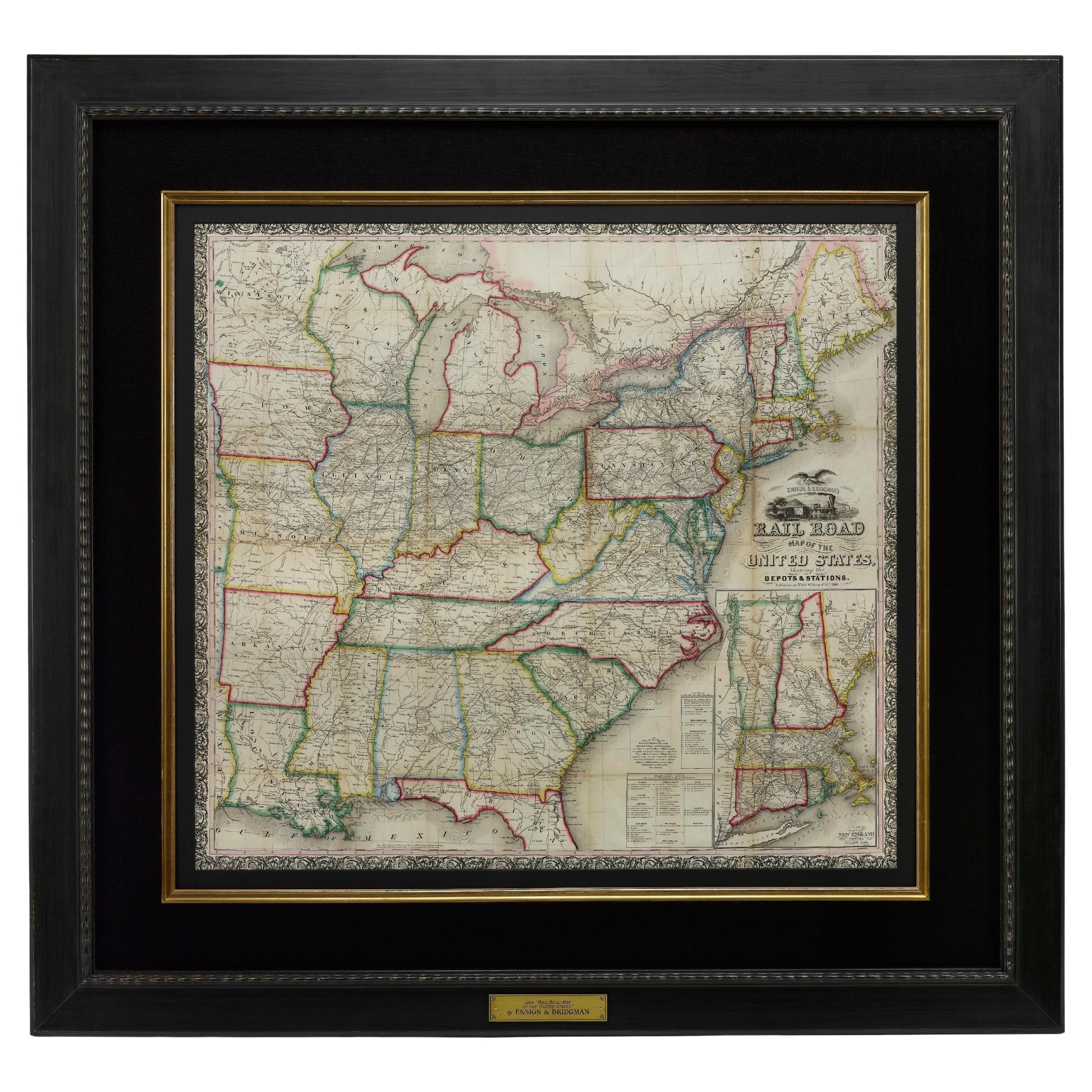
1866 Ensign & Bridgman's Rail Road Map of the United States
Located in Colorado Springs, CO
Presented is an 1866 issue of “Ensign & Bridgeman’s Rail Road Map of the United States, showing Depots & Stations.” First published in 1856, this is the third edition, following anot...
Category
Antique 1860s American Late Victorian Maps
Materials
Paper

Backcountry VIII Drawing on 10 Sheets Rag Paper, 2023
Located in Orange, CA
Backcountry VIII, 2023
Additional information:
Medium: Mixed media paper collage and drawing on 10 sheets rag paper
Dimensions: 88 x 150 in
Jennifer Gunlock (American, b. 1972) exp...
Category
21st Century and Contemporary Abstract Paintings
Materials
Mixed Media, Rag Paper
1837 Mitchell's "Tourist's Pocket Map of the State of Virginia" by J.H. Young
Located in Colorado Springs, CO
This is J. H. Young's pocket map of the Virginia, which shows county development current to 1835. The map was engraved by E. Yeager and F. Dankworth and published by S. A. Mitchell. ...
Category
Antique 1830s American Maps
Materials
Paper
