Items Similar to Schwäbisch Hall - Etching by G. Braun e F. Hogenberg- Late 16th Century
Want more images or videos?
Request additional images or videos from the seller
1 of 6
George BraunSchwäbisch Hall - Etching by G. Braun e F. Hogenberg- Late 16th CenturyLate 16th Century
Late 16th Century
$599.31
£448.32
€500
CA$825.12
A$903
CHF 477.15
MX$10,777.85
NOK 6,089.08
SEK 5,568.96
DKK 3,809.44
About the Item
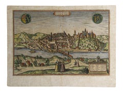
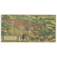
This Schwäbisch Hall is an original etching realized by George Braun and Frans Hogenberg, part of the famous series “Civitates Orbis Terrarum”"
The state of preservation of the artwork is aged with diffused foxings and the middle lne on the folding had been cut and is partially repaired.
Sheet dimension: 33.5 x 49.5 cm.
Interesting B/W etching on coeval paper, this artwork represents skilfully a detailed view of the city of Schwäbisch Hall through confident strokes. "Hala" is printed at the top.
The “Civitates Orbis Terrarum” (Atlas of Cities of the World) was the second oldest printed atlas in the history of world cartography and the first atlas totally dedicated to topographical views. The first volume of this collection was published in Cologne in 1572; the others in 1575, 1581, 1588, and 1598. The sixth and final volume appeared in 1617, just before the extensive devastation wreaked by the Thirty Years’ War.
- Creator:George Braun
- Creation Year:Late 16th Century
- Dimensions:Height: 13.19 in (33.5 cm)Width: 19.49 in (49.5 cm)Depth: 0.04 in (1 mm)
- Medium:
- Period:
- Framing:Framing Options Available
- Condition:Insurance may be requested by customers as additional service, contact us for more information.
- Gallery Location:Roma, IT
- Reference Number:Seller: M-1132771stDibs: LU65037308102
About the Seller
4.9
Platinum Seller
Premium sellers with a 4.7+ rating and 24-hour response times
1stDibs seller since 2017
7,854 sales on 1stDibs
Typical response time: 1 hour
- ShippingRetrieving quote...Shipping from: Grasse, France
- Return Policy
More From This Seller
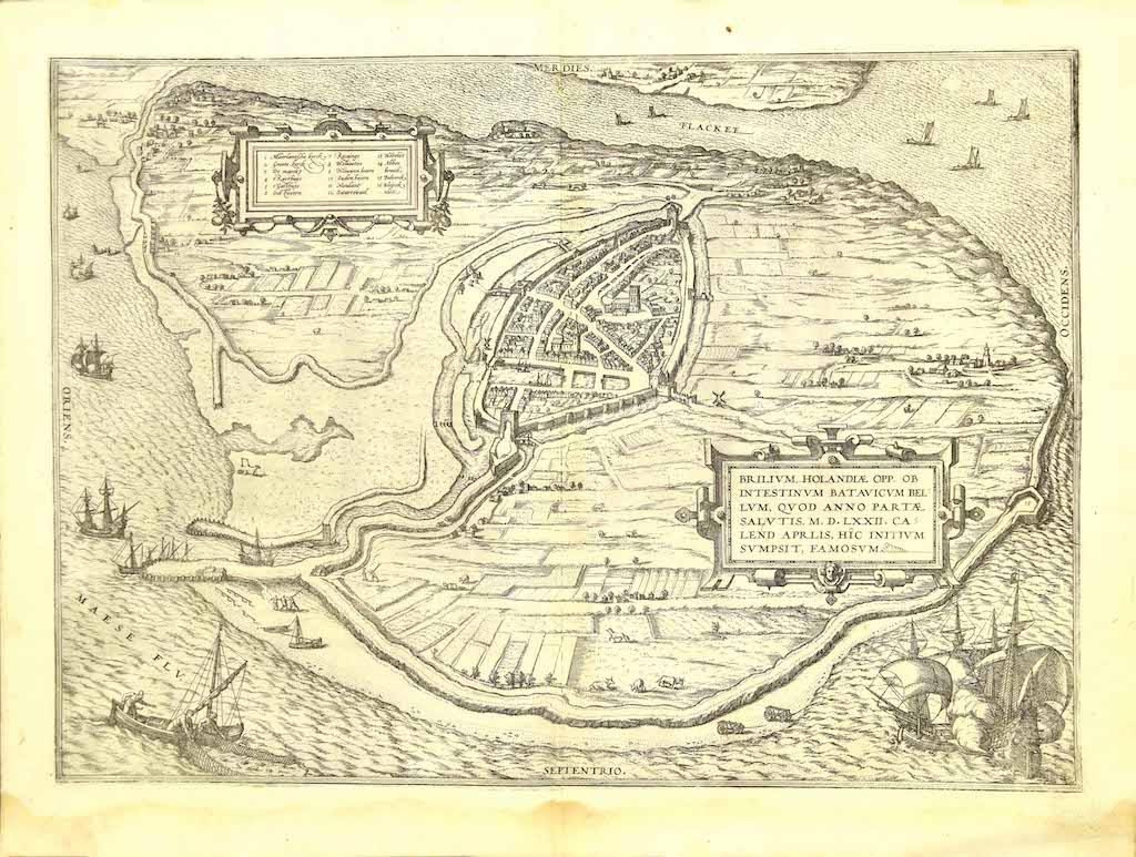
View AllBrielle Den Briel - Etching by G. Braun and F. Hogenberg - Late 16th Century
By Franz Hogenberg
Located in Roma, IT
This View of Brilium is an original etching realized by George Braun and Franz Hogenberg as part of the famous series "Civitates Orbis Terrarum".
The “Civitates Orbis Terrarum” (At...
Category
16th Century Figurative Prints
Materials
Etching
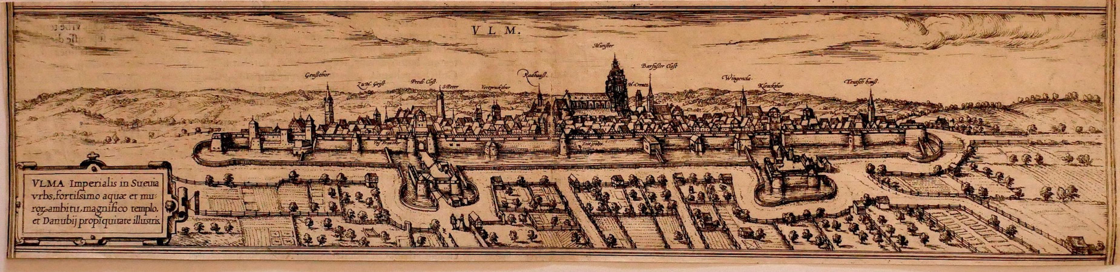
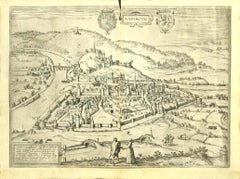
Ulm - Etching by George Braun - Late 16th Century
Located in Roma, IT
Ulm is an original etching realized by George Braun and Franz Hogenberg
The state of preservation of the artwork is good except in the middle of the map...
Category
16th Century Figurative Prints
Materials
Etching
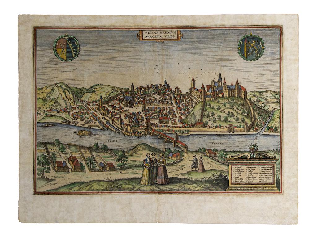
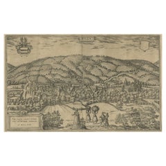
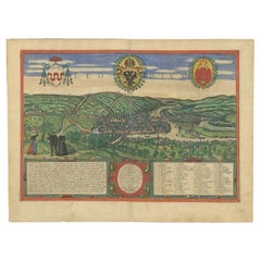
Map of Meissen - Etching by George Braun - Late 16th Century
By Franz Hogenberg
Located in Roma, IT
This map of Meissen is an original etching realized by George Braun and Franz Hogenberg as part of the famous Atlas "Civitates Orbis Terrarum".
The s...
Category
16th Century Old Masters Figurative Prints
Materials
Etching
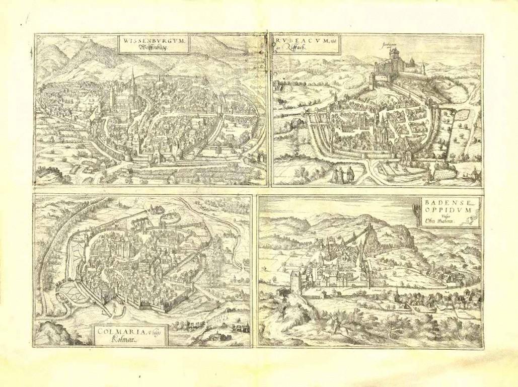
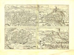
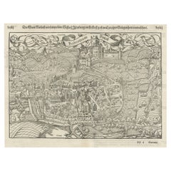
View of 4 Ancient German Cities - Etching by G. Braun and F. Hogenberg
By Franz Hogenberg
Located in Roma, IT
Maps is an original etching realized by G. Braun and F. Hogenberg as part of the so called "Civitates Orbis Terrarum".
The “Civitates Orbis Terrarum” (Atlas of Cities of the World) ...
Category
16th Century Figurative Prints
Materials
Etching
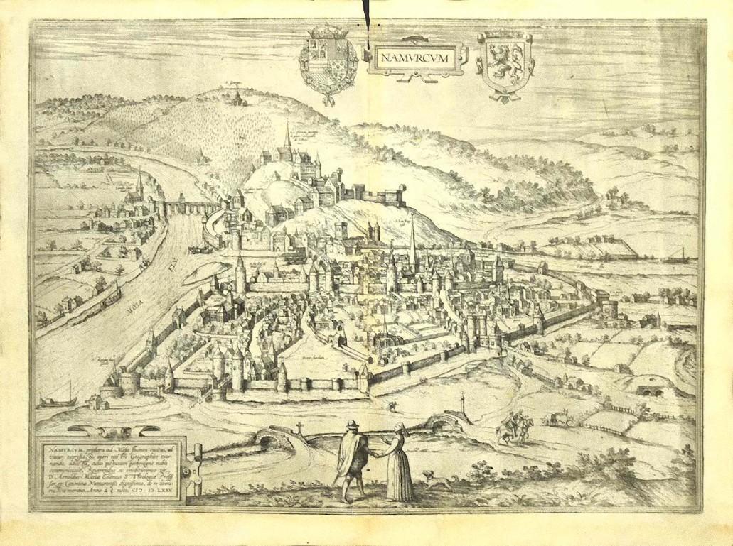
View of Namur (Belgium) - Etching by G. Braun and F. Hogenberg - Late 1500
By Franz Hogenberg
Located in Roma, IT
This View of Namvrcvm (the ancient city of Namur, Belgium) is an original etching realized by George Braun and Franz Hogenberg, as part of the famous Series "Civitates Orbis Terrarum...
Category
16th Century Figurative Prints
Materials
Etching
Malaga - Etching on Paper by George Braun - Early 17th Century
Located in Roma, IT
Malaga is an original etching realized in 1616 by George Braun and Franz Hogenberg.
The state of preservation of the artwork is good but aged with trace of foxing that doesn't affec...
Category
Early 17th Century Figurative Prints
Materials
Etching

You May Also Like
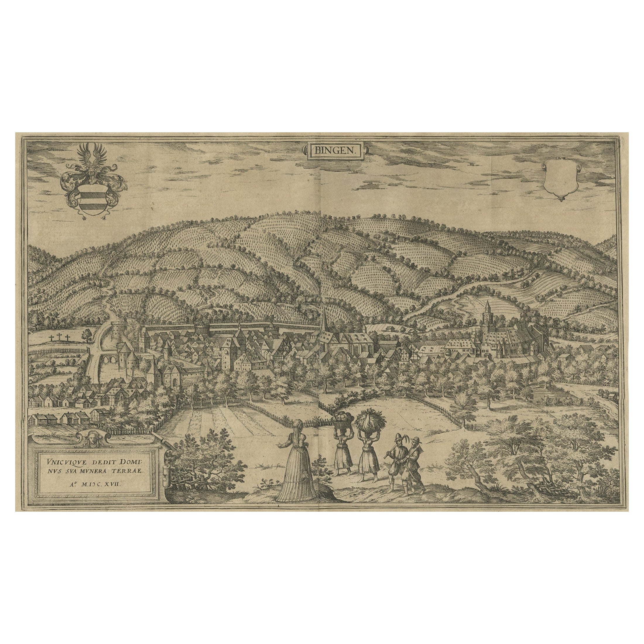
Antique Print of Büdingenin Germany by Braun & Hogenberg, 1617
Located in Langweer, NL
Antique map titled 'Bingen'. Bird's eye-view of Büdingen, Germany. The view shows a city surrounded by vineyards and well fortified with walls and moats. On the right is the castle w...
Category
Antique 17th Century Prints
Materials
Paper
$278 Sale Price
20% Off
Engraving of St. Gallen and its Monastery, from Civitates Orbis Terrarum (1575)
Located in Langweer, NL
Description of the Engraving: Braun & Hogenberg’s "S. Galli Opp. et Monasterium Heluetiorum" from Civitates Orbis Terrarum (1575)
This is an original, hand-colored copper engraving ...
Category
Antique 16th Century Maps
Materials
Paper
$661 Sale Price
20% Off
Original Antique Plan of Rouffach, France, with Chateau d'Isenbourgh, 1588
Located in Langweer, NL
Antique map titled 'Die Statt Rufach mit sampt dem Schloss Isenburg (..)'.
Original antique bird's-eye view plan of Rouffach, France, with Chateau d'Isenbourg. This map originate...
Category
Antique 16th Century Maps
Materials
Paper
$460 Sale Price
20% Off
Frankfort, Germany: A 16th Century Hand-colored Map by Braun & Hogenberg
By Franz Hogenberg
Located in Alamo, CA
This is a 16th century original hand-colored copperplate engraved map of Frankfort, Germany entitled "Francenbergum, vel ut alij Francoburgum Hassiae Opp" by Georg Braun & Franz Hogenberg, from their famous city atlas "Civitates Orbis Terrarum", published in Cologne, Germany in 1595.
This is an English translation of an excerpt from the original text in the atlas:
"Frankenberg or, according to others, Francoburgum, a town in Hesse. Charlemagne vested the town of Frankenberg with many freedoms and privileges, which it still enjoys to this day, and on account of its valiant and victorious soldiers awarded a signet, upon which there formerly appeared a golden castle with a tower, together with the letter F and a golden crown.
Frankenberg, seen here from the northeast, lies on a hill above the River Eder. The hillside is covered with fields neatly separated by bushes and fences. Soaring above the town is the massive Liebfrauenkirche, which was modelled on St Elizabeth's church in Marburg. The New Town was founded in 1335 at the foot of the hill (right) and merged with the Old Town as late as 1556. Frankenberg was founded by Conrad of Thuringia in 1233/34 to prevent the archbishops of Mainz from expanding their sphere of influence...
Category
16th Century Old Masters Landscape Prints
Materials
Engraving

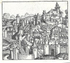
Tolosa (Toulouse); Leaf LXXI from Hartmann Schedel's Nuremberg Chronicle
Located in Middletown, NY
Woodcut on laid paper, 8 3/8 x 9 1/8 inches (212 x 233 mm), the full sheet. In excellent condition with text and portraits of Empedocles, Sapho, Zeuxis and others on the verso, as is...
Category
15th Century and Earlier Old Masters Figurative Prints
Materials
Ink, Handmade Paper, Laid Paper, Woodcut
Antique Print of Liège / Luik in Belgium by Braun & Hogenberg, 1575
Located in Langweer, NL
Antique print titled 'Leodium'. View of Liège / Luik, Belgium with surrounding hills and the city wall. With text explaining the origins of Liège, a cartouche expressing thanks to th...
Category
Antique 16th Century Prints
Materials
Paper
More Ways To Browse
Dali Illustrates Casanova
Dali Man Of La Mancha
Dali Othello
Dali Pig And Pepper
Dali Purgatory Signed
Dali Saba
Dali Signed Ecstatic
Dali Skeleton
Dali Spinning Man
Dali The Annunciation
Dali Thus Was Earth Created
Dame Laura Knight On Sale
Danos Flower Shop
Daumier Actualites
David Ham
David Schluss Serigraph
David Shrigley You Are Special
Degas Poster