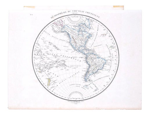
Items Similar to Hemisphere Of The New Continent - Ancient Map by J.G. Heck - 1834.


Want more images or videos?
Request additional images or videos from the seller
1 of 5
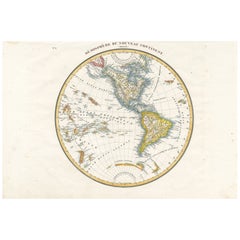
Johann Georg HeckHemisphere Of The New Continent - Ancient Map by J.G. Heck - 1834.1834
1834
$769.26
£584.93
€650
CA$1,079.36
A$1,179.43
CHF 611.45
MX$14,089.93
NOK 7,781.12
SEK 7,284.98
DKK 4,950.76
About the Item
Hemisphere Of The New Continent is an artwork realized around 1760 by Johann Georg Heck
Original colored print.
Good conditions except for yellowing of paper and tears along the margin.
Original title Hemisphere du Nouveau Continent et ses Antipodes. Printed by Engelmann & Compagnie, S.F., Paris.
This print is the plate n. 7 from "Atlas geographique, astronomique et historique, servant a l'intelligence de l'histoire ancienne, du moyen age et moderne et a la lecture des voyages les plus recens. Dresse d'apres les meilleurs materiaux tant francais qu'etrangers conformement aus progres de la science, par J.G. Heck."
Johann Georg Heck (1795 - 1857) was a German bookseller and publisher, lithographer, cartographer, geographer and author. He became known through his work the Illustrated atlas for Conversations lexicon, Iconographic Encyclopaedia of Sciences and Arts, one of the largest German view works of the 19th century.
- Creator:Johann Georg Heck (1795 - 1857)
- Creation Year:1834
- Dimensions:Height: 11.23 in (28.5 cm)Width: 17.33 in (44 cm)Depth: 0.08 in (2 mm)
- Medium:
- Movement & Style:
- Period:
- Condition:Insurance may be requested by customers as additional service, contact us for more information.
- Gallery Location:Roma, IT
- Reference Number:Seller: M-1032061stDibs: LU65035001311
Johann Georg Heck
Johann Georg Heck was born in Strasbourg in 1795. He was a German publisher, lithographer, cartographer, geographer and author. He became famous through his work the Pictures-Atlas of the Conversations-lexicon, Iconographic Encyclopaedia of Sciences and Arts, one of the most extensive German-language visual works of the 19th century. Heck died on November 20, 1857, in Leipzig.
About the Seller
4.9
Platinum Seller
Premium sellers with a 4.7+ rating and 24-hour response times
1stDibs seller since 2017
7,813 sales on 1stDibs
Typical response time: 1 hour
- ShippingRetrieving quote...Shipping from: Monaco, Monaco
- Return Policy
More From This Seller
View AllHemisphere Of The New Continent - Ancient Map by J.G. Heck - 1834.
By Johann Georg Heck
Located in Roma, IT
Hemisphere Of The New Continent - West is an artwork realized in 1834 by Johann Georg Heck
Original colored print.
Good conditions except for yellowing of the paper and very littl...
Category
1830s Modern Figurative Prints
Materials
Etching

World Map - Etching by Hubert Nicholas-Jaillot - 1719
Located in Roma, IT
World map is an original modern artwork realized by Hubert Nicholas - Jaillot, printed by Louis Cordier in Paris 1719.
Etching on copper
The artwork depicts two hemispheres, conti...
Category
1710s Old Masters Figurative Prints
Materials
Etching

Map of the World - Original Etching - 1820
Located in Roma, IT
Map of the World is an Original Etching realized by an unknown artist of 19th century in 1820.
Very good condition on two sheets of white paper joine...
Category
1820s Modern Figurative Prints
Materials
Etching

Old British Empire Map - Ancient Map by Karl Spruner - 1760 ca.
By Karl Spruner von Merz
Located in Roma, IT
Old British Empire Map is an artwork realized around 1760 by Karl Spruner.
Original hand-colored print.
Good conditions except for yellowing of pa...
Category
1760s Modern Figurative Prints
Materials
Etching

Ancient Map of Oceania - Original Etching - 19th century
Located in Roma, IT
This Map of Oceania is an etching realized in the 19th century.
The state of preservation of the artwork is good. At the top of the paper, the inscription “Longitudine del Meridiano...
Category
19th Century More Prints
Materials
Etching

Map of North America - Etching - 19th Century
Located in Roma, IT
Map of America is an etching realized during the 19th century.
Good condition.
Category
Early 19th Century Modern Figurative Prints
Materials
Etching
You May Also Like
Antique Map of the Northern Hemisphere by Lowry, '1852'
Located in Langweer, NL
Antique map titled 'Perspective Projection of the World on the horizon of London'. Original map of the northern hemisphere. This map originates fro...
Category
Antique Mid-19th Century Maps
Materials
Paper

$142 Sale Price
20% Off
Antique Map of The World in Hemispheres by W. G. Blackie, 1859
Located in Langweer, NL
Antique map titled 'The World in Hemispheres with other projections'. Original antique map of The World. This map originates from ‘The Imperial Atlas of Modern Geography’. Published ...
Category
Antique Mid-19th Century Maps
Materials
Paper

$289 Sale Price
30% Off
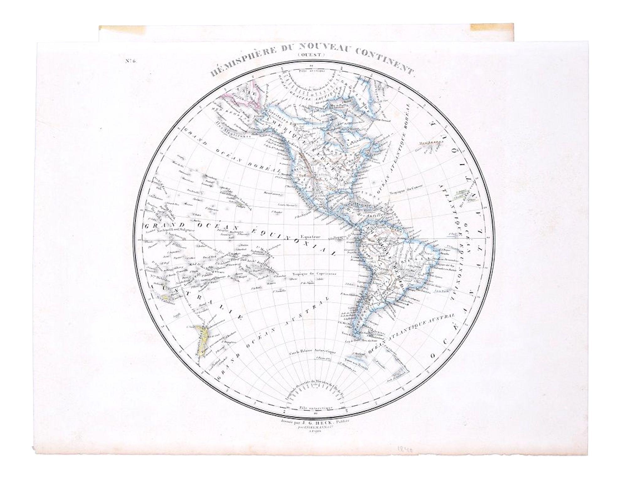
Antique Map of the Western Hemisphere by Lapie, France, circa 1830
Located in Langweer, NL
Antique Map of the Western Hemisphere by Lapie, France, circa 1830
This beautifully engraved and delicately hand-colored map, titled Hémisphère du Nouveau Continent (Ouest), depict...
Category
Antique 1830s Maps
Materials
Paper
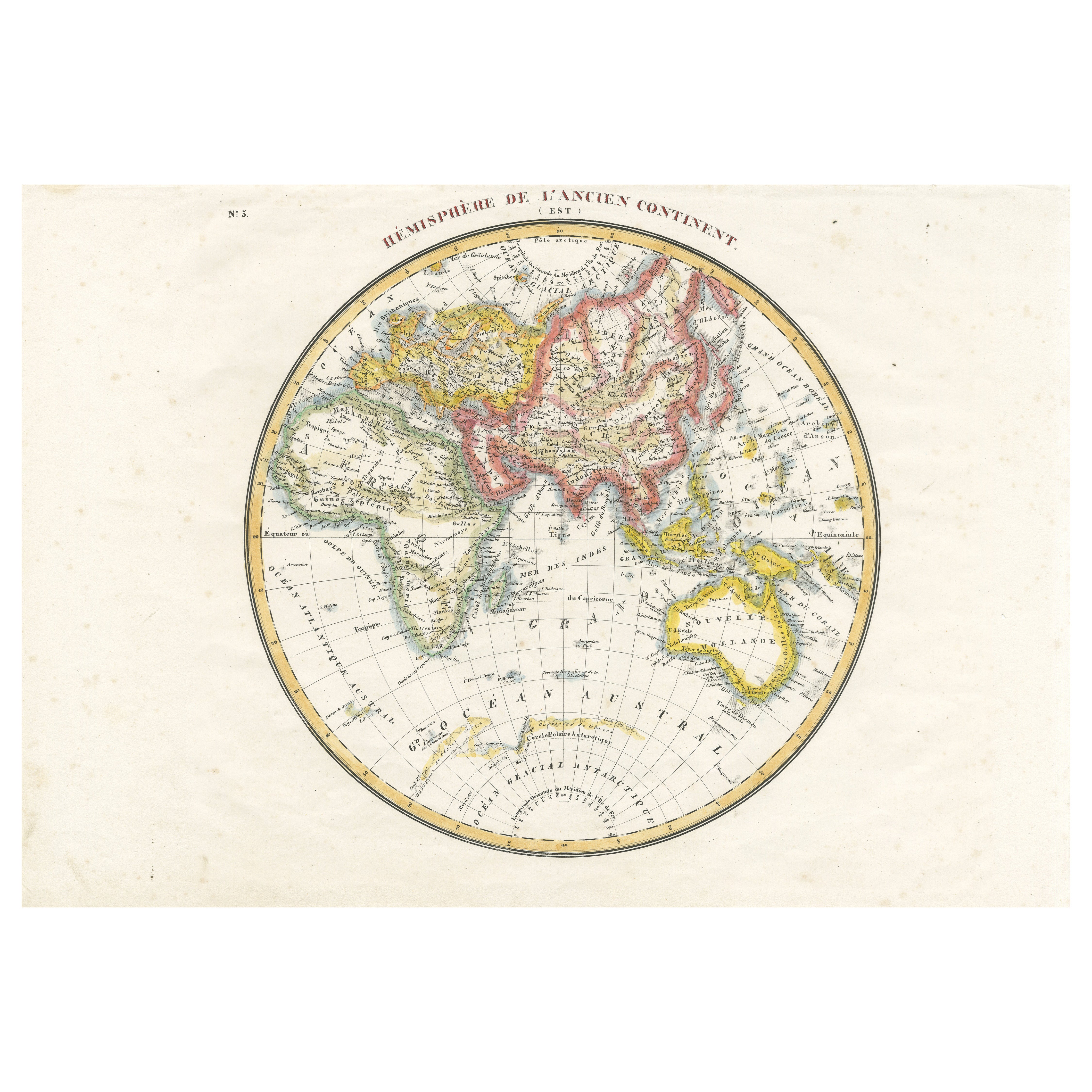
Antique Map of the Eastern Hemisphere by Lapie, France, circa 1830
Located in Langweer, NL
Antique Map of the Eastern Hemisphere by Lapie, France, circa 1830
This finely engraved and hand-colored antique map, titled Hémisphère de l'ancien continent (Eastern Hemisphere), w...
Category
Antique 1830s Maps
Materials
Paper
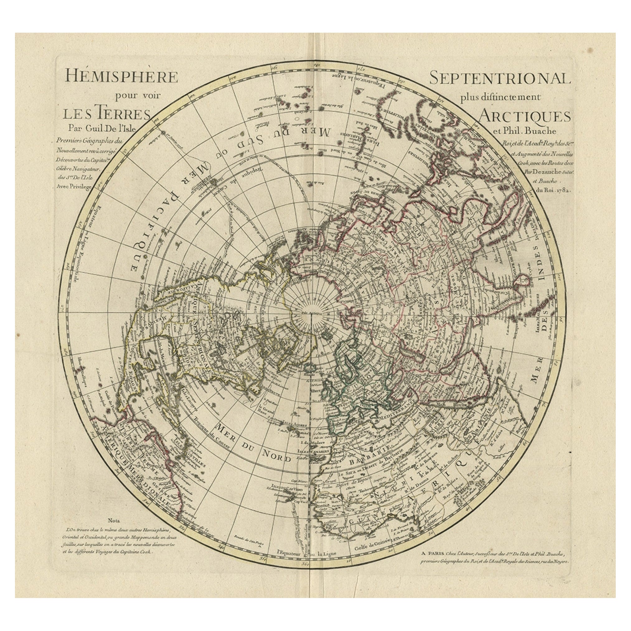
Antique Map of the Northern Hemisphere, 1782
Located in Langweer, NL
Antique map titled 'Hémisphère Septentrional pour voir plus distinctement les Terres Arctiques (..)'.
Map of the Northern Hemisphere, originall...
Category
Antique 1780s Maps
Materials
Paper
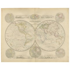
Double Hemisphere World Map from the Nieuwe Hand-Atlas, Leiden 1876
Located in Langweer, NL
Title: Double Hemisphere World Map from the Nieuwe Hand-Atlas, Leiden 1876
Description:
This 19th-century double-hemisphere world map, titled “Wereldkaart volgens gewone projectie v...
Category
Antique 1870s Dutch Maps
Materials
Paper
More Ways To Browse
Ancient Maps
Hemispheres Map
Henry Gerbault
Heran Chaban
Hermes Uniform
Hockney Los Angeles Olympics
Hogarth Election
House Of Raquel Vega
Inuit Doll
Iona Rozeal Brown
Iris Woodblock Print
Irving Amen On Sale
Israel Museum Poster
Itzchak Tarkay Afternoon Tea
Itzchak Tarkay Serigraph
Ivory Cigarette Holder
J Alphege Brewer
J Didier