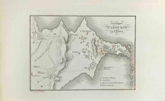
Items Similar to Map of Battle of Rivoli - Etching by Pierre François Tardieu - 1837

Want more images or videos?
Request additional images or videos from the seller
1 of 2
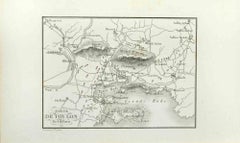
Pierre Francois TardieuMap of Battle of Rivoli - Etching by Pierre François Tardieu - 18371837
1837
$295.09
£224.74
€250
CA$413.65
A$452.54
CHF 236.35
MX$5,407.97
NOK 2,969.45
SEK 2,794.73
DKK 1,904.30
About the Item
Map of Battle of Rivoli is an Etching realized by Pierre François Tardieu in 1837.
Good conditions.
The artwork is realized in a well-balanced composition. the artwork and belongs to the suite suite "AtlasBatt" realized within Jacques Norvins' Histoire de Napoleon, published in 1837. Author Jacques Norvins published one of the most comprehensive and influential histories on the life and military career of Napoleon, trought the works of the most important engravers of the time.
- Creator:Pierre Francois Tardieu
- Creation Year:1837
- Dimensions:Height: 5.12 in (13 cm)Width: 8.67 in (22 cm)Depth: 0.04 in (1 mm)
- Medium:
- Movement & Style:
- Period:
- Framing:Framing Options Available
- Condition:Insurance may be requested by customers as additional service, contact us for more information.
- Gallery Location:Roma, IT
- Reference Number:Seller: T-1475781stDibs: LU650314140352
About the Seller
4.9
Platinum Seller
Premium sellers with a 4.7+ rating and 24-hour response times
1stDibs seller since 2017
7,795 sales on 1stDibs
Typical response time: 1 hour
- ShippingRetrieving quote...Shipping from: Grasse, France
- Return Policy
Authenticity Guarantee
In the unlikely event there’s an issue with an item’s authenticity, contact us within 1 year for a full refund. DetailsMoney-Back Guarantee
If your item is not as described, is damaged in transit, or does not arrive, contact us within 7 days for a full refund. Details24-Hour Cancellation
You have a 24-hour grace period in which to reconsider your purchase, with no questions asked.Vetted Professional Sellers
Our world-class sellers must adhere to strict standards for service and quality, maintaining the integrity of our listings.Price-Match Guarantee
If you find that a seller listed the same item for a lower price elsewhere, we’ll match it.Trusted Global Delivery
Our best-in-class carrier network provides specialized shipping options worldwide, including custom delivery.More From This Seller
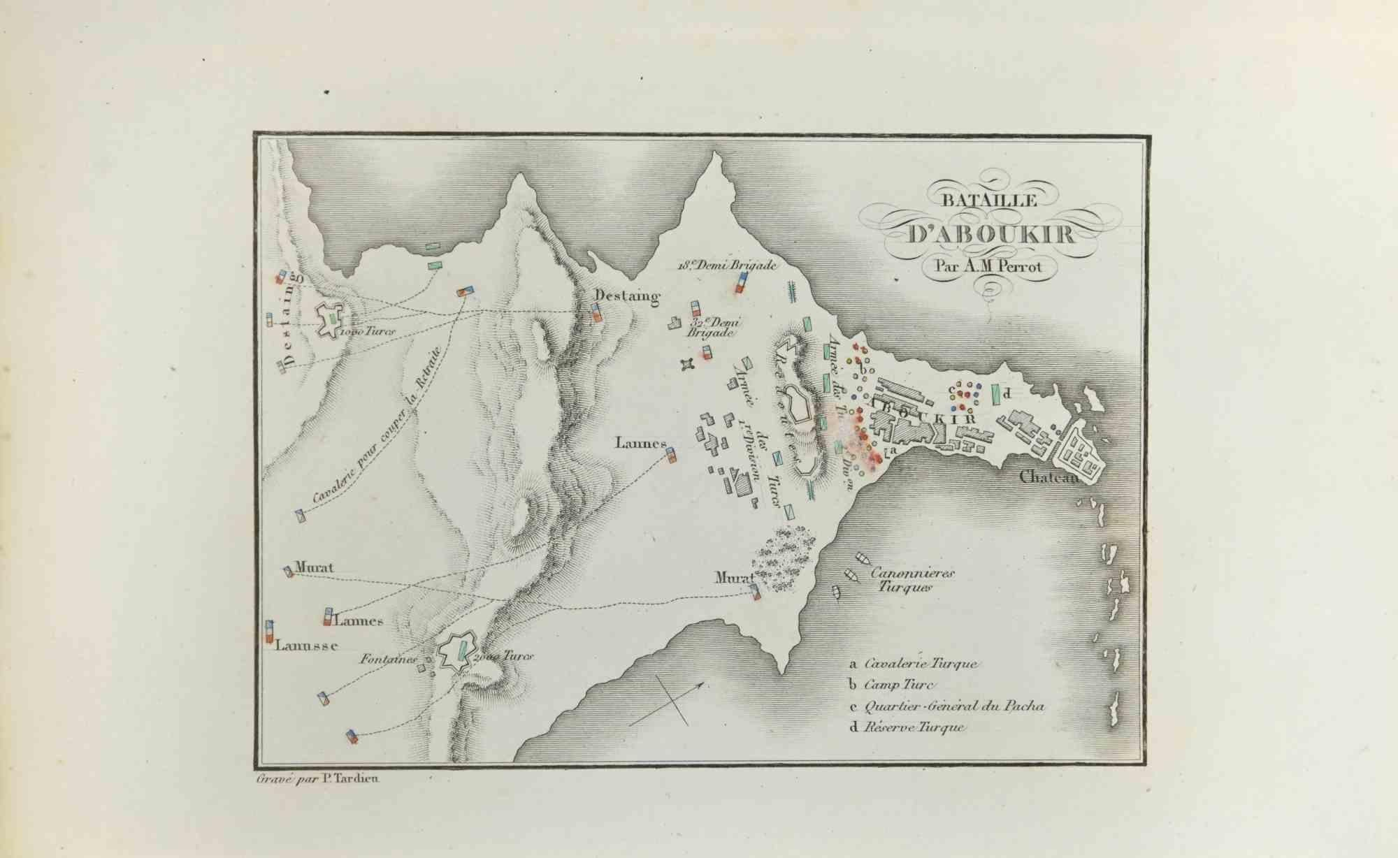
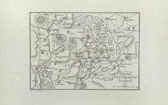
View AllMap of Battle of Aboukir - Etching by Pierre François Tardieu - 1837
Located in Roma, IT
Map of Battle of Aboukir is an Etching realized by Pierre François Tardieu in 1837.
Good conditions.
The artwork is realized in a well-balanced composition. and belongs to the sui...
Category
1830s Modern Figurative Prints
Materials
Etching
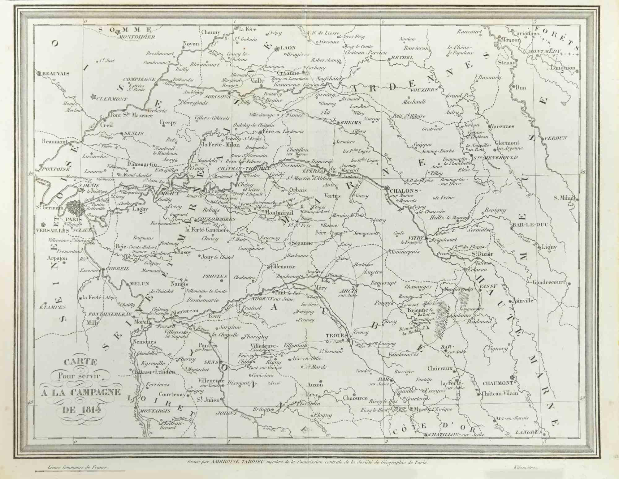
Map of Campaign of 1814 - Etching by Pierre François Tardieu - 1837
Located in Roma, IT
Map of Campaign of 1814 is an Etching realized by Pierre François Tardieu in 1837.
Good conditions.
The artwork is realized in a well-balanced composition. the artwork and belongs ...
Category
1830s Modern Figurative Prints
Materials
Lithograph

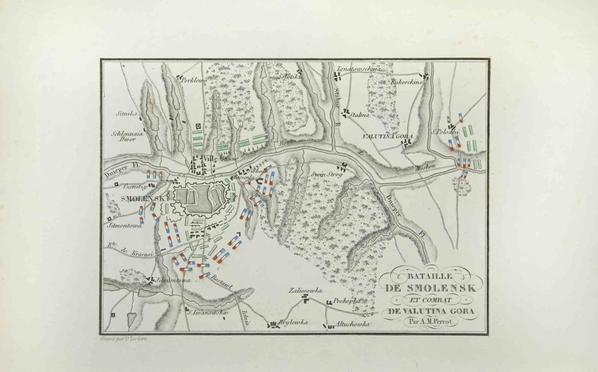
Map of Battle of Smolensk - Etching by Pierre François Tardieu - 1837
Located in Roma, IT
Map of Battle of Smolensk is an Etching realized by Pierre François Tardieu in 1837.
Good conditions.
The artwork is realized in a well-balanced composition. the artwork and belong...
Category
1830s Modern Figurative Prints
Materials
Lithograph
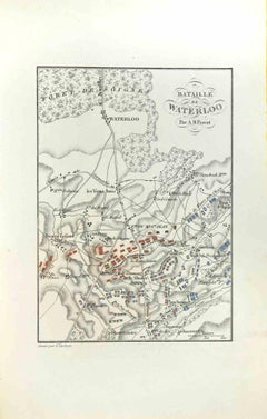
Map of Battle of Waterloo - Etching by Pierre François Tardieu - 1837
Located in Roma, IT
Map of Battle of Waterloo is an Etching realized by Pierre François Tardieu in 1837.
Good conditions.
The artwork is realized in a well-balanced composition. the artwork and belong...
Category
1830s Modern Figurative Prints
Materials
Etching
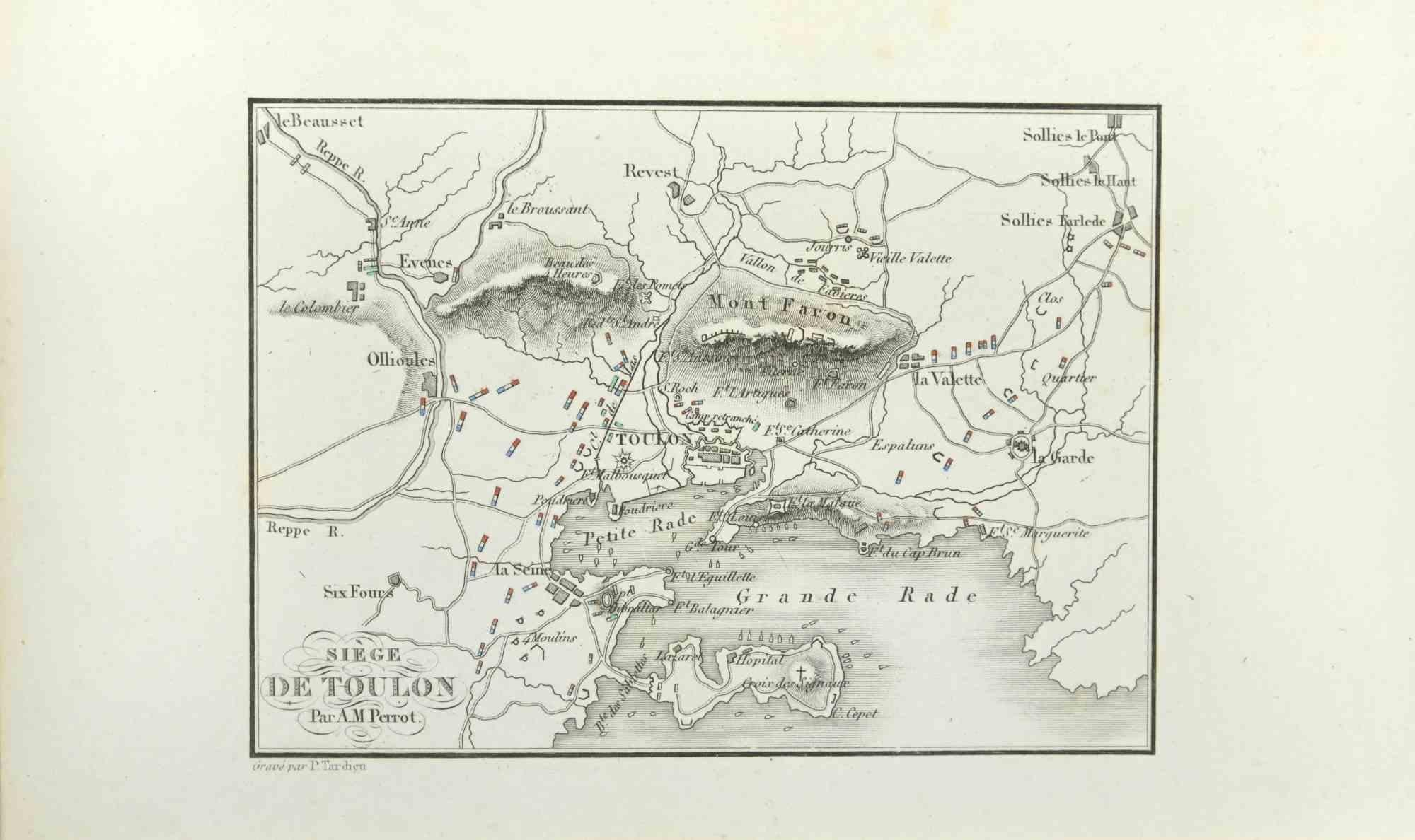
Siege of Toulon - Etching by Pierre François Tardieu - 1837
Located in Roma, IT
Siege of Toulon is an Etching realized by Pierre François Tardieu in 1837.
Good conditions.
The artwork is realized in a well-balanced composition. the artwork and belongs to the s...
Category
1830s Modern Figurative Prints
Materials
Lithograph
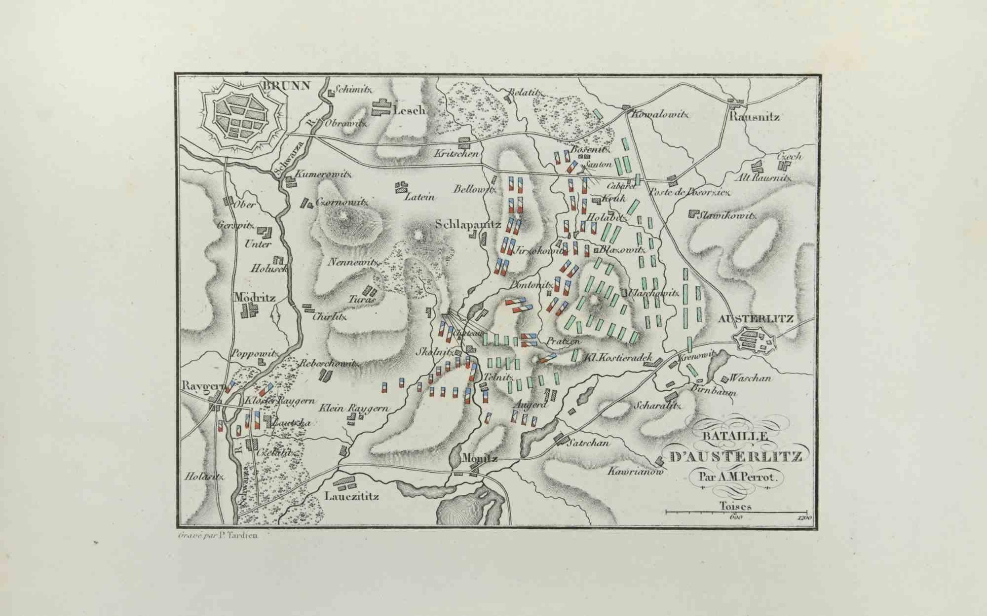
Battle of Austerlitz - Etching by Pierre François Tardieu - 1837
Located in Roma, IT
Battle of Austerlitz is an Etching realized by Pierre François Tardieu in 1837.
Good conditions.
The artwork is realized in a well-balanced composition. the artwork and belongs to ...
Category
1830s Modern Figurative Prints
Materials
Lithograph
You May Also Like
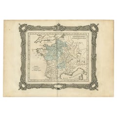
Antique Map of France by Balbi '1847'
Located in Langweer, NL
Antique map titled 'France'. Original antique map of France. This map originates from 'Abrégé de Géographie (..)' by Adrien Balbi. Published 1847.
Category
Antique Mid-19th Century Maps
Materials
Paper

$118 Sale Price
20% Off
Antique Map of France in Ancient Roman Times by d'Anville, c.1795
Located in Langweer, NL
Antique map titled 'Gallia Antiqua ex Aevi Romani Monumentis (..)'. Original, large, map of France in ancient Roman times. Bottom left, a large inset shows Gallia's southern most Rom...
Category
Antique Late 18th Century French Maps
Materials
Paper

$661 Sale Price
30% Off
Antique Map of France under the Reign of Philip II by Zannoni, 1765
Located in Langweer, NL
Antique map France titled 'Carte de l'accroissement du Domaine sous Philippe Auguste (..)'. Beautiful old map of France. This map originates from 'Atlas Historique de la France Ancie...
Category
Antique 18th Century Maps
Materials
Paper
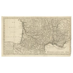
France Map 1757 – Southern Provinces by Isaak Tirion in Dutch Engraving
Located in Langweer, NL
France Map 1757 – Southern Provinces by Isaak Tirion in Dutch Engraving
This original copperplate engraving published in 1757 by Isaak Tirion in Amsterdam presents a highly detailed...
Category
Antique Mid-18th Century Dutch Maps
Materials
Paper
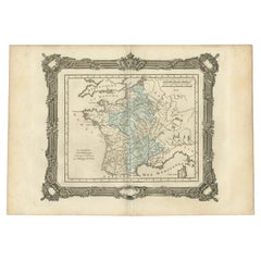
Antique Map of France under the Reign of Philip VI by Zannoni, 1765
Located in Langweer, NL
Antique map France titled 'Le Dauphine et la Champagne (..)'. Beautiful old map of France. This map originates from 'Atlas Historique de la France Ancienne...
Category
Antique 18th Century Maps
Materials
Paper
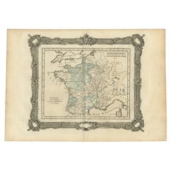
Antique Map of France under the Reign of St. Louis by Zannoni, 1765
Located in Langweer, NL
Antique map France titled 'Le Domaine de la Couronne (..)'. Beautiful old map of France. This map originates from 'Atlas Historique de la France Ancienne et Moderne' by M. Rizzi Zann...
Category
Antique 18th Century Maps
Materials
Paper
More Ways To Browse
Die Schaffenden
Diego Rivera Print New York Graphic Society
Foujita Woodcut
Francois Langlois
G Barbier
George Bellows Lithographs
George Harrison Marks
George Rouault Woodcut
Gerard Dou
Giacometti Annette
Giorgio Morandi Etching
Goupil Prints
Henry Moore Sculptural Ideas
Hermes Paris Rue Du Faubourg Saint Honore
Hockney Glasses
Hockney Olympic
Homage To Chagall
Howard Smith