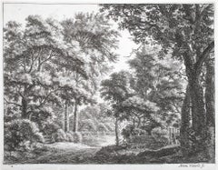
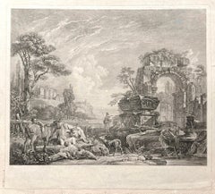
Items Similar to Landscape with Roman Ruins
Want more images or videos?
Request additional images or videos from the seller
1 of 5
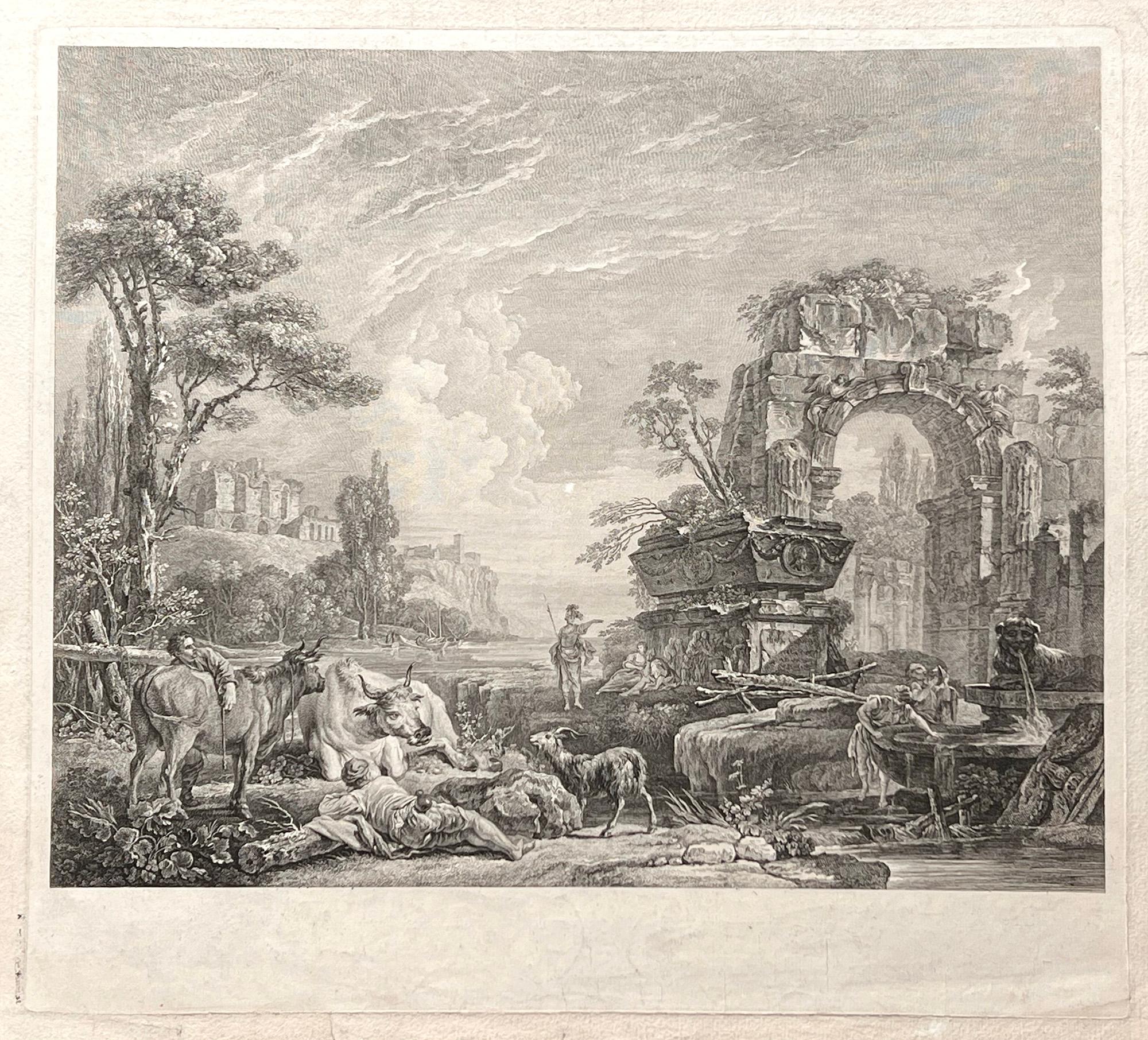
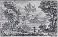
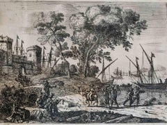
(After) Peter Paul RubensLandscape with Roman Ruins1638
1638
$11,500
£8,678.73
€9,935.84
CA$16,218.81
A$17,806.23
CHF 9,289.55
MX$215,480.22
NOK 116,430.09
SEK 109,707.76
DKK 74,168.38
About the Item
Engraving after Peter Paul Rubens (Siegen 1577 - 1640 Antwerp), executed by Schelte Adams Bolswert (Bolsward c. 1586 -1659 Antwerp).
Bolswert was one of the major printmakers in the circle of Rubens.
Watermark:
Coat of Arms
- Creator:(After) Peter Paul Rubens (1577 - 1640, Dutch)
- Creation Year:1638
- Dimensions:Height: 13.25 in (33.66 cm)Width: 17.625 in (44.77 cm)
- Medium:
- Movement & Style:
- Period:
- Condition:
- Gallery Location:Chicago, IL
- Reference Number:1stDibs: LU36535746292
About the Seller
5.0
Recognized Seller
These prestigious sellers are industry leaders and represent the highest echelon for item quality and design.
Established in 1955
1stDibs seller since 2016
14 sales on 1stDibs
Associations
International Fine Print Dealers Association
- ShippingRetrieving quote...Shipping from: Chicago, IL
- Return Policy
Authenticity Guarantee
In the unlikely event there’s an issue with an item’s authenticity, contact us within 1 year for a full refund. DetailsMoney-Back Guarantee
If your item is not as described, is damaged in transit, or does not arrive, contact us within 7 days for a full refund. Details24-Hour Cancellation
You have a 24-hour grace period in which to reconsider your purchase, with no questions asked.Vetted Professional Sellers
Our world-class sellers must adhere to strict standards for service and quality, maintaining the integrity of our listings.Price-Match Guarantee
If you find that a seller listed the same item for a lower price elsewhere, we’ll match it.Trusted Global Delivery
Our best-in-class carrier network provides specialized shipping options worldwide, including custom delivery.More From This Seller
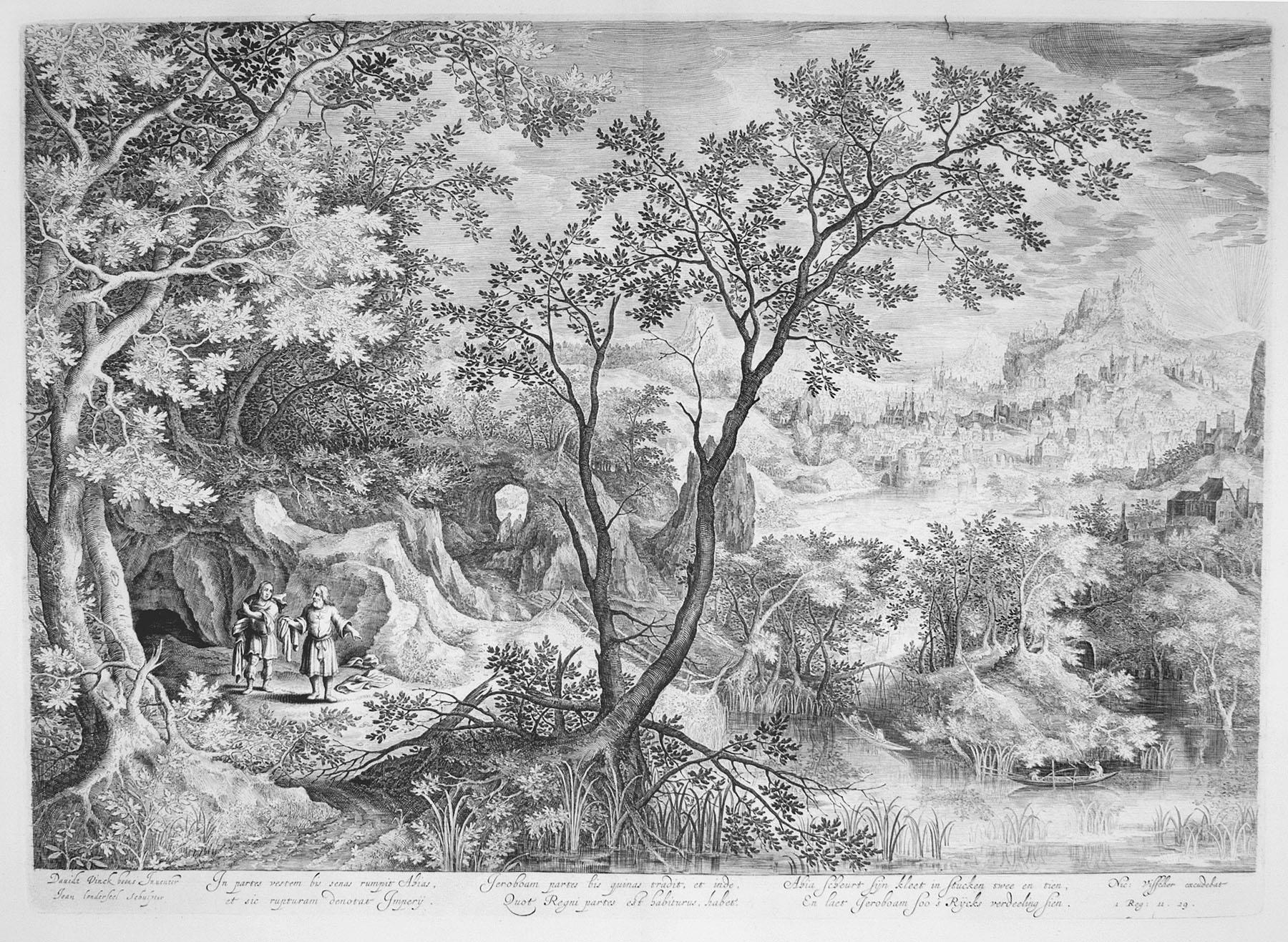
View AllLandscape with the Prophets Ahias and Jerobeam
Located in Chicago, IL
Engraving after David Vinckboons (Malines 1576-1629 Amsterdam), executed by James Van Londerseel (Antwerp c. 1570 - 1624/25 Rotterdam)
Category
17th Century Old Masters Prints and Multiples
Materials
Engraving
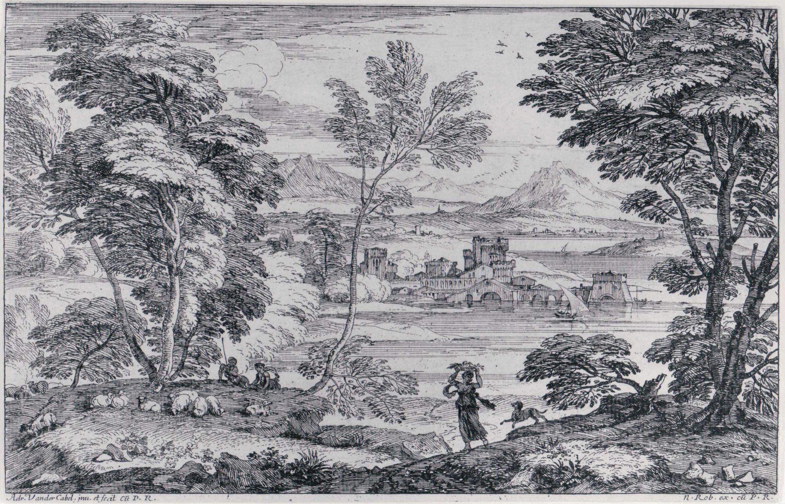
Landscape with a Maiden and her Dog
By Adriaen van der Cabel
Located in Chicago, IL
A very fine impression
Category
Mid-17th Century Landscape Prints
Materials
Etching
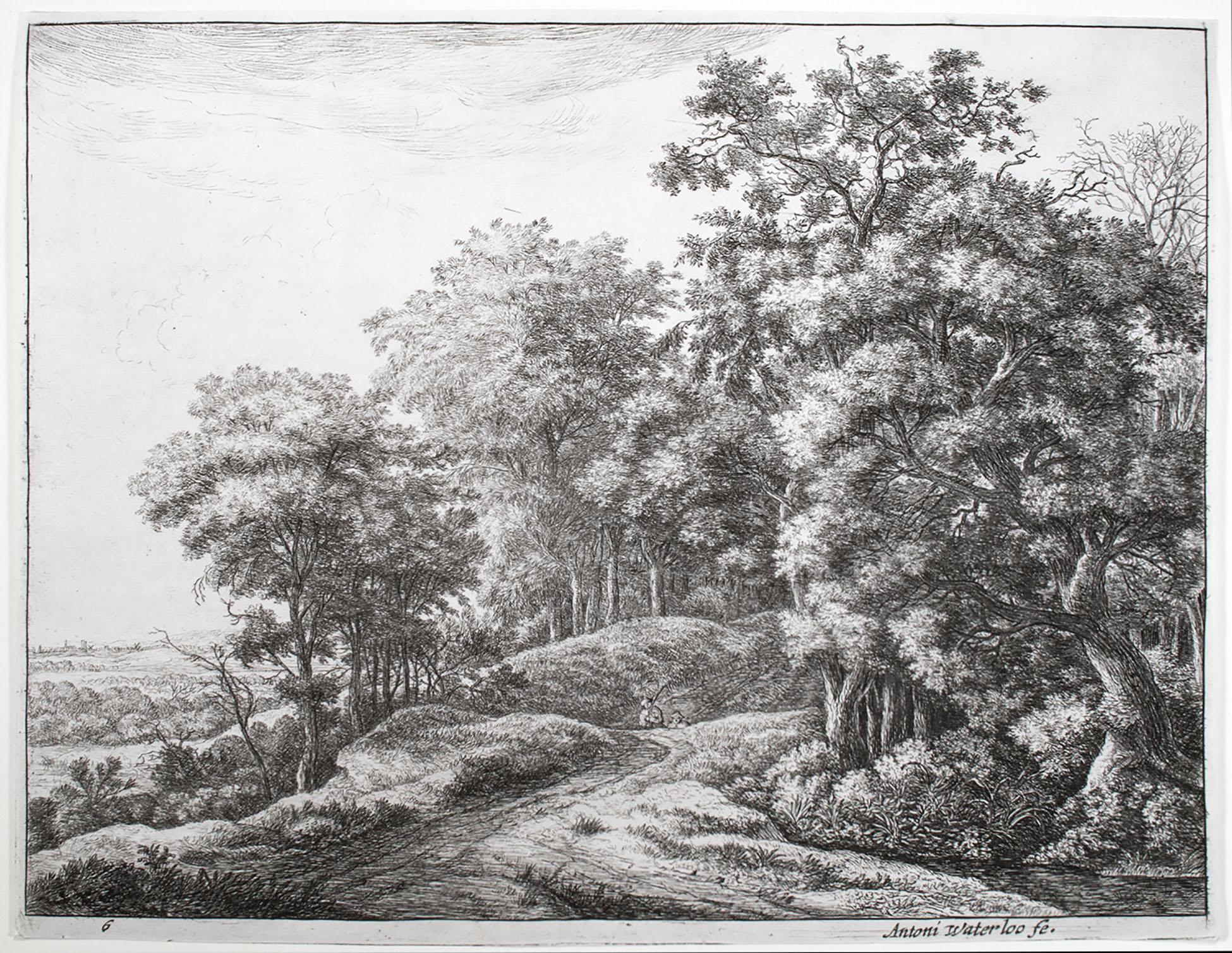
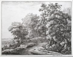
The Great Landscapes VI (2nd State)
By Anthonie Waterloo
Located in Chicago, IL
Watermark:
Wappen von Amsterdam mit Nebenmarke
Category
17th Century Old Masters Landscape Prints
Materials
Etching
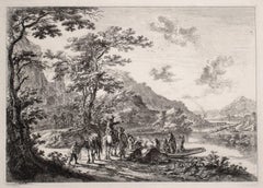
View of the Tiber with Country Landscape
By Jan Dirksz Both
Located in Chicago, IL
Etching on paper with Schriftband watermark.
Reference: Bartsch 7 III/IV (from VI).
A very fine, early impression. Printed with the name of the artist, but before the addition...
Category
15th Century and Earlier Old Masters Landscape Prints
Materials
Etching
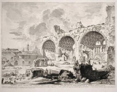
The Basilica of Constantine
By Giovanni Battista Piranesi
Located in Chicago, IL
A very fine impression of the 3rd State, still with the address and price which were eliminated in the following 4th state. The presence of the address and price confirms that this ...
Category
18th Century and Earlier Old Masters Landscape Prints
Materials
Etching
The Great Landscapes II, (4th State)
By Anthonie Waterloo
Located in Chicago, IL
Watermark:
Schellenkappe (Foolscap) Similar to Churchill no. 340
Category
17th Century Old Masters Landscape Prints
Materials
Etching
You May Also Like
Les Bergers Romains, landscape with Roman ruins, 18th century engraving
Located in Melbourne, Victoria
Les Bergers Romains
Copper-line engraving by Jean Jacques Leveau (1729-1786) after Pierre Mettay (1728-1759). C1755.
Proof, before lettering. Laid, watermarked paper.
A landscap...
Category
18th Century French School Landscape Prints
Materials
Engraving
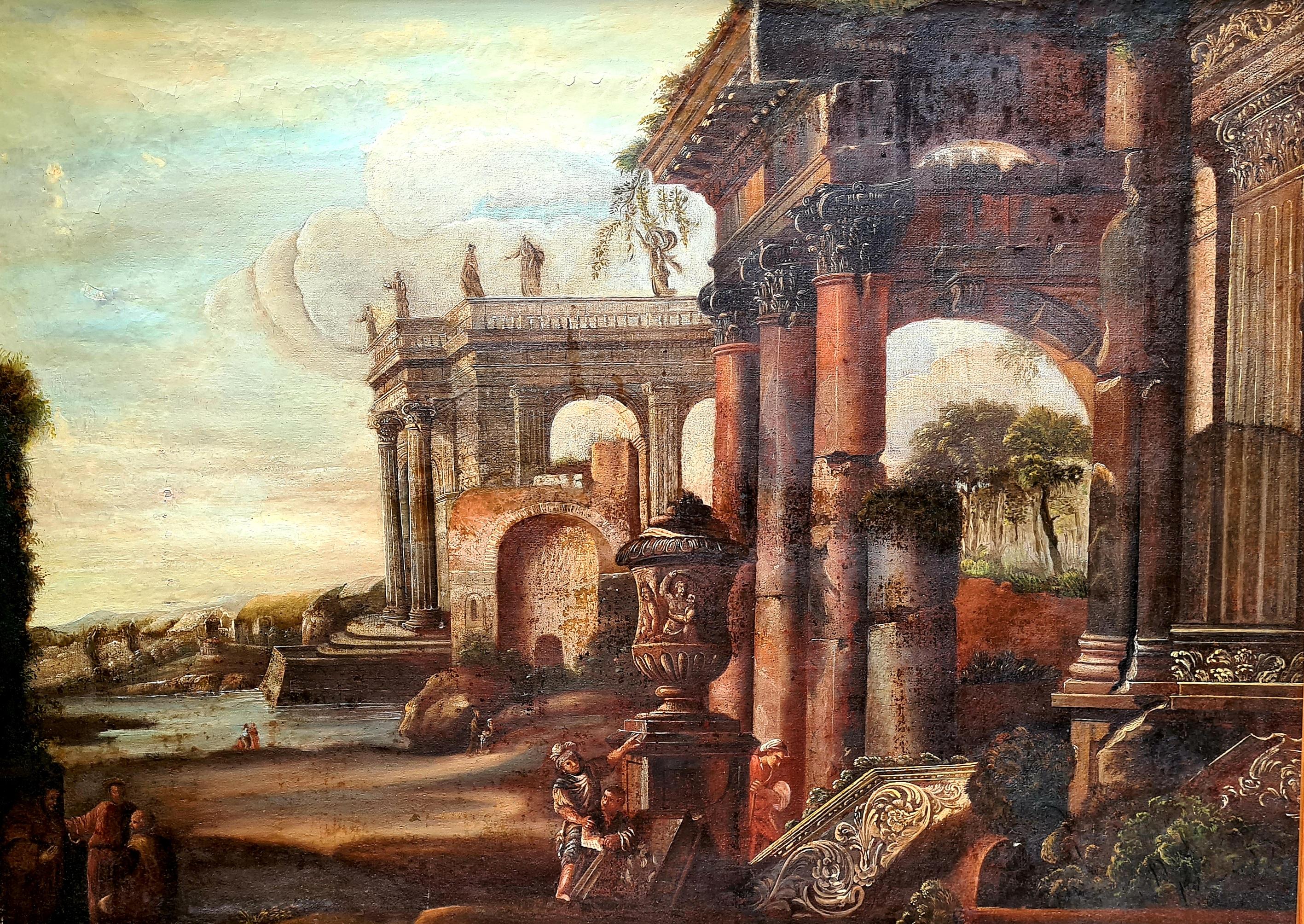
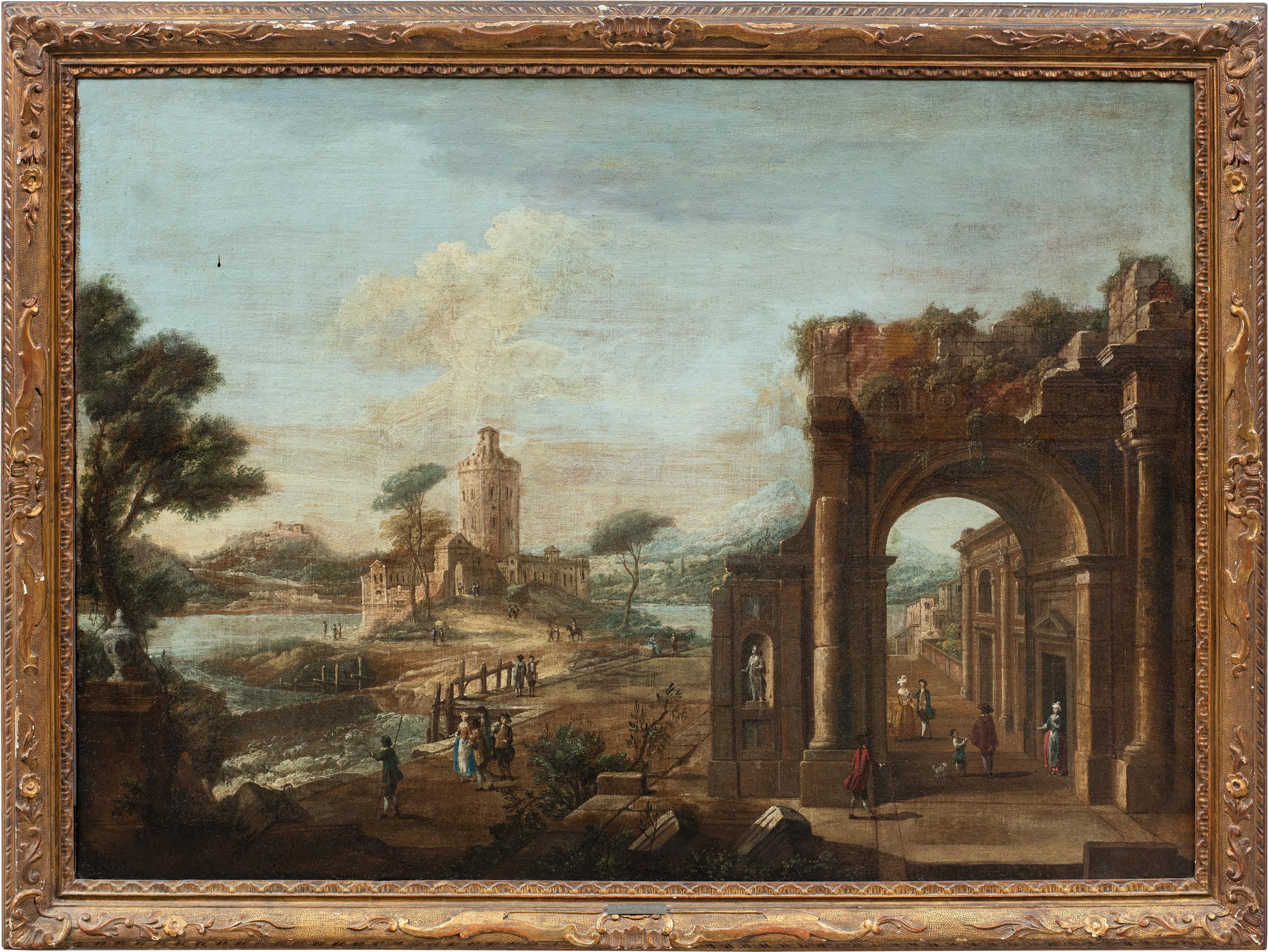
Large Grand Tour 18th Century Capriccio Painting Roman Ruins after Gennaro Greco
Located in Cotignac, FR
A fine, large 18th century veduta capriccio scene with temple ruins after Gennaro Greco from the circle of Pietro Cappelli. The painting is presented in a more modern carved gilt woo...
Category
18th Century Baroque Landscape Paintings
Materials
Oil, Canvas

$9,151 Sale Price
20% Off
Francesco Battaglioli (Venetian master) - 18th century painting - Landscape
By Francesco Battaglioli
Located in Varmo, IT
Francesco Battaglioli (Modena c. 1710 - Venice post-1796) - Architectural Capriccio with Figures.
83.5 x 114.5 cm unframed, 98 x 130 cm with fra...
Category
Mid-18th Century Rococo Landscape Paintings
Materials
Canvas, Oil
Louis Lesueur (1746-1803) Landscape with ruins, 1789, drawing signed and dated
Located in Paris, FR
Louis Lesueur (1746-1803)
A Fantasy Landscape with ancient ruins, 1789,
signed and dated "L Lesueur 1789" in the bottom centre
Pen and ink and ink wash on paper
14.8 x 22 cm
In goo...
Category
1780s Old Masters Landscape Drawings and Watercolors
Materials
Ink
Landscape - Etching - 17th Century
Located in Roma, IT
Landscape is an old master artwork realized by Artist of late 17th Century.
Etching on paper.
Includes frame 31.8 x 37 cm
Category
17th Century Old Masters Figurative Prints
Materials
Etching
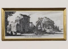
17th century engraving black and white landscape ancient building scene
By Israel Silvestre
Located in Milwaukee, WI
"Tempo di Minerva Medica" is an original engraving by Israel Silvestre, titled along the lower edge. This miniature print depicts the ruins of the Temple of Minerva Medica in the Rom...
Category
1650s Baroque Landscape Prints
Materials
Engraving