Items Similar to Jerusalem, Antique Map from "Civitates Orbis Terrarum" - 1572-1617
Want more images or videos?
Request additional images or videos from the seller
1 of 5
Franz HogenbergJerusalem, Antique Map from "Civitates Orbis Terrarum" - 1572-16171572-1617
1572-1617
$1,675.38
£1,244.53
€1,400
CA$2,311.31
A$2,540.76
CHF 1,335.31
MX$30,854.14
NOK 16,657.65
SEK 15,781.95
DKK 10,657.53
About the Item
Braun G., Hogenberg F., Jerusalem, from the collection Civitates Orbis Terrarum, Cologne, T. Graminaeus, 1572-1617.
Image dimensions: cm 32.8 x 41; dimensions: cm 41 x 54; Passepartout dimensions: cm 50 x 64.4.
Interesting B/W etching on coeval paper, representing a detailed view of the holy city of Jerusalem, the “Hierosolyma urbs sancta”. The title is on plate at the top, whilst there is a caption in Latin in a cartouche at the bottom left. Good conditions, with the usual medial fold and some light foxings on the margins.
The Civitates Orbis Terrarum (Atlas of the Cities of the World) was the second oldest printed atlas in the history of world cartography and the first atlas totally dedicated to topographical views. The first volume of this collection was published in Cologne in 1572; the following in 1575, 1581, 1588, and 1598. The sixth and final volume appeared in 1617, shortly before the extensive devastation wreaked by the Thirty Years’ War.
This artwork is shipped from Italy. Under existing legislation, any artwork in Italy created over 70 years ago by an artist who has died requires a licence for export regardless of the work’s market price. The shipping may require additional handling days to require the licence according to the final destination of the artwork.
- Creator:Franz Hogenberg (1540 - 1590, Flemish)
- Creation Year:1572-1617
- Dimensions:Height: 16.15 in (41 cm)Width: 21.26 in (54 cm)Depth: 0.04 in (1 mm)
- Medium:
- Period:
- Framing:Framing Options Available
- Condition:Insurance may be requested by customers as additional service, contact us for more information.
- Gallery Location:Roma, IT
- Reference Number:Seller: M-947761stDibs: LU65033858651

Franz Hogenberg
Braun and Hogenberg's 'The Civitates Orbis Terrarum' was the second atlas of maps ever published and the first atlas of cities and towns of the world. It is one of the most important books published in the 16th century. Most of the maps in the atlas were engraved by Franz Hogenberg and the text, with its descriptions of the history and additional factual information of the cities, was written by a team of writers and edited by Georg Braun. The work contained 546 bird-eye views and map views of cities and towns from all over the world. It gave graphic representation of the main features of the illustrated cities and towns, including the buildings and streets. Although the ordinary buildings are stylized, the principal buildings are reproduced from actual drawings created on location. The principal landmarks and streets can still be recognized today. In addition, the maps often include the heraldic arms of the city, the nature of the surrounding countryside, the important rivers, streams and harbors, even depicting stone bridges, wooden pontoons, flat-bottomed ferries, ships and working boats, wharves and jetties, as well as land-based activities, including horsemen, pedestrians, wagons, coaches, and palanquins. Small vignettes are often included which illustrate the trade, occupations and habits of the local inhabitants, such as agriculture, paper-making and textiles, as well as local forms of punishment, such as gibbets, wheels, floggings etc. Large figures dressed in their local costume are often presented out of proportion in the foreground. The aim of the authors was to give as much information as possible in a pleasing visual form. They succeeded in creating maps that were both informative and decorative works of art. The atlas is a wonderful glimpse of life in medieval Europe. Georg Braun (1541-1622) was German Catholic cleric who was born and who died in Cologne, Germany. He was the principal editor of 'The Civitates Orbis Terrarum', acquiring the tables, hiring the artists, and composing the texts. Abraham Ortelius, whose Theatrum Orbis Terrarum of 1570 was the first atlas of maps ever published, assisted Braun in his compilation of the details and maps for the atlas. The Civitates was intended as a companion for the Ortellius' Theatrum, as suggested by the similarity in the titles. Braun was the only survivor of the original team to live to see the publication of last volume (VI) in 1617. Franz Hogenberg (1535-1590) was a Flemish and German painter, engraver, and mapmaker. He was born in Mechelen (also known as Malines) in Flanders, the son of an engraver. After being expelled from Antwerp by the Duke of Alva, he moved to London and then eventually to Cologne, Germany, where he met Georg Braun and Abraham Ortellius. He engraved most of the plates for Ortelius's Theatrum and the majority of those in the Civitates. Many believe that he was responsible for originating the Civitates project.
About the Seller
4.9
Platinum Seller
Premium sellers with a 4.7+ rating and 24-hour response times
1stDibs seller since 2017
7,707 sales on 1stDibs
Typical response time: 2 hours
- ShippingRetrieving quote...Shipping from: Roma, Italy
- Return Policy
Authenticity Guarantee
In the unlikely event there’s an issue with an item’s authenticity, contact us within 1 year for a full refund. DetailsMoney-Back Guarantee
If your item is not as described, is damaged in transit, or does not arrive, contact us within 7 days for a full refund. Details24-Hour Cancellation
You have a 24-hour grace period in which to reconsider your purchase, with no questions asked.Vetted Professional Sellers
Our world-class sellers must adhere to strict standards for service and quality, maintaining the integrity of our listings.Price-Match Guarantee
If you find that a seller listed the same item for a lower price elsewhere, we’ll match it.Trusted Global Delivery
Our best-in-class carrier network provides specialized shipping options worldwide, including custom delivery.More From This Seller
View AllHuts - Etching by Pierre Boncompain - Late 20th Century
By Pierre Boncompain
Located in Roma, IT
Huts is an original etching and drypoint on cream colored paper, hand-number and signed in pencil on the lower margin by Pierre Boncompain. Edition of 24 prints.
In excellent condit...
Category
Late 20th Century Landscape Prints
Materials
Etching
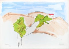
Landscape - Original Litho Reotuché by Fredy Lapenna - 1990s
By Fredy Lapenna
Located in Roma, IT
Landscape is a retouché on paper, realized by the Belgian artist Fredy Lapenna.
This original print, representing a natural country landscape with sweet hills, is numbered in Roman ...
Category
1990s Contemporary More Prints
Materials
Lithograph
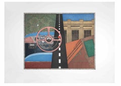
Taxi: Steering Wheel - Aquatint and Etching by Fifo Stricker - 1982
Located in Roma, IT
Taxi: steering wheel is a contemporary artwork realized by the artist Fifo Stricker in 1982.
Mixed colored aquatint and etching.
Hand signed and dated by the artist on the lower r...
Category
1980s Contemporary More Prints
Materials
Etching
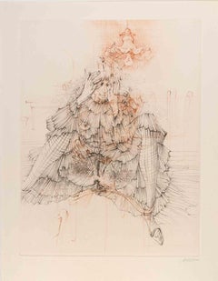
Madame est Servie - Etching by Hans Bellmer - 1960
By Hans Bellmer
Located in Roma, IT
Hand signed and numbered. Edition of 120 copies.
Provenance: "La Rive Gauche" 28/4/1970.
Category
1960s Surrealist More Prints
Materials
Paper, Etching
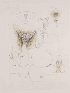
Notes pour la Nouvelle Justine - Etching by Hans Bellmer - 1968
By Hans Bellmer
Located in Roma, IT
Notes pour la Nouvelle Justine is a contemporary artwork realized by Hans Bellmer.
Hand Signed. From the Portfolio "Petit Traité de Morale", Paris, Editions Georges Visat, 1968.
Co...
Category
1960s Surrealist More Prints
Materials
Paper, Etching
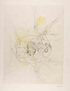
Les Infortunes de la Vertu - Etching by Hans Bellmer - 1968
By Hans Bellmer
Located in Roma, IT
Les Infortunes de la Vertu is a modern artwork realized by Hans Bellmer.
Hand Signed. From the Portfolio "Petit Traité de Morale", Paris, Editions Georges Visat, 1968.
Copy on Véli...
Category
1960s Surrealist More Prints
Materials
Paper, Etching
You May Also Like
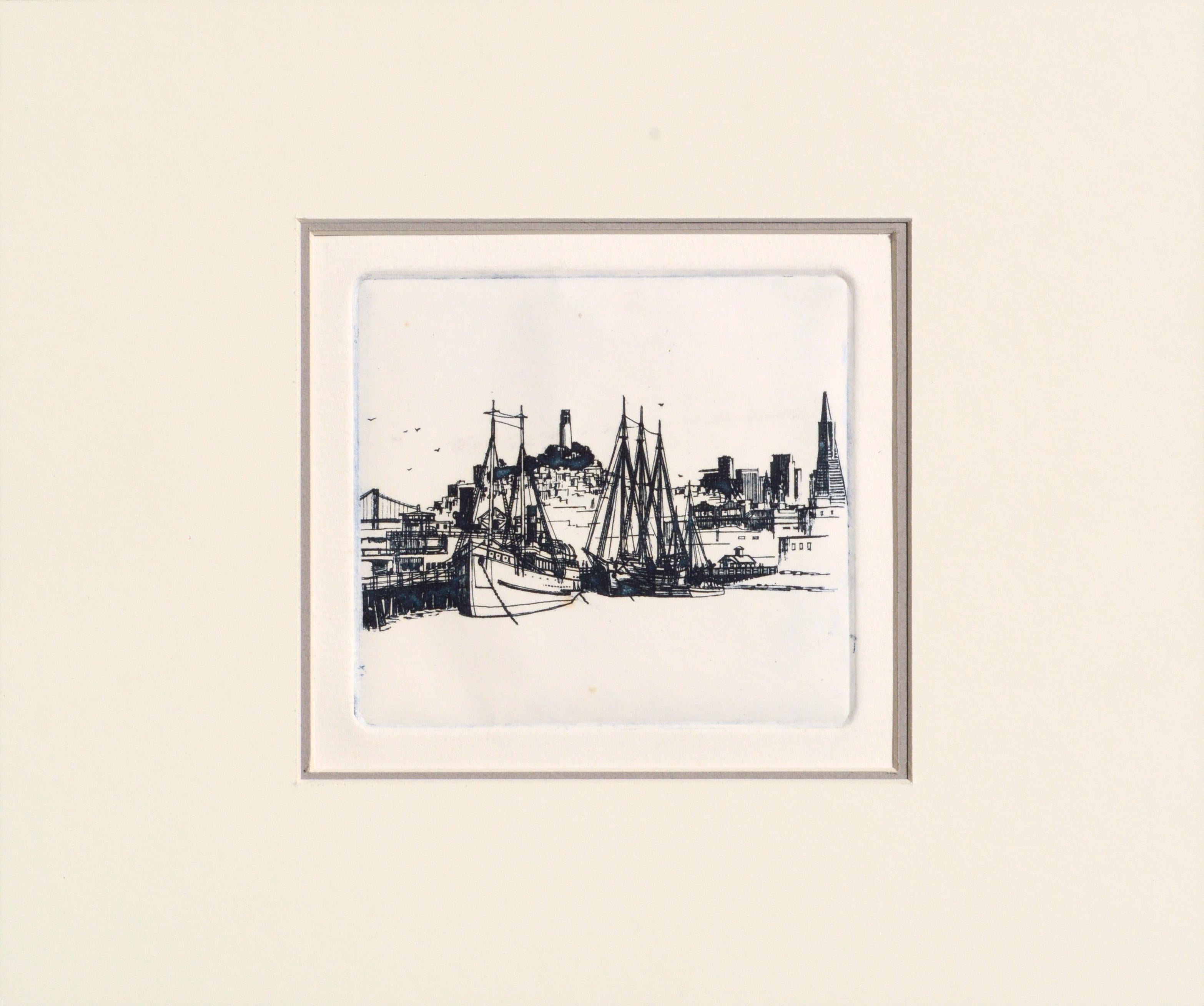
Fishing Boats in the Wharf - San Francisco Bay Area Maritime Landscape
Located in Soquel, CA
Delicate print of Fishing and sailboats on the Wharf In San Francisco from the collection of Patricia Pearce by one of her contemporaries or students, at the College of San Mateo, sh...
Category
1980s Contemporary Landscape Prints
Materials
Paper, Ink, Etching
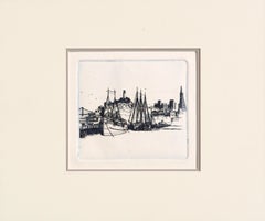
$340 Sale Price
20% Off
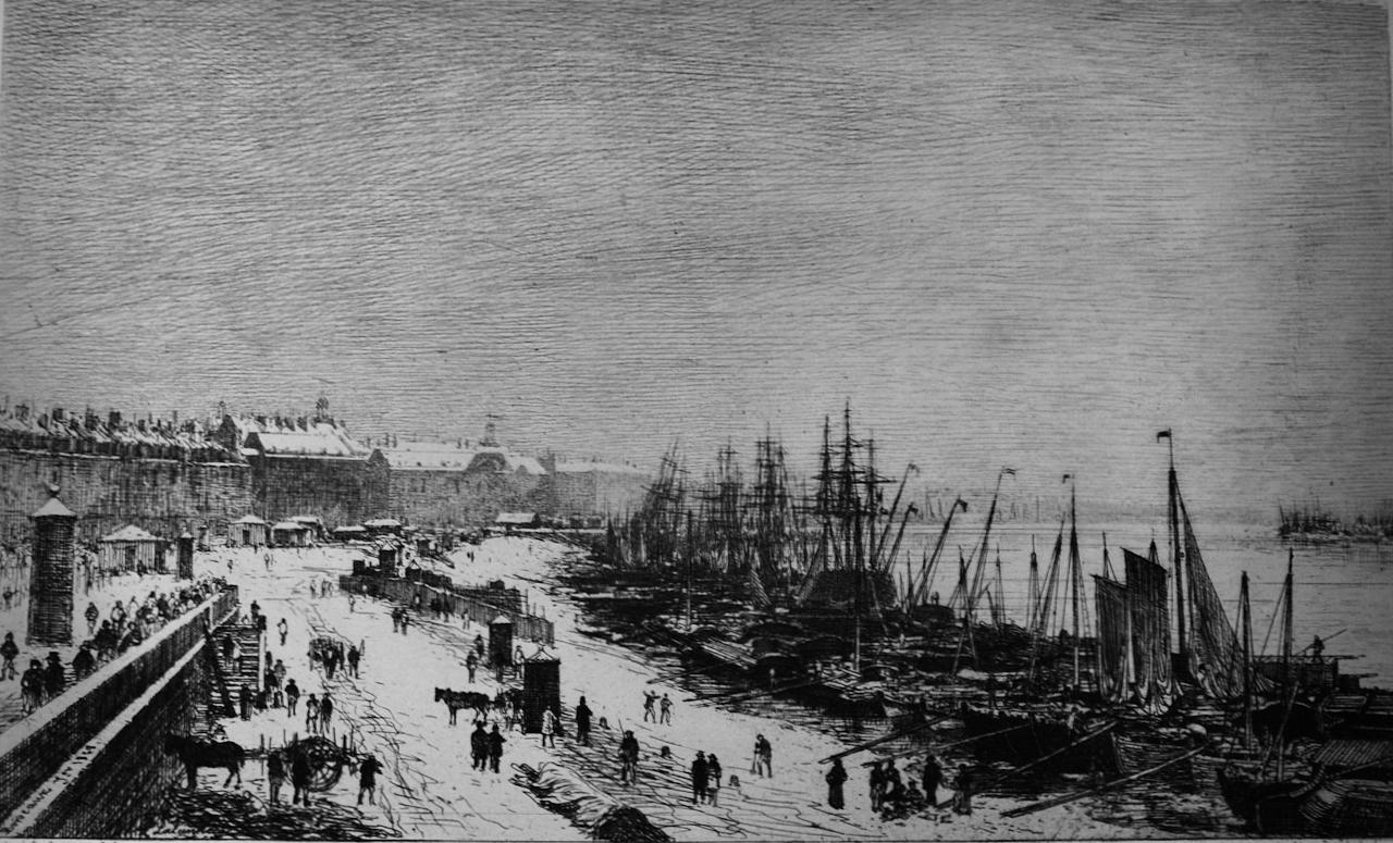
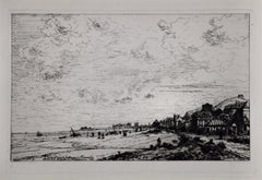
The Port Of Bordeaux, France In Winter: A 19th C. Etching by Maxime Lalanne
By Maxime Lalanne
Located in Alamo, CA
This is a mid 19th century etching entitled "Rade de Bordeaux, Janvier" (Port Of Bordeaux In Winter), etched by Phillip Gilbert Hamerton after a drawing by Maxime Lalanne in London in 1868. The etching depicts many boats in the busy harbor of Bordeaux, including small sailboats, as well as tall ships. Another harbor is seen in the distance across the river on the left. Snow covered buildings are on the left and extending long distances in the distant background. Many people occupy the road and ground centrally and on the left along with some horses or mules attached to carts. The sky is a wintery gray.
This etching is an excellent impression printed on thick chain-linked, laid, deckle-edge paper with wide margins, watermarked with a 2 in the lower left corner. It is signed in the plate in the lower left, the title and date are in the center and Bordeaux and the year are included in script along the top of a wall in the lower left of the engraving. The sheet measures 8.75" high by 12" wide. The print is in excellent condition. This etching is held by many museums and institutions, including The National Gallery of Art, Washington, D.C.
François Antoine Maxime Lalanne (1827-1886) was a leading French etcher and painter of landscapes and urban views, who was at the forefront of the French revival of etching during the 1860's. He grew up in Bordeaux, but he refined his artistic skills and worked in Paris. His art was first exhibited at the Paris Salon in 1852 and he continued to regularly show both etchings and paintings there until the mid 1880's. He was also the author of several important books on the subjects of etching and other graphic arts. He was a founding member of the Societe des Aquafortistes, along with Auguste Delatre, Cadart, Ribot and Bracquemond. Lalanne created over one hundred and fifty fine etchings. Lalanne's unique style of art influenced many French and English artists in the twentieth century.
Philip Gilbert Hamerton (1834-1894) was a British artist, art critic and author. He was particularly focussed on contemporary graphic art and printmaking techniques. He frequently wrote about the theory of the English Etching...
Category
Mid-19th Century Landscape Prints
Materials
Etching

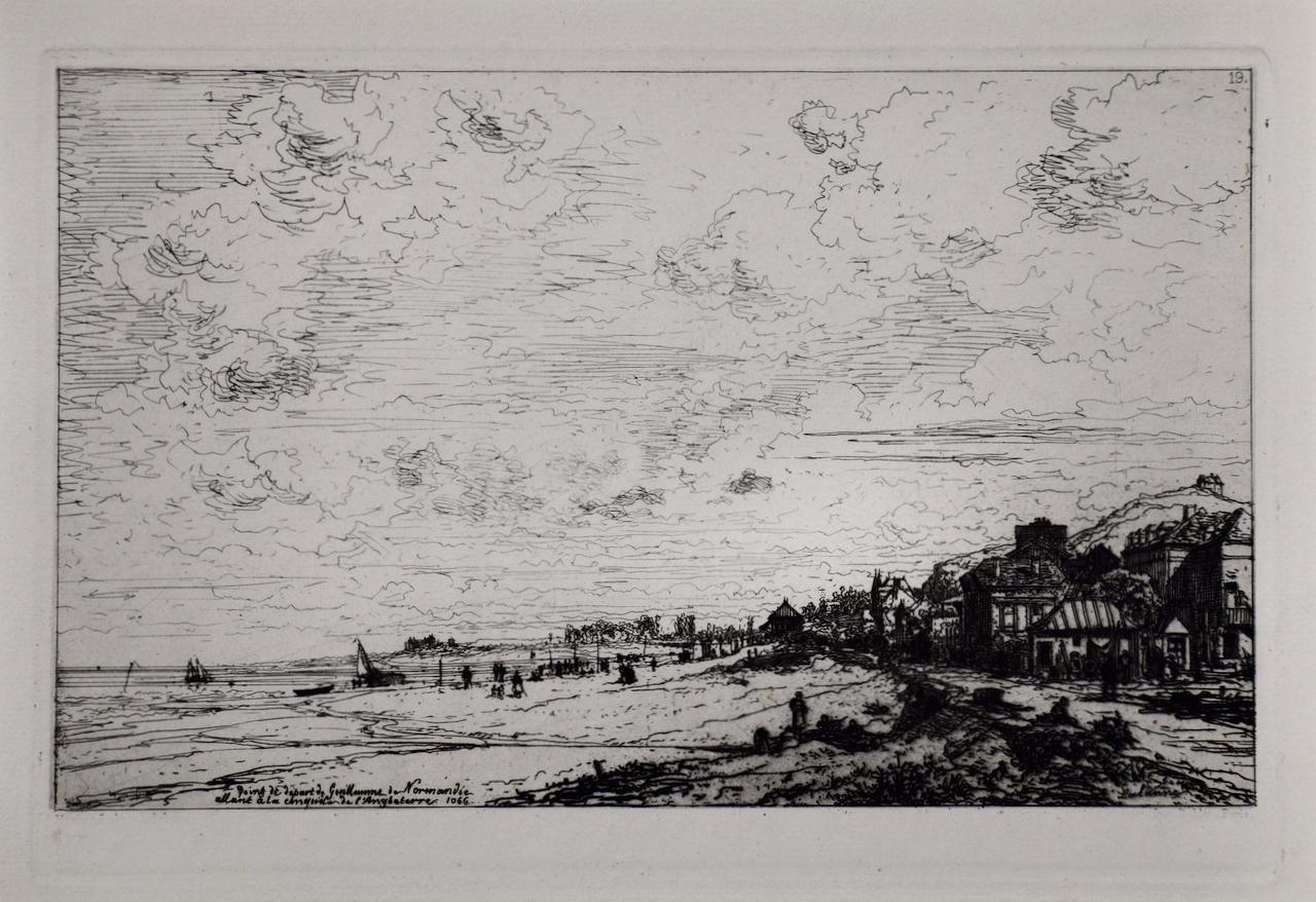
The Beach in Normandy, France, Near Bayeux: A 19th C. Etching by Maxime Lalanne
By Maxime Lalanne
Located in Alamo, CA
This is a mid 19th century etching entitled "Point de Depart de Guillaume de Normandie, Beuzeval, Emboucher de la Dives Calvados (The point of departure of William of Normandy (William the Conqueror)), created by Maxime Lalanne and published in 'L'Illustration Nouvelle' in 1868 by Alfred Cadart. The etching depicts the beach at Beuzeval in Normandy; with the shore in the foreground on the right lined by a row of houses, the sea at the left, and an expansive sky above. There are people on the beach and sailboats in the water. This is the point of departure of William the Conqueror for his voyage to England in 1066, resulting in his victory over the Anglo-Saxons at the Battle of Hastings and the establishment of Norman rule. The events are memorialized in the Bayeux tapestry, created by William's wife.
This etching is presented in a white mat that is suitable for framing. This excellent impression is printed on thick chain-linked, laid cream-colored paper with wide margins. It is signed in plate in the lower right and titled in the plate in the lower left. There is a collector's stamp (either an "NC" or a "CN") in the lower right corner. The sheet measures 9.5" high by 12.75" wide and the mat measures 13.5" high by 16" wide. There are two tiny faint spots in the periphery of the upper margin, but the print is otherwise in excellent condition. This etching is held by many museums and institutions, including The British Museum, The Yale University Art Gallery, The Cleveland Museum of Art, The Philadelphia Museum of Art, Columbia University Libraries and The William Morris Gallery...
Category
Late 19th Century Landscape Prints
Materials
Etching
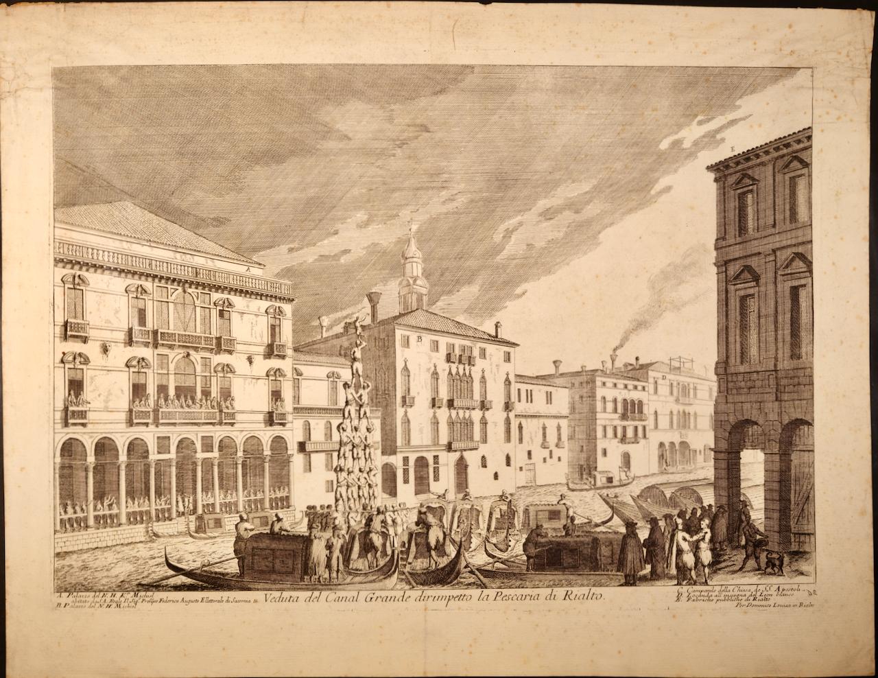
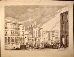
Venice: 18th Century View of the Grand Canal by Lovisa
By Domenico Lovisa
Located in Alamo, CA
This is an early 18th century etching of the Grand Canal in Venice entitled "Veduta del Canal Grande dirimpetto la Pescaria di Rialto" by Domenico Lovisa, first published in 1720 in ...
Category
Early 18th Century Landscape Prints
Materials
Etching
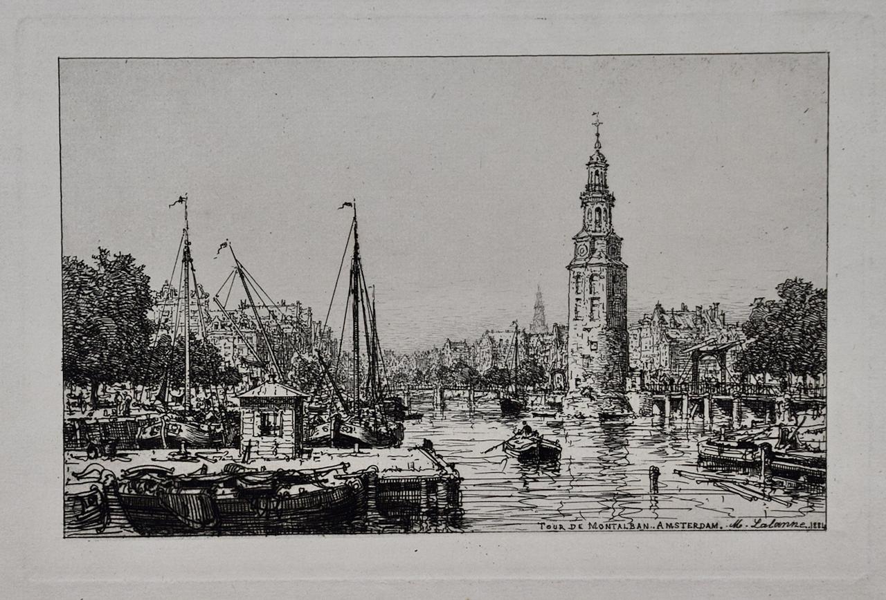
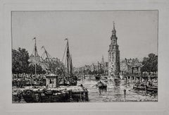
Tour De Montalban, Amsterdam: A 19th C. Etching by Maxime Lalanne
By Maxime Lalanne
Located in Alamo, CA
This is a 19th century etching entitled "Tour De Montalban, Amsterdam" (Montalban Tower, Amsterdam) by Maxime Lalanne, published by Phillip Gilbert Hamerton in 1884. The etching depicts a canal scene in Amsterdam with Montalban Tower on the right. Row boats are moored along a dock in the foreground on the left and larger sail boats are seen on the other side of the dock. A boat in the middle of the canal is being rowed by one man. Many buildings are seen along both shores.
This etching is presented in a white mat that is suitable for framing. This excellent impression is printed on thick chain-linked, laid cream-colored paper with wide margins and two watermarks; "Portfolio" along the left margin and "MBM" along the right margin. It is signed, titled and dated in the plate in the lower right. There is a collector's stamp (either an "NC" or a "CN") in the lower right corner. The sheet measures 10" high by 15" wide and the mat measures 13" high by 16" wide. There is a small spot in the right margin and some mild discoloration in the periphery on the upper margin. The print is otherwise in excellent condition. This etching is held by many museums and institutions, including The Fine Arts Museums of San Francisco, The Museum of Fine Arts, Boston, The Yale University Art Gallery and The Philadelphia Museum of Art. References: Beraldi (1889) 105; Villet (2016) 148, IV; Lalanne (1882) 137; Bibliothèque Nationale (1932) 82; Gutekunst (1905) 105.
François Antoine Maxime Lalanne (1827-1886) was a leading French etcher and painter of landscapes and urban views, who was at the forefront of the French revival of etching during the 1860's. He grew up in Bordeaux, but he refined his artistic skills and worked in Paris. His art was first exhibited at the Paris Salon in 1852 and he continued to regularly show both etchings and paintings there until the mid 1880's. He was also the author of several important books on the subjects of etching and other graphic arts. He was a founding member of the Societe des Aquafortistes, along with Auguste Delatre, Cadart, Ribot and Bracquemond. Lalanne created over one hundred and fifty fine etchings. Lalanne's unique style of art influenced many French and English artists in the twentieth century.
Philip Gilbert Hamerton (1834-1894) was a British artist, art critic and author. He was particularly focussed on contemporary graphic art and printmaking techniques. He frequently wrote about the theory of the English Etching...
Category
Late 19th Century Landscape Prints
Materials
Etching
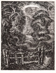
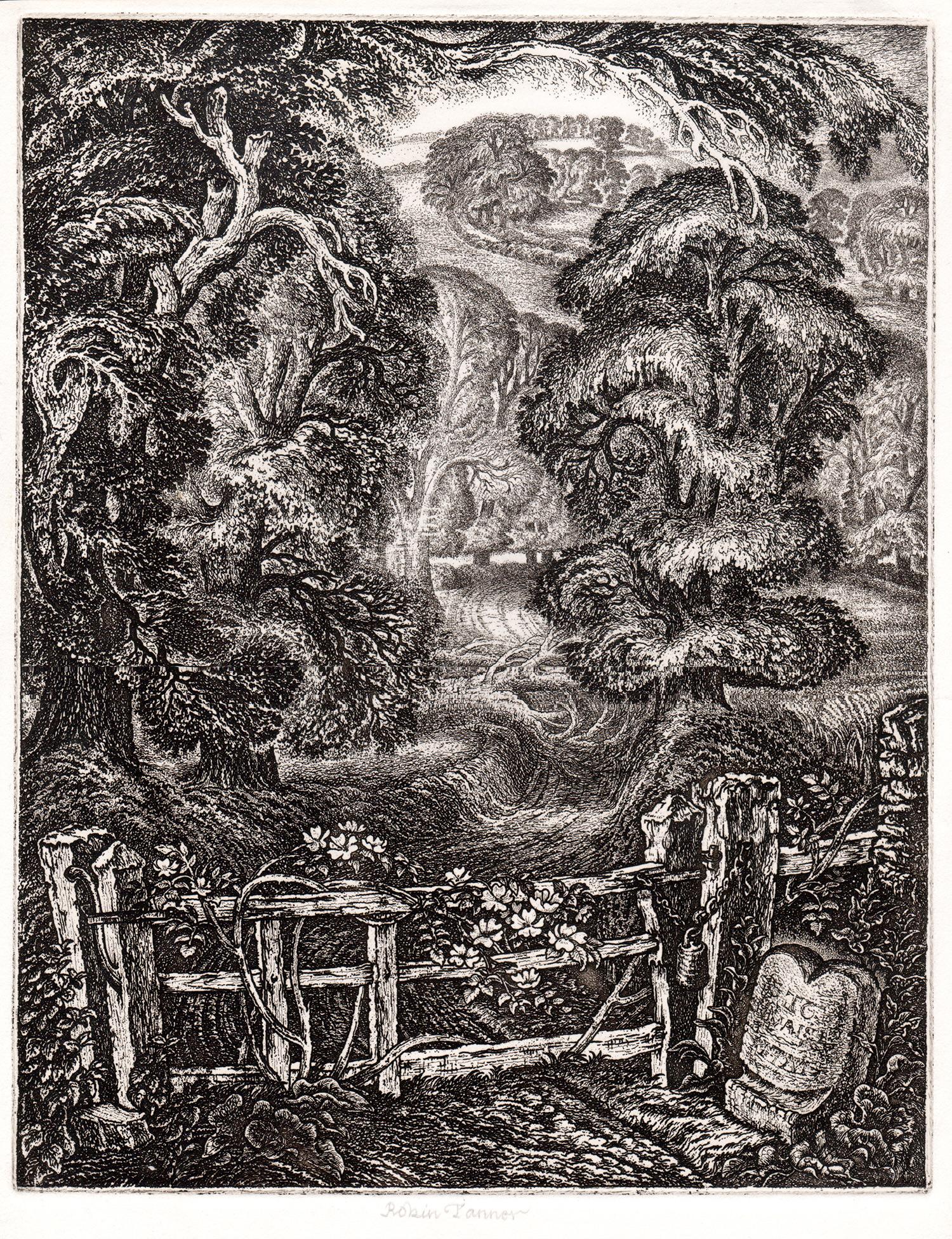
The Old Road: Elegy for the English Elm I, Robin Tanner signed artist etching
By Robin Tanner
Located in Melbourne, Victoria
The Old Road: Elegy for the English Elm I
Etching by Robin Tanner (1904-1988), signed by the artist in pencil.
Very good, strong impression with excellent contrast. From the editio...
Category
1970s English School Landscape Prints
Materials
Etching