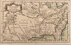
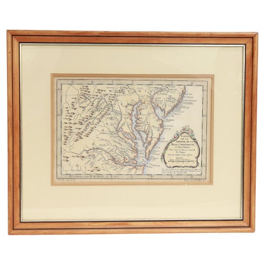
La Louisiane et Pays Voisins (Louisiana and surrounding areas) by Bellin


1 of 6
Jacques-Nicolas BellinLa Louisiane et Pays Voisins (Louisiana and surrounding areas) by Bellin1764
1764
Price:$536
$595List Price
About the Item
- Creator:Jacques-Nicolas Bellin (1703 - 1772, French)
- Creation Year:1764
- Dimensions:Height: 9 in (22.86 cm)Width: 14.25 in (36.2 cm)
- Medium:
- Movement & Style:
- Period:1760-1769
- Condition:
- Gallery Location:New York, NY
- Reference Number:1stDibs: LU5185172482
Jacques-Nicolas Bellin
Jacques Nicolas Bellin (1703 –1772) was a French hydrographer (official cartographer) and a geographer. While still a teenager he became the chief cartographer to the French Navy and later to the king of France. Bellin created a large number of maps for Antoine François Prévost's (L'Abbe Prevost) 'Histoire Generale des Voyages', which was a 25 volume publication focused on 17th and 18th century exploration.It was published in French, Dutch and German. He also contributed maps and articles to the 35-volume Encyclopédie edited by Denis Diderot and Jean le Rond d'Alembert. He was part of the group called Philosophes, which included many of the great intellectuals of the Age of Enlightenment, including Voltaire, Rousseau and Montesquieu. Bellin died at Versailles in 1772.
Authenticity Guarantee
In the unlikely event there’s an issue with an item’s authenticity, contact us within 1 year for a full refund. DetailsMoney-Back Guarantee
If your item is not as described, is damaged in transit, or does not arrive, contact us within 7 days for a full refund. Details24-Hour Cancellation
You have a 24-hour grace period in which to reconsider your purchase, with no questions asked.Vetted Professional Sellers
Our world-class sellers must adhere to strict standards for service and quality, maintaining the integrity of our listings.Price-Match Guarantee
If you find that a seller listed the same item for a lower price elsewhere, we’ll match it.Trusted Global Delivery
Our best-in-class carrier network provides specialized shipping options worldwide, including custom delivery.You May Also Like
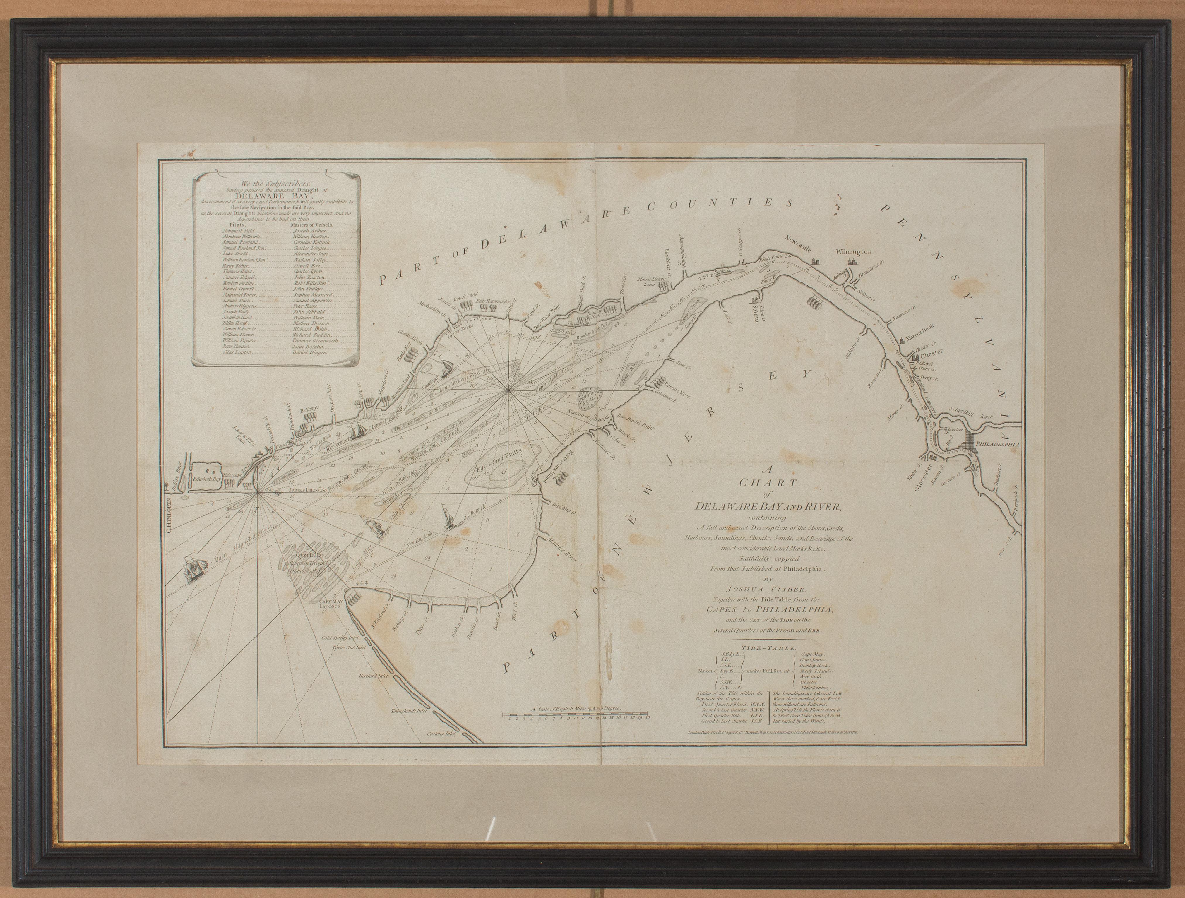
1776 Navigational chart/map of the Delaware bay and river including Philadelphia
Located in Philadelphia, PA
JOSHUA FISHER
(AMERICAN, EIGHTEENTH CENTURY)
A Chart of Delaware Bay and River, 1776
Printed for John Bennet and Robert Sayer, London
Engraving on pape...
Category
1770s Realist Landscape Prints
Materials
Paper, Engraving

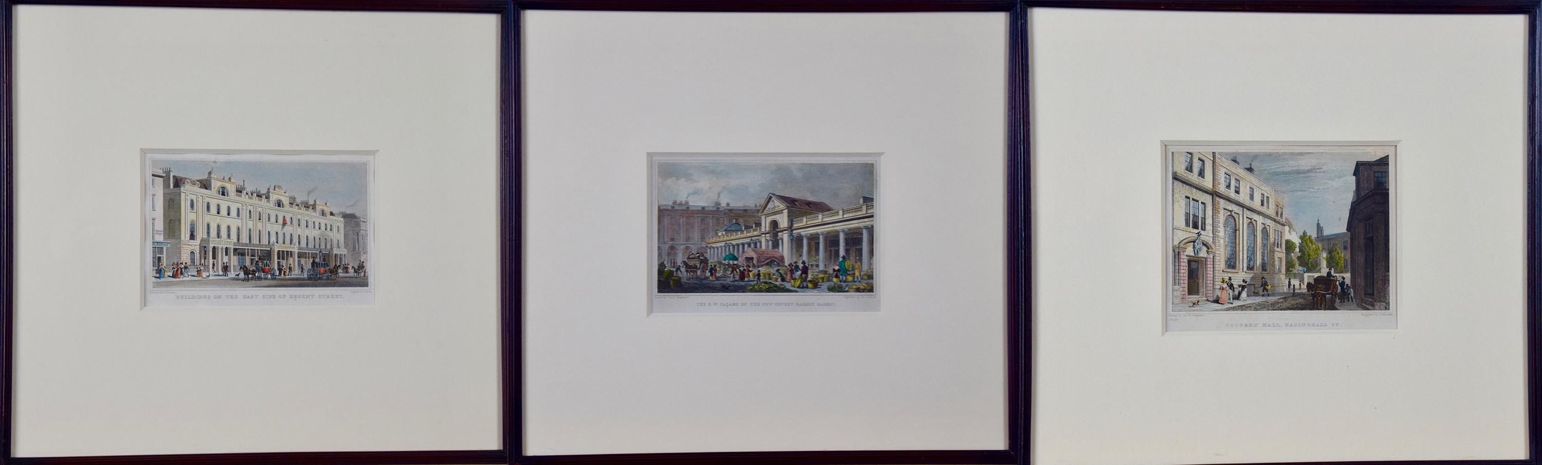
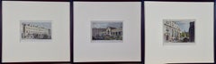
Three 19th C. Hand Colored Engravings of London Architecture by T. Shepherd
By Thomas Hosmer Shepherd
Located in Alamo, CA
A set of three hand-colored engravings from "Metropolitan Improvements; or London in the Nineteenth Century", published in London, England in 1828. The scenes were drawn by Thomas Ho...
Category
1820s Realist Landscape Prints
Materials
Engraving
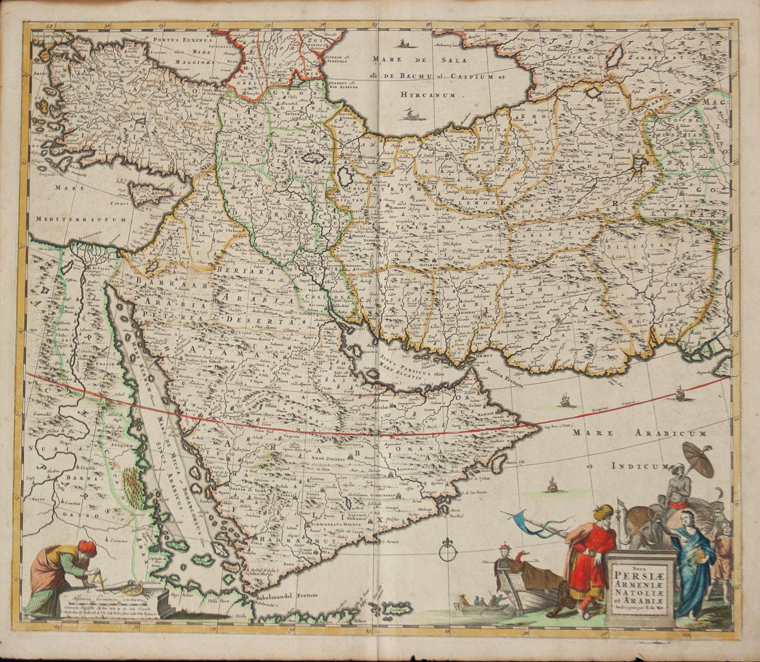
Persiae, Armeniae, Natoliae et Arabiae Descriptio per Frederick deWit 1666 map
Located in Paonia, CO
Map of Persiae, Armeniae, Natoliae et Arabiae Descriptio per F de Wit 1688 engraving from: Atlas Contractus Orbis Terrarum Praecipuas ac Novissimas Complectens Tabulas. Amsterdam, N. Visscher, 1656-77. (Koeman III, Vis5-8) This highly decorative map of the Middle East is by the Dutch engraver, publisher, and map seller...
Category
1660s Realist Landscape Prints
Materials
Engraving

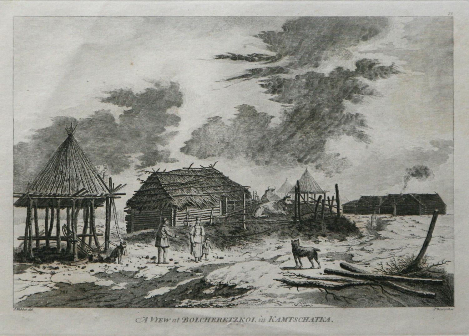
A View at Bolcheretzko (Russia) 1784 Captains Cook Final Voyage by John Webber
By John Webber
Located in Paonia, CO
A View at Bolcheretzko (Russia) is from the 1784 First Edition Atlas Accompanying Capt. James Cook and King; Third and Final Voyage of Captain James Cook.John Webber (1752-1793) was ...
Category
1780s Realist Landscape Prints
Materials
Engraving

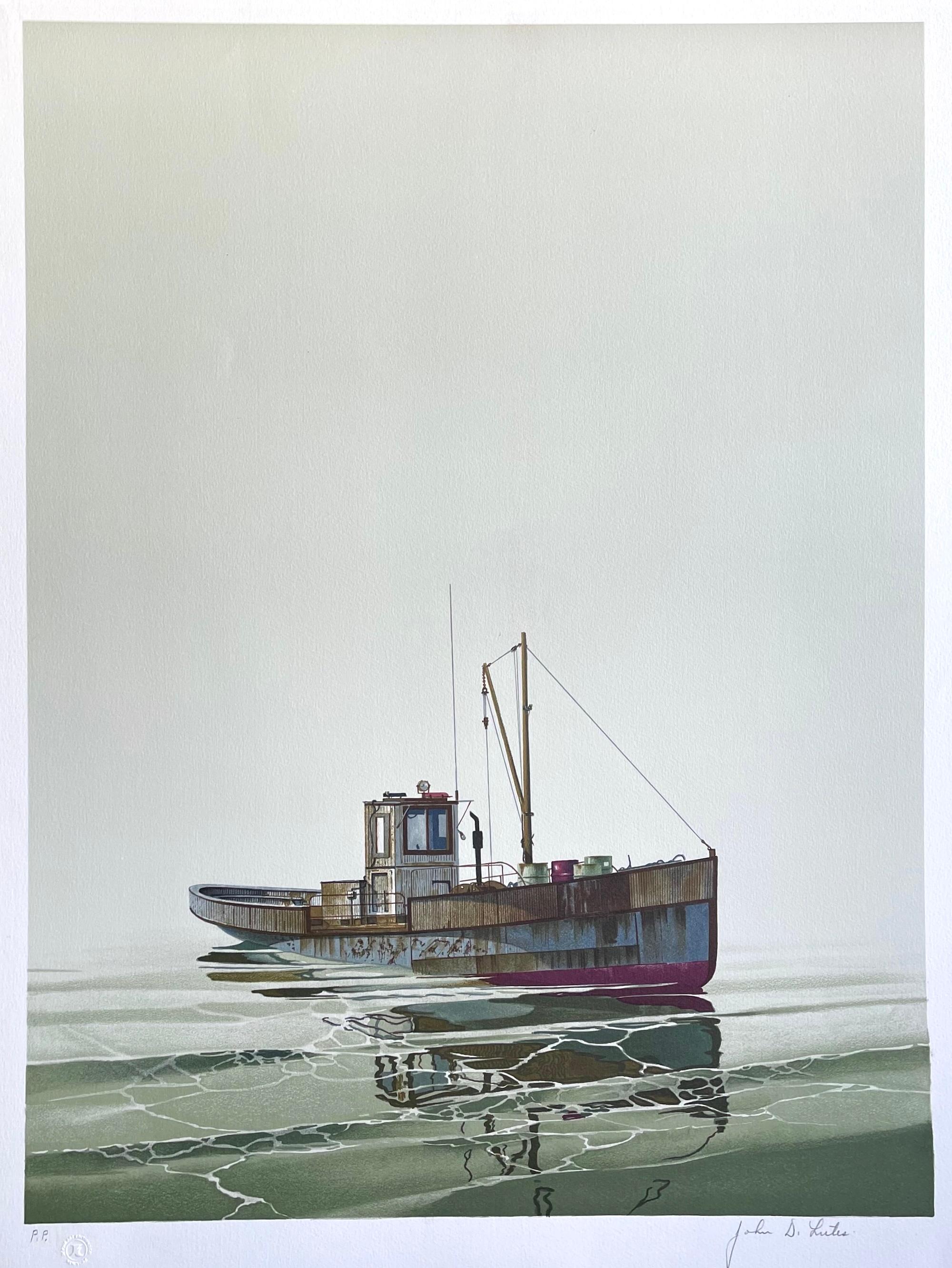
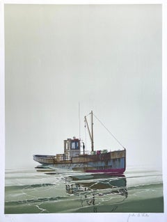
CAY RUNNER Signed Lithograph, Realistic Runner Boat on Calm Water, Marine Art
By John Lutes
Located in Union City, NJ
Artist - John Lutes (1926-2001)
Title - Cay Runner
Medium - Lithograph
Year Published - 1980
Print Size - 29 x 22 in.
Printer - J K Fine Art Editions Co., NY
Cay Runner is an original hand drawn, limited edition lithograph, (not a photographically reproduced or digital print) by the American artist John D. Lutes created using traditional hand lithography techniques, proofed and printed in multiple colors on archival Arches paper 100% acid free.
Cay Runner depicts a very detailed realistic rendition of a runner boat in still water, a solid light khaki grey sky serving as the backdrop for this quiet marine boat portrait. This is a rare limited edition lithograph by Mr. Lutes not often seen on the marketplace. Cay Runner is in excellent condition, unframed, pencil signed by John Lutes.
Print size - 30 x 22 inches, unframed, excellent condition, hand signed in pencil by John Lutes
Edition size - 300, plus proofs
Year published - 1980
Printer - J K Fine Art Editions Co. NY
John D. Lutes, born 1926 in Chicago, died 2001...
Category
1980s Realist Landscape Prints
Materials
Lithograph
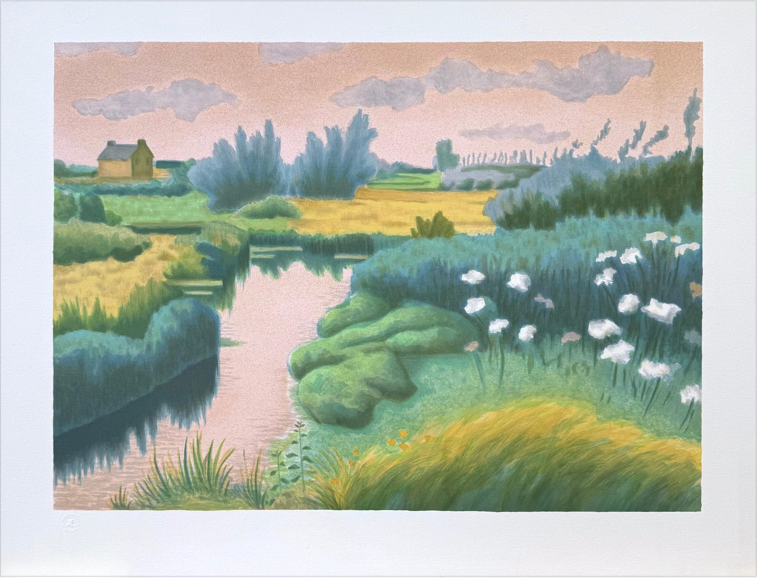
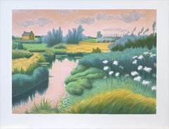
BRITTANY LANDSCAPE Hand Drawn Lithograph, Impressionist Style Waterway Scene
By Laurent Marcel Salinas
Located in Union City, NJ
Artist - Laurent Marcel Salinas (born 1913 Alexandria, Egypt, died 2010 in America)
Title - BRITTANY LANDSCAPE
BRITTANY LANDSCAPE is an original hand drawn limited edition lithograp...
Category
1970s Realist Landscape Prints
Materials
Lithograph
Recently Viewed
View AllMore Ways To Browse
Antique Great Lakes Map
Antique Mississippi Map
Antique Florida Map
Antique Louisiana Map
Shona Stone
Erte Bronze
Nando Kallweit
Paul Norton
Pumpkin Box
Rhino Gold
Vivian Brown
Apostles Painting
Black Greek Statue
Hare Sculpture Bronze
Peacock Photography
Portrait Of Nobleman
Shona Sculptures
19th Century Male Oil Paintings