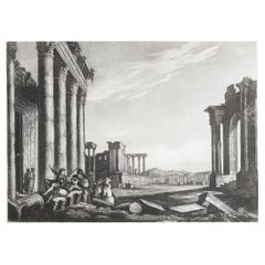
Items Similar to After Paul Fourdrinier - 19th Century Engraving, The Ruins of Palmyra I

Want more images or videos?
Request additional images or videos from the seller
1 of 9
UnknownAfter Paul Fourdrinier - 19th Century Engraving, The Ruins of Palmyra I19th Century
19th Century
$361
£273.53
€313.85
CA$507.99
A$558.42
CHF 293.48
MX$6,781.20
NOK 3,661.06
SEK 3,468.60
DKK 2,342.34
About the Item
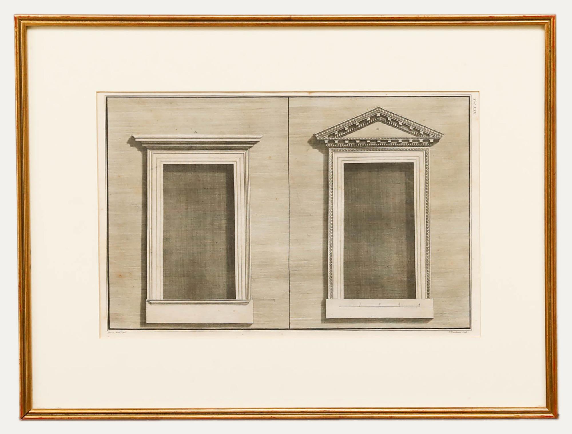
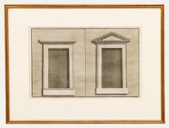
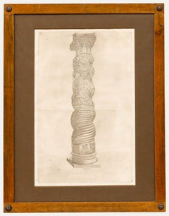
This architectural drawing showcases the intricate details of a classical column and entablature, emphasising the ornate pediment and decorative frieze.
The original plate was made in 1757 for Plate L from 'The Ruins of Palmyra'. Designs for Window Lintels and Sills. Artist name inscribed. Presented in a gilt frame. On paper.
- Creation Year:19th Century
- Dimensions:Height: 21.26 in (54 cm)Width: 16.15 in (41 cm)
- Medium:
- Period:
- Condition:There is evidence of very light foxing to the outer edges of the paper. Light wear to the frame.
- Gallery Location:Corsham, GB
- Reference Number:Seller: sk7941stDibs: LU881315936062
About the Seller
4.9
Platinum Seller
Premium sellers with a 4.7+ rating and 24-hour response times
Established in 2010
1stDibs seller since 2018
1,357 sales on 1stDibs
Typical response time: 2 hours
- ShippingRetrieving quote...Shipping from: Corsham, United Kingdom
- Return Policy
Authenticity Guarantee
In the unlikely event there’s an issue with an item’s authenticity, contact us within 1 year for a full refund. DetailsMoney-Back Guarantee
If your item is not as described, is damaged in transit, or does not arrive, contact us within 7 days for a full refund. Details24-Hour Cancellation
You have a 24-hour grace period in which to reconsider your purchase, with no questions asked.Vetted Professional Sellers
Our world-class sellers must adhere to strict standards for service and quality, maintaining the integrity of our listings.Price-Match Guarantee
If you find that a seller listed the same item for a lower price elsewhere, we’ll match it.Trusted Global Delivery
Our best-in-class carrier network provides specialized shipping options worldwide, including custom delivery.More From This Seller
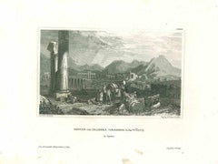
View AllAfter P. Fourdrinier - 19th Century Engraving, Ruins of Baalbek
Located in Corsham, GB
This architectural drawing showcases the intricate details of a classical column and entablature, focusing on the ornate pediment and frieze.
The original plate was created in 1757 ...
Category
19th Century Landscape Prints
Materials
Engraving
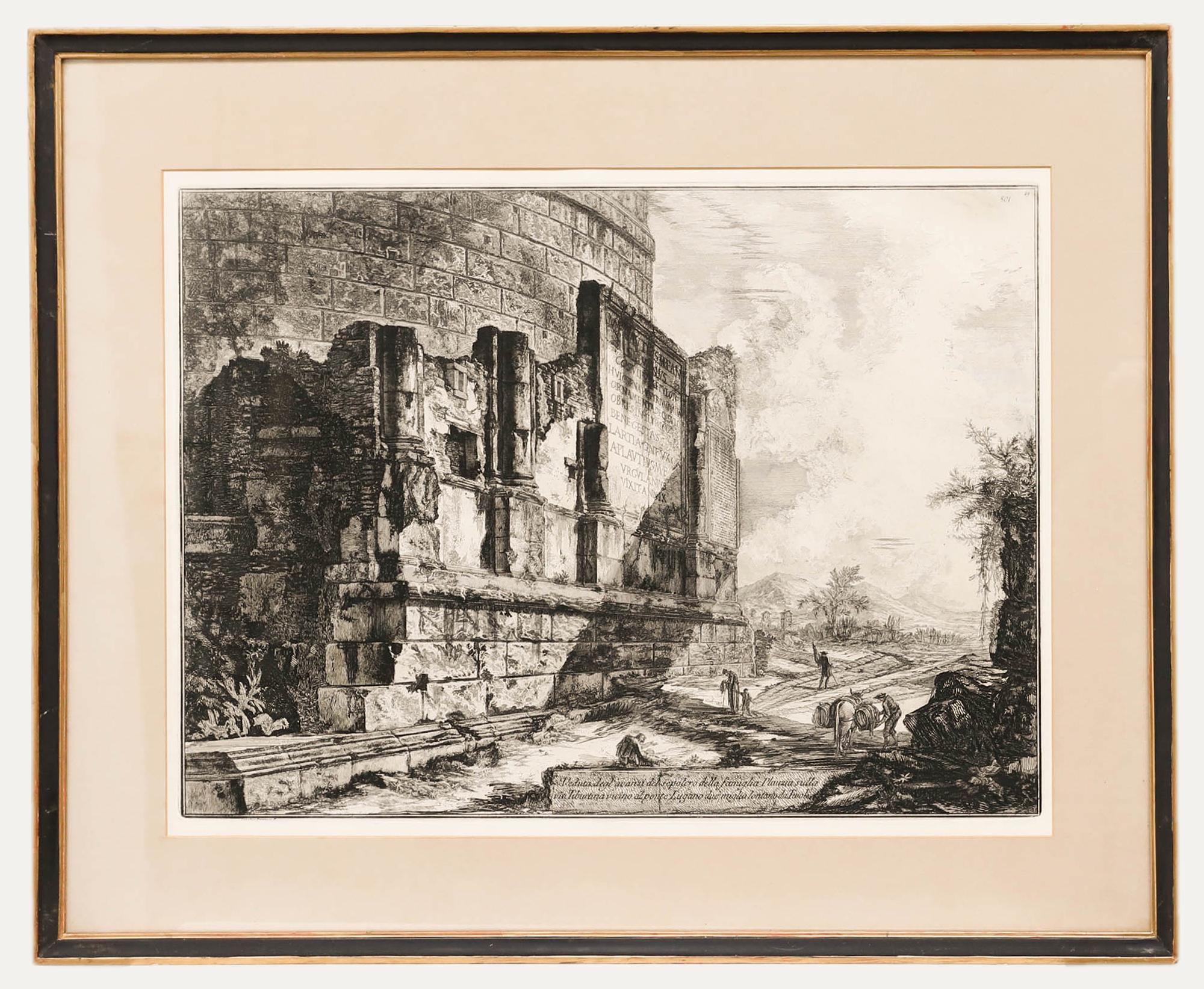
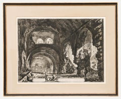
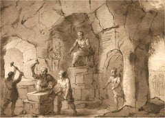
After Giovanni Battista Piranesi - 20th Century Engraving, Plautii Mausoleum
Located in Corsham, GB
A charming engraving with etched details. Inscribed in plate. Presented in a painted black and gold gilt frame. On paper.
Category
20th Century Landscape Prints
Materials
Engraving

After Giovanni Battista Piranesi - Early 20th Century Etching, Villa of Maecenas
Located in Corsham, GB
A charming etching depicting Giovanni Battista Piranesi's Villa of Maecenas at Tivoli. Inscribed with artist name in plate. Presented in a black and gilt frame. On paper.
Category
20th Century Landscape Prints
Materials
Etching
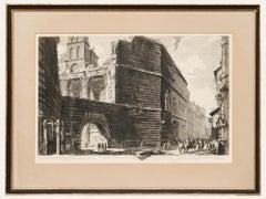
After Giovanni Battista Piranesi - Early 20th Century Engraving, Forum of Nerva
Located in Corsham, GB
A charismatic engraving with etched details after Giovanni Battista Piranesi (1720-1778). Inscribed in plate. Presented in a painted black and gilt frame. On paper.
Category
20th Century Landscape Prints
Materials
Engraving
Antonio Lafrery (1512-1577) - 16th Century Engraving, St. Peter's Baldachin
Located in Corsham, GB
A finely detailed engraving depicting one of the Solomonic columns from St. Peter's Baldachin in St. Peter's Basilica, Vatican City. The print is from Antonio Lafreri's Speculum Roma...
Category
Early 19th Century Figurative Prints
Materials
Engraving
Richard Earlom after Lorrain - 1802 Etching, Liber Vertatis Landscape No. 7
Located in Corsham, GB
A fine example of the 1802 strike of Landscape No. 7 from the etched version of the Liber Vertatis. Sculptured by Richard Earlom (1743-1822) after the original from the book by Claud...
Category
19th Century Interior Prints
Materials
Etching
You May Also Like
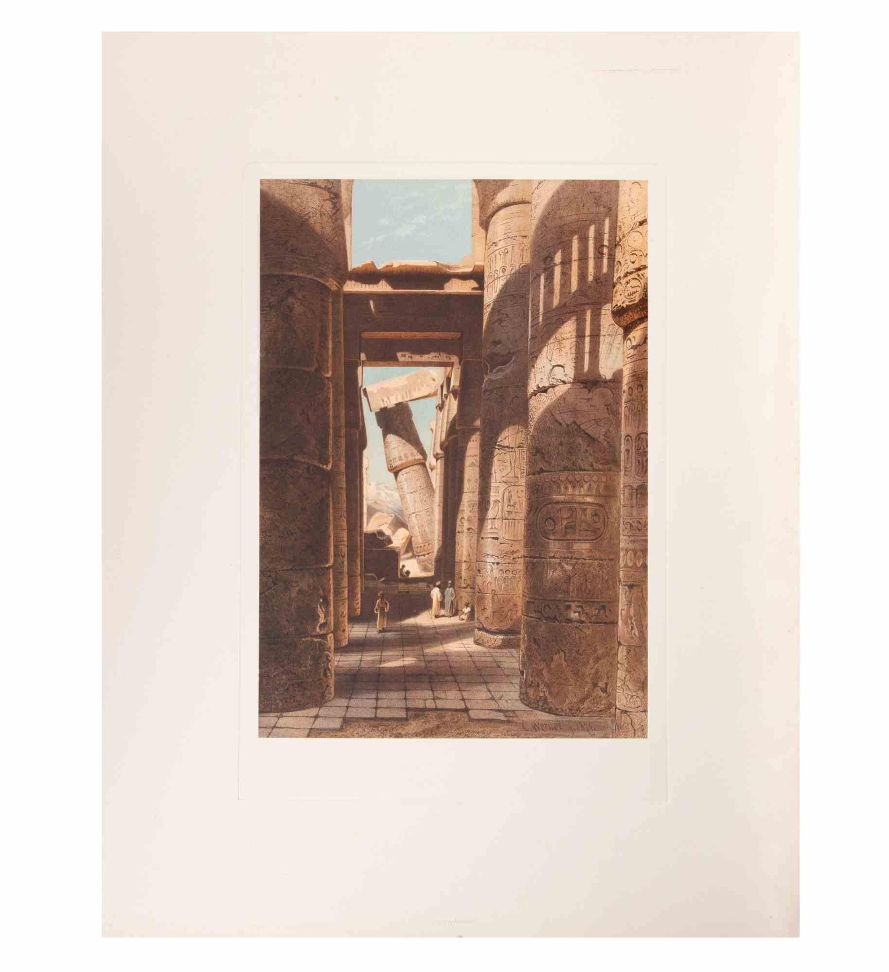
Egyptian Ruins - Lithograph after Karl Werner - 1881
Located in Roma, IT
Egyptian Ruins is a modern artwork realized d'apres Karl Werner.
Mixed colored cromolithograph.
The artwork is after the watercolor realized by the artist during a trip to Egypt b...
Category
1880s Modern Figurative Prints
Materials
Lithograph
Ancient Roman Temple - Etching by Various Authors - 18th Century
Located in Roma, IT
Ancient Roman Temple from the series "Antiquities of Herculaneum", is an etching on paper realized by Various Authors in the 18th Century.
Good conditions with folding.
The etching...
Category
18th Century Old Masters Figurative Prints
Materials
Etching
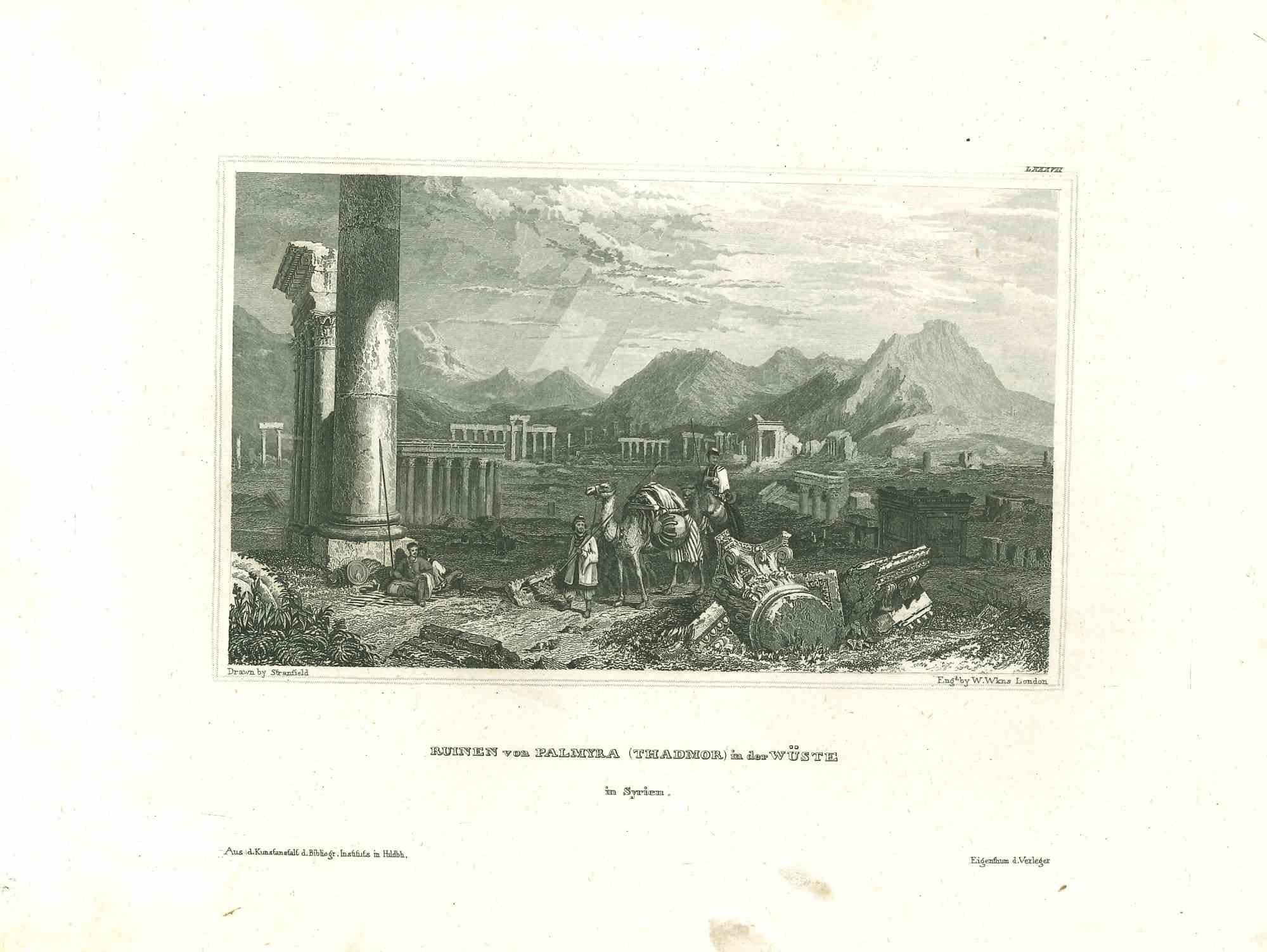
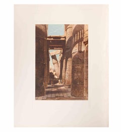
Original Antique Print of The Ancient City of Palmyra, Syria, circa 1840
Located in St Annes, Lancashire
Wonderful image of Palmyra, Syria
Fine mezzotint engraving
Published by Thomas Kelly, London, circa 1840
Unframed.
Category
Antique 1840s English Greco Roman Prints
Materials
Paper
Ancient View of the Ruins of Palmira - Original Lithograph - Mid-19th Century
Located in Roma, IT
Ancient Ruins of Palmira is an original modern artwork realized in the mid-19th Century.
Original B/W Lithograph on Ivory Paper.
Inscripted on the lower margin in Capital Letters...
Category
Mid-19th Century Modern Figurative Prints
Materials
Paper, Lithograph
Antiquities of Herculaneum Exposed - Etching - 18th Century
Located in Roma, IT
Antiquities of Herculaneum Exposed, original etching from the end of the 18th century, made by Various Old Masters.
Good condition....
Category
Late 18th Century Modern Figurative Prints
Materials
Etching
Antiquities of Herculaneum Exposed - Original Etching - 18th Century
Located in Roma, IT
Antiquities of Herculaneum Exposed, original etching from the end of the 18th century, made by Various Old Masters.
Good condition....
Category
Late 18th Century Old Masters Figurative Prints
Materials
Etching
More Ways To Browse
19th Century Engravings
19th Century Engraving Framed
Used Lintels
Ruins Engravings
Lawrence Heyman
Lawrence Josset
Leroy Neiman Serigraphs Sailing
Lilian May Miller
Lionel Lindsay
Maine Woodcut
Mammoth Ski Poster
Marco Sadeler
Mary Teichman
Monet Etching
Orchard By David Harrison
Oscar De Mejo
Pablo Picasso Original Inc Sketch
Paul Baum