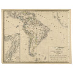
Items Similar to Charte von Sud-America (Map of South America) - Etching with Hand-Drawn Outlines


Want more images or videos?
Request additional images or videos from the seller
1 of 13
Franz PluthCharte von Sud-America (Map of South America) - Etching with Hand-Drawn Outlines1820
1820
$260
$32520% Off
£200.32
£250.4020% Off
€228.83
€286.0420% Off
CA$372.24
CA$465.2920% Off
A$406
A$507.5020% Off
CHF 213.47
CHF 266.8420% Off
MX$4,872.15
MX$6,090.1920% Off
NOK 2,695.29
NOK 3,369.1120% Off
SEK 2,513.97
SEK 3,142.4620% Off
DKK 1,709.03
DKK 2,136.2920% Off
About the Item
Map of south America, engraved by Franz Pluth (Czech, 1800-1871), from the book "Neueste Länder - und Völkerkunde, ein geographisches Lesebuch für alle Stände" by Linder, F. L. (Prague) 1820. Catalog listing is attached to verso, which reads: "193. [SOUTH AMERICA] [MAP] Charte von Sud-America nach den Neusten und Besten Hulssmitteln Entworfen. Prag: (C.F. Weiland). 1820. Engraved broadside map, 18 x 12 inches, with color outline. Folded, but a very good copy." Presented in a wood frame with a double mat and glass. Image size: 18"H x 12"W
Franz Pluth (1800 - 1871) was an engraver based in Prague, the capital of the Kingdom of Bohemia, then part of the Habsburg Austrian Empire. Pluth was born in Prague and most likely died in Zbraslav. He was active as a map engraver until at least 1848.
- Creator:Franz Pluth (1800 - 1871)
- Creation Year:1820
- Dimensions:Height: 23 in (58.42 cm)Width: 19 in (48.26 cm)Depth: 0.75 in (1.91 cm)
- Medium:
- Period:
- Condition:
- Gallery Location:Soquel, CA
- Reference Number:Seller: 0064_DBH1stDibs: LU5426736232
About the Seller
5.0
Platinum Seller
Premium sellers with a 4.7+ rating and 24-hour response times
Established in 1986
1stDibs seller since 2014
3,046 sales on 1stDibs
Typical response time: <1 hour
- ShippingRetrieving quote...Shipping from: Soquel, CA
- Return Policy
More From This Seller
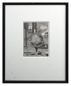
View AllEarly 18th Century Globe Terrestre Engraving
By Francois Halma
Located in Soquel, CA
Wonderfully detailed steel engraving of the earth, locations labeled in French: Afrique, Grande Tartarie, La Chine, etc., by By Francois Halma (Dutch, 1653-1722), 1705. Interesting f...
Category
Early 1700s Realist Landscape Prints
Materials
Paper, Ink
$460 Sale Price
20% Off
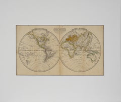
"The World" Published by Cummings & Hilliard, No. 1, Cornhill, Boston
Located in Soquel, CA
"The World" Published by Cummings & Hilliard, No. 1, Cornhill, Boston
Early 19th century engraved double hemisphere Atlas Map, titled "The World." Hand colored original outlines. Pu...
Category
1820s American Realist Landscape Prints
Materials
Paper, Printer's Ink, Etching
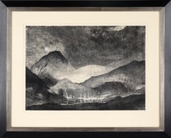
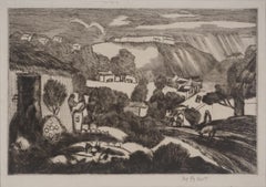
"Bajo el Volcan" Etching and Aquatint on Archival Paper, Limited Edition X/XXII
Located in Soquel, CA
"Bajo el Volcan" Etching and Aquatint on Archival Paper, Limited Edition X/XXII
Dramatic etching by Jorge Martínez García (Chilean, b. 1963). A mountain range rises into a cloudy sk...
Category
2010s Contemporary Landscape Prints
Materials
Ink, Archival Paper, Etching, Aquatint
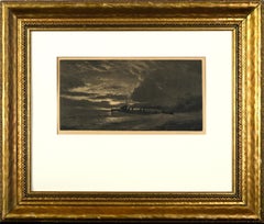
Antique British Steamship Signed Etching
Located in Soquel, CA
Antique British Steamship Etching
This moody etching by Joseph Kirkpatrick (British, b. 1874 d. 1936) features a steamboat in the midst of choppy w...
Category
1910s English School Landscape Prints
Materials
Paper, Ink, Etching
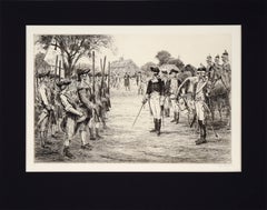
Washington Assumes Command - Etching on Paper
Located in Soquel, CA
Washington Assumes Command - Etching in Ink on Paper
Historical engraving by Ralph Ludwig Boyer (American, 1879-1952). George Washington is shown holding a sword, with an army stand...
Category
1930s Impressionist Figurative Prints
Materials
Paper, Drypoint, Lithograph
Early 20th Century Santo Domingo Landscape Etching Proof
By George Overbury Hart
Located in Soquel, CA
Prize winning 1923 Dry Point Etching of Santo Domingo by George "Pop" Hart.
Wonderful early 20th century modern etching of the Santo Domingo, capital of Dominican Republic by Georg...
Category
1920s Contemporary Landscape Prints
Materials
Laid Paper, Drypoint, Etching
$1,400 Sale Price
20% Off
You May Also Like
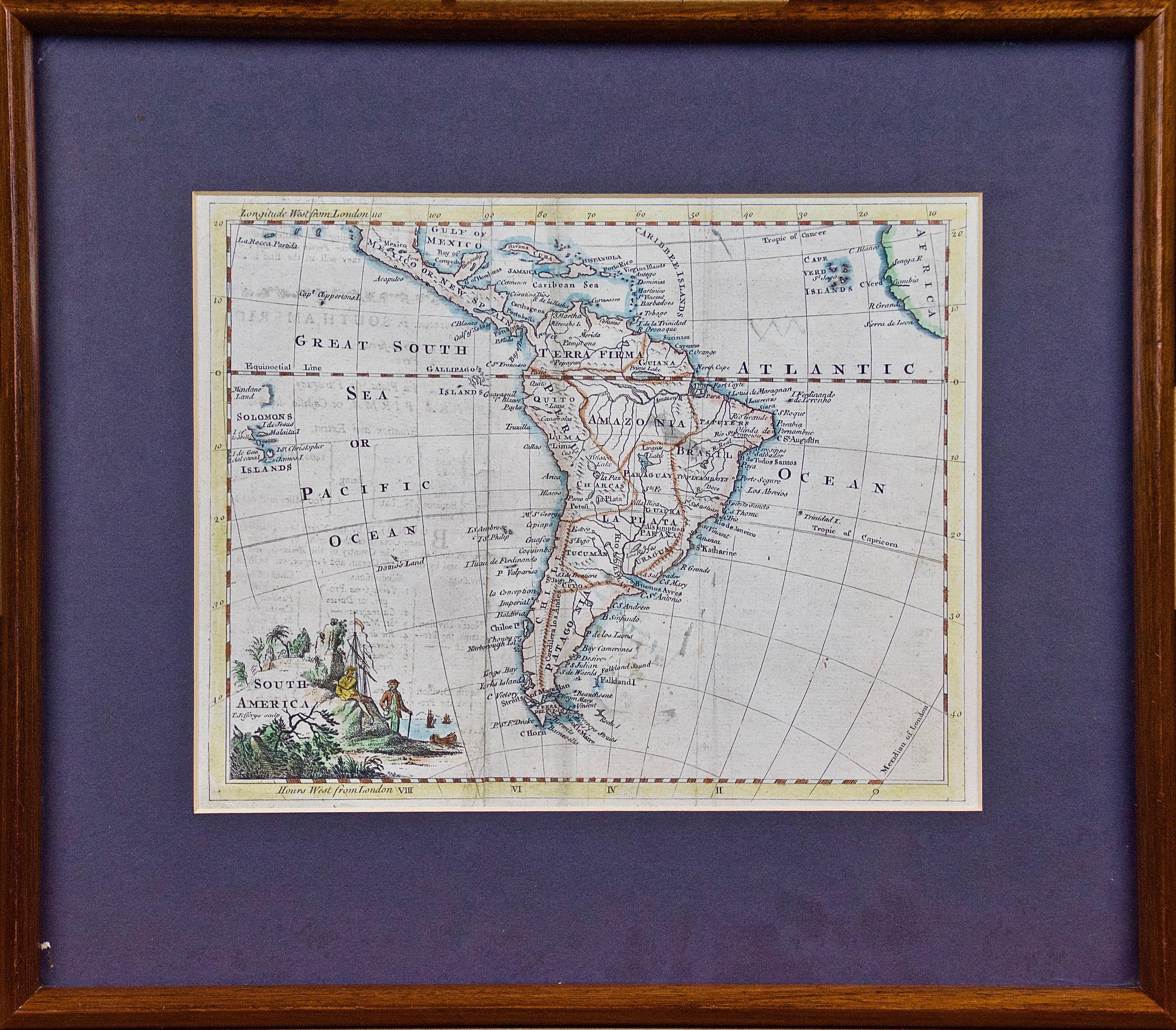
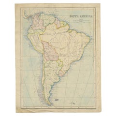
A Hand Colored 18th Century Framed Map of South America by Thomas Jefferys
Located in Alamo, CA
This detailed hand colored map of South America by Thomas Jefferys was published in London in 1750. The map shows countries, early colonial possessions, towns, rivers, mountains, and...
Category
Mid-18th Century Other Art Style Landscape Prints
Materials
Engraving

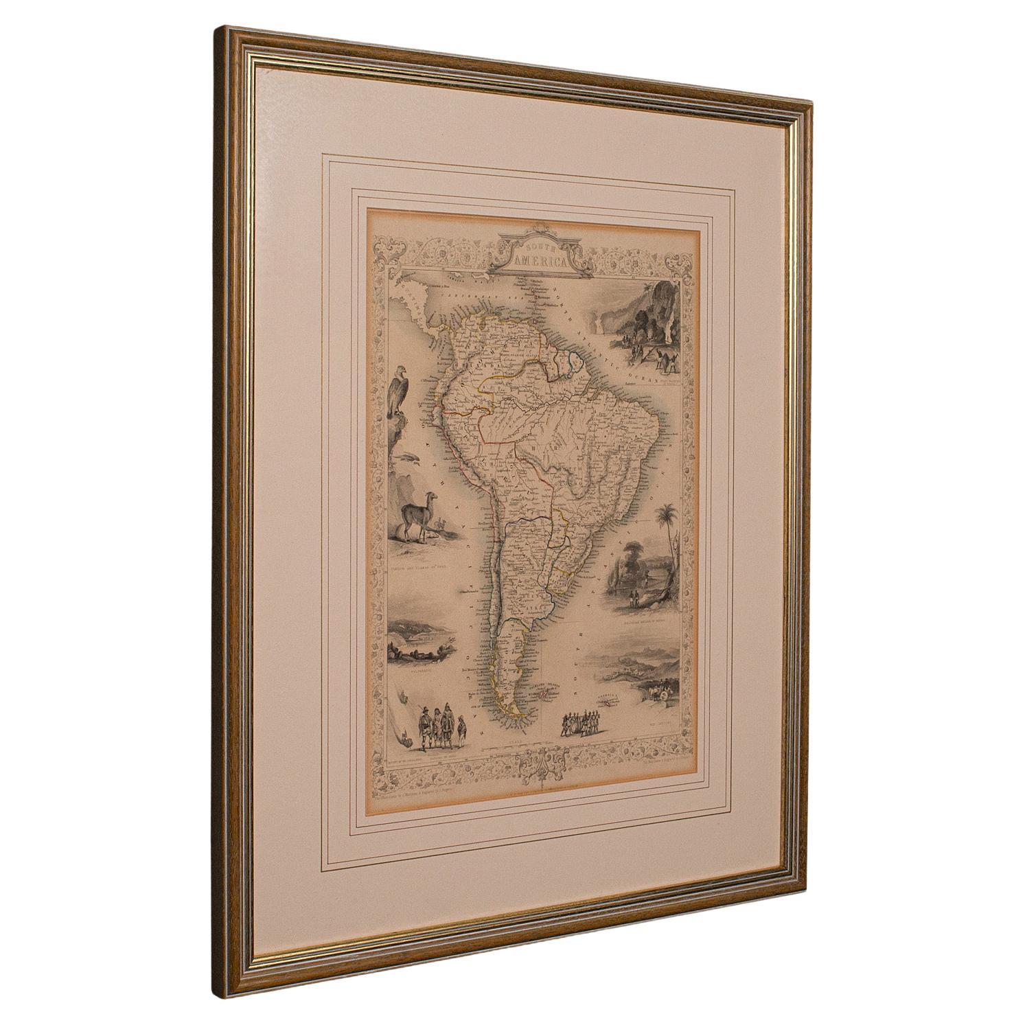
Antique Lithography Map, South America, English, Framed, Cartography, Victorian
Located in Hele, Devon, GB
This is an antique lithography map of South America. An English, framed atlas engraving of cartographic interest by John Rapkin , dating to the early Victorian period and later, circ...
Category
Antique Mid-19th Century British Early Victorian Maps
Materials
Wood

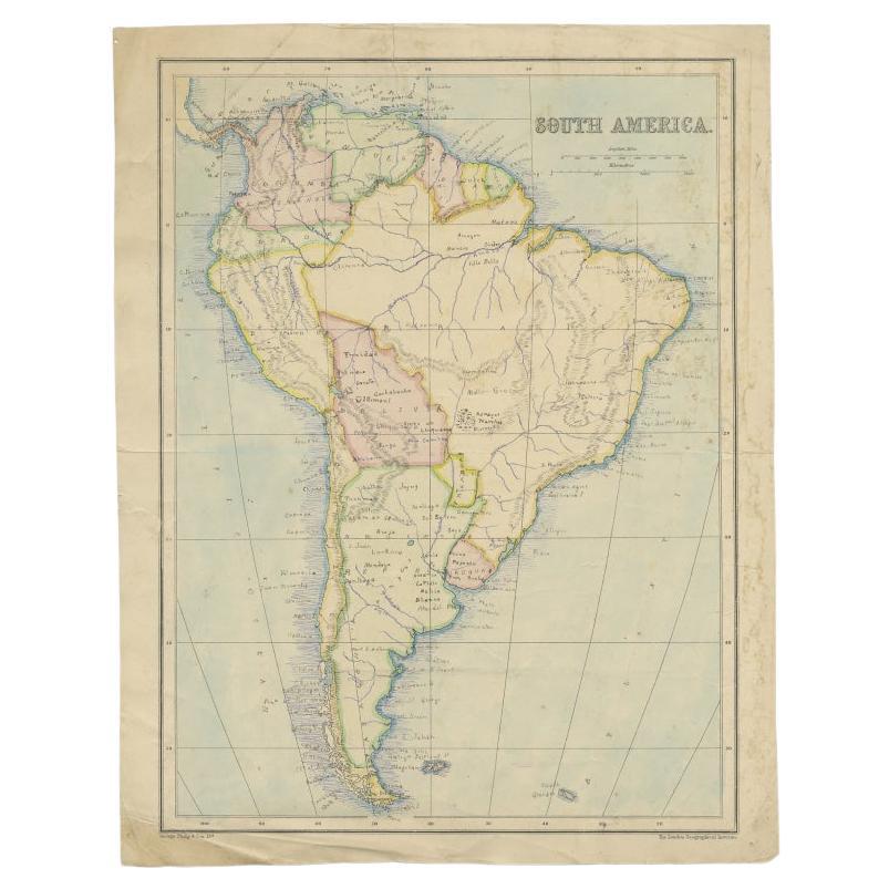
Antique Map of South America, c.1840
Located in Langweer, NL
Antique map titled 'South America'. Original, antique map depicting South America. With outline coloring. Source unknown, to be determined. Artists and Engravers: Anonymous.
Artist:...
Category
Antique 19th Century Maps
Materials
Paper

$69 Sale Price
20% Off
Antique German Map of South America by Kiepert, c.1870
Located in Langweer, NL
Antique map titled 'Süd-America'. Old map of South America. This map originates from 'H. Kiepert's Kleiner Atlas der Neueren Geographie für Schule und Haus'. Artists and Engravers: K...
Category
Antique 19th Century German Maps
Materials
Paper
Antique Map of South America by Philip & Son, 1875
Located in Langweer, NL
Antique map titled 'South America'. Old map of South America. Source unknown, to be determined.
Artists and Engravers: George Philip (1800–1882) was a cartographer, map publisher...
Category
Antique 19th Century Maps
Materials
Paper
$56 Sale Price
20% Off
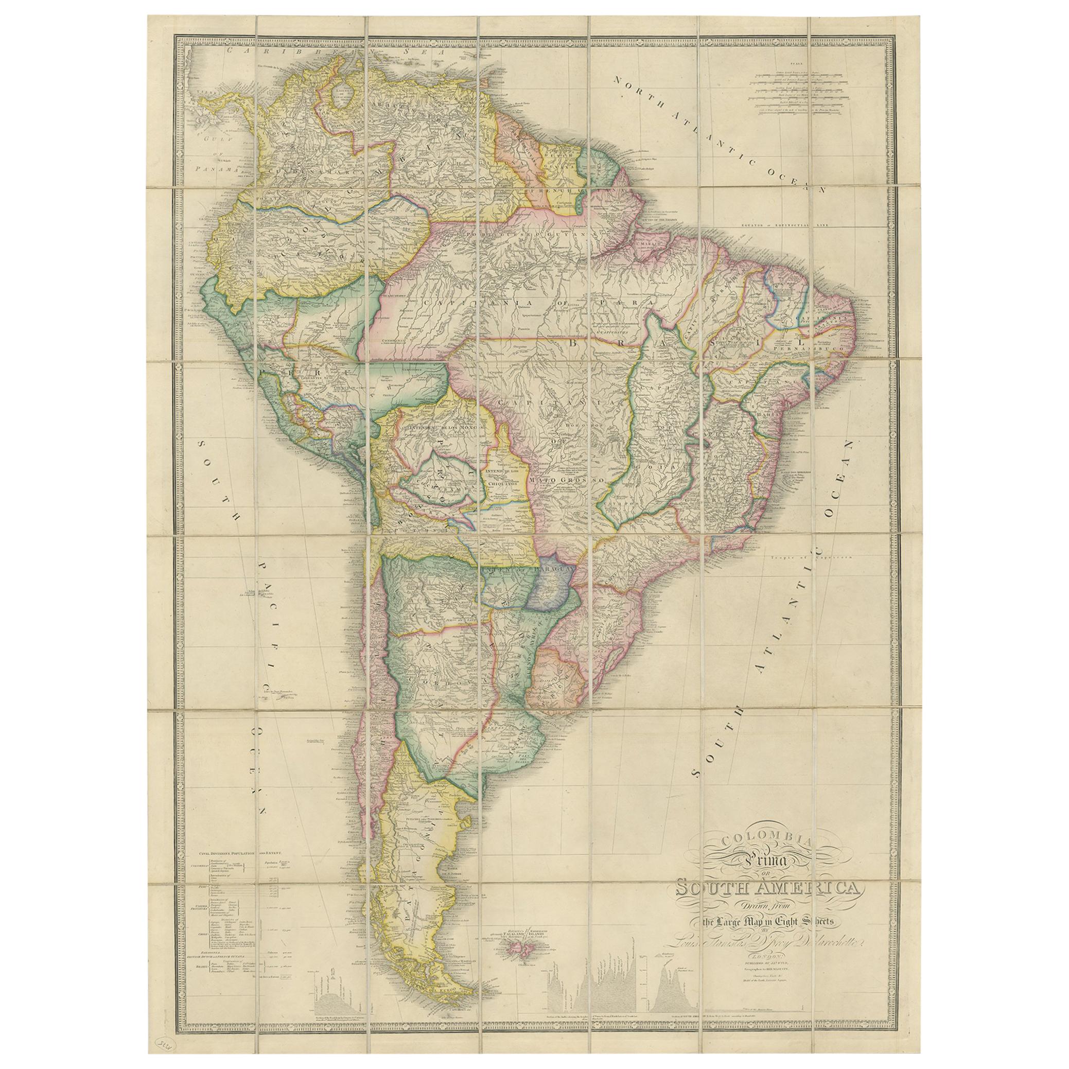
Antique Map of South America by Wyld, circa 1850
By J. Wyld
Located in Langweer, NL
Beautiful folding map of South America titled 'Colombia Prima or South America Drawn from the Large Map in Eight Sheets by Louis Stanislas D ' Arcy Delarochette'. Three insets in the...
Category
Antique Mid-19th Century British Maps
Materials
Paper

$1,371 Sale Price
20% Off