Items Similar to Framed 18th Century Hand Colored German Book Page W/ Illustration and Text


Want more images or videos?
Request additional images or videos from the seller
1 of 13
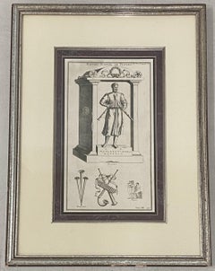
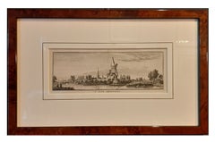
UnknownFramed 18th Century Hand Colored German Book Page W/ Illustration and TextMid 18th Century
Mid 18th Century
$350
£265.19
€304.29
CA$492.51
A$541.40
CHF 284.54
MX$6,574.57
NOK 3,549.50
SEK 3,362.91
DKK 2,270.96
About the Item
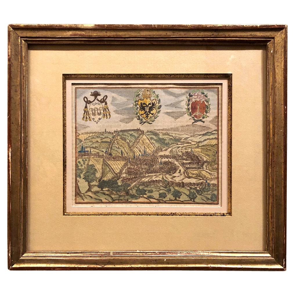
Framed 18th Century Hand Colored German Book Page W/ Illustration and Text
Antique Book Page
German Text
Dimensions 10" wide x 15" high
The frame measures 17" wide x 24" high
Very good antique condition
- Creation Year:Mid 18th Century
- Dimensions:Height: 24 in (60.96 cm)Width: 17 in (43.18 cm)Depth: 0.5 in (1.27 cm)
- Medium:
- Period:
- Condition:
- Gallery Location:San Francisco, CA
- Reference Number:1stDibs: LU137827231182
About the Seller
4.9
Gold Seller
Premium sellers maintaining a 4.3+ rating and 24-hour response times
1stDibs seller since 2020
553 sales on 1stDibs
Typical response time: 5 hours
- ShippingRetrieving quote...Shipping from: San Francisco, CA
- Return Policy
Authenticity Guarantee
In the unlikely event there’s an issue with an item’s authenticity, contact us within 1 year for a full refund. DetailsMoney-Back Guarantee
If your item is not as described, is damaged in transit, or does not arrive, contact us within 7 days for a full refund. Details24-Hour Cancellation
You have a 24-hour grace period in which to reconsider your purchase, with no questions asked.Vetted Professional Sellers
Our world-class sellers must adhere to strict standards for service and quality, maintaining the integrity of our listings.Price-Match Guarantee
If you find that a seller listed the same item for a lower price elsewhere, we’ll match it.Trusted Global Delivery
Our best-in-class carrier network provides specialized shipping options worldwide, including custom delivery.More From This Seller
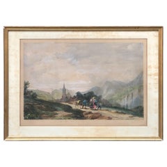
View AllVintage European School Hand Colored Lithograph C.1940s
Located in San Francisco, CA
Vintage European School Hand Colored Lithograph C.1940s
Beautiful hand colored lithograph
Rich Color - Strong Pencil Signature (illegible - see images)
Dimensions 14" wide x 18" ...
Category
Mid-20th Century Landscape Prints
Materials
Lithograph
Johann Weinmann 18th Century Hand Colored Copper Plate Engraving
By Johann Wilhelm Weinmann
Located in San Francisco, CA
Rare hand colored copper plate engraving by noted Botanist Johann Wilhelm Weinmann (1683-1741)
Beautiful color after 250+ years!
This wonderful antique engraving is beautifully mat...
Category
18th Century Naturalistic More Prints
Materials
Engraving

19th Century Etching "Master of Flutes" Etching After Robert Boissard
By Robert Boissard
Located in San Francisco, CA
19th Century Etching "Master of Flutes" Etching After Robert Boissard
Framed etching with neoclassical elements
After Robert Boissard (1570-160...
Category
Mid-19th Century Figurative Prints
Materials
Etching
18th C. Engraving "Shire of the Seat of Phillip Stanhope, Earl of Chesterfield"
Located in San Francisco, CA
18th C. Engraving "Shire of the Seat of Phillip Stanhope, Earl of Chesterfield" C.1724
Bird's eye view of Bredby Hall, in Derbyshire; with formal gardens and landscaped grounds; fro...
Category
Early 18th Century Landscape Prints
Materials
Etching
19th C. Engraving After Albrecht Durer
By Albrecht Dürer
Located in San Francisco, CA
19th C. Engraving After Albrecht Durer
6" x 8" unframed
6.5" x 8.5" framed
Category
19th Century Mixed Media
Materials
Engraving
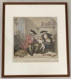
Edward Williams "A College Scene" After Thomas Rowlandson Color Engraving C.1787
By Thomas Rowlandson
Located in San Francisco, CA
Edward Williams "A College Scene" After Thomas Rowlandson Color Engraving C.1787
Late 18th century hand colored engraving after Thomas Rowlandson
A scene of a young student asking ...
Category
Late 18th Century Figurative Prints
Materials
Engraving
You May Also Like
Early 19th Century Framed Lithograph of a Work by Sebastian Munster '1488-1522'
Located in Dallas, TX
Early 19th century framed lithograph of a work by Sebastian Munster (1488-1522) is a new printing using the original woodcut dating to the 16th centu...
Category
Antique Early 19th Century Swiss Renaissance Revival Prints
Materials
Paper
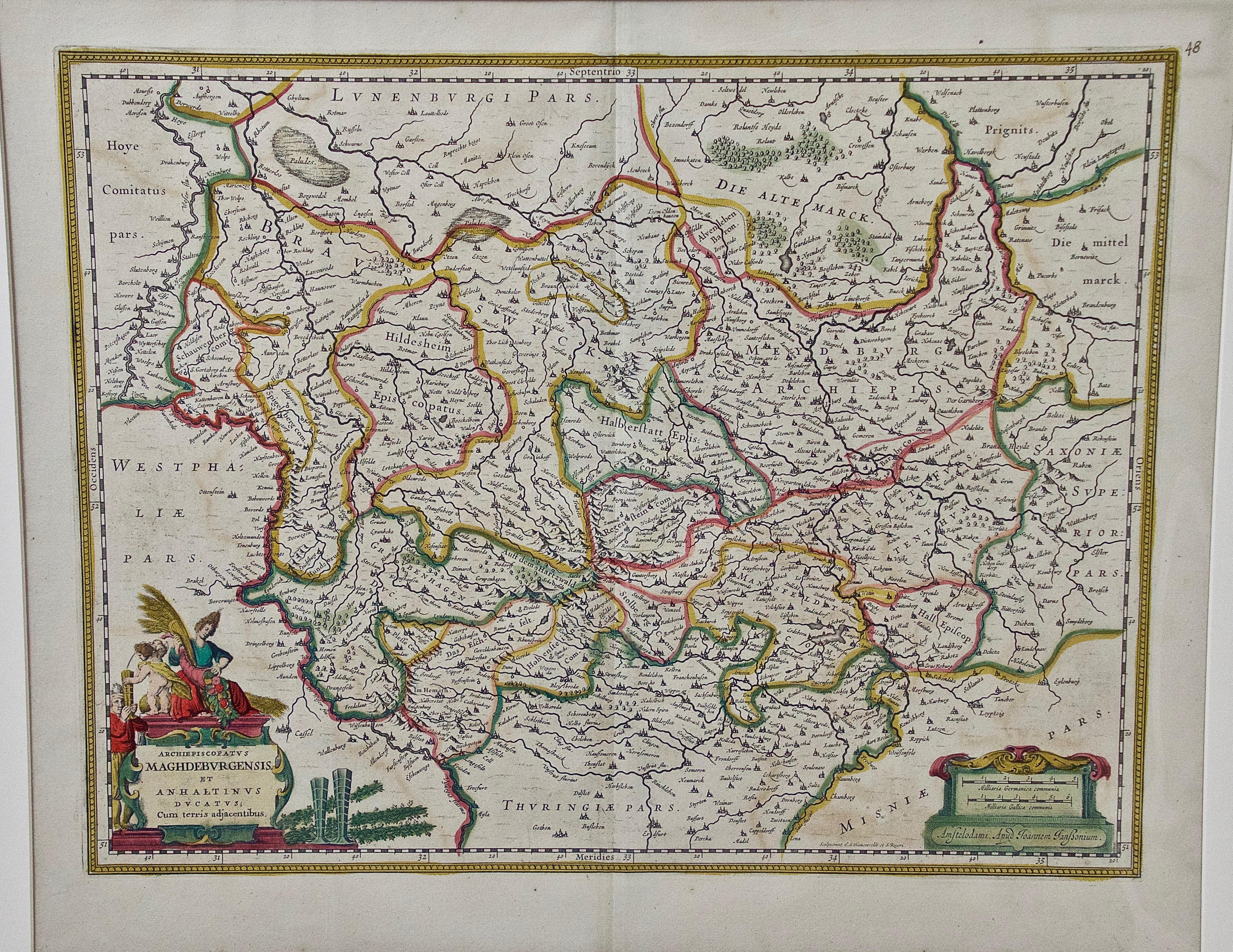
West Germany: Original Hand Colored 17th Century Map by Johannes Janssonius
By Johannes Janssonius
Located in Alamo, CA
An original hand colored copperplate engraved map entitled in Latin "Archiepiscopatus Maghdeburgensis et Anhaltinus Ducatus cum terris adjacentibus", published in Amsterdam in 1640 i...
Category
Mid-17th Century Old Masters More Prints
Materials
Engraving

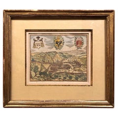
Canterbury: An Original 16th C. Framed Hand-colored Map by Braun & Hogenberg
By Franz Hogenberg
Located in Alamo, CA
This is a framed 16th century map and city view of Canterbury, England entitled "Cantuarbury" by Braun & Hogenburg, from their famous landmark atlas of city views 'Civitates Orbis Terrarum' (Atlas of the Cities of the World), which was first published in Cologne, Germany in 1572. The map of Canterbury was first published in 1588. It depicts a detailed birdseye view of the completely walled and fortified city of Canterbury, with its cathedral the most prominent feature. The coat of arms of England, Canterbury, and the Archbishop of Canterbury are included.
This beautifully hand-colored map is presented in a gold-colored wood frame with a beaded inner trim and a paprika-colored mat that highlights details in the map. The frame measures 18.75" high by 22.25" wide by 0.875" deep. There is a central vertical fold, as issued. The map is in excellent condition.
Braun and Hogenberg's 'The Civitates Orbis Terrarum' was the second atlas of maps ever published and the first atlas of cities and towns of the world. It is one of the most important books published in the 16th century. Most of the maps in the atlas were engraved by Franz Hogenberg and the text, with its descriptions of the history and additional factual information of the cities, was written by a team of writers and edited by Georg Braun. The work contained 546 bird-eye views and map views of cities and towns from all over the world. It gave graphic representation of the main features of the illustrated cities and towns, including the buildings and streets. Although the ordinary buildings are stylized, the principal buildings are reproduced from actual drawings created on location. The principal landmarks and streets can still be recognized today. In addition, the maps often include the heraldic arms of the city, the nature of the surrounding countryside, the important rivers, streams and harbors, even depicting stone bridges, wooden pontoons, flat-bottomed ferries, ships and working boats, wharves and jetties, as well as land-based activities, including horsemen, pedestrians, wagons, coaches, and palanquins. Small vignettes are often included which illustrate the trade, occupations and habits of the local inhabitants, such as agriculture, paper-making and textiles, as well as local forms of punishment, such as gibbets, wheels, floggings etc. Large figures dressed in their local costume are often presented out of proportion in the foreground. The aim of the authors was to give as much information as possible in a pleasing visual form. They succeeded in creating maps that were both informative and decorative works of art. The atlas is a wonderful glimpse of life in medieval Europe.
Georg Braun (1541-1622) was German Catholic...
Category
16th Century Old Masters Landscape Prints
Materials
Engraving

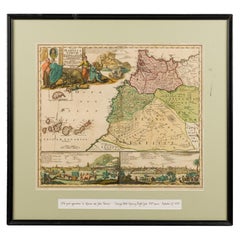
Framed Print of an Antique German Map of Morocco
Located in Queens, NY
Antique German map (print) of Morocco (circa 1728) featuring a central map above two city views depicted below and an upper scenic cartouche featur...
Category
Mid-20th Century German Biedermeier Paintings
Materials
Wood
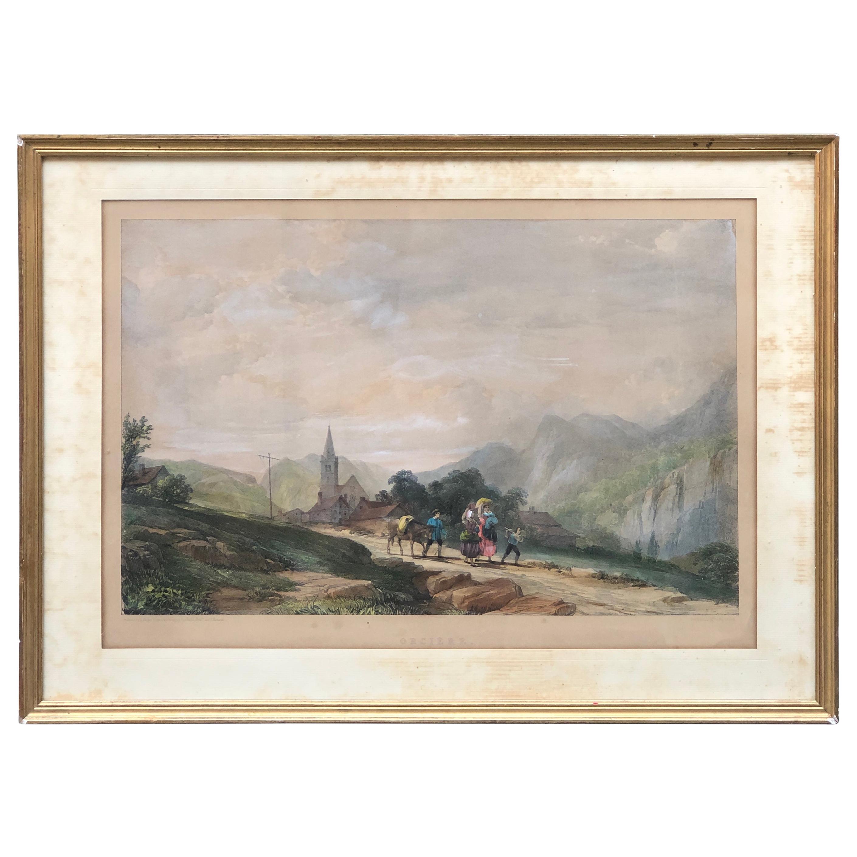
19th Century Hand-Colored Engraving on a Paper, France
Located in Sofia, BG
Fine engraving of the peaceful landscape of Orcière in France with a few figures on the road.
France, circa 1890.
Category
Antique Late 19th Century French Drawings
Materials
Paper
Framed Antique Print of the City of Montfoort in The Netherlands, circa 1750
Located in Langweer, NL
Antique print titled 'De Stad Montfoort'. View on the city of Montfoort, the Netherlands.
Artists and Engravers: Engraved by H. Spilman.
Condition: Good, general age-related to...
Category
Antique 18th Century Prints
Materials
Paper
$248 Sale Price
20% Off
More Ways To Browse
Antique Book Pages
Antique German Book
Lux Soap
Marcus Uzilevsky
Marino Marini Jongleur Et Chevaux
Maurin Green Devil
Musee Matisse Nice Vintage Poster
Naomi Limont
New Mexico Travel Posters
Nicolas De Poilly
Noel Fielding
Oman Map
Omega Poster
Original Gay Art
Pablo Picasso Pencil Signed
Pakistan Vintage Travel Posters
Peter Mac
Porsche Targa Poster